
")
Current Snapshot
For all the latest updates visit: DisasterAWARE
epac

1800×1080
fun
close
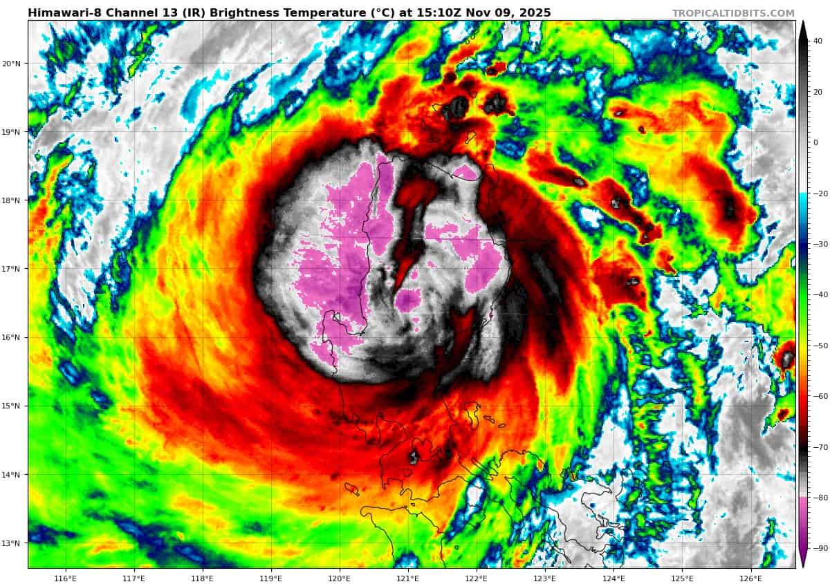
himawari8_ir_32W_202511091510_lat16.1-lon121.8
32W_tracks_latest
By PDC’s Senior Weather
Specialist Glenn James

The Pacific Disaster Center’s (PDC Global) Sunday, November 9, 2025, Tropical Cyclone Activity Report…for the Pacific Ocean, the Indian Ocean, and adjacent Seas
Current Tropical Cyclones:
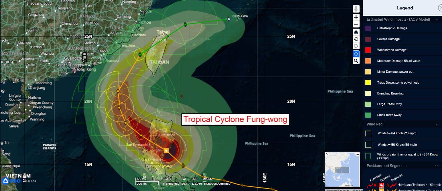
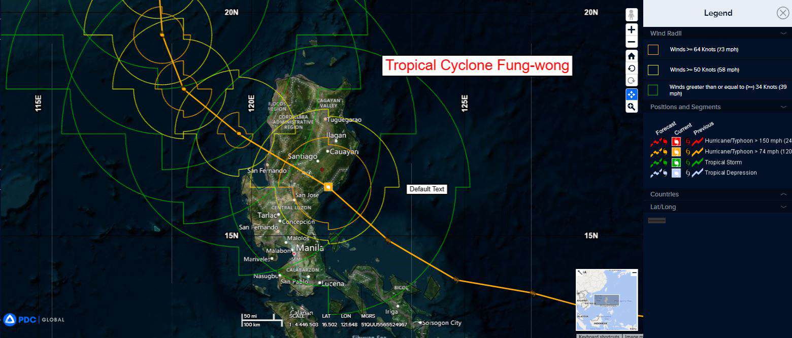
Tropical Cyclone 32W (Fung-wong)…is located 192 NM north-northwest of Manila, Philippines
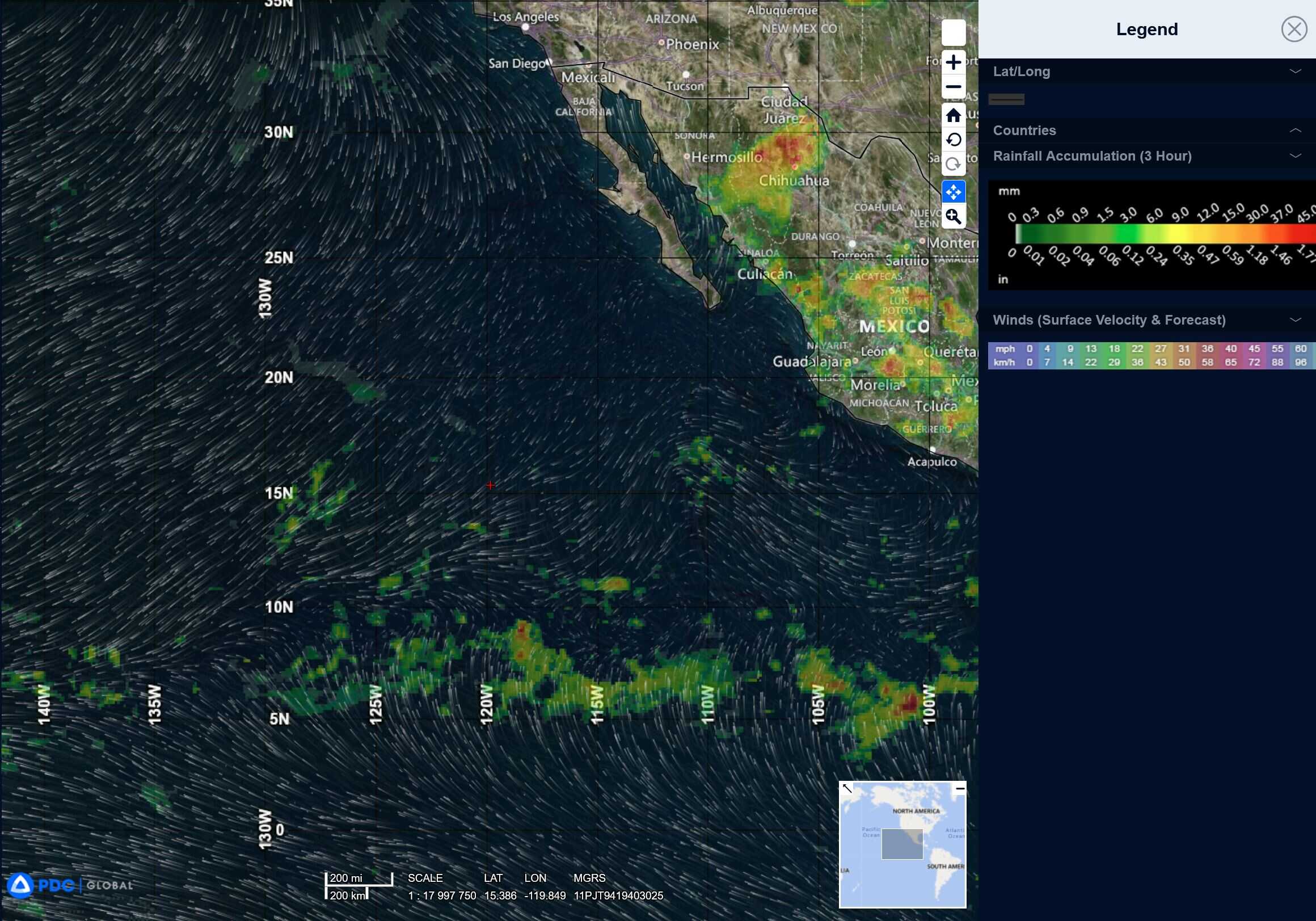
Northeast Pacific Ocean: There are no Tropical Cyclones
Tropical cyclone formation is not expected during the next 7 days.
Central Pacific Ocean: There are no Tropical Cyclones
Tropical cyclone formation is not expected during the next 7 days.
Western Pacific, Indian Ocean, and adjacent Seas:
Western Pacific
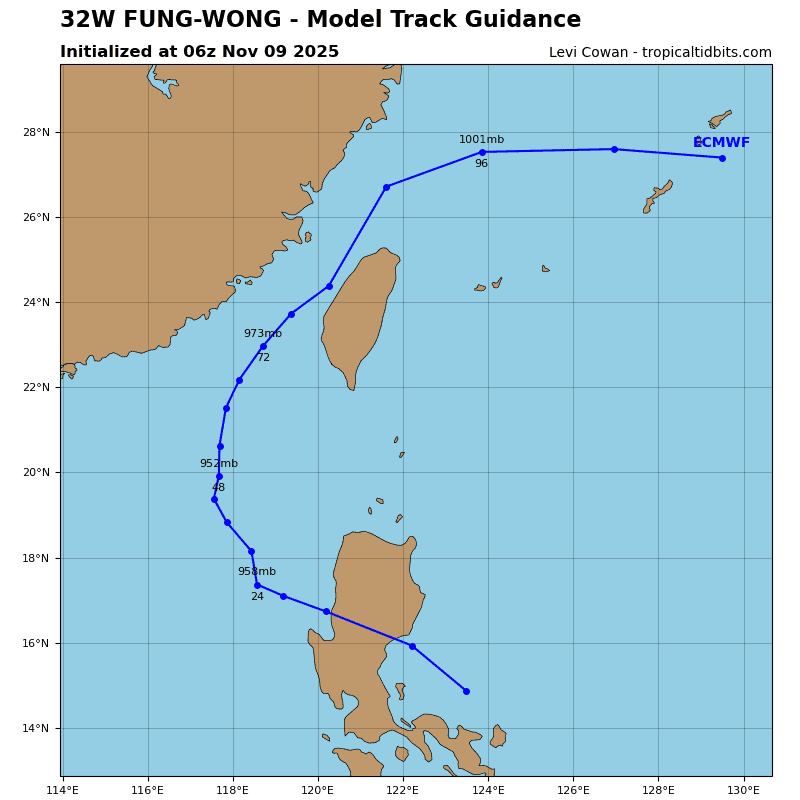
Tropical Cyclone 32W (Fung-wong)
According to the JTWC warning number 24…sustained winds are 85 knots with gusts to 105 knots
Typhoon 32W (Fung-wong) has made landfall as of the 12Z, with the center of the system moving inland over Luzon as depicted by animated enhanced infrared (eir) satellite imagery. The system has undergone slight weakening over the past 6 hours facilitated by topographic interaction. Deep convection remains strong around the center.
Environmental analysis reflects a marginal environment for development as TY Fung-wong will now contend with dry air surrounding the system as it attempts to re-consolidate. Additional environmental analysis reveals warm (28 c to 29 c) sea surface temperatures (sst) and moderate (15-20 kts) vertical wind shear (vws) ahead of the system.
TY Fung-wong will now track northwestward across Luzon and into the South China Sea (scs) over the Lingayen Gulf. Continued weakening is expected as topographic effects chip away at the structure of the system. As the system re-emerges over the scs, the str to the northwest will weaken, while the str centered to the northeast will build and eventually assume primary steering role. As a result TY 32W will round the axis of the latter of the discussed ridges, turning initially northward, and then northeastward toward Taiwan.
Along the way dry air will become entrained in the vortex along with the increase in vertical wind
shear will further weaken TY 32W. Landfall over Taiwan is now depicted north of Xianxi, between 72 and 96 hours. Afterwards the system will track over the northern portion of the island before moving back over water in the East China Sea. Dissipation is forecast to occur shortly after 120 hours.