
")
Current Snapshot
For all the latest updates visit: DisasterAWARE
epac

1800×1080
fun
32W_071200sair
32W_tracks_latest
By PDC’s Senior Weather
Specialist Glenn James

The Pacific Disaster Center’s (PDC Global) Friday, November 7, 2025, Tropical Cyclone Activity Report…for the Pacific Ocean, the Indian Ocean, and adjacent Seas
Current Tropical Cyclones:
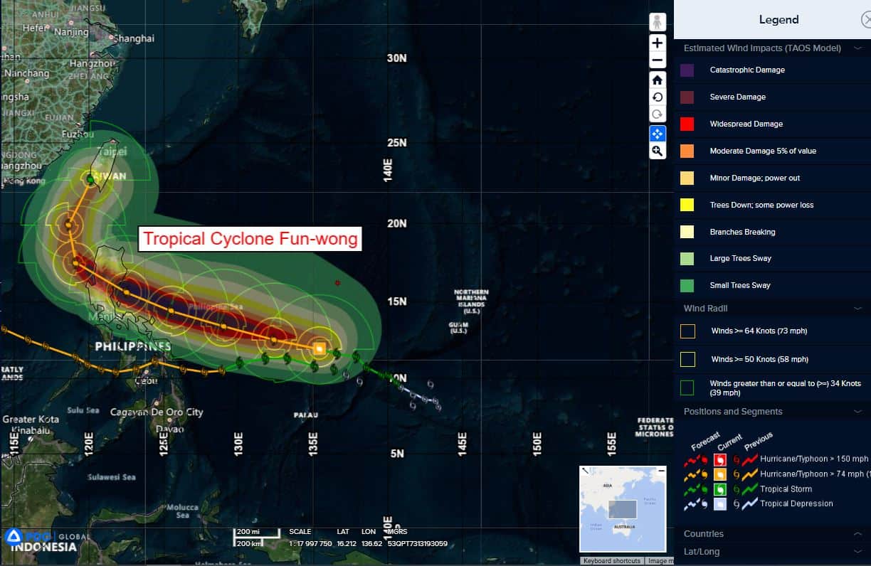
Tropical Cyclone 32W (Fung-wong)…is located 856 NM east of Manila, Philippines
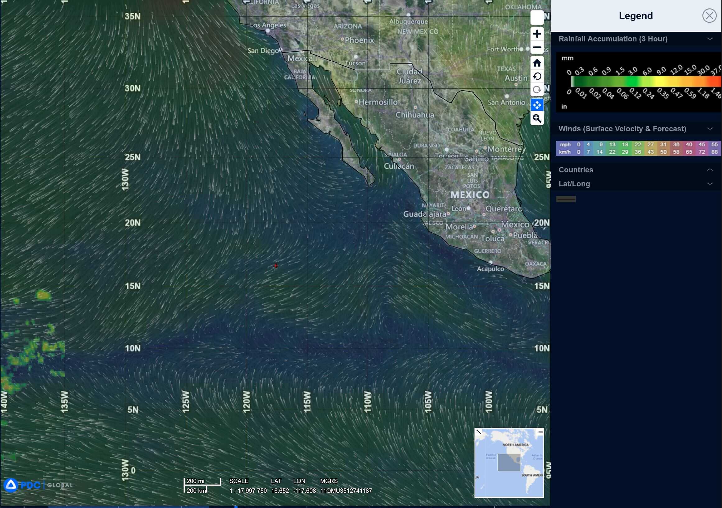
Northeast Pacific Ocean: There are no Tropical Cyclones
Tropical cyclone formation is not expected during the next 7 days.
Central Pacific Ocean: There are no Tropical Cyclones
Tropical cyclone formation is not expected during the next 7 days.
Western Pacific, Indian Ocean, and adjacent Seas:
Western Pacific
Tropical Cyclone 32W (Fung-wong)
According to the JTWC warning number 14…sustained winds are 65 knots with gusts to 80 knots
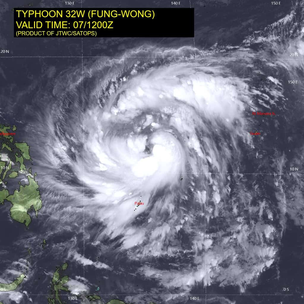
Animated enhanced infrared (eir) satellite imagery depicts typhoon 32W (Fung-wong) with tightly curved convective banding and defined cirrus filaments expanding outward. The system has continued to consolidate over the past 6 hours and deep convection is now starting to form right along the edges of the low-level circulation center (llcc). A 070921z f16 ssmis 91 ghz microwave image revealed a prominent convective band that is now extending all the way from the western to the eastern periphery of the circulation.
Environmental analysis indicates that 32W is in a highly favorable environment characterized by strong radial outflow aloft, low (5-10 kts) vertical wind shear, and warm (29-30 c) sea surface temperatures.
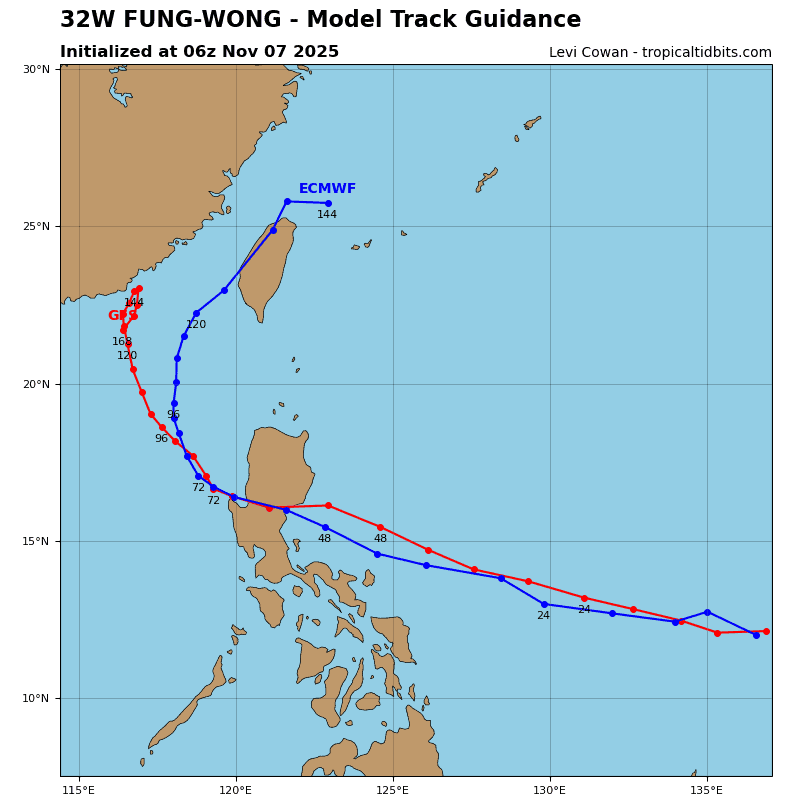
32W is forecast to track west-northwestward under the influence of a building str to the northeast. This ridge is expected to break off from the larger ridge further northeast near 24 hours due to a passing upper-level trough. 32W will track along the southwestern periphery of the str through 72 hours. Landfall along the eastern coast of Luzon is forecast to occur just after 48 hours, south of Casiguran.
The system will then emerge within the South China Sea and begin to round the western extent of the str. A northward turn is expected to commence near 72 hours with rather slow tracks speeds due to competing steering with a separate str that will
be centered over Hainan. A final landfall is expected to occur within southern Taiwan right around 120 hours.
In terms of intensity, 32W is forecast to rapidly intensify through 36 hours to around 115 kts. The intensification trend will then halt as easterly shear begins to increase to around 25-30 kts. An intensity of 115 kts is currently forecast for the time of landfall in Luzon. After making landfall, the mountainous terrain will rapidly weaken the vortex.
Once the system enters the South China Sea redevelopment will be hindered by increasing southerly shear and dry air intrusion. As a result, 32W is forecast to weaken through the remainder of the forecast period as it tracks toward southern Taiwan.