
")
Current Snapshot
For all the latest updates visit: DisasterAWARE
32
32p
32P_tracks_latest
himawari9_ir_94P_202505111500_lat-10.3-lon155.3

94P_tracks_latest
By PDC’s Senior Weather
Specialist Glenn James

The Pacific Disaster Center’s (PDC Global) Sunday, May 11, 2025, Tropical Cyclone Activity Report…for the Pacific Ocean, the Indian Ocean, and adjacent Seas
Current Tropical Cyclones:
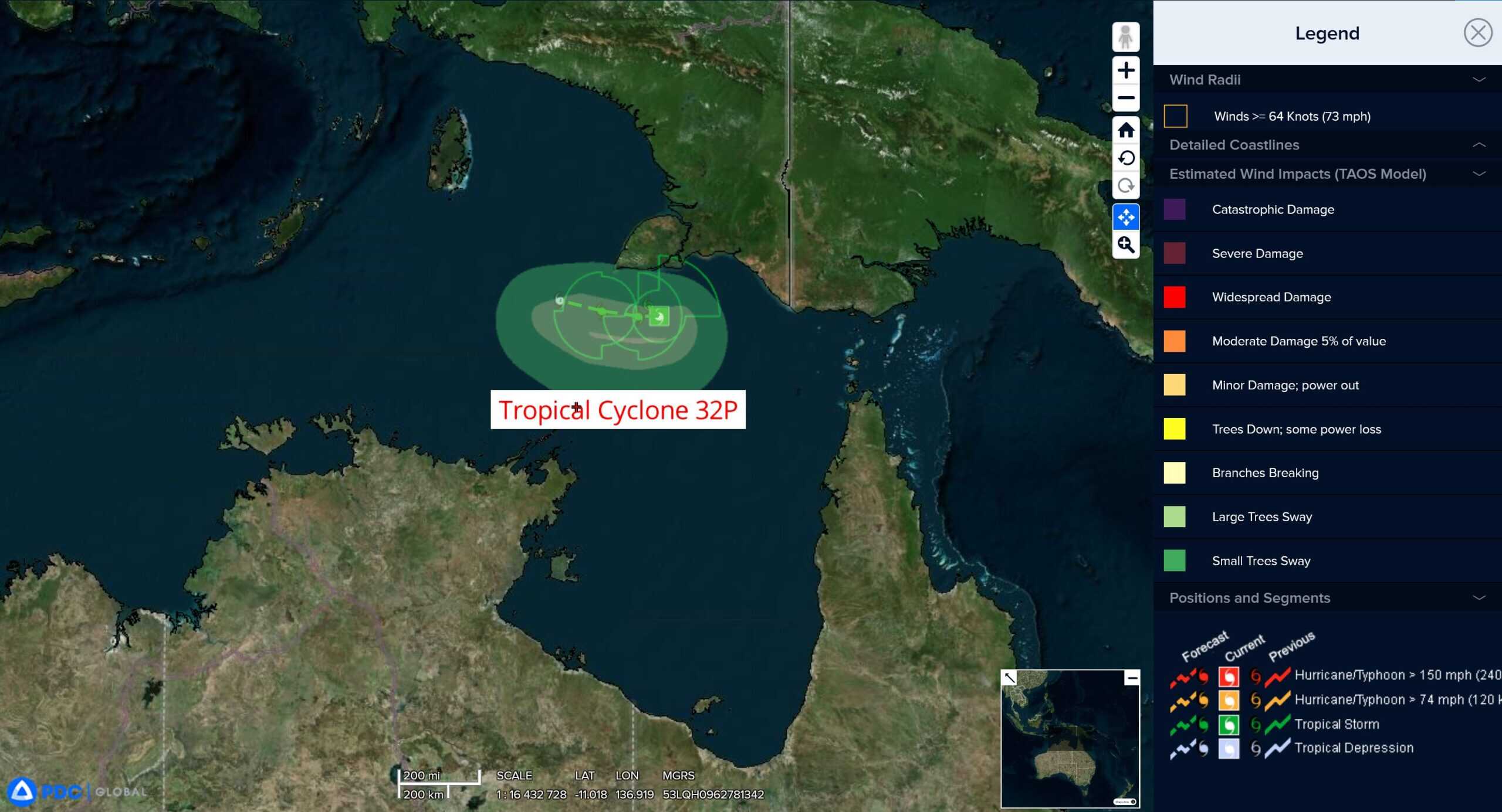
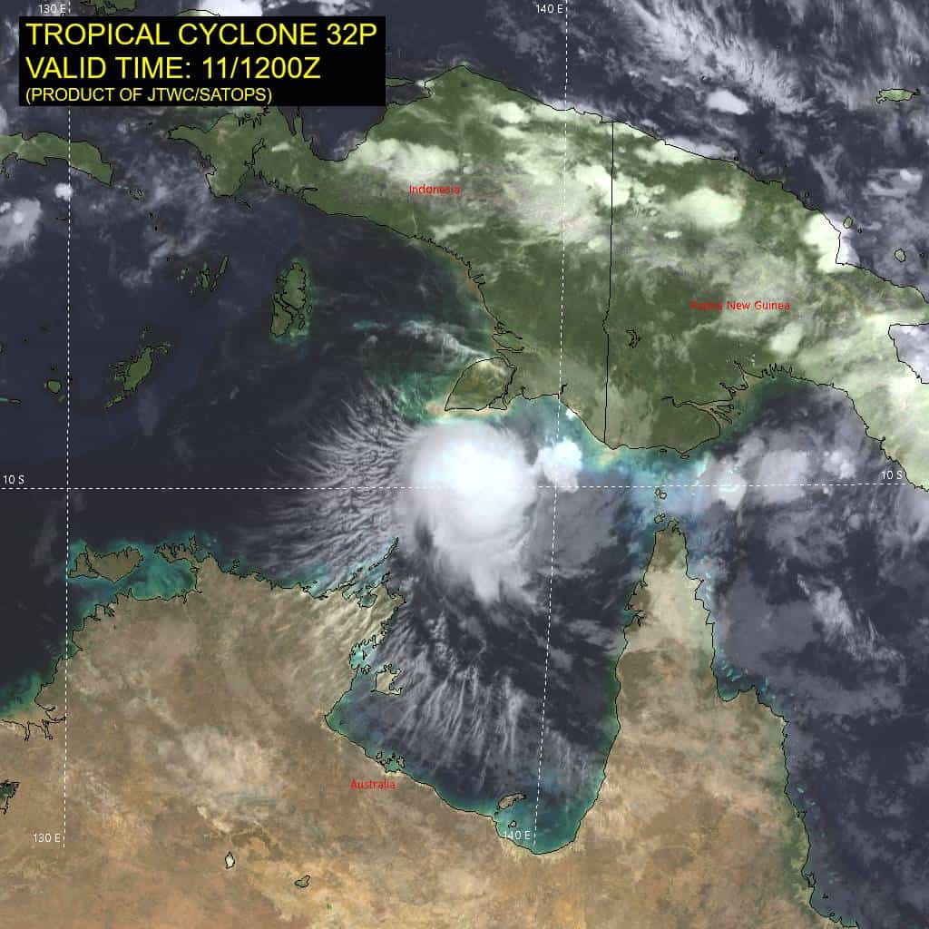
Tropical Cyclone 32P is located approximately 478 NM east-northeast of Darwin, Australia – Final Warning
Northeast Pacific Ocean: There are no Tropical Cyclones
The last regularly scheduled Tropical Cyclone Activity Report of the 2024 eastern North Pacific Hurricane Season has been issued. Routine issuance of this section of the PDC product will resume on May 15, 2025. During the off-season, Special Tropical Weather Outlooks will be issued as conditions warrant by the NHC.
Central Pacific Ocean: There are no Tropical Cyclones
The 2024 central North Pacific hurricane season has ended. As such, the final routine Tropical Cyclone Activity Report for the 2024 season has been issued. Routine issuance of this section of the PDC product will resume on June 1, 2025. During the off-season, Special Tropical Weather Outlooks will be issued as conditions warrant by the CPHC.
Western Pacific, Indian Ocean, and adjacent Seas:
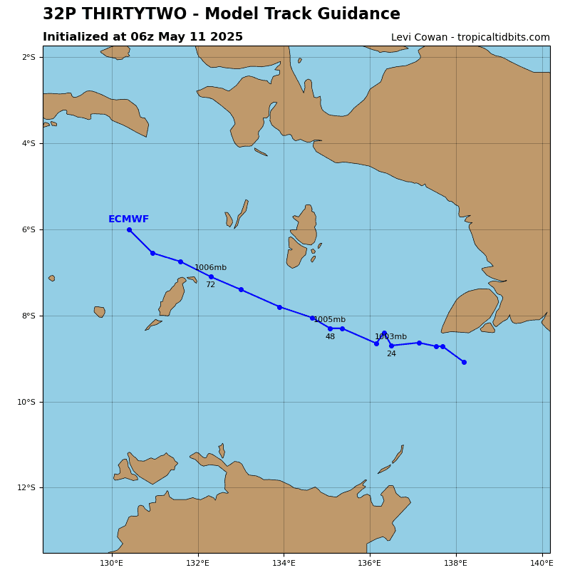
Tropical Cyclone 32P – Final Warning
Southwest Pacific Ocean
According to the JTWC warning number 4, sustained winds are 30 knots with gusts to 40 knots
Animated multi-spectral satellite imagery depicts tropical cyclone 32P with a highly disorganized wind field. The low-level circulation has become stretched while the mid-level center remains displaced far to the east-southeast, near the flaring convection.
Environmental analysis indicates that 32P is in a marginally favorable environment characterized by strong poleward outflow, low (10-15 knot) vertical wind shear, and warm sea surface temperatures, offset by dry air entrainment. However, the environment is expected to quickly worsen as northerly shear increases to around 25 knots by 12 hours, causing the vortex to further shallow. 32P is forecast to track off towards the west under the low-level easterly steering influence.
Numerical model guidance agrees on the westward track and no indication for redevelopment.
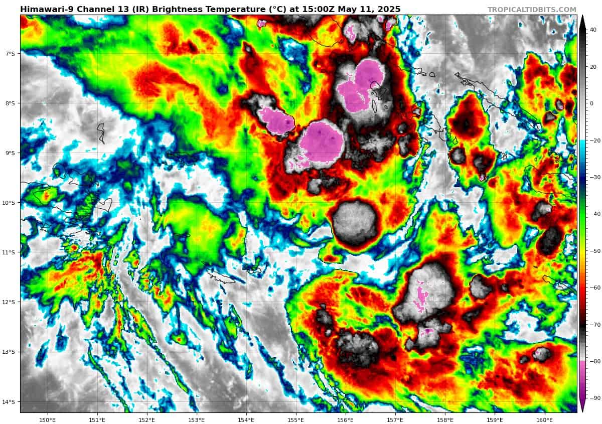
>>> There’s an area of disturbed weather being referred to as Invest 94P, which is located approximately 238 NM west-southwest of Honiara
Animated enhanced infrared satellite imagery (eir) depict a poorly organized low level circulation center (llcc) obscured by flaring convection currently being sheared from the southwest.
Environmental analysis for the area indicates marginally favorable conditions for development with warm sea surface temperatures and moderate poleward outflow aloft. Furthermore, moderate to high (20-25 knot) vertical wind shear and dry air entrainment are the main hindrances against the development of 94P.
Global deterministic models are in fair agreement that the area of convection will track southeast and gradually intensify over the next 24 hours. Ensemble guidance agrees on a southeastward track with ecens being more aggressive overall in terms of development.
Maximum sustained surface winds are estimated at 18 to 23 knots.
The potential for the development of a significant tropical cyclone within the next 24 hours remains low.