
")
Current Snapshot
For all the latest updates visit: DisasterAWARE
kal

31W_031200sair
31W_tracks_latest
himawari8_ir_90W_202511031430_lat9.0-lon145.5

90W_tracks_latest
By PDC’s Senior Weather
Specialist Glenn James

The Pacific Disaster Center’s (PDC Global) Monday, November 3, 2025, Tropical Cyclone Activity Report…for the Pacific Ocean, the Indian Ocean, and adjacent Seas
Current Tropical Cyclones:
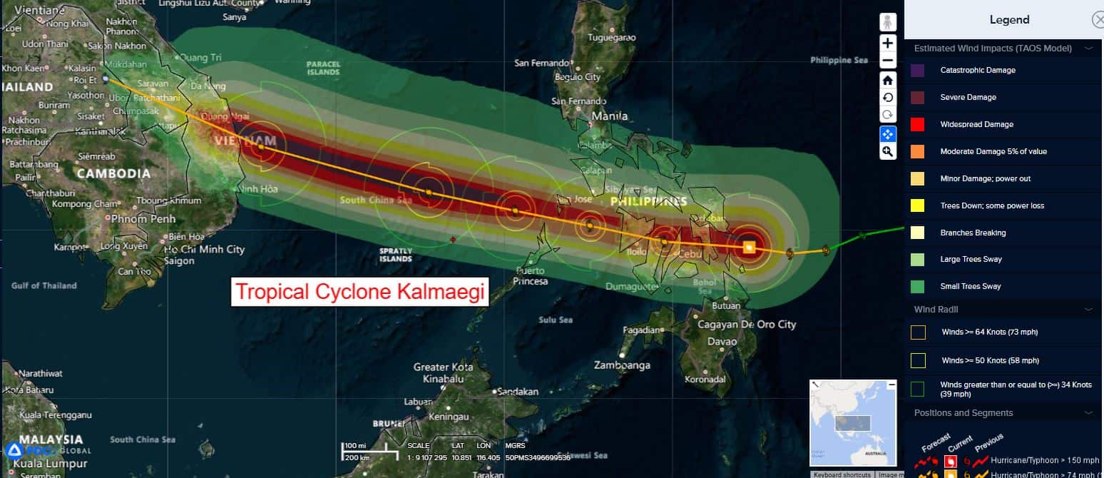
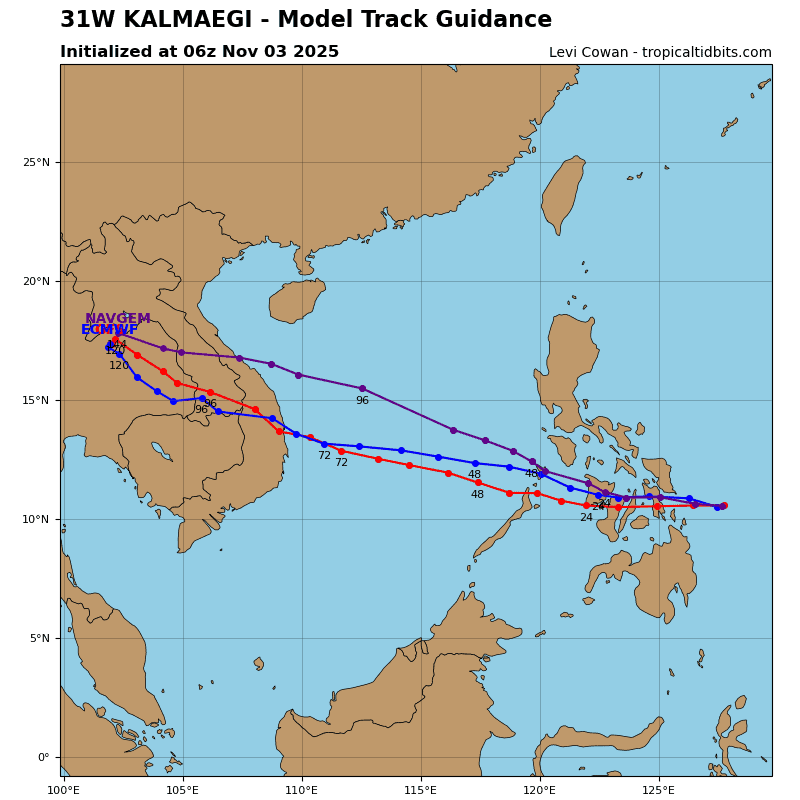
Tropical Cyclone 31W (Kalmaegi)…is located 289 NM southeast of Manila, Philippines
Northeast Pacific Ocean: There are no Tropical Cyclones
Tropical cyclone formation is not expected during the next 7 days.
Central Pacific Ocean: There are no Tropical Cyclones
Tropical cyclone formation is not expected during the next 7 days.
Western Pacific, Indian Ocean, and adjacent Seas:
Tropical Cyclone 31W (Kalmaegi)
According to the JTWC warning number 11…sustained winds are 80 knots with gusts to 100 knots
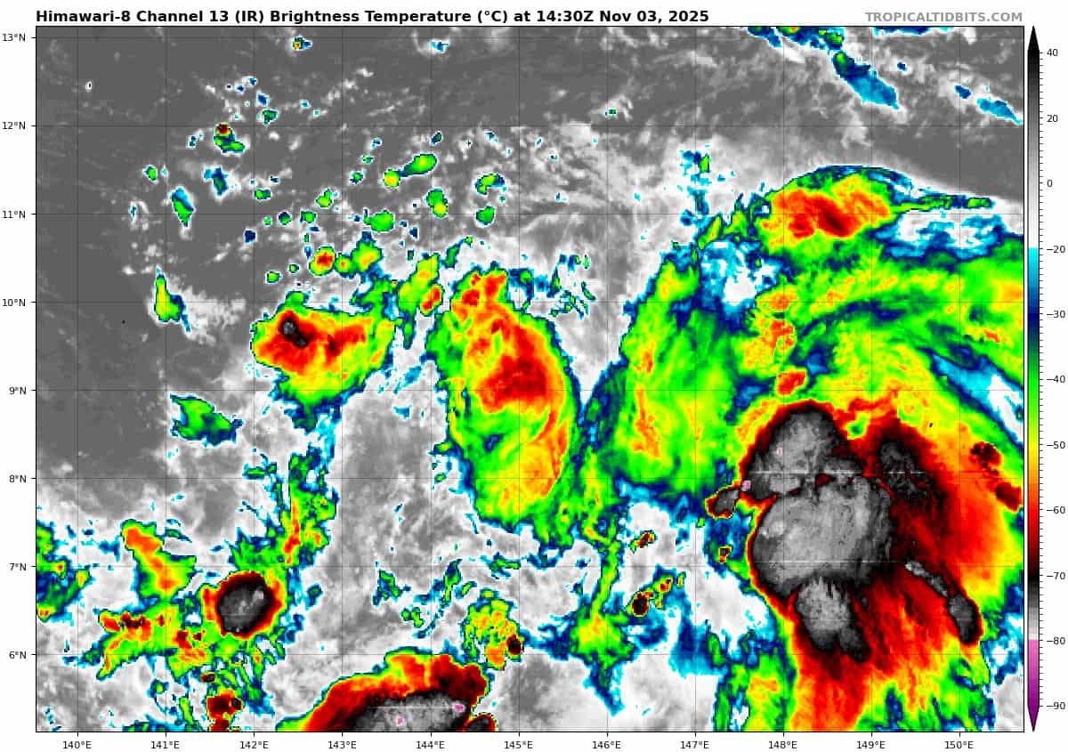
Animated enhanced infrared (eir) satellite imagery depicts typhoon 31W (Kalmaegi) with an extremely symmetric and very cold central dense overcast (cdo) directly over the center. The system has about as strong of an appearance as possible without having an eye. as of 031200z, 31W is about 70 NM off the coast of Leyte, with landfall expected in the next 4-6 hours. A 031016z f16 ssmis 91 ghz microwave image revealed a highly compact core with a small microwave eye feature and a defined convective band along the western periphery.
Environmental analysis indicates that 31W is in a favorable environment characterized by strong poleward and equatorward outflow aloft, moderate (15-20 kts) vertical wind shear, and warm (29-30 c) sea surface temperatures.
Once 31W makes landfall in Vietnam, rugged terrain interaction will rapidly deteriorate the vortex. Complete dissipation is forecast to occur around 96 hours as the remnant vortex tracks into eastern Thailand.