
")
Current Snapshot
For all the latest updates visit: DisasterAWARE

ensenada.jpg

dsc_0053.jpg
PDC executive team and AHA Centre Executive Director Adelina Kamal (third from left) at PDC headquarters.
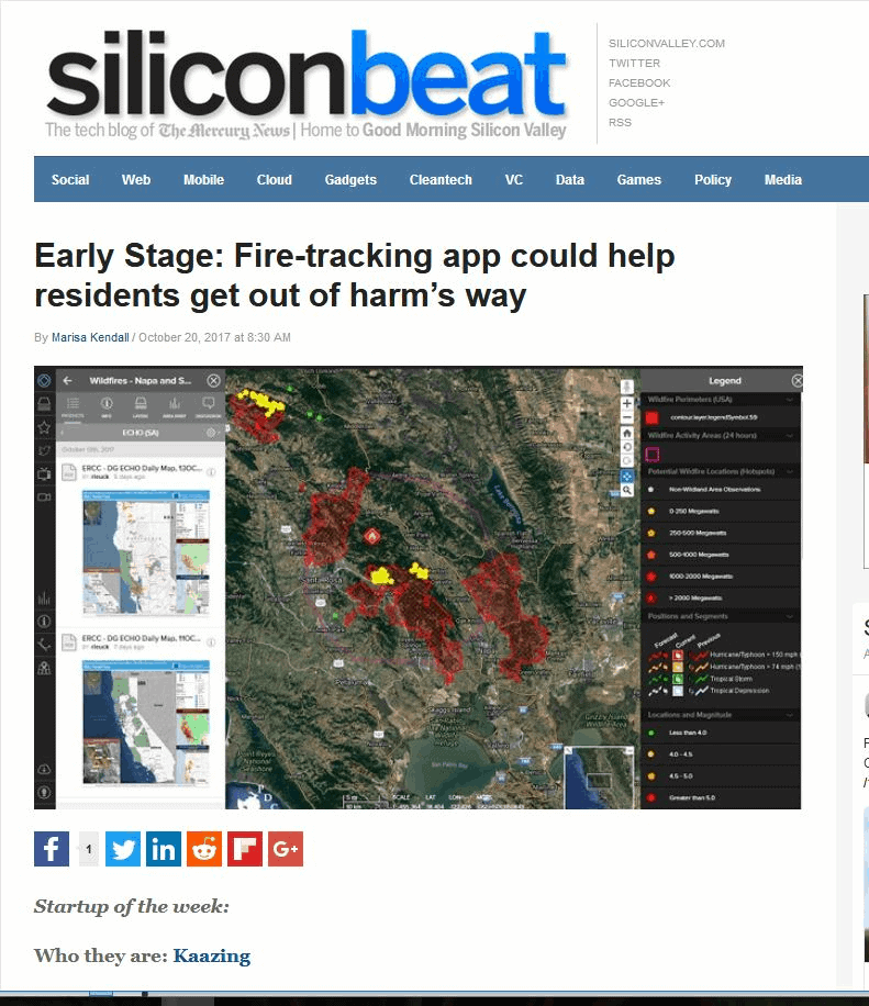
silicon.jpg
proceso.jpg
vigia.jpg
By PDC’s Senior Weather
Specialist Glenn James

The Pacific Disaster Center’s (PDC Global) Tuesday, April 22, 2025, Tropical Cyclone Activity Report…for the Pacific Ocean, the Indian Ocean, and adjacent Seas
Current Tropical Cyclones:
There are no Tropical Cyclones
Northeast Pacific Ocean: There are no Tropical Cyclones
The last regularly scheduled Tropical Cyclone Activity Report of the 2024 eastern North Pacific Hurricane Season has been issued. Routine issuance of this section of the PDC product will resume on May 15, 2025. During the off-season, Special Tropical Weather Outlooks will be issued as conditions warrant by the NHC.
Central Pacific Ocean: There are no Tropical Cyclones
The 2024 central North Pacific hurricane season has ended. As such, the final routine Tropical Cyclone Activity Report for the 2024 season has been issued. Routine issuance of this section of the PDC product will resume on June 1, 2025. During the off-season, Special Tropical Weather Outlooks will be issued as conditions warrant by the CPHC.
Western Pacific, Indian Ocean, and adjacent Seas: There are no Tropical Cyclones
Southwest Pacific Ocean
There’s an area of disturbed weather being referred to Remnants of 31P, which is located approximately 268 NM northeast of Darwin, Australia
Animated multi-spectral satellite imagery depicts bursting convection in the northern periphery displaced east of a disorganized llcc. The remnant vortex is tilted eastward with height due to mid-level shear. A microwave image showed scattered and highly disorganized convection.
Environmental analysis shows marginally favorable conditions throughout the area with low to moderate vws (10-15 knots), warm sea surface temperatures, and moderate divergence aloft, but also a lack of strong vertical instability, which has periodically disrupted convective activity. global models are currently in fair agreement on slight potential for regeneration over the next few days.
Maximum sustained surface winds are estimated at 15 to 20 knots.
The potential for the development of a significant tropical cyclone within the next 24 hours is low.