
")
Current Snapshot
For all the latest updates visit: DisasterAWARE

2
7

1800×1080
feng
30W_221800sair
chenge
04S_221800sair
97w
himawari8_ir_97W_202510222140_lat21.2-lon122.6

97W_tracks_latest
95S
himawari8_ir_95S_202510222140_lat-7.9-lon90.1
95S_tracks_latest
92A
meteosat9_ir_92A_202510222151_lat9.4-lon67.0
92A_tracks_latest
By PDC’s Senior Weather
Specialist Glenn James

The Pacific Disaster Center’s (PDC Global) Wednesday, October 22, 2025, Tropical Cyclone Activity Report…for the Pacific Ocean, the Indian Ocean, and adjacent Seas
Current Tropical Cyclones:
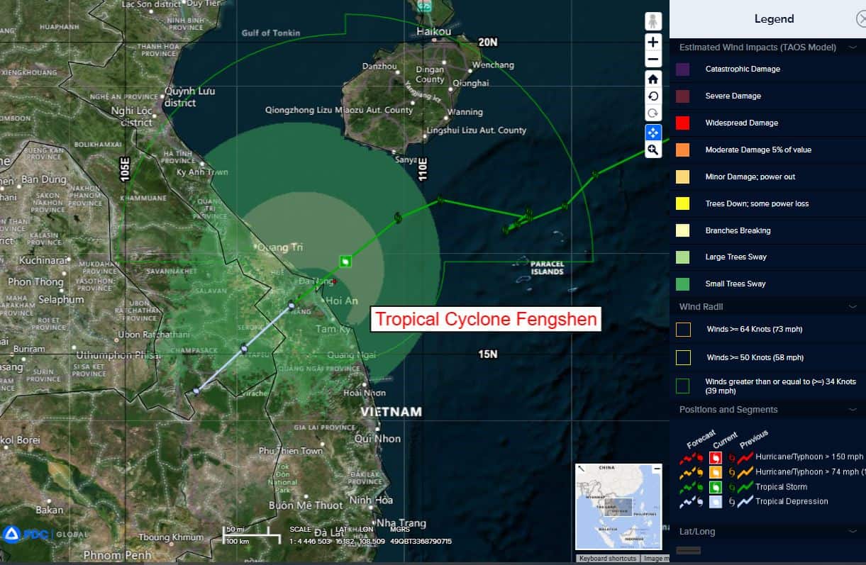
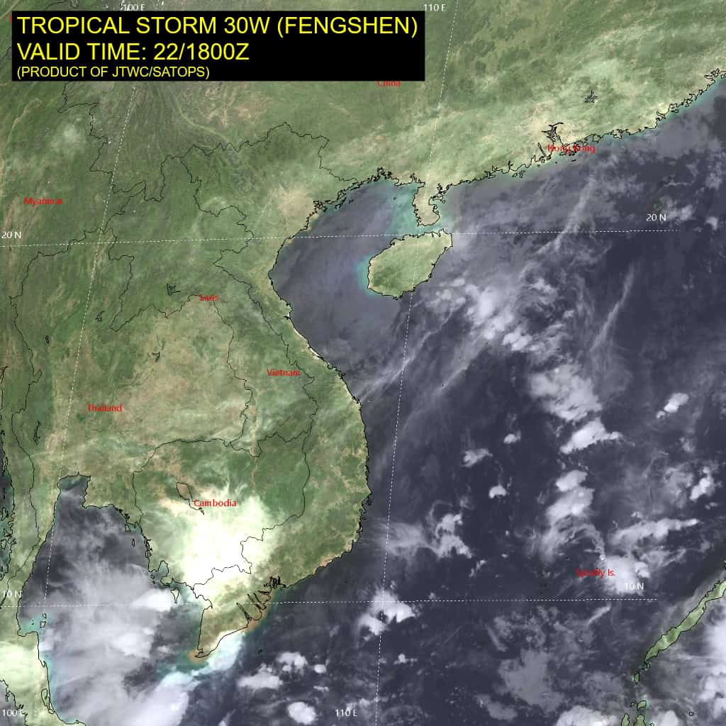
Tropical Cyclone 03W (Fengshen)…is located approximately 17 NM east of Da Nang, Vietnam – Final Warning
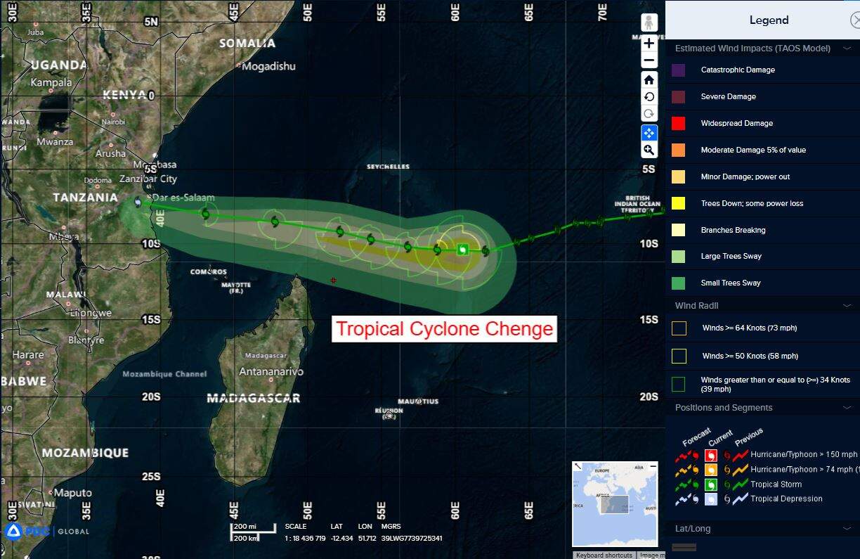
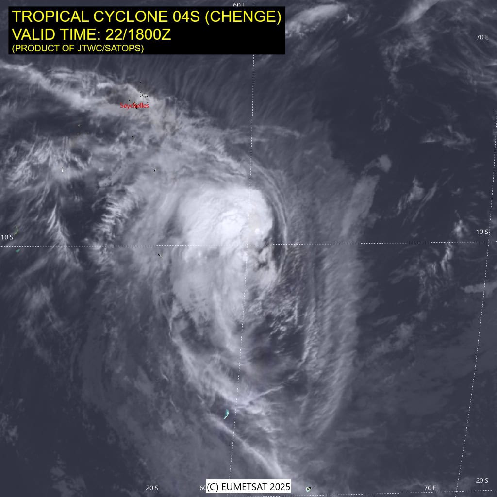
Tropical Cyclone 04S (Chenge)…is located approximately 611 NM north-northeast of Port Louis, Mauritius
Northeast Pacific Ocean: There are no Tropical Cyclones
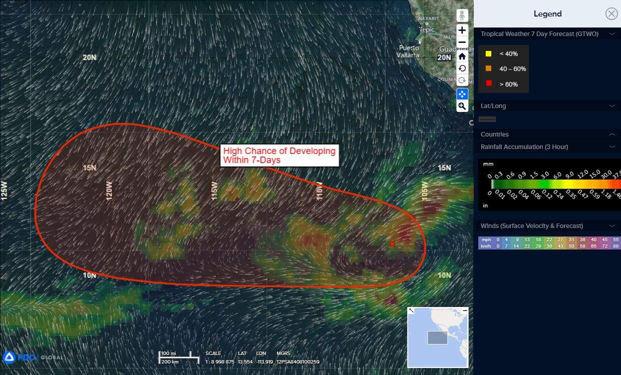
Central East Pacific:
>>> A tropical wave located several hundred miles southwest of the coast of southwestern Mexico is producing disorganized showers and thunderstorms. Environmental conditions appear conducive for gradual development of this system, and a tropical depression is likely to form by the end of the weekend while it moves generally westward at 10 to 15 mph.
* Formation chance through 48 hours…low…30 percent
* Formation chance through 7 days…high…70 percent
Central Pacific Ocean: There are no Tropical Cyclones
Tropical cyclone formation is not expected during the next 7 days.
Western Pacific, Indian Ocean, and adjacent Seas:
Western Pacific
Tropical Cyclone 03W (Fengshen) – Final Warning
According to the JTWC warning number 21, sustained winds are 25 knots with gusts to near 35 knots
Animated multi-spectral imagery reveals that the low-level circulation center is fully exposed and located just off the coast of Da Nang, Vietnam. The significant dry air entrainment and southwesterly vertical wind shear has considerably weakened 30W over the past 6 hours.
As Fengshen has tracked closer to land, terrain interaction has become an additional factor in expediting Fengshen’s terminal weakening. 30W will continue tracking southwestward while over land in Vietnam, and dissipation is expected within 24 hours of landfall.
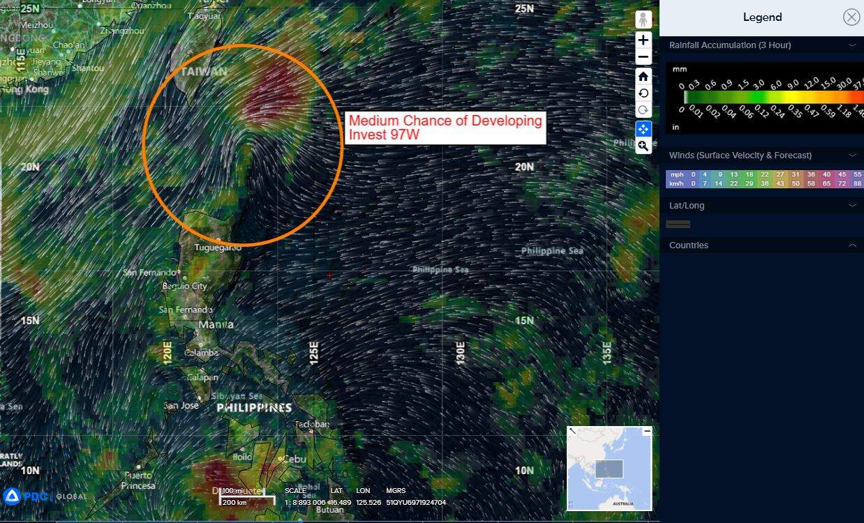
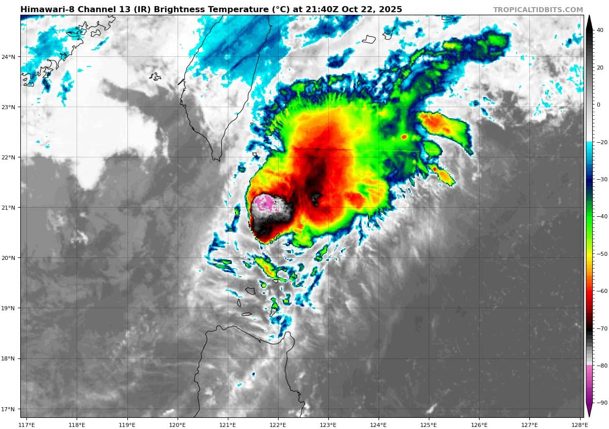
>>> There’s an area of disturbed weather being referred to as Invest 97W…which is located approximately 156 NM east of Kaohsiung, Taiwan
Animated enhanced multi-spectral satellite imagery (msi) depicts a partially-exposed low level circulation center (llcc) to the southwest of a patch of persistent, flaring convection. a 220108
ascat metop-c shows a compact low level circulation positioned just to the east of gale force winds associated with a cold surge to the west and extensive 15-20 kt winds wrapping along the eastern periphery.
Environmental analysis indicates marginal conditions for development with warm sea surface temperatures (29-30 c) and good equatorward outflow aloft offset by high vertical wind shear (25-30 kts).
Global models depict 97W potentially developing as a distinct, but short lived, tropical depression separate from the cold surge flow over the next two days.
Maximum sustained surface winds are estimated at 18 to 23 knots.
The potential for the development of a significant tropical cyclone within the next 24 hours remains medium.
South Indian Ocean
Tropical Cyclone 04S (Chenge)
According to the JTWC warning number 14, sustained winds are 55 knots with gusts to near 70 knots
Animated enhanced infrared (eir) satellite imagery depicts a partially exposed low level circulation center (llcc) with struggling convection sheared to the west-southwest. The storm is struggling to maintain structure against the moderate to high (20-25 kts) easterly vertical wind shear and dry air from the east entraining into the core. A 221438z 91ghz ssmis image reveals that the upper-level center is displaced to the west of the low level center.
Tropical cyclone 04S (Chenge) will continue along a westward track as it remains under the steering influence of the str to its southeast for the next 24 hours. Beginning around 24 hours, the steering str will build and extend westward, causing 04S to assume a west-northwestward trajectory, which will continue for the remainder of the forecast period.
Landfall is forecast near Dar Es Salaam, Tanzania around 102 hours. The environment will remain marginally unfavorable over the forecast duration, stifling chances for re-intensification.
Significant dry air entrainment along the eastern flank and easterly vertical wind shear will continue to pummel chenge, leading it to slowly but steadily weaken, with dissipation forecast over water between 96-120 hours.
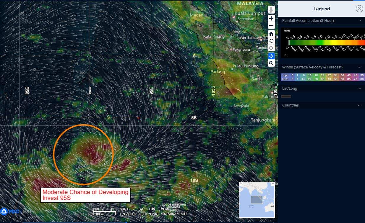
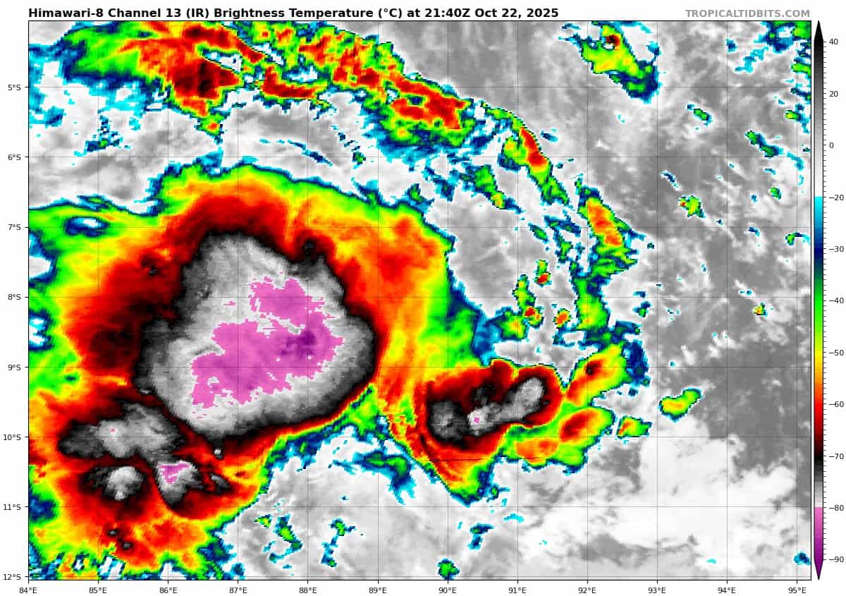
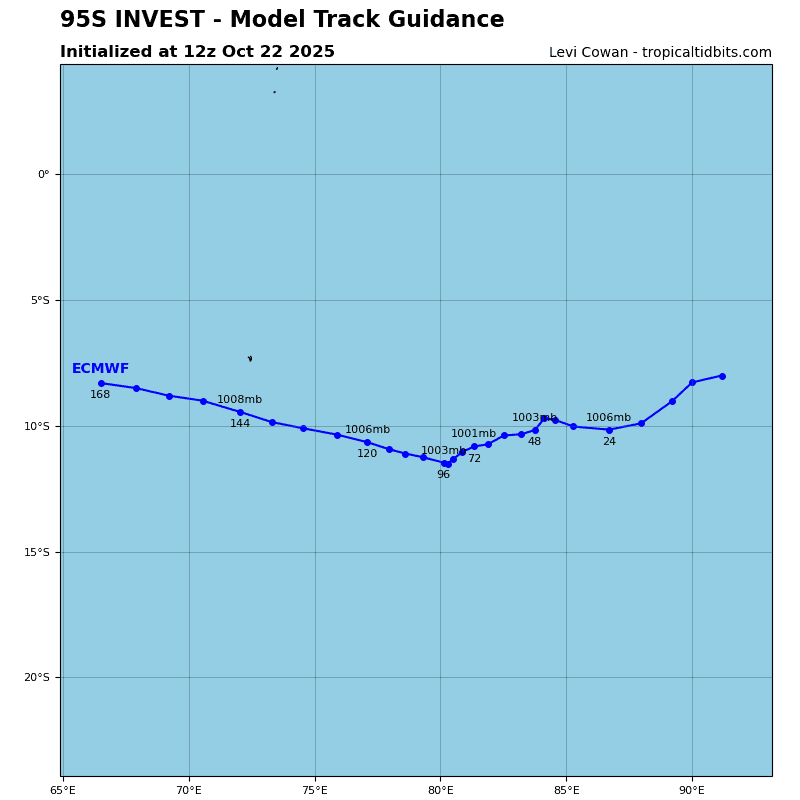
>>> There’s an area of disturbed weather being referred to as Invest 95S…which is located approximately 443 NM northwest of Cocos Islands.
Enhanced infrared satellite imagery (eir) depicts a slow consolidating circulation with persistent deep convection associated with the low-level circulation center.
Environmental analysis reveals marginal conditions for development with moderate vertical wind shear (20-25 knots) good poleward outflow aloft, and warm sea surface temperatures (28-29 c).
Global models reveal a trackable circulation, with weak development and a west-southwest track over the next 24-48 hours.
Maximum sustained surface winds are estimated at 22 to 28 knots.
The potential for the development of a significant tropical cyclone within the next 24 hours remains medium.
Arabian Sea
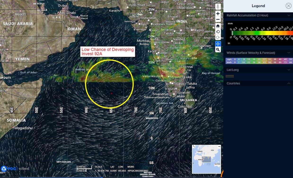
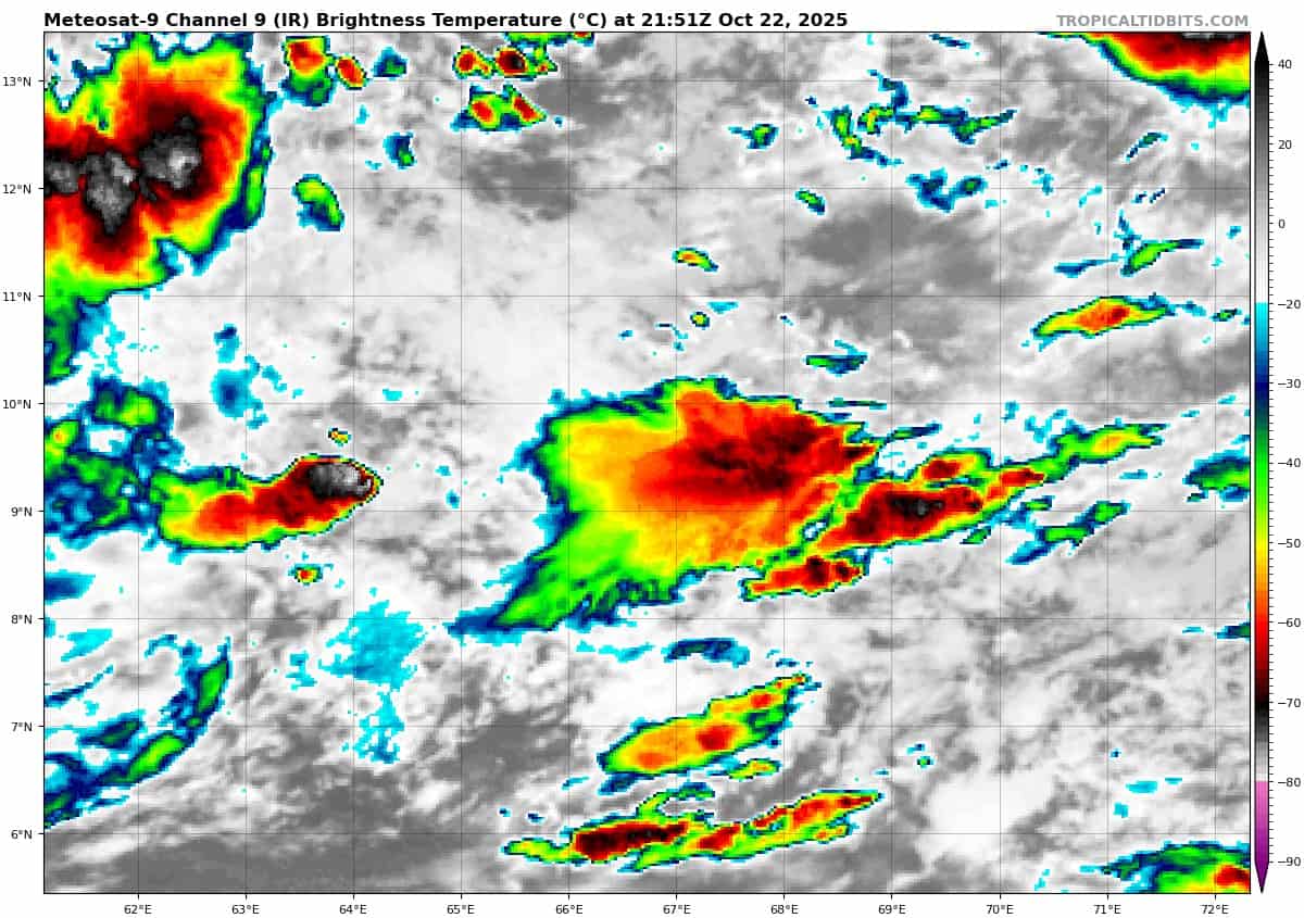
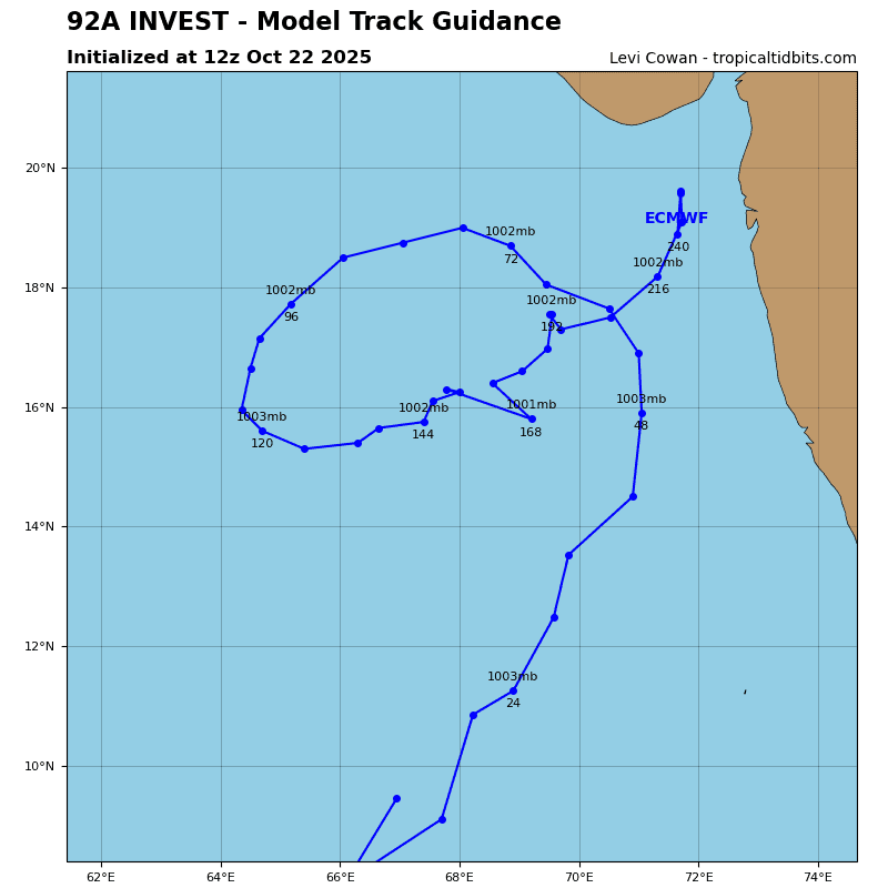
>>> There’s an area of disturbed weather being referred to as Invest 92A…which is located approximately 495 NM west of Cochin.
Enhanced infrared satellite imagery (eir) depicts a poorly disorganized broad circulation with minimal, but flaring convection throughout the greater broad turning associated with invest 92A.
Environmental analysis reveals marginal conditions for development with moderate to high vertical wind shear (20-25 knots), diffluent outflow, and warm sea surface temperatures (28-29 c).
Global models are in fair agreement that invest 92A will remain a broad disorganized circulation with a northwestern track within the next 24-48 hours.
Maximum sustained surface winds are estimated at 18 to 23 knots.
The potential for the development of a significant tropical cyclone within the next 24 hours remains low.