Western Pacific, Indian Ocean, and adjacent Seas:
Western Pacific

")
By PDC’s Senior Weather
Specialist Glenn James

The Pacific Disaster Center’s (PDC Global) Sunday, October 12, 2025, Tropical Cyclone Activity Report…for the Pacific Ocean, the Indian Ocean, and adjacent Seas
Current Tropical Cyclones:
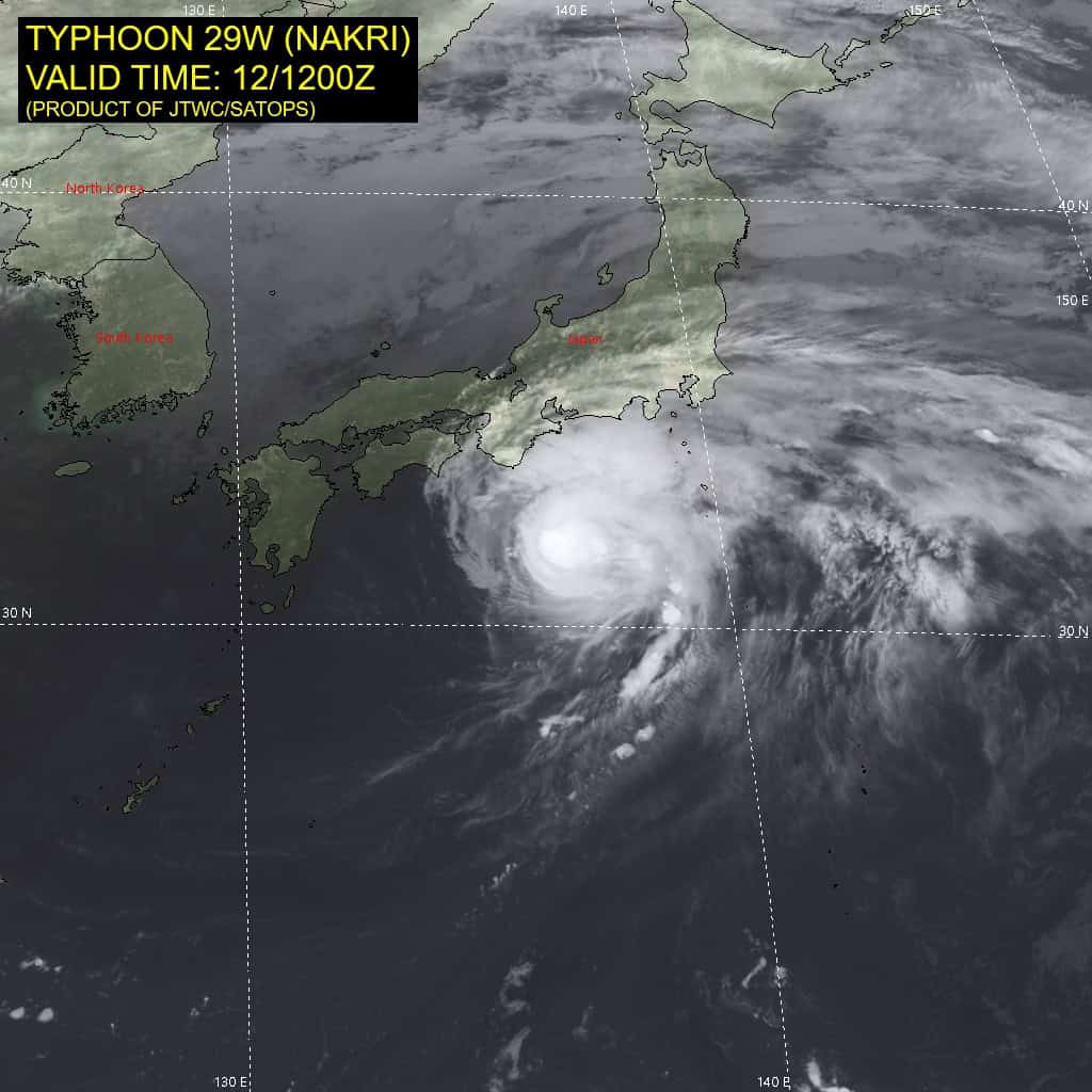
Tropical Cyclone 29W (Nakri) is located approximately 188 NM south of Camp Fuji
Northeast Pacific Ocean:
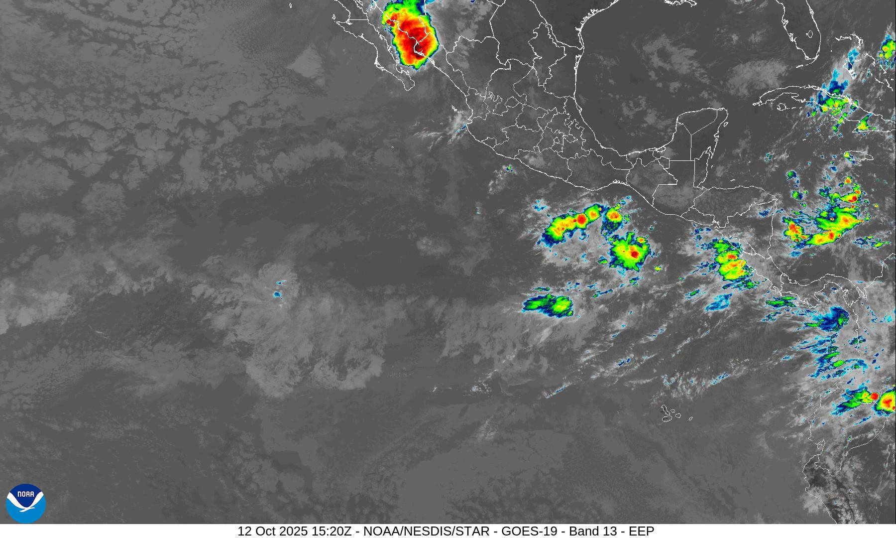
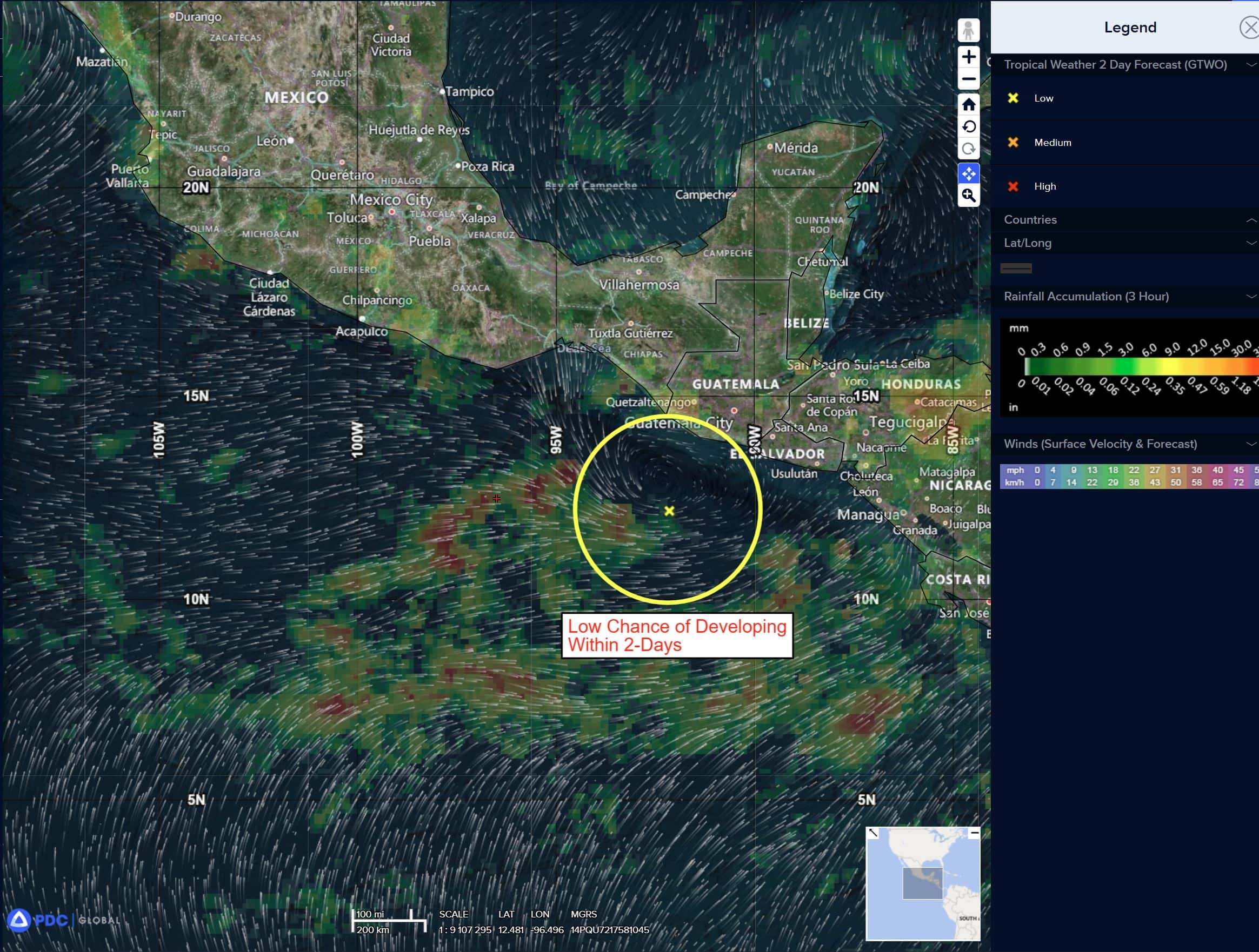
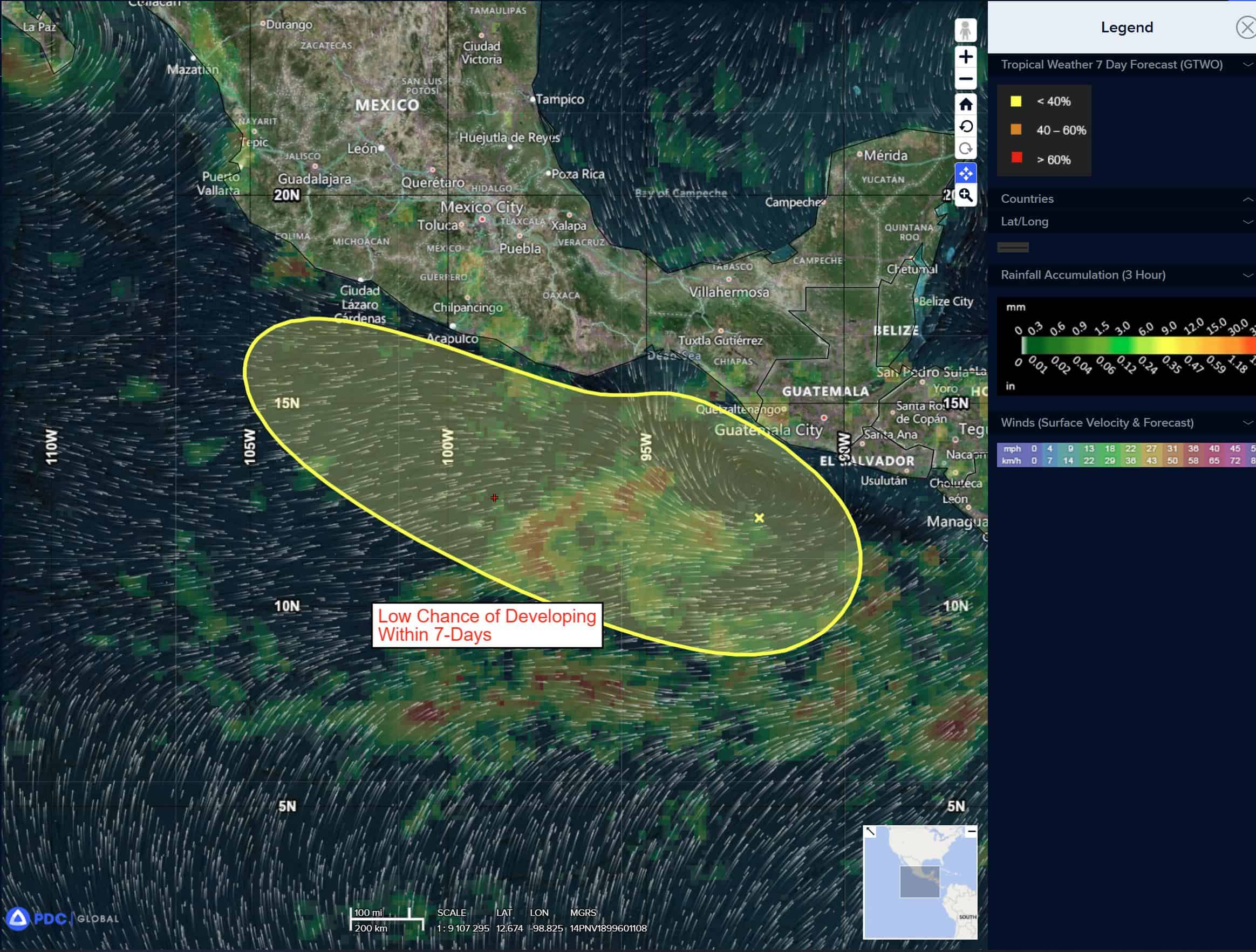
South of Southern Mexico:
>>> A large area of showers and thunderstorms, located a couple of hundred miles south of the coast of southern Mexico, is associated with an elongated area of low pressure. Little, if any, development is expected to occur during the next few days while it meanders well offshore. Toward the end of the week, environmental conditions appear conducive for some development while the system drifts northward or northwestward near or just offshore of the coast of southern Mexico.
* Formation chance through 48 hours…low…near 0 percent
* Formation chance through 7 days…low…30 percent
Central Pacific Ocean: There are no Tropical Cyclones
Tropical cyclone formation is not expected during the next 7 days.
Western Pacific, Indian Ocean, and adjacent Seas:
Western Pacific
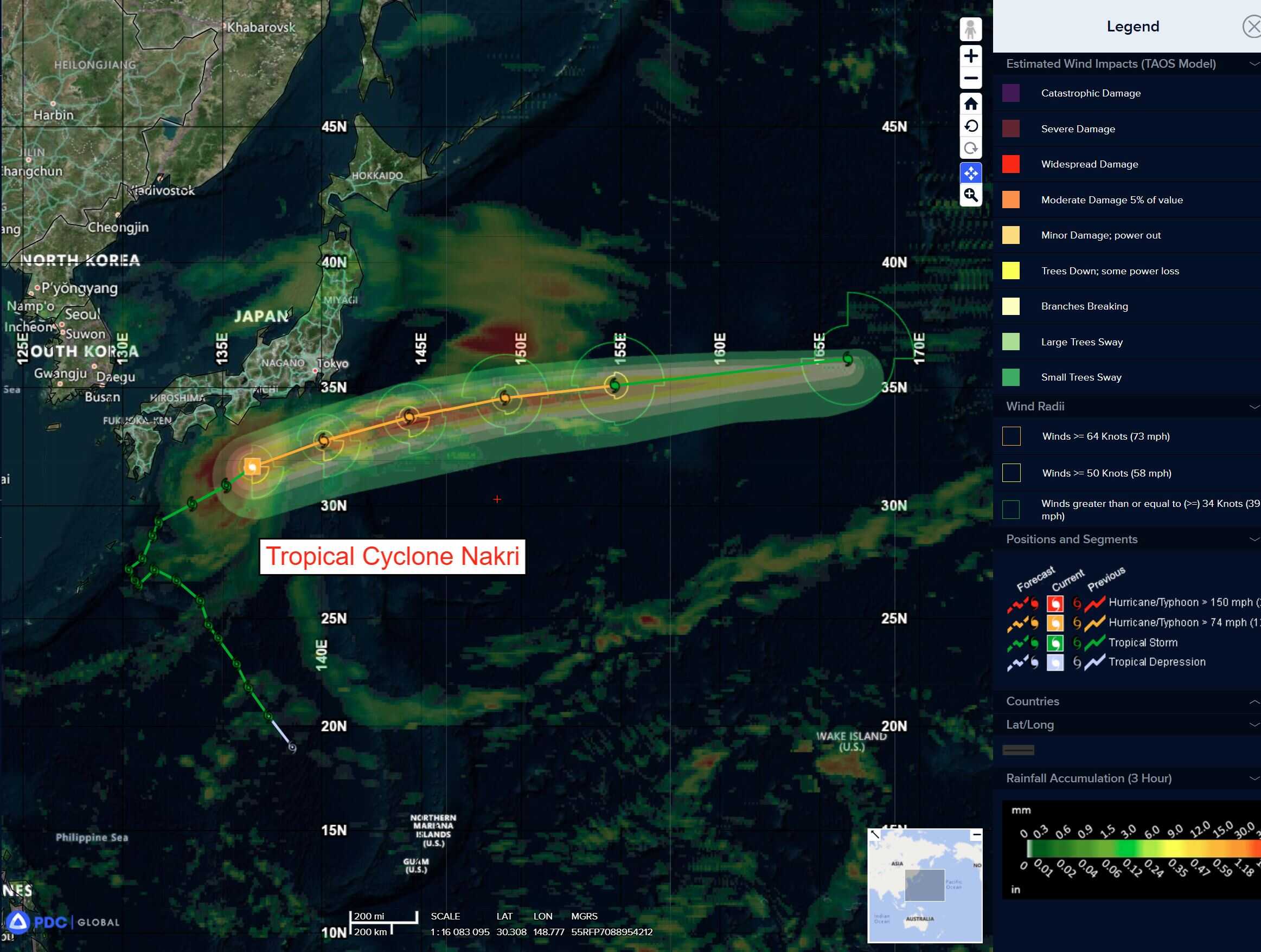
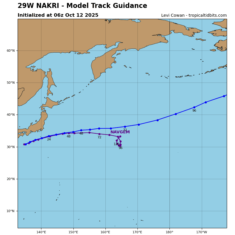
Tropical Cyclone 29W (Nakri)
According to the JTWC warning number 19
Sustained winds are 70 knots with gusts to 85 knots
Animated enhanced infrared (eir) satellite imagery depicts typhoon 29W (Nakri) with improving circulation wrapped by deep convection. TY Nakri continues to strengthen as witnessed by increased rate of convection and a cooling trend evident in the eir. The translation speed of the system has remained fairly consistent as it rounds the northern periphery of a str to the southeast.
TY Nakri has started to encounter slightly less favorable environmental conditions with vertical winds shear (vws) increasing to 10-15 knots and sea surface temperatures cooling to between 27-28 c.
TY Nakri has continued to track northeast under the influence of a str to the southeast. The system has continued to improve over the past 6 hours and will continue to improve till around 24 hours having achieved a peak intensity of 75 knots. Slightly deteriorating environmental conditions are not yet significant enough to degrade the strong system.
Expectation is for the dry air to start wrapping into the core within the next 24 hours. Simultaneously around 48 hours, TY Nakri will encounter more unfavorable wind shear (30-40 knots) resulting in a weakening trend and kicking off extratropical transition (ett), which is expected to conclude by 72 hours.
There’s an area of disturbed weather being referred to as Invest 96W, which is located approximate 507 NM south-southeast of Guam
Animated multi-spectral satellite imagery depicts a poorly organized circulation with weak flaring convection.
Environmental analysis for this area is moderately unfavorable with very warm (30-31 c) sea surface temperatures, moderate poleward outflow, offset by high (20-25 knot) southwesterly vertical wind shear.
Deterministic and ensemble models are in good agreement that 96W will develop along a north-westward track with gradual intensification over time, with the exception of ecmwf lacking development until the system approaches the northern tip of Luzon.
Maximum sustained surface winds are estimated at 13 to 17 knots.
The potential for the development of a significant tropical cyclone within the next 24 hours is low.