
")
Current Snapshot
For all the latest updates visit: DisasterAWARE
1800x1080e
7
nak
29W_141200sair
29W_tracks_latest
96w

96W_tracks_latest
By PDC’s Senior Weather
Specialist Glenn James

The Pacific Disaster Center’s (PDC Global) Tuesday, October 14, 2025, Tropical Cyclone Activity Report…for the Pacific Ocean, the Indian Ocean, and adjacent Seas
Current Tropical Cyclones:
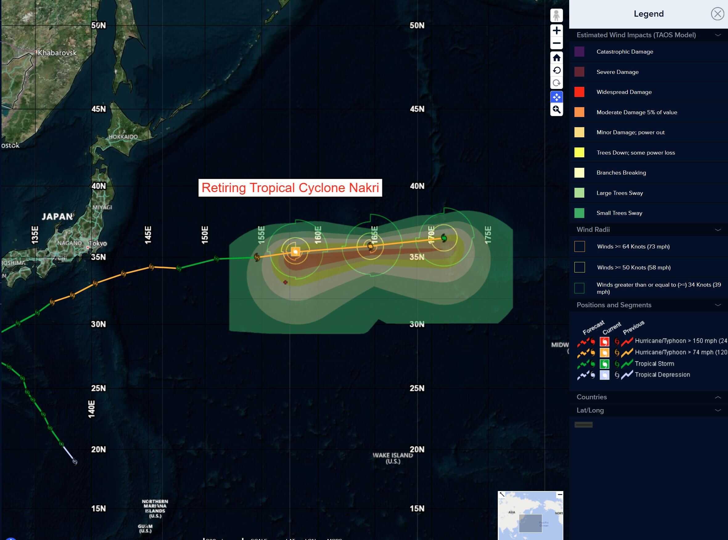
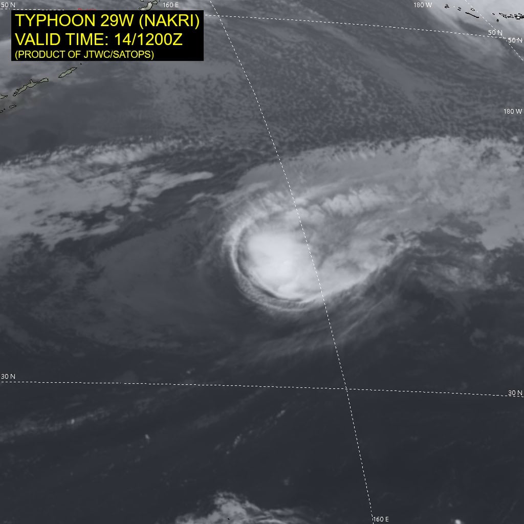
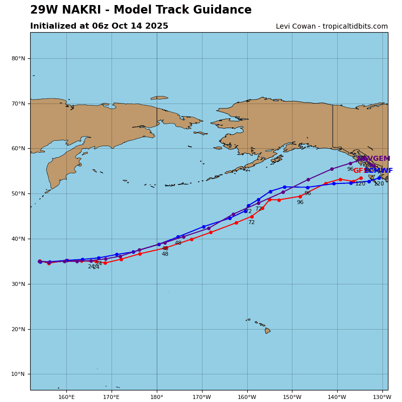
Tropical Cyclone 29W (Nakri) is located approximately 703 NM north-northeast of Minami Tori Shima – Final Warning
Northeast Pacific Ocean:
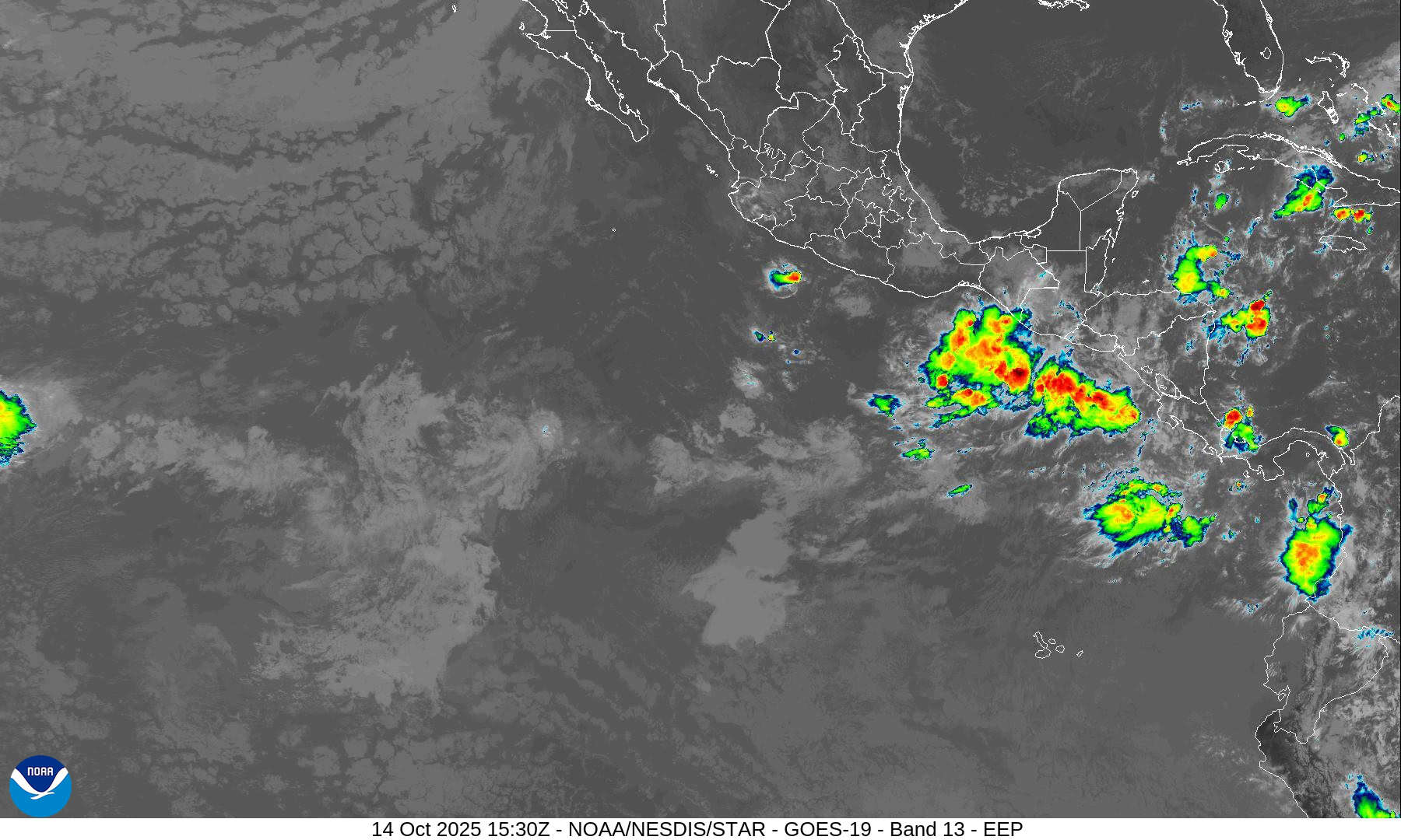
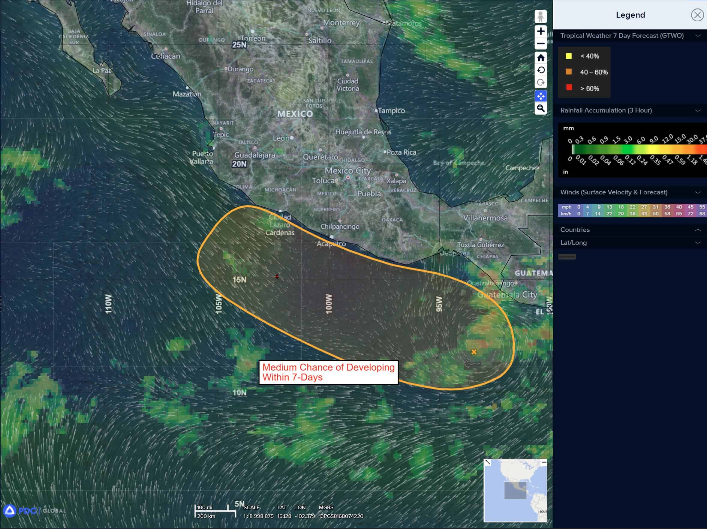
South of Southern Mexico:
>>> A broad area of low pressure is producing a large area of disorganized showers and thunderstorms near the coast of southern Mexico and portions of Central America. Environmental conditions appear conducive for gradual development, and a tropical depression could form late this week or over the weekend. This system is expected to move little during the next few days, but a slow northwestward motion near the coast of southern and southwestern Mexico is expected by the weekend.
* Formation chance through 48 hours…low…40 percent
* Formation chance through 7 days…medium…60 percent
Central Pacific Ocean: There are no Tropical Cyclones
Tropical cyclone formation is not expected during the next 7 days.
Western Pacific, Indian Ocean, and adjacent Seas:
Western Pacific
Tropical Cyclone 29W (Nakr) – Final Warning
According to the JTWC warning number 26
Sustained winds are 70 knots with gusts to 85 knots
Typhoon 29W has begun extratropical transition (ett), based on fsu phase-space diagrams, Manual phase classification worksheets and on the overall structural changes seen in a 141004z ascat-c pass, which shows an elongated low level circulation center (llcc) and a strong warm frontal signature.
A 141004z amsu-b 89ghz microwave image revealed a highly asymmetric structure, with a delta rain region in the northeastern sector, along and near the warm front, providing additional confirmation that the system is in the throws of ett.
Animated eir imagery also shows a rapidly deteriorating structure, though the system retains some tropical-like characteristics particularly in the upper-level outflow structure.
Environmental conditions are highly unfavorable, with shear exceeding 35 knots, ssts well below 26c and robust poleward outflow into the right rear entrance region of a 150 knot jet max.
The system will continue tracking eastward through the forecast period, along the northern periphery of a deep subtropical ridge (str) to the south. TY 29W is forecast to transition into strong storm-force, cold-core, mid-latitude cyclone within the next 12 hours.
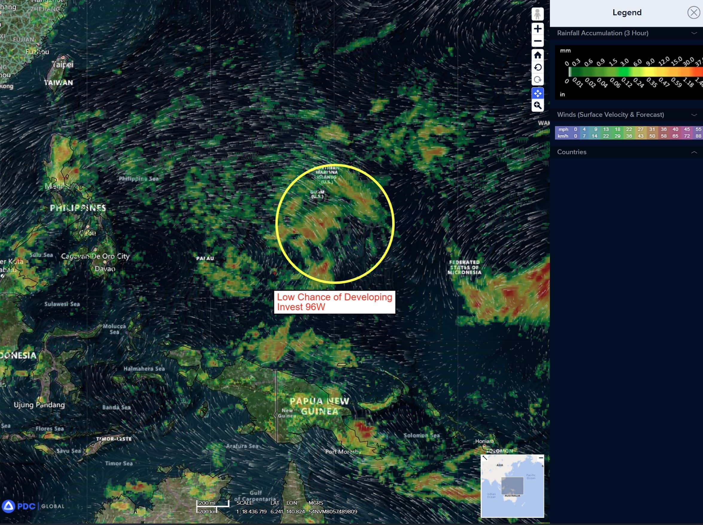
There’s an area of disturbed weather being referred to as Invest 96W, which is located approximate 163 NM south-southeast of Guam
Animated multi-spectral imagery (msi) depicts a wave-like feature with no defined low-level circulation (llc), moving toward the north-west. A 132330z ascat-b pass also shows no closed circulation, but a weak trough or wave, with a southwest-northeast axis, situated to the southeast of Guam.
The animated msi suggests some mid-level rotation, however the shape and orientation of the mid- and upper-level clouds is a reflection of the upper-level
outflow orientation and there is no actual evidence of any rotation anywhere in the column.
Environmental analysis reveals favorable conditions for development with low vertical wind shear (less than 15 knots), warm ssts (29-30c) and good poleward outflow aloft along the eastern side of the tropical upper-tropospheric trough (tutt) which extends from the Philippines to the northeast of the Marianas.
Deterministic models depict 96W moving in a northwestward track, with little to no development within next 24-48 hours. Both the GEFS and ECENS ensemble models are both in agreement that 96W will also track to the north-northwest over the next 24-48 hours, but also depict little in the way of development until the system is well past Guam.
Maximum sustained surface winds are estimated at 18 to 23 knots.
The potential for the development of a significant tropical cyclone within the next 24 hours remains low.