
")
Current Snapshot
For all the latest updates visit: DisasterAWARE
1800x1080eee
2
7
nak
29W_131200sair
29W_tracks_latest
96w
96W_geps_latest
By PDC’s Senior Weather
Specialist Glenn James

The Pacific Disaster Center’s (PDC Global) Monday, October 13, 2025, Tropical Cyclone Activity Report…for the Pacific Ocean, the Indian Ocean, and adjacent Seas
Current Tropical Cyclones:
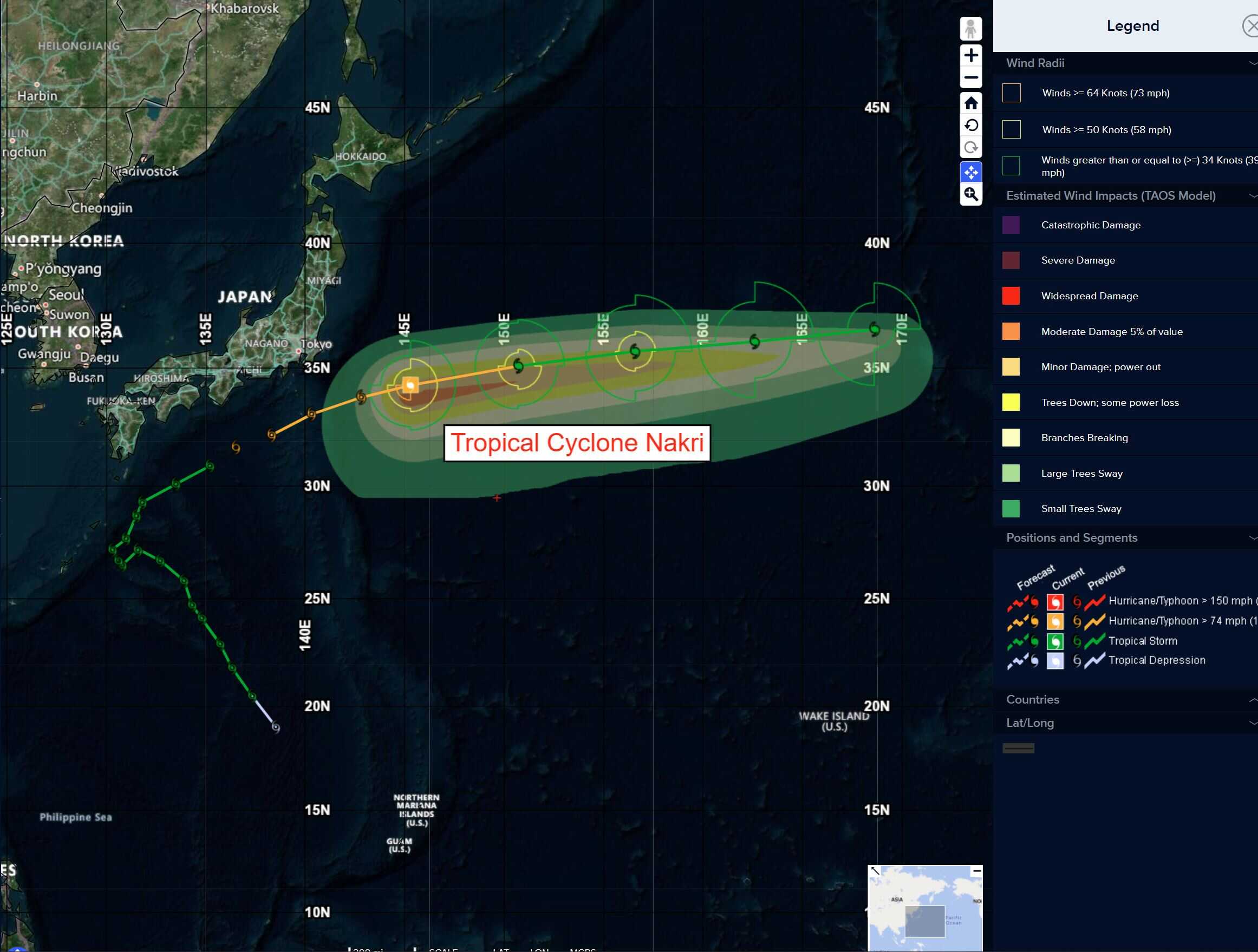
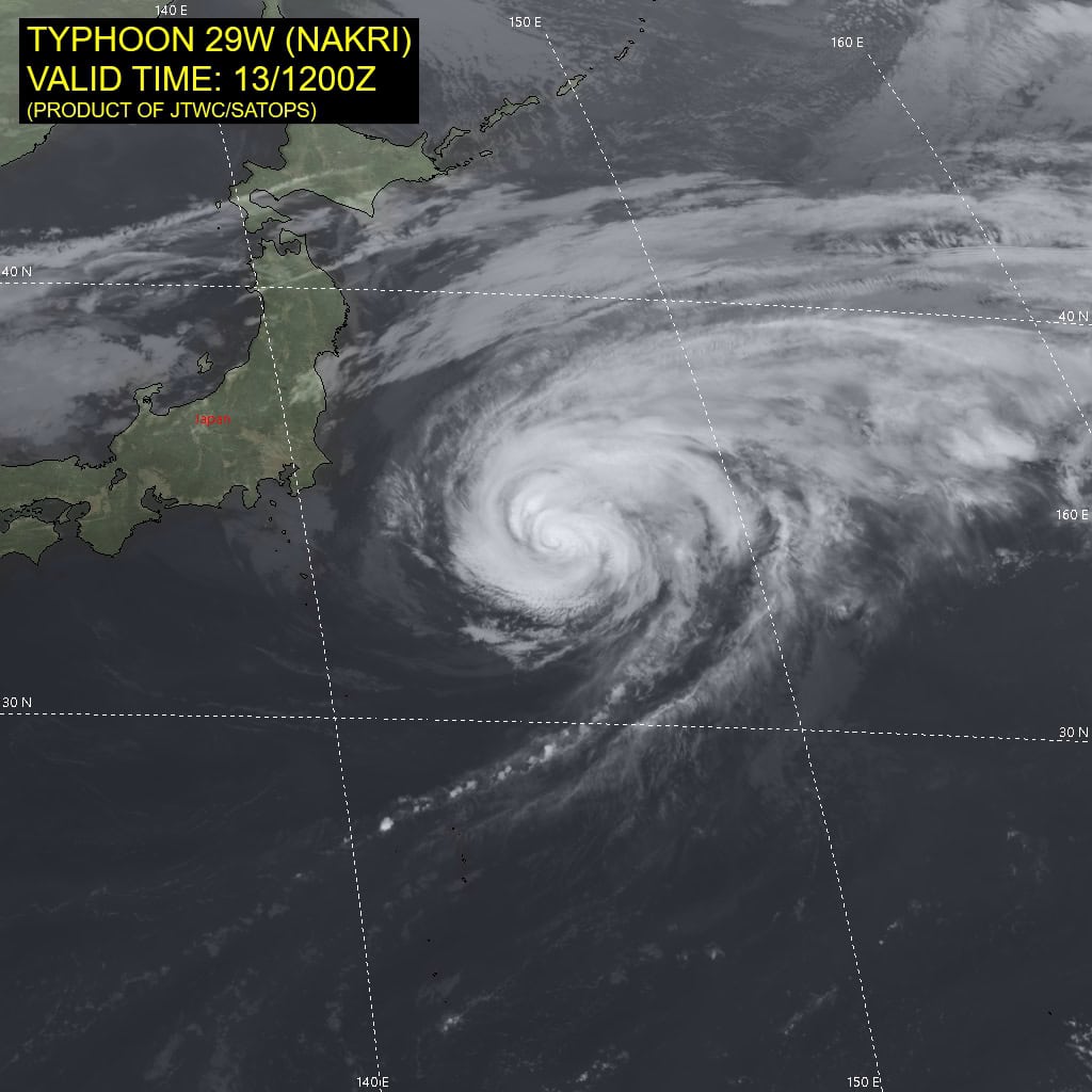
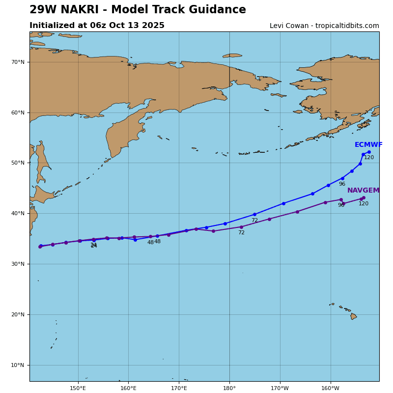
Tropical Cyclone 29W (Nakri) is located approximately 555 NM east of Yokosuka, Japan
Northeast Pacific Ocean:
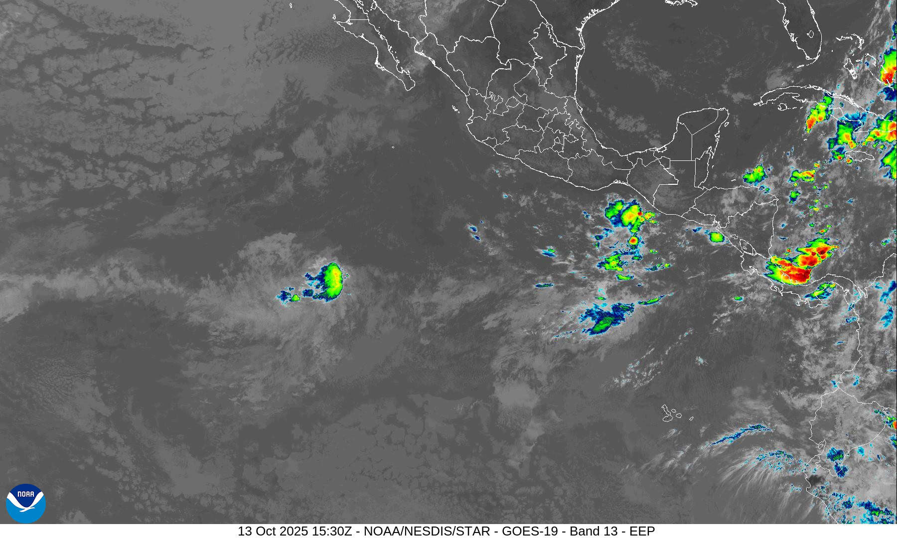
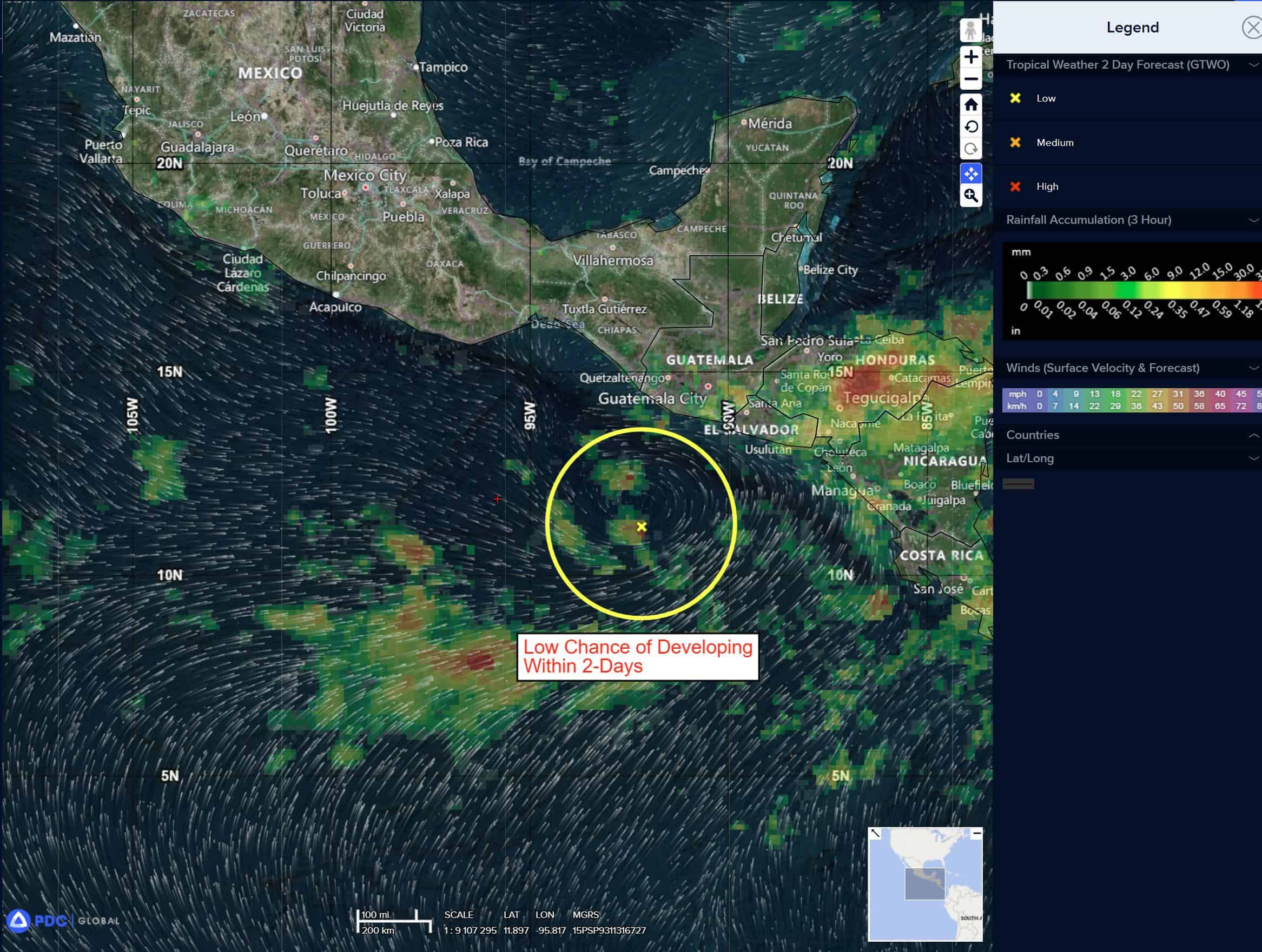
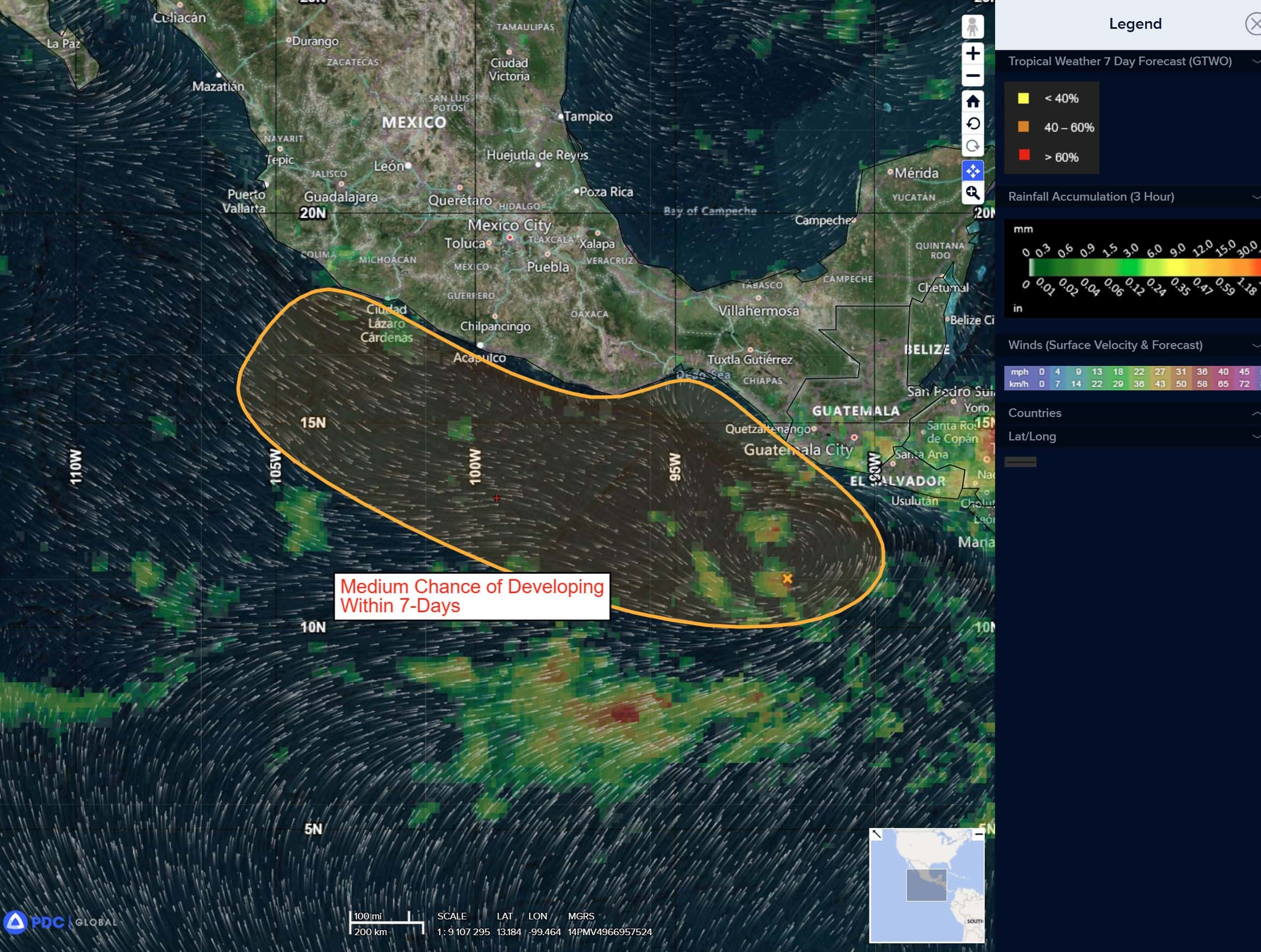
South of Southern Mexico:
>>> A broad area of low pressure located a couple hundred miles south-southwest of Guatemala is producing disorganized showers and thunderstorms. Environmental conditions appear conducive for development during the latter half of the week, and a tropical depression could form as the system drifts northward, then northwestward, near or just offshore of the southern coast of Mexico.
* Formation chance through 48 hours…low…10 percent
* Formation chance through 7 days…medium…50 percent
Central Pacific Ocean: There are no Tropical Cyclones
Tropical cyclone formation is not expected during the next 7 days.
Western Pacific, Indian Ocean, and adjacent Seas:
Western Pacific
Tropical Cyclone 29W (Nakr)
According to the JTWC warning number 24
Sustained winds are 60 knots with gusts to 75 knots
Animated enhanced infrared (eir) satellite imagery depicts little change in the intensity of typhoon 29W (Nakri) as evidenced by fairly steady cloud tops temperatures in eir imagery. As the system has tracked northeastward, steered by an elongated subtropical ridge (str) to the south, equatorward outflow has decreased. strong poleward outflow now stands out as the primary exhaust mechanism.
Current environmental conditions continue to become more unfavorable for TY Nakri with cooling sea surface temperatures (25 c to 26 c), high vertical wind shear (25-30 kts), and a significant amount of dry air wrapping into the core of the vortex.
Typhoon 29W (Nakri) will continue east-northeastward for the remainder of the forecast period.
Environmental conditions are forecast to increasingly deteriorate with the circulation encountering even higher wind shear (35-45 knots) and cooling sea surface temperatures (24 c to 25 c), while continuing to entrain dry air into the core of the system.
Extratropical transition (ett) will commence around 24 hours. though the forecast environmental setup suggests that the system could complete the ett cycle soon after 36 hours, the JTWC forecast maintains that TY Nakri will become fully extratropical at or prior to 48 hours, at an intensity of around 35 knots.
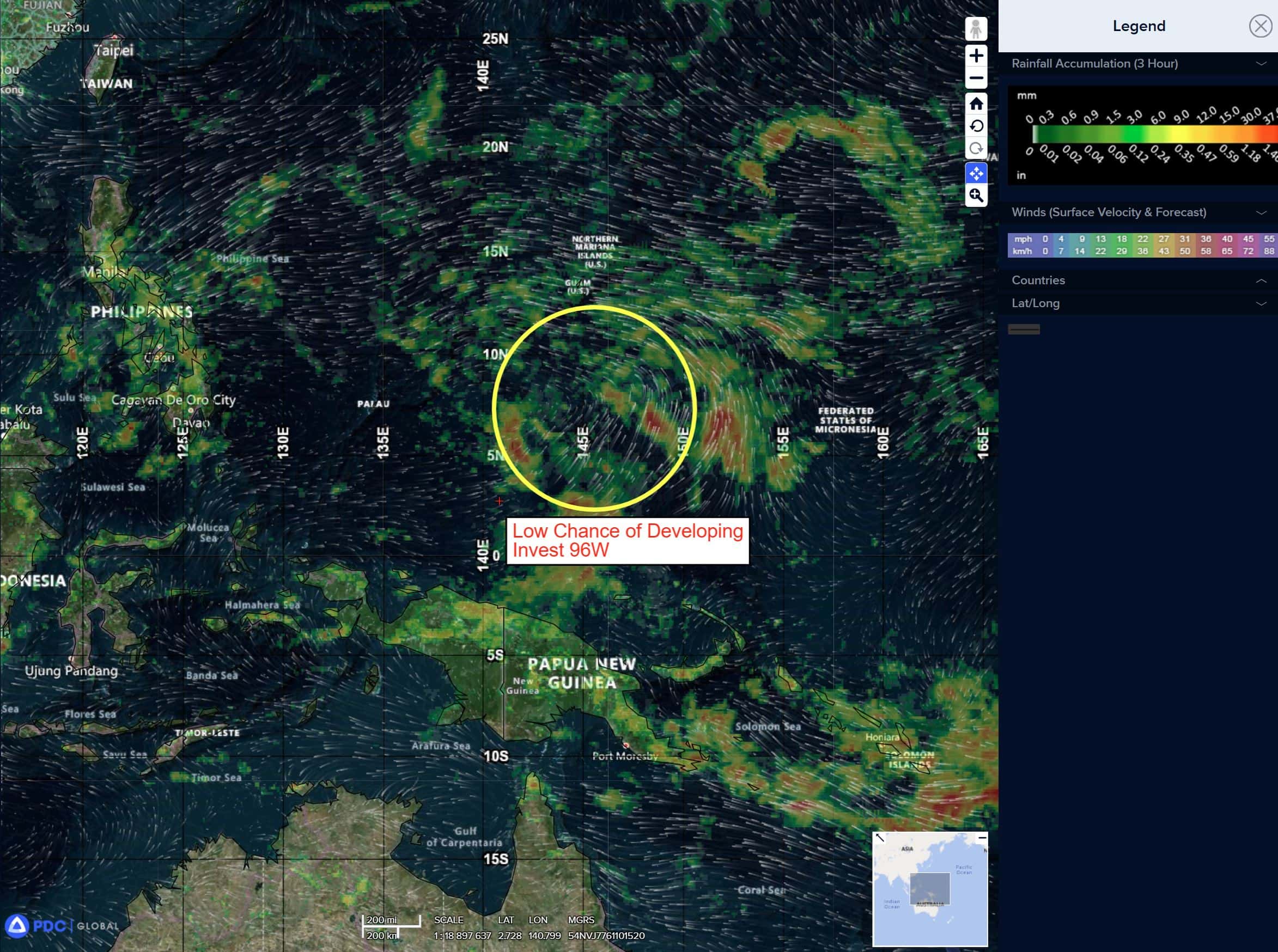
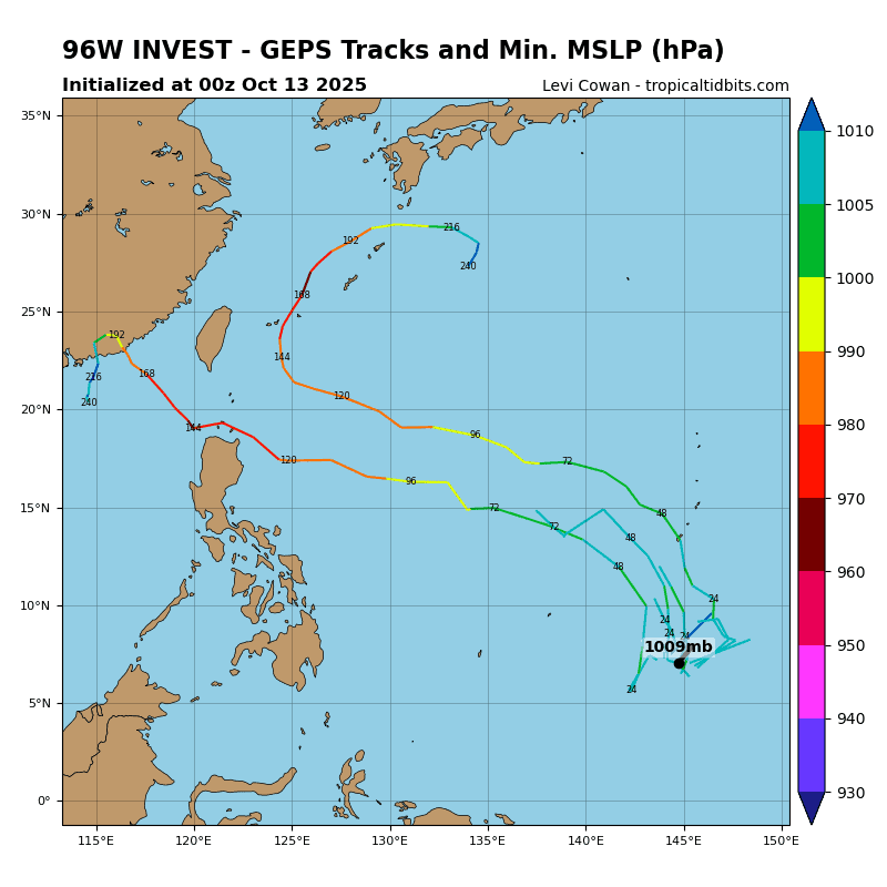
There’s an area of disturbed weather being referred to as Invest 96W, which is located approximate 478 NM south of Guam
Animated multi-spectral satellite imagery as well as a 130433 gmi 89ghz microwave image depict a poorly organized broad area of turning with weak flaring convection along the southern periphery.
Environmental analysis for this area is moderately favorable for development with very warm (30-31 c) sea surface temperatures, moderate poleward outflow, and low (5-10 knot) vertical wind shear.
Deterministic and ensemble models are in good agreement that the area of convection (96W) will develop along a north-westward track with gradual intensification over time, with the exception of ECMWF which lacks development until the system approaches the northern tip of Luzon.
Maximum sustained surface winds are estimated at 13 to 18 knots.
The potential for the development of a significant tropical cyclone within the next 24 hours remains low.