

")
Current Snapshot
For all the latest updates visit: DisasterAWARE
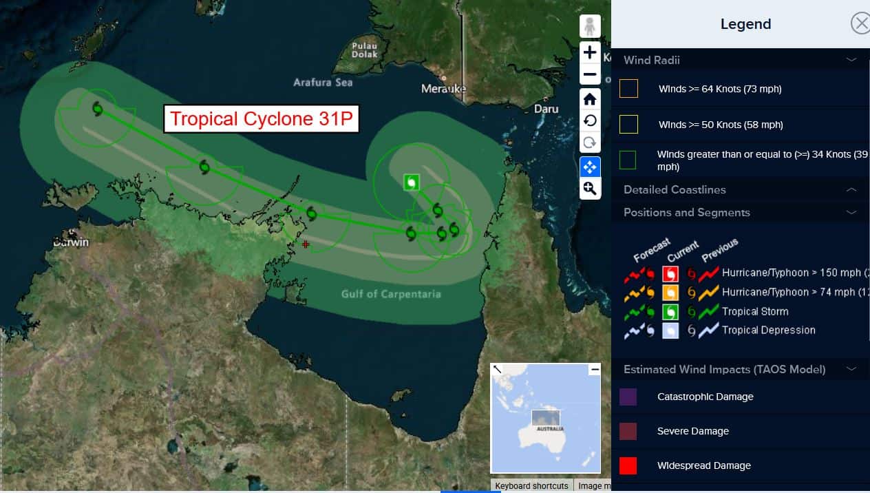
31p
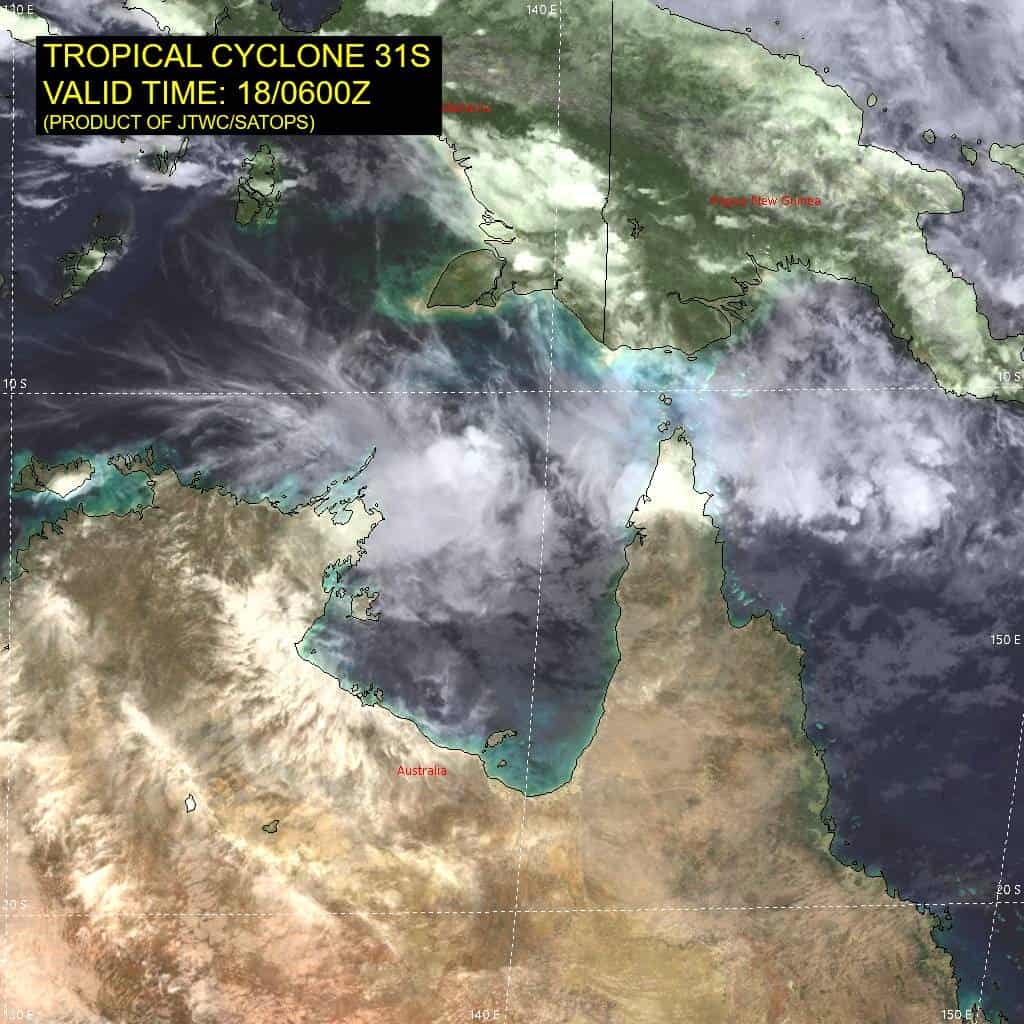
31P_180600sair
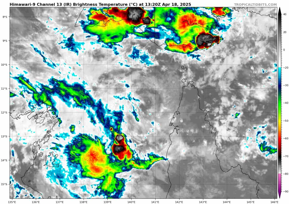
himawari9_ir_31P_202504181320_lat-11.6-lon140.5
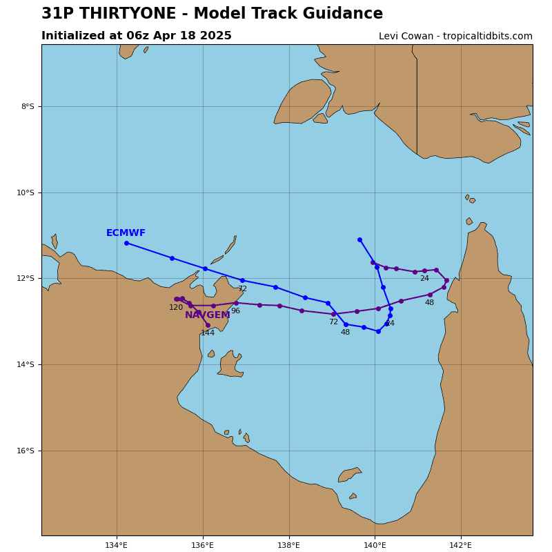
31P_tracks_latest
99s
meteosat9_ir_99S_202504180851_lat-14.4-lon71.3
99S_tracks_latest
By PDC’s Senior Weather
Specialist Glenn James

The Pacific Disaster Center’s (PDC Global) Friday, April 18, 2025, Tropical Cyclone Activity Report…for the Pacific Ocean, the Indian Ocean, and adjacent Seas
Current Tropical Cyclones:
Tropical Cyclone 31P…is located approximately 627 NM east of Darwin, Australia
Northeast Pacific Ocean: There are no Tropical Cyclones
The last regularly scheduled Tropical Cyclone Activity Report of the 2024 eastern North Pacific Hurricane Season has been issued. Routine issuance of this section of the PDC product will resume on May 15, 2025. During the off-season, Special Tropical Weather Outlooks will be issued as conditions warrant by the NHC.
Central Pacific Ocean: There are no Tropical Cyclones
The 2024 central North Pacific hurricane season has ended. As such, the final routine Tropical Cyclone Activity Report for the 2024 season has been issued. Routine issuance of this section of the PDC product will resume on June 1, 2025. During the off-season, Special Tropical Weather Outlooks will be issued as conditions warrant by the CPHC.
Western Pacific, Indian Ocean, and adjacent Seas:
Southwest Pacific Ocean
Tropical Cyclone 31P
According to the JTWC Warning number 4, sustained winds are 30 knots, with gusts to 40 knots.
Animated multi-spectral satellite imagery depicts tropical cyclone 31P with a well-defined, partially exposed low-level circulation center and flaring convection along the southwestern quadrant of the system.
Environmental analysis indicates that 31P is in a marginally favorable environment characterized by moderate (15-20 knot) easterly vertical wind shear, weak outflow aloft, and warm sea surface temperatures.
TC 31P is forecast to track southeastward through 24 hours, along the southern periphery of the ner. Near 24 hours, ridging will begin to build to the south of the system, causing 31P to turn sharply westward. as the ridge builds to the south and begins to propagate westward, the steering pattern will become more defined, allowing for an increase in track speeds as the vortex rides along the northeastern periphery of the ridge through the end of the forecast period.
Regarding intensity, 31P is is expected to remain in a marginal environment due to the absence of a good outflow channel and some slight dry air entrainment along the western periphery. However, shear is expected to begin slightly decreasing after 12 hours to around 10-15 knots. Overall, no significant intensification is currently expected throughout the forecast period at this time.
South Indian Ocean
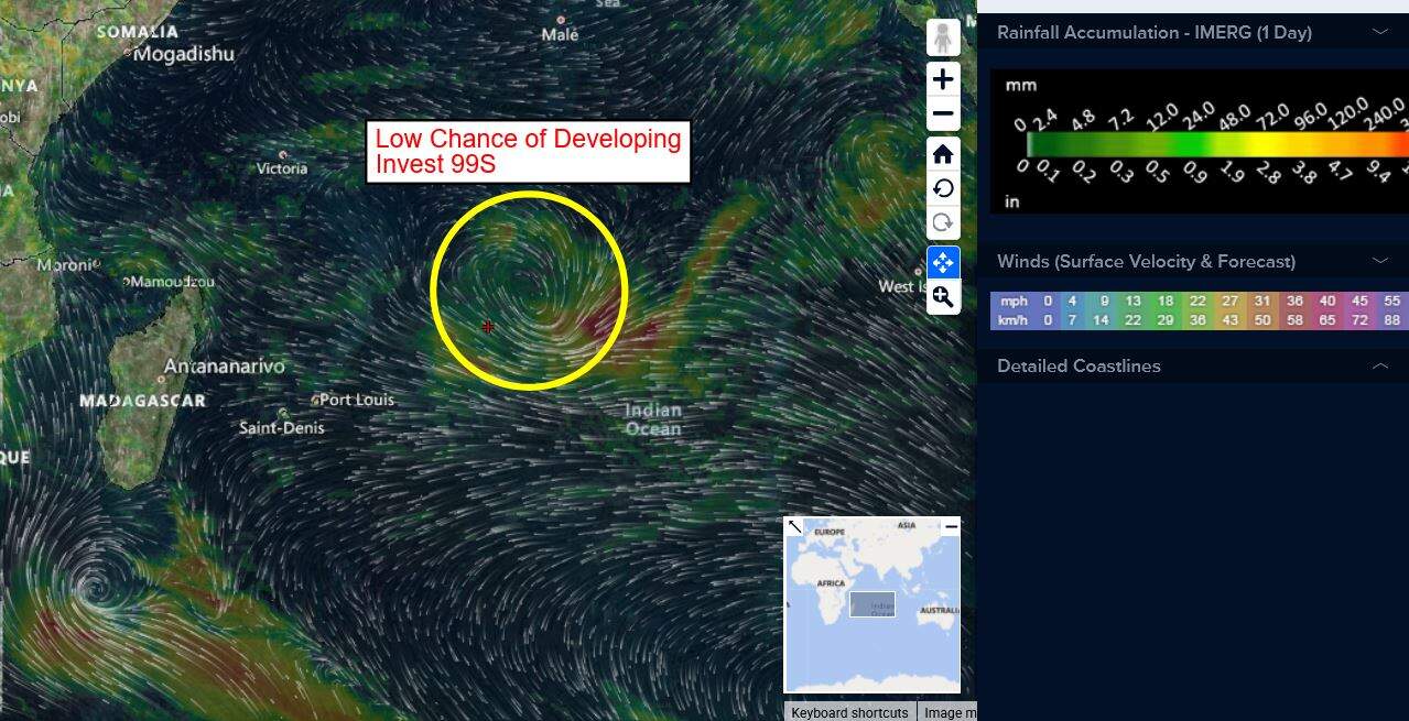
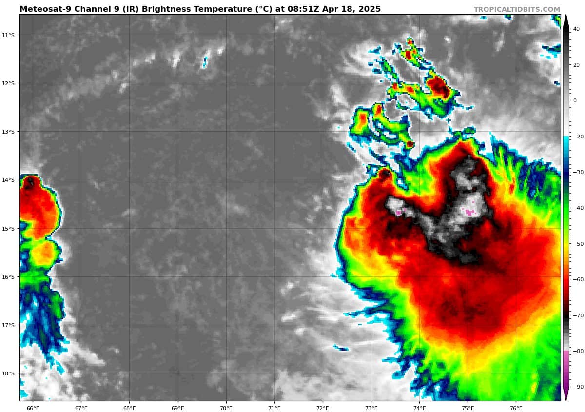
>>> An area of Disturbed weather being referred to as Invest 99S is located approximately 428 NM south of Diego Garcia
Animated enhanced infrared satellite imagery depict a poorly organized low level circulation center with a broad area of flaring convection within the southeastern quadrant. An ascat-b image emphasizes a broad weak circulation at the surface.
Environmental analysis reveals a marginally favorable environment for development with moderate to high (20-25 knots) vertical wind shear, good poleward upper-level outflow, and warm sea surface temperatures.
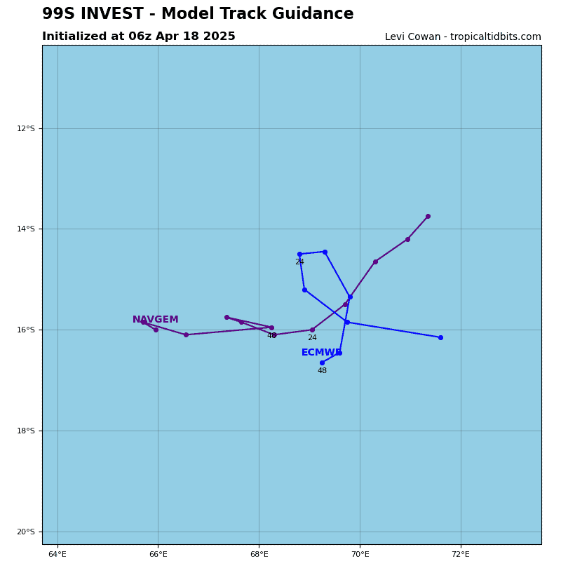
Deterministic and ensemble models are in fair agreement, showing gradual intensification in the South Indian Ocean over the next 48 hours.
Maximum sustained surface winds are estimated at 23 to 28 knots.
The potential for the development of a significant tropical cyclone within the next 24 hours remains low.