Western Pacific, Indian Ocean, and adjacent Seas:
Western Pacific

")
By PDC’s Senior Weather
Specialist Glenn James

The Pacific Disaster Center’s (PDC Global) Saturday, September 20, 2025, Tropical Cyclone Activity Report…for the Pacific Ocean, the Indian Ocean, and adjacent Seas
Current Tropical Cyclones:
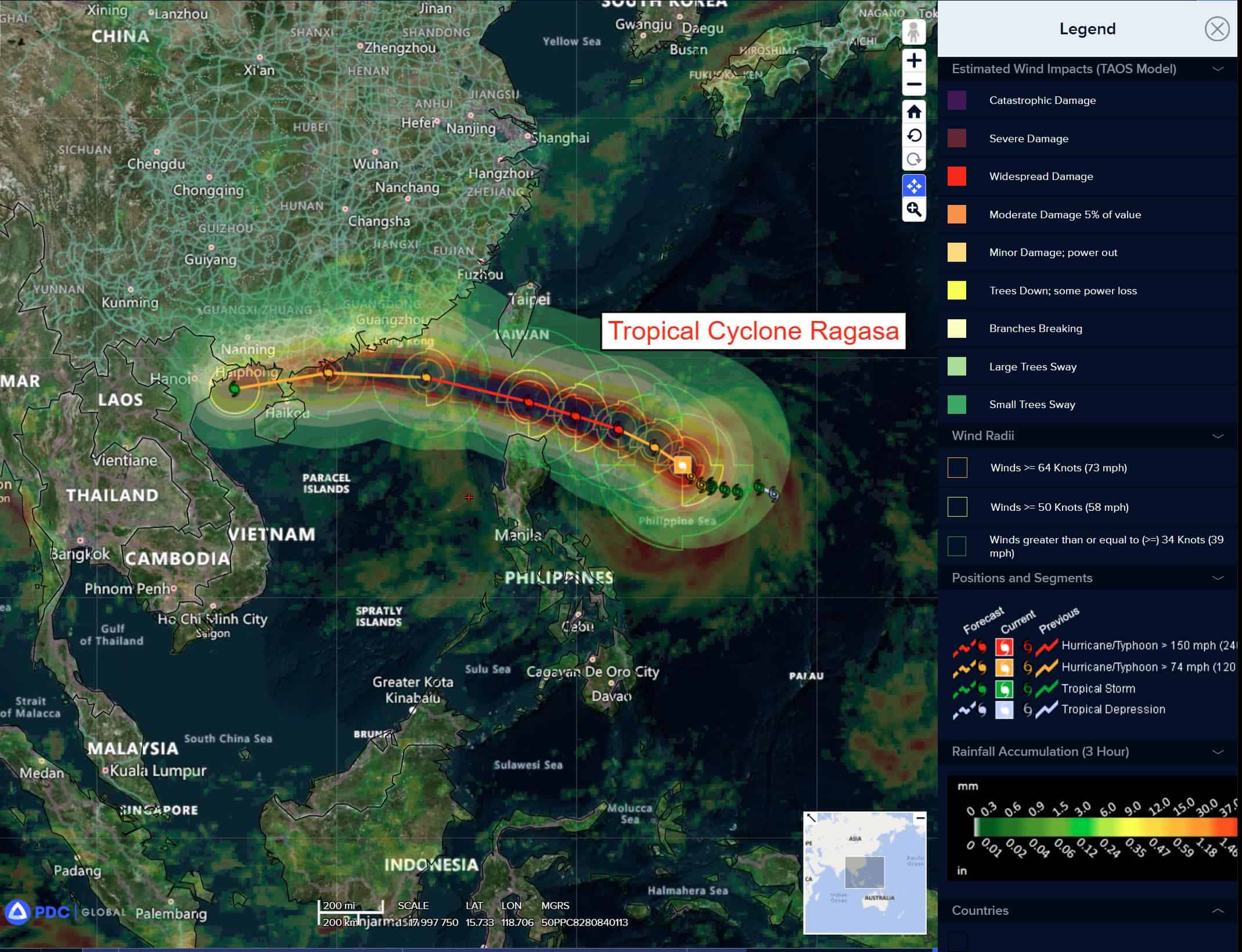
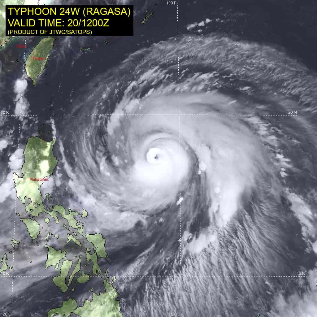
Tropical Cyclone 24W (Ragasa) is located approximately 398 NM east-northeast of Manila, Philippines
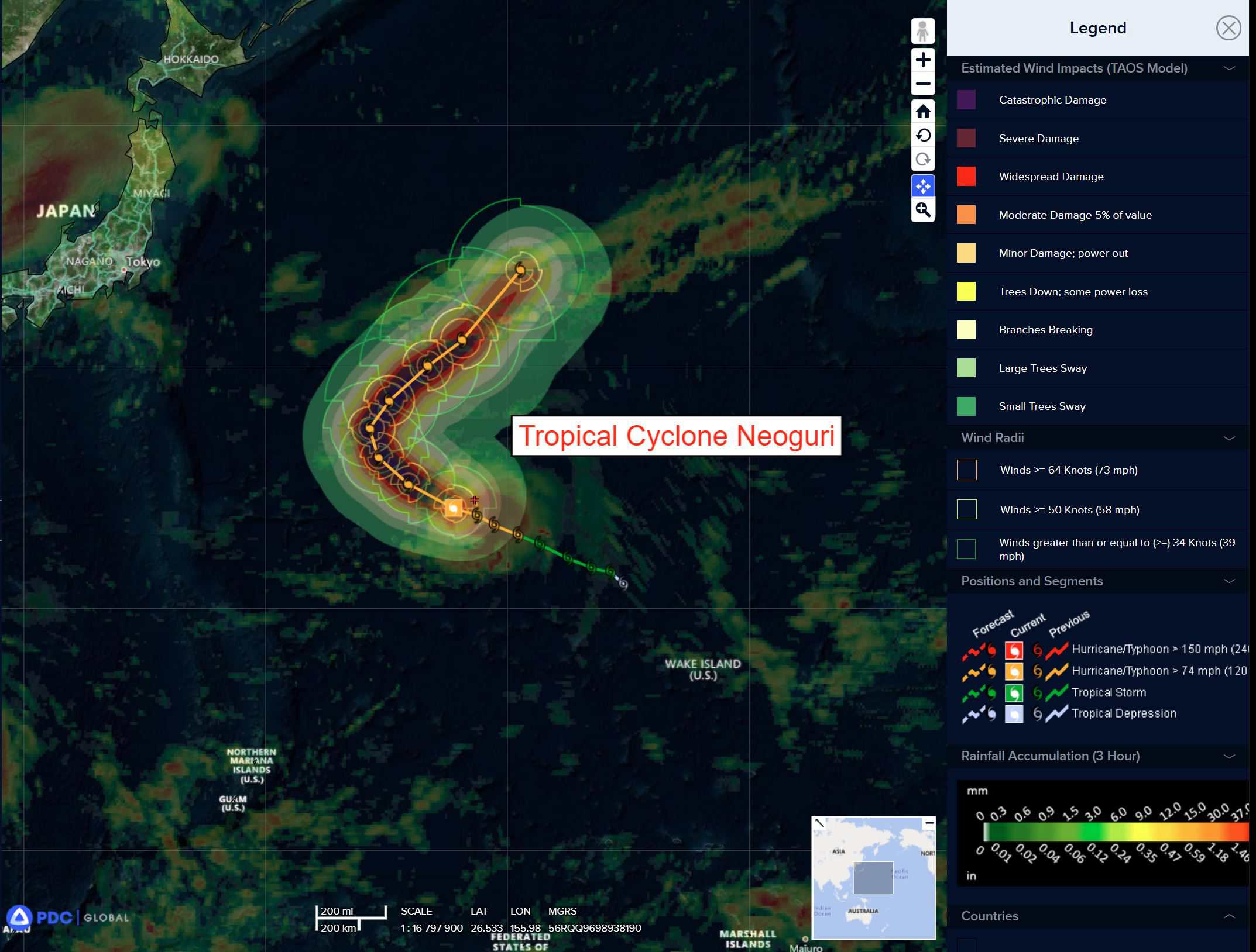
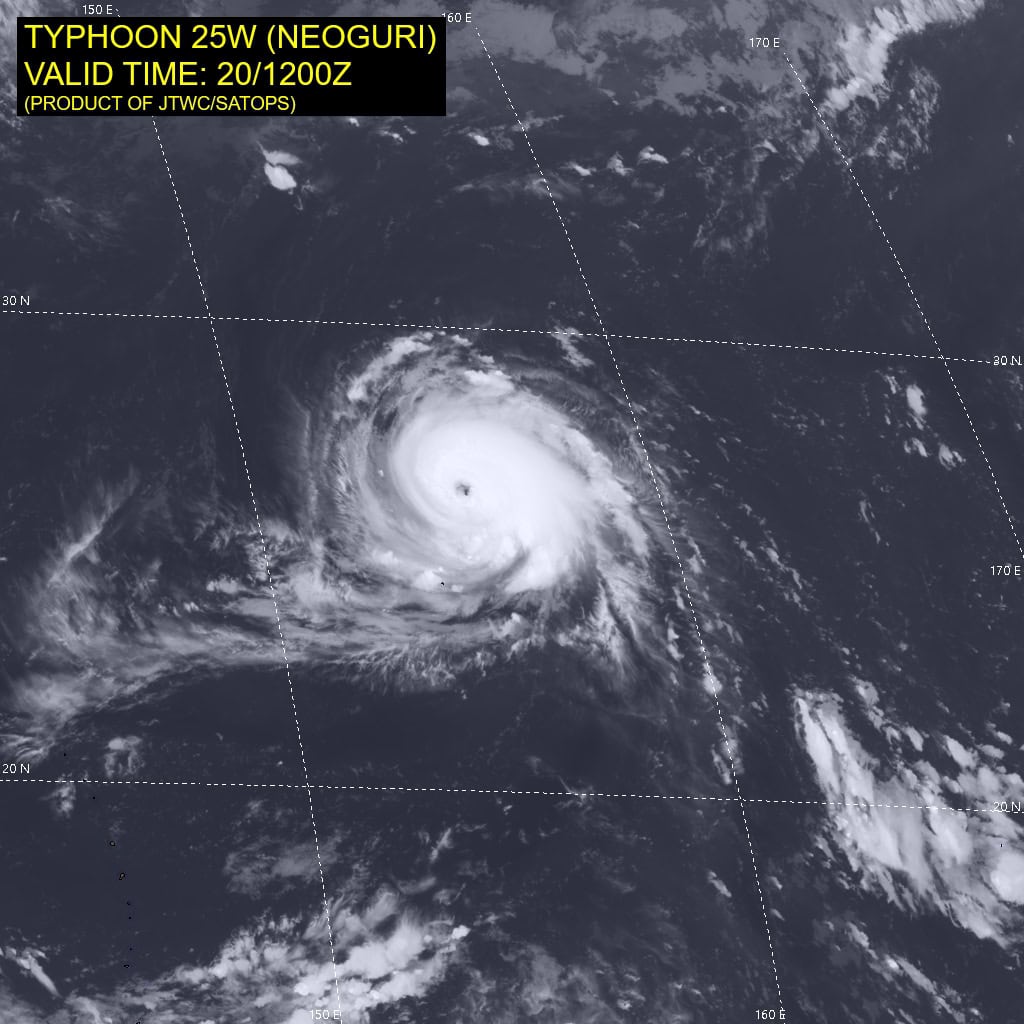
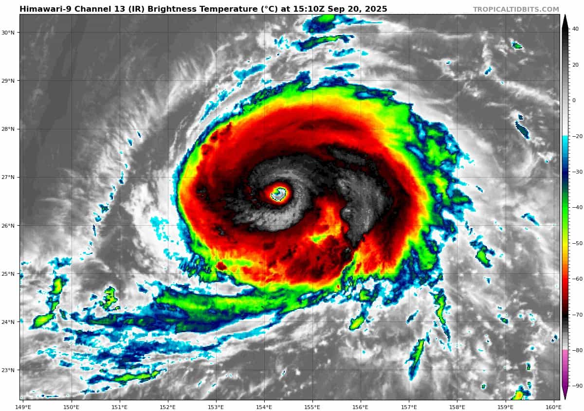
Tropical Cyclone 25W (Neoguri) is located approximately 824 NM east-southeast of Yokosuka, Japan
Northeast Pacific Ocean:
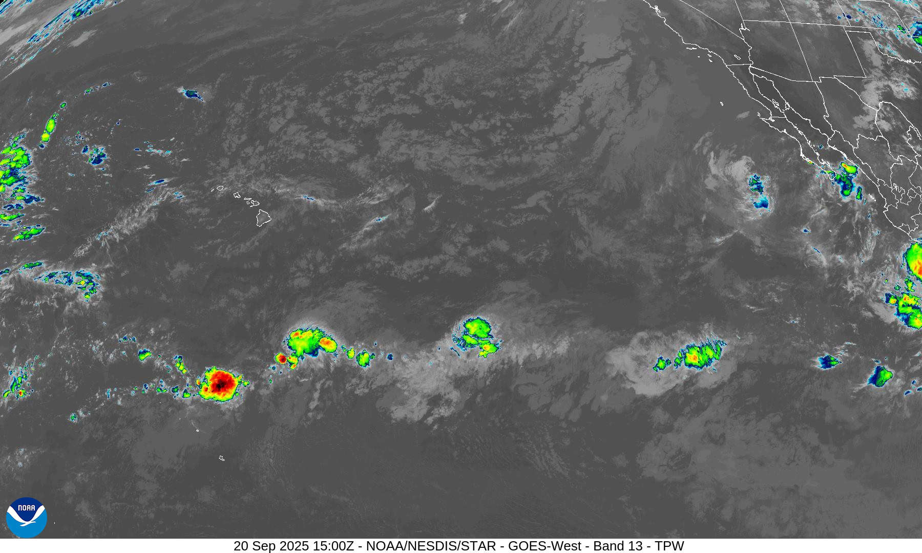
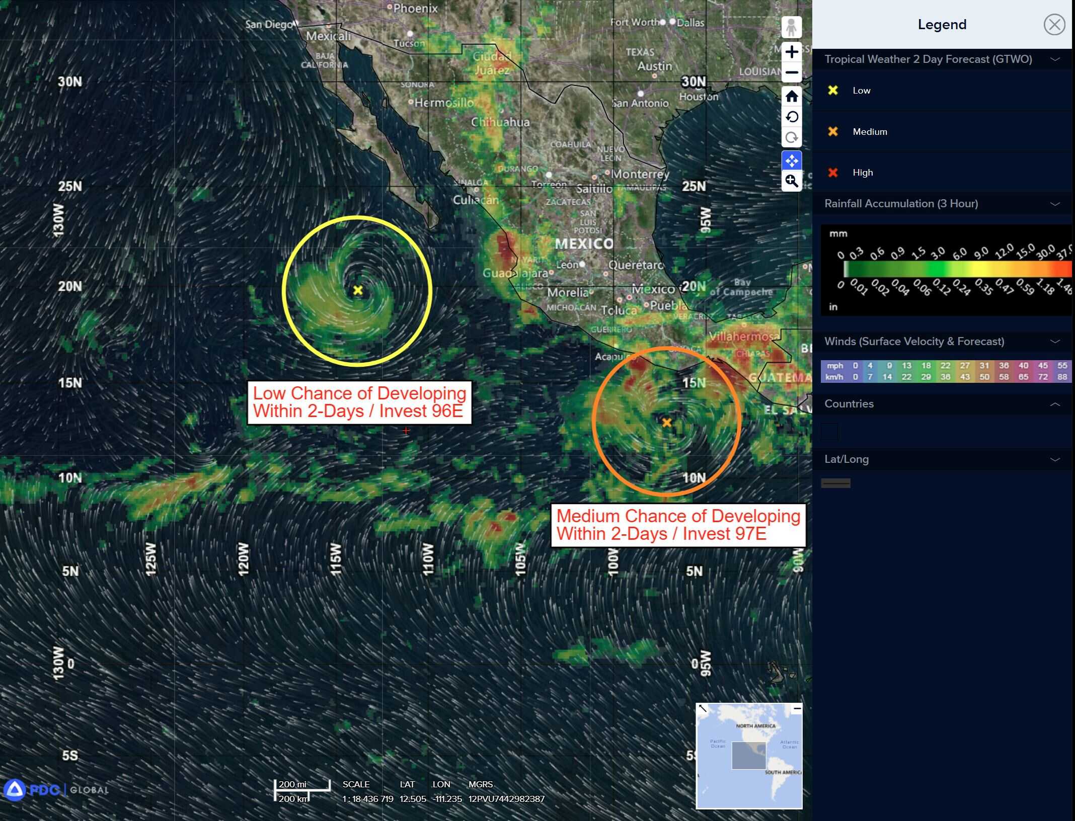
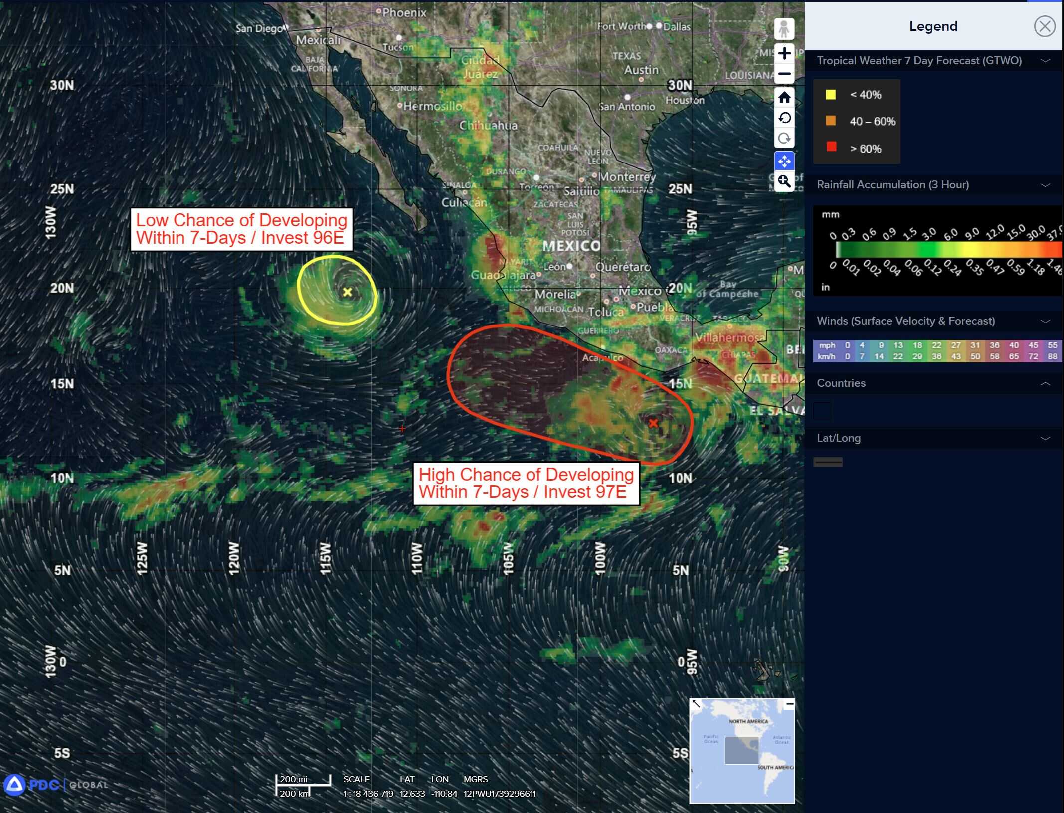
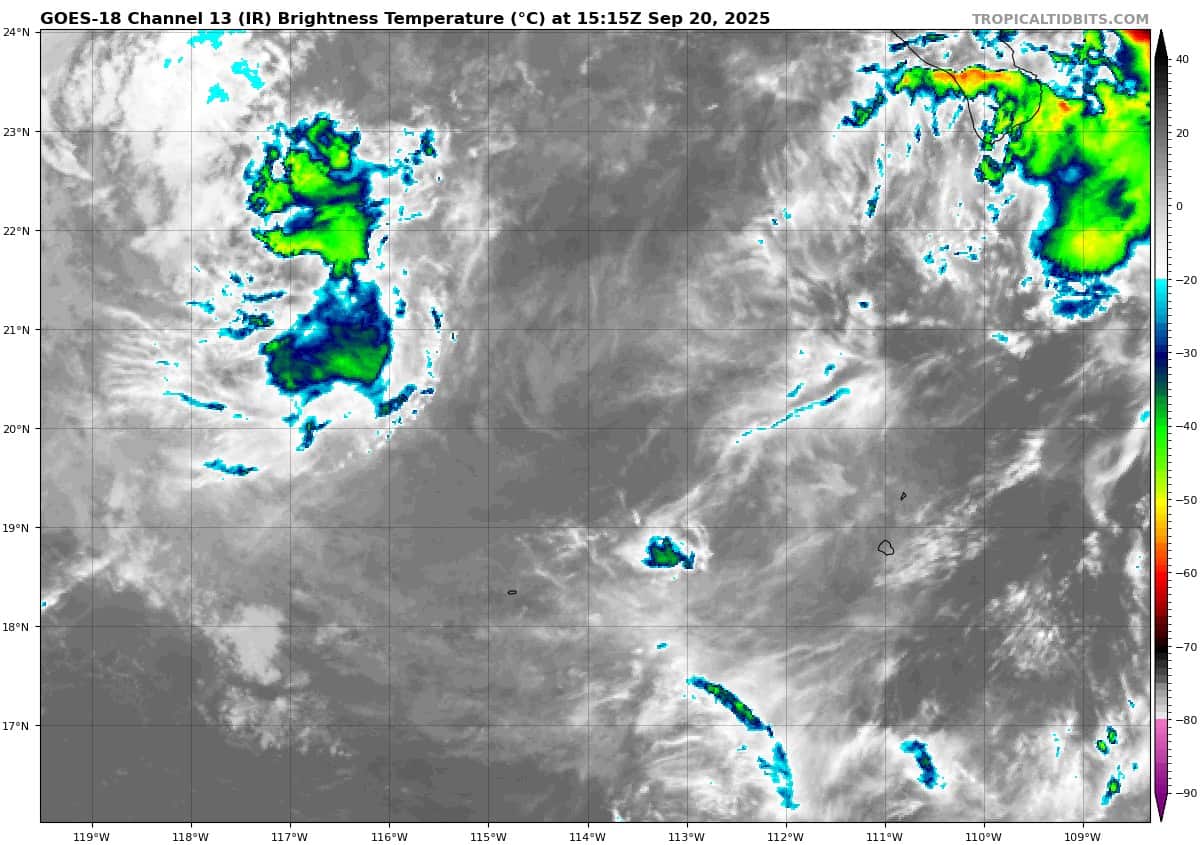
Off the coast of Southern Mexico:
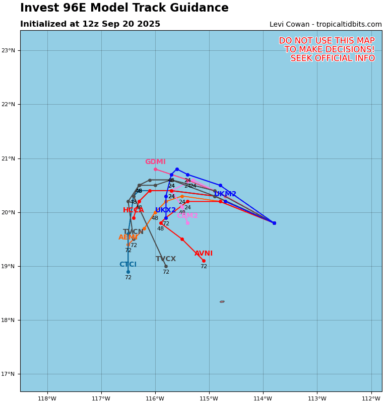
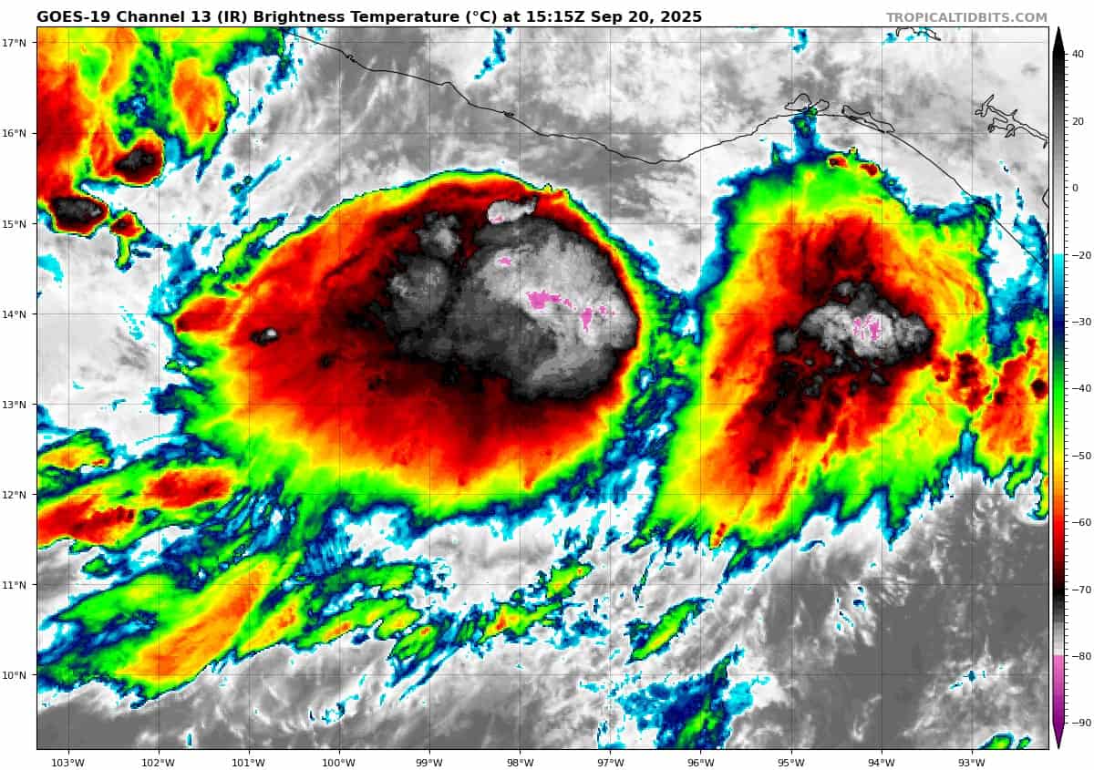
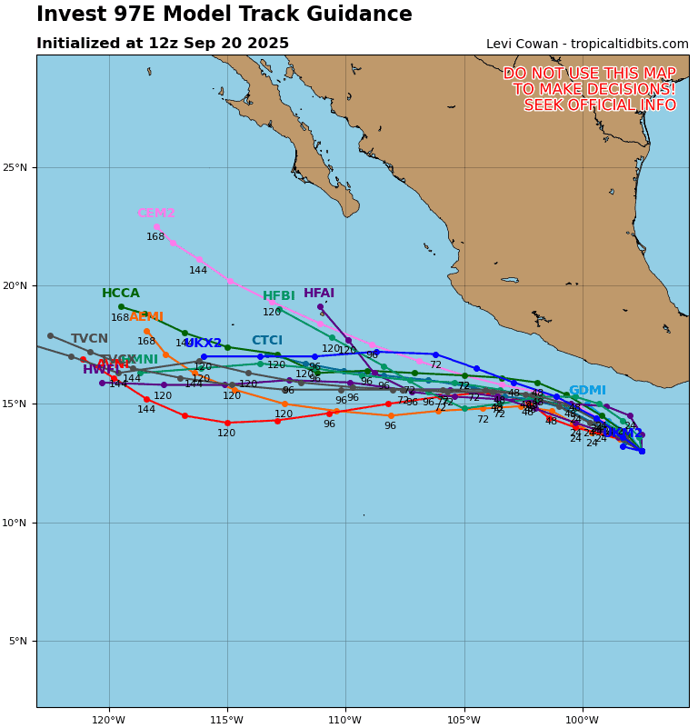
Invest 97E
>>> A broad area of low pressure located a couple of hundred miles south of the southern coast of Mexico continues to show signs of organization. Environmental conditions are favorable for additional development, and a tropical depression or tropical storm is expected to form within the next day or so, while the system moves west-northwestward at 5 to 10 mph, roughly parallel to the coast of southern and southwestern Mexico. Locally heavy rainfall is possible along portions of the coast of southern and southwestern Mexico through Monday.
*Formation chance through 48 hours…high…90 percent
*Formation chance through 7 days…high…90 percent
Central Pacific Ocean: There are no Tropical Cyclones
Tropical cyclone formation is not expected during the next 7 days.
Western Pacific, Indian Ocean, and adjacent Seas:
Western Pacific
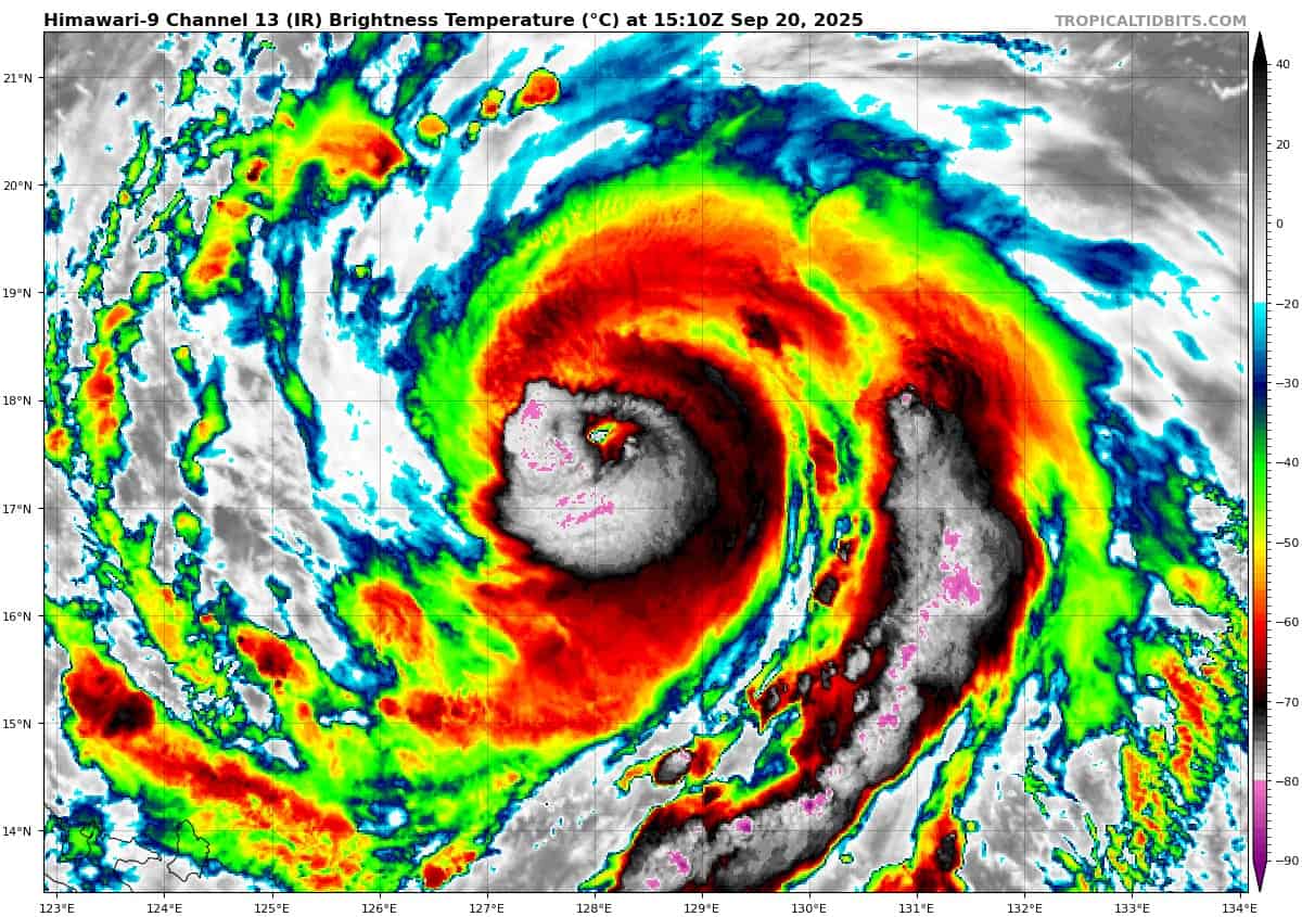
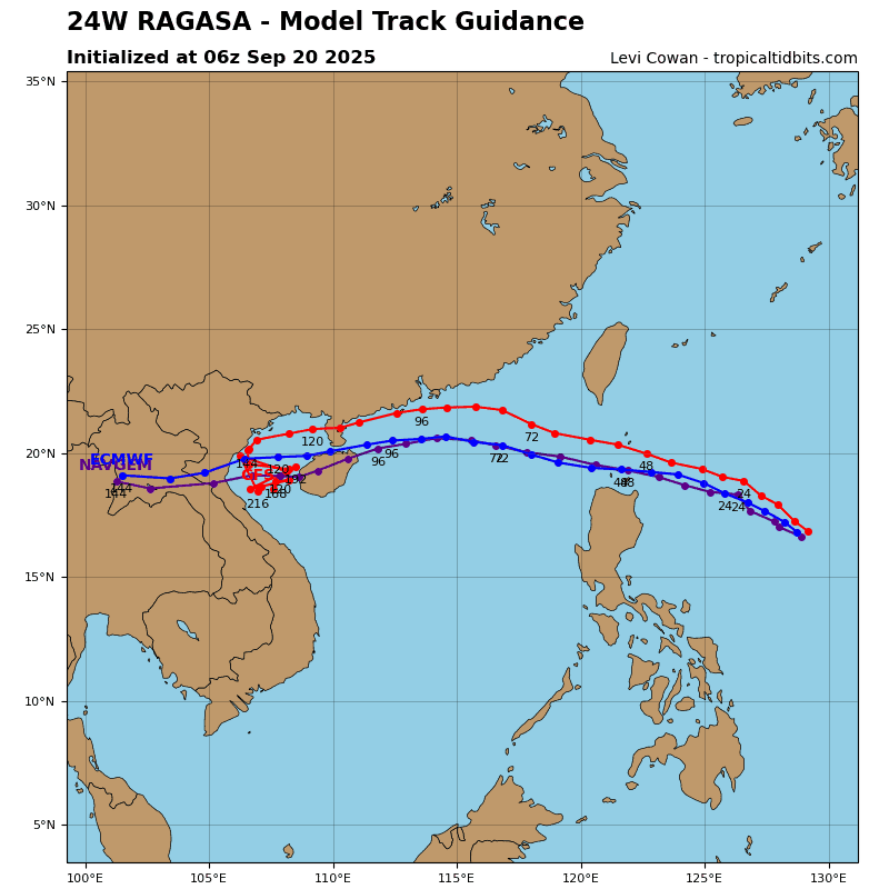
Tropical Cyclone 24W (Ragasa)
According to the JTWC warning number 11…sustained winds are 120 knots with gusts to near 145 knots.
Animated multi-spectral satellite imagery (msi) depicts symmetric convective banding wrapping along the northern and southern peripheries into a ragged eye feature of typhoon 24W. A dry air slot is apparent as continental dry air from the northwest wraps along the western and southwestern periphery of the typhoon.
Rapid intensification has occurred over the last 24 hours, and TY 24W has intensified into a 70 knot system. The current environment is highly favorable with expansive upper-level divergence, and the ocean heat content is high .
TY 24W will track west-northwestward along the southern periphery of a subtropical ridge to the north. the near equatorial ridge over the South China Sea will weaken, allowing the storm track to gradually increase after 48 hours.
The environment will remain highly favorable for intensification in the near-term as the system tracks westward over several warm core eddies east of Luzon. Upper-level divergence will be enhanced favorably by a jet to the north and linear southwesterly flow for the entirety of the forecast period.
North of Luzon, TY 24W will reach a peak intensity of 125 knots. After 48 hours, ocean heat content will significantly decrease and the water column will become shallower. As TY 24W tracks along the coast of Hong Kong, Macao, China, and Vietnam, upwelling of cool water will drive the weakening trend gradually.
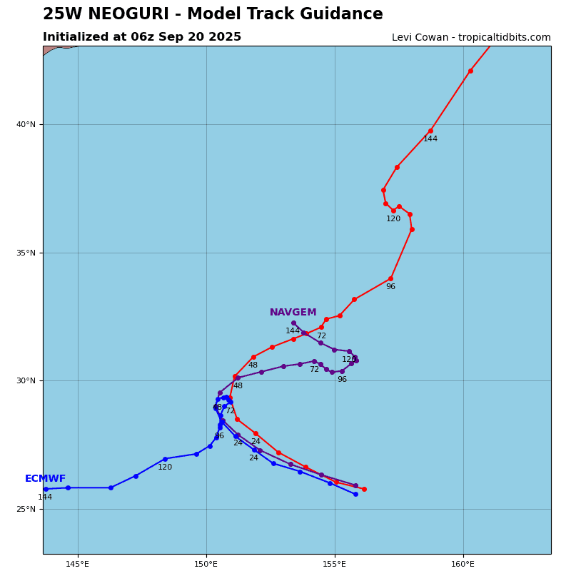
Tropical Cyclone 25W (Neoguri)
According to the JTWC warning number 11…sustained winds are 125 knots with gusts to near 150 knots.
Animated enhanced infrared (eir) satellite imagery depicts a compact typhoon slowly tracking west-northwestward with slight
trochoidal motion. An earlier arctic weather satellite awr 89ghz
microwave imager reveals the compact convective banding surrounding a small microwave eye.
TY 25W has continued to rapidly intensify in a highly favorably environment and is now assessed to be 95 knots. The initial position is placed with high confidence based on the aforementioned animated eir and extrapolation from a 201053z
metop-b ascat image revealing a distinct low-level circulation
center.
TY 25W will curve northwestward along the southern periphery of a subtropical ridge over the next 36 hours while the steering environment becomes increasingly complex. The subtropical ridge to the west will build over the next 36 hours, slowing the track of TY 25W and causing irregular track motion until 48 hours.
Around 48 hours, a deep-layer trough will break down the ridge to the west, allowing for TY 25W to track northeastward for the remainder of the forecast period. By 96 hours, TY 25W will begin to become embedded within the approaching upper-level trough,
and begin extratropical transition.
The environment will be favorable over the next 48 hours for intensification while in warm sea surface temperatures, low vertical wind shear, and strong upper-level divergence. Vertical wind shear will increase unfavorably after 72 hours due to the approaching trough.