The Pacific Disaster Center’s (PDC Global) Thursday, September 18, 2025, Tropical Cyclone Activity Report…for the Pacific Ocean, the Indian Ocean, and adjacent Seas
Current Tropical Cyclones:
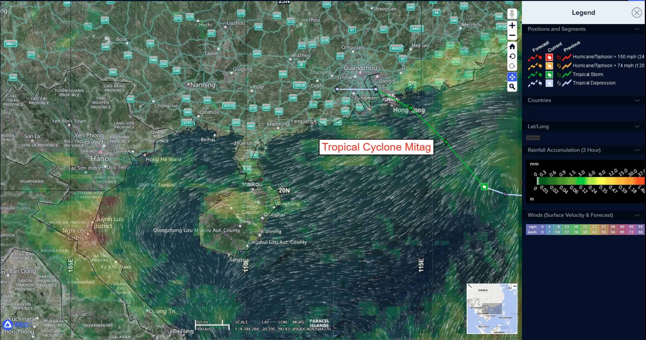
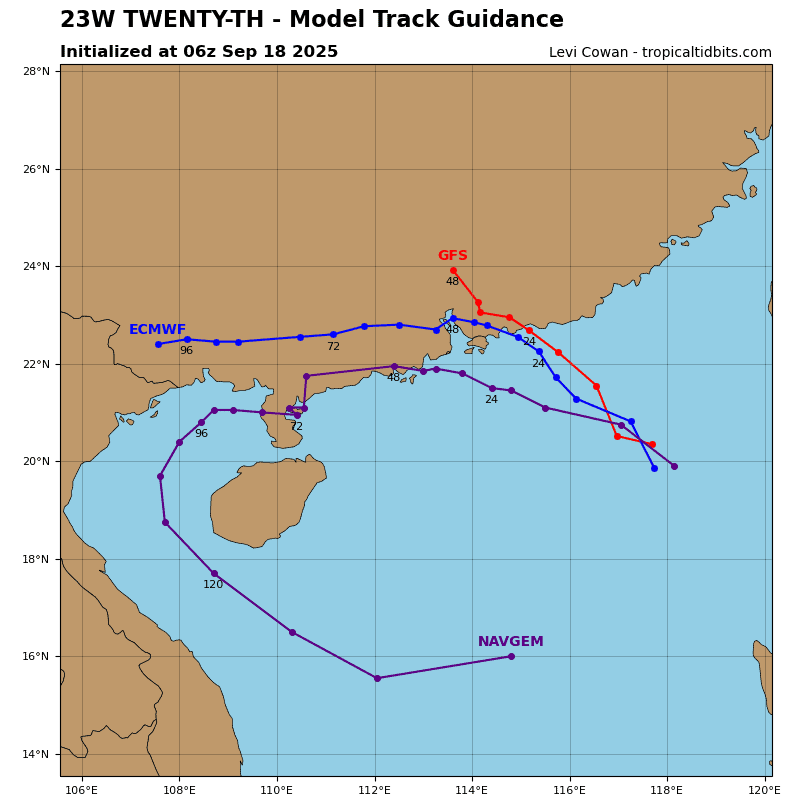
Tropical Cyclone 23W (Mitag) is located approximately 89 NM east of Hong Kong
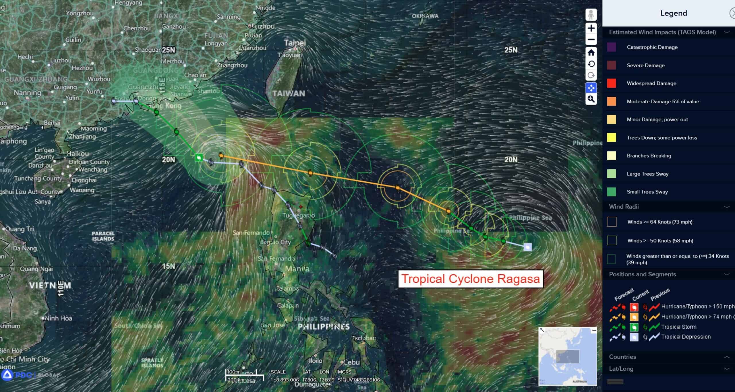
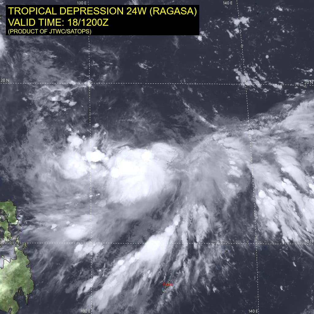
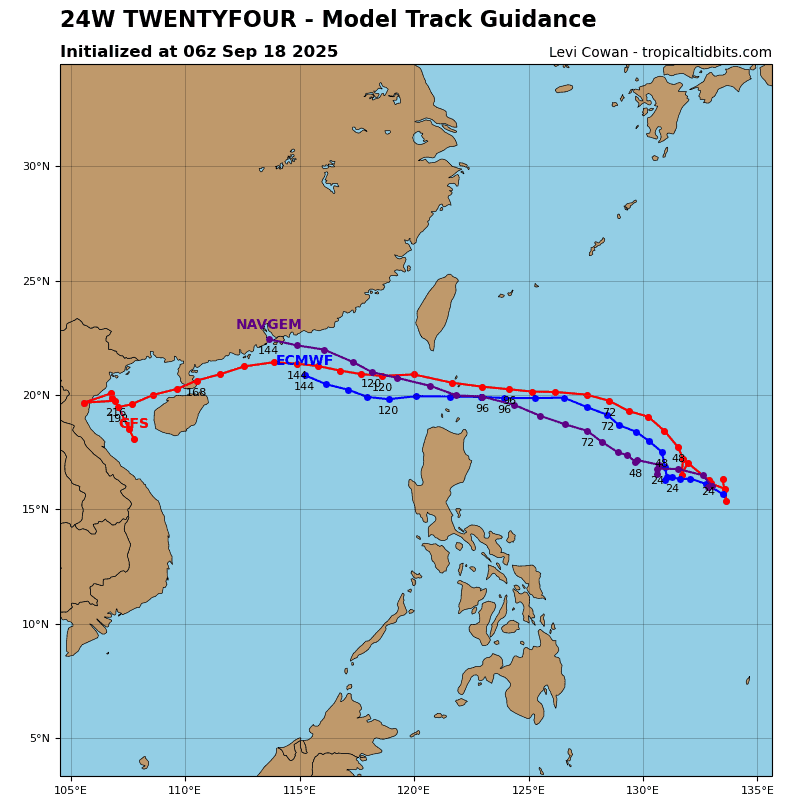
Tropical Cyclone 24W (Ragasa) is located approximately 602 NM east of Manila, Philippines
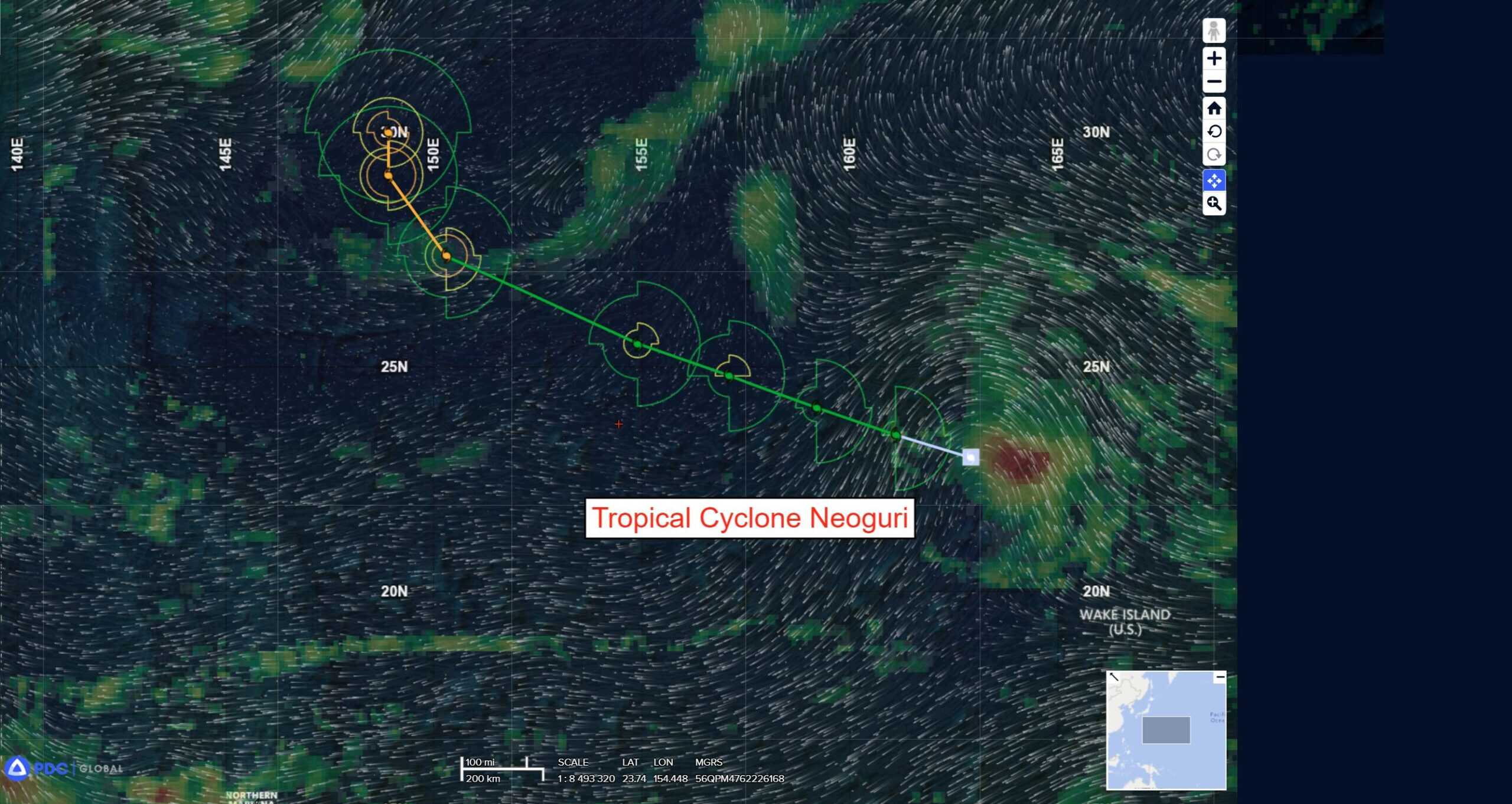
Tropical Cyclone 25W (Neoguri) is located approximately 392 NM northwest of Wake Island
Northeast Pacific Ocean:
Off the coast of Southwestern Mexico:
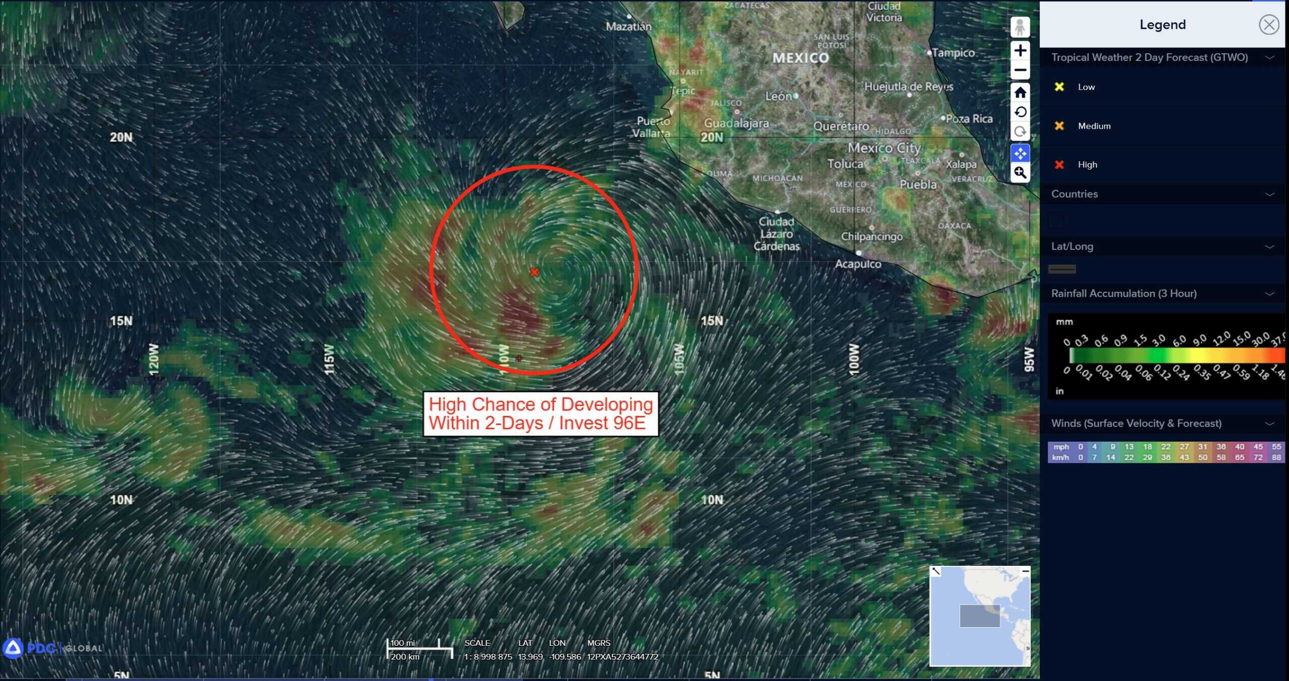
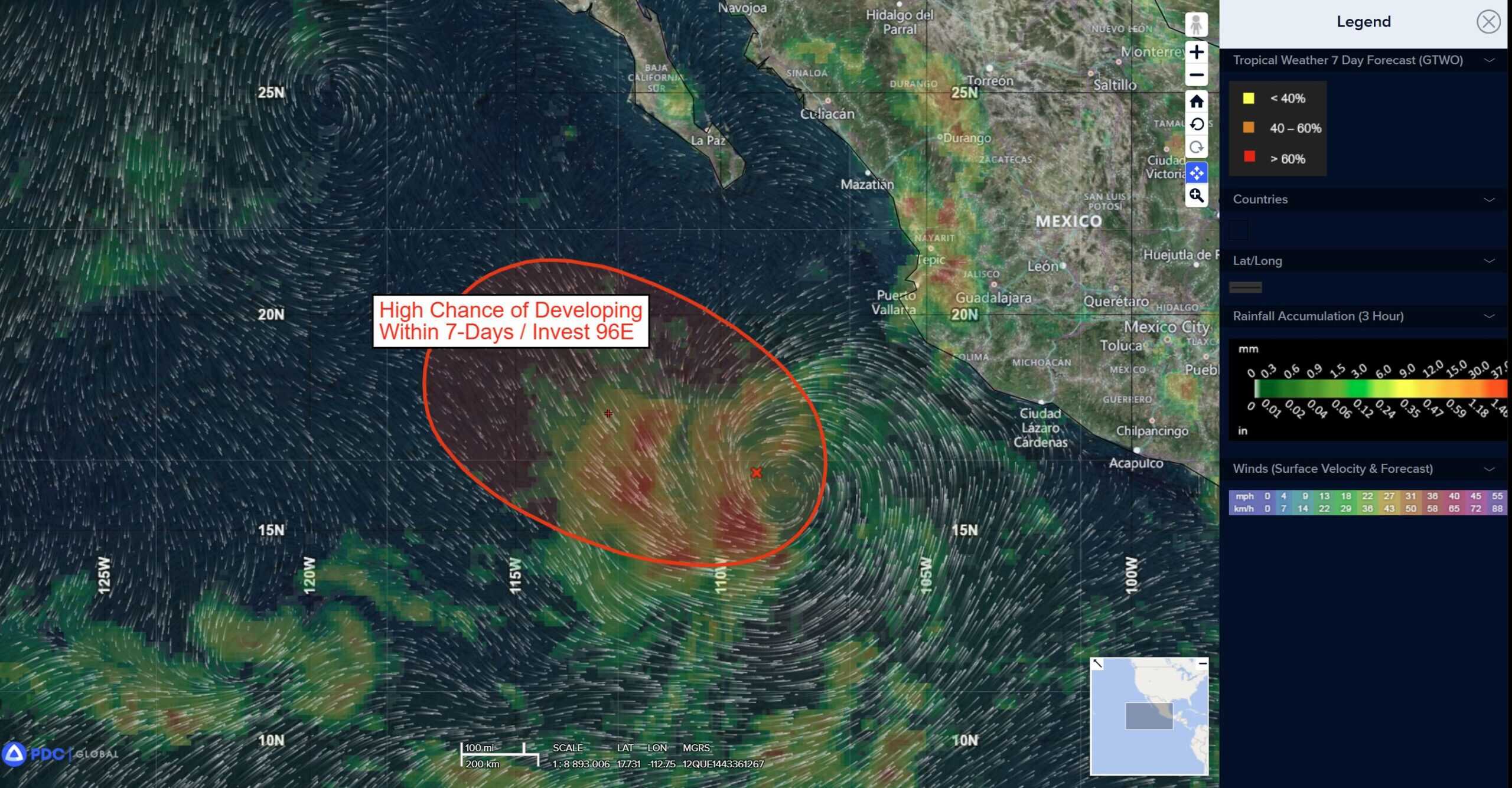
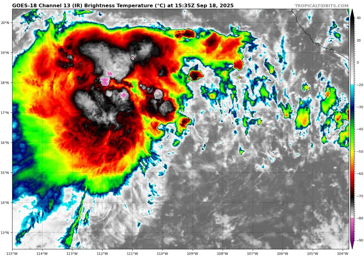
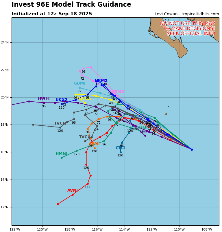
Invest 96E
>>> South of the Southern Tip of the Baja California Peninsula:
Showers and thunderstorms remain displaced well to the west of a broad area of low pressure located a few hundred miles south of the southern tip of the Baja California Peninsula.
Although a tropical depression is still likely to form during the next day or so, the system is forecast to encounter progressively cooler waters and a drier, stable airmass over the weekend, which will inhibit any further development.
*Formation chance through 48 hours…high…70 percent
*Formation chance through 7 days…high…70 percent
Off the coast of Southwestern Mexico:
>>> A large area of disorganized showers and thunderstorms located a couple of hundred miles south of the southern coast of Mexico is associated with a trough of low pressure.
Environmental conditions could support some gradual development of this system during the next several days while it moves generally west-northwestward at 5 to 10 mph, roughly parallel to the coast of southern and southwestern Mexico.
*Formation chance through 48 hours…low…10 percent
*Formation chance through 7 days…medium…40 percent
Central Pacific Ocean: There are no Tropical Cyclones
Tropical cyclone formation is not expected during the next 7 days.
Western Pacific, Indian Ocean, and adjacent Seas:
Western Pacific
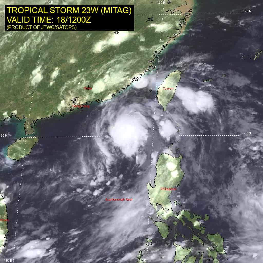
Tropical Cyclone 23W (Mitag)
According to the JTWC warning number 12…sustained winds are 45 knots with gusts to near 55 knots.
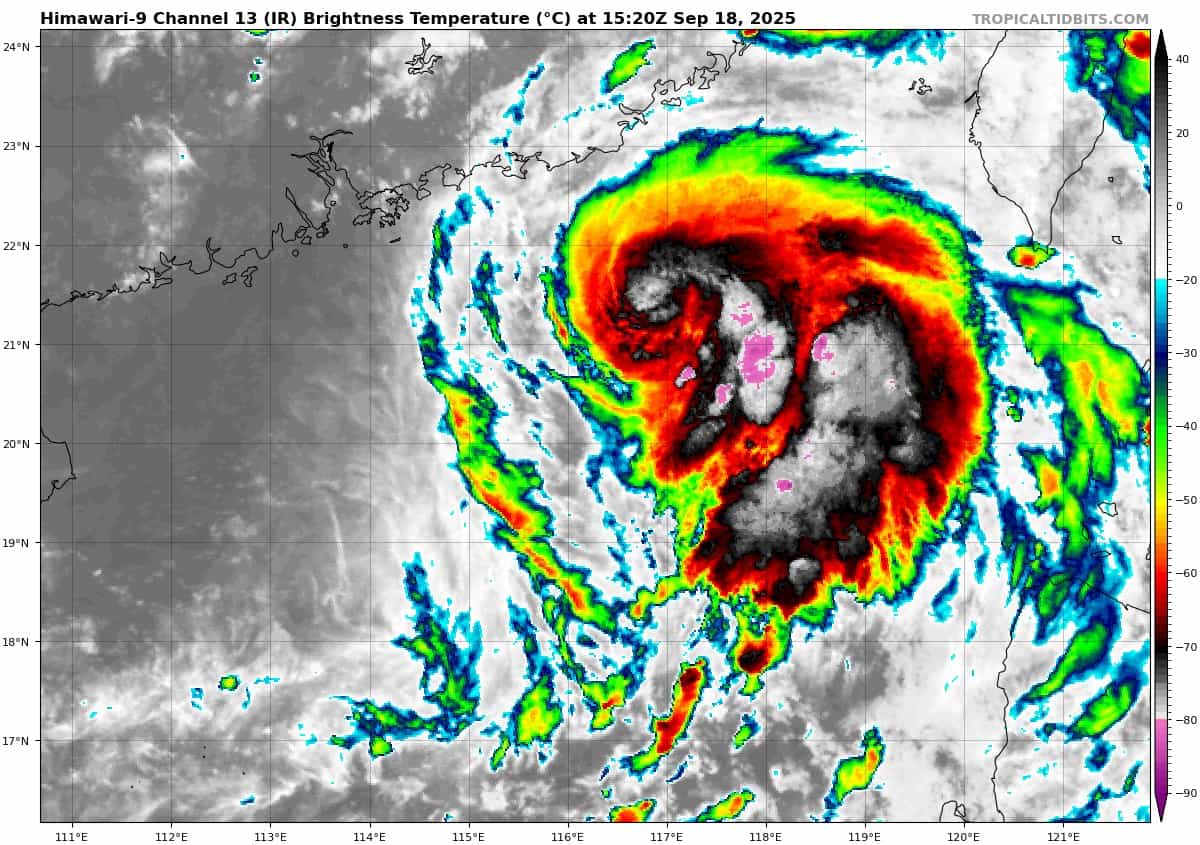
Animated multi-spectral satellite imagery (msi) depicts a fully obscured low-level circulation (llcc) accompanied by building convection over the center. The mid-level rotation previously offset to the east has become more vertically aligned with the llcc.
Environmental analysis indicates tropical storm 23W is in a marginally favorable environment, characterized by warm sea surface temperatures (29-30 c) and low vertical wind shear (5-10 knots), offset by dry air entrainment from the west.
TS 23W is forecast to continue its northwestward track as it is steered by the elongated southwestern periphery of the str to the northeast. landfall is expected to occur between 24-36 hours in eastern Hong Kong. After landfall, 23W is expected to curve westward as the system approaches the southern extent of the str.
23W has become vertically aligned with the moist mid levels, which contributed to its slight intensification to its peak at 35 knots. 23W will maintain 35 knots until landfall; however, the western semicircle is expected to remain weaker than the eastern semicircle. After landfall, 23W will rapidly weaken as terrain interaction erodes the system. Dissipation is forecast too occur no later than 48 hours over southern China.
Tropical Cyclone 24W (Ragasa)
According to the JTWC warning number 3…sustained winds are 40 knots with gusts to near 50 knots.
Animated enhanced infrared (eir) satellite imagery depicts tropical depression 24W (Ragasa) with widespread deep convection along the southern periphery of the system. An 181132z metop-b ascat image revealed a large swath of 25 knot winds within the eastern semicircle with a patch of 30 knots confined to the southeastern quadrant.
Environmental analysis indicates that 24W is in a favorable environment characterized by strong equatorward outflow aloft, low (10-15 knots) vertical wind shear, and warm (29-30 c) sea surface temperatures. There currently is dry air over the northern portion of the vortex, which is hindering convective development in that region.
24W is forecast to track generally west-northwestward over the next 72 hours. Track speeds are expected to be relatively slow due to the weak steering pattern as the subtropical ridge to the north gradually builds. After 72 hours, the ridge centered south of Kyushu will have more influence on the motion of the vortex, causing track speeds to pick up and the track to turn more westward. A westward track through the Luzon Strait is expected to persist from 96 hours through the remainder of the forecast period.
Regarding intensity, 24W is forecast to steadily intensify through 36 hours to around 60 hours due to the favorable environment. After 36 hours, poleward outflow is expected to markedly increase, allowing for rapid intensification through 72 to around 105 knots. Sea surface temperatures will remain very warm through the entire forecast, allowing for prime conditions for intensification.
As the system tracks through the Luzon Strait, 24W is forecast to reach a peak intensity of near 115 knots. Near the end of the forecast, northeasterly shear is expected to slightly increase to around 15-20 knots, causing the intensification trend to halt.
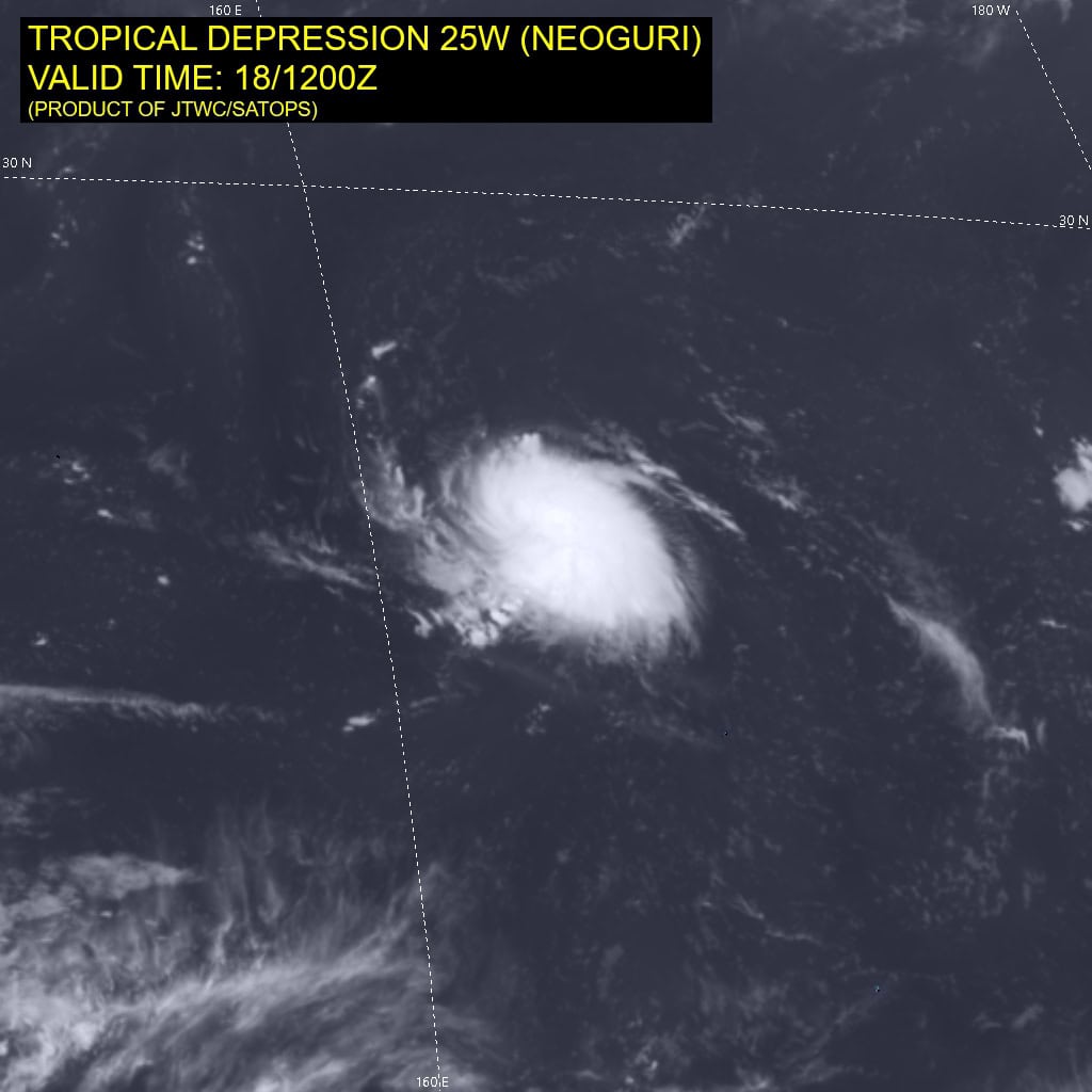
Tropical Cyclone 25W (Neoguri)
According to the JTWC warning number 3…sustained winds are 40 knots with gusts to near 50 knots.
Animated enhanced infrared (eir) satellite imagery depicts tropical depression 25W (Neoguri) with deep central convection obscuring the low-level circulation center (llcc). Cirrus filaments are expanding outward in all directions, hinting at good divergence aloft. An 181042z metop-c ascat image shows an asymmetric wind field with the strongest winds (30 knots) confined to the eastern semicircle.
Environmental analysis indicates that 25W is in a favorable environment characterized by moderate radial outflow, low (5-10 knots) vertical wind shear, and warm (29-30 c) sea surface temperatures. The vortex center appears to be fending off the dry air that is entirely surrounding the system.
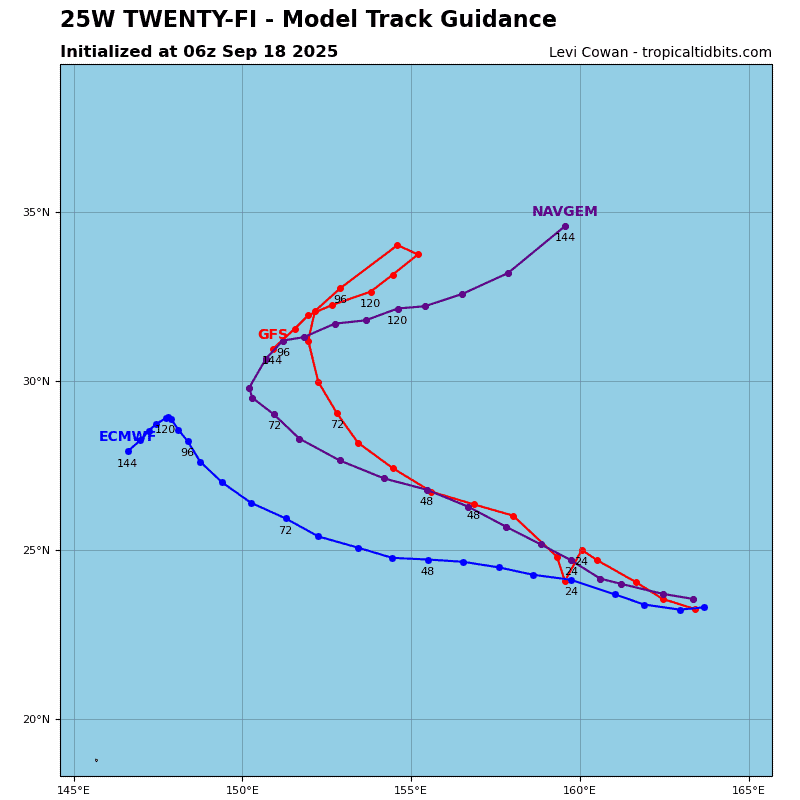
25W is forecast to track northwestward, along the southwestern periphery of the subtropical ridge through 72 hours. Near 72 hours, an incoming upper-level trough is expected to break down the ridge, allowing for a brief turn northward. However, a second subtropical ridge will quickly follow behind the first and potentially inhibit the system from recurving.
The JTWC forecast slows the track speed near the end of the forecast, which is right around the inflection point of the system either recurving or beginning a westward track, along the southern periphery of the ridge.
Regarding intensity, 25W is forecast to steadily intensify through 96 hours to a peak of around 80 knots. The environment is expected to remain overall conducive with low shear and warm sst.

")