The Pacific Disaster Center’s (PDC Global) Wednesday, September 17, 2025, Tropical Cyclone Activity Report…for the Pacific Ocean, the Indian Ocean, and adjacent Seas
Current Tropical Cyclones:
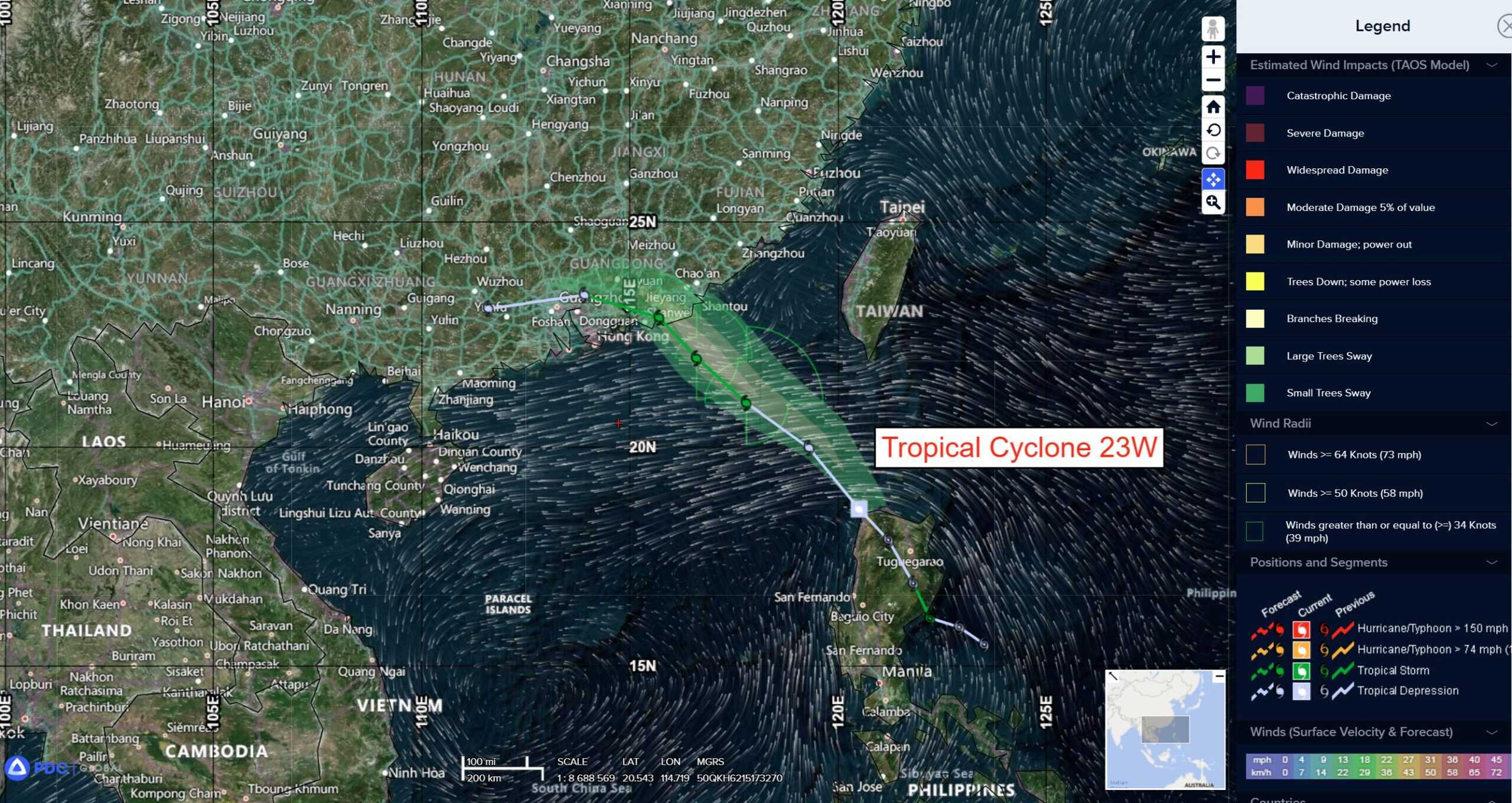
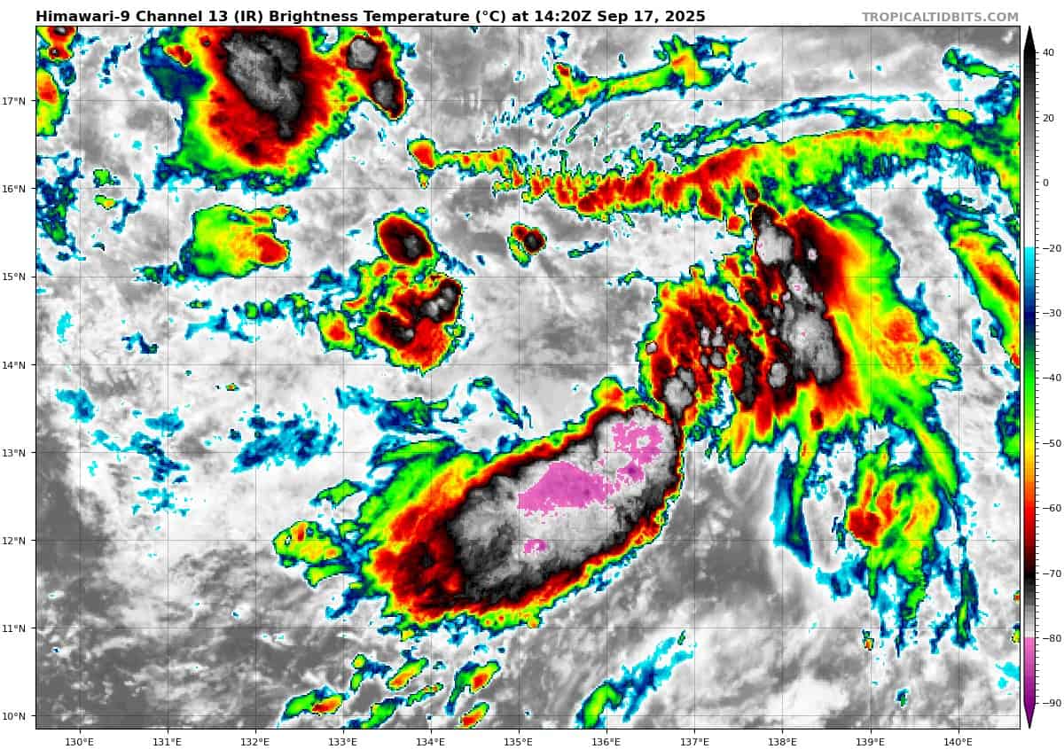
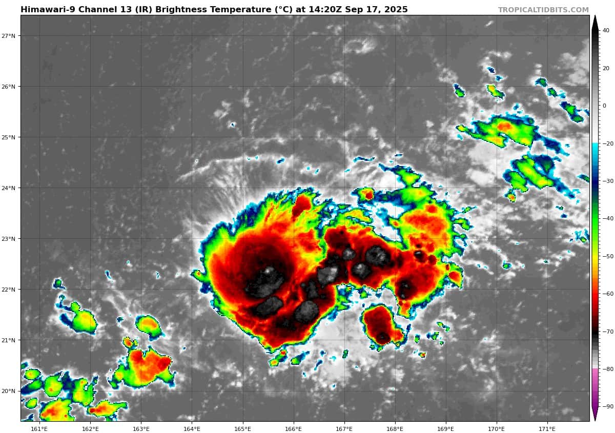
Tropical Cyclone 23W is located approximately 303 NM east-southeast of Hong Kong
Northeast Pacific Ocean:
Off the coast of Southwestern Mexico:
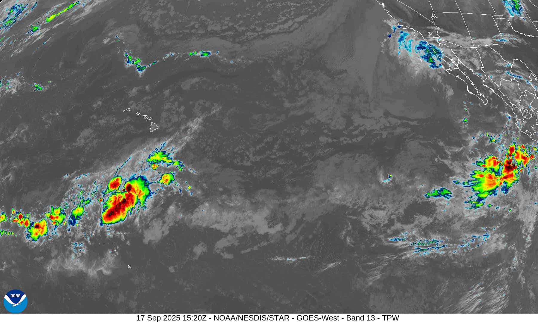
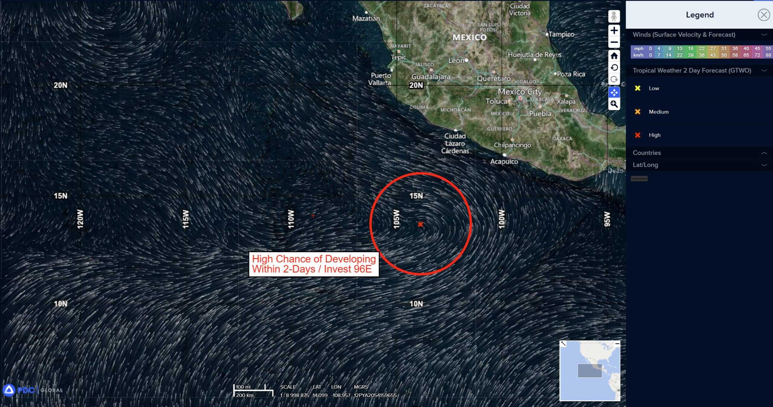
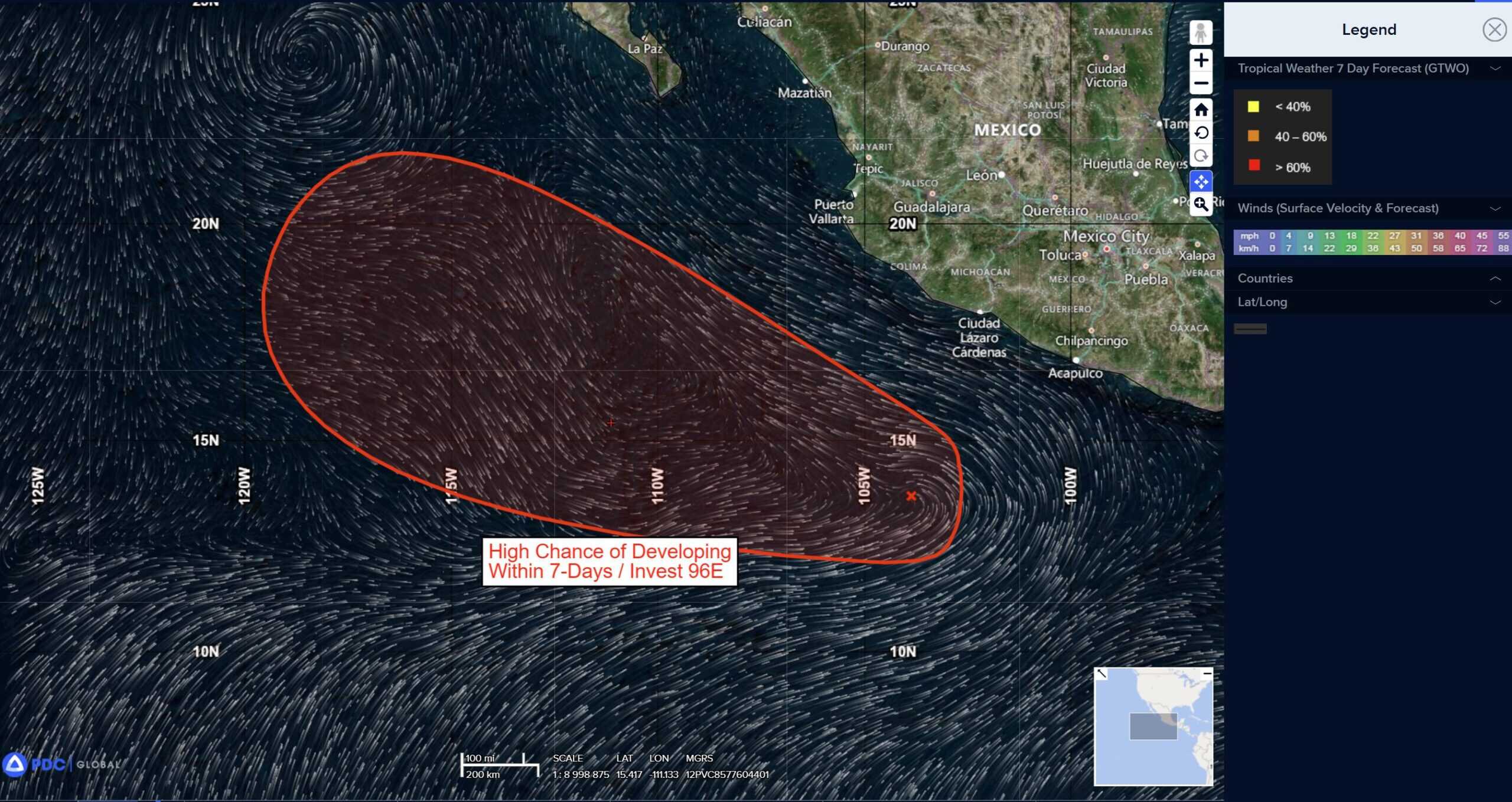
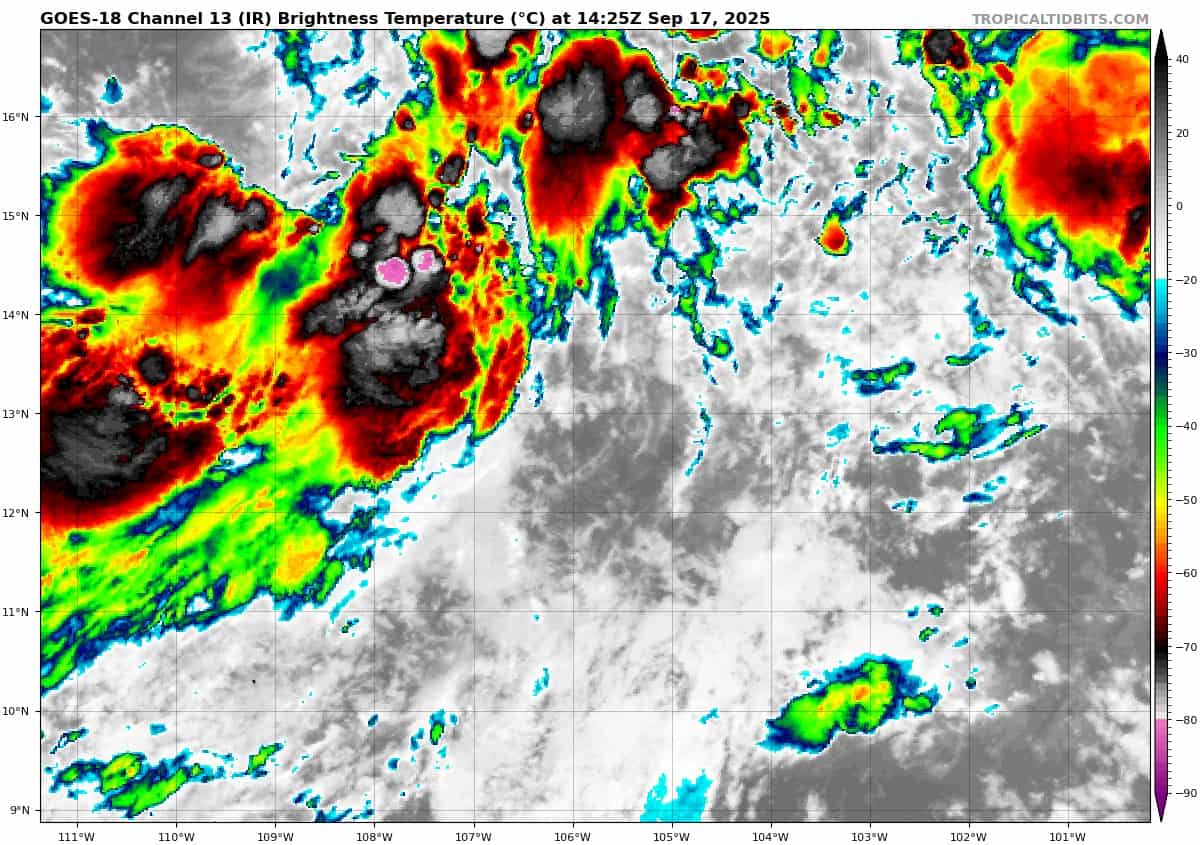
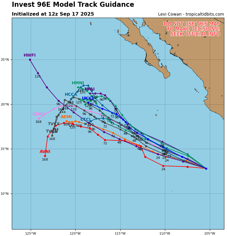
Invest 96E
>>> A broad area of low pressure located a few hundred miles off the coast of southwestern Mexico is producing a large area of showers and thunderstorms. Satellite-derived wind data indicate that the circulation remains fairly well organized. Environmental conditions are conducive for further development of this system, and a tropical depression is likely to form in the next day or two while it moves west-northwestward at 10 to 15 mph over the central portion of the eastern Pacific. However, the system is expected to encounter cooler waters and a drier airmass over the weekend, which will inhibit additional development.
*Formation chance through 48 hours…high…80 percent
*Formation chance through 7 days…high…80 percent
Central Pacific Ocean: There are no Tropical Cyclones
Tropical cyclone formation is not expected during the next 7 days.
Western Pacific, Indian Ocean, and adjacent Seas:
Western Pacific
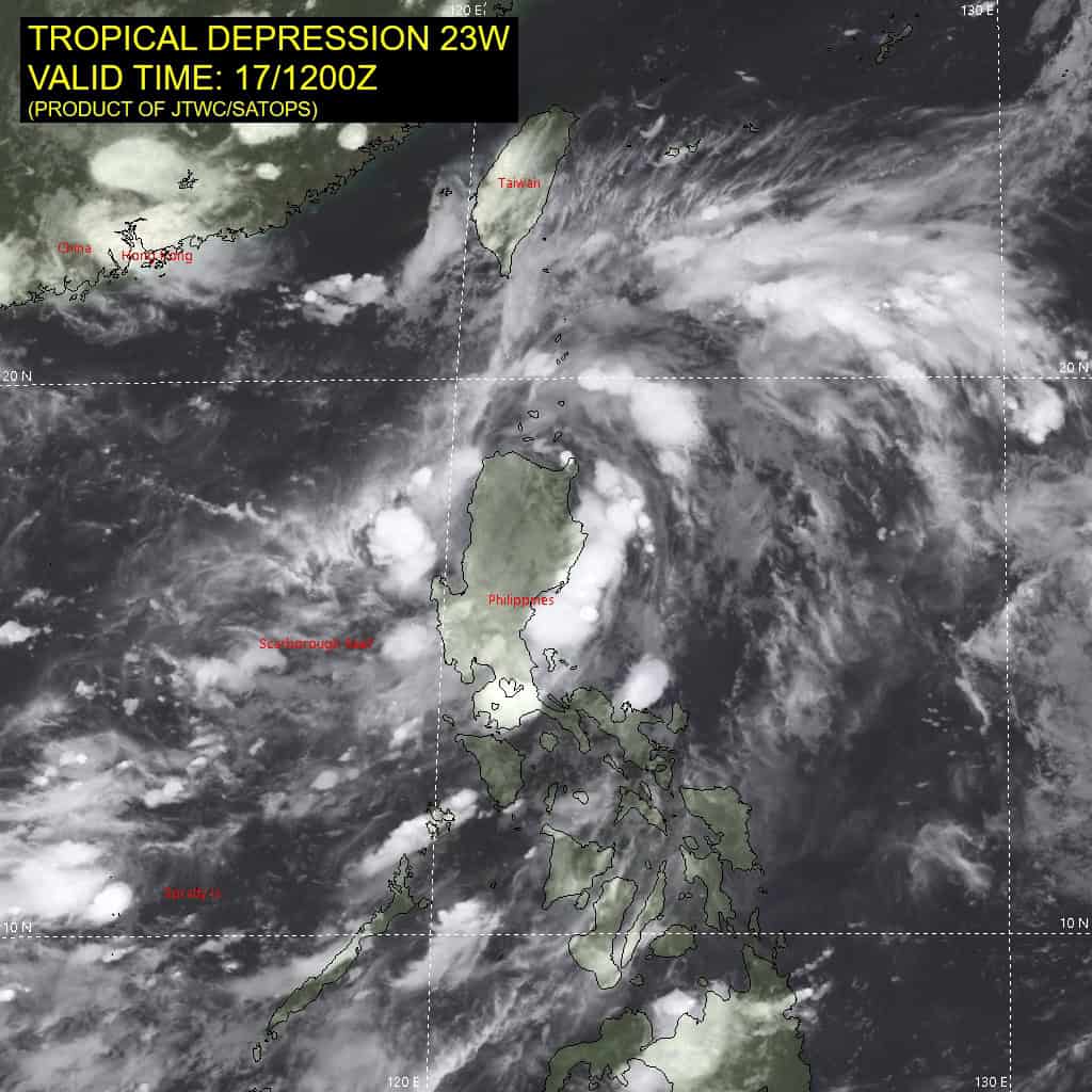
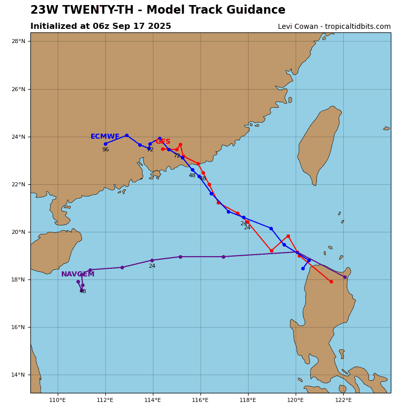
Tropical Cyclone 23W
According to the JTWC warning number 8…sustained winds are 30 knots with gusts to near 40 knots.
Animated enhanced infrared (eir) satellite imagery depicts a disorganized a weakening circulation with deep convective bands wrapping broadly along the northern and southeastern peripheries. It is currently assessed that tropical depression 23W is in the process of a phenomenon known as a leeside jump, and the center of vorticity has shifted north off of the coast of Cape Bojeador, Philippines.
Enhanced infrared imagery and a 171308z gpm gmi 89ghz image revealing low-level banding north of Luzon and a potential circulation center.
TD 23W will track northwestward for the next 48 hours while under the steering influence of a subtropical ridge positioned to the north. During this time, the low-level flow of TD 23W will struggle to consolidate and redevelop into a well-defined and symmetrical wind field.
Otherwise, favorable features of warm sea surface temperatures, low vertical wind shear, and strong upper-level diffluence will allow for intensification to a peak of 40 knots. By 48 hours, the system is expected to have made landfall, and will weaken while curving westward. Ultimately, TD 23W will dissipate over land between 72-96 hours.
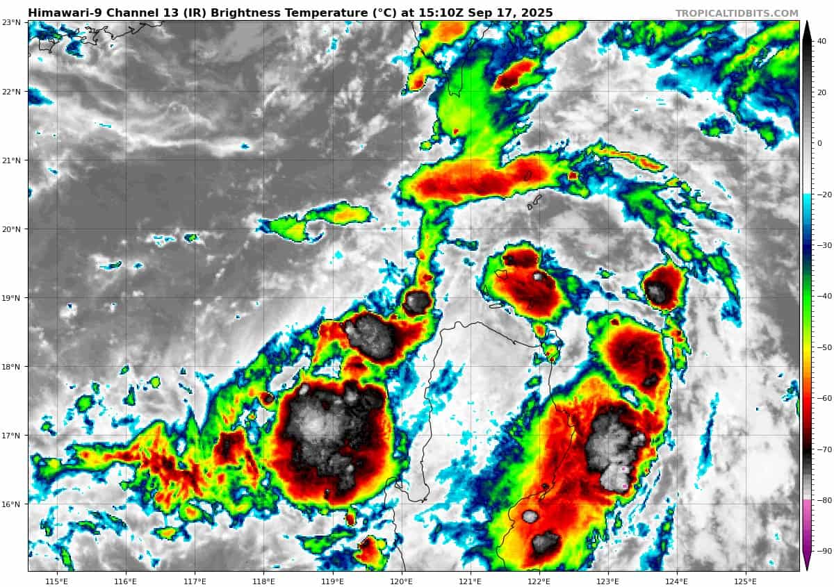
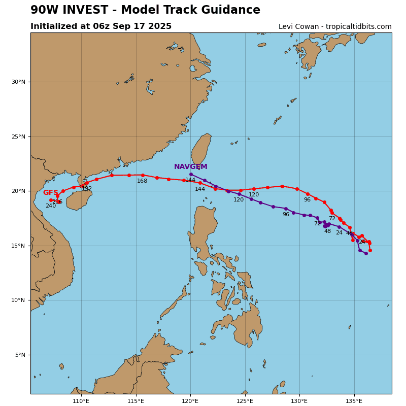
>>> There’s a, area of disturbed weather being referred to as Invest 90W, which is located approximately 421 NM northwest of Yap
Animated multi-spectral imagery (msi) depicts a poorly organized broad circulation center with dissipating central convection.
Environmental analysis reveals marginal to favorable conditions for development with low to moderate vertical wind shear (15-20 knots), poleward upper-level outflow aloft, and warm sea surface (28-29 c) temperatures.
Global models are in agreement that Invest 90W will steadily develop along a generally west-northwestward track over the next 24-48 hours.
Maximum sustained surface winds are estimated at 18 to 23 knots.
The potential for the development of a significant tropical cyclone within the next 24 hours remains medium.
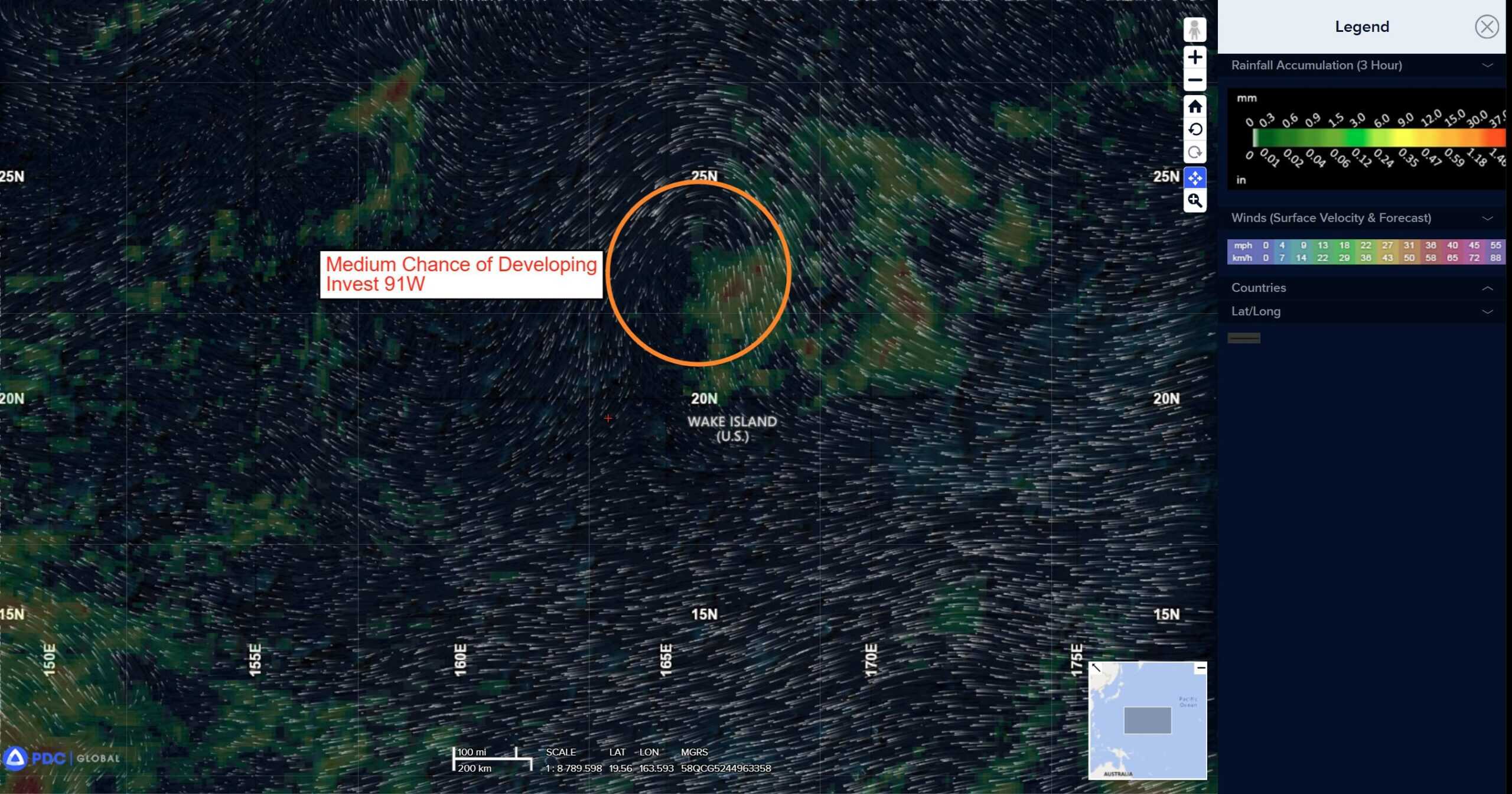
>>> There’s a, area of disturbed weather being referred to as Invest 91W, which is located approximately 282 NM north-northwest of Wake Island
Animated multi-spectral imagery (msi) depicts an ill-defined low-level circulation center (llcc) with flaring convection wrapping along the western periphery.
Environmental analysis reveals a favorable environment for development with low vertical wind shear (15 knots or less), good poleward outflow aloft, and warm sea surface (30-31 c) temperatures.
Deterministic models are in agreement that Invest 91W will have a west-northwestward track, but disagree on development timeline. Primarily, ECMWF develops Invest 91W the strongest compared to the other deterministic models. However, both ECENS and GEFS ensemble solutions shows stronger intensification compared to the deterministic models.
Maximum sustained surface winds are estimated at 23 to 28 knots.
The potential for the development of a significant tropical cyclone within the next 24 hours is upgraded to high.

")