
")
Current Snapshot
For all the latest updates visit: DisasterAWARE
sonia
1800x1080e
goes18_ir_18E_202510281415_lat15.0-lon-123.1
18E_tracks_latest
montha
03B_281200sair
03B_tracks_latest
92A
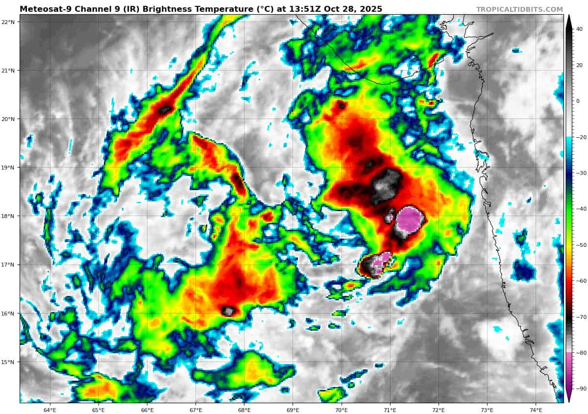
meteosat9_ir_92A_202510281351_lat17.7-lon68.8
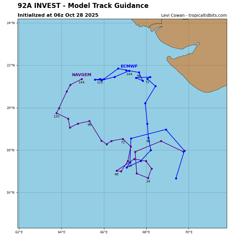
92A_tracks_latest
By PDC’s Senior Weather
Specialist Glenn James

The Pacific Disaster Center’s (PDC Global) Tuesday, October 28, 2025, Tropical Cyclone Activity Report…for the Pacific Ocean, the Indian Ocean, and adjacent Seas
Current Tropical Cyclones:
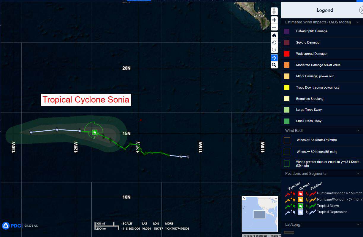
Tropical Cyclone 18E (Sonia)…is located approximately 1075 miles west-southwest of the southern tip of Baja California
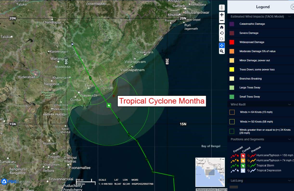
Tropical Cyclone 03B Montha…is located approximately 564 NM southwest of Kolkata, India
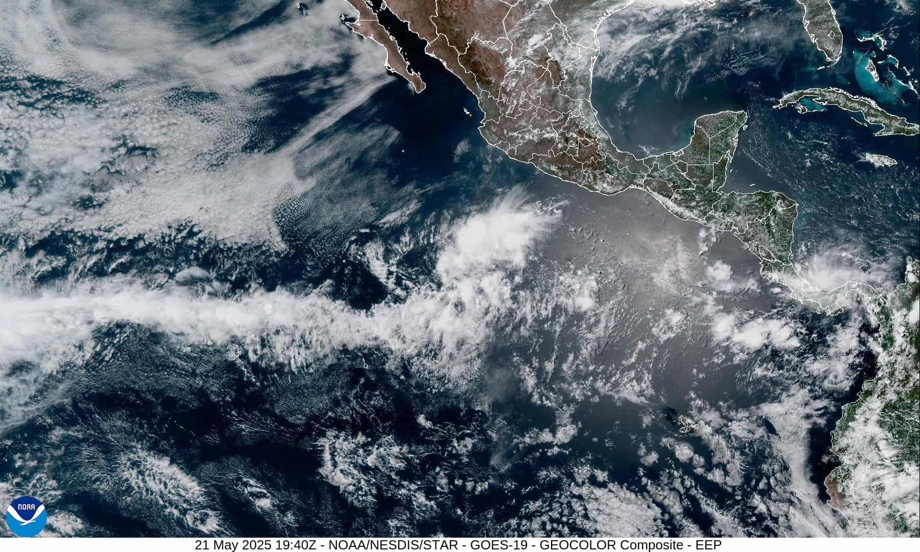
Northeast Pacific Ocean:
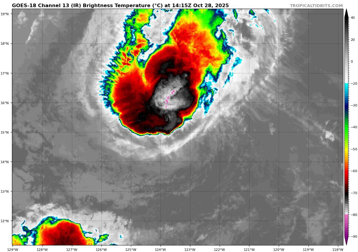
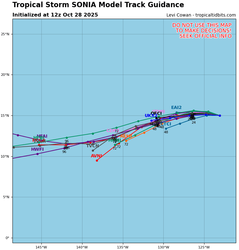
Tropical Cyclone 18E (Sonia)
SONIA WEAKENING, FORECAST TO BECOME A REMNANT LOW TONIGHT
According to the NHC advisory number 17
Sonia is moving toward the west-northwest near 9 mph (15 km/h). A turn toward the west is expected later today, followed by a gradual increase in forward speed during the next day or so.
Maximum sustained winds have decreased to near 40 mph (65 km/h) with higher gusts. Gradual weakening is forecast during the next or two, with Sonia expected to become a post-tropical remnant low tonight.
Tropical-storm-force winds extend outward up to 60 miles (95 km) from the center. The estimated minimum central pressure is 1004 mb (29.65 inches).
Central Pacific Ocean: There are no Tropical Cyclones
Tropical cyclone formation is not expected during the next 7 days.
Western Pacific, Indian Ocean, and adjacent Seas:
North Indian Ocean
Tropical Cyclone 03B (Montha)
According to the JTWC warning number 10, sustained winds are 40 knots with gusts to near 59 knots.
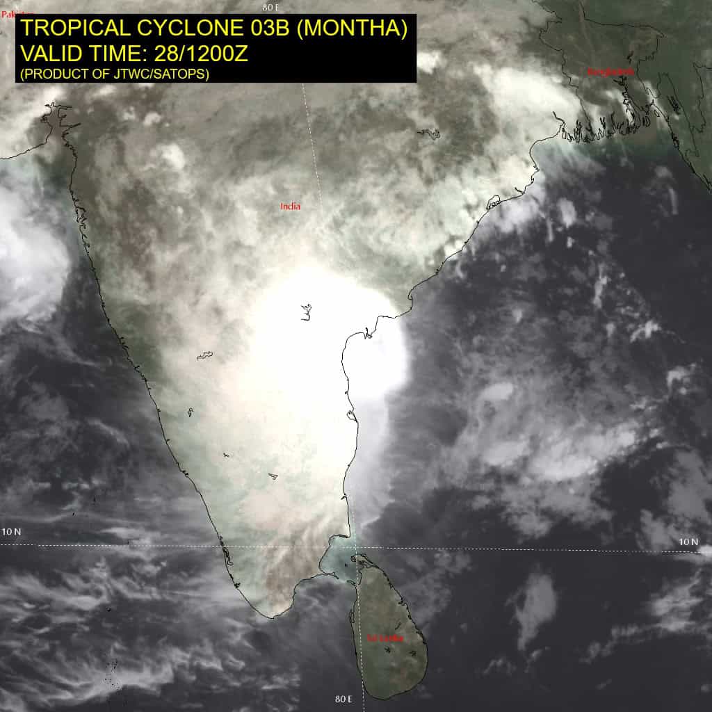
Animated enhanced infrared (eir) satellite imagery depicts tropical cyclone 03B (Montha) with vigorous bursts of deep convection confined to the western semicircle of a partially exposed low-level circulation center (llcc).
The cloud tops continue to be very cold with some areas measuring colder than -90 c. a 281218z f17 ssmis 91 ghz microwave image revealed the low-level clouds tightly wrapping into the assessed center from the south and deep convection offset about 54 nm to the west.
Environmental analysis indicates that 03B is in a marginally unfavorable environment characterized by moderate equatorward outflow aloft and warm (28-29 c) sea surface temperatures, offset by high (30-35 kts) east-northeasterly vertical wind shear and dry air to the east.
Arabian Sea
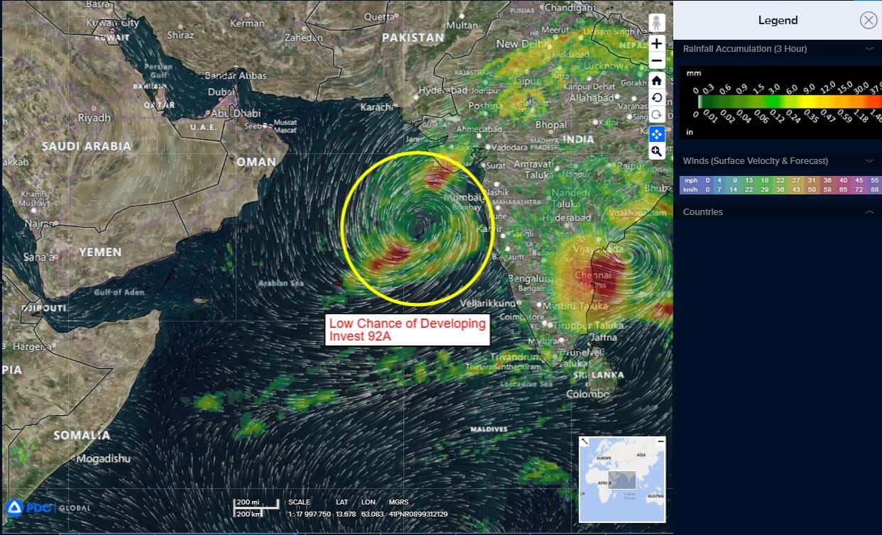
>>> There’s an area of disturbed weather being referred to as Invest 92A…which is located approximately 335 NM west-southwest of Mumbai, India
Enhanced infrared satellite imagery (eir) depicts 92A as a broad area of poorly defined rotation with convection sheared to the southwest. A partial ascat-b 271623z pass reveals an asymmetrical wind field of 10-15 knot winds near the circulation center with 20-25 knots displaced to the east and southeast.
Environmental analysis reveals marginally favorable conditions for development with low vertical wind shear (10-15 knots) and warm sea surface temperatures (28-29 c), offset by weak divergence aloft.
Global deterministic and ensemble models are in agreement that invest 92A has potential for slow, steady development while tracking northward to northwestward over the next 24-48 hours.
Maximum sustained surface winds are estimated at 18 to 23 knots.
The potential for the development of a significant tropical cyclone within the next 24 hours remains low.