
")
Current Snapshot
For all the latest updates visit: DisasterAWARE
Sonia
goes18_ir_18E_202510271415_lat13.8-lon-120.8
271432_earliest_reasonable_toa_34
18E_tracks_latest
mntha
03B_271200sair
03B_tracks_latest
92a
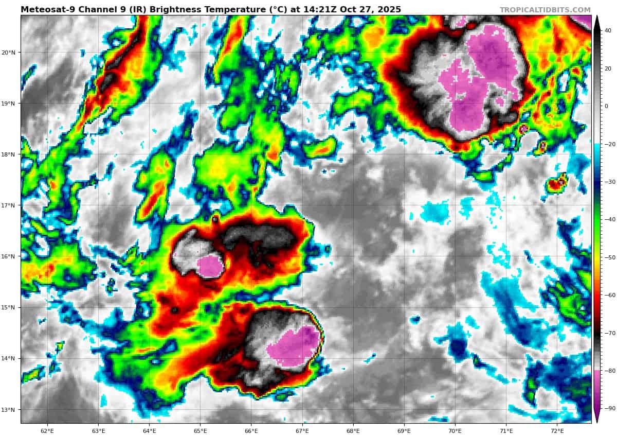
meteosat9_ir_92A_202510271421_lat16.6-lon67.2
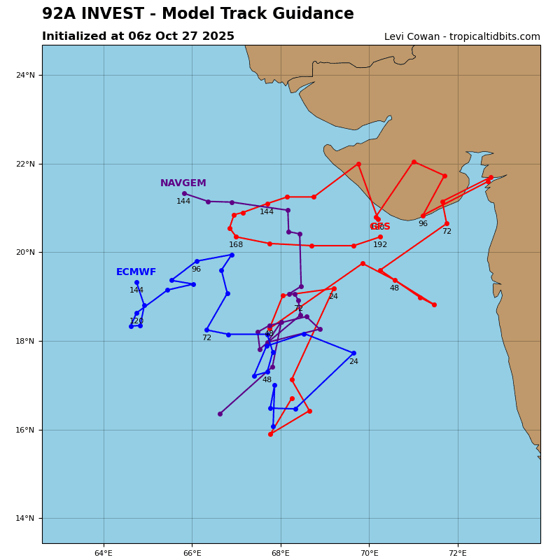
92A_tracks_latest
By PDC’s Senior Weather
Specialist Glenn James

The Pacific Disaster Center’s (PDC Global) Monday, October 27, 2025, Tropical Cyclone Activity Report…for the Pacific Ocean, the Indian Ocean, and adjacent Seas
Current Tropical Cyclones:
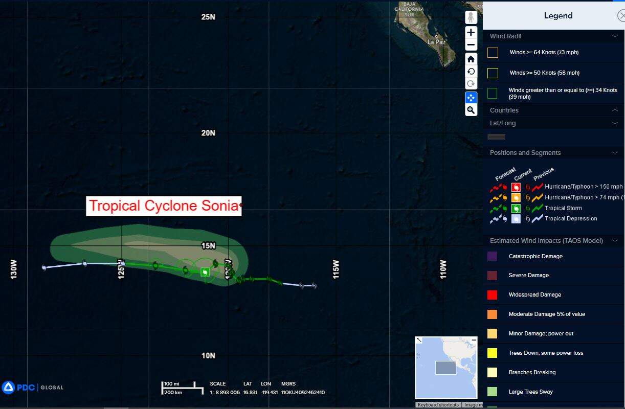
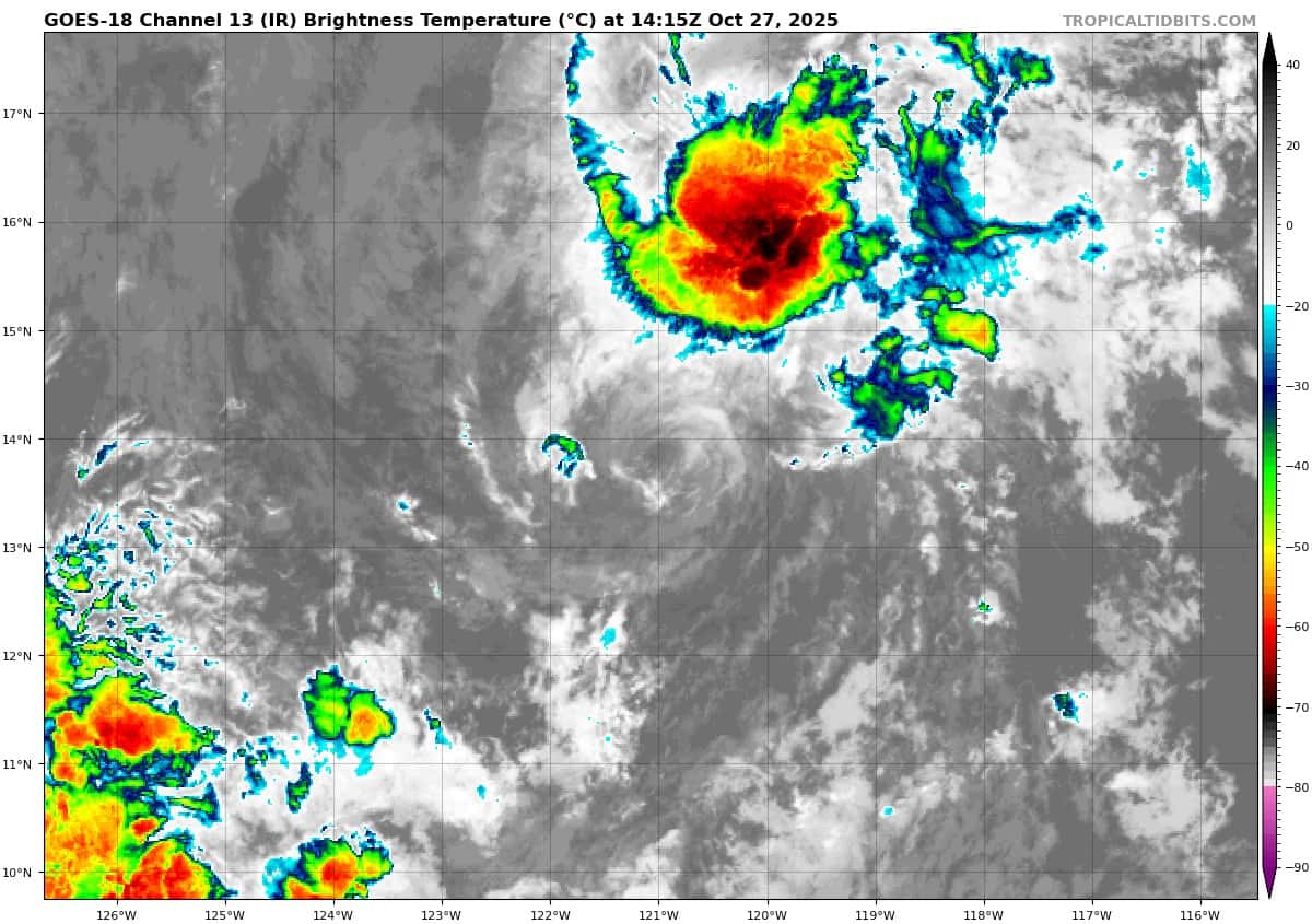
Tropical Cyclone 18E (Sonia)…is located approximately 965 miles southwest of the southern tip of Baja California
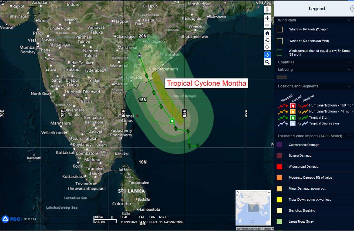
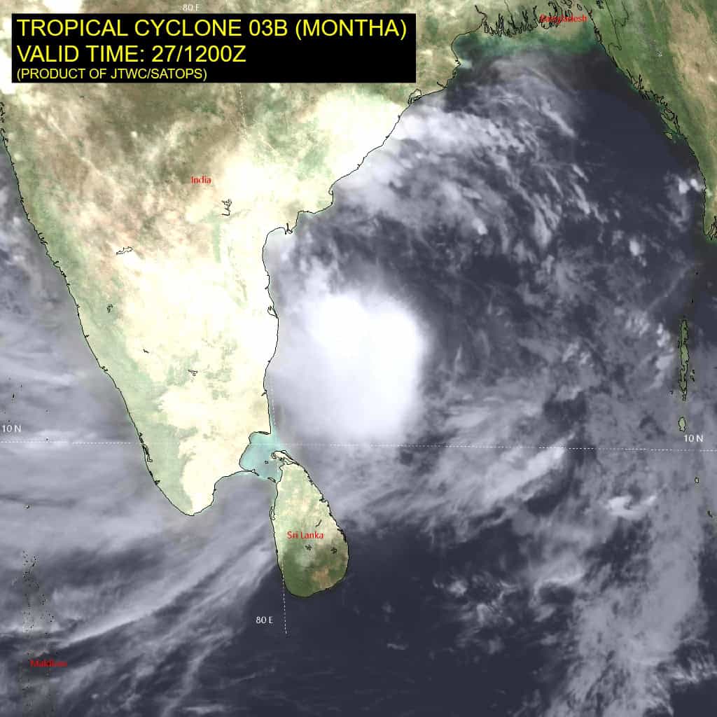
Tropical Cyclone 03B Montha…is located approximately 612 NM south-southwest of Kolkata, India
Northeast Pacific Ocean:
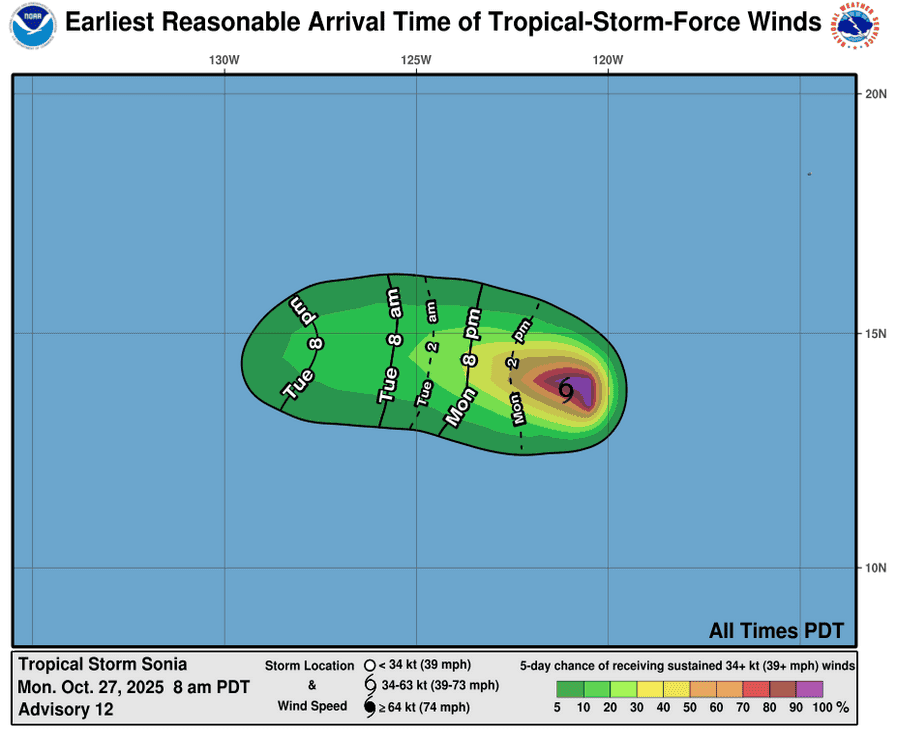
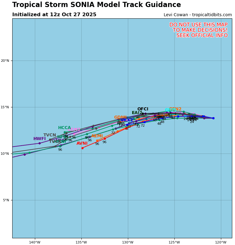
Tropical Cyclone 18E (Sonia)
SHEARED SONIA MOVING WESTWARD
According to the NHC advisory number 12
Sonia is moving toward the west near 7 mph (11 km/h) and this motion is expected to continue during the next few days.
Maximum sustained winds are near 45 mph (75 km/h) with higher gusts. Gradual weakening is forecast during the next couple of days, and Sonia is expected to become a post-tropical remnant low Tuesday or Wednesday
Tropical-storm-force winds extend outward up to 45 miles (75 km) from the center. The estimated minimum central pressure is 1004 mb (29.65 inches).
Central Pacific Ocean: There are no Tropical Cyclones
Tropical cyclone formation is not expected during the next 7 days.
Western Pacific, Indian Ocean, and adjacent Seas:
North Indian Ocean
Tropical Cyclone 03B (Montha)
According to the JTWC warning number 5, sustained winds are 45 knots with gusts to near 55 knots.
Animated enhanced infrared (eir) satellite imagery depicts tropical cyclone 3B (Montha) with continued poleward and equatorward outflow and a significant amount of deep convection displaced to the west. Vertical wind shear remains high (25-30 kts) causing the system to appear less organized.
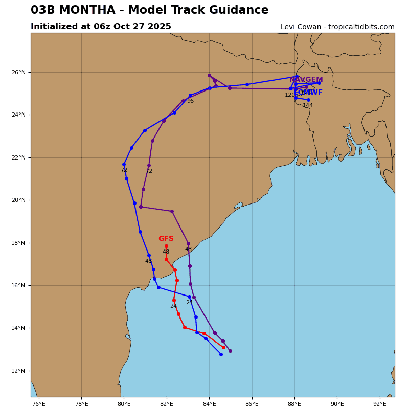
TC Montha will remain transiting northwestward for the remainder of the forecast period under the influence of a subtropical ridge to the northeast.
The system has likely reached its peak and will remain close to 45 kt strength until after 24 hours. A slight increase in shear and interaction with land features will start to weaken TC Montha with a steeper weakening trend expected after 36 hours due to the combination of increased shear and frictional effects of the terrain. TC Montha will fully dissipate over land by 48 hours.
Arabian Sea
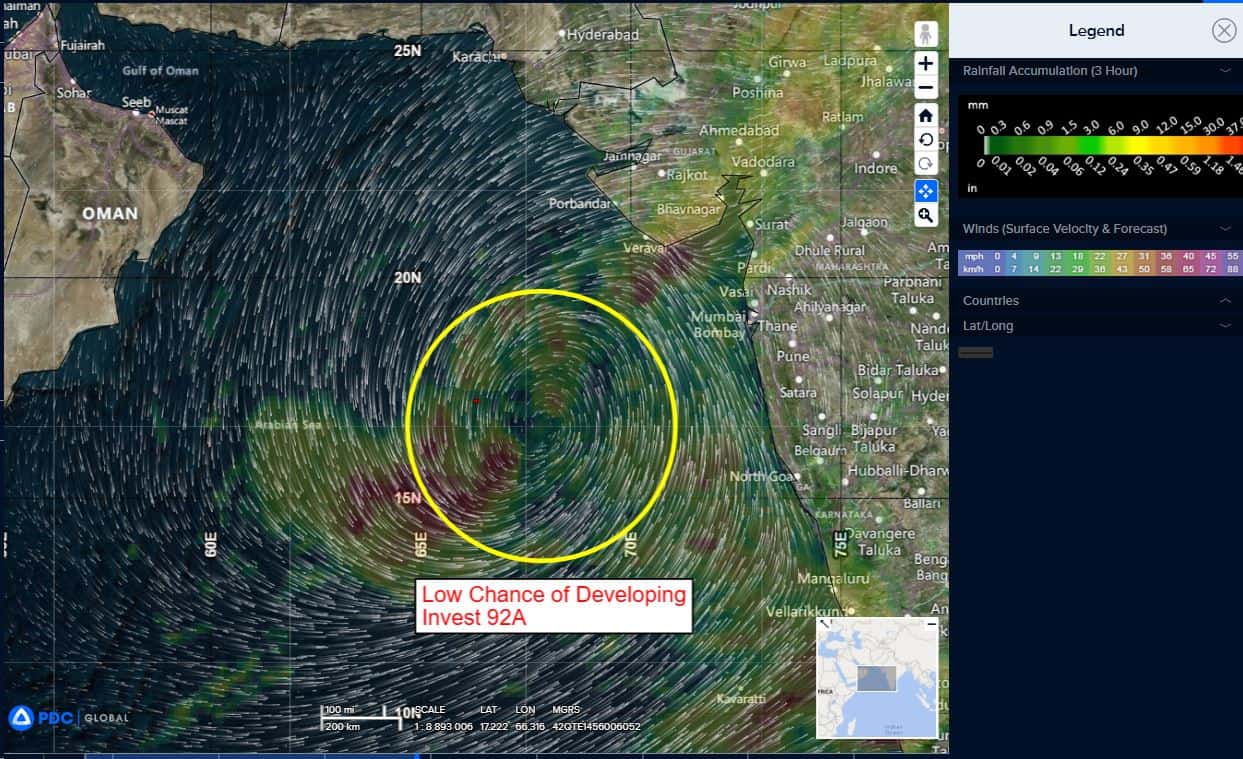
>>> There’s an area of disturbed weather being referred to as Invest 92A…which is located approximately 409 NM west-southwest of Mumbai, India
Animated enhanced multi-spectral imagery (msi) depicts flaring convection in the western periphery along a poorly organized low level circulation center (llcc).
Environmental analysis for the area indicates favorable conditions for development with moderate vertical wind shear (15-20 kts), warm sea surface temperatures (28-29 c), and good equatorward outflow aloft.
Global deterministic and ensemble models are in agreement that 92A will continue north.
Maximum sustained surface winds are estimated at 18 to 23 knots.
The potential for the development of a significant tropical cyclone within the next 24 hours remains low.