The Pacific Disaster Center’s (PDC Global) Monday, August 18, 2025, Tropical Cyclone Activity Report…for the Pacific Ocean, the Indian Ocean, and adjacent Seas
Current Tropical Cyclones:
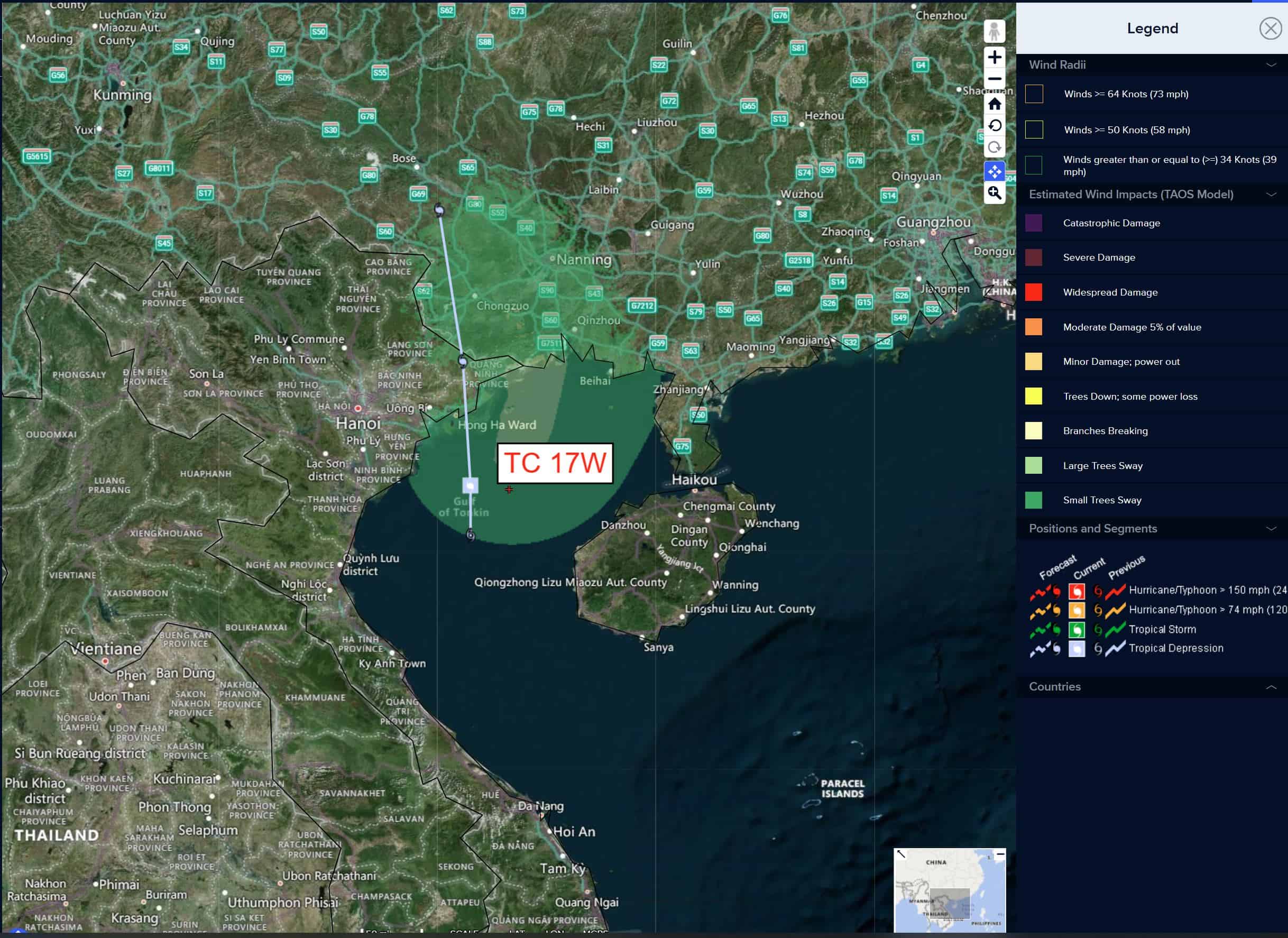
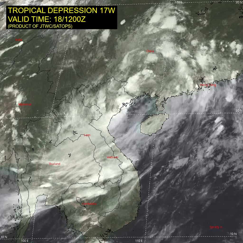
Tropical Cyclone 17W is located approximately 79 NM east of Hanoi, Vietnam – Final Warning
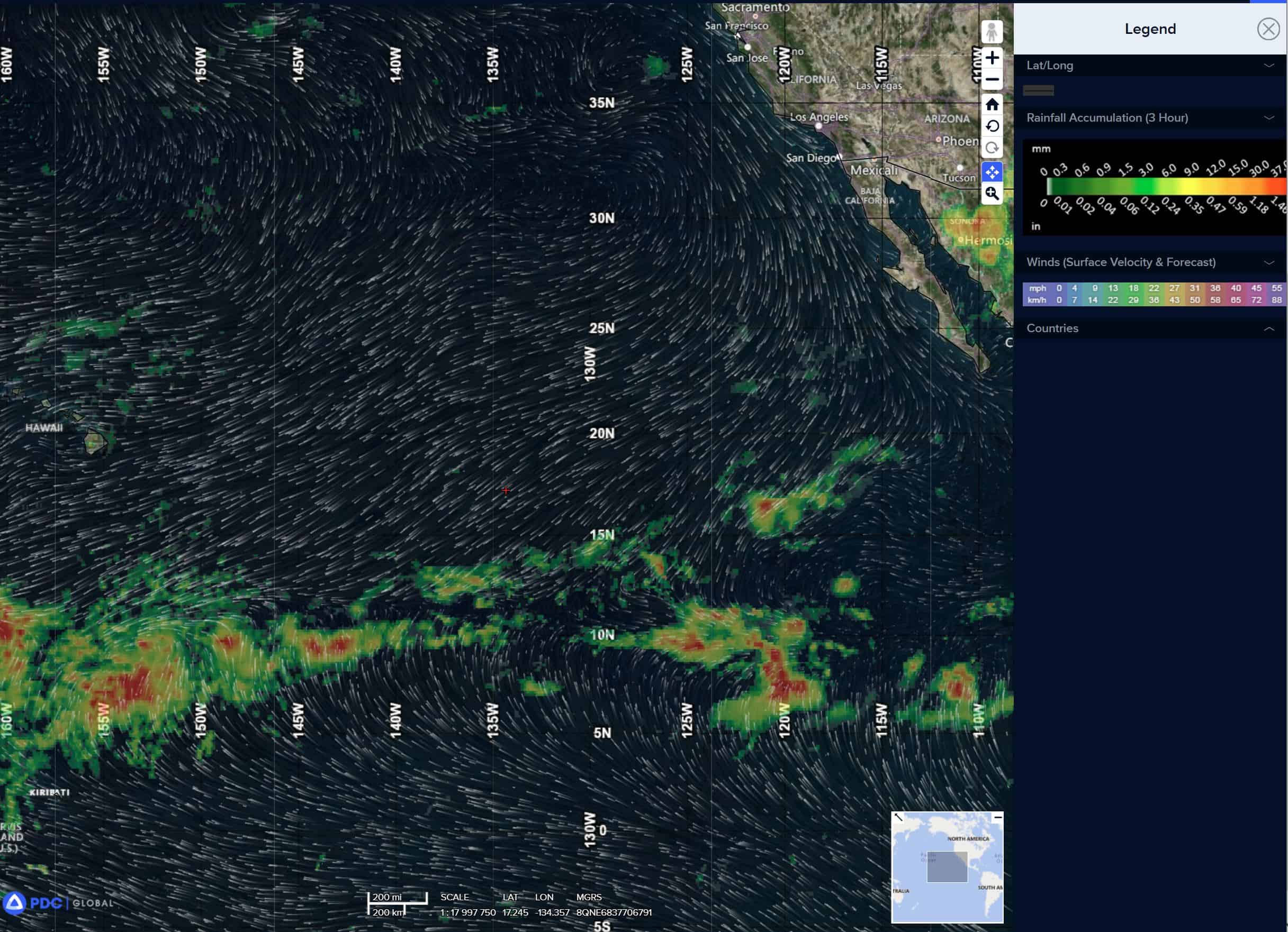
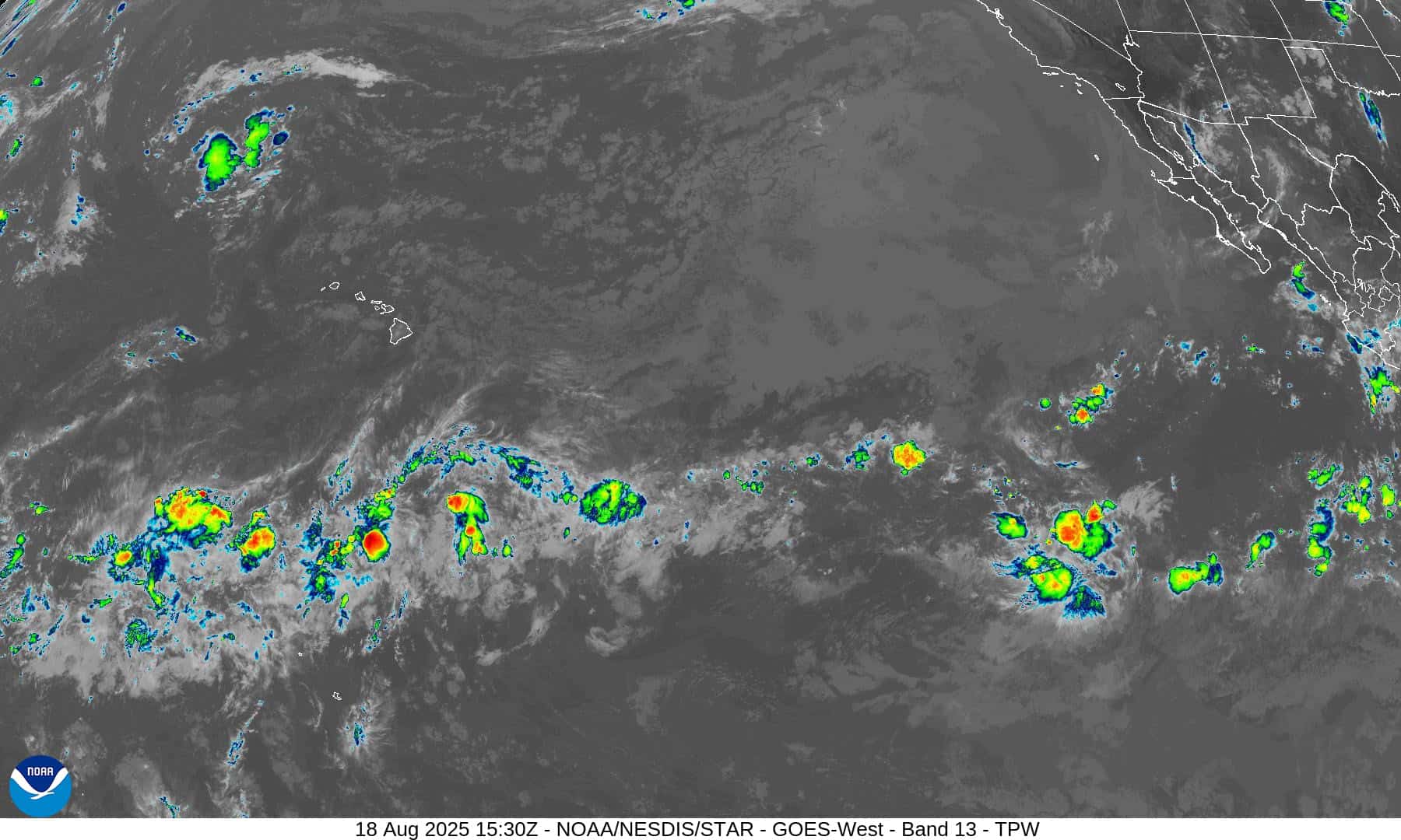
Northeast Pacific Ocean: There are no active tropical cyclones
Tropical cyclone formation is not expected during the next 7 days.
Central Pacific Ocean: There are no active tropical cyclones
Tropical cyclone formation is not expected during the next 7 days.
Western Pacific, Indian Ocean, and adjacent Seas:
Western Pacific
Tropical Cyclone 17W – Final Warning
Animated enhanced infrared imagery shows that tropical depression 17W has made landfall in the central Quang Ninh province of Vietnam.
The system will track northward over mountainous and dry terrain and dissipate within the next 12 hours.
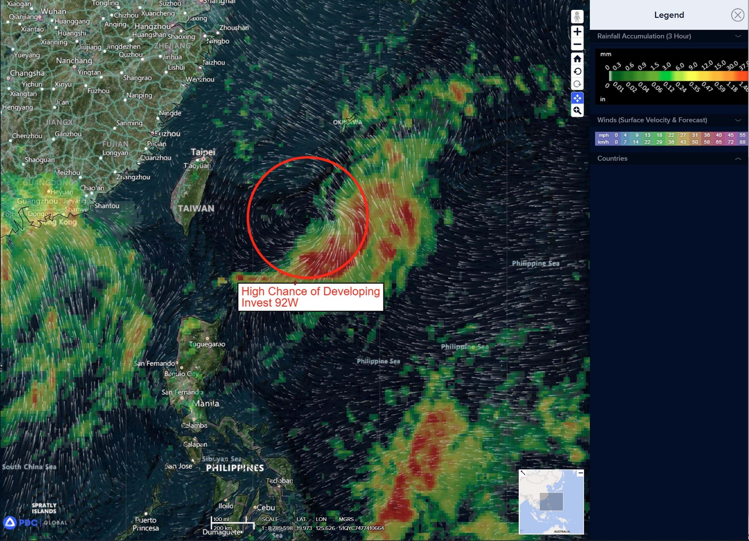
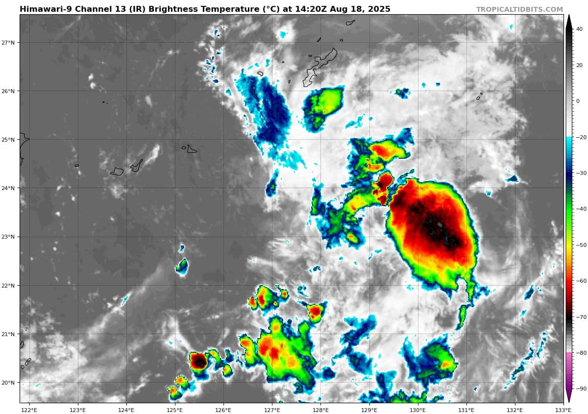
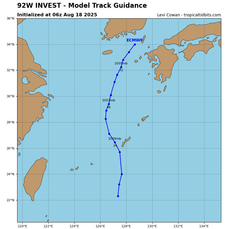
>>> There’s an area of disturbed weather being referred to as Invest 92W, which is located approximately 24 NM northeast of Kadena AB, Okinawa
Animated enhanced infrared imagery (eir) depicts a partially exposed and rather ill-defined low level circulation center (llcc), embedded within a reverse oriented monsoon trough. The system is currently devoid of significant convective activity, due to the persistent southwesterly shear aloft and the presence of dry mid-level air along the western flank of the rotation.
The tutt cell previously positioned to the north of the circulation has moved to a position west of the llcc, and become a hindrance to development with strong southerly flow pushing the convection and the mid-level vortex away to the northeast.
Environmental analysis for the area indicates marginally favorable conditions with warm sea surface temperatures (30 c), and strong poleward outflow aloft, offset by low-moderate vertical wind shear (15-20 knots).
Global models are in good agreement that 92W will track generally northward over the next 24 hours. However, the intensity guidance is split with ECENS being extremely generous and GEFS holding onto a conservative estimate.
Maximum sustained surface winds are estimated at 18 to 23 knots.
The potential for the development of a significant tropical cyclone within the next 24 hours remains high.
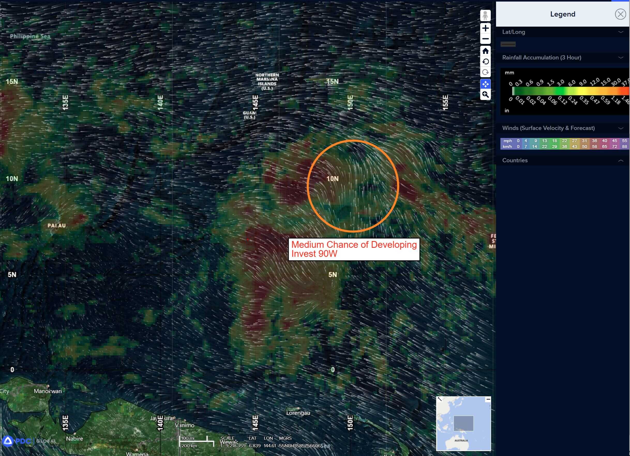
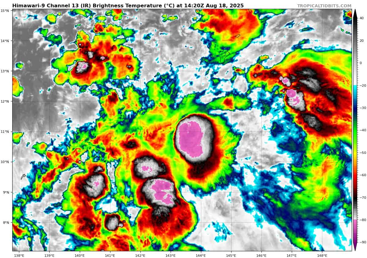
>>> There’s a second area of disturbed weather being referred to as Invest 90W, which is located approximately 97 NM north-northeast of Yap
Animated enhanced infrared imagery (eir) depicts flaring convection building over a slowly consolidating cusp or low-level circulation center (llcc), at the northern end of an easterly wave feature. A combination of an 180015z and 172351z partial ascat passes revealed the fact that 90W remains primarily a wave with a rapidly developing cusp at the northern end of it.
Southerly winds of 20-25 knots extend from southwest of Chuuk to the northwest of Fananu, then turn sharply to easterlies at the
latitude of 90W, with embedded pockets of 25 knot easterly winds extending to a point about 290 NM southeast of Guam.
Environmental conditions are assessed to be moderately favorable with good equatorward outflow and very warm (30-31c) ssts and low to moderate (15-20 knot) vertical wind shear.
Global models are in good agreement that 90W will track north-northwest into substantially lower shear over the next 24-36 hours but do not currently depict the system developing into a tropical cyclone within the next 24 hours. However, elevated winds of 25-30 knots are possible along the northern periphery
of the system, in the gradient flow, as it passes to the south of
Guam.
Ensemble development is strong on this circulation with ECENS
being the most favorable model intensity wise however GEFS is still in agreement on a northwestward track
Maximum sustained surface winds are estimated at 18 to 23 knots.
The potential for the development of a significant tropical cyclone within the next 24 hours is downgraded to low.

")