Western Pacific, Indian Ocean, and adjacent Seas:
Western Pacific

")
By PDC’s Senior Weather
Specialist Glenn James

The Pacific Disaster Center’s (PDC Global) Saturday, October 11, 2025, Tropical Cyclone Activity Report…for the Pacific Ocean, the Indian Ocean, and adjacent Seas
Current Tropical Cyclones:
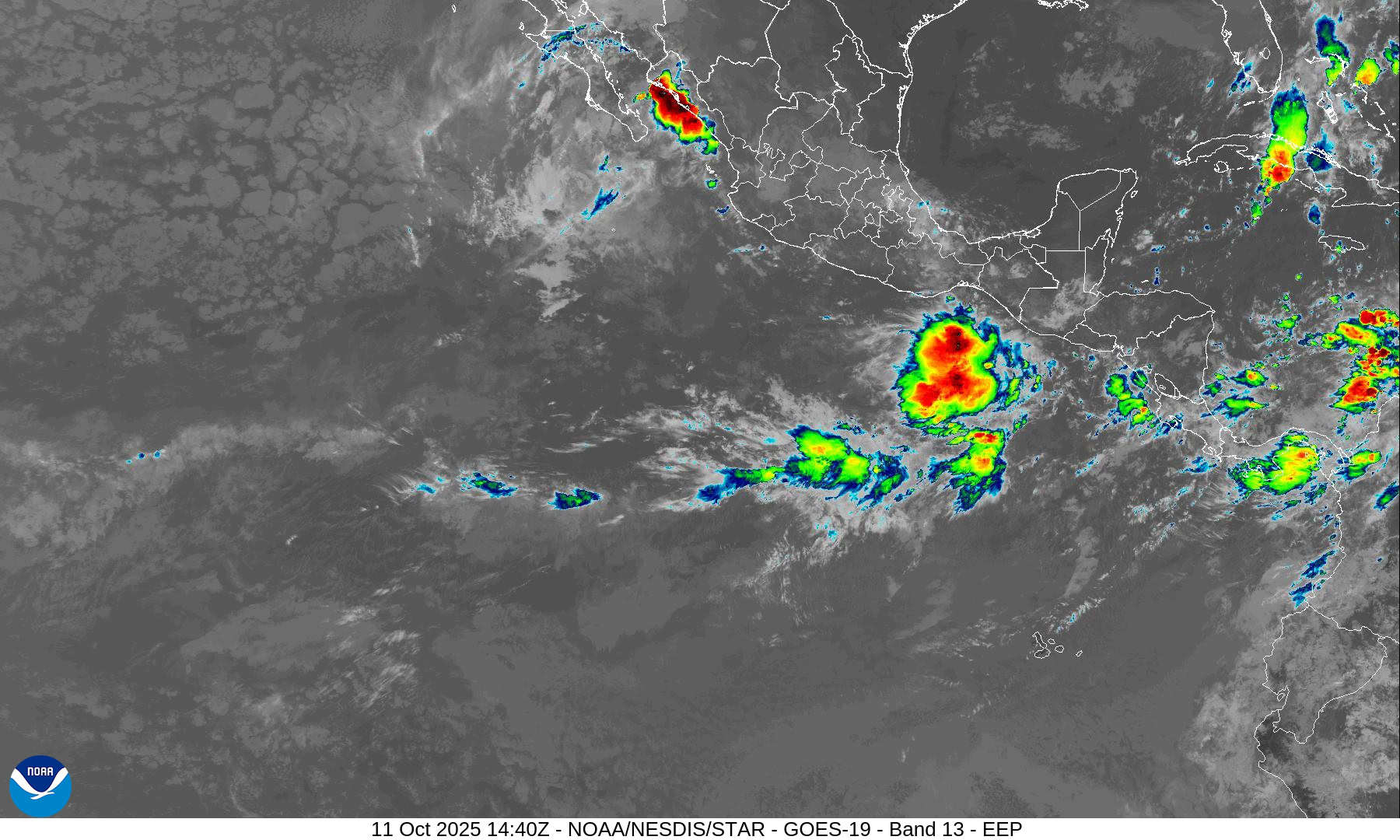
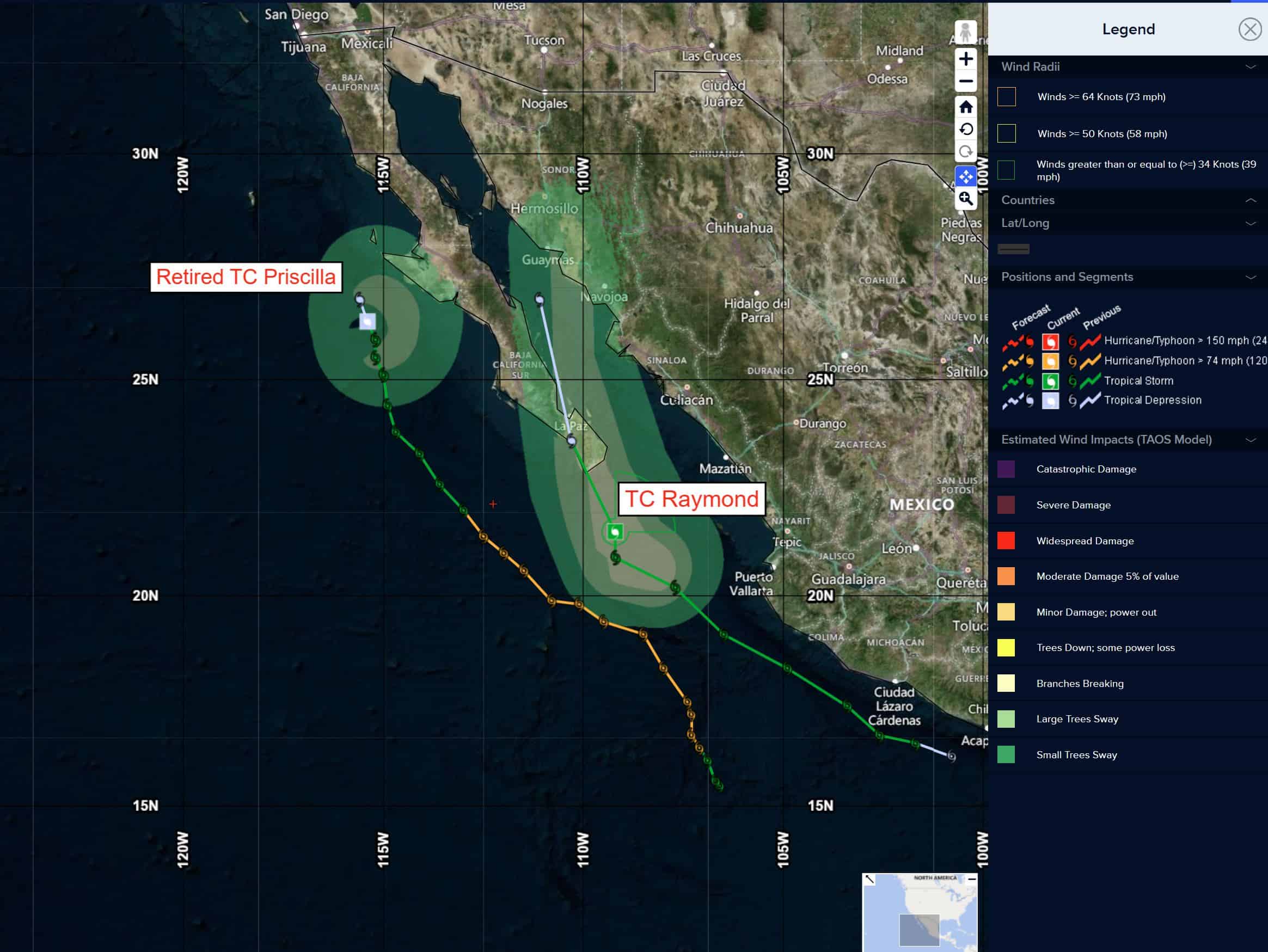
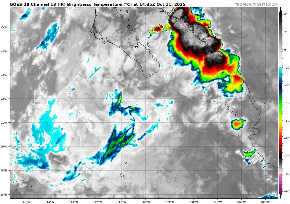
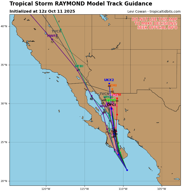
Post-Tropical Cyclone 17E (Raymond) is located about 5 miles west of the southern tip of Baja California
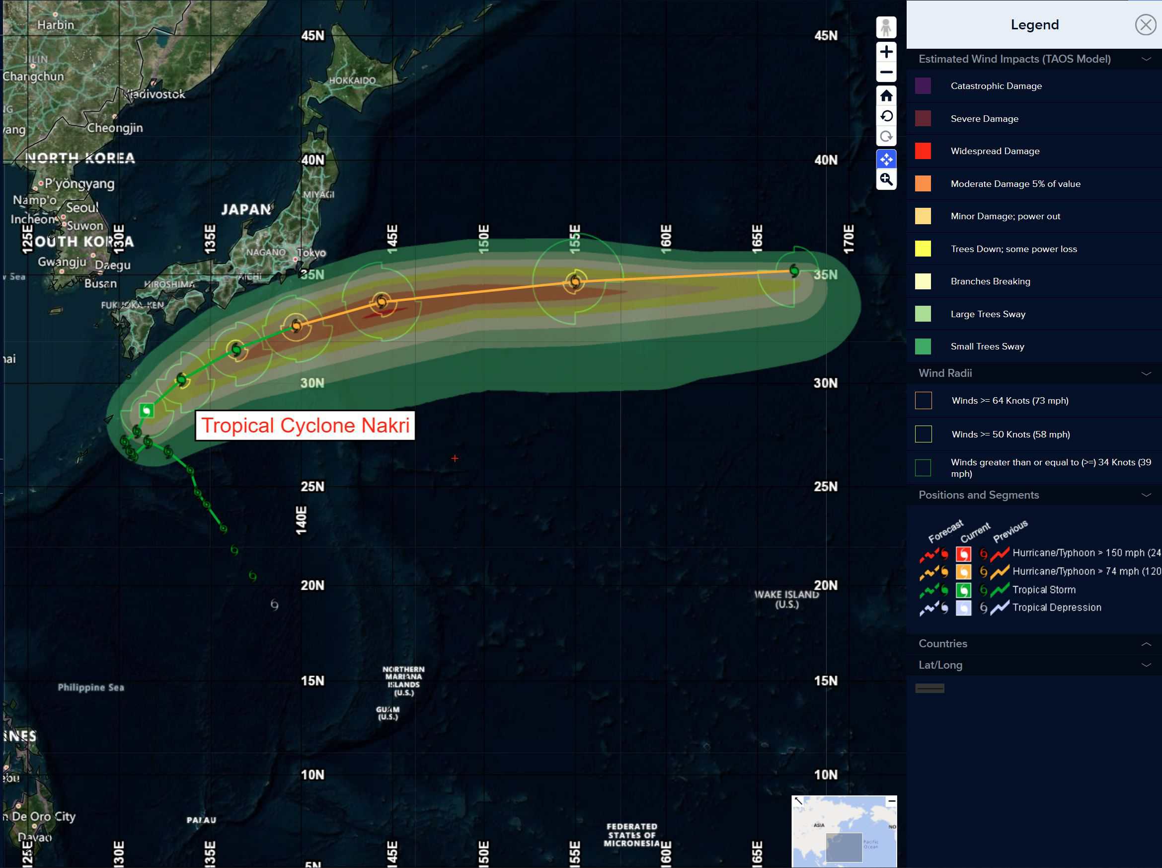
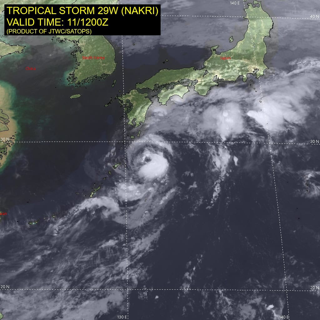
Tropical Cyclone 29W (Nakri) is located approximately 262 NM south-southeast of Iwakuni, Japan
Northeast Pacific Ocean:
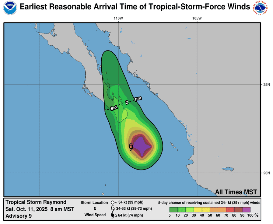
Tropical Cyclone 17E (Raymond)
RAYMOND BECOMES A REMNANT LOW… REMNANT MOISTURE TO BRING A RISK OF FLASH FLOODING TO NORTHWESTERN MEXICO AND SOUTHWESTERN UNITED STATES FOR ANOTHER FEW DAYS
According to the NHC advisory number 11
The post-tropical cyclone is moving toward the north-northwest near 9 mph (15 km/h). A north-northwestward to northward motion at a faster forward speed is expected until dissipation on Sunday. On the forecast track, the remnants of Raymond will move over Baja California Sur tonight. Maximum sustained winds are near 30 mph (45 km/h) with higher gusts. The remnant low should gradually weaken and dissipate on Sunday. The estimated minimum central pressure is 1005 mb (29.68 inches).
HAZARDS AFFECTING LAND
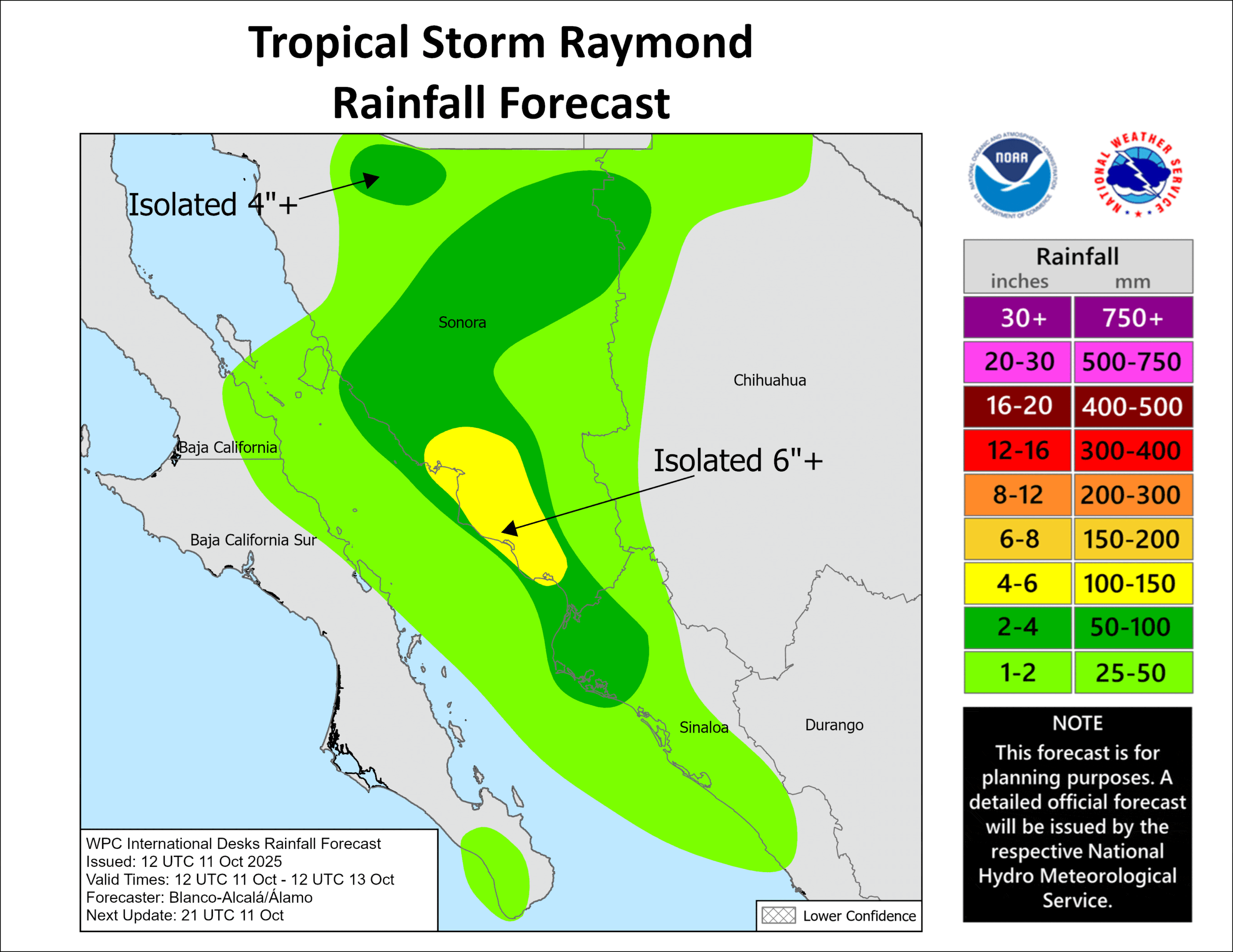
RAINFALL: Additional rainfall totals of 2 to 4 inches are expected across much of Sonora, northwestern Sinaloa, and northern Chihuahua through Sunday. This rainfall will bring a risk of flash flooding, especially in areas of higher terrain. Rainfall totals of 1 to 2 inches are expected across central Sinaloa, portions of Baja California Sur, and across the far southeast portion of Baja California. Moisture from Raymond will also bring the potential for additional heavy rainfall over portions of the Southwest U.S. Sunday into early next week.
SURF: Swells generated by Raymond are affecting the coasts of southwest and west-central Mexico, and southern Baja California Sur. These swells are likely to cause life-threatening surf and rip current conditions.
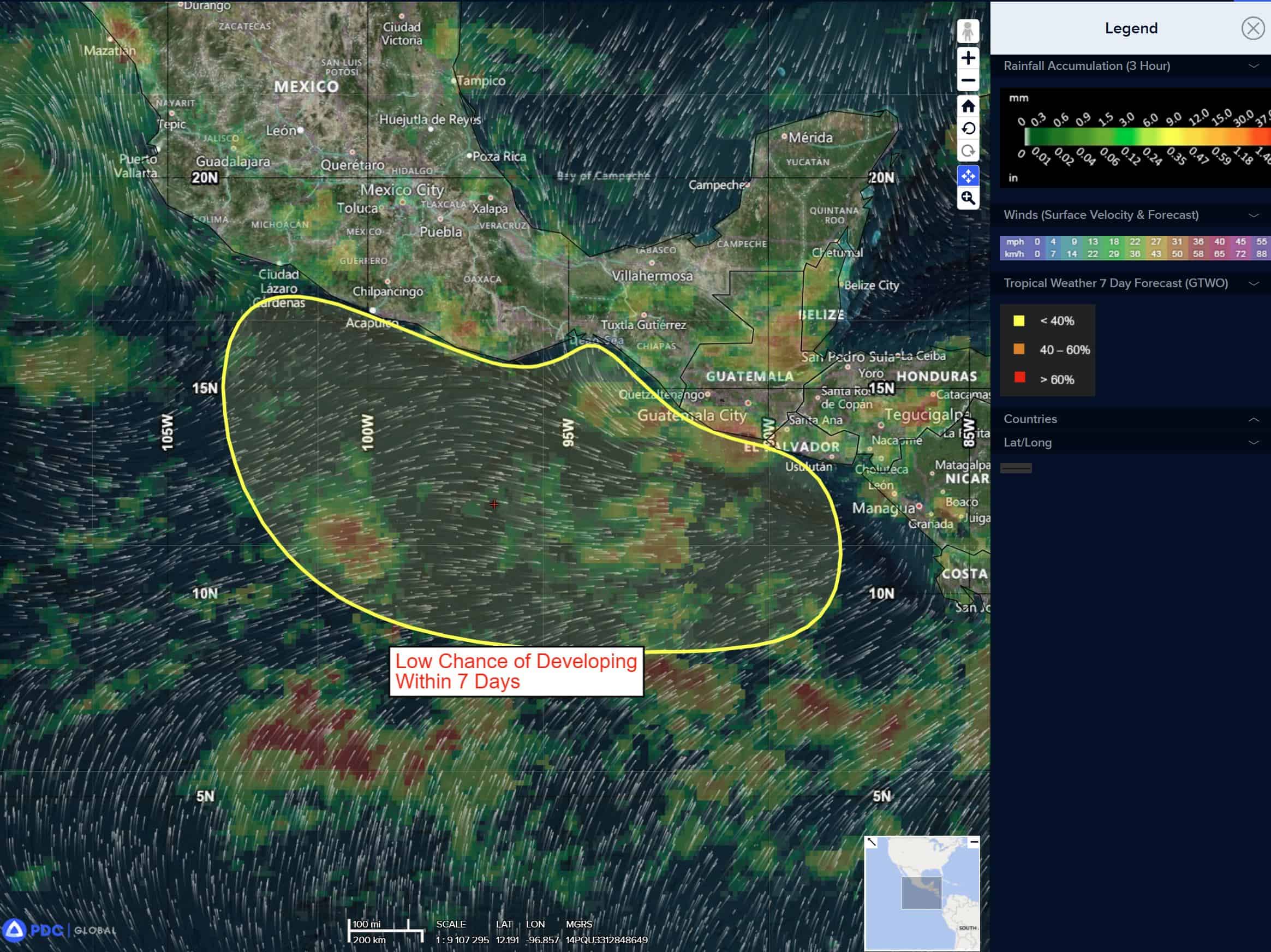
South of Southern Mexico:
>>> An area of low pressure is expected to form off the coast of southern Mexico by the middle of next week. Environmental conditions are forecast to be conducive for some development thereafter, as the system moves slowly northward or northwestward near or just offshore of the coast of southern Mexico.
* Formation chance through 48 hours…low…near 0 percent
* Formation chance through 7 days…medium…40 percent
Central Pacific Ocean: There are no Tropical Cyclones
Tropical cyclone formation is not expected during the next 7 days.
Western Pacific, Indian Ocean, and adjacent Seas:
Western Pacific
Tropical Cyclone 29W (Nakri)
According to the JTWC warning number 16, sustained winds were 60 knots with gusts to 75 knots
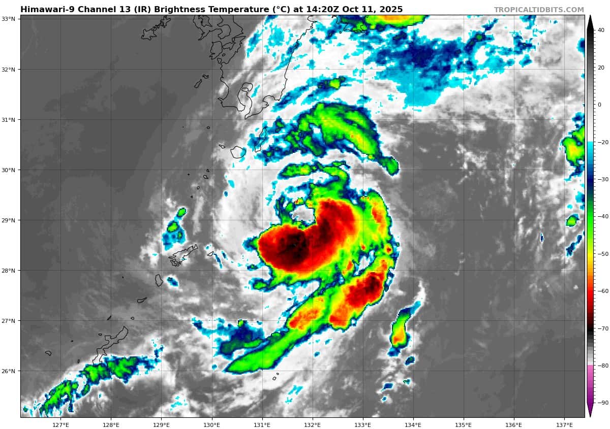
Animated enhanced infrared (eir) satellite imagery depicts tropical storm 29W (Nakri) with a partially exposed low-level circulation (llcc). associated convection continues to flare up primarily in the southwest quadrant, although a small pocket of convective activity in the northeast quadrant has kicked up again.
Though vertical wind shear remains favorable (5-10 kts), the small system is struggling to maintain organization. the cloud tops have been on a warming trend (-65 c to -69 c). Additional environmental analysis reveals a continuously moist vortex core, despite dry air impinging on the circulation from west and east.
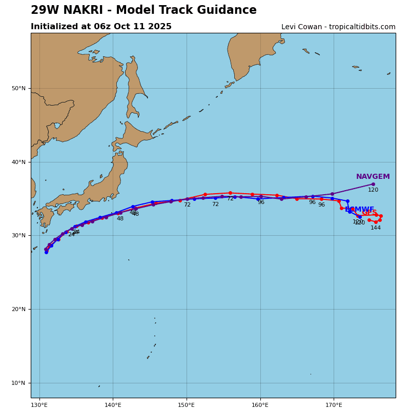
TS Nakri has begun its northeastward track having come back under the influence of a str to the east as its primary steering mechanism. The system will continue northeast through 72 hours, while encountering increasingly warm sea temperatures (29-30 c) along the way. This will allow for a period of re-strengthening through 48 hours, before increasing vertical wind shear, cooler sea temperatures (26-27 c), and the influence of the jet help the system along its extratropical transition (ett). TS Nakri is forecast to complete the ett by 96 hours.