Western Pacific, Indian Ocean, and adjacent Seas:
Western Pacific

")

By PDC’s Senior Weather
Specialist Glenn James

The Pacific Disaster Center’s (PDC Global) Friday, October 10, 2025, Tropical Cyclone Activity Report…for the Pacific Ocean, the Indian Ocean, and adjacent Seas
Current Tropical Cyclones:
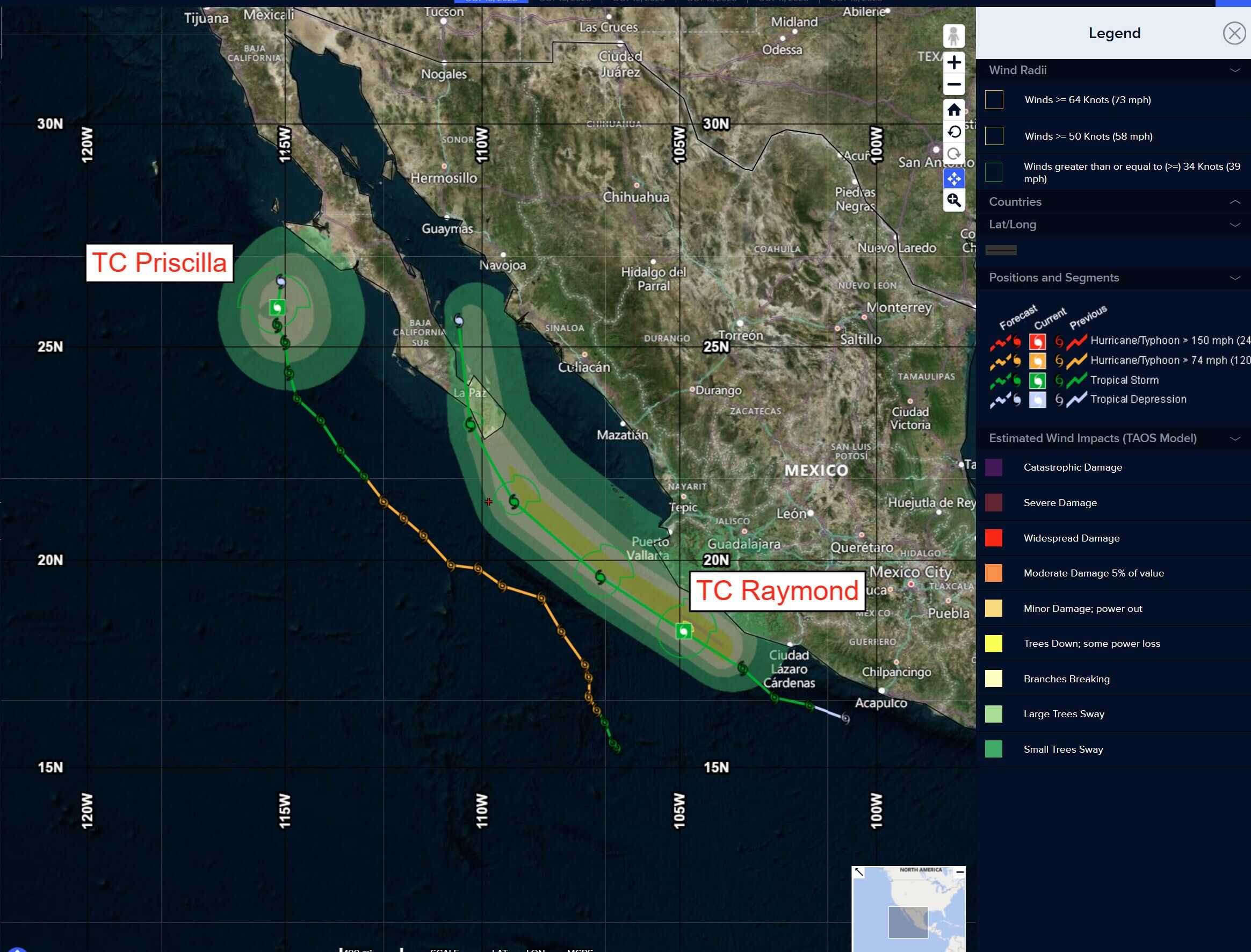
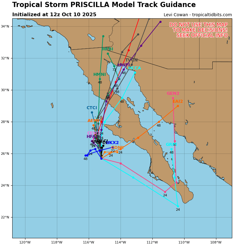
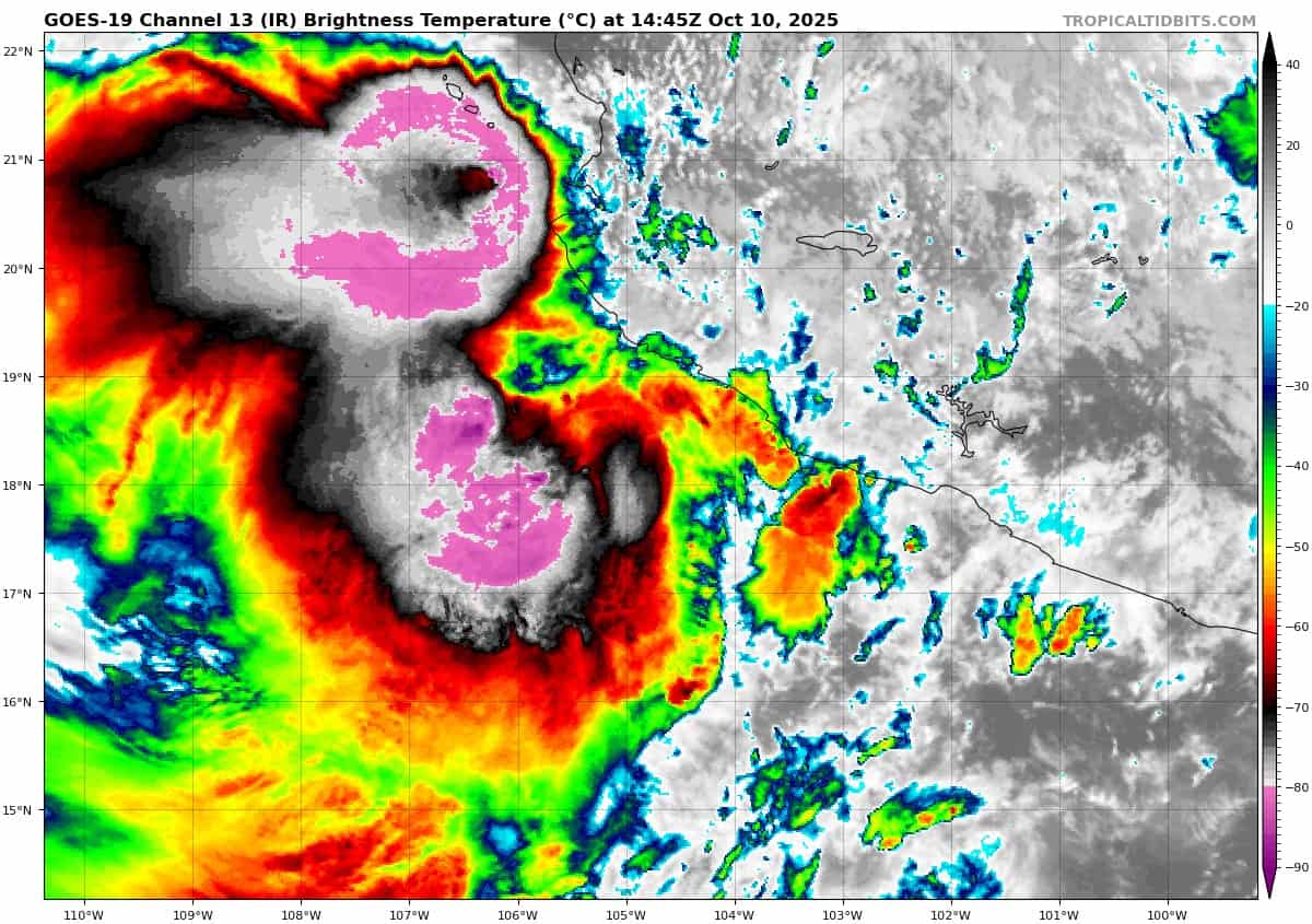
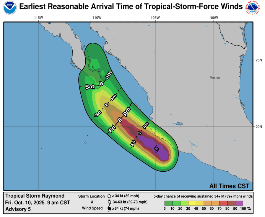
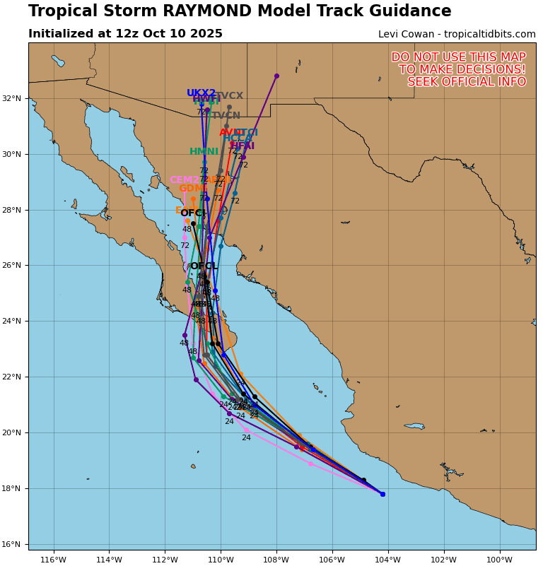
Tropical Cyclone 17E (Raymond) is located about 235 miles southeast of the southern tip of Baja California
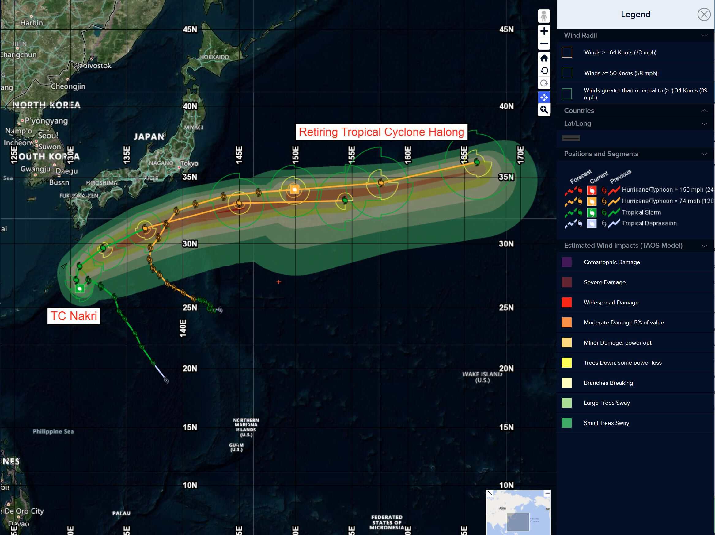
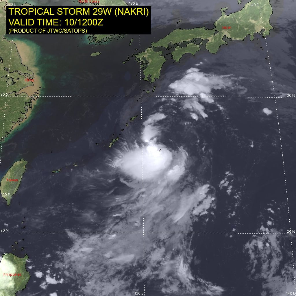
Tropical Cyclone 29W (Nakri) is located approximately 151 NM east of Kadena AB
Northeast Pacific Ocean:
Tropical Cyclone 17E (Raymond)
RAYMOND APPROACHING BAJA CALIFORNIA SUR…HEAVY RAINS AND TROPICAL STORM CONDITIONS EXPECTED THERE ON SATURDAY
According to the NHC advisory number 7
Raymond is moving toward the northwest near 18 mph and this motion is expected to continue tonight, followed by a turn toward the north Saturday through Sunday. On the forecast track, the center of Raymond is expected to be near the southern Baja California Sur on Saturday.
Maximum sustained winds are near 50 mph with higher gusts. Little change in strength is expected tonight, but the storm is forecast to weaken as it moves near or over Baja California Sur over the weekend.
Tropical-storm-force winds extend outward up to 80 miles from the center. The estimated minimum central pressure is 1000 mb (29.53 inches).
HAZARDS AFFECTING LAND
WIND: Tropical storm conditions are expected within the warning area through today. Tropical storm conditions are possible within the watch area on Saturday.
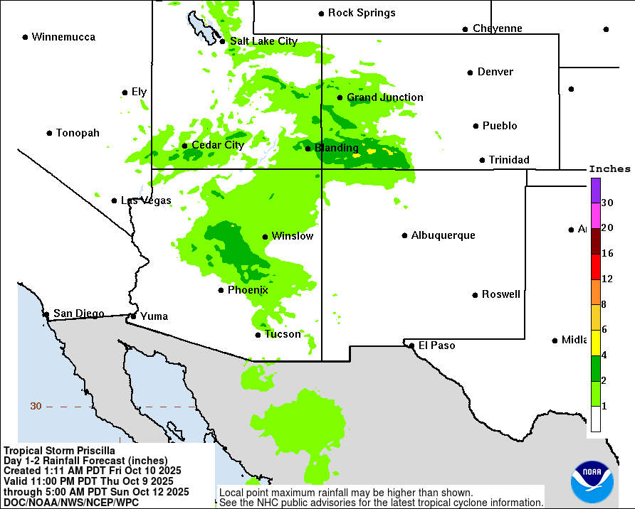
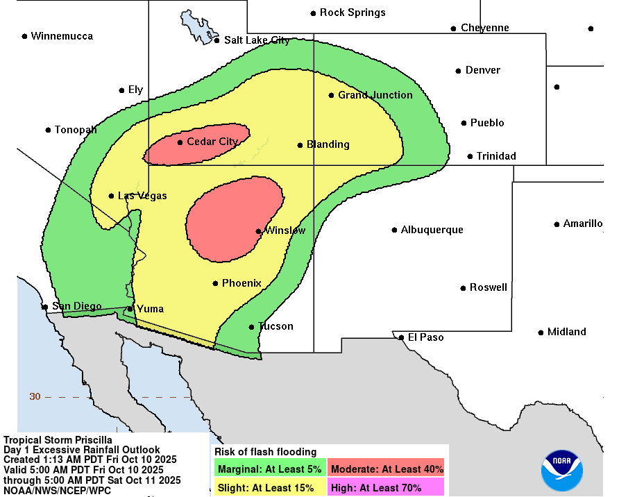
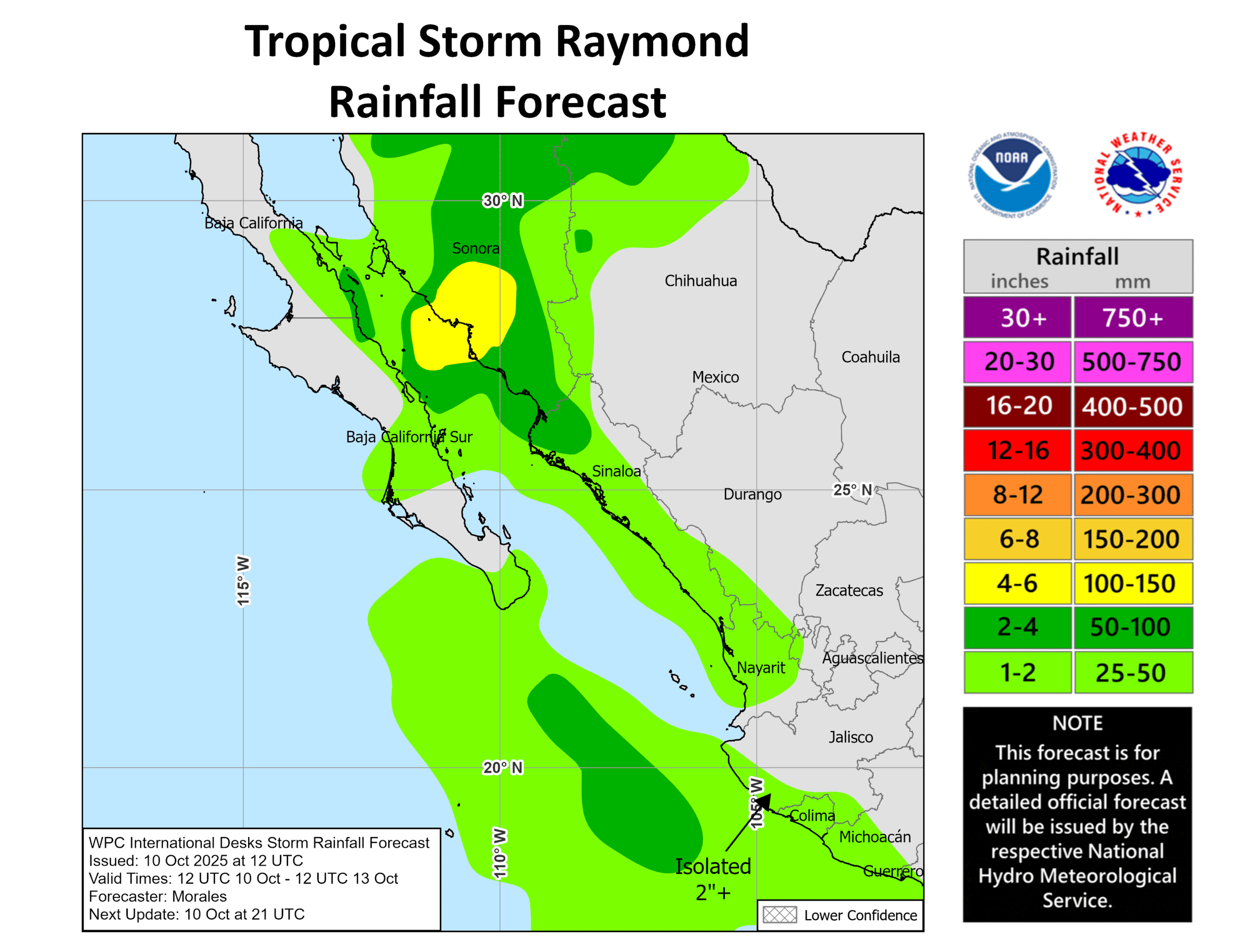
RAINFALL: Outer bands from Raymond will bring heavy rain to portions of southwestern to northwestern Mexico through Sunday. Across coastal portions of Michoacan, Colima, Jalisco, Nayarit, Sinaloa and the central to southern portions of Baja California Sur, rainfall totals of 1 to 2 inches are expected. Rainfall totals of 4 to 6 inches with local amounts of 10 inches are expected across northern Sinaloa, Sonora and northern Chihuahua. This rainfall will bring a risk of flash flooding, especially in areas of higher terrain. Moisture from Raymond will also bring the potential for additional heavy rainfall over portions of the Southwest U.S. Sunday into early next week.
SURF: Swells generated by the storm are expected to spread westward along the southwestern coast of Mexico today and reach southern Baja California Sur on Saturday.
Central Pacific Ocean: There are no Tropical Cyclones
Tropical cyclone formation is not expected during the next 7 days.
Western Pacific, Indian Ocean, and adjacent Seas:
Western Pacific
Tropical Cyclone 29W (Nakri)
According to the JTWC warning number 12, sustained winds were 35 knots with gusts to 45 knots
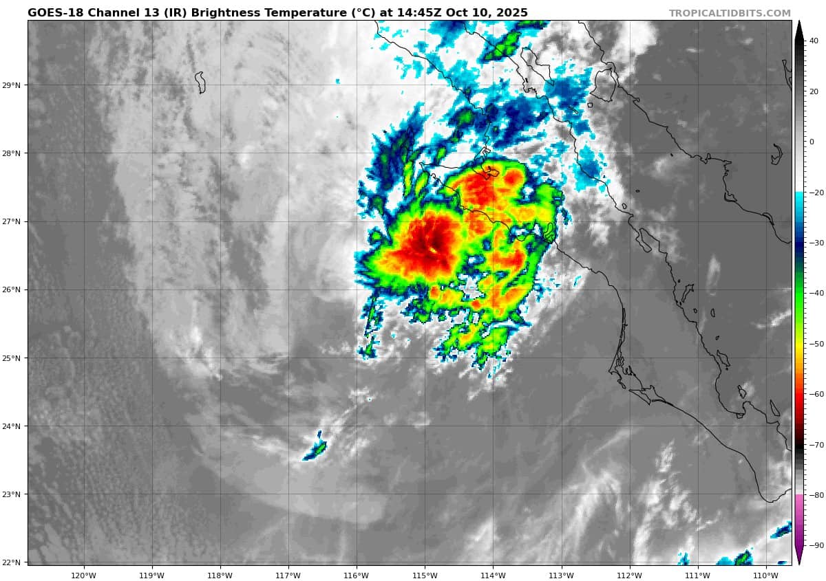
Tropical storm 29W continues to undergo a complex interaction with a low- to mid-level mesovortex to the south which can be tracked back 24 hours to when it was much more vertically aligned with the low-level circulation center (llcc). Around 18 hours ago, this mid-level vortex decoupled from the llcc which continued to the northwest, while the remnant mid-level rotation pushed off to the west, like two ice skaters circling back to one another, these two vortices are about to merge once again.
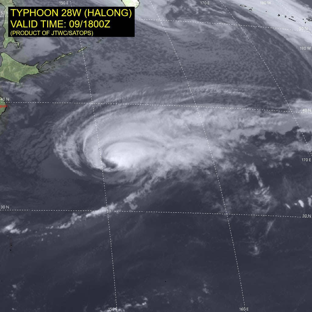
Animated enhanced infrared (eir) satellite imagery depicts the llcc associated with TS 29W having turned southwestward over the past six hours, being pulled in towards the mid-level vortex to the south. The eir loop shows strong convection and intense lightning activity in the
vicinity of Minamidaitojima Island, and radar data confirms the mid-level rotation centered just to the northwest of the island.
Surface winds at the island have shifted from northeast to south-southwest over the past couple of hours as the rotation has built down towards the surface and moved to the west of the island. A timely 101222z ascat-b bullseye confirms that the vortex to the south has in fact built down to the surface and is starting to connect to the llcc of TS 29W, as the scatterometer shows an elongated circulation oriented along a northwest-southeast axis. The scatterometer also showed 35-40 knot winds in the southeastern quadrant, near Minamidaitojima, and 30-35 knot winds to the west and southwest, providing confirmation of the initial intensity.
Environmental conditions are favorable with low shear, warm ssts and good dual channel outflow aloft, complicated by the interaction and merger of the two vortices which will disrupt the intensification process for a bit.
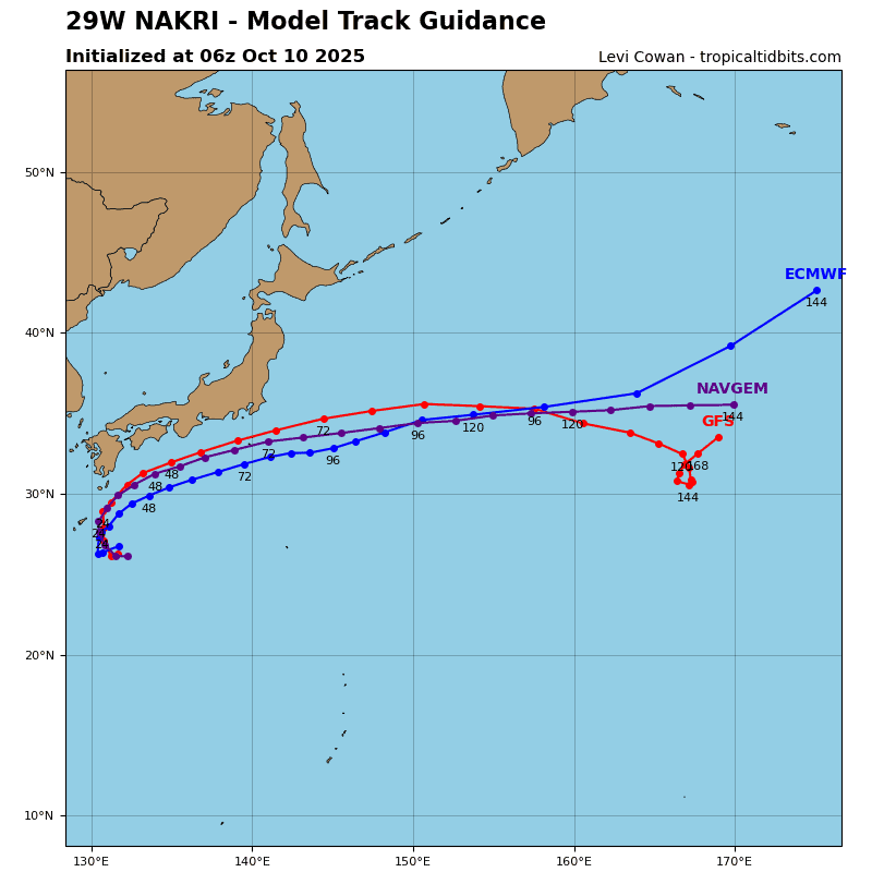
Over the past six hours, TS 29W has turned sharply southwestward, and over the last hour appears to be moving southward and making a very tight loop. The track scenario to highly complex, involving two vortices doing the Fujiwara dance with one another, embedded within a weak steering environment. Six hours ago, the mid-level mesocyclone was located about 120 NM south of TS 29W, but now the two have started to merge into one large circulation as discussed above.
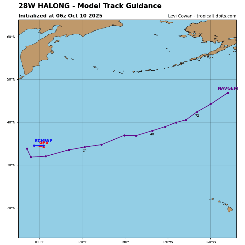
The hafs-a model captured this process quite well and since it’s done so well to date, we are going to stick with it. It depicts a merger of the two vortices within the next 12 hours, then a track northward as the ridge to the east strengthens and moves closer to TS 29W. It will take about 24 hours for the vortex to fully align, and thus only a small amount of intensification is expected through 24 hours. but once the system completes axisymmetrization, it will be primed to take advantage of a near-optimum environment of very warm ssts, moderately high ohc, and robust poleward outflow into the base of a strong jet max over Japan.
The system rounds the ridge axis around 24 hours, and will then accelerate northeastward through 72 hours, flattening out to a more eastward track by the end of the forecast period. Rapid intensification is possible between 24 and 48 hours as this will be when the system will experience the most favorable conditions.
The peak intensity of 80-85 knots is not captured directly in the forecast points but is likely to occur around 60 hours as the system passes south of Tokyo. Extratropical transition (ett) will begin by 72 hours, with completion of ett expected by 96 hours.