Western Pacific, Indian Ocean, and adjacent Seas:
Tropical Cyclone 27W

")


By PDC’s Senior Weather
Specialist Glenn James

The Pacific Disaster Center’s (PDC Global) Wednesday, October 1, 2025, Tropical Cyclone Activity Report…for the Pacific Ocean, the Indian Ocean, and adjacent Seas
Current Tropical Cyclones:
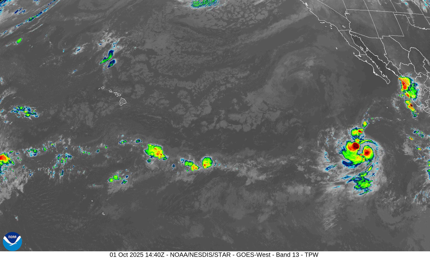
Tropical Cyclone 15E (Octave) is located about 875 miles south-southwest of the southern tip of Baja California
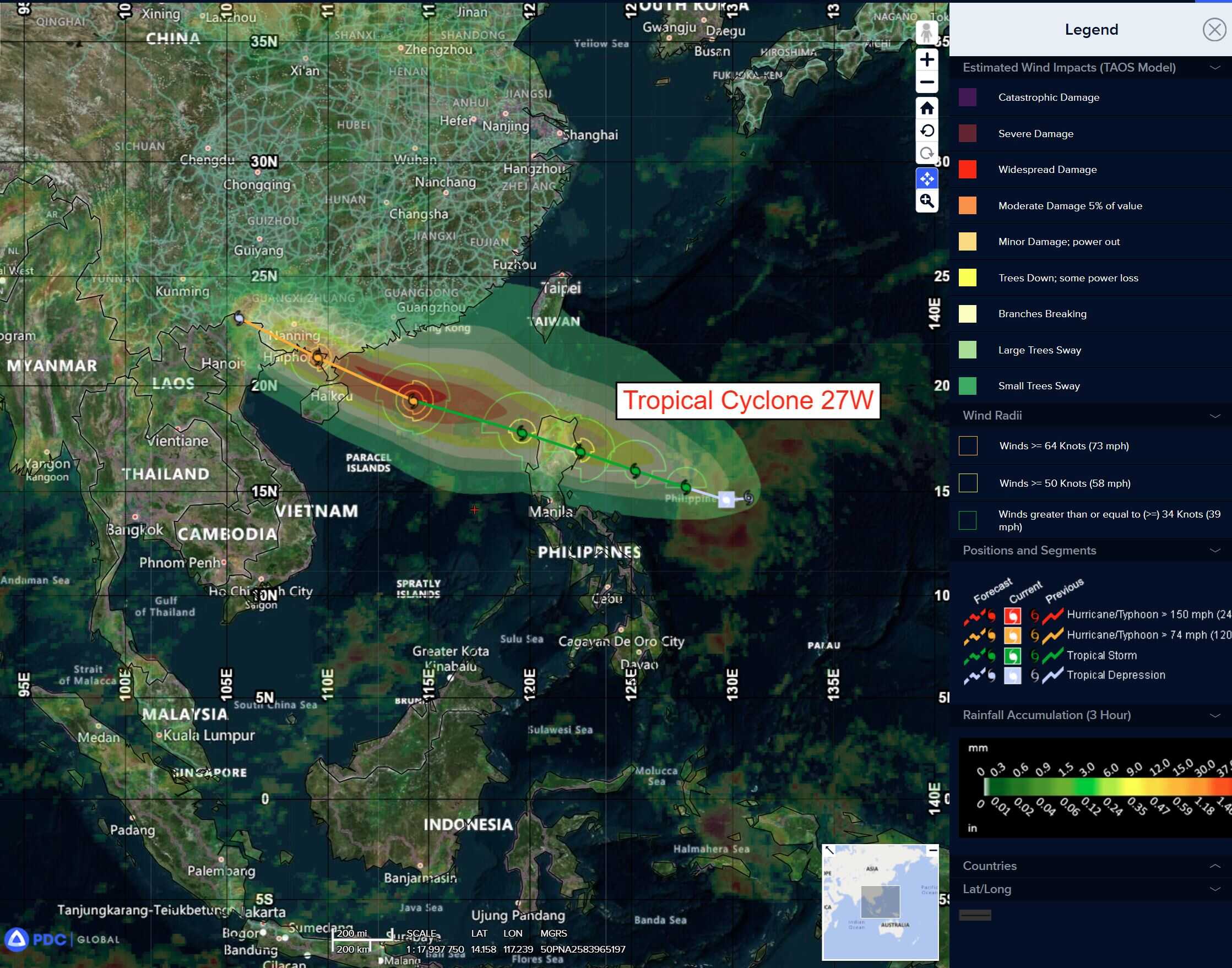
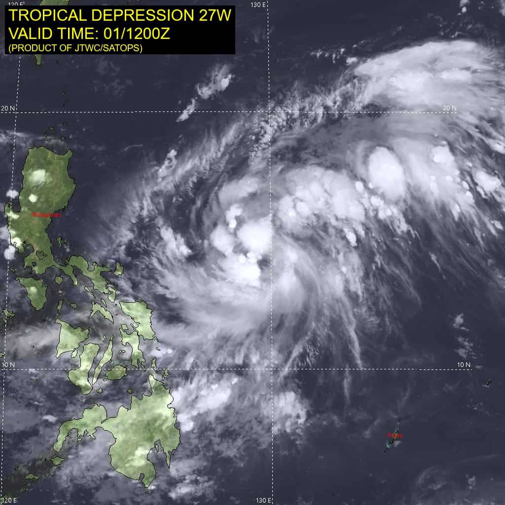
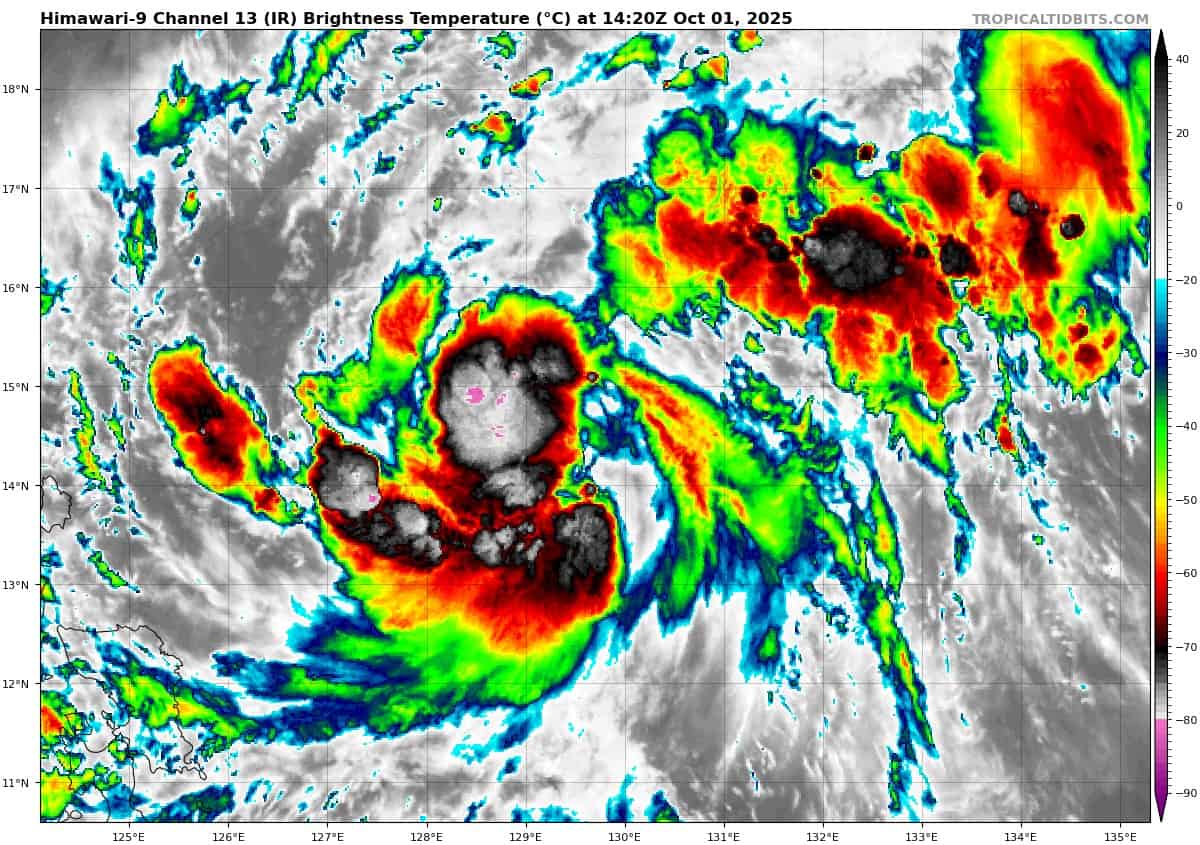
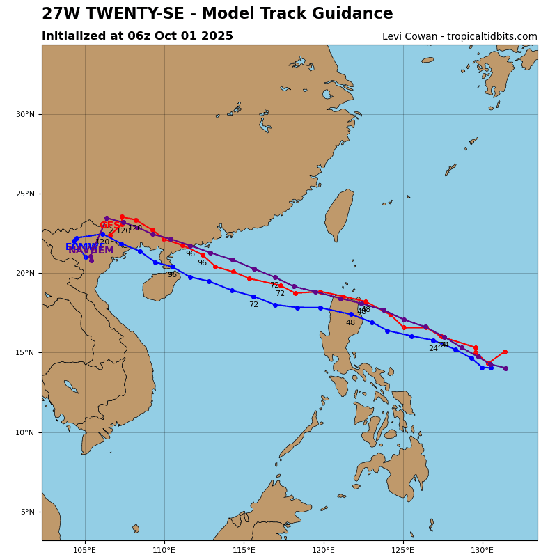
Tropical Cyclone 27W is located about 350 NM east of Manila, Philippines
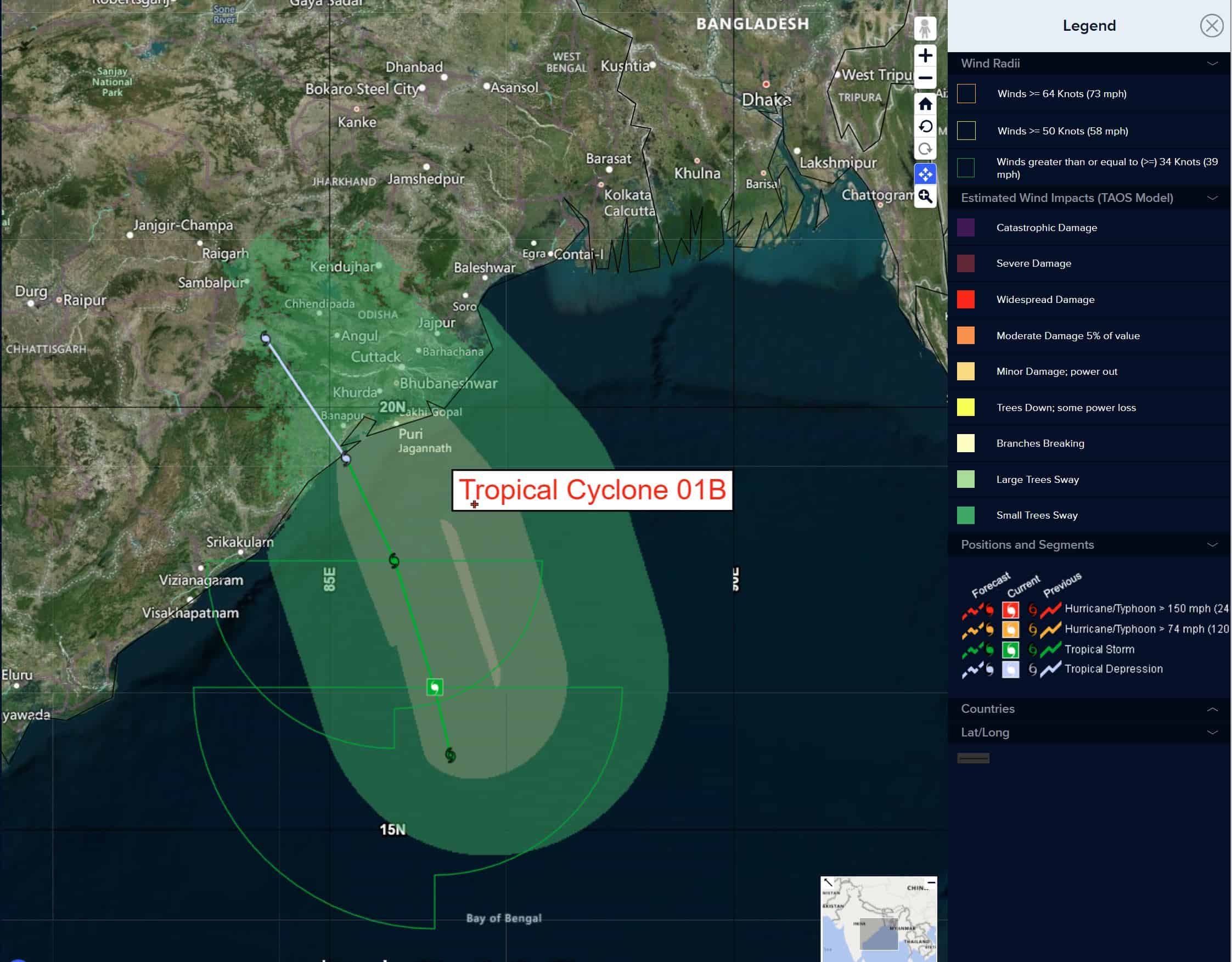
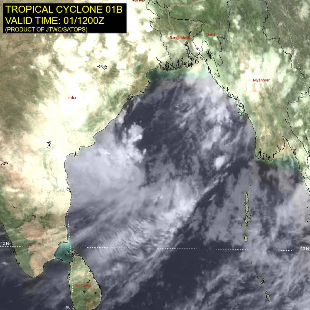
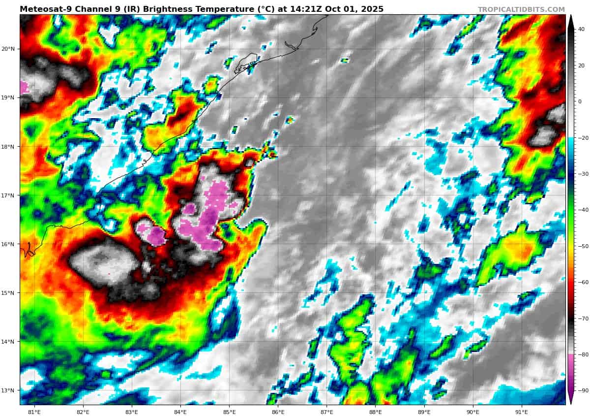
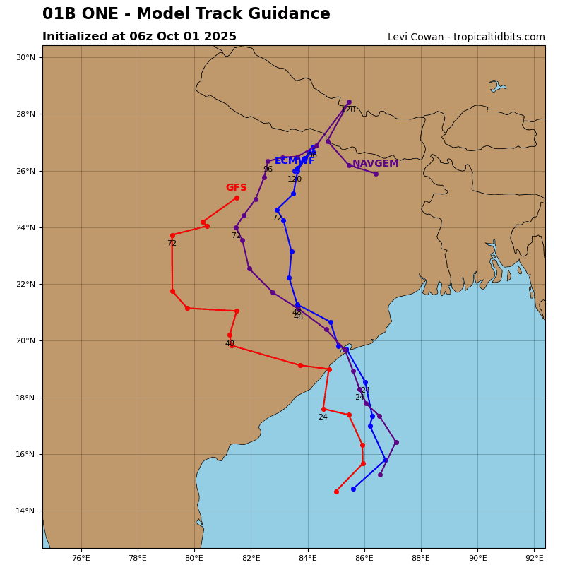
Tropical Cyclone 01B is located about 387 NM south-southwest of Kolkata, India
Northeast Pacific Ocean:
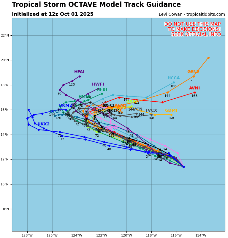
Tropical Cyclone 15E (Octave)
OCTAVE HEADING WEST-NORTHWESTWARD OVER THE OPEN TROPICAL EAST PACIFIC
According to the NHC advisory number 8
Octave is moving toward the northwest near 8 mph (13 km/h), and a generally west-northwestward motion is expected over the next couple of days.
Maximum sustained winds remain near 65 mph (100 km/h) with higher gusts. Little change in strength is forecast during the next 48 hours.
Tropical-storm-force winds extend outward up to 60 miles (95 km) from the center. The estimated minimum central pressure is 994 mb (29.36 inches).
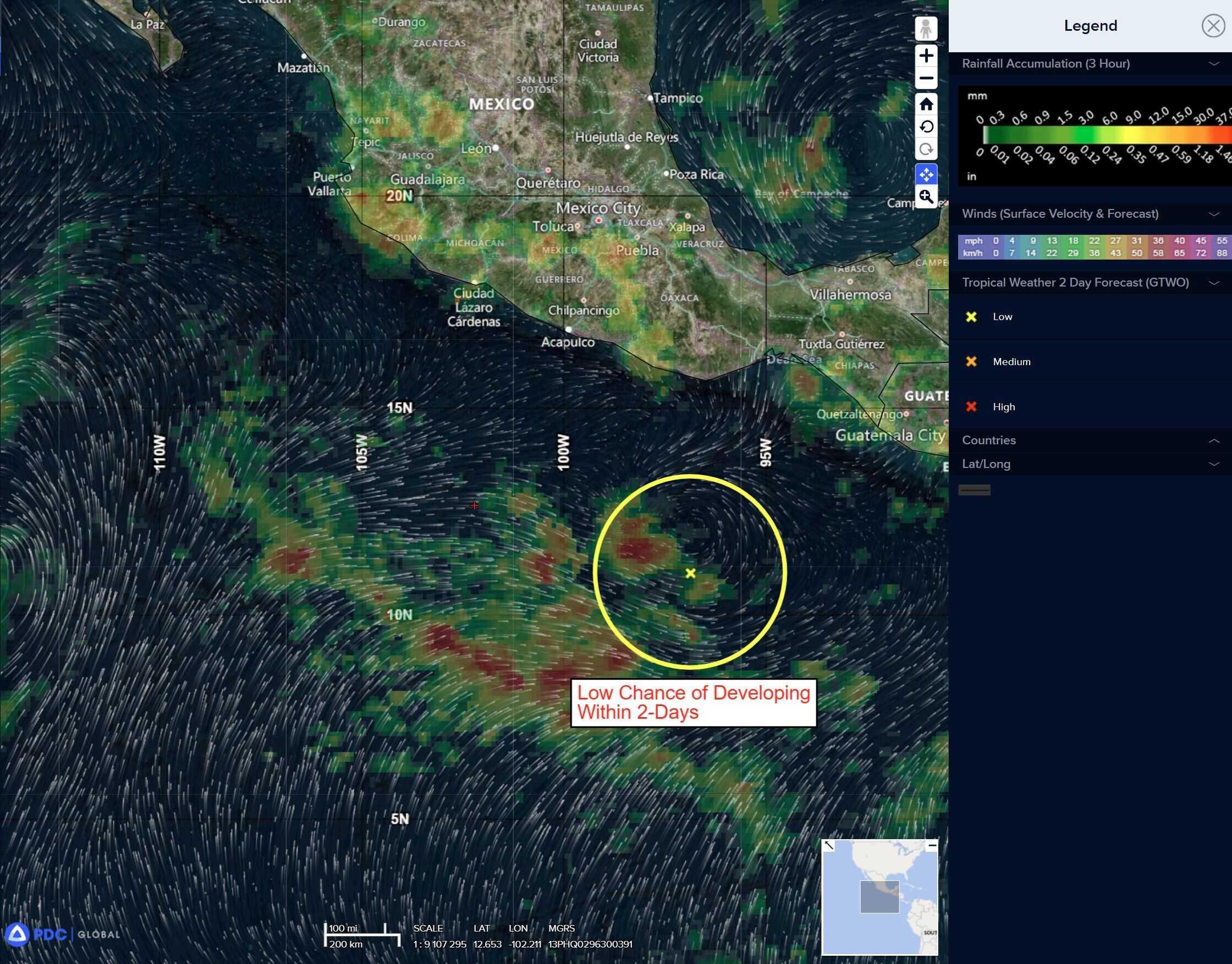
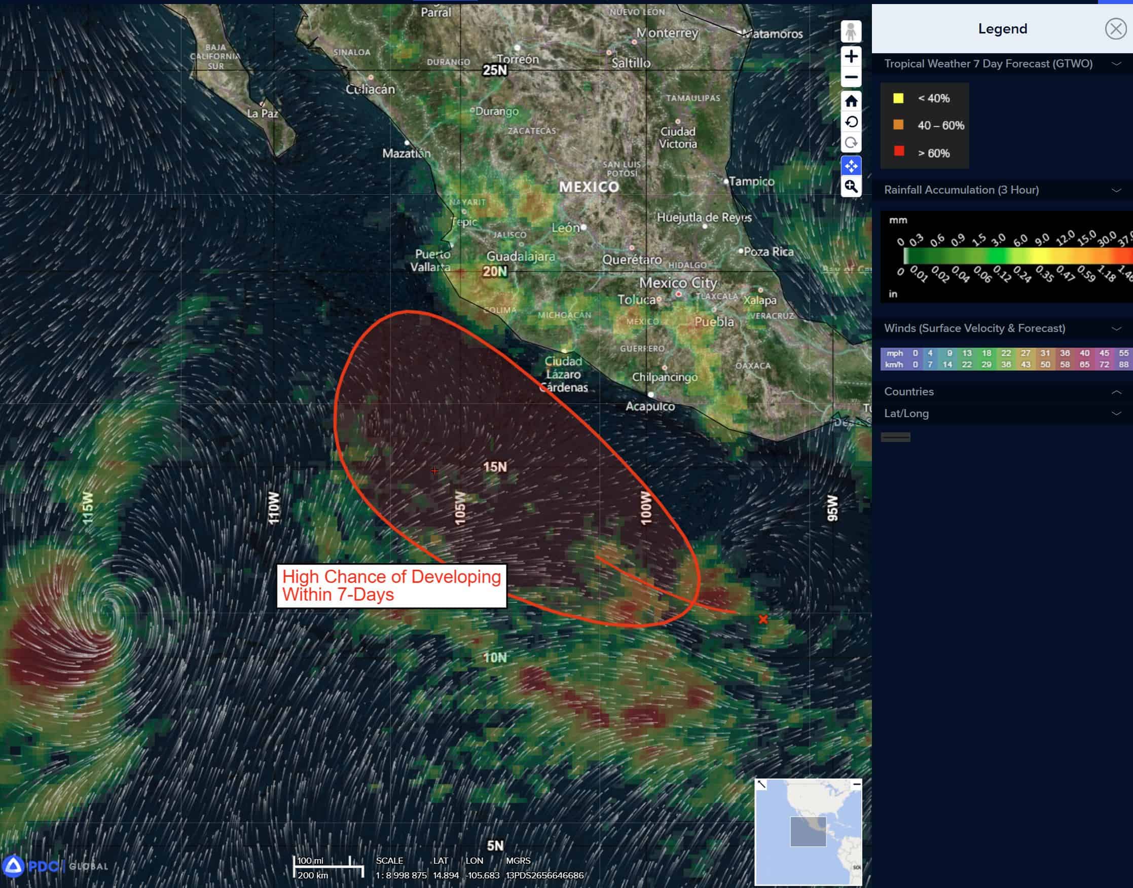
Offshore of the southwestern Coast of Mexico:
>>> A trough of low pressure located a few hundred miles off the coast of southern and southwestern Mexico is producing a large area of disorganized showers and thunderstorms. Environmental conditions appear conducive for gradual development, and a tropical depression is likely to form Friday night or over the weekend while the system moves generally west-northwestward, remaining parallel to but offshore of the southwestern coast of Mexico. Interests along the southwestern coast of Mexico should closely monitor the progress of this system.
* Formation chance through 48 hours…medium…50 percent
* Formation chance through 7 days…high…90 percent
Central Pacific Ocean: There are no Tropical Cyclones
Tropical cyclone formation is not expected during the next 7 days.
Western Pacific, Indian Ocean, and adjacent Seas:
Tropical Cyclone 27W
Tropical Cyclone 01B
The upstream environment between the system and the coast is moderately more favorable. Current steering mechanism: a mid and upper level extension over the eastern Bay of Bengal is forcing the system towards the Indian coast.Tropical cyclone 01B will track through an area of slightly warmer waters and lower wind shear to the north, keeping the system viable through landfall. It is expected to come ashore south of Brahmapur, near Palasa. Wind fields will remain unbalanced, with no gale force easterlies likely over the poleward semicircle.
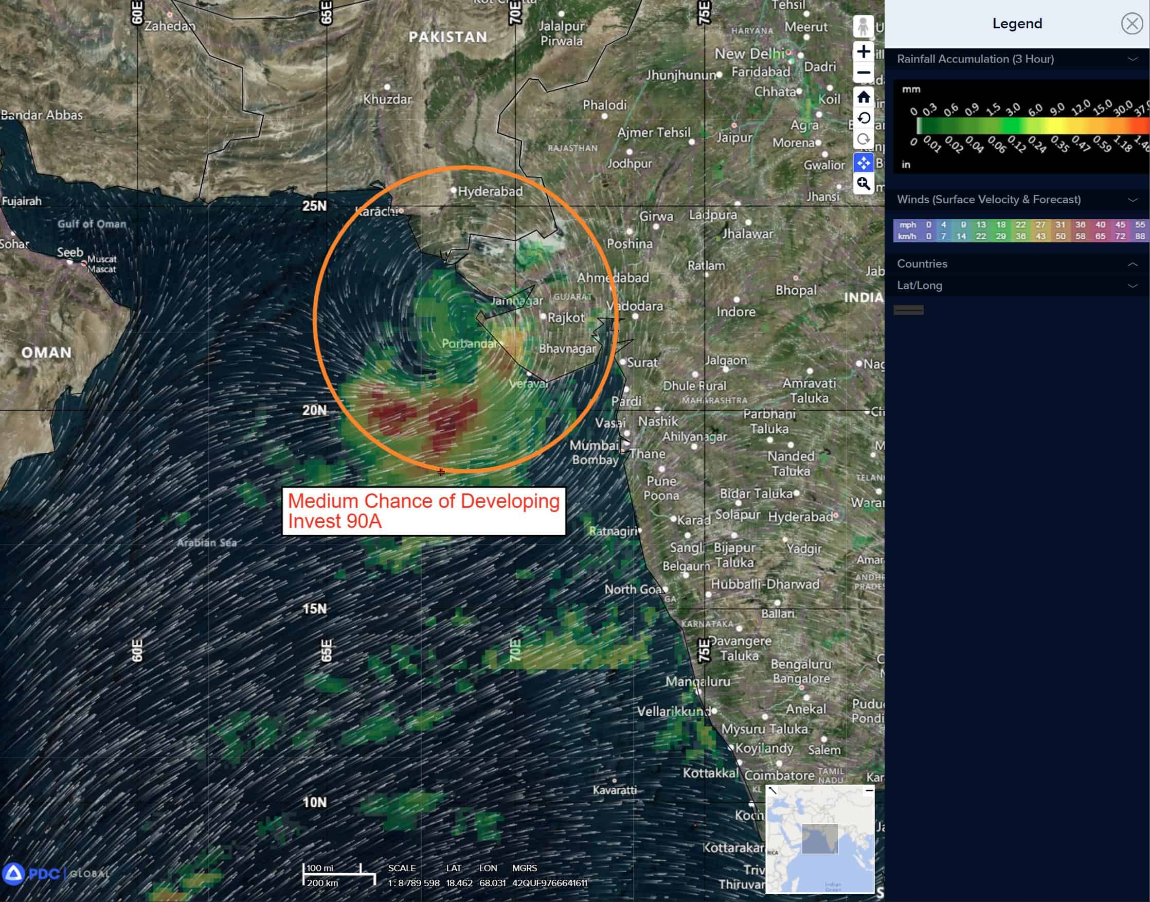
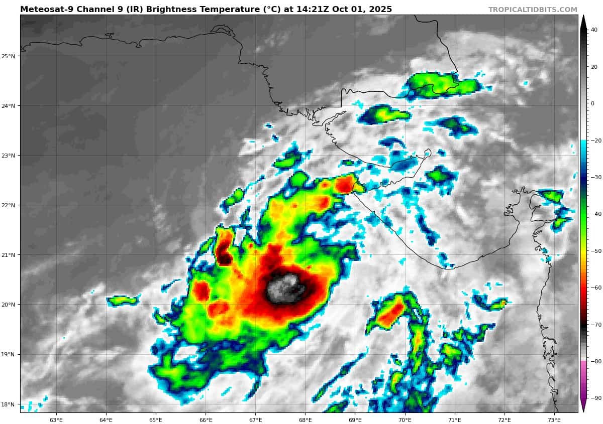
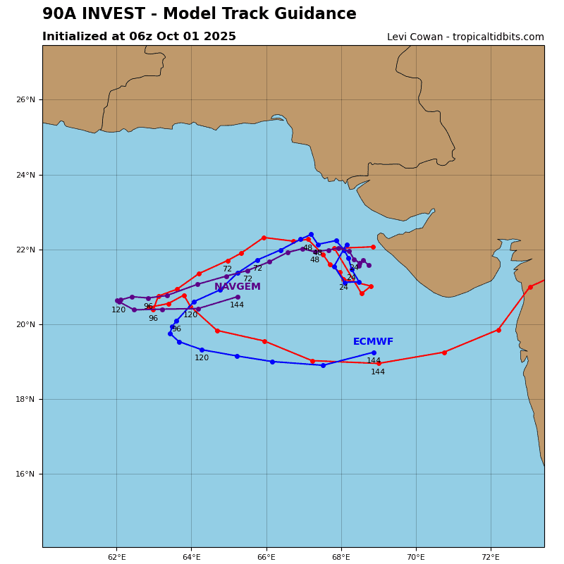
>>> There’s an area of disturbed weather being referred to as Invest 90A, which is located approximately 195 NM south-southeast of Karachi
Animated enhanced infrared imagery (eir) depicts a partially exposed low level circulation center slowly consolidating and becoming embedded within flaring convection.
Environmental analysis shows favorable conditions for development with low vertical wind shear (10-15 knots), good equatorward outflow aloft, and warm sea surface temperatures (27-28 c).
Models are in good general agreement on steady development over the next 48 hours. The system is expected to have very slow track speeds and possible erratic motion over the next 24-48 hours due to the placement between ridging to both the
east and west.
Maximum sustained surface winds are estimated at 23 to 28 knots.
The potential for the development of a significant tropical cyclone within the next 24 hours remains medium.