The Pacific Disaster Center’s (PDC Global) Thursday, October 2, 2025, Tropical Cyclone Activity Report…for the Pacific Ocean, the Indian Ocean, and adjacent Seas
Current Tropical Cyclones:
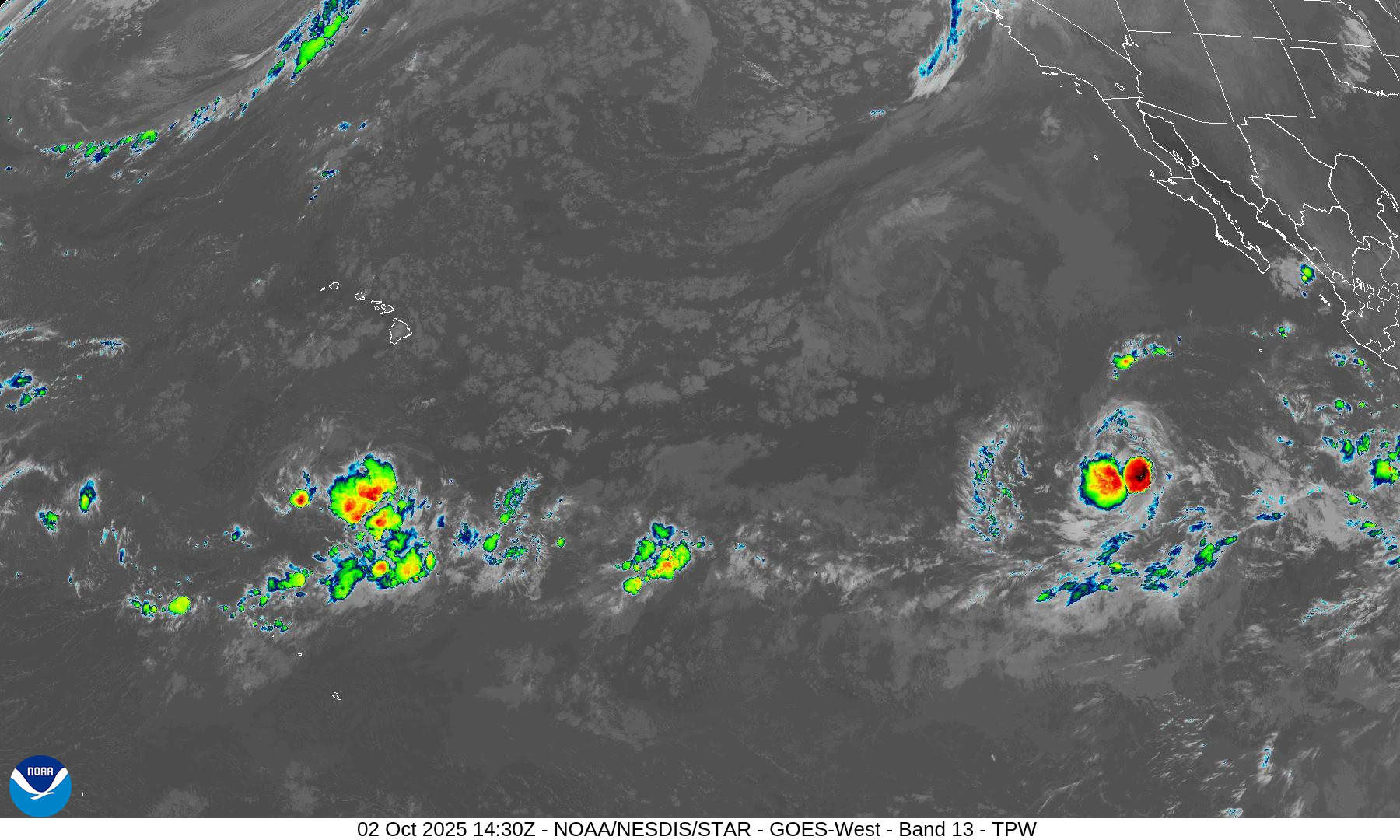
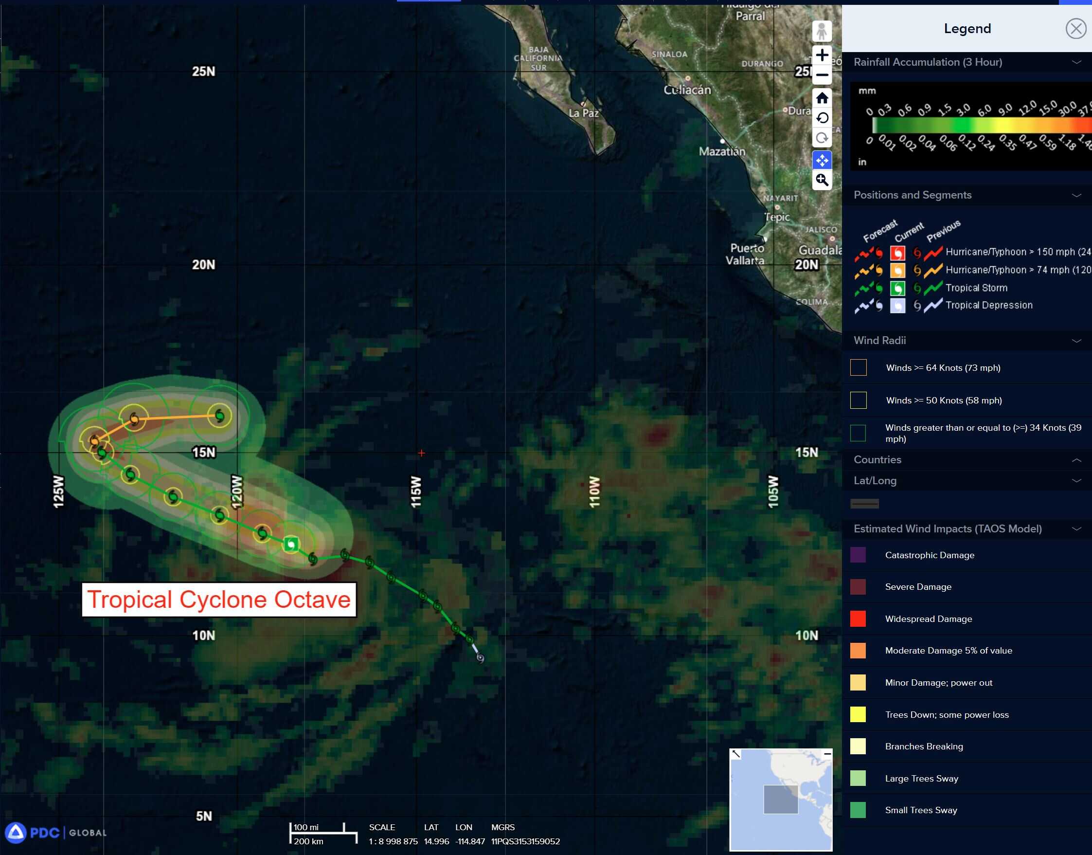
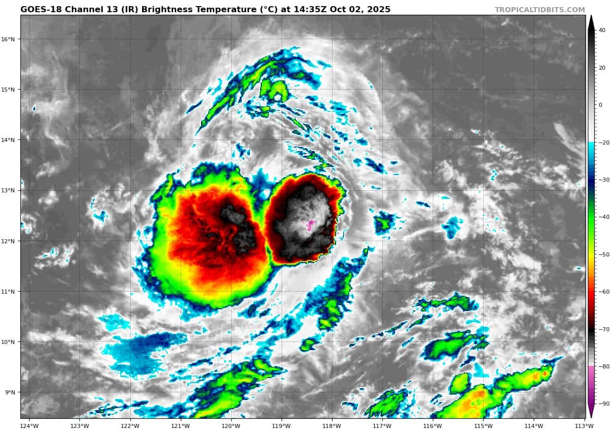
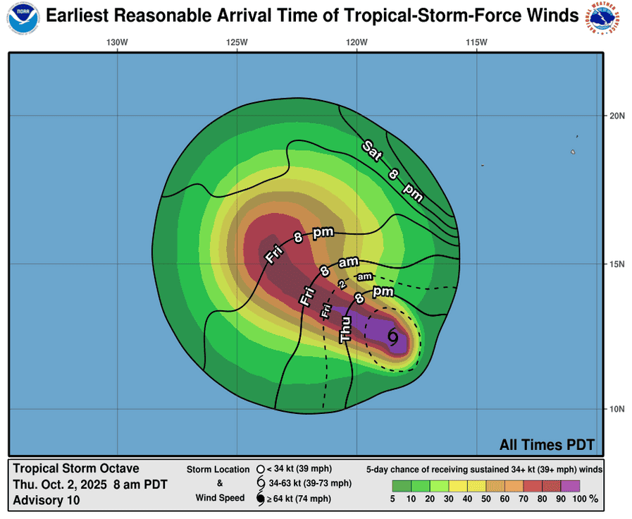
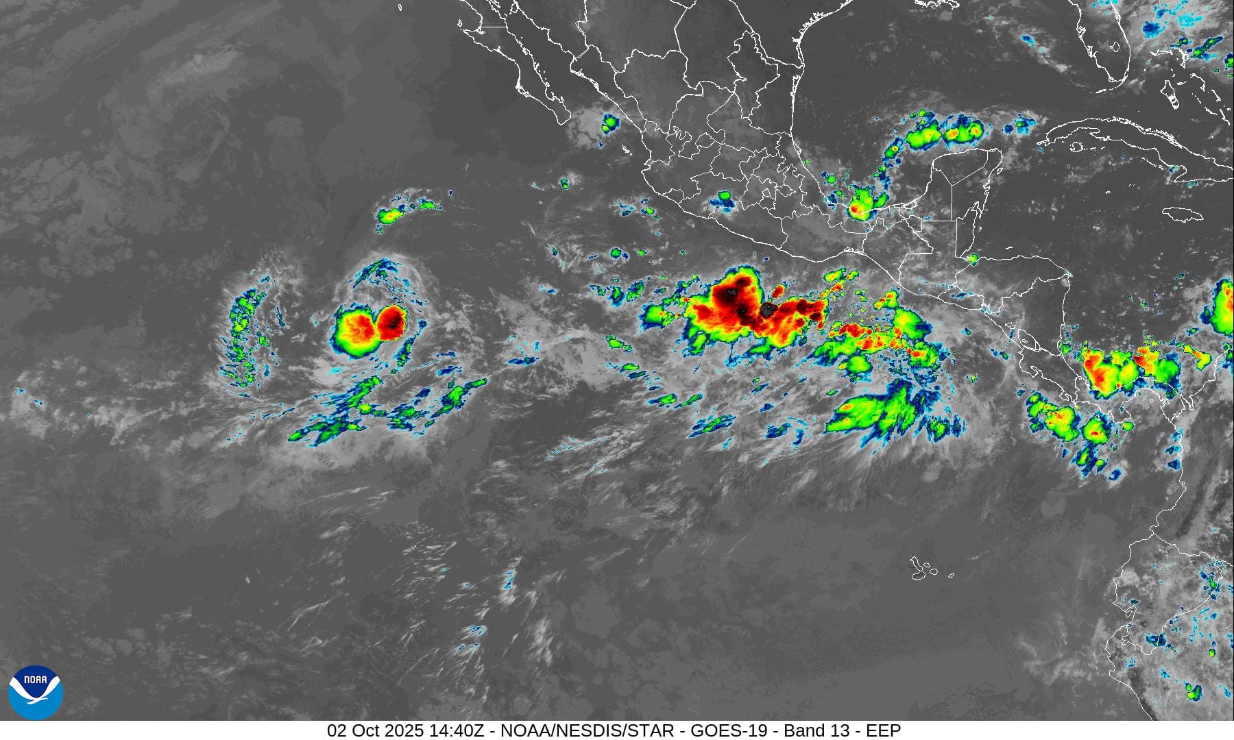
Tropical Cyclone 15E (Octave) is located about 940 miles southwest of the southern tip of Baja California
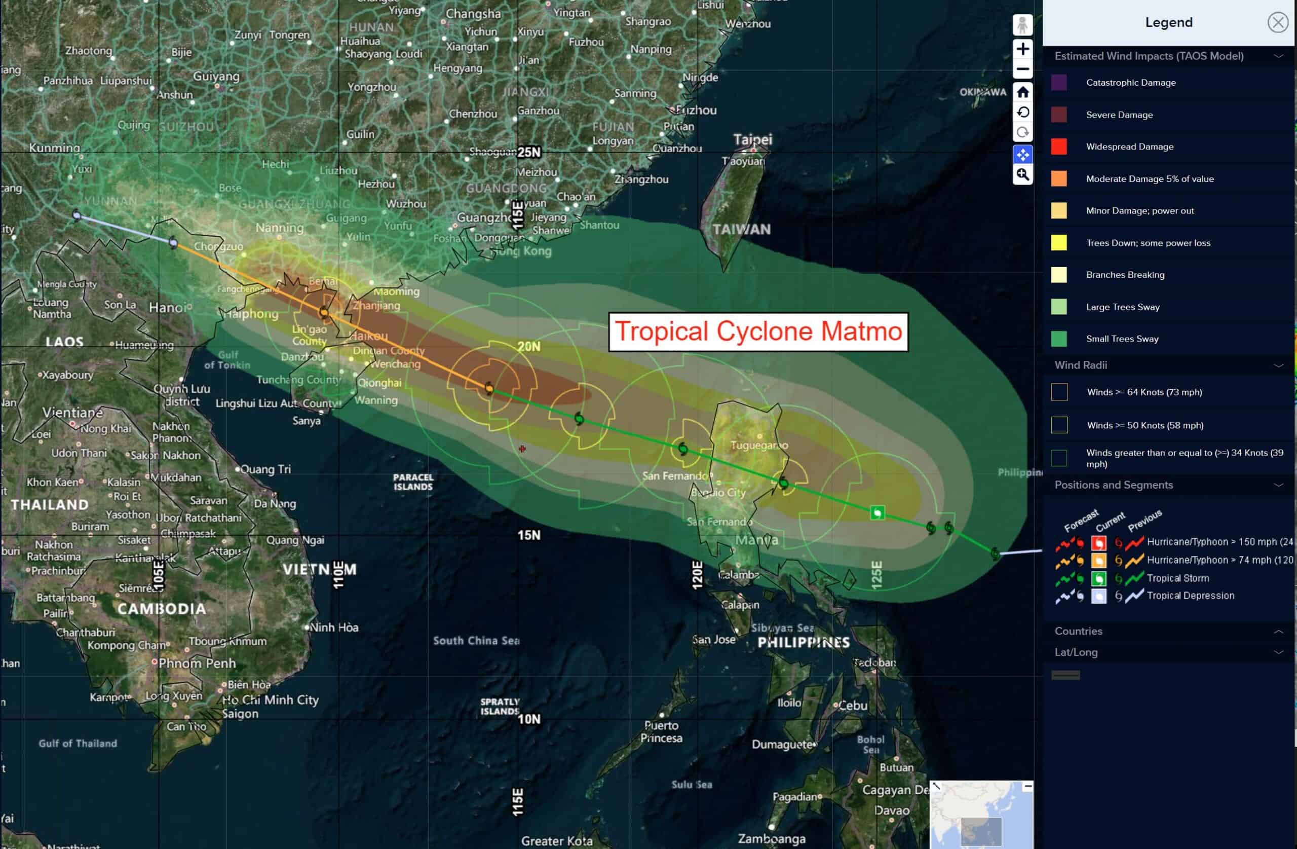
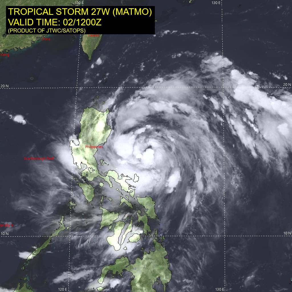
Tropical Cyclone 27W (Matmo) is located about 142 NM northeast of Manila, Philippines
Tropical Cyclone 02A is located about 198 NM south of Kolkata, India
Northeast Pacific Ocean:
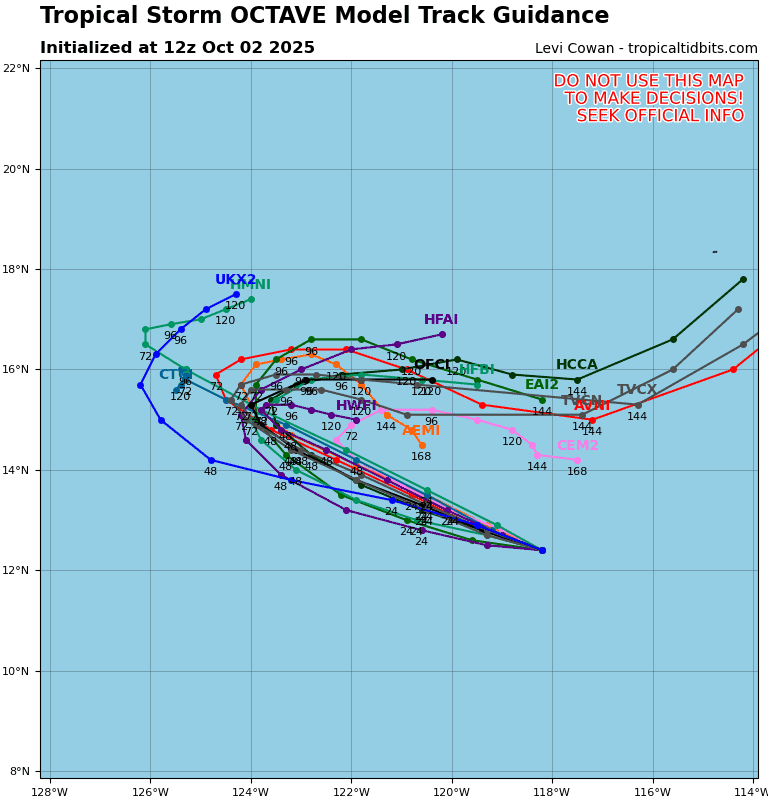
Tropical Cyclone 15E (Octave)
OCTAVE MOVING STEADILY WEST-NORTHWESTWARD
According to the NHC advisory number 12
Octave is moving toward the west-northwest near 7 mph (11 km/h) and this general motion is expected to continue for the next couple of days. Over the weekend, Octave is forecast to turn sharply eastward.
Maximum sustained winds are near 60 mph (95 km/h) with higher gusts. Little change in strength is forecast during the next 48 hours followed by some gradual strengthening.
Tropical-storm-force winds extend outward up to 60 miles (95 km) from the center. The estimated minimum central pressure is 997 mb (29.44 inches).
Offshore of the southwestern Coast of Mexico:
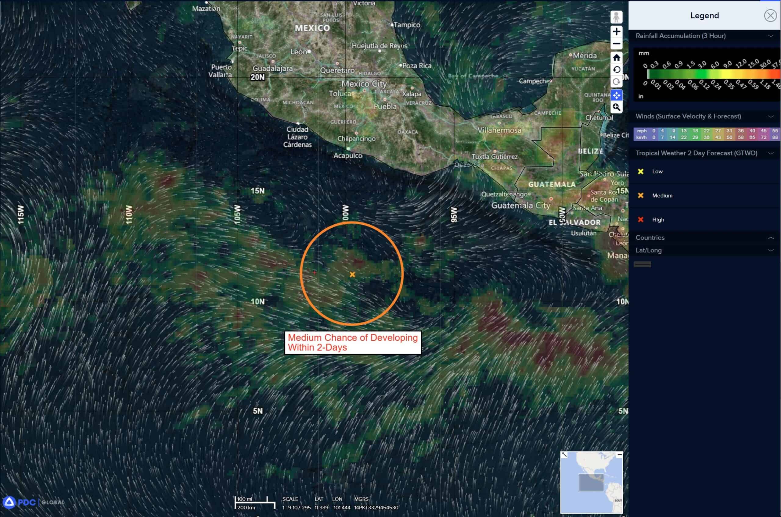
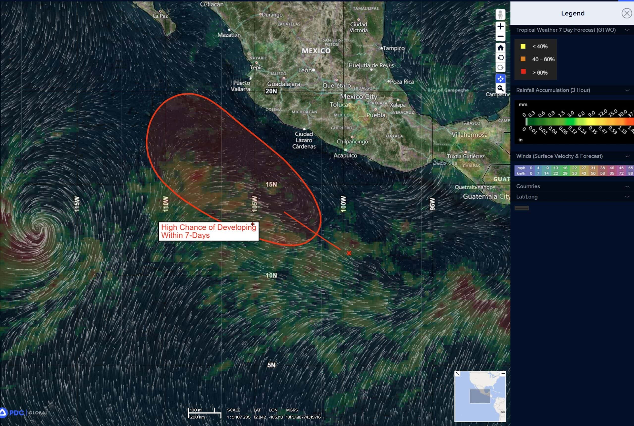
Invest 99E
>>> Showers and thunderstorms associated with a trough of low pressure located a few hundred miles off the coast of southwestern Mexico are showing signs of organization. Environmental conditions appear conducive for development, and a tropical depression is likely to form in the next day or so as the system moves generally west-northwestward, parallel to but offshore of the southwestern coast of Mexico. Interests along the southwestern coast of Mexico should monitor the progress of this system.
* Formation chance through 48 hours…high…80 percent
* Formation chance through 7 days…high…90 percent
Central Pacific Ocean: There are no Tropical Cyclones
Tropical cyclone formation is not expected during the next 7 days.
Western Pacific, Indian Ocean, and adjacent Seas:
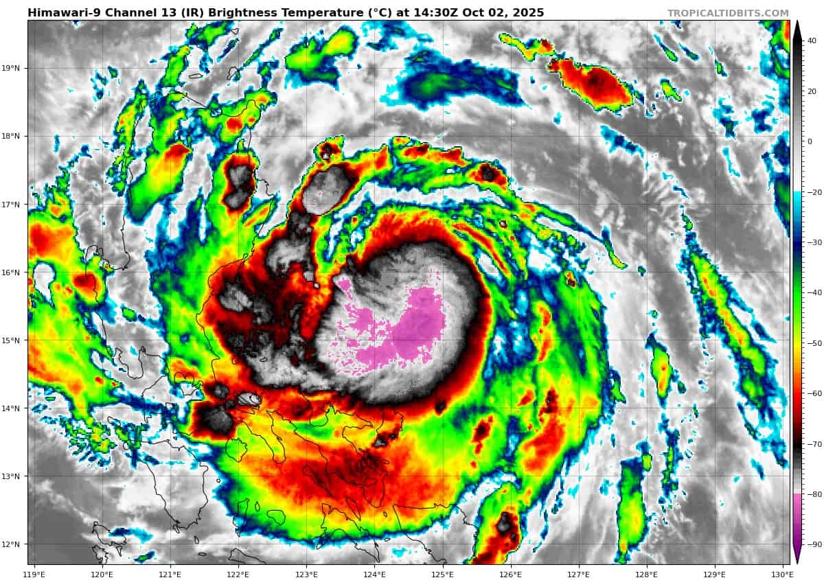
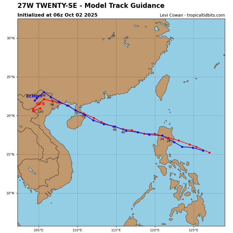
Tropical Cyclone 27W (Matmo)
According to the JTWC warning number 8, sustained winds were 65 knots with gusts to 80 knots
Animated multi-spectral satellite imagery (msi) depicts developing and consolidating spiral bands of deep convection wrapping into the low-level circulation center (llcc) of tropical storm 27W.
The system is benefiting from favorable environment, characterized by strong equatorward outflow, warm (29-30 c) sea surface temperatures (sst), low (5-10 kts) vertical wind shear (vws) and deep-layer moisture available throughout the atmospheric column.
TS 27W is forecast to continue tracking northwestward and towards the northern philippines along the southern periphery of a deep str to the north. The system is expected to make landfall over Luzon, just prior to 24 hours, reaching 65-75 knots just prior to that, while taking advantage of the favorable environment.
After landfall, frictional effects of land interaction will result in weakening of the storm to sub-typhoon maximum wind speeds.
Prior to 36 hours, the system is expected to re-emerge over slightly cooler, but still very warm (28-29 c) waters of the South China Sea. As the subtropical ridge shifts eastward over the next few days, TS 27W will continue along its southwestern periphery and towards the coast of China.
Favorable conditions will result in re-intensification, likely to 75-80 knots. Current track forecast predicts landfall just north of the Hainan Island and over the Leizhou Peninsula. afterwards, another landfall is expected around 96 hurs, near the border of China with northern Vietnam. The system will then begin weakening and eventually dissipate prior to the end of the current forecast period.
Tropical Cyclone 02A
According to the JTWC warning number 1, sustained winds were 35 knots with gusts to 45 knots

")