Western Pacific, Indian Ocean, and adjacent Seas:
Western Pacific

")
By PDC’s Senior Weather
Specialist Glenn James

The Pacific Disaster Center’s (PDC Global) Tuesday, October 7, 2025, Tropical Cyclone Activity Report…for the Pacific Ocean, the Indian Ocean, and adjacent Seas
Current Tropical Cyclones:
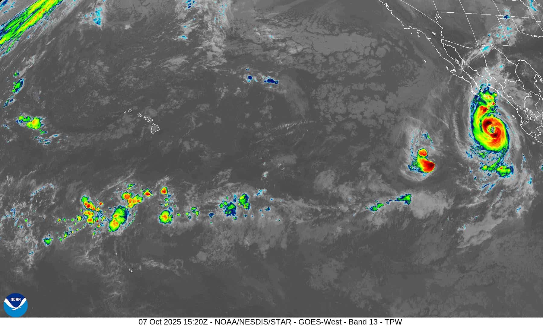
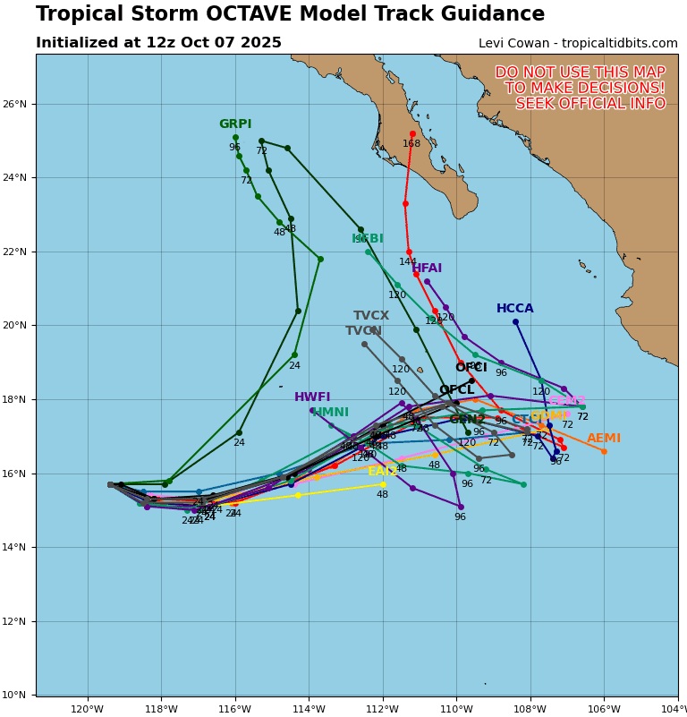
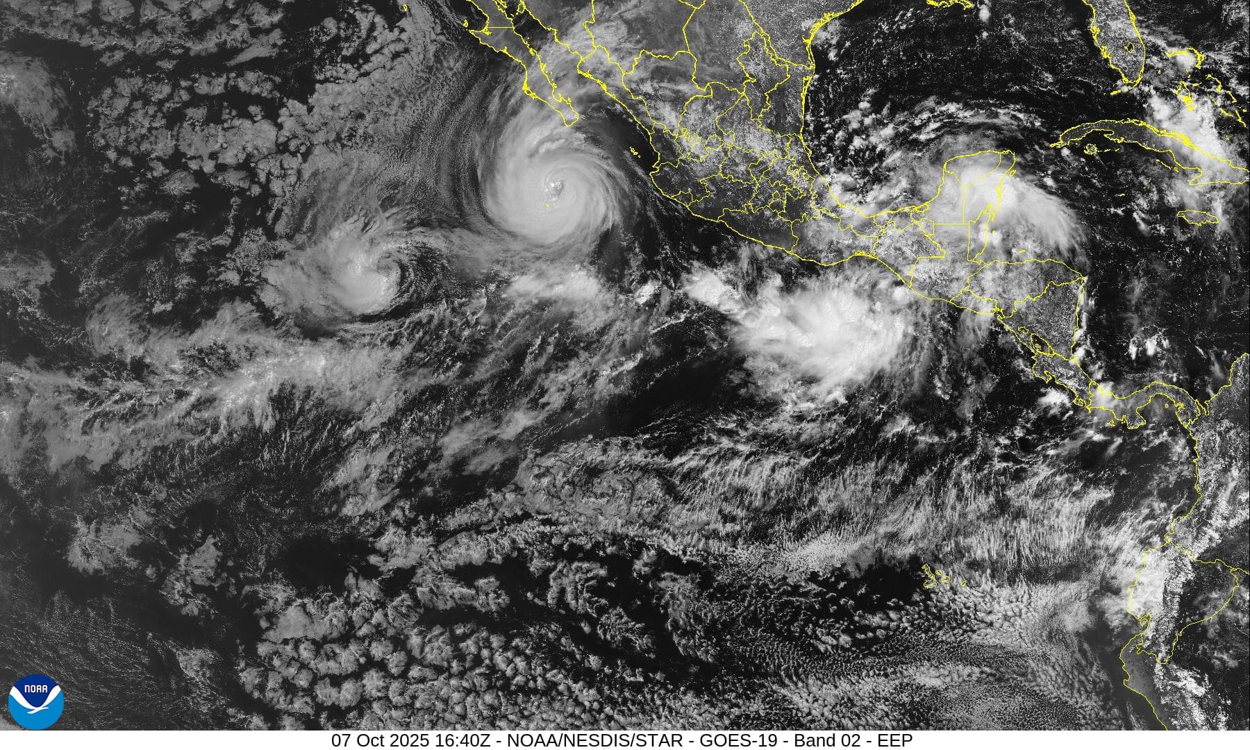
Tropical Cyclone 15E (Octave) is located about 780 miles southwest of the southern tip of Baja California
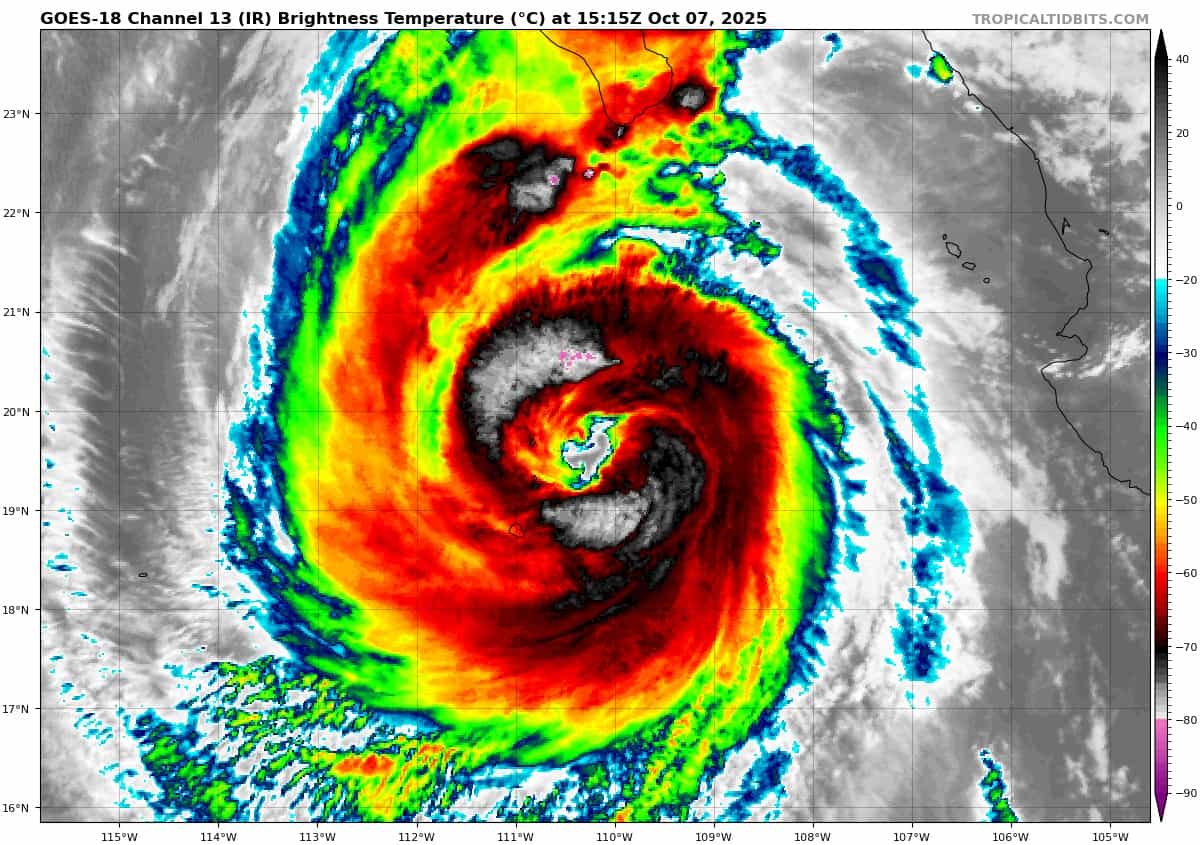
Tropical Cyclone 16E (Priscilla) is located about 215 miles south of the southern tip of Baja California
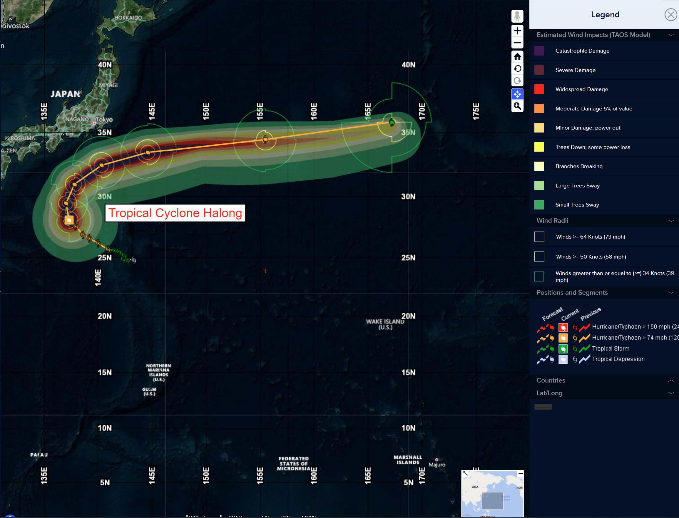
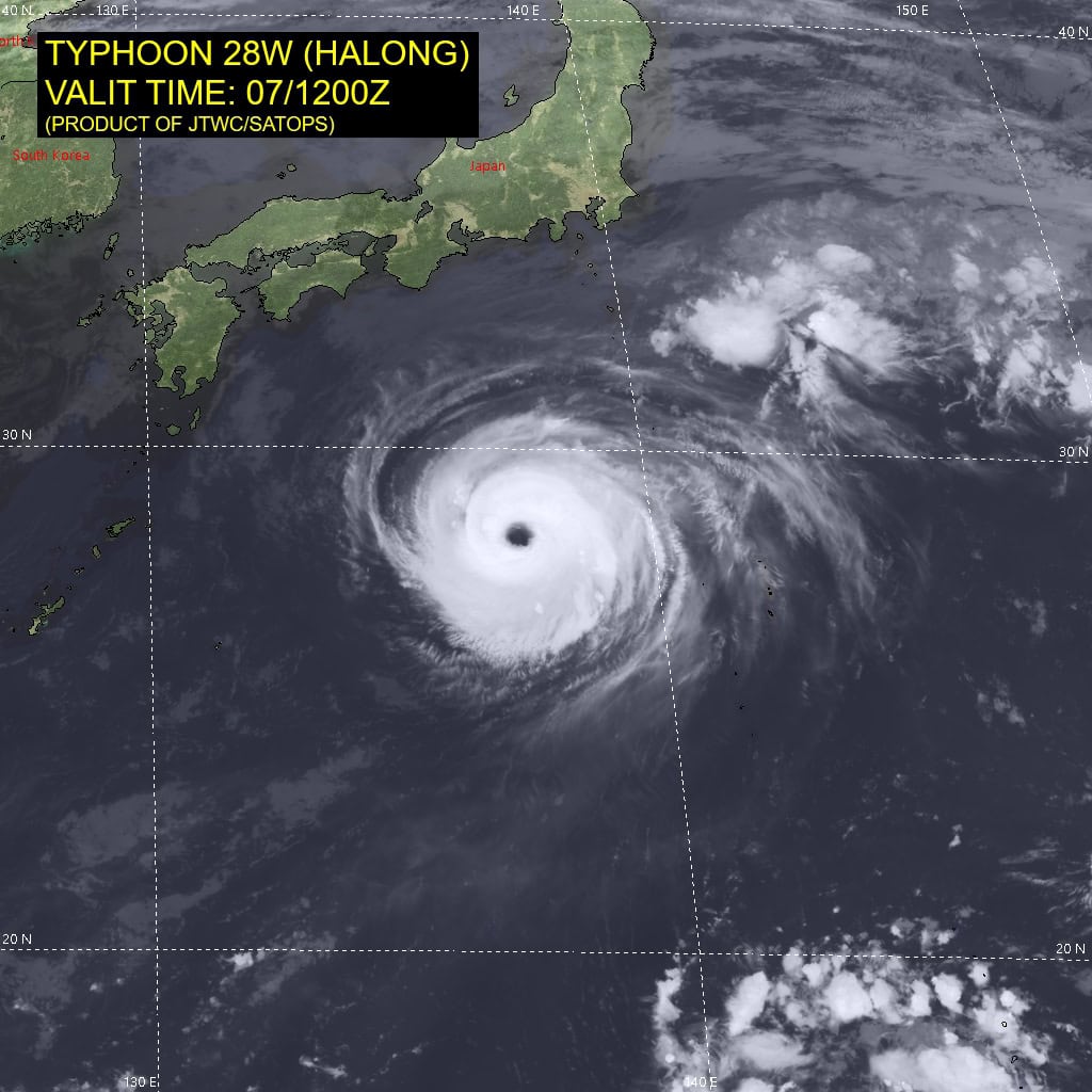
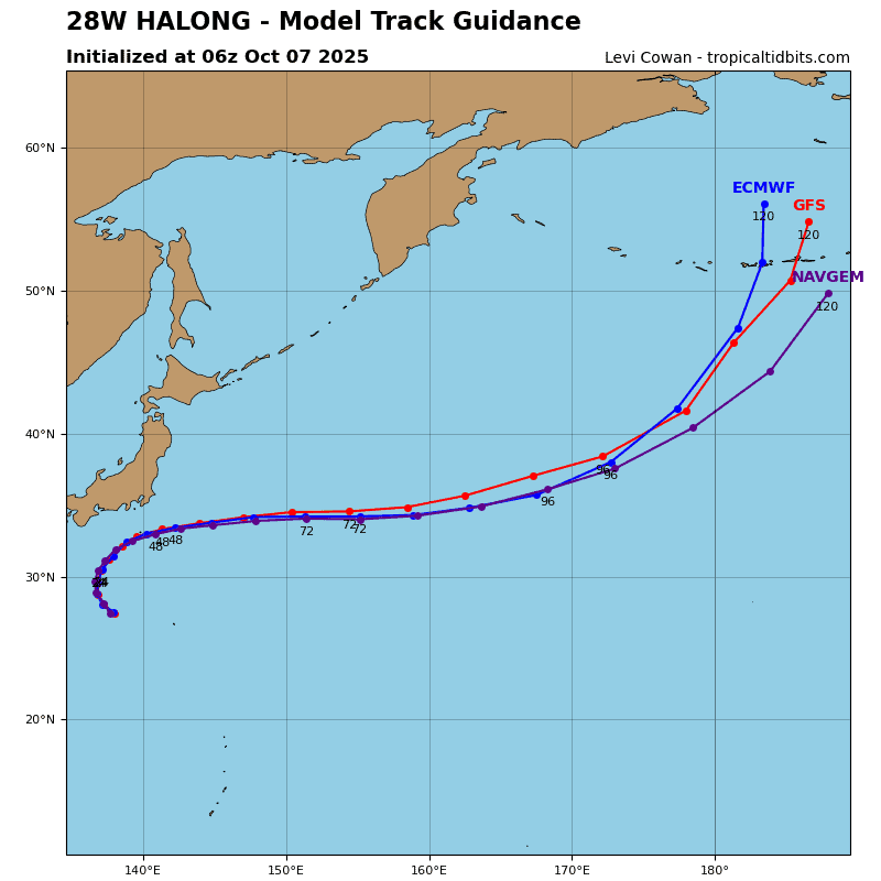
Tropical Cyclone 28W (Halong) is located approximately 267 NM west-northwest of Chichi Jima
Northeast Pacific Ocean:
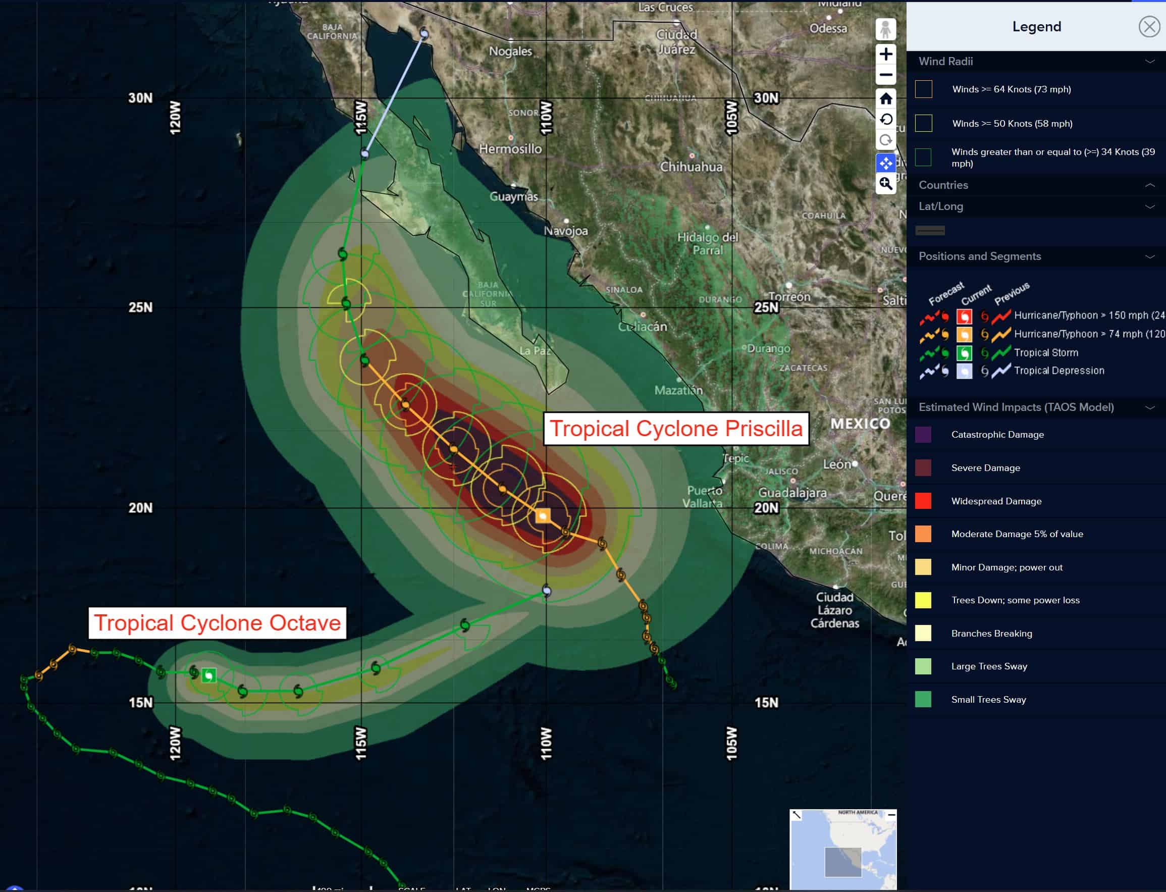
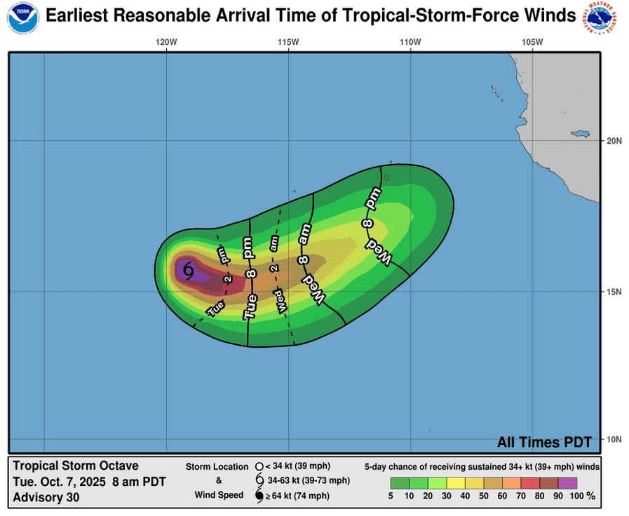
Tropical Cyclone 15E (Octave)
OCTAVE CONTINUES MOVING EAST-SOUTHEASTWARD
According to the NHC advisory number 30
Octave is moving toward the east-southeast near 7 mph (11 km/h). This general motion is expected to continue during the next day or so, followed by a faster motion toward the east-northeast thereafter.
Maximum sustained winds remain near 50 mph (85 km/h) with higher gusts. Little change in strength is expected through tonight, followed by gradual weakening and dissipation by late Thursday.
Tropical-storm-force winds extend outward up to 45 miles (75 km) from the center. The estimated minimum central pressure is 998 mb (29.47 inches).
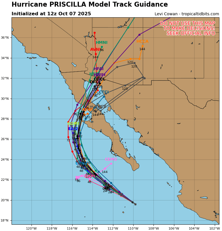
Tropical Cyclone 16E (Priscilla)
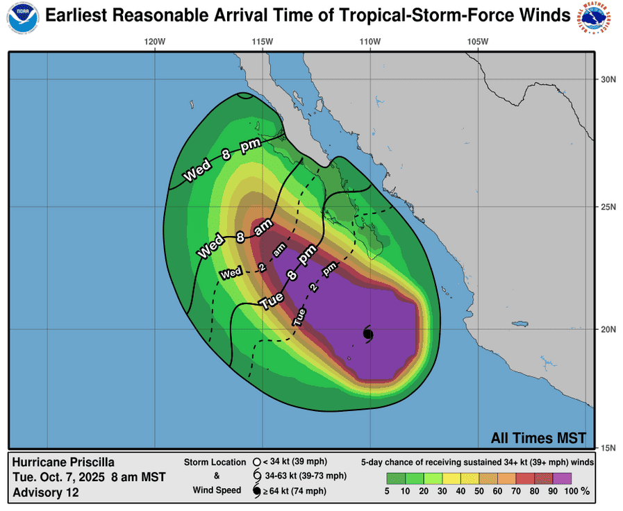
PRISCILLA STRENGTHENS…OUTER BANDS ARE AFFECTING THE SOUTHERN BAJA CALIFORNIA PENINSULA
According to the NHC advisory number 12
Priscilla is moving toward the northwest near 10 mph (17 km/h) and a continued northwestward motion is expected over the next couple of days, followed by a turn toward the north Thursday night or Friday. On the forecast track, the center of Priscilla is expected to move parallel to, but offshore of, the coast of west-central Mexico and Baja California Sur during the next couple of days.
Maximum sustained winds have increased to near 110 mph (175 km/h) with higher gusts. Additional strengthening is expected, and Priscilla is forecast to become a major hurricane later today. Weakening is forecast to begin on Wednesday and continue through the rest of the week.
Hurricane-force winds extend outward up to 50 miles (85 km) from the center and tropical-storm-force winds extend outward up to 185 miles (295 km). Socorro island, located about 80 miles (130 km) southwest of Priscilla’s eye, recently reported a sustained wind of 52 mph (84 km/h) with a gust of 75 mph (120 km/h). The estimated minimum central pressure is 959 mb (28.32 inches).
HAZARDS AFFECTING LAND WIND:
WIND: Tropical storm conditions are possible along the Pacific coast of Baja California Sur within the watch area later today and Wednesday.
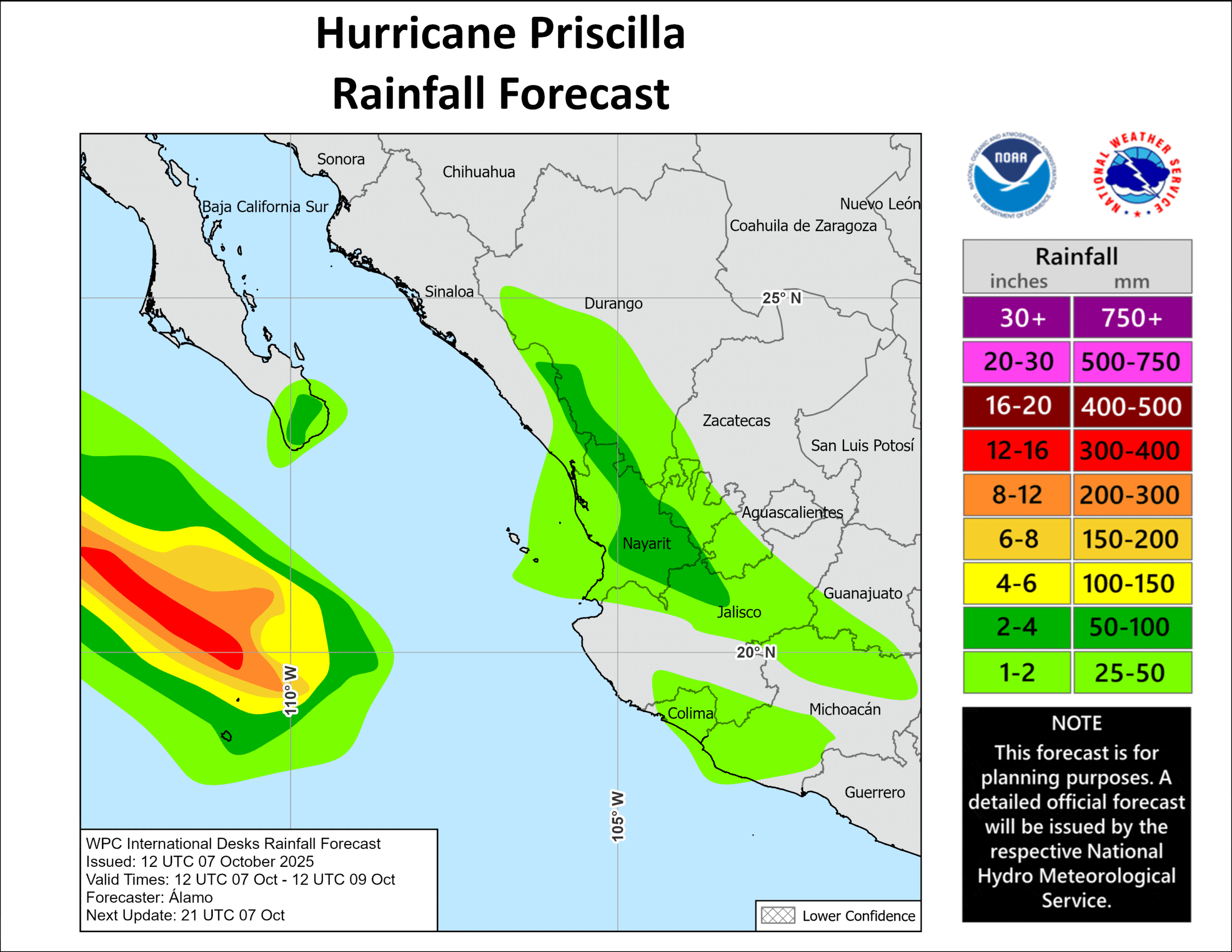
RAINFALL: From today into Wednesday, 1 to 2 inches of rain are expected in southern Baja California Sur, with local storm totals up to 4 inches as the outer bands of Priscilla reach the area. This rainfall could bring a risk of flash flooding, especially in areas of higher terrain. Moisture from Priscilla should bring 1 to 2 inches of rain, with local amounts to 4 inches, to portions of west-central Mexico, which could lead to flash flooding within the area’s terrain. From late this week into this weekend, moisture from Priscilla leads to heavy rainfall and a flash flood risk over portions of the U.S. Desert Southwest.
SURF: Swells generated by Priscilla are affecting portions of the coast of southwestern and west-central Mexico, as well as portions of the coast of the southern Baja California peninsula. These swells are likely to cause life-threatening surf and rip current conditions.
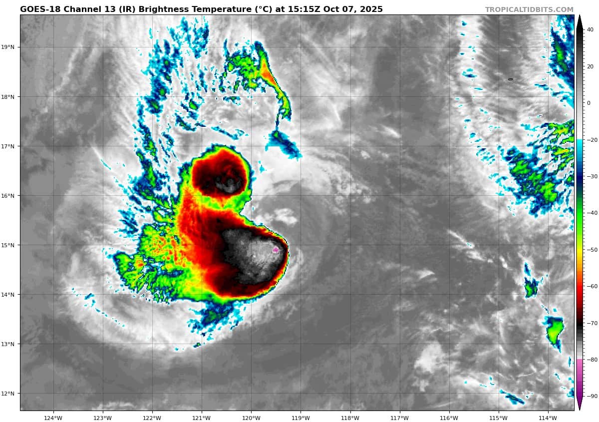
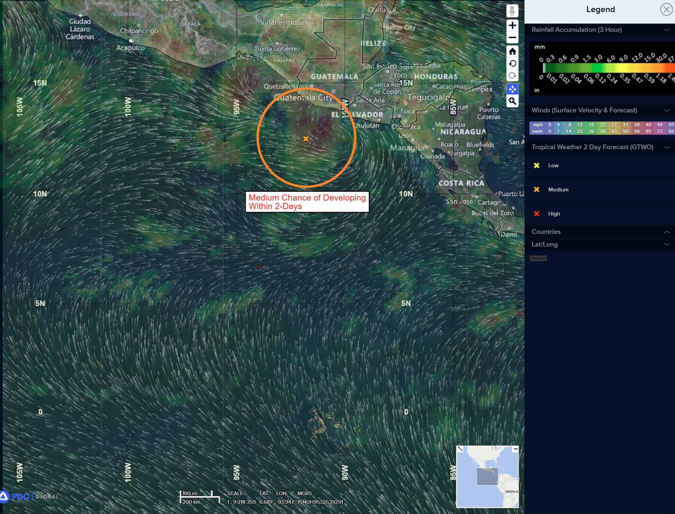
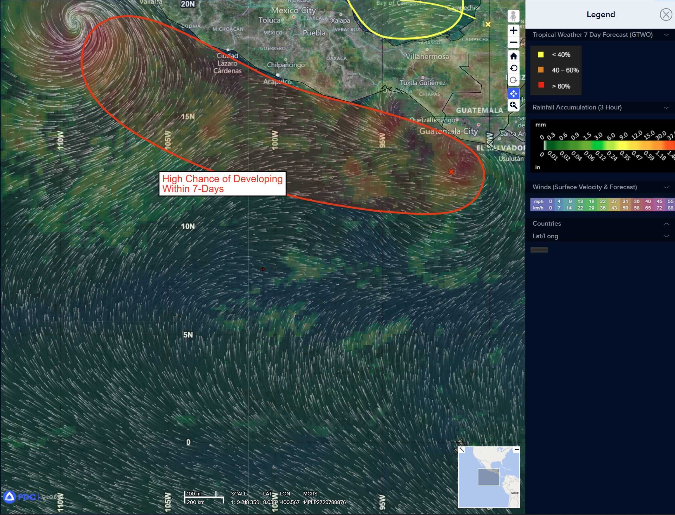
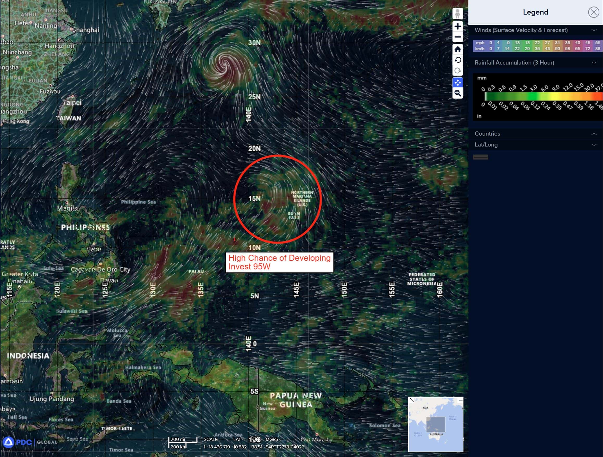
South of Southern Mexico:
>>> Disorganized showers and thunderstorms have increased in coverage in association with a broad area of low pressure located a short distance offshore of Guatemala.
Environmental conditions are expected to gradually become more favorable for development of this system over the next few days, and a tropical depression is likely to form late this week while moving west-northwestward at 10 to 15 mph, near or parallel to the coast of southern Mexico.
Interests along the coast of southern Mexico should monitor the progress of this system.
Regardless of development, this system is likely to produce periods of heavy rainfall over portions of Guatemala today, and along the southern coast of Mexico through the end of the week.
* Formation chance through 48 hours…medium…40 percent
* Formation chance through 7 days…high…80 percent
Central Pacific Ocean: There are no Tropical Cyclones
Tropical cyclone formation is not expected during the next 7 days.
Western Pacific, Indian Ocean, and adjacent Seas:
Western Pacific
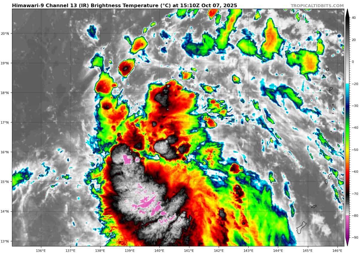
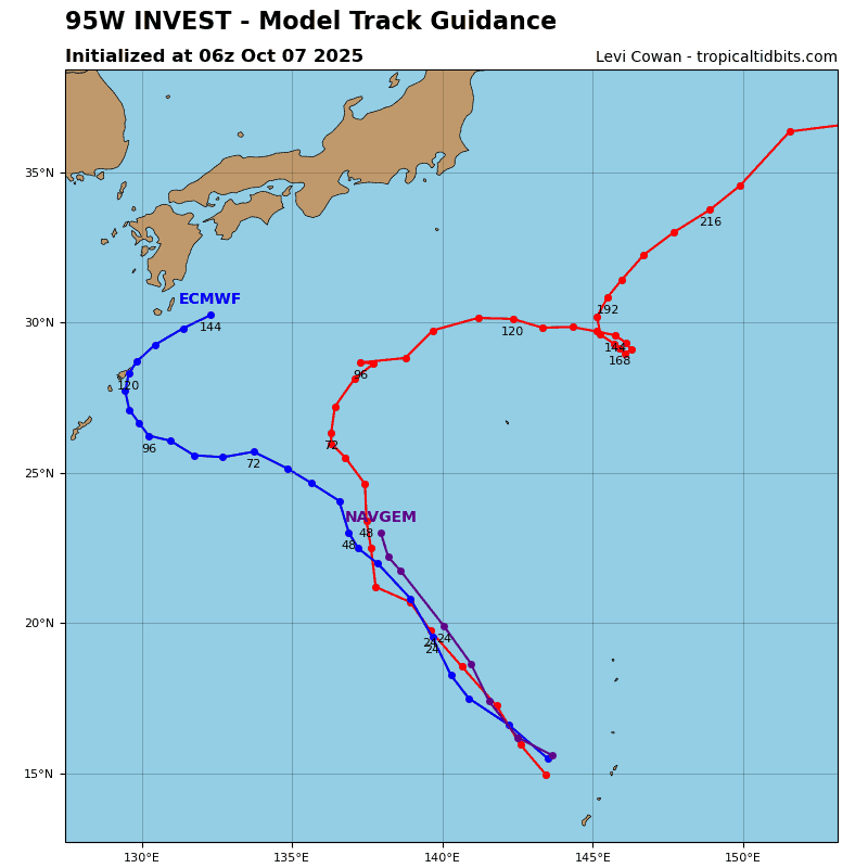
Tropical Cyclone 28W (Halong)
According to the JTWC warning number 13, sustained winds were 115 knots with gusts to 140 knots
Animated multi-spectral satellite imagery (msi) depicts a clear eye feature with symmetric convection around the low-level circulation center (llcc). A slight cloud tops warming trend around the center suggests that intensification has slowed for now. Radial outflow remains consistent.
Typhoon 28W (Halong) will track northwestward as it rounds the axis of the subtropical ridge to the east. Afterwards, TY 28W will recurve to the north-northeast. TY 28W is forecast to remain in a highly favorable environment at least until 24 hours with warm (29-30 c) sea surface temperatures (sst), low (5-10 knot) vertical wind shear (vws), and good outflow.
Following 24 hours the system is forecast to encounter cooler waters, higher wind shear, and relatively dry air entraining the core of the vortex – conditions that will cause a weakening trend and signal the beginning of a simultenous transition into an extratropical system.
As TY Halong continues to transit northeast, unfavorable conditions will cause a more dramatic decline of the system. Maximum wind speeds are expected to weaken to 50 knots by 96 hours as the system will have completed its extra-tropical transition.