The Pacific Disaster Center’s (PDC Global) Sunday, October 5, 2025, Tropical Cyclone Activity Report…for the Pacific Ocean, the Indian Ocean, and adjacent Seas
Current Tropical Cyclones:
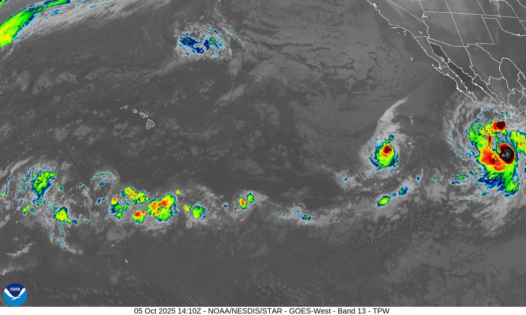
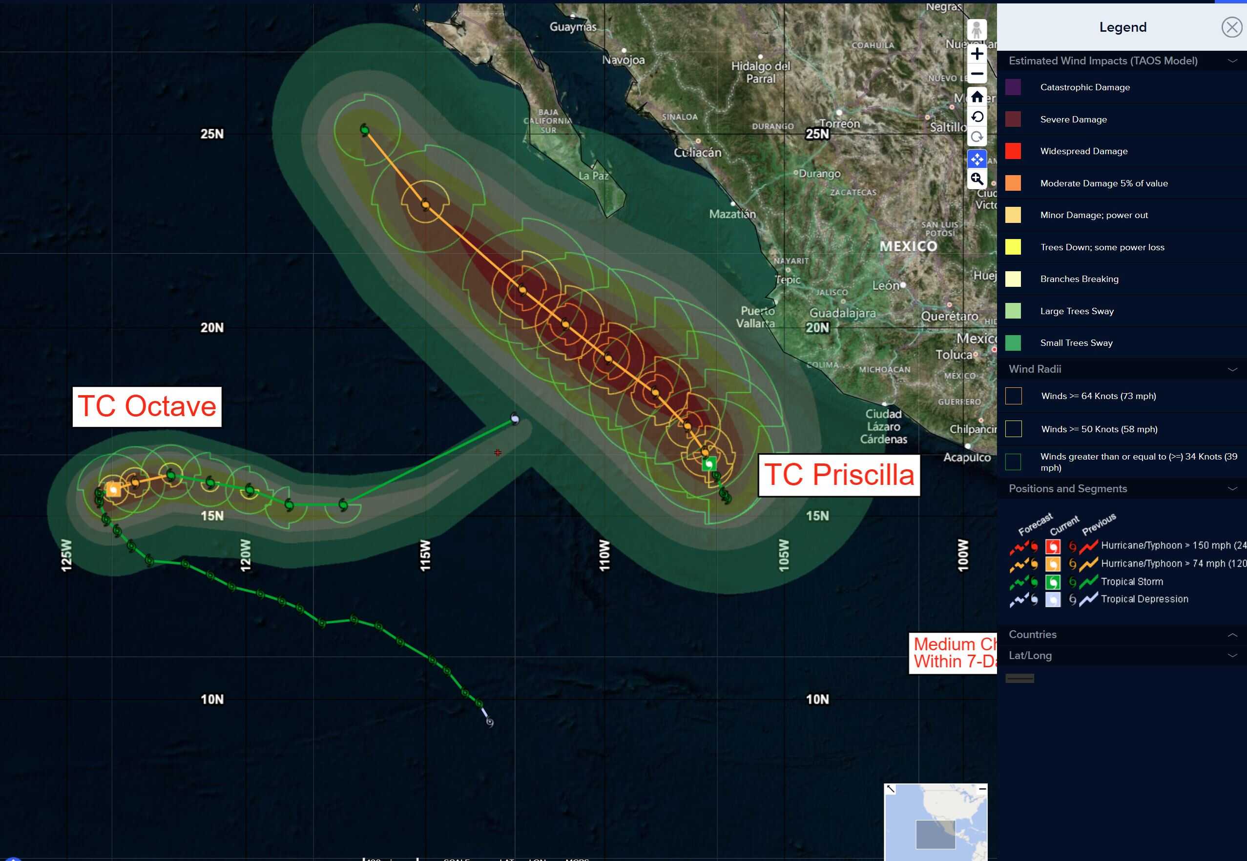
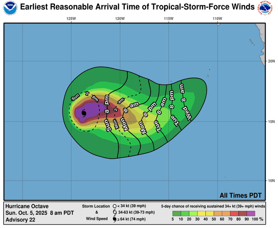
Tropical Cyclone 15E (Octave) is located about 1025 miles west-southwest of the southern tip of Baja California
Tropical Cyclone 16E (Priscilla) is located about 485 miles south-southeast of the southern tip of Baja California
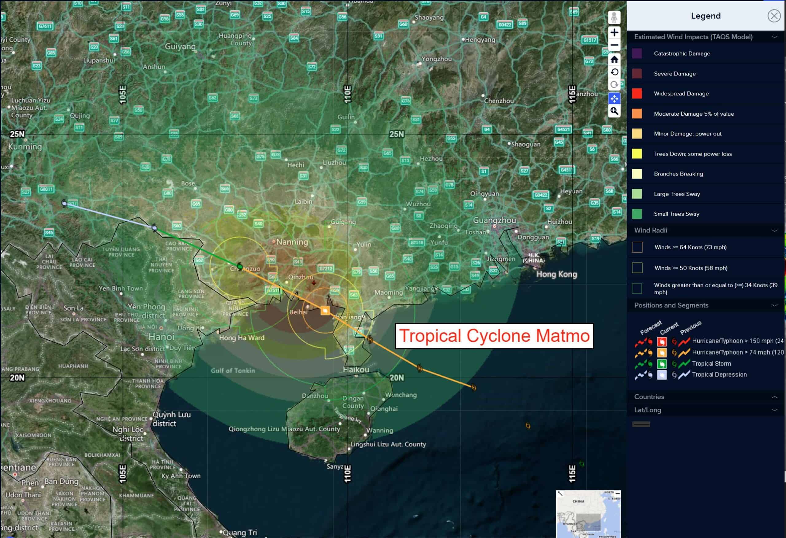
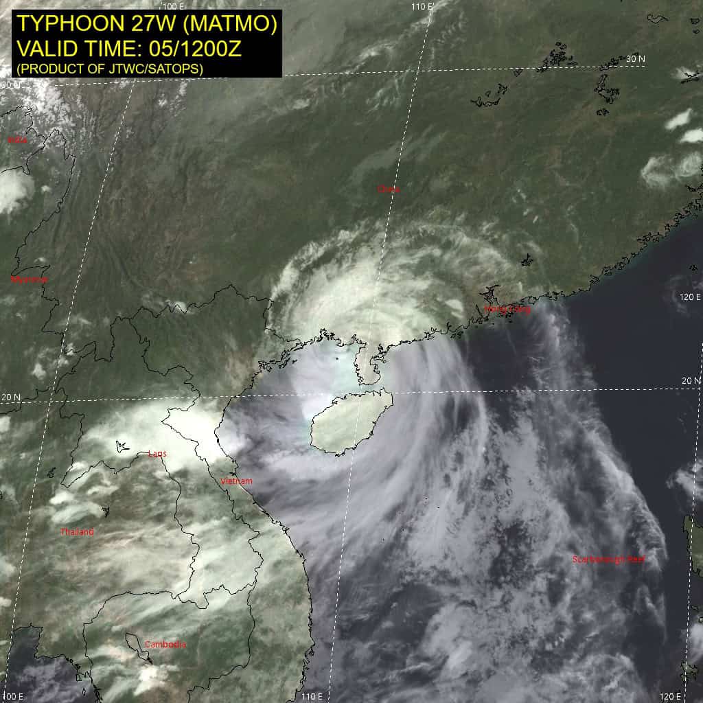
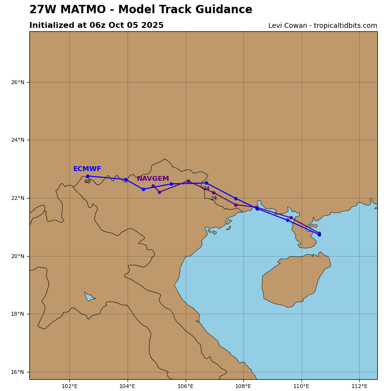
Tropical Cyclone 27W (Matmo) is located about 203 NM east of Hanoi, Vietnam
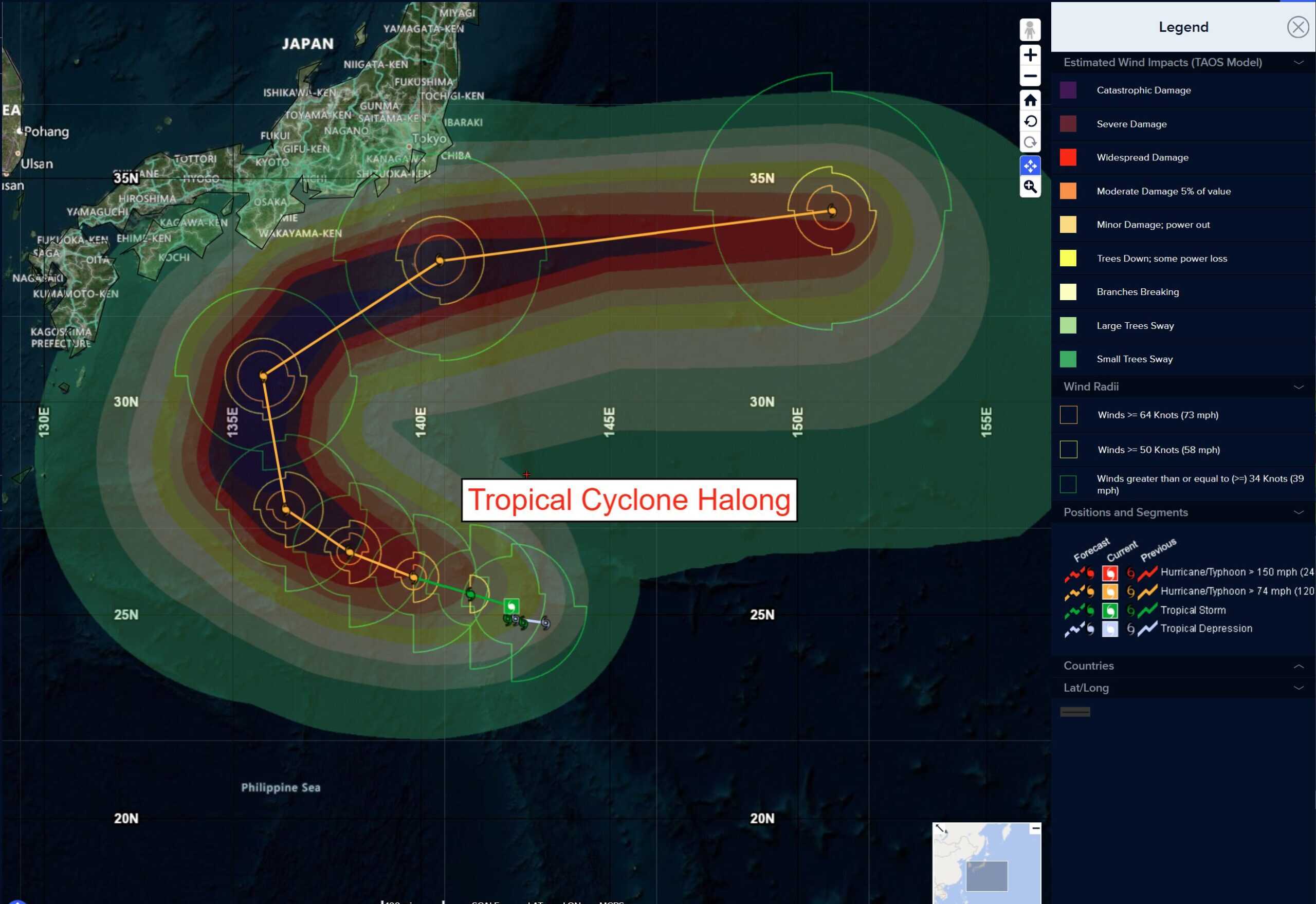
Tropical Cyclone 28W (Halong) is located approximately 64 NM east-northeast of Iwo To
Tropical Cyclone 02A (Shakhti) is located approximately 104 NM east-southeast of Masirah Island
Northeast Pacific Ocean:
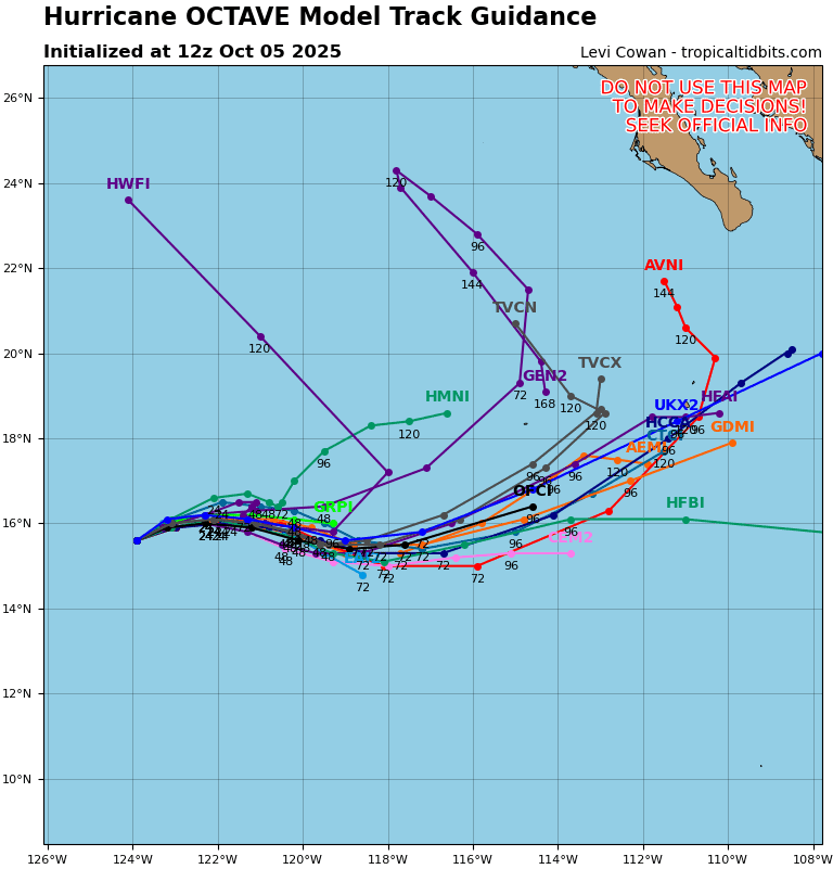
Tropical Cyclone 15E (Octave)
OCTAVE STRENGTHENS AND BECOMES THE NINTH HURRICANE OF THE 2025 EAST PACIFIC HURRICANE SEASON
According to the NHC advisory number 22
Octave is now moving toward the northeast near 3 mph (6 km/h). A turn toward the east and east-southeast with a slight increase in forward speed is expected on Monday.
Maximum sustained winds have increased to near 80 mph (130 km/h) with higher gusts. Little change in strength is expected today, followed by a gradual weakening trend beginning on Monday.
Hurricane-force winds extend outward up to 15 miles (30 km) from the center and tropical-storm-force winds extend outward up to 70 miles (110 km). The estimated minimum central pressure is 987 mb (29.15 inches).
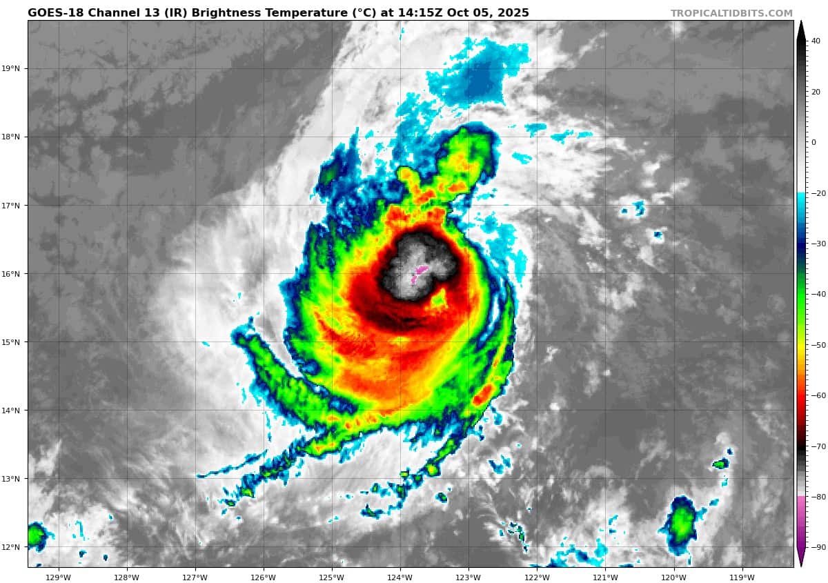
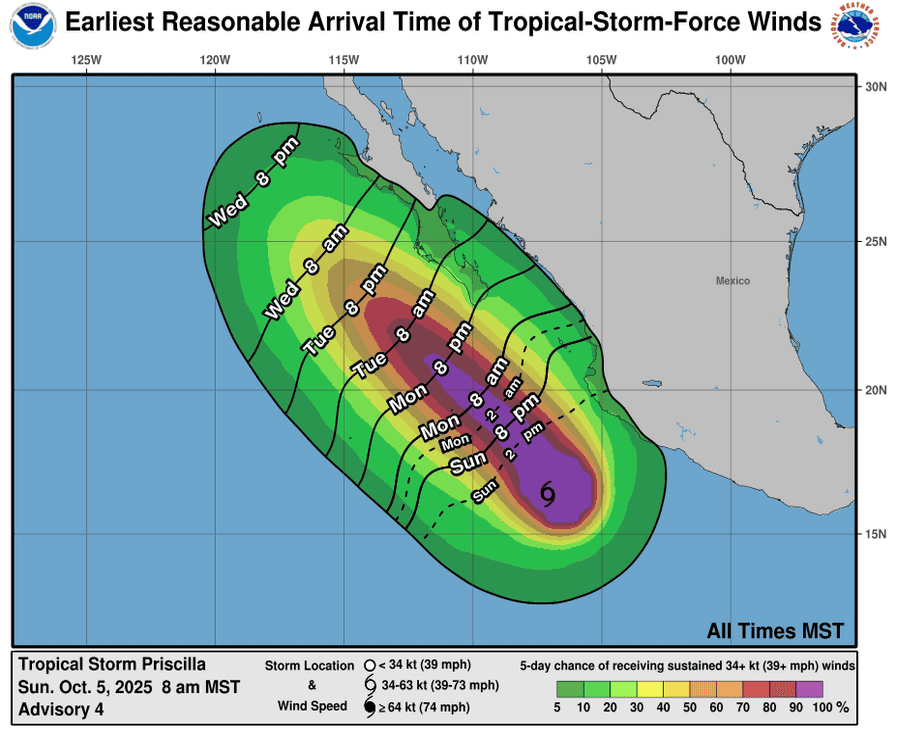
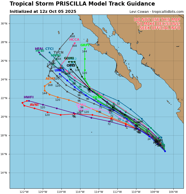
Tropical Cyclone 16E (Priscilla)
PRISCILLA FORECAST TO BECOME A LARGE HURRICANE OVER THE EARLY PART OF THIS WEEK…HEAVY RAINFALL AND GUSTY WINDS POSSIBLE FOR COASTAL SOUTHWESTERN MEXICO
According to the NHC advisory number 4
Priscilla is moving toward the north-northwest near 3 mph (6 km/h) and this general motion at a slightly faster forward speed is expected over the next few days. On the forecast track, the center of the system is expected to move offshore of and parallel to the coast of southwestern Mexico through the early part of this week.
Maximum sustained winds are near 65 mph (100 km/h) with higher gusts. Additional strengthening is forecast during the next 48 hours, and Priscilla is likely to become a hurricane over the next day or so.
Tropical-storm-force winds extend outward up to 125 miles (205 km) from the center. The estimated minimum central pressure is 991 mb (29.27 inches).
HAZARDS AFFECTING LAND WIND:
WIND: Tropical storm conditions are possible within the watch area along the southwestern coast of Mexico today into Monday.
RAINFALL: Outer bands from Priscilla will bring heavy rain to portions of southwestern Mexico through Monday. Across coastal portions of Michoacán and far western Guerrero, additional rainfall amounts of 2 to 4 inches are expected, with local amounts up to 6 inches. Across Colima, western Jalisco, and the rest of Guerrero along the coast,1 to 3 inches of additional rainfall are expected. This rainfall will bring a risk of flash flooding, especially in areas of higher terrain.
SURF: Swells generated by Priscilla are affecting portions of the coast of southwestern Mexico and will reach portions of the coast of west-central Mexico and the southern Baja California peninsula by Monday. These swells are likely to cause life-threatening surf and rip current conditions.
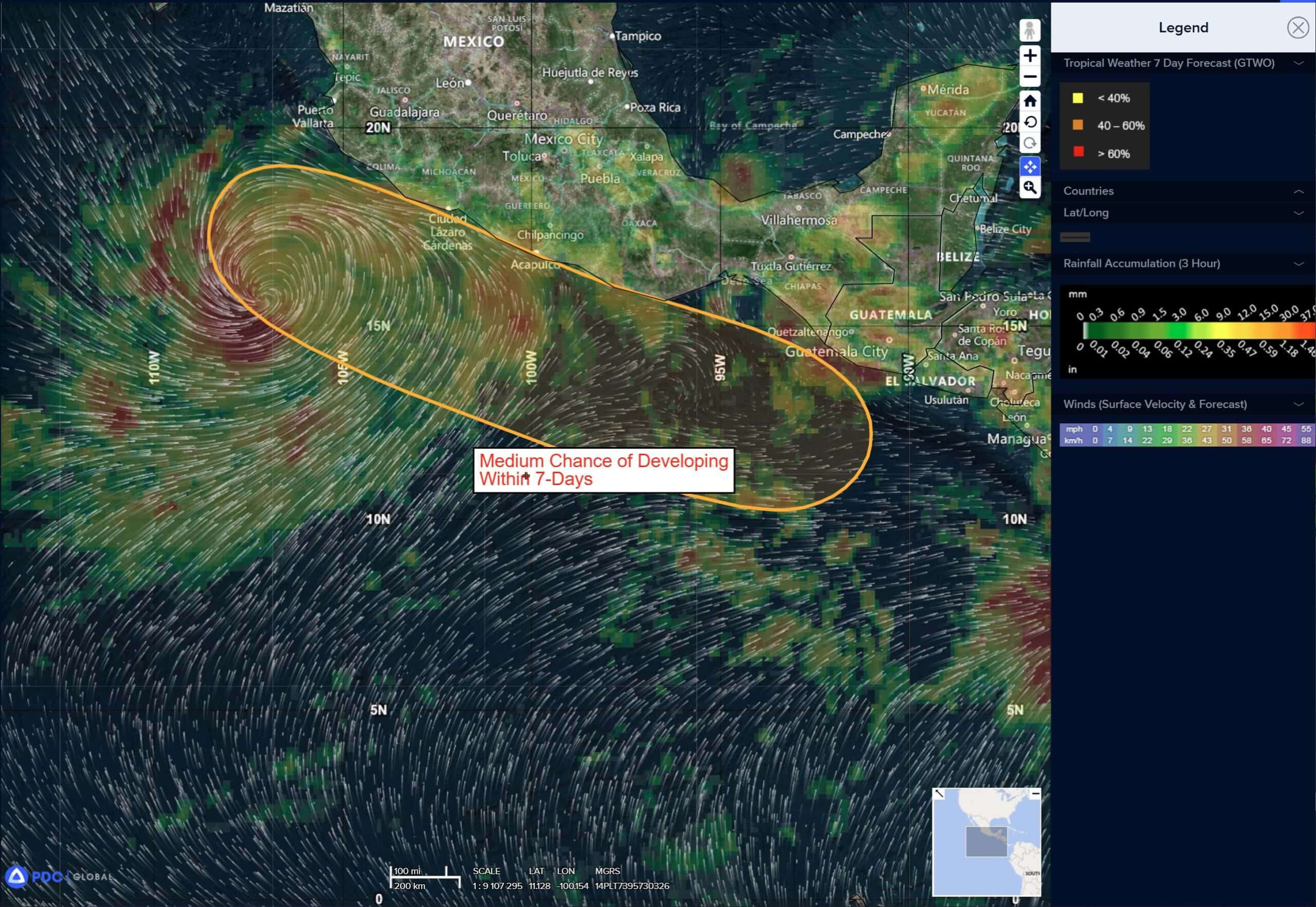
South of Southern Mexico:
>>> An area of low pressure is expected to form off the southern coast of Mexico by midweek. Gradual development of this system is likely thereafter, and a tropical depression could form during the latter part of the week while moving slowly west-northwestward, near or parallel to the coast of Mexico.
* Formation chance through 48 hours…low…near 0 percent
* Formation chance through 7 days…medium…60 percent
Central Pacific Ocean: There are no Tropical Cyclones
Tropical cyclone formation is not expected during the next 7 days.
Western Pacific, Indian Ocean, and adjacent Seas:
Tropical Cyclone 27W (Matmo)
According to the JTWC warning number 18, sustained winds were 80 knots with gusts to 100 knots
Animated multi-spectral satellite imagery (msi) depicts typhoon 27W (Matmo) with a well-defined, large (45 NM) eye and spiral bands of deep convection encircling the system. The system is currently making landfall within the Leizhou Peninsula and is expected to emerge within the northern Gulf of Tonkin in the coming hours. A 050613z amsr2 89 ghz microwave image revealed a symmetric microwave eye with cold cloud tops entirely surrounding the center.
27W is forecast to track west-northwestward, along the southwestern periphery of the subtropical ridge throughout the forecast period. A second landfall, just east of the Vietnam-China border is expected near12 hours. 27W is forecast to weaken throughout the forecast period as increasing terrain interaction continues to deteriorate the vortex. a complete dissipation is expected to occur no later than 48 hours, north of Vietnam and Laos.
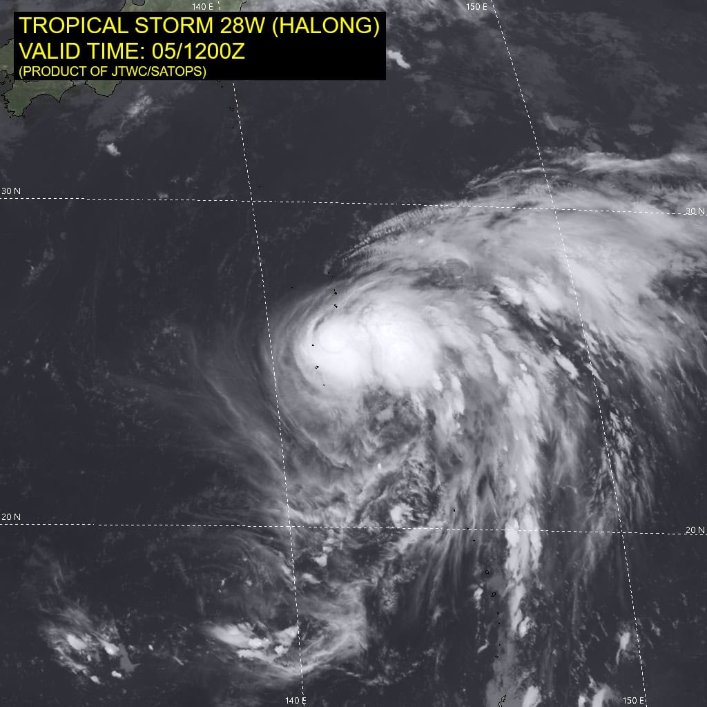
Tropical Cyclone 28W (Halong)
According to the JTWC warning number 5, sustained winds were 45 knots with gusts to 55 knots
Animated multi-spectral satellite imagery (msi) depicts tropical storm 28W with deep convective bursts still slightly offset to the east of the partially exposed low-level circulation center (llcc).
The vortex appears to be in better alignment with the convection
inching closer to the center of the system.
Environmental analysis indicates that 28W is in a favorable environment characterized by strong eastward outflow aloft, low (5-10 knot) vertical wind shear, and warm (29-30 c) sea surface temperatures.
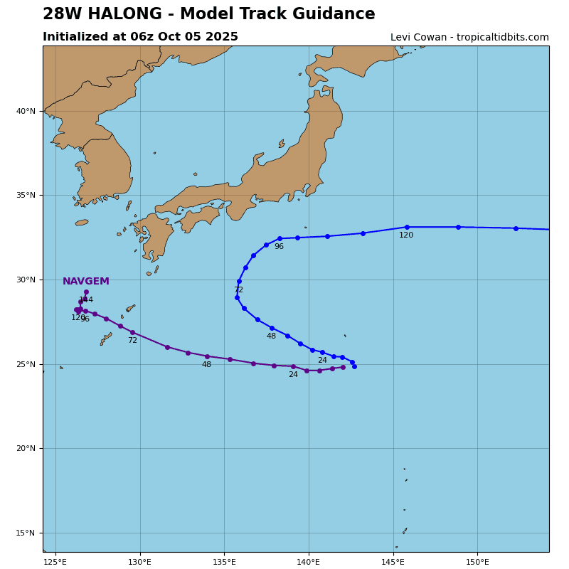
28W is forecast to track west-northwestward, along the southern portion of an extension of the str centered to the northeast through 48 hours. Around 48 hours, 28W is forecast to begin rounding the southwestern periphery of the str to the east.
Near 72 hours, a turn to the northeast is expected as the system
continues to round the str. Track speeds will then increase as the
system begins to interact with the strong midlatitude westerlies to
the north. Extratropical transition is not expected to start within
the forecast period as the upper-level flow remains zonal. There
continues to be very low confidence in the timing of the recurve,
however, models are in far better agreement on a recurve well
before interacting with the northern Ryukyu Islands.
Regarding intensity, 28W is forecast to rapidly intensify from 24 (60
knots) to 48 (110 knots) hours. The vortex is expected to be completely aligned in around 18 hours and the poleward outflow channel is expected to significantly improve, aiding in the rapid
intensification (ri). After 72 hours, westerly shear is expected to
quickly increase, causing the system to weaken through the
remainder of the forecast period.
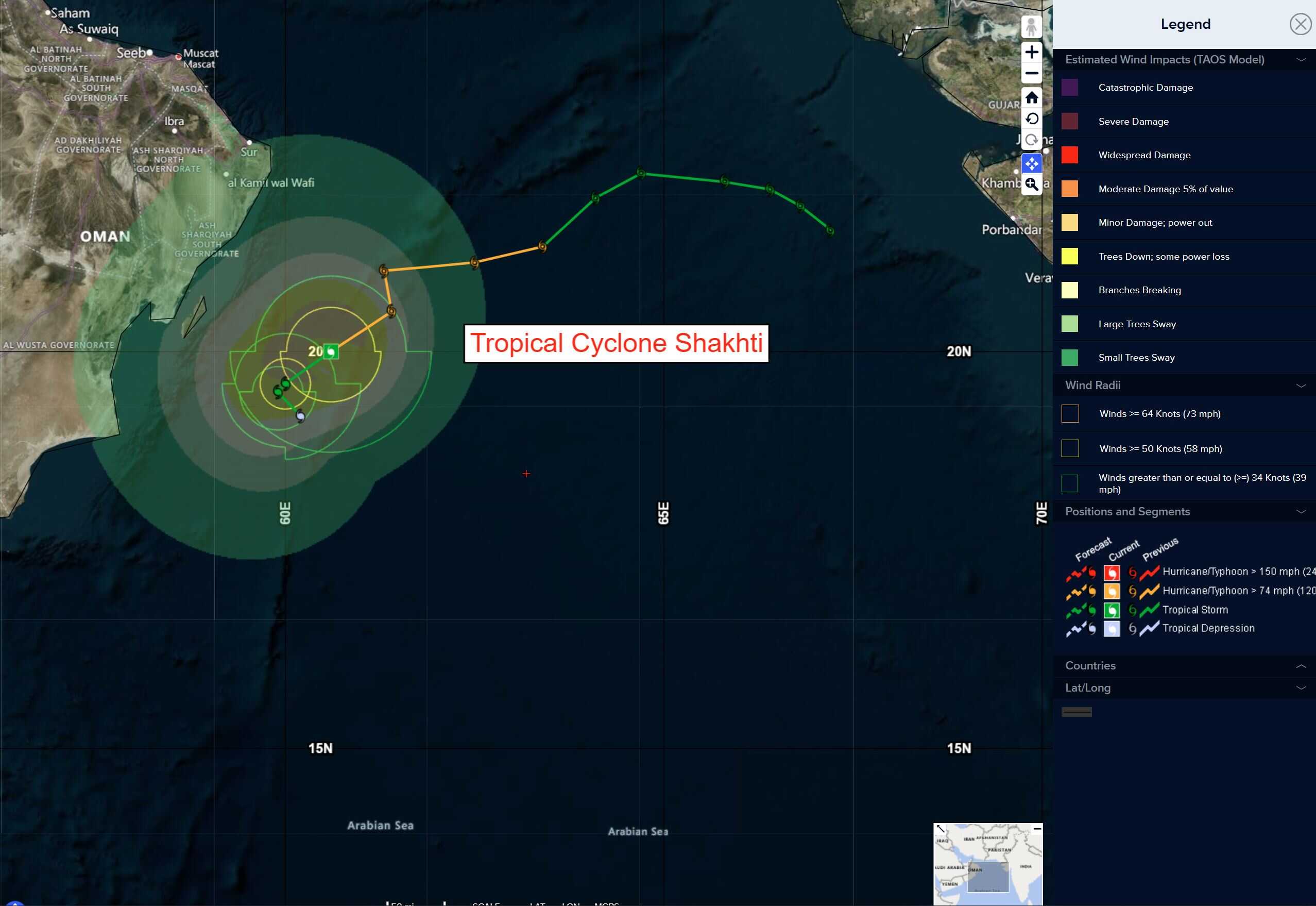
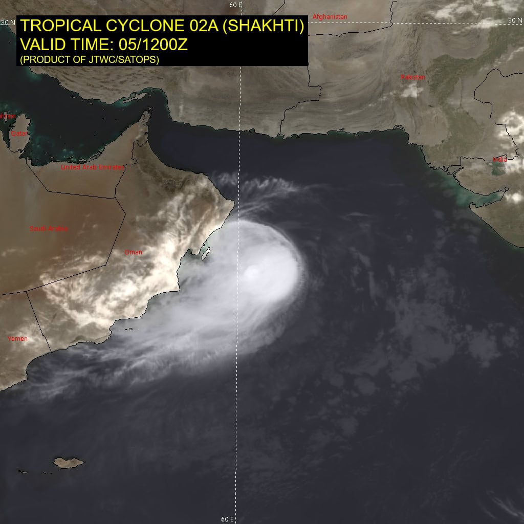
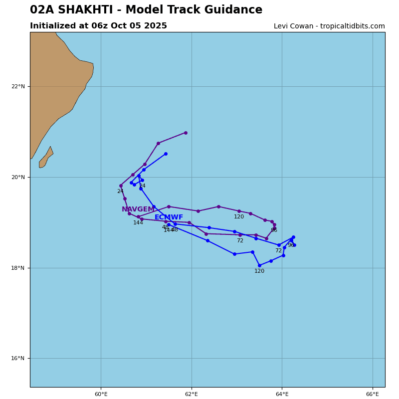
Tropical Cyclone 02A (Shakhti)
According to the JTWC warning number 11, sustained winds were 60 knots with gusts to 75 knots
Animated multi-spectral satellite imagery (msi) depicts persistent deep convection offset to the south of the compact low-level circulation center (llcc). The poleward outflow has weakened, indicative of the easterly dry air entrainment and the east-northeasterly shear. A 050216z wsfm microwave image reveals that tropical cyclone (tc) 02a has retained its microwave eye, despite the marginally unfavorable environment and obfuscation of the llcc by the central dense overcast.
Analysis indicates that the environment is characterized by moderate to high (20-25 knot) vertical wind shear, dry air, and upwelling associated with the storm’s stagnation. TC 02A will continue its slow southwestward track for the next 24 hours as it remains under the influence of the southeastern periphery of the primary steering ridge over Saudi Arabia.
Around 24 hours, 02A will take an east-southeastward curve as a deep-layer trough breaks down the str positioned over the eastern Arabian Sea. The str will extend southwest and west, causing 02A to briefly stall before recurving over the now-dominant steering ridge. 02A will track east-southeastward along the northwestern periphery of the str until the end of the forecast period.
02A is forecast to steadily weaken from here on out due to the significant dry air entrainment and increasing wind shear. As a result of the storm’s slow track motion, cooler water upwelling has also hindered development and will likely hasten dissipation. Dissipation is forecast no later than 48 hours.

")