Western Pacific, Indian Ocean, and adjacent Seas:
Western Pacific

")


By PDC’s Senior Weather
Specialist Glenn James

The Pacific Disaster Center’s (PDC Global) Monday, October 6, 2025, Tropical Cyclone Activity Report…for the Pacific Ocean, the Indian Ocean, and adjacent Seas
Current Tropical Cyclones:
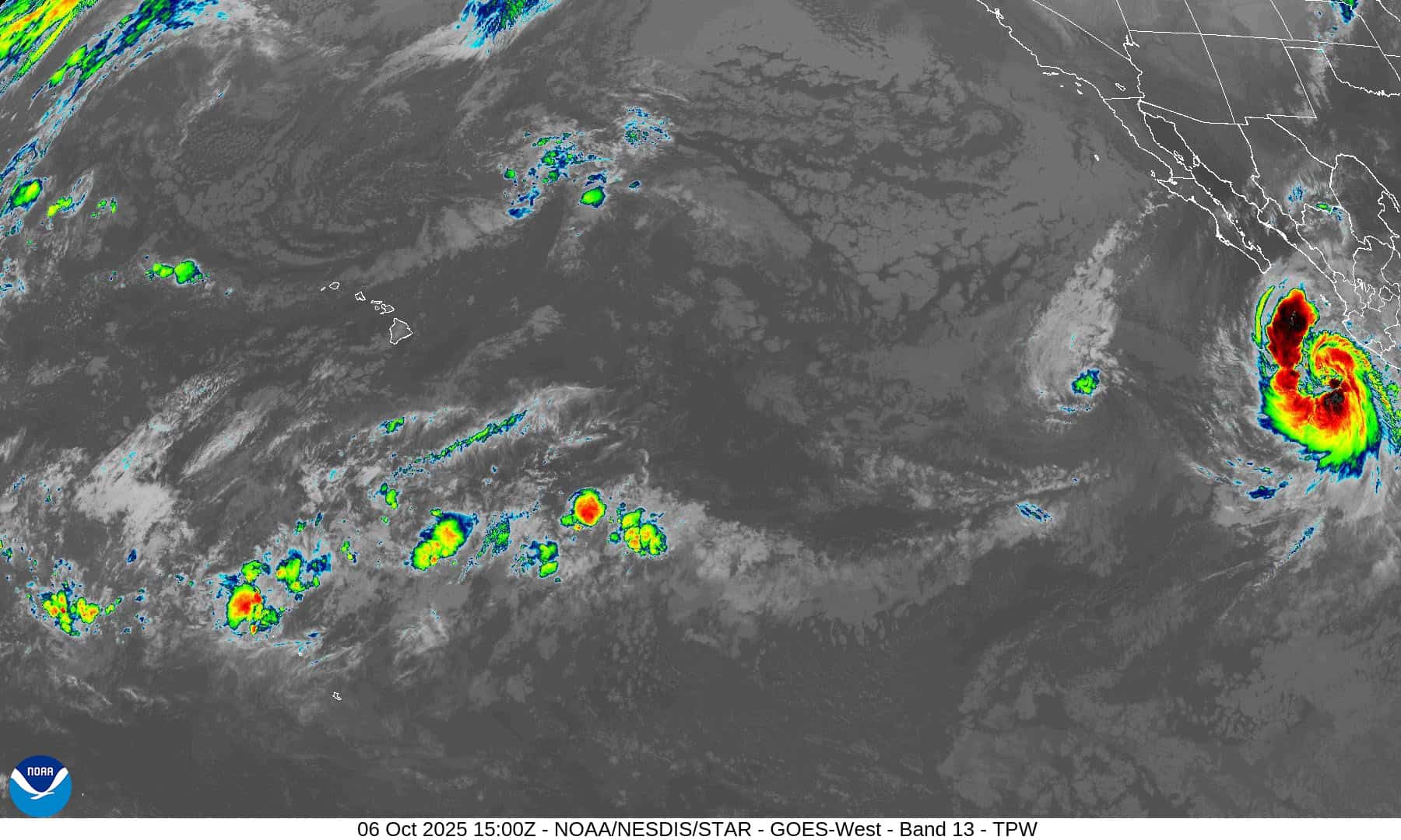
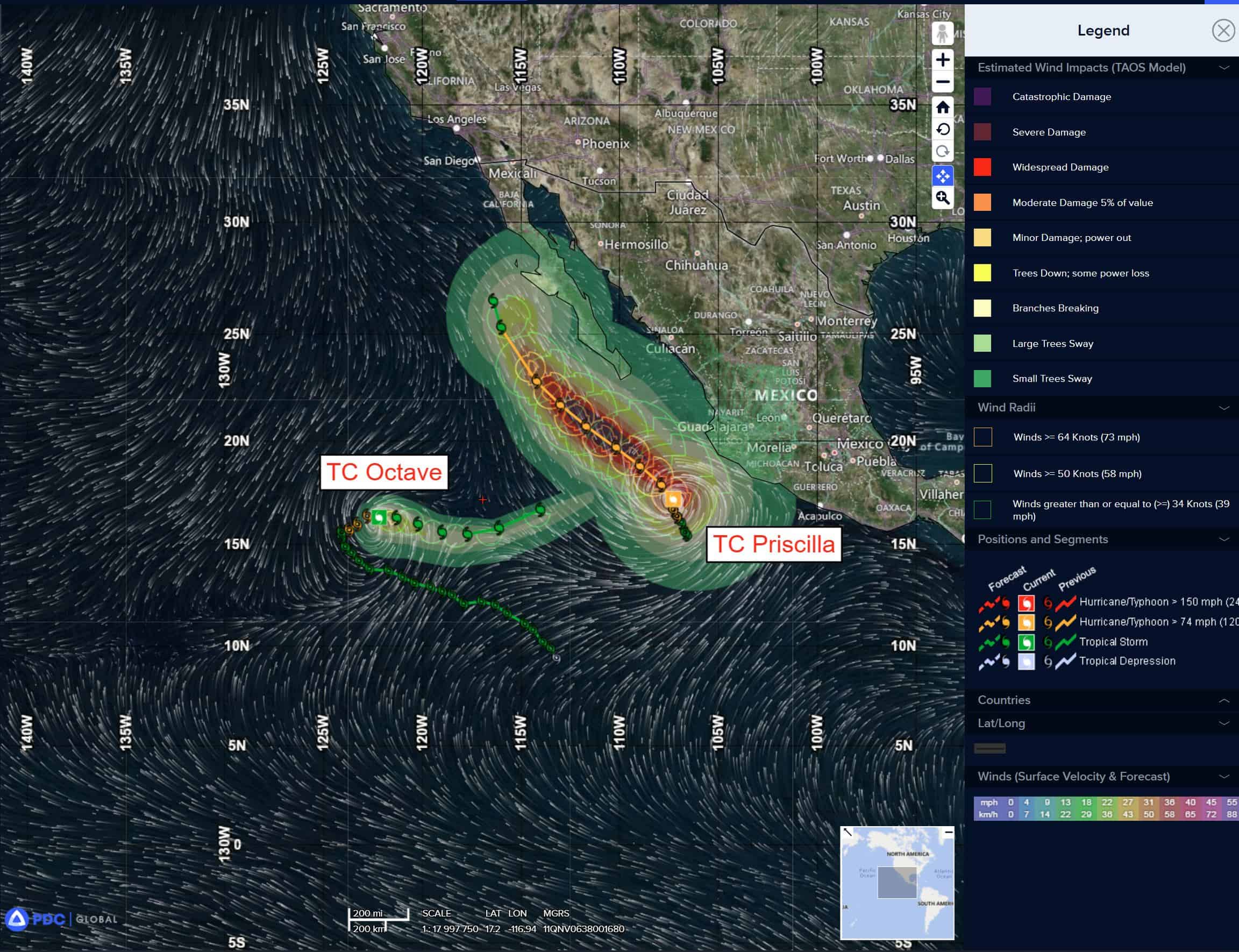
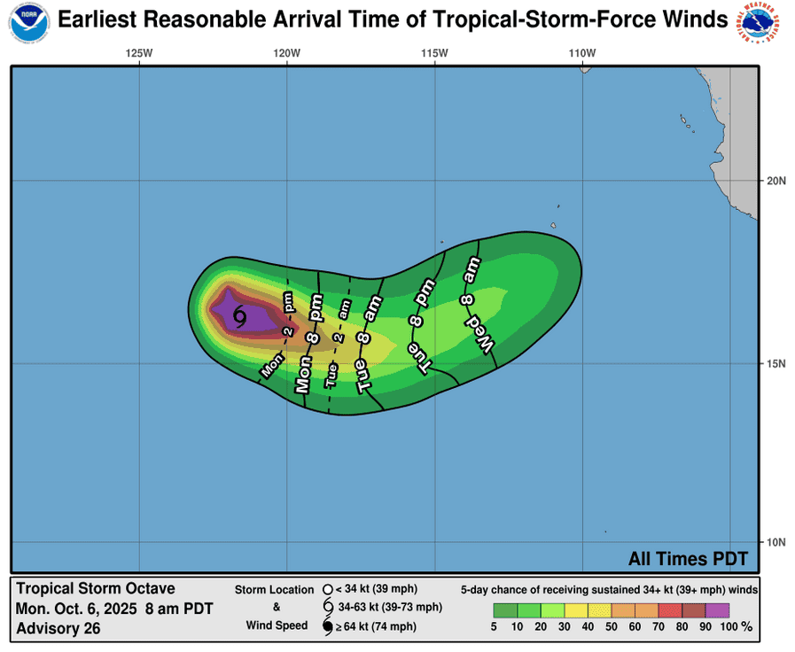
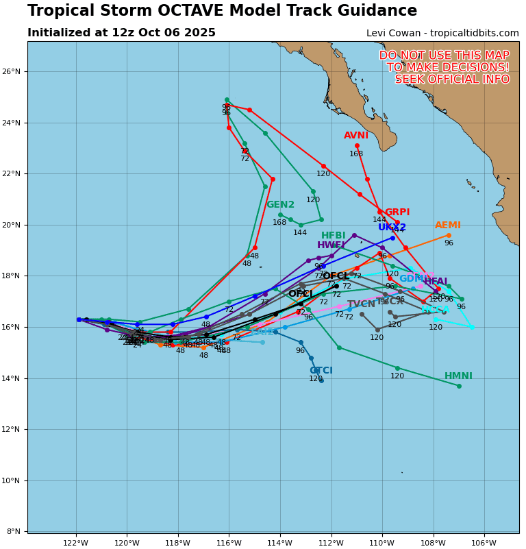
Tropical Cyclone 15E (Octave) is located about 840 miles west-southwest of the southern tip of Baja California
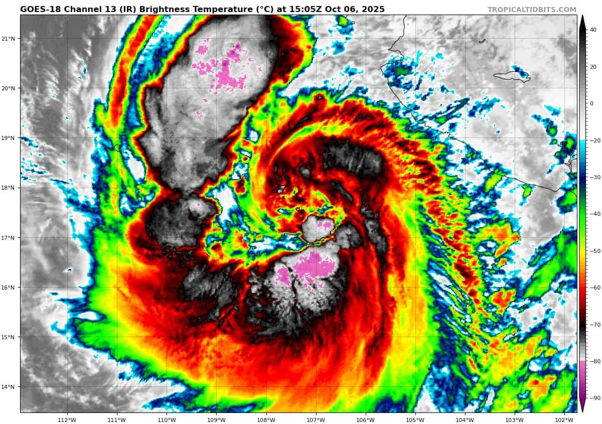
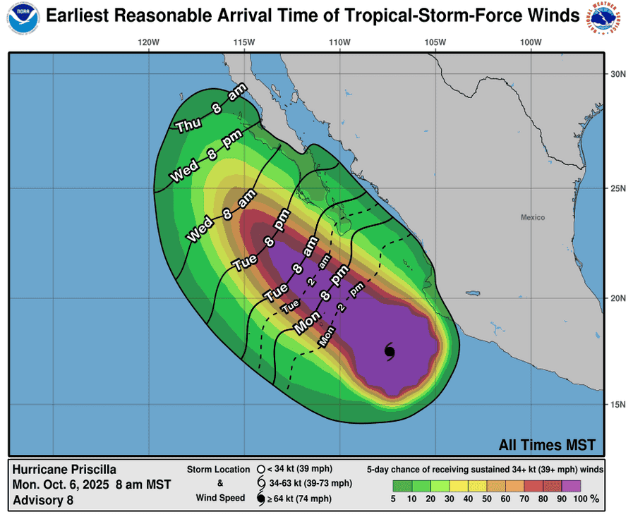
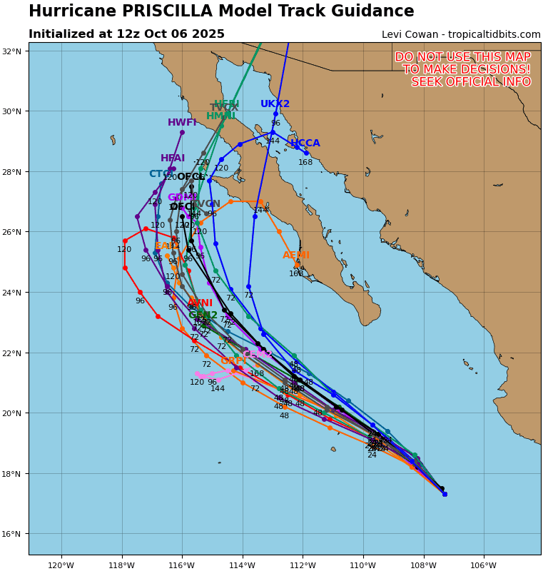
Tropical Cyclone 16E (Priscilla) is located about 310 miles south-southeast of the southern tip of Baja California
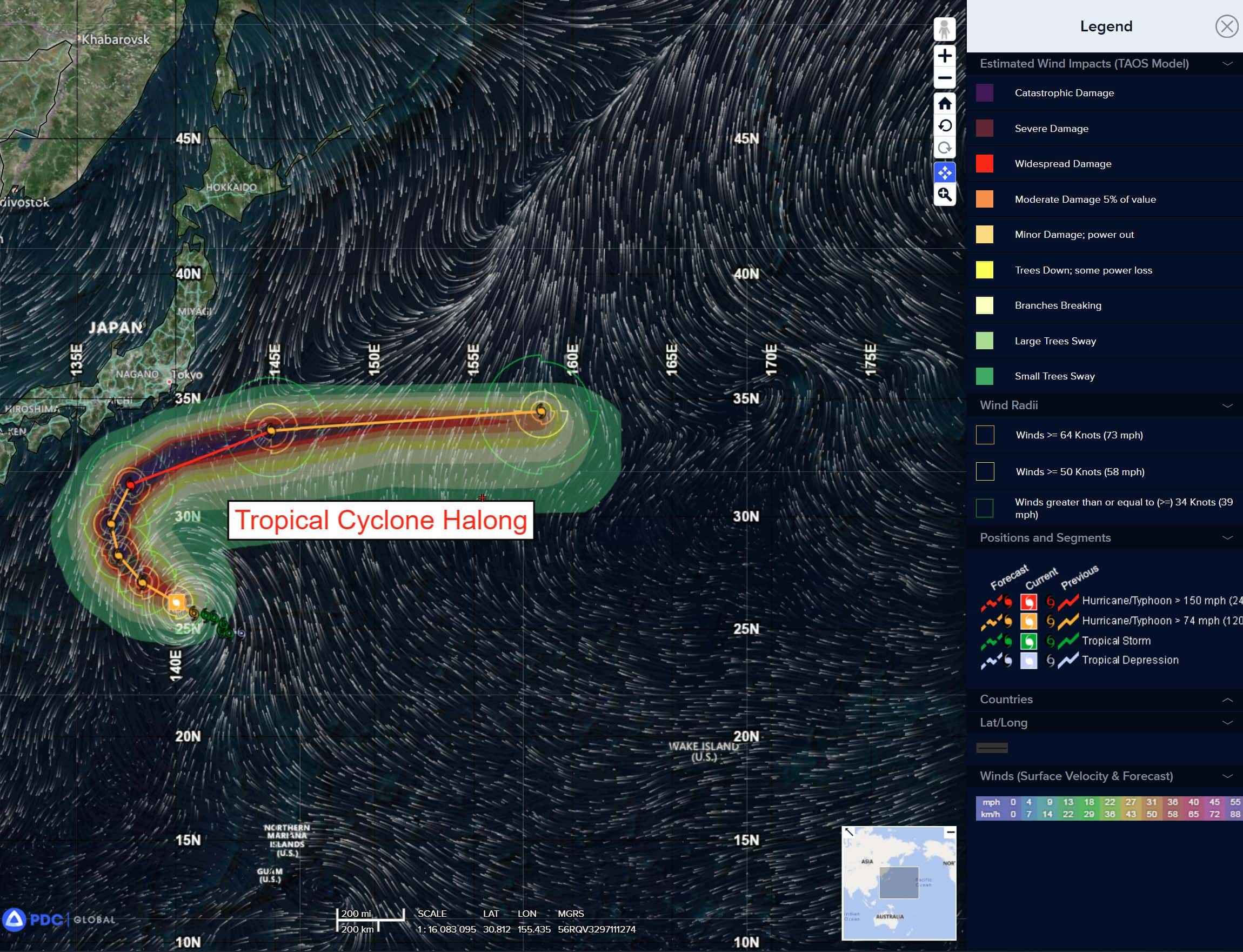
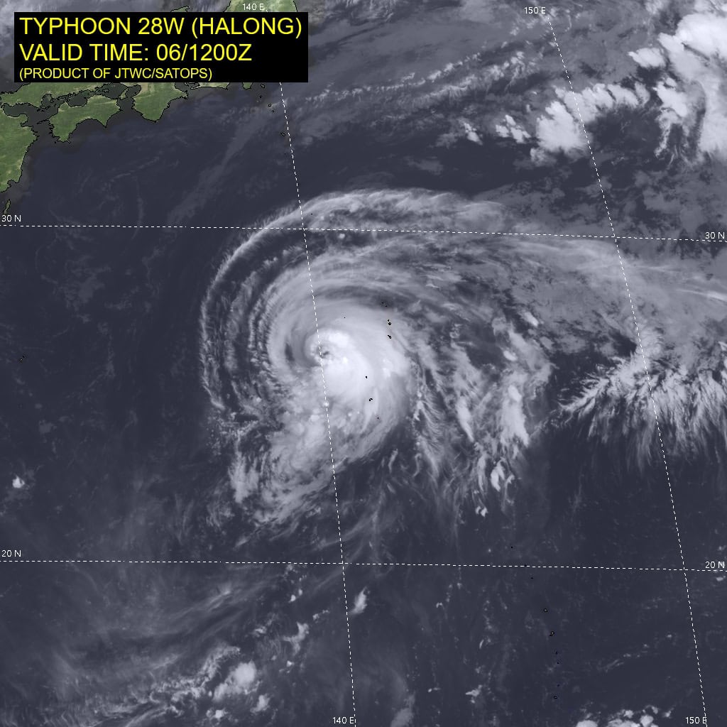
Tropical Cyclone 28W (Halong) is located approximately 546 NM south of Yokosuka, Japan
Northeast Pacific Ocean:
Tropical Cyclone 15E (Octave)
OCTAVE HOLDING STEADY WHILE HEADING EAST-SOUTHEASTWARD
According to the NHC advisory number 28
Octave is moving toward the east near 7 mph (11 km/h). An east to east-southeast motion is expected during the next day or two, followed by a faster motion to the northeast.
Maximum sustained winds have decreased to near 65 mph (100 km/h) with higher gusts. Gradual weakening is expected to continue, and Octave is forecast to dissipate in a few days.
Tropical-storm-force winds extend outward up to 60 miles (95 km) from the center. The estimated minimum central pressure is 995 mb (29.39 inches).
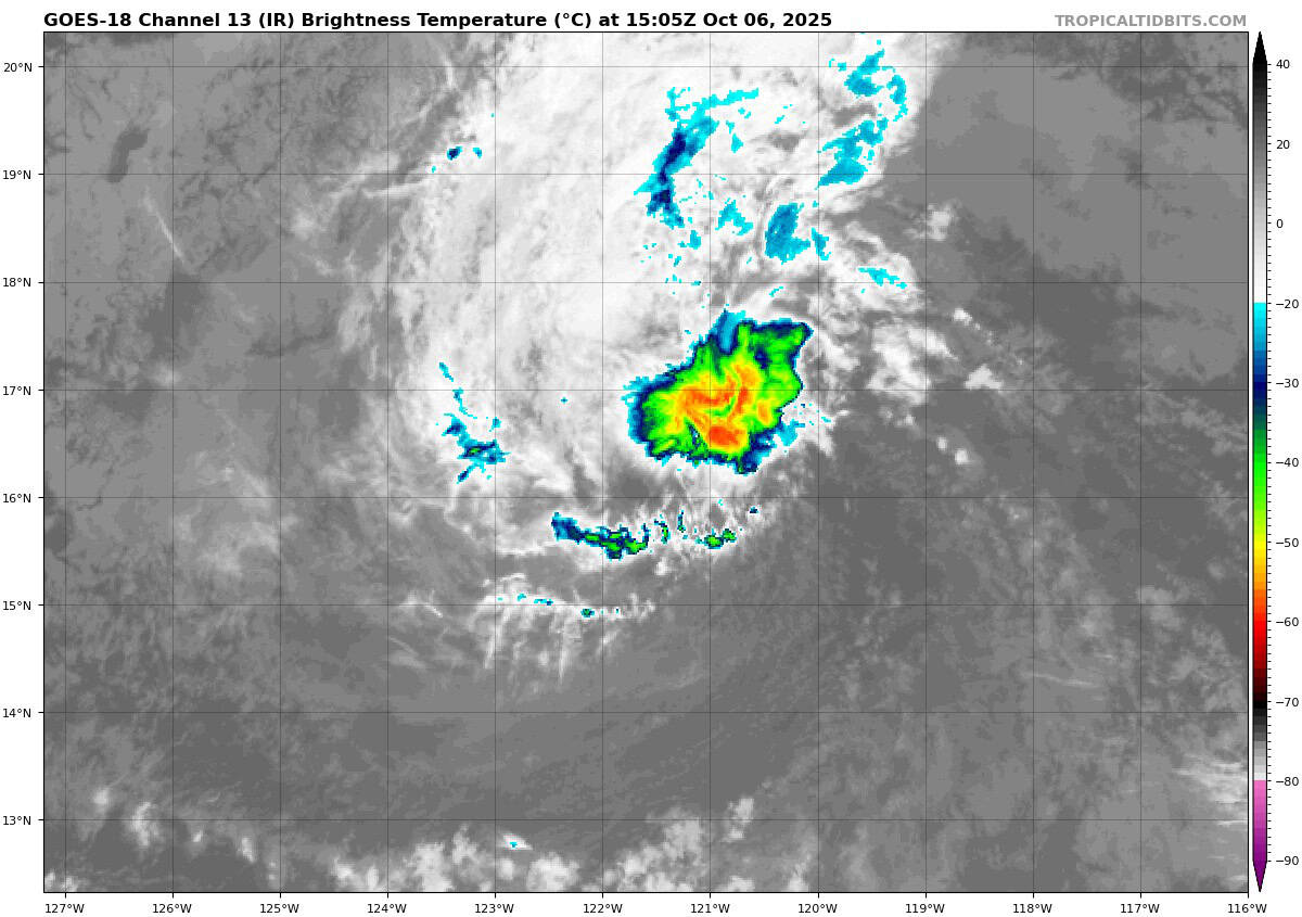
Tropical Cyclone 16E (Priscilla)
HEAVY RAINS AND GUSTY WINDS POSSIBLE OVER PORTIONS OF BAJA CALIFORNIA SUR ON TUESDAY AND WEDNESDAY
According to the NHC advisory number 9A
Priscilla is moving toward the north-northwest near 5 mph (7 km/h). This general motion with a bend to the northwest at a slightly faster forward speed is expected over the next few days. On the forecast track, the center of the system is expected to move offshore of and parallel to the coast of southwestern Mexico and Baja California Sur through the early-to-middle part of this week.
Maximum sustained winds are near 85 mph (140 km/h) with higher gusts. Additional strengthening is forecast, and Priscilla is expected to become a category 2 hurricane, and could approach major hurricane status within the next couple of days before weakening likely commences by midweek.
Hurricane-force winds extend outward up to 50 miles (85 km) from the center and tropical-storm-force winds extend outward up to 205 miles (335 km). The estimated minimum central pressure is 973 mb (28.74 inches).
HAZARDS AFFECTING LAND WIND:
WIND: Tropical storm conditions are possible within the watch area along the southwestern coast of Mexico today, and are possible in Baja California Sur Tuesday night into Wednesday.
RAINFALL: Outer bands from Priscilla will continue to bring heavy rain to portions of southwestern Mexico today. Across coastal portions of Michoacán and Colima, additional rainfall amounts of 1 to 2 inches are expected. From Tuesday into Wednesday, 2-4 inches (with local amounts up to 6 inches) are expected in southern portions of Baja California Sur as outer bands of Priscilla reach that area. This rainfall will bring a risk of flash flooding, especially in areas of higher terrain. Moisture from Priscilla should bring heavy rainfall potential over the Southwestern U.S. late this week into this weekend.
SURF: Swells generated by Priscilla are affecting portions of the coast of southwestern and west-central Mexico, and will reach portions of the coast of the southern Baja California peninsula today. These swells are likely to cause life-threatening surf and rip current conditions.
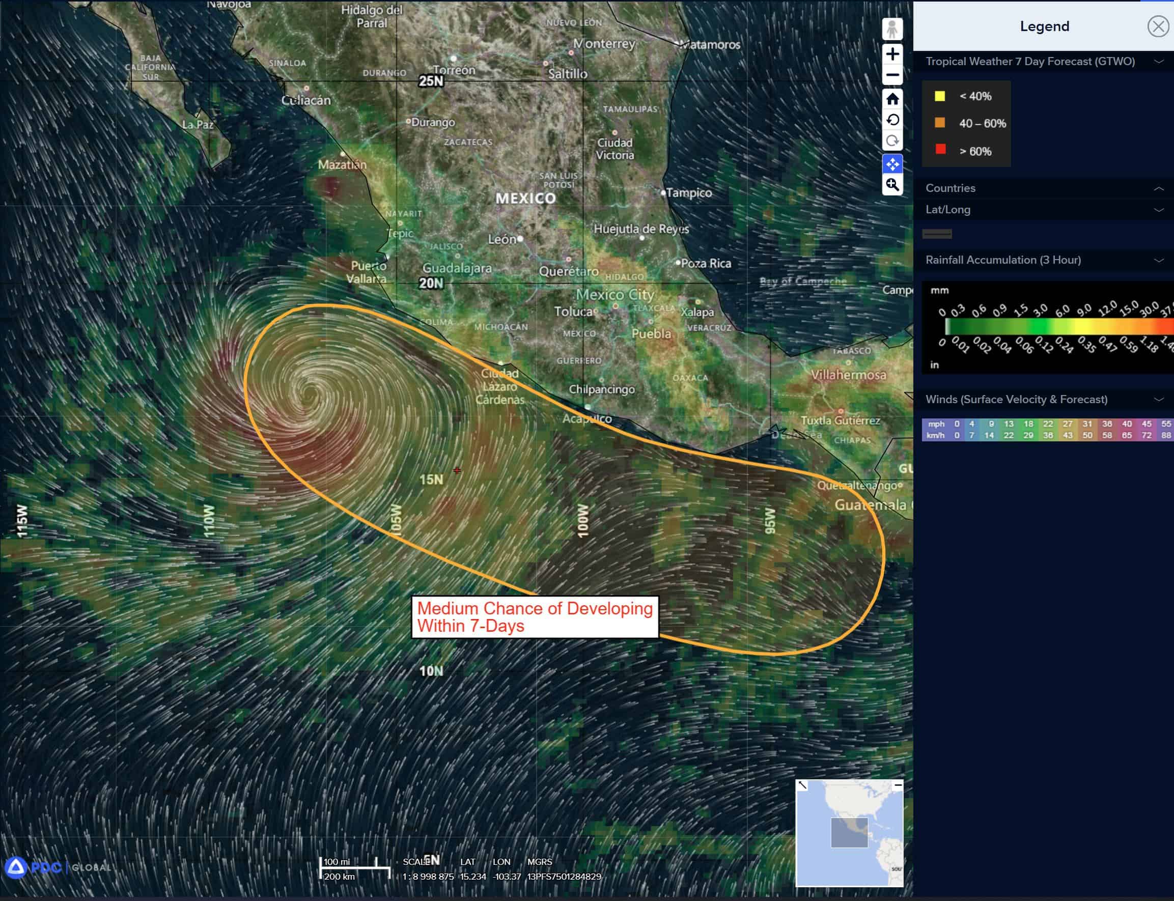
South of Southern Mexico:
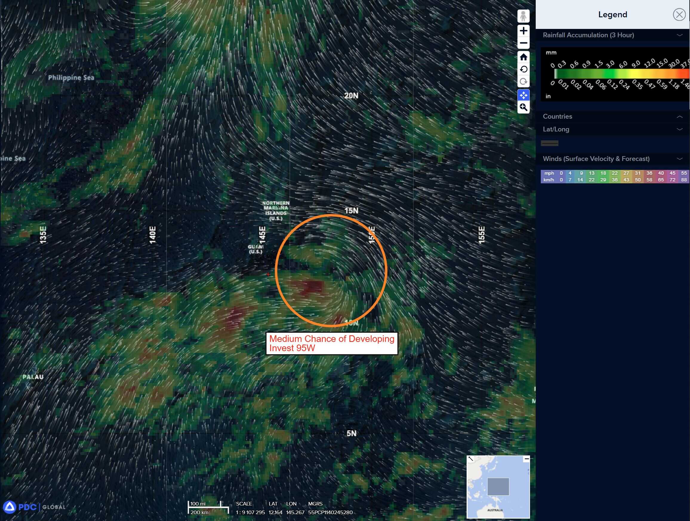
>>> Showers and thunderstorms associated with a broad area of low pressure located a couple of hundred miles off the coast of Guatemala remain disorganized.
Environmental conditions are expected to become more favorable for gradual development of this system later this week, and a tropical depression is likely to form by the weekend while moving west-northwestward at 10 to 15 mph, near or parallel to the coast of southern Mexico.
Regardless of development, this system could produce periods of heavy rainfall along portions of the southern coast of Mexico through the end of the week.
* Formation chance through 48 hours…low…20 percent
* Formation chance through 7 days…high…70 percent
Central Pacific Ocean: There are no Tropical Cyclones
Tropical cyclone formation is not expected during the next 7 days.
Western Pacific, Indian Ocean, and adjacent Seas:
Western Pacific
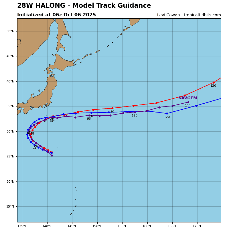
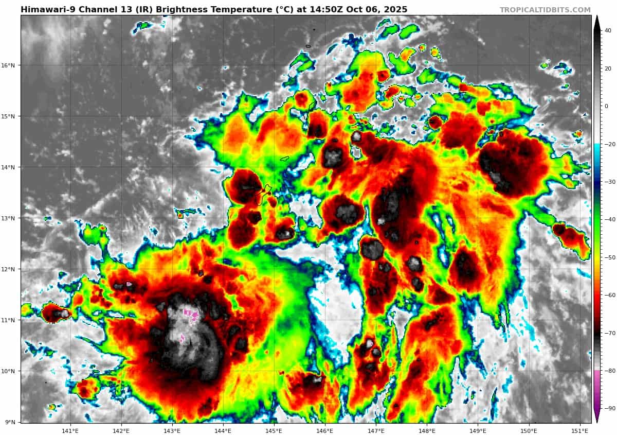
Tropical Cyclone 28W (Halong)
According to the JTWC warning number 11, sustained winds were 80 knots with gusts to 100 knots
Animated enhanced infrared (eir) satellite imagery depicts typhoon 28W with fragmentation in the western semicircle of the developing eyewall. Cloud tops in the southern periphery have cooled over the past 6 hours with the coldest tops now measuring around -88 c.
Environmental analysis indicates that 28W continues to be in a highly favorable environment characterized by strong poleward
outflow aloft, low (5-10 knots) vertical wind shear, and warm (29-30 c) sea surface temperatures.
28W is forecast to track northwestward, along the western periphery of the subtropical ridge to the east through 24 hours. Near 24 hours, the system is expected to turn northward as it rounds the subtropical ridge axis. After 48 hours, 28W is forecast to track off to the east-northeast with increasing track speeds as the system begins to interact with the strong mid-latitude westerlies.
Regarding intensity, 28W is forecast to rapidly intensify over the next 48 hours to a peak of around 130 knots. The environment is
expected to remain highly favorable, prime for rapid intensification (ri).
Westerly shear will significantly increase to around 35-40 knots at 72 hours, causing 28W to rapidly weaken as it tracks off to the
east-northeast. Extratropical transition is forecast to begin around 72 hours and complete near 96 hours as the system becomes embedded within the mid-latitude westerlies.