Western Pacific, Indian Ocean, and adjacent Seas:
Western Pacific

Hurricane Melissa latest impacts, updates, and response efforts can be accesses by disaster managers via DisasterAWARE Pro.

")
By PDC’s Senior Weather
Specialist Glenn James

The Pacific Disaster Center’s (PDC Global) Wednesday, October 8, 2025, Tropical Cyclone Activity Report…for the Pacific Ocean, the Indian Ocean, and adjacent Seas
Current Tropical Cyclones:
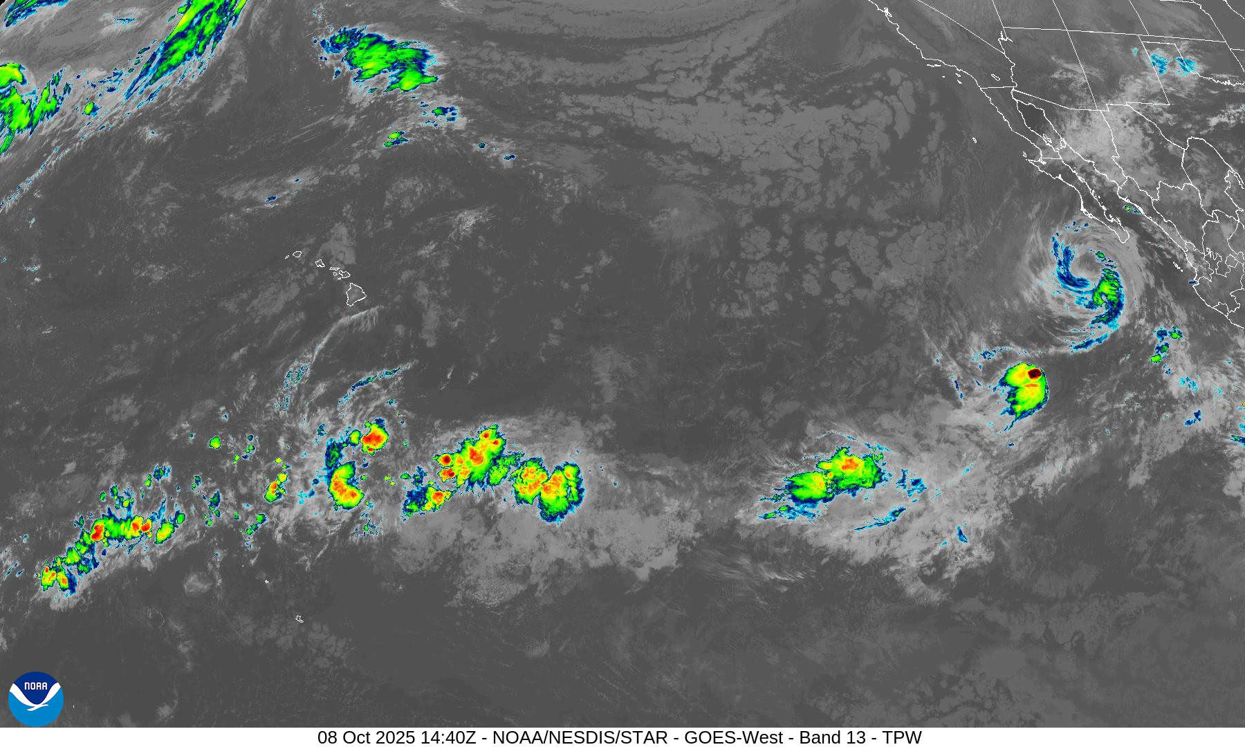
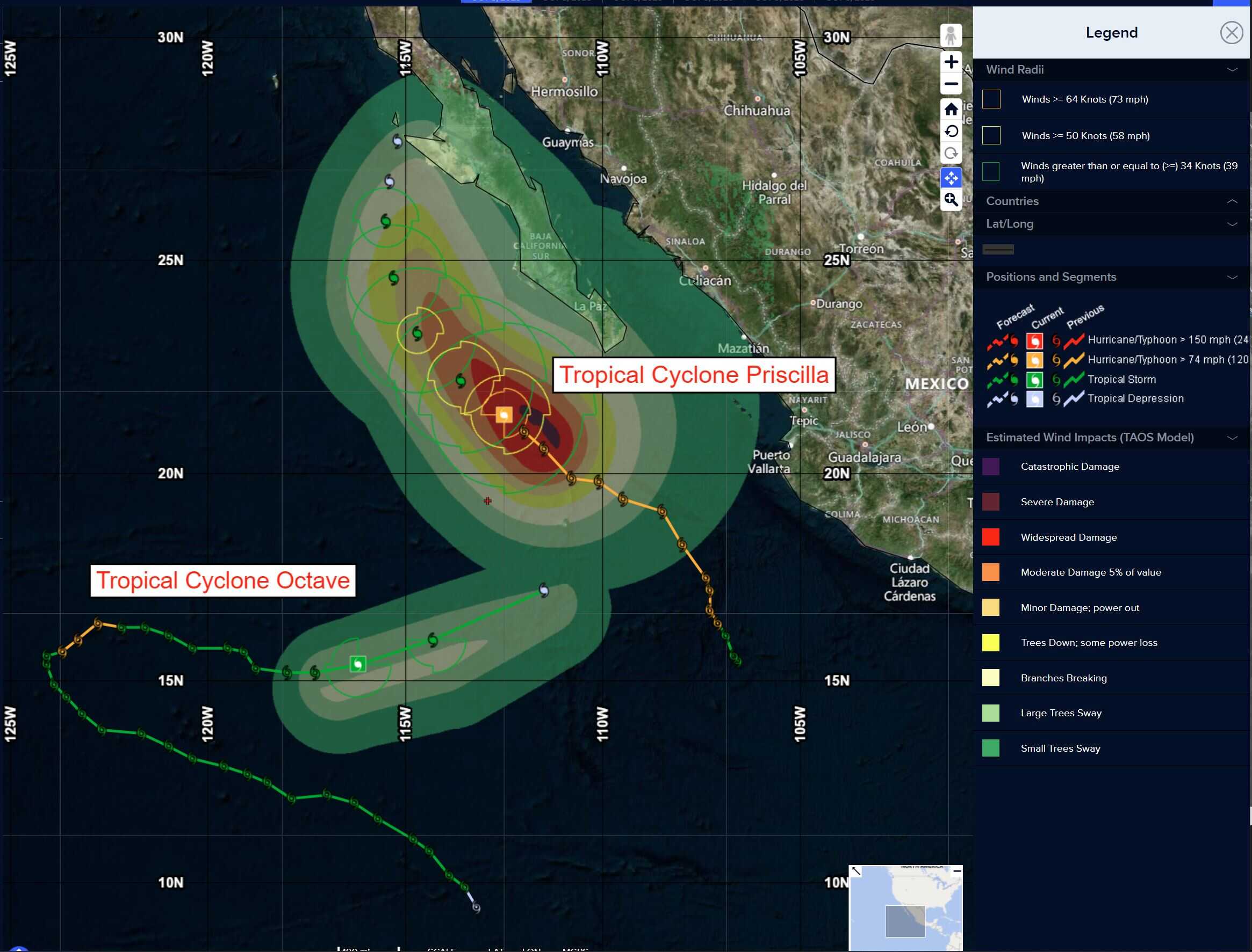
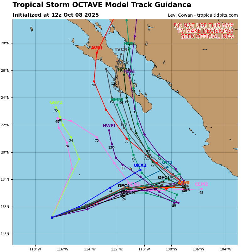
Tropical Cyclone 15E (Octave) is located about 515 miles south-southwest of the southern tip of Baja California
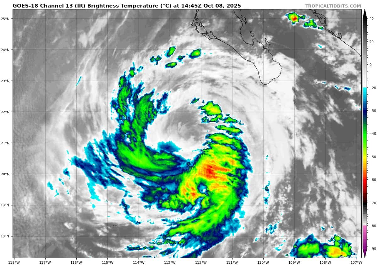
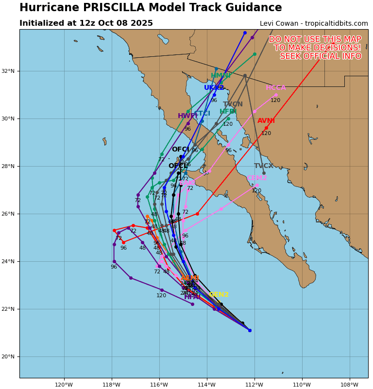
Tropical Cyclone 16E (Priscilla) is located about 255 miles west of the southern tip of Baja California
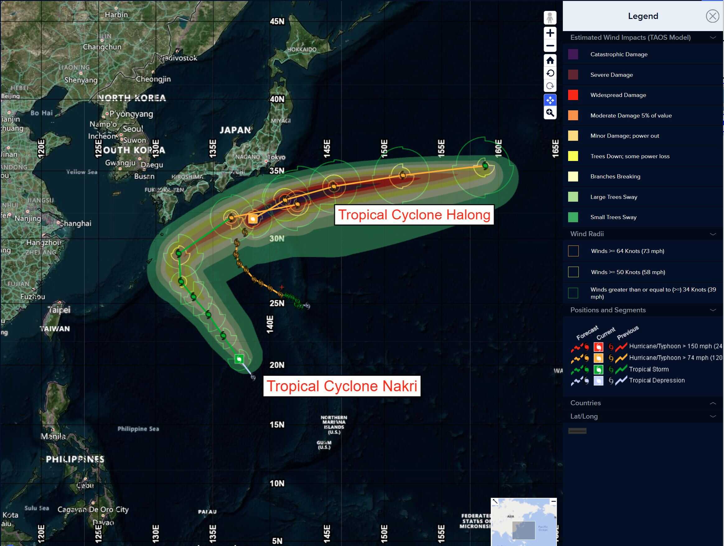
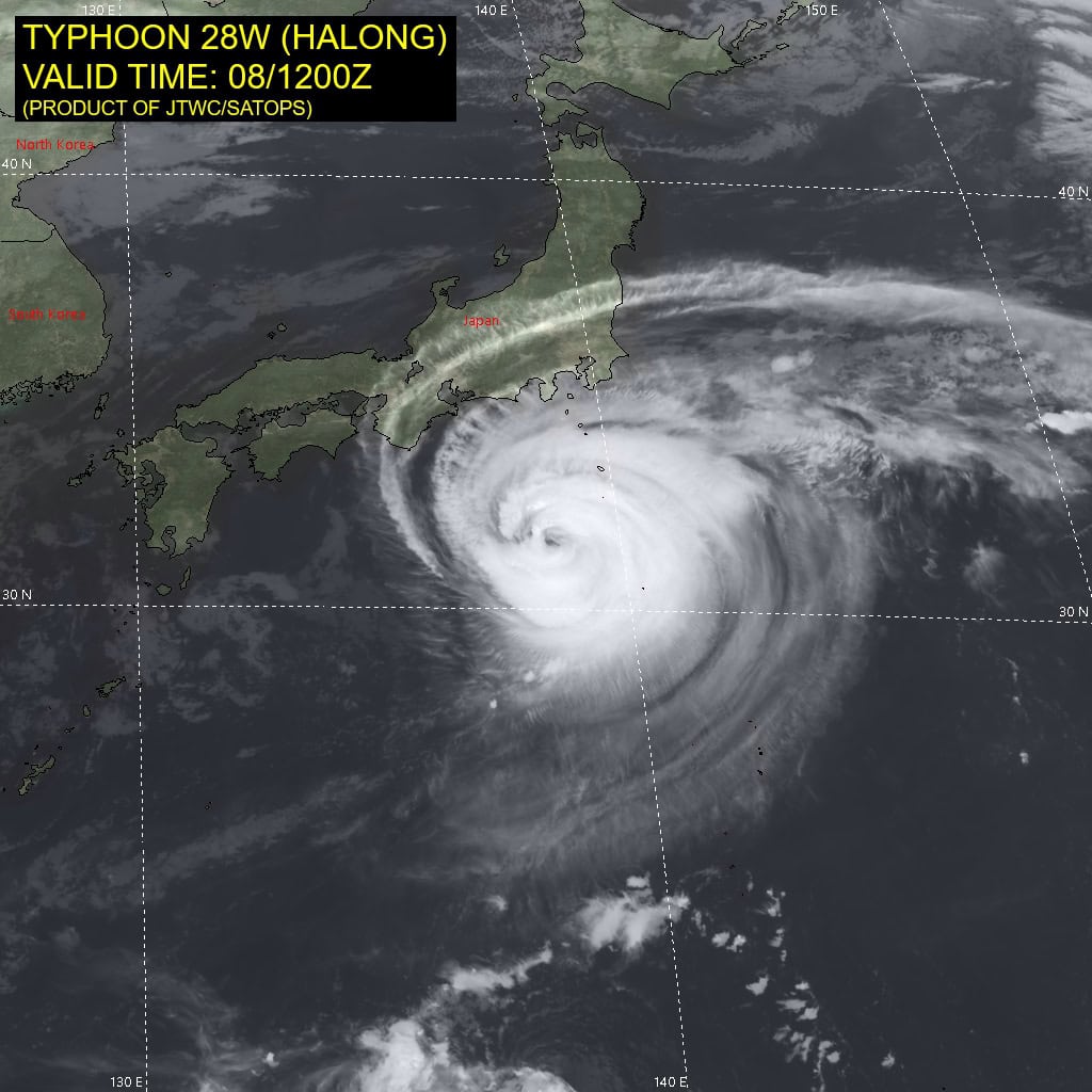
Tropical Cyclone 28W (Halong) is located approximately 155 NM south-southeast of Yokosuka, Japan
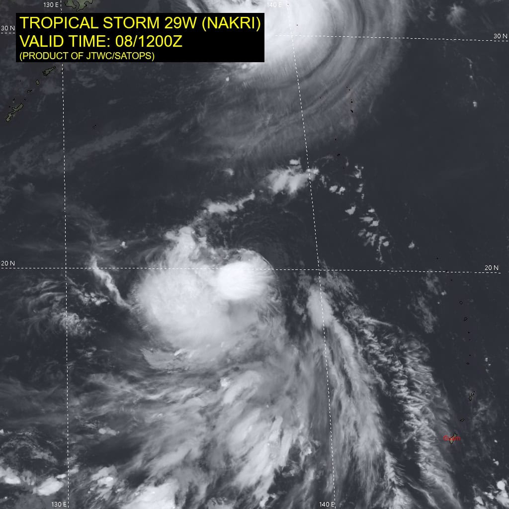
Tropical Cyclone 29W (Nakri) is located approximately 482 NM east-southeast of Kadena AB
Northeast Pacific Ocean:
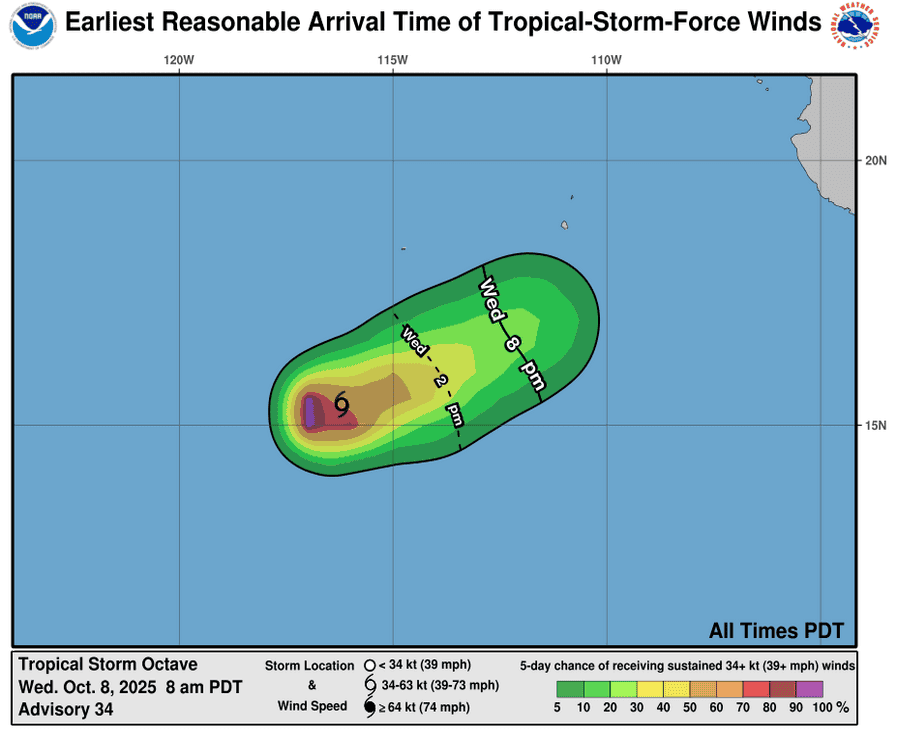
Tropical Cyclone 15E (Octave)
OCTAVE ACCELERATES EAST-NORTHEASTWARD, STILL A TROPICAL STORM
According to the NHC advisory number 36
Octave is moving toward the east near 12 mph (19 km/h). A gradual turn toward the northeast with an increase in forward speed is expected later today.
Maximum sustained winds are near 40 mph (65 km/h) with higher gusts. Some slight weakening is expected during the next day or so, and Octave is forecast to dissipate on Thursday.
Tropical-storm-force winds extend outward up to 60 miles (95 km) from the center. The estimated minimum central pressure is 1003 mb (29.62 inches).
Tropical Cyclone 16E (Priscilla)
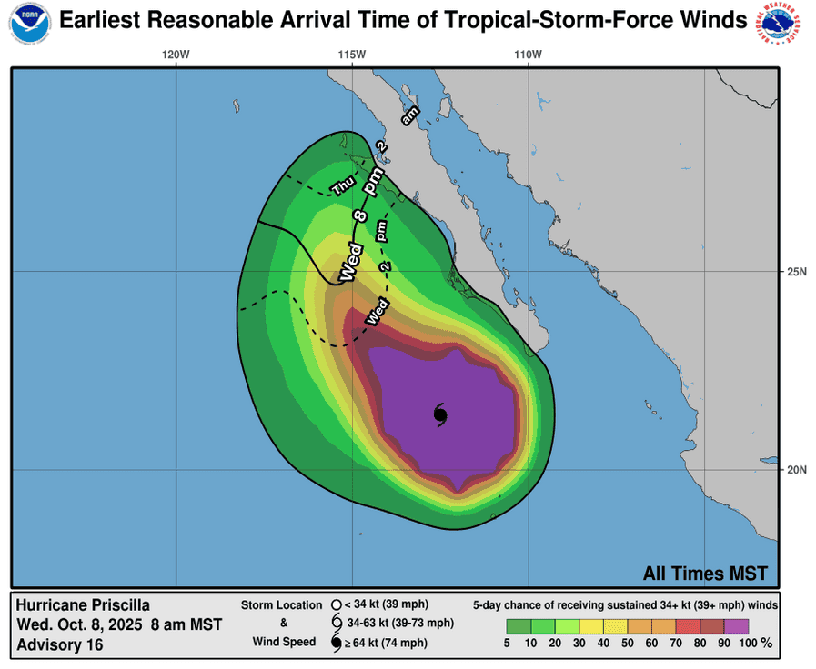
PRISCILLA OFF THE COAST OF BAJA CALIFORNIA SUR…INCREASED RISK OF FLOODING ACROSS THE U.S. SOUTHWEST DURING THE NEXT FEW DAYS
According to the NHC advisory number 18A
Priscilla is moving toward the northwest near 7 mph (11 km/h), and this general motion is expected to continue through Thursday, followed by a turn toward the north Thursday night. On the forecast track, the center of Priscilla is expected to move parallel to, but offshore of, the coast of Baja California Sur through Thursday.
Maximum sustained winds have decreased to near 75 mph (120 km/h) with higher gusts. Continued weakening is forecast during the next 48 hours.
Hurricane-force winds extend outward up to 45 miles (75 km) from the center and tropical-storm-force winds extend outward up to 160 miles (260 km). Los Cabos International Airport in Cabo San Lucas, Mexico, recently reported a sustained wind of 38 mph (61 km/h) with a gust to 49 mph (79 km/h). The estimated minimum central pressure is 982 mb (29.00 inches).
HAZARDS AFFECTING LAND WIND:
WIND: Tropical storm conditions are possible along the Pacific coast of Baja California Sur within the watch area today.
RAINFALL: As Priscilla moves off the west coast of Baja California, up to an inch of rain is expected across the Baja California peninsula. Farther north across the southwestern United States, heavy rain from Priscilla’s moisture is expected to lead to 2 to 4 inches, with local storm total amounts to 6 inches, across portions of central and northern Arizona and southern Utah from Thursday into Saturday morning. Scattered occurrences of flash flooding are anticipated from central Arizona across southern Utah and the Four Corners into southwest Colorado and far northwest New Mexico.
SURF: Large swells generated by Priscilla are affecting portions of the coast of southwestern and west-central Mexico, as well as portions of the coast of the southern Baja California peninsula. These swells are likely to cause life-threatening surf and rip current conditions, in addition to some coastal flooding.
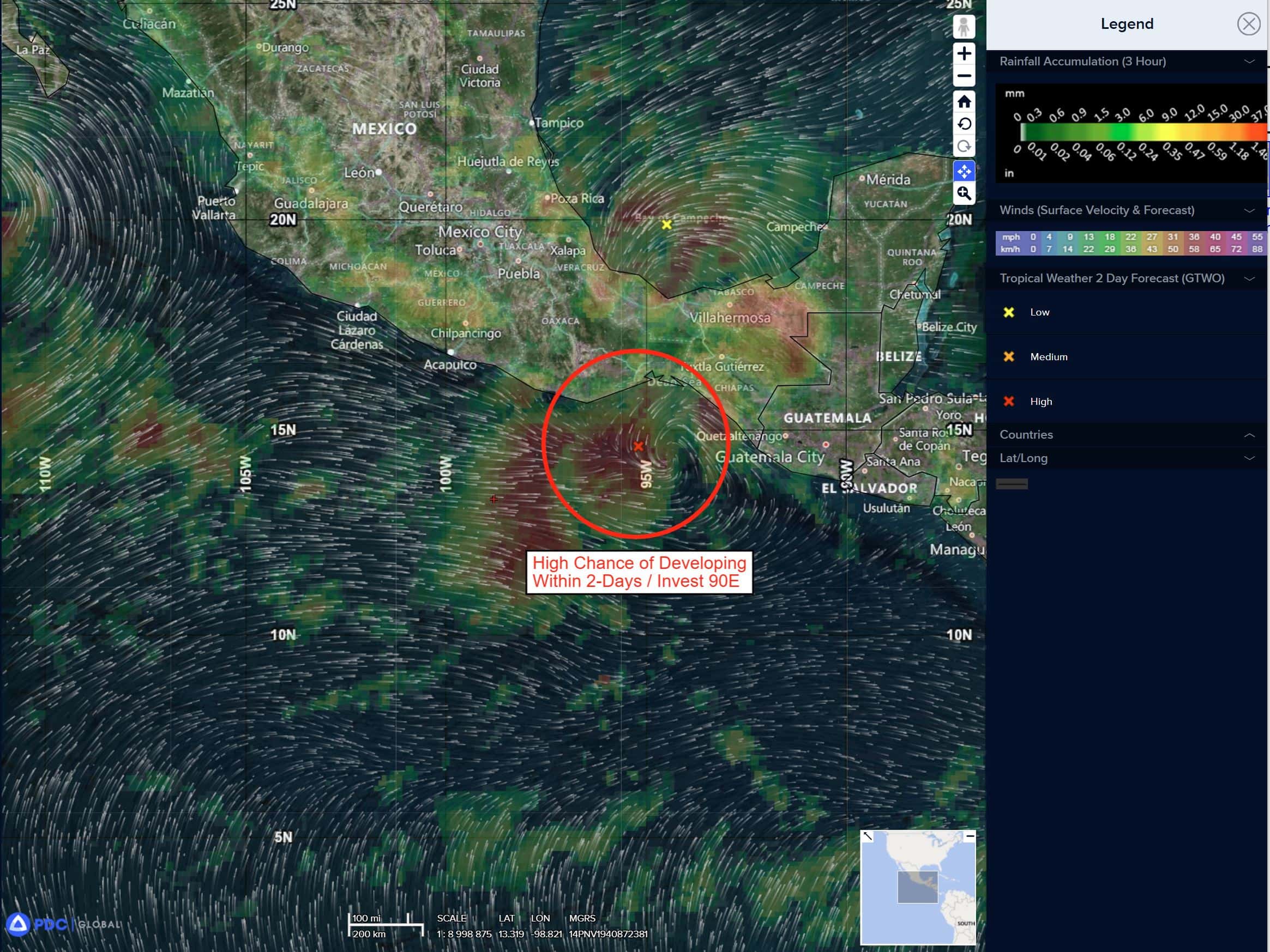
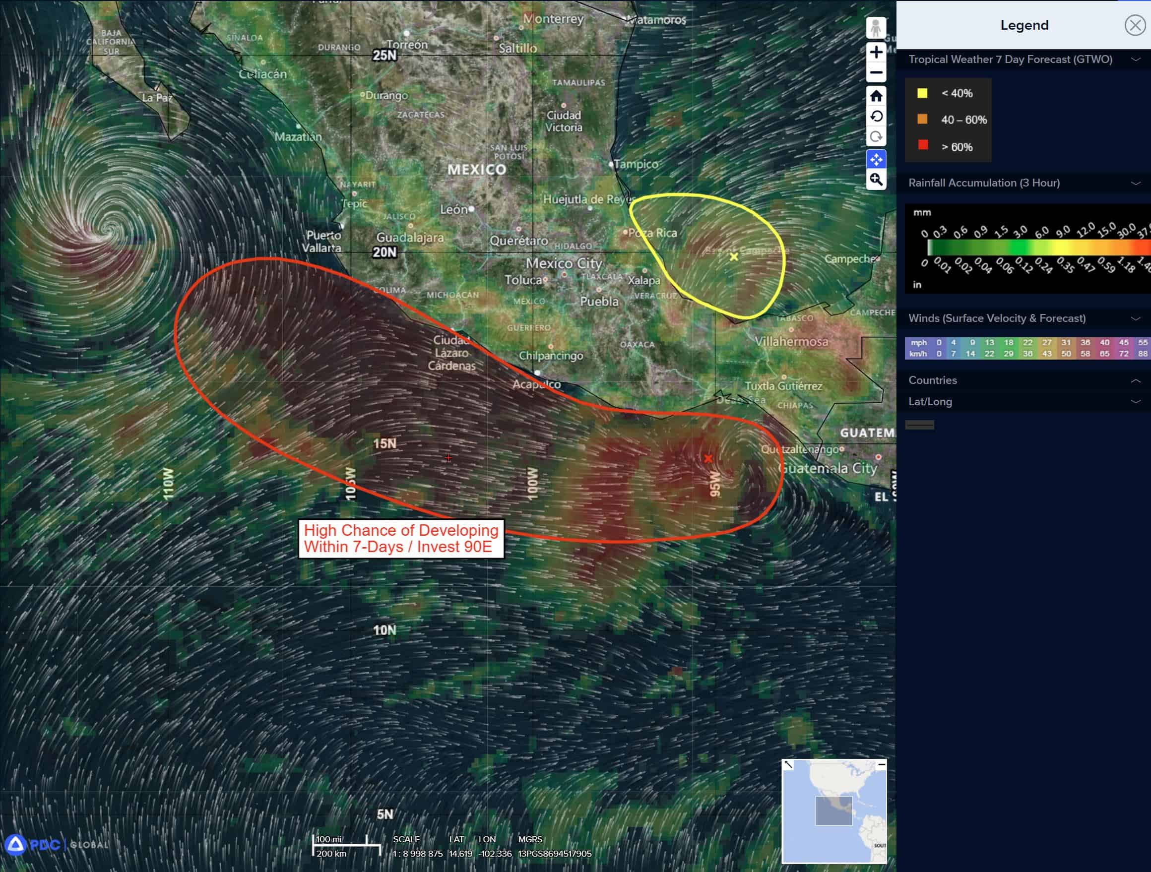
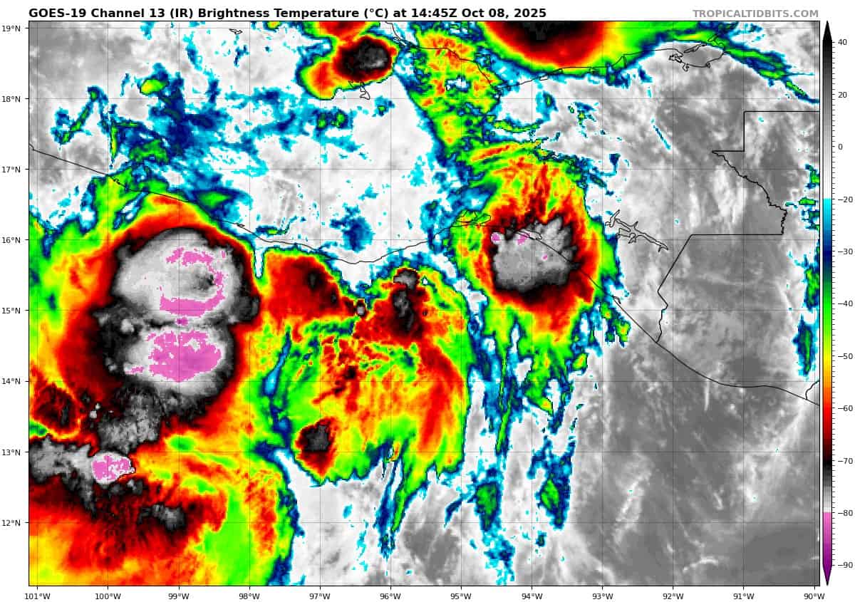
South of Southern Mexico:
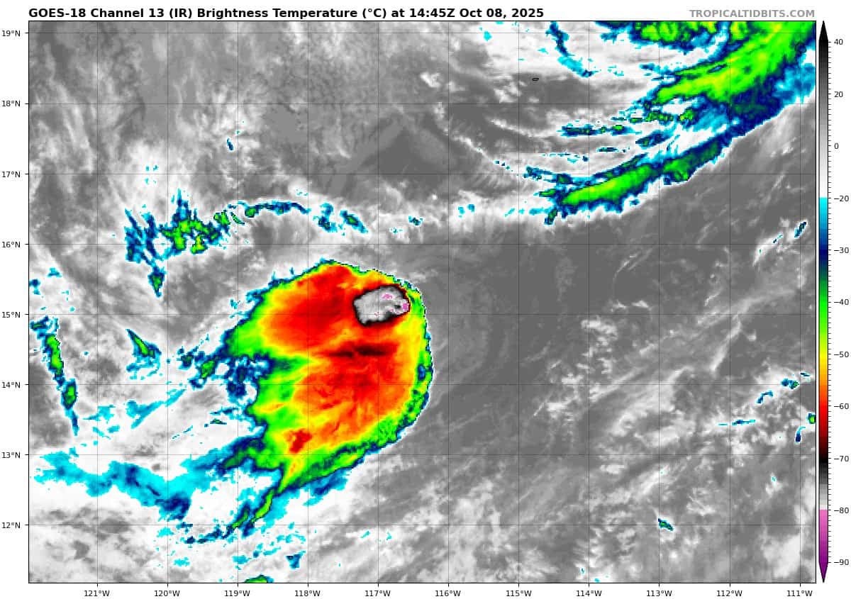
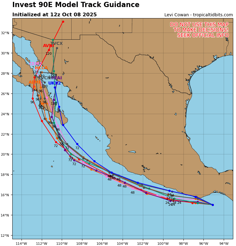
Invest 90E
>>> A large and persistent area of showers and thunderstorms remains disorganized near and to the west of a broad area of low pressure located in the Gulf of Tehuantepec. Environmental conditions appear conducive for gradual development over the next few days, and a tropical depression is likely to form late this week if the system remains over water. The disturbance is forecast to move west-northwestward at 10 to 15 mph, roughly parallel to the coast of southern and southwestern Mexico, and interests there should monitor its progress. Regardless of development, the disturbance is expected to produce periods of heavy rainfall along portions of the southern and southwestern coasts of Mexico through the end of the week, which could lead to localized flooding.
* Formation chance through 48 hours…high…80 percent
* Formation chance through 7 days…high…80 percent
Central Pacific Ocean: There are no Tropical Cyclones
Tropical cyclone formation is not expected during the next 7 days.
Western Pacific, Indian Ocean, and adjacent Seas:
Western Pacific
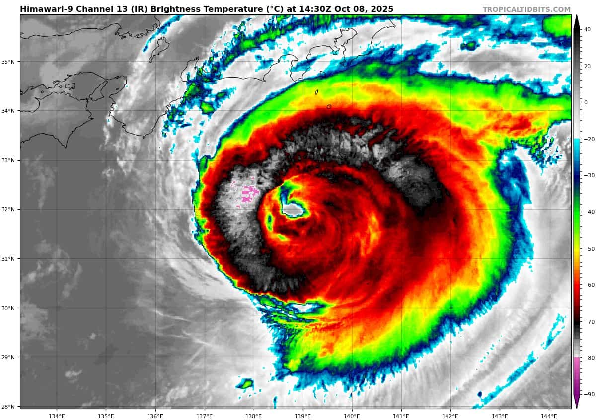
Tropical Cyclone 28W (Halong)
According to the JTWC warning number 19, sustained winds were 105 knots with gusts to 130 knots
Animated multi-spectral satellite imagery (msi) depicts typhoon 28W (Halong) with an evident eye feature that has become less symmetrical over the past 6 hours. The associated convection outside of the eyewall has sustained temperatures between -73 and -75 c. Strong radial outflow persists.
Environmental conditions are now marginally favorable with the system reaching an area of elevated vertical wind shear (between 15-20 kts), slightly cooler sea temperatures (27-28 c), as well as dry air in the vicinity, though not yet penetrating the core.
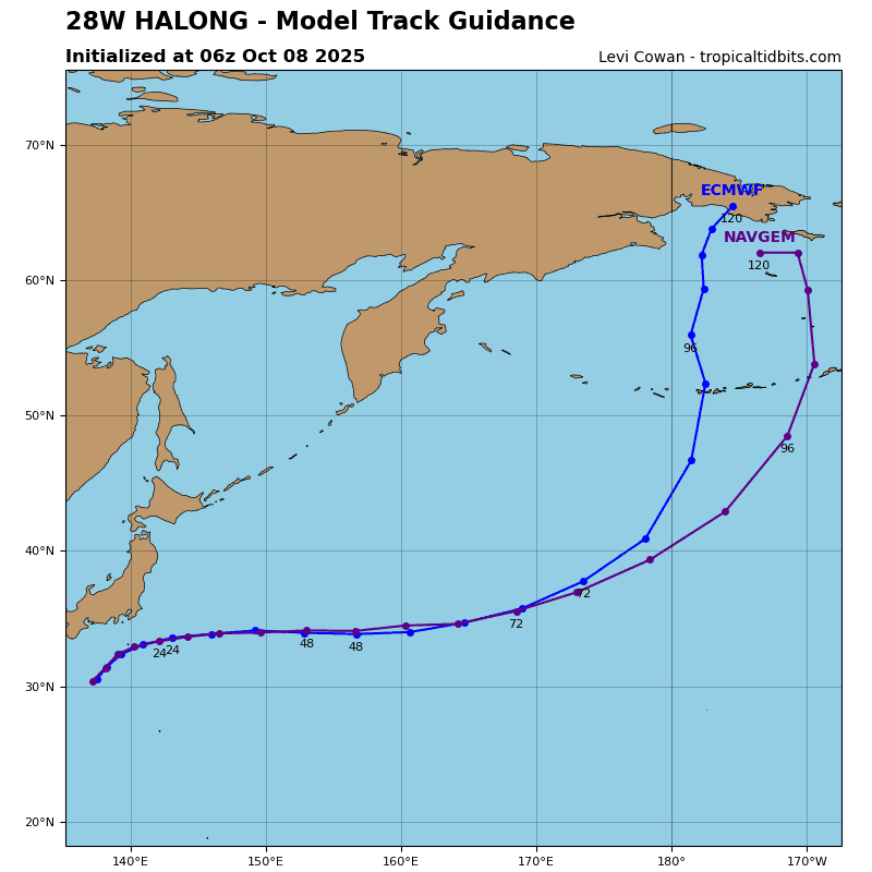
TY 28W is forecast to continue on a east-northeastward track around the western-most extent of the deep-layer subtropical ridge to the southeast. This movement will continue through the remainder of the forecast with the ridge continuing to steer the system northeast as it transition to its extratropical phase.
With regard to intensity, typhoon Halong is forecast to maintain around 120 knots over the next 12 hours and then start to weaken as it continues in the forecast marginal environment. By 24 hours, vws (20+ kts), dry air wrapping into the southern semicircle, and cooler sea surface temperatures (26-27 c) will bring TY 28W down to 115 knots. The extratropical transition will rapidly progress and by 72 hours, TY 28W is forecast to become fully extratropical, while maintaining surface intensities of 45 knots under the influence of the mid-latitude upper-level jet.
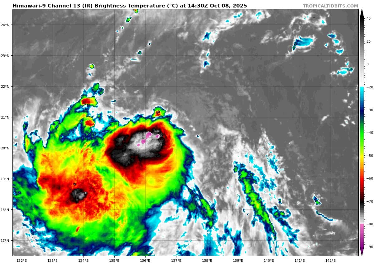
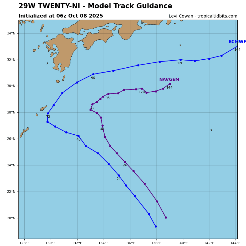
Tropical Cyclone 29W (Nakri)
According to the JTWC warning number 4, sustained winds were 40 knots with gusts to 50 knots
Animated multi-spectral satellite imagery (msi) depicts a partially exposed low-level circulation center (llcc) associated with tropical depression 29W (Nakri). The system has recently consolidated from a trough cup feature, into a complete circulation within the last few hours, while simultaneously developing persistent convection near the center.
Environmental analysis reveals marginally favorable conditions. Upper-level flow indicates moderate westward and equatorward outflow driven by an upper-level anticyclonic flow centered just to the north of the system, with diffluent region to the south of it.
Sea surface temperatures (sst) are warm (29-30 c), while vertical wind shear (vws) is borderline unfavorable with upper range of 15-20 knots. Additionally, dry air can be observed throughout the northern and eastern section of the circulation further inhibiting any serious intensification.
TD Nakri is forecast to track northwestward for the next 72 hours, under primary influence from a str centered to the northeast. However, another str building to the north of Taiwan will eventually introduce a completing mechanism, which will result in slower speed over water and potentially even a slight westward turn just prior to 72 hours.
Currently available numerical model guidance indicates that the ridge to the east-northeast will
begin to build again soon after, resulting in assuming the primary steering yet again, and resulting in a recurvature of the track for TD Nakri.
In terms of intensity, the system is forecast to remain in a marginally favorable environment for intensification, driven by offsetting parameters mentioned earlier. As a result, multi-model intensity consensus indicates moderate intensification of the system throughout the forecast period.
Of note, after the northeastward turn, most models indicate significant intrusion of dry air, as well as gradually increasing vws resulting in a cap on peak intensity, which is currently assessed at 55-60 knots, and forecast to occur around 96 hours.