The Pacific Disaster Center’s (PDC Global) Friday, October 3, 2025, Tropical Cyclone Activity Report…for the Pacific Ocean, the Indian Ocean, and adjacent Seas
Current Tropical Cyclones:
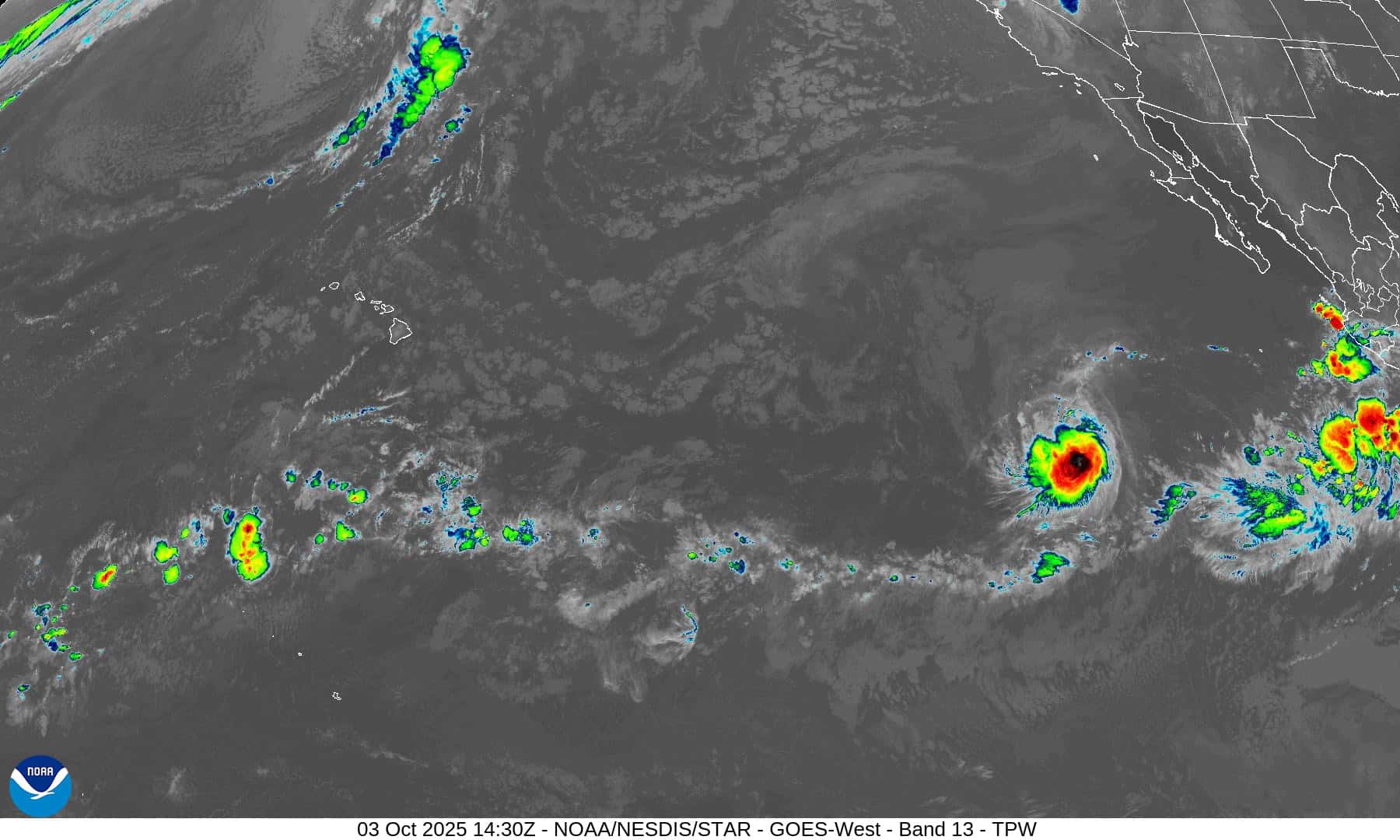
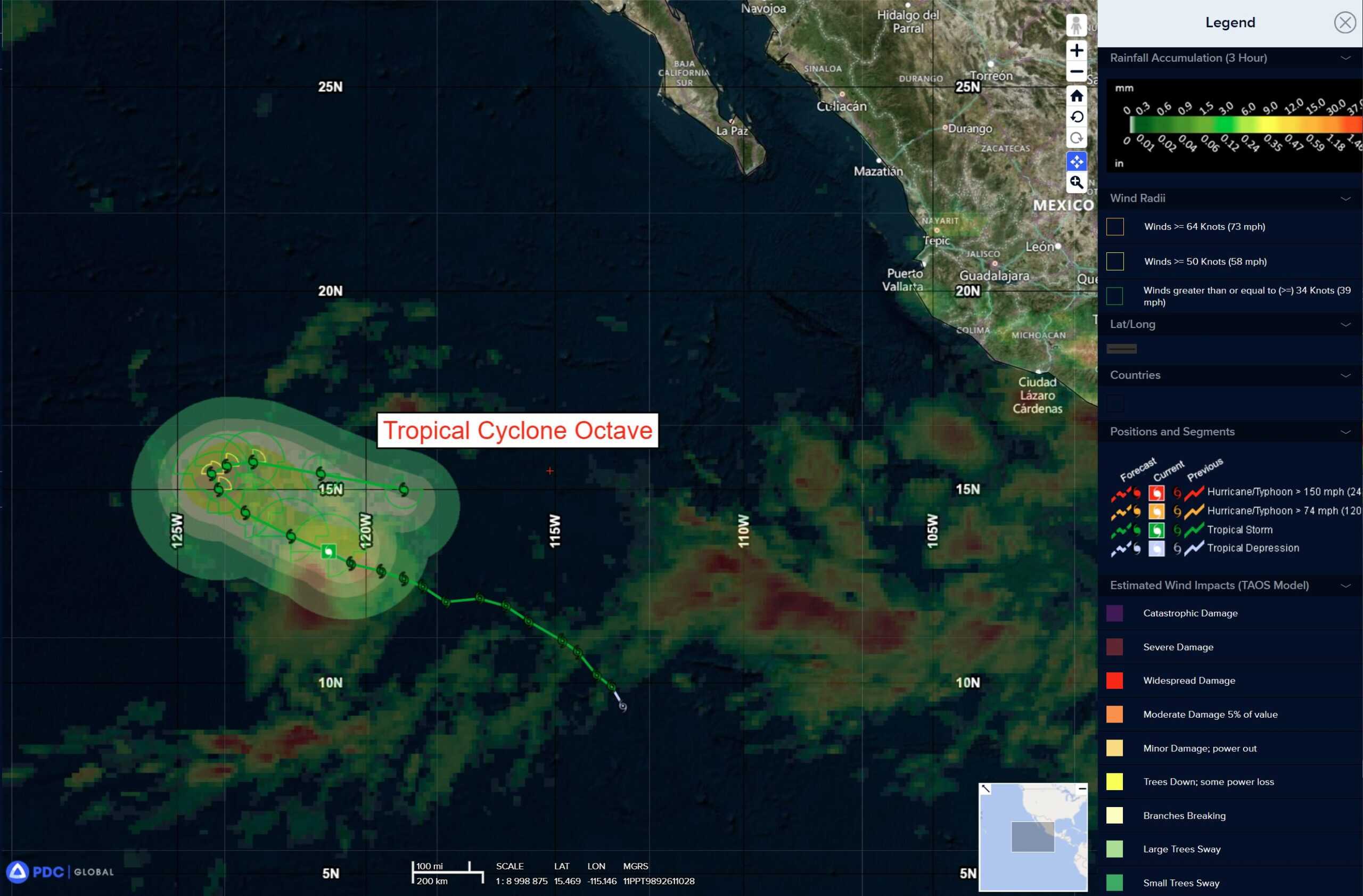
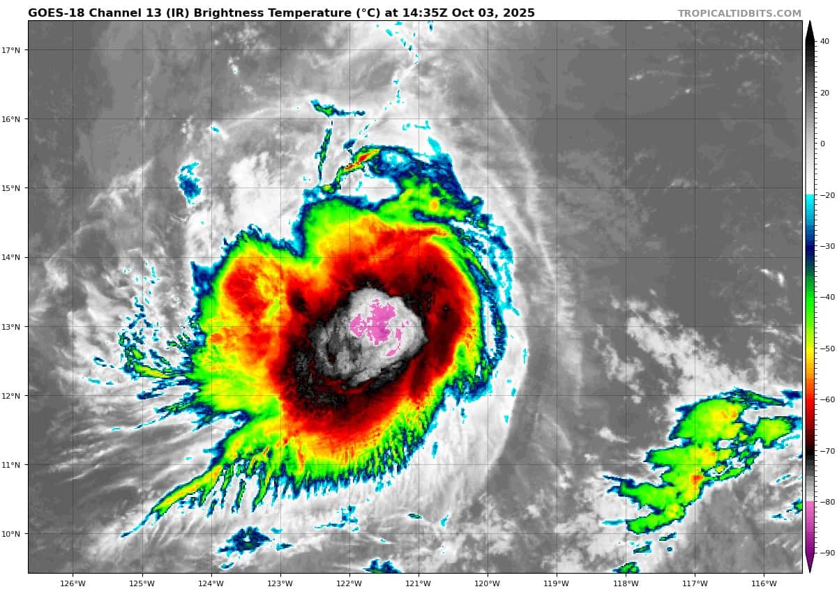
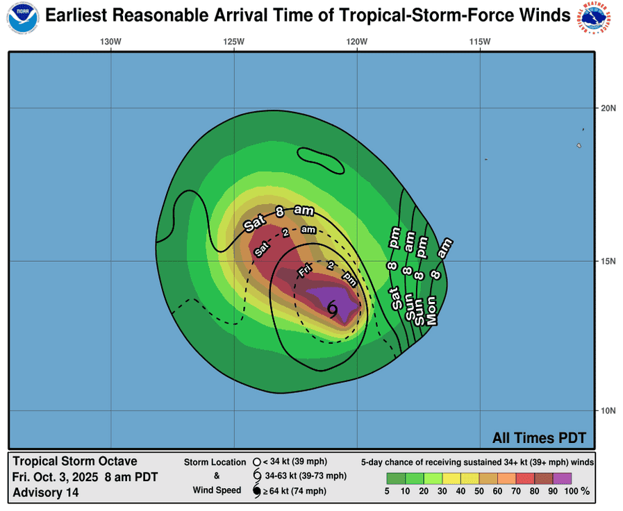
Tropical Cyclone 15E (Octave) is located about 1000 miles southwest of the southern tip of Baja California
Tropical Cyclone 27W (Matmo) is located about 246 NM northwest of Manila, Philippines
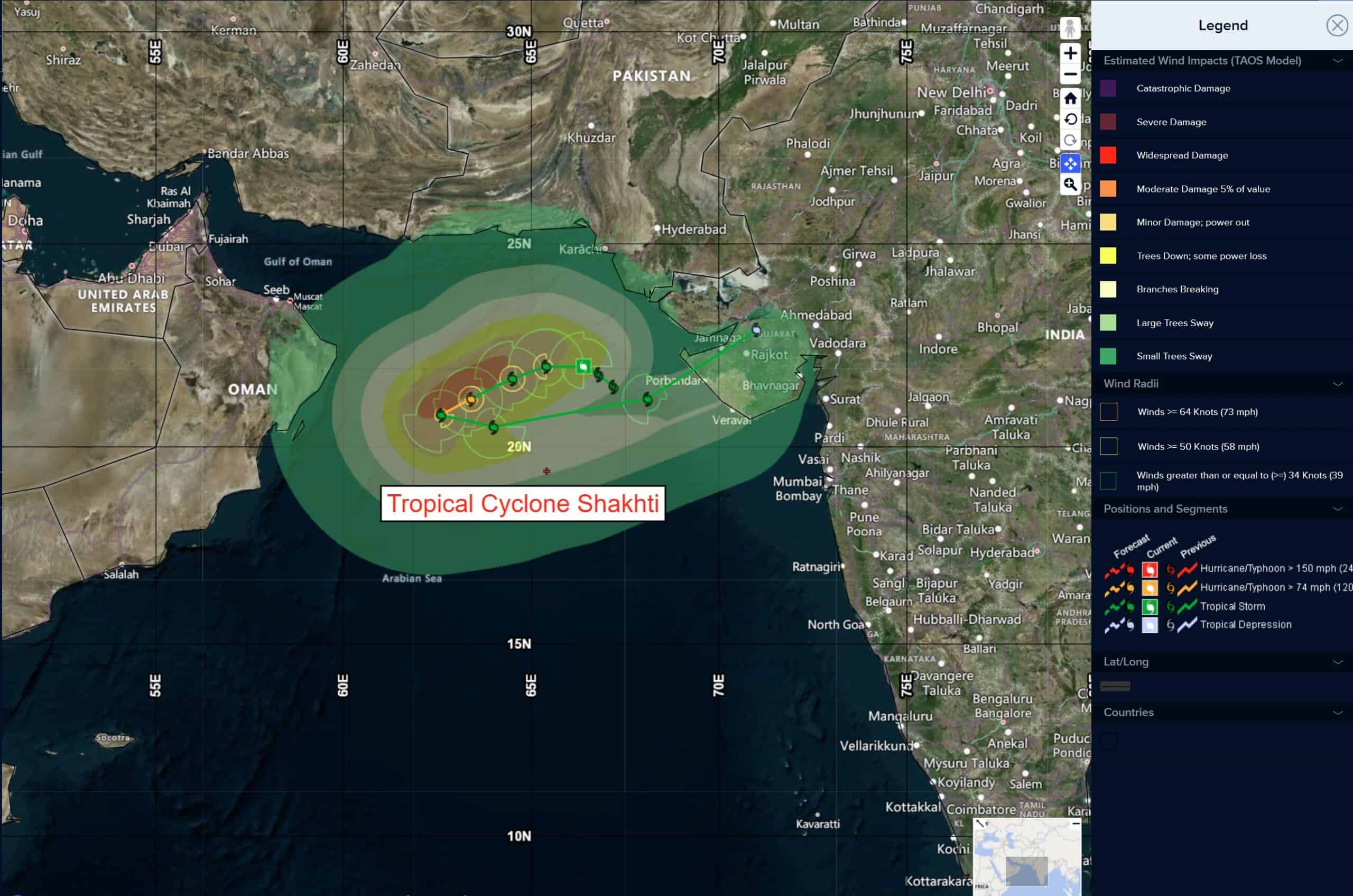
Tropical Cyclone 02A (Shakhti) is located about 404 NM east-northeast of Masirah Island
Northeast Pacific Ocean:
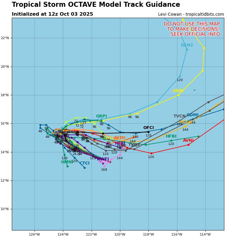
Tropical Cyclone 15E (Octave)
OCTAVE HEADING STEADILY WEST-NORTHWESTWARD
According to the NHC advisory number 15
Octave is moving toward the west-northwest near 8 mph (13 km/h) and this motion is expected to continue through tonight. The tropical storm is expected to slow and turn northward on Sunday, and then turn slowly eastward early next week.
Maximum sustained winds have increased slightly to near 60 mph (95 km/h) with higher gusts. Small fluctuations in intensity are expected today. Some additional strengthening is possible by the end of the weekend.
Tropical-storm-force winds extend outward up to 70 miles (110 km) from the center. The estimated minimum central pressure is 1000 mb (29.53 inches).
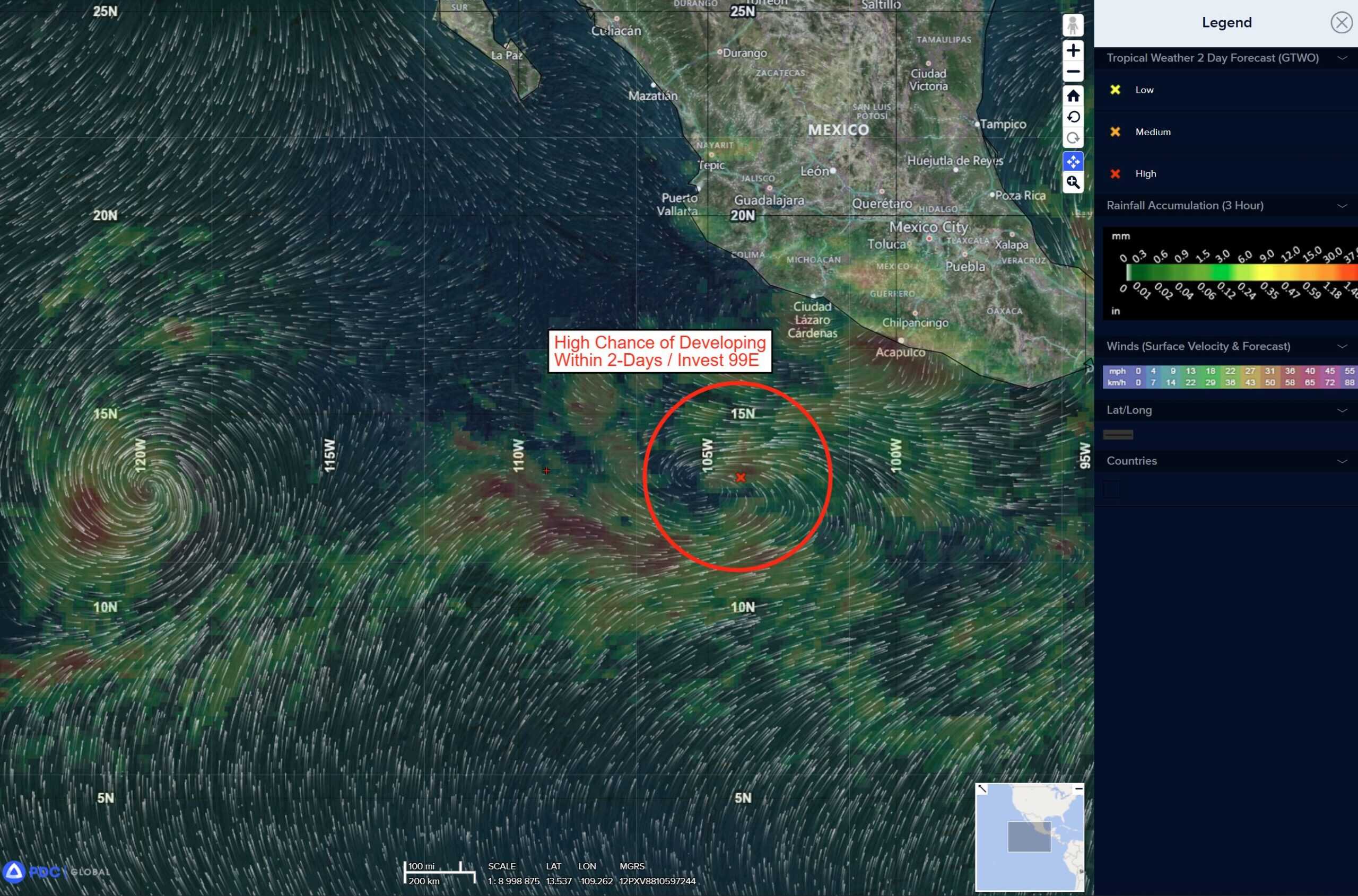
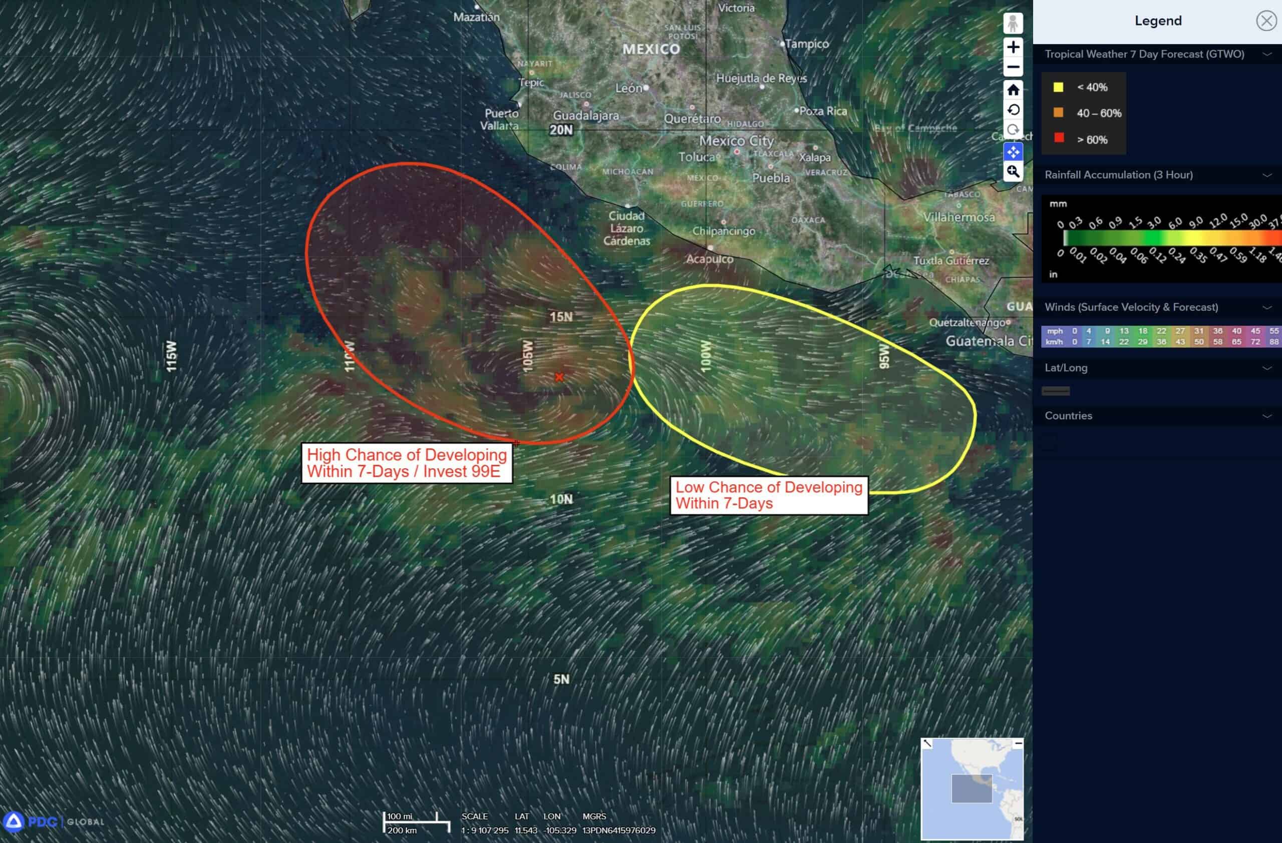
Offshore of the southwestern Coast of Mexico:
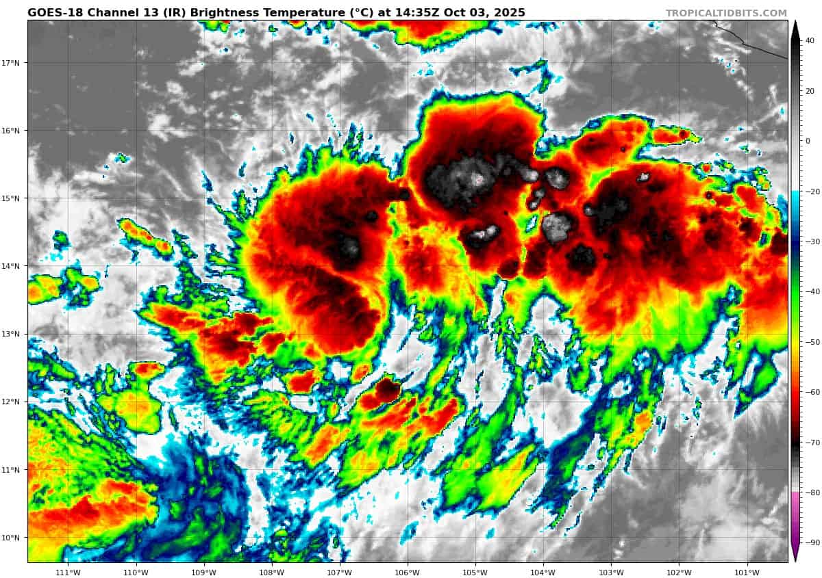
Invest 99E
>>> Shower and thunderstorm activity associated with a broad low pressure system located a few hundred miles off the coast of southwestern Mexico is gradually becoming better organized. Additional development is expected, and a tropical depression will likely form later today or tomorrow. The system is forecast to move very slowly west-northwestward, parallel to but offshore of the southwestern coast of Mexico for the next several days. Interests along the southwestern coast of Mexico should monitor the progress of this system.
* Formation chance through 48 hours…high…90 percent
* Formation chance through 7 days…high…90 percent
South of Southern Mexico:
>>> An area of low pressure is expected to form off the south coast of Mexico by the middle of next week. Environmental conditions are expected to be conducive for gradual development of the disturbance thereafter while it moves generally west-northwestward to northwestward near or parallel to the coast of Mexico.
* Formation chance through 48 hours…low…near 0 percent
* Formation chance through 7 days…low…30 percent
Central Pacific Ocean: There are no Tropical Cyclones
Tropical cyclone formation is not expected during the next 7 days.
Western Pacific, Indian Ocean, and adjacent Seas:
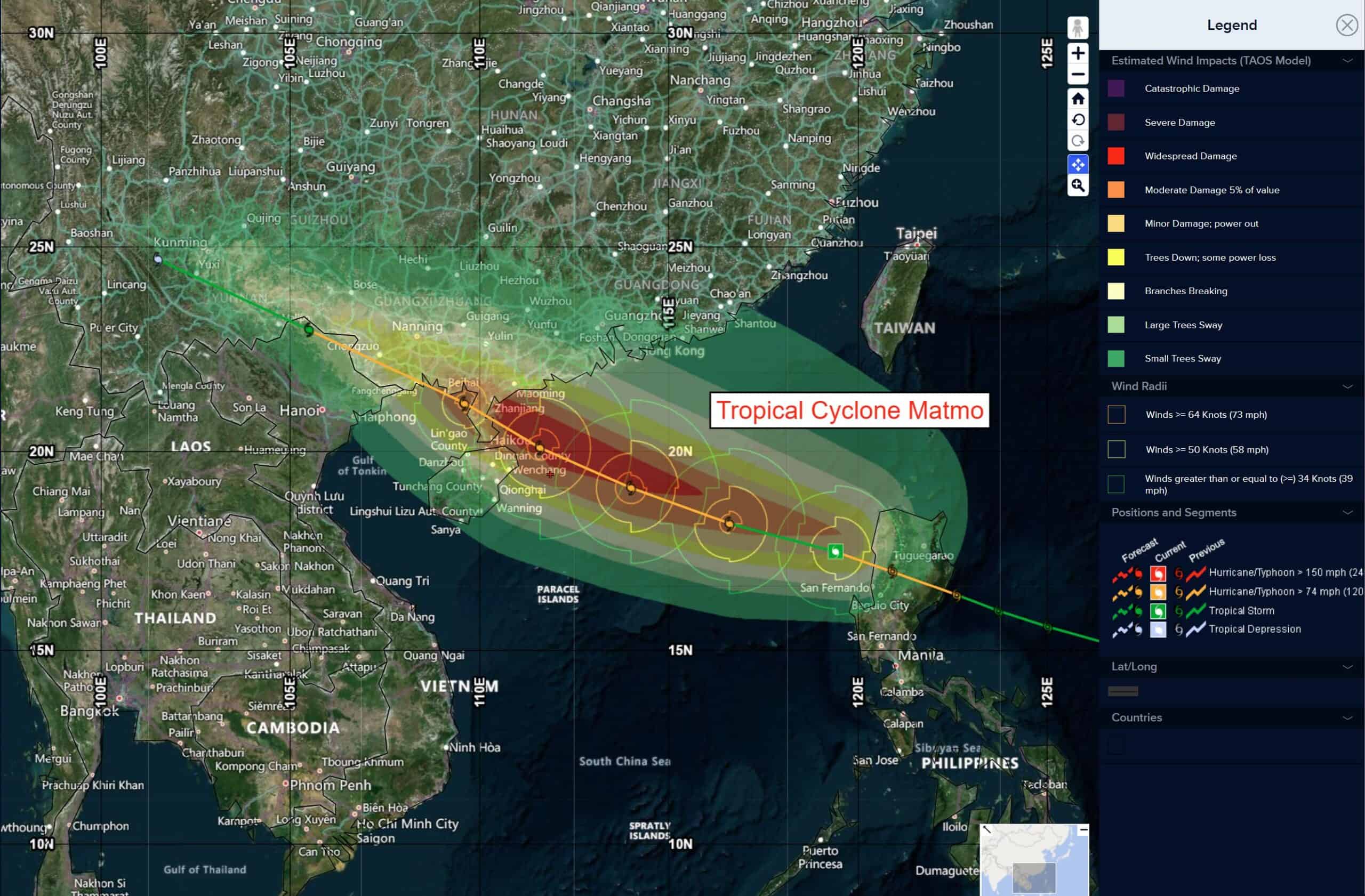
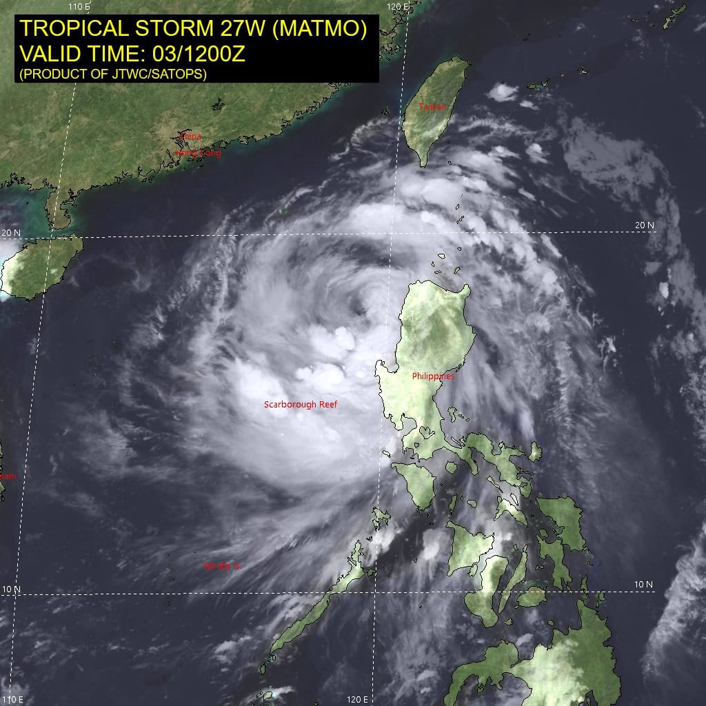
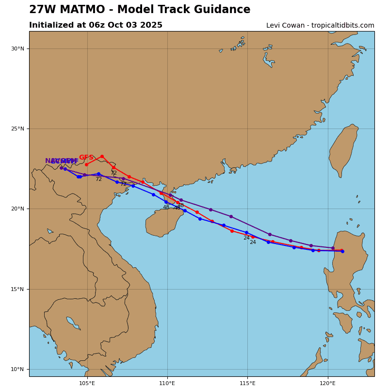
Tropical Cyclone 27W (Matmo)
According to the JTWC warning number 11, sustained winds were 60 knots with gusts to 75 knots
Animated multi-spectral satellite imagery (msi) depicts deep convective banding pattern wrapping into the low-level circulation
center (llcc) of typhoon 27W (Matmo), while the system transits over northern Luzon, Philippines. Impressive central dense overcast and associated feeding bands extend well beyond the
perimeter of the island.
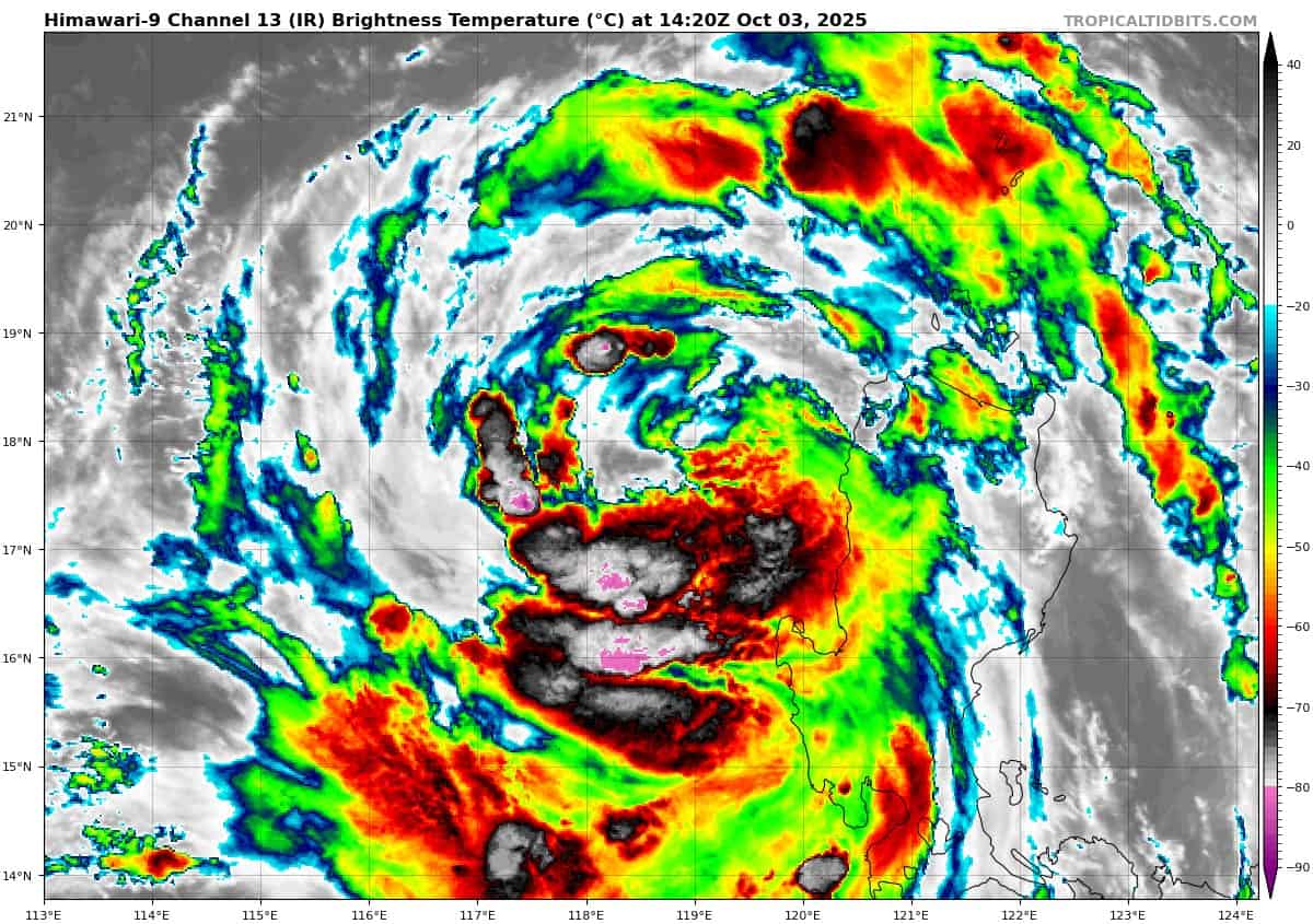
As the center of the system approaches the South China Sea, it will remain embedded in a favorable synoptic environment, characterized by enhanced radial outflow resulting from upper-level divergence, with a particularly strong westward component, sea surface temperatures (sst) between 29-30 c surrounding Luzon, low vertical wind shear (5-10 kts), and a moist tropospheric
column, which supports sustained deep convection.
TY 27W is expected to continue tracking northwestward under the influence of a persistent subtropical ridge (str) located to the north. Interaction with the rugged terrain over Luzon is causing some frictional disruption to the low-level inflow, however the system being fed by outer bands remaining over warm water does not appear to be particularly affected. Subsequently, TY Matmo is forecast to re-emerge over the South China Sea within the next few hours.
Environmental conditions, including sst values (28-29 c) will remain conducive to re-intensification. TY Matmo is expected to track along the southern periphery of a str to the north toward the
Chinese coast.
The synoptic environment is forecast to remain favorable for intensification, with peak intensity expected to reach 85 knots before final landfall. The current track forecast suggests a primary landfall just north of Hainan Island, over the Leizhou Peninsula, around 48 hours, followed by a secondary landfall near the China-Vietnam border between 48 and 72 hours.
Afterward, the system is expected to weaken steadily due to increasing land interaction and dissipate before the end of the forecast period.
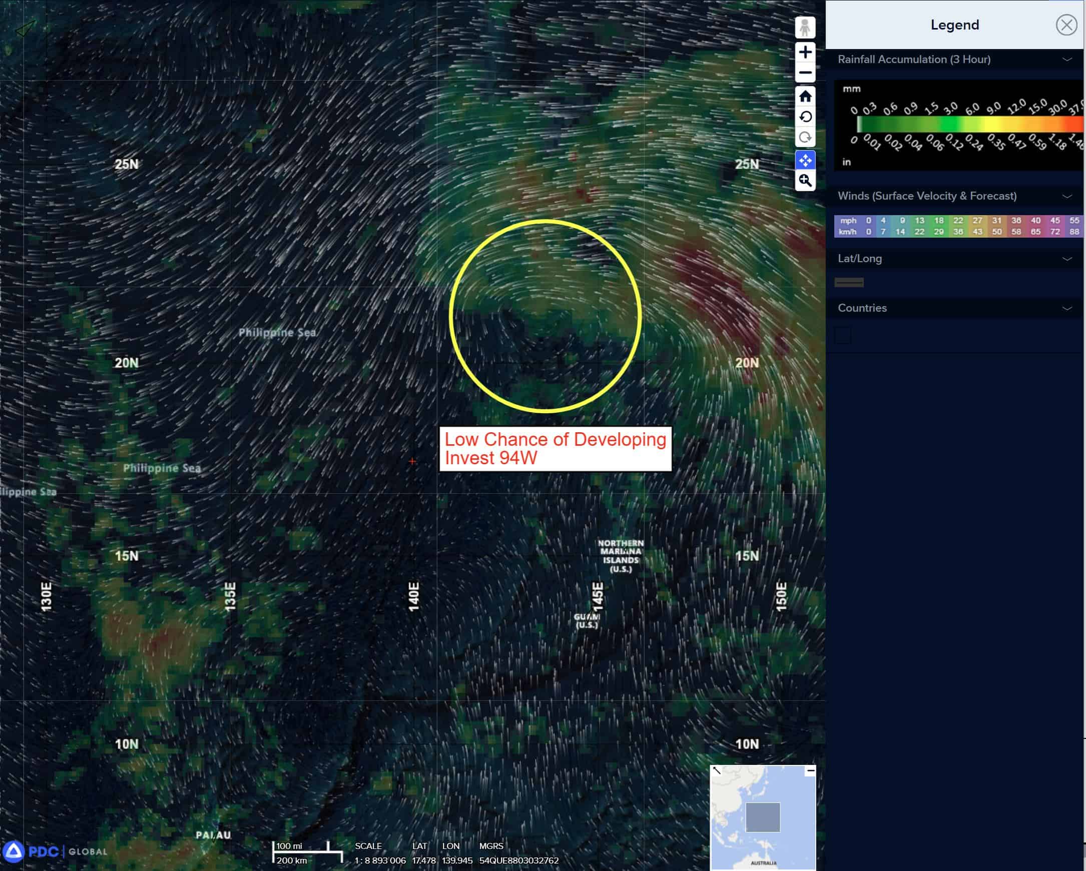
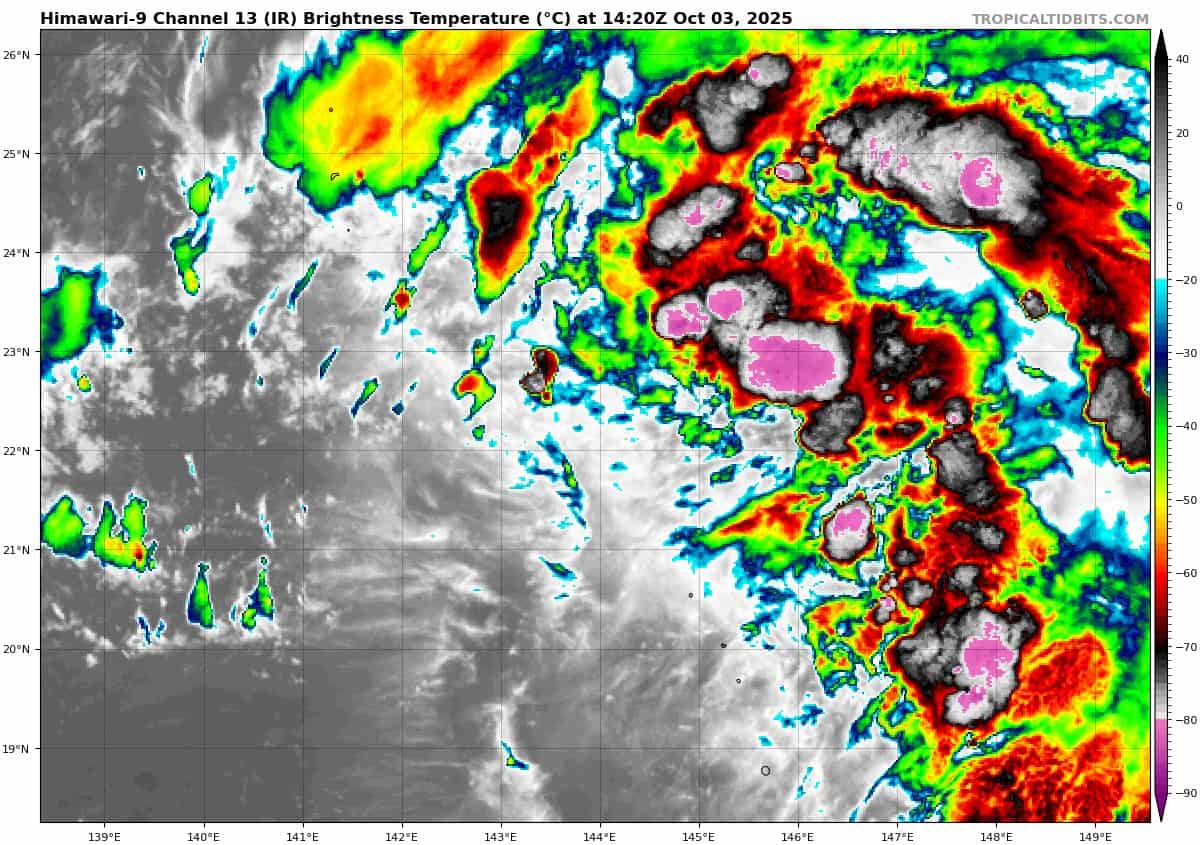
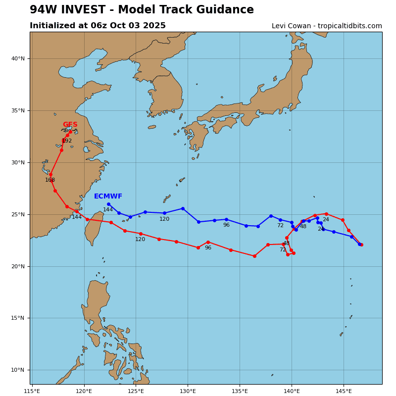
>>> There’s an area of disturbed weather being referred to as Invest 94W, which is located approximately 264 NM southeast of Iwo To, Japan
Animated enhanced infrared imagery (eir) as well as a 031122z metop-b ascat pass reveal a very broad area of turning with flaring convection over the eastern periphery with no discernable llcc. The aforementioned ascat pass further highlights the wave like nature of this area (94W) with wrapping 10-15 knot winds along the eastern boundary and weak multi directional winds along the western boundary.
Environmental conditions for this system indicate marginally favorable conditions with low to moderate vertical wind shear (15-20 knot), warm sea surface temperatures (28-29c) and moderate outflow aloft.
Global deterministic models are in good agreement that 94W will continue to track west over the next 48-72 hours and gradually consolidate.
Maximum sustained surface winds are estimated at 18 to 23 knots.
Minimum sea level pressure is estimated to be near 1011 mb.
The potential for the development of a significant tropical cyclone within the next 24 hours is low.
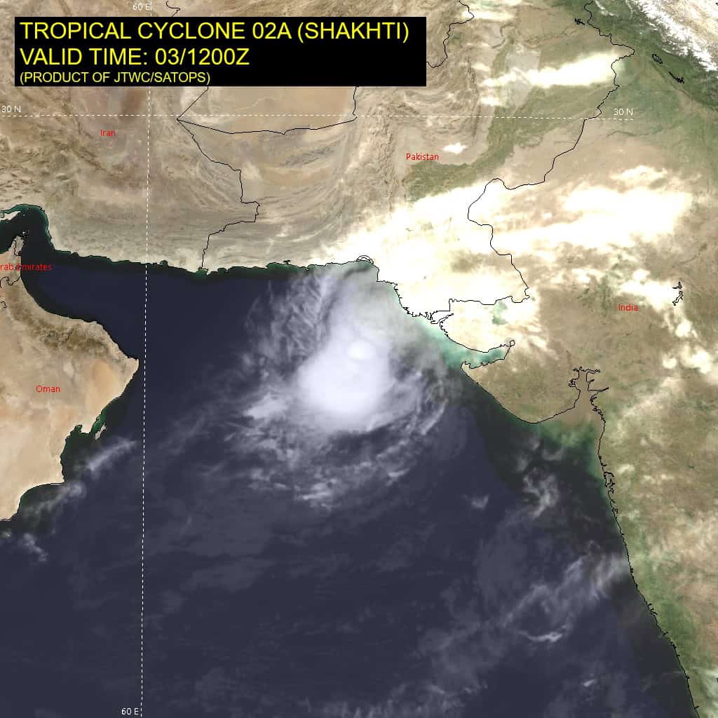
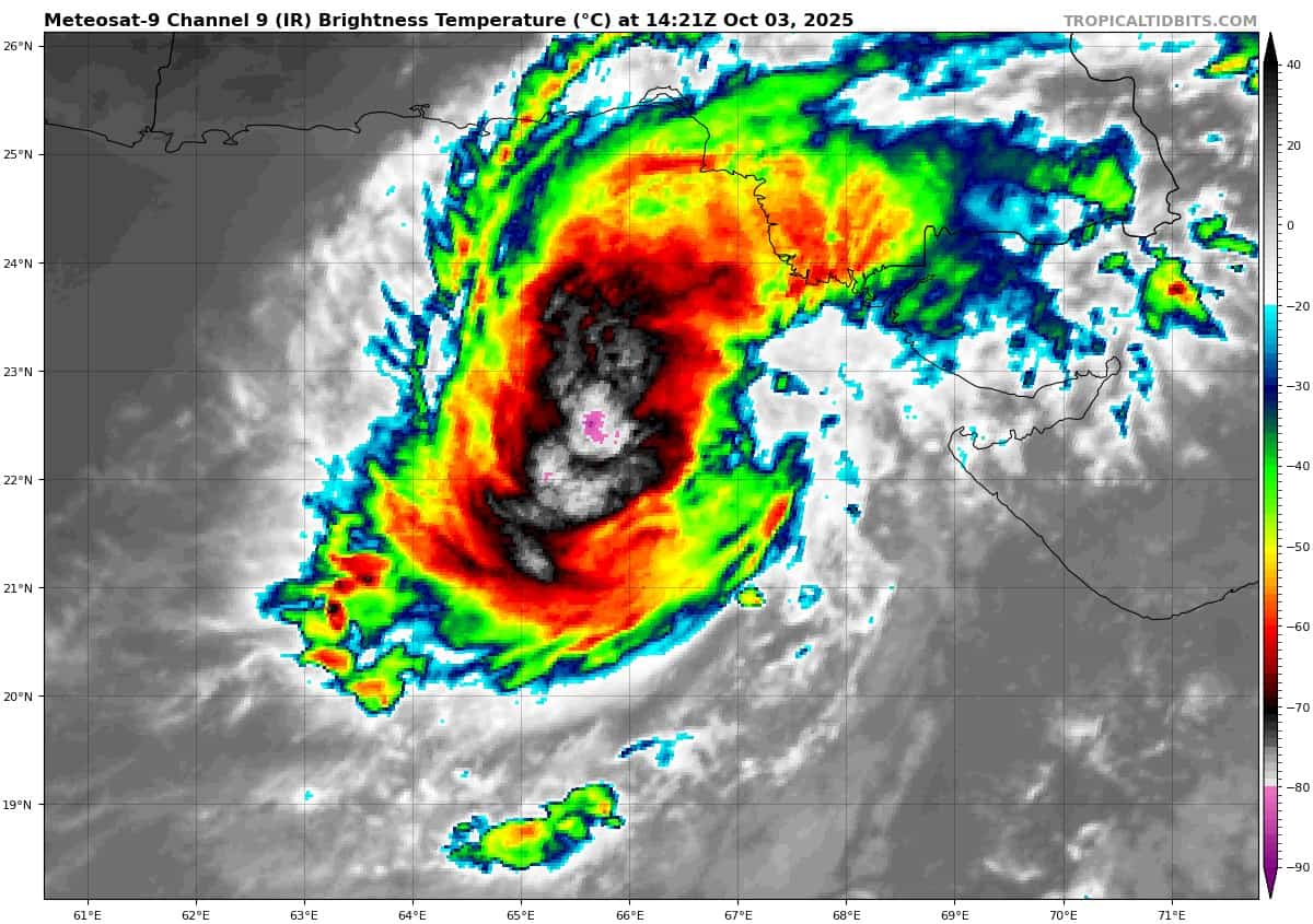
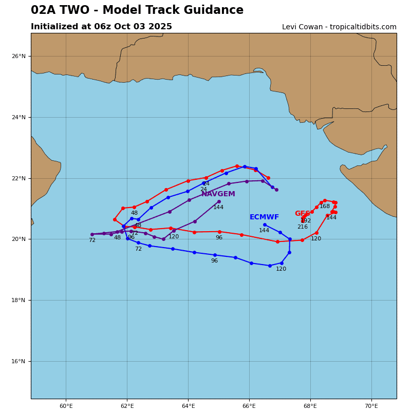
Tropical Cyclone 02A (Shakhti)
According to the JTWC warning number 3, sustained winds were 45 knots with gusts to 55 knots
Animated multi-spectral satellite imagery (msi) depicts a compact and slowly developing tropical cyclone 02A. the initial position is placed with medium confidence based on persistent central convection obscuring the low-level circulation center (llcc).
Environmental analysis reveals condition favorable for further intensification, characterized by warm (28-29 c) sea surface temperatures (sst), strong upper level divergence assisting with the outflow, as well as low (5-10 knot) vertical wind shear (vws).
TC 02A is currently quasi-stationary with 5 knot or below translation speeds over the last 12 hours. The system is forecast to begin turning west-southwestward under the influence of a strengthening ridging pattern to the north within the next 12 hours.
As a result, the system is expected to consolidate and intensify, reaching peak intensity of 55-65 knots within the next 48 hours. Around that time however, a deep shortwave trough developing north of the steering ridge will erode the pattern and shift the primary steering influence to another str centered to the southeast of the system.
This will not only reverse the track motion to east-northeastward, but also result in a weakening trend, driven by increasing vertical
wind shear, but also increased dry air entrainment into the core of
the vortex. As the system then transits toward state of Gujarat,
India it will begin its dissipation, which is expected to be complete by or before 120 hours, and after landfall.

")