Western Pacific, Indian Ocean, and adjacent Seas:
Western Pacific

")

By PDC’s Senior Weather
Specialist Glenn James

The Pacific Disaster Center’s (PDC Global) Tuesday, September 30, 2025, Tropical Cyclone Activity Report…for the Pacific Ocean, the Indian Ocean, and adjacent Seas
Current Tropical Cyclones:
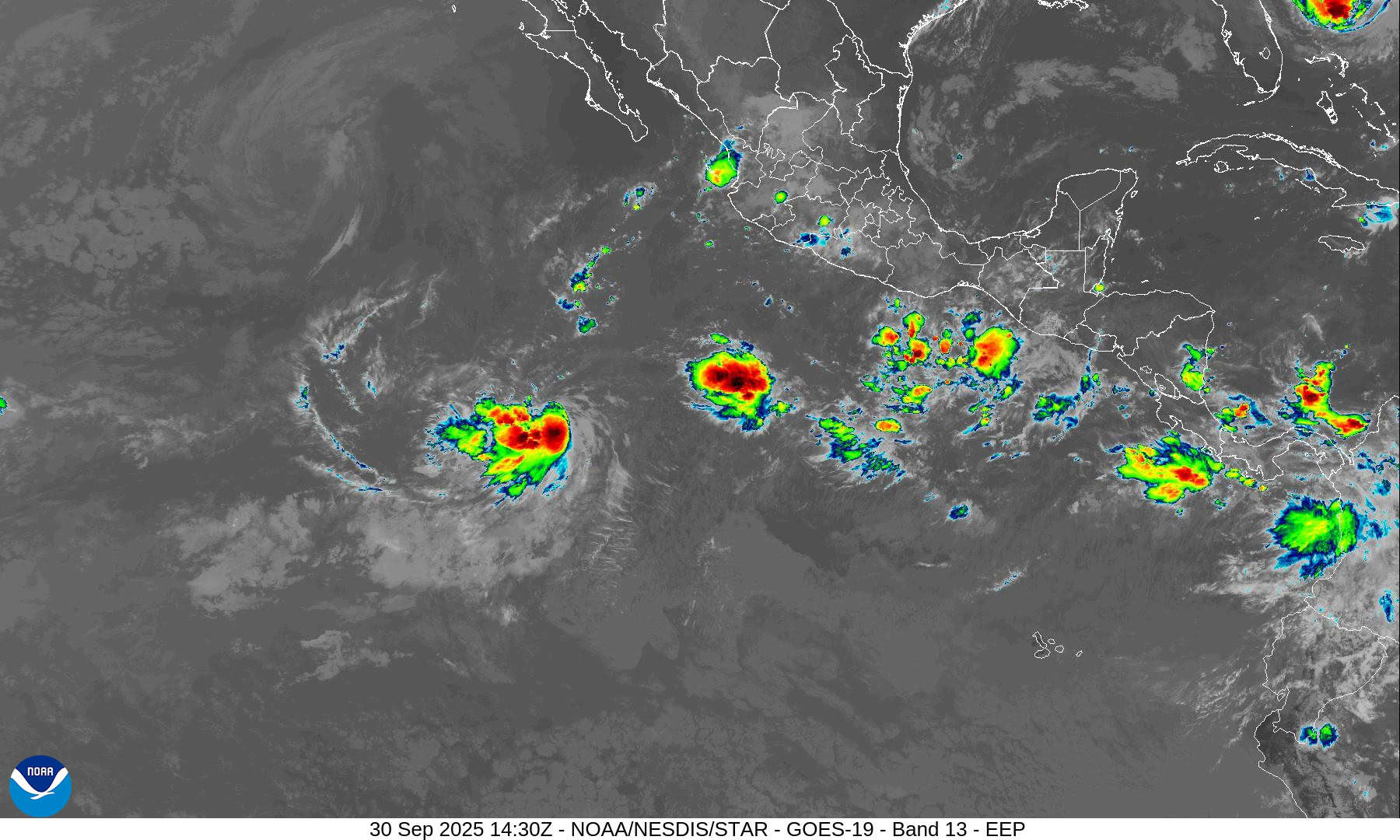
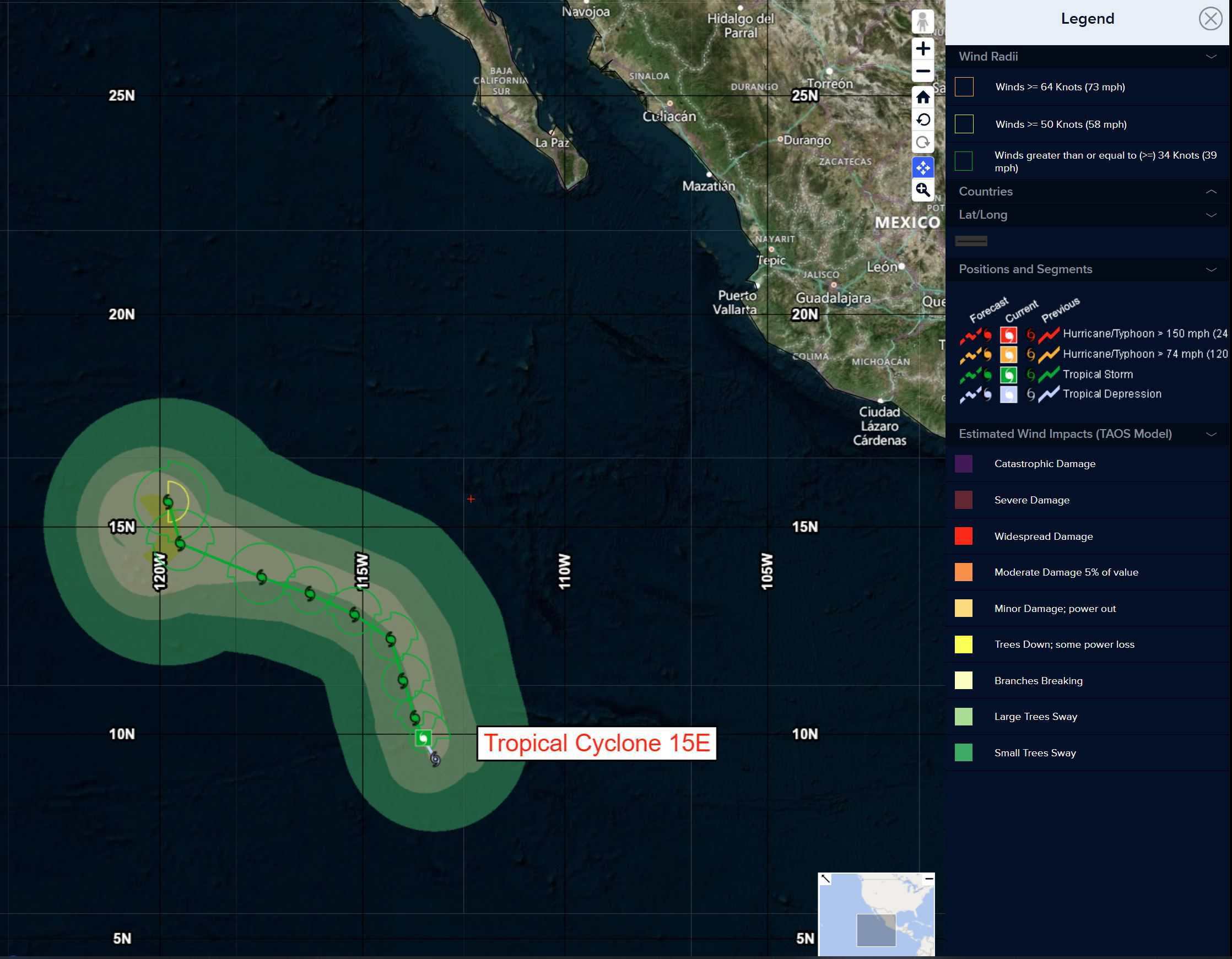
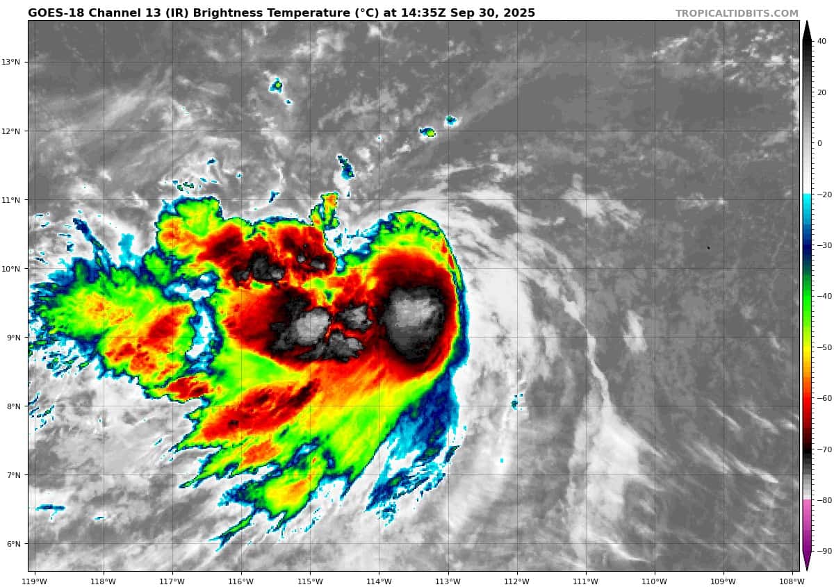
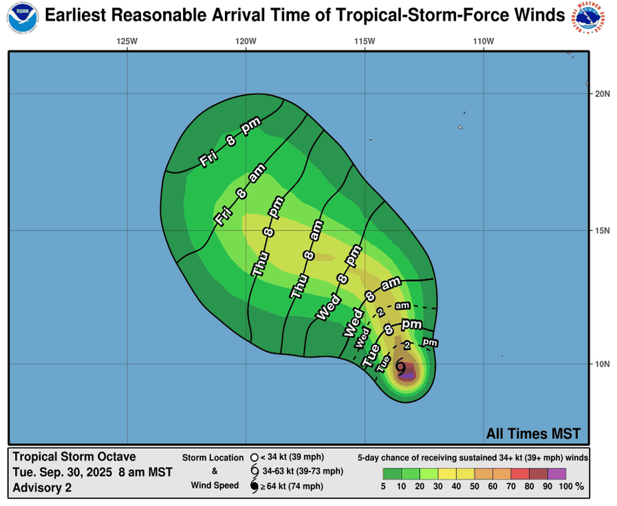
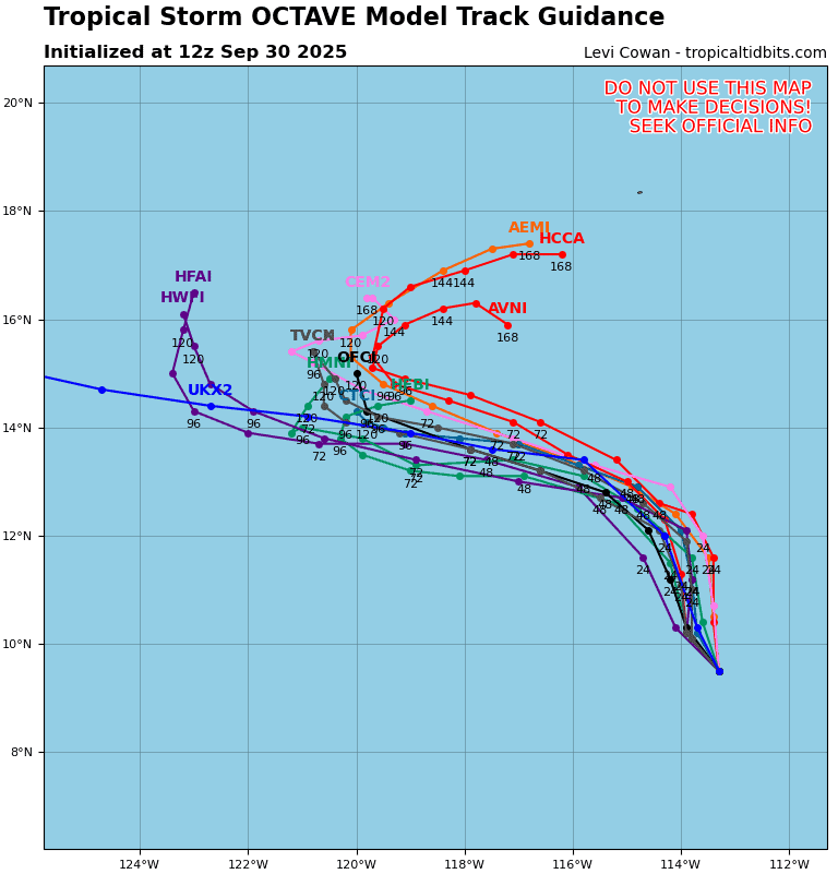
Tropical Cyclone 15E (Octave) is located about 885 miles south-southwest of the southern tip of Baja California
Northeast Pacific Ocean:
Tropical Cyclone 15E (Octave)
OCTAVE HEADING NORTH-NORTHWESTWARD OVER THE OPEN TROPICAL EASTERN PACIFIC
According to the NHC advisory number 4
Octave is moving toward the north-northwest near 7 mph (11 km/h). This general motion is expected to continue for the next day or so, followed by a turn back toward the west-northwest Wednesday night into the weekend. Maximum sustained winds are near 45 mph (75 km/h) with higher gusts. Slight strengthening is forecast tonight followed by little change in strength during the next couple of days. Tropical-storm-force winds extend outward up to 45 miles (75 km) from the center. The estimated minimum central pressure is 1001 mb (29.56 inches).
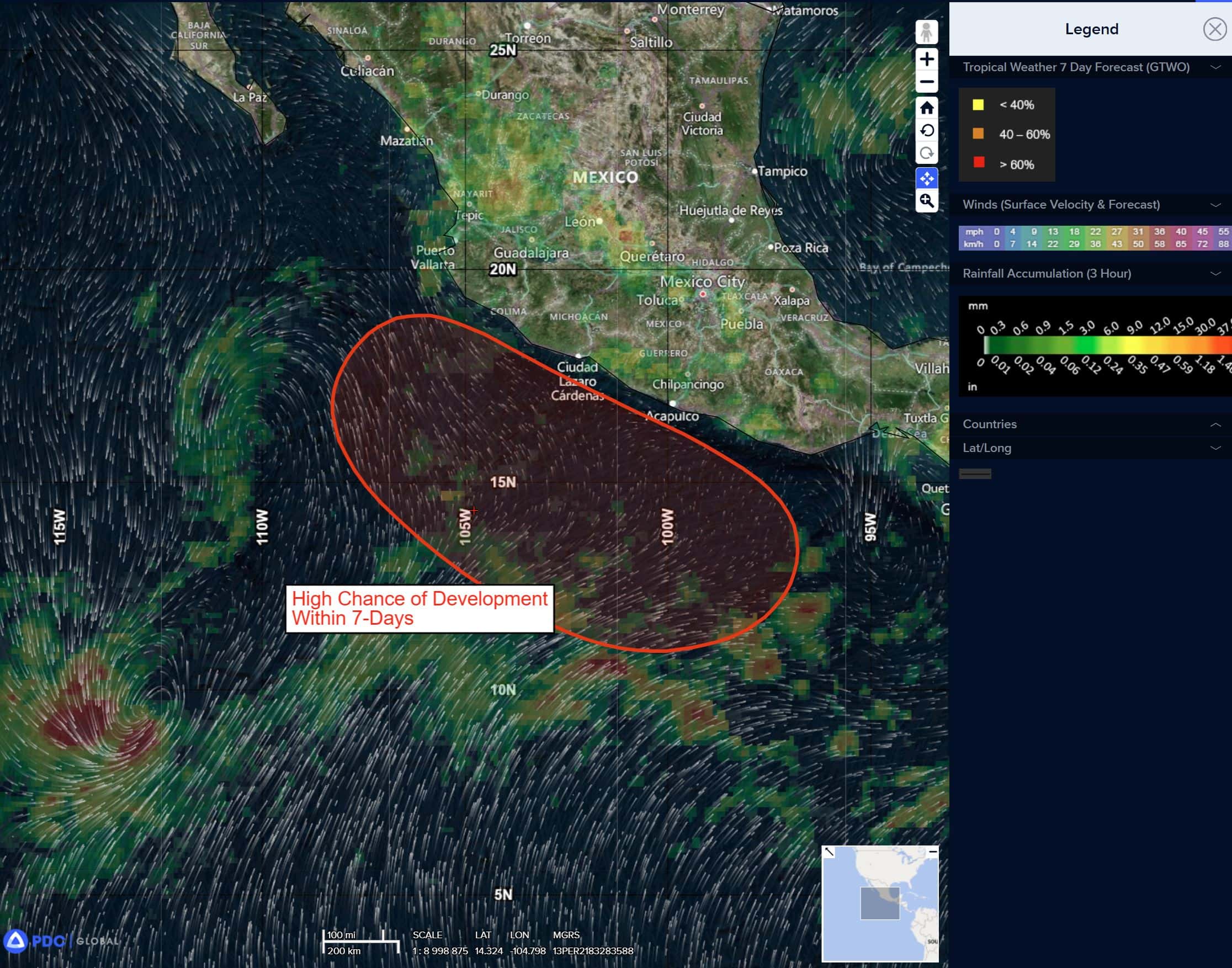
Offshore of the southwestern Coast of Mexico:
>>> An area of low pressure is expected to form off the coast of southwestern Mexico in a couple of days. Thereafter, environmental conditions are expected to be conducive for additional development, and a tropical depression will likely form late this week or this weekend while the system moves generally west-northwestward, parallel to but offshore of the southwestern coast of Mexico.
* Formation chance through 48 hours…low…20 percent
* Formation chance through 7 days…high…80 percent
Central Pacific Ocean: There are no Tropical Cyclones
Tropical cyclone formation is not expected during the next 7 days.
Western Pacific, Indian Ocean, and adjacent Seas:
Western Pacific
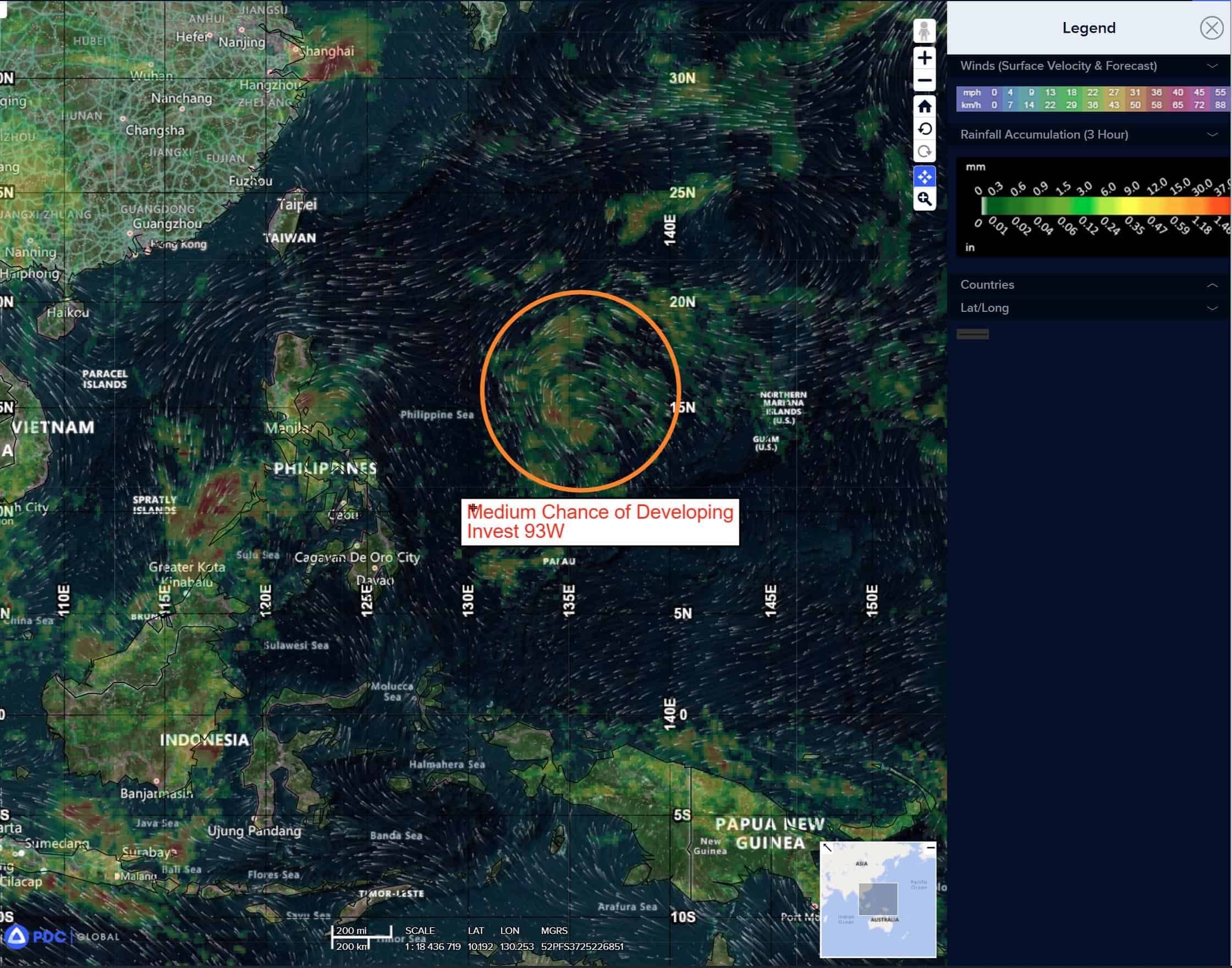
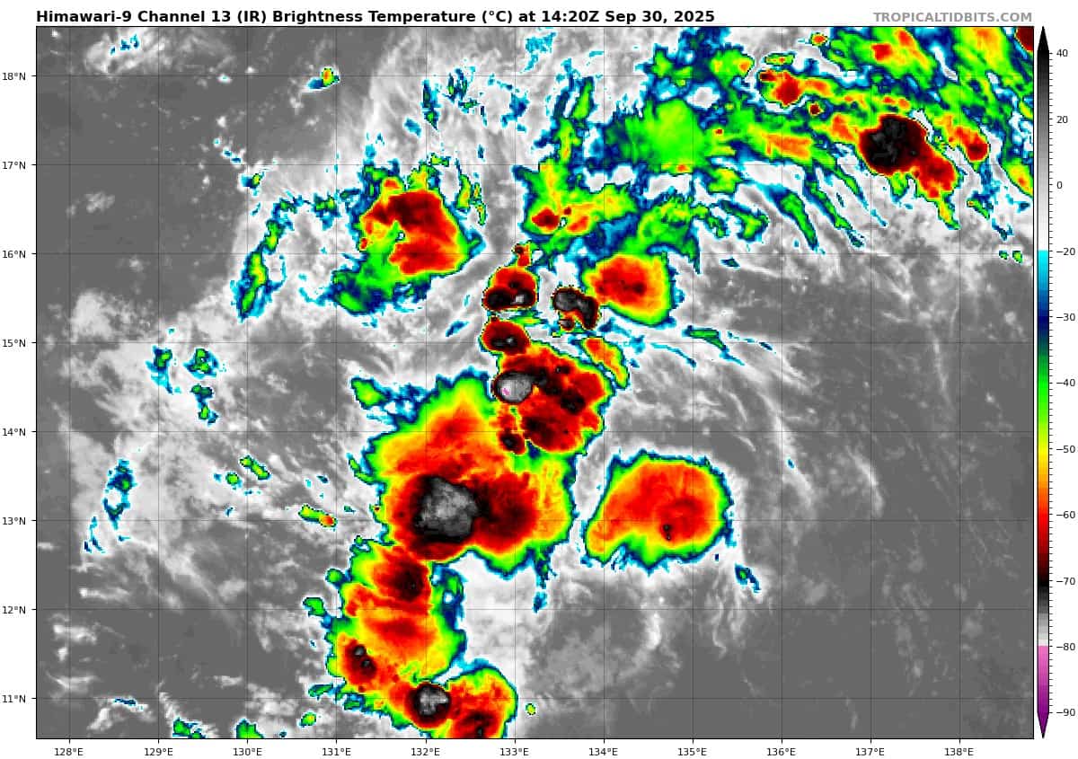
>>> There’s an area of disturbed weather being referred to as Invest 93W, which is located approximately 633 NM east of Manila
Animated multi-spectral satellite imagery depicts formative banding wrapping around the western periphery of a broad
low level circulation (llc), with strong mid-level turning over the
southwestern quadrant. A 292336z ascat-b image reveals an elongated but more defined circulation, with a swath of 15-20 knot winds over the northern quadrant. A 292115z gmi 89ghz color composite microwave image shows a consolidating llc, with improved deep convective banding over the western periphery and fragmented banding near the center.
Environmental conditions are favorable for development with low
(5-10 knot) vertical wind shear, warm (28c-30c) ssts and good outflow aloft, enhanced by the tutt positioned to the north.
Global models indicate gradual intensification, with a west-northwestward track over the next two days.
Maximum sustained surface winds are estimated at 20 to 25 knots.
The potential for the development of a significant tropical cyclone within the next 24 hours is upgraded to high.
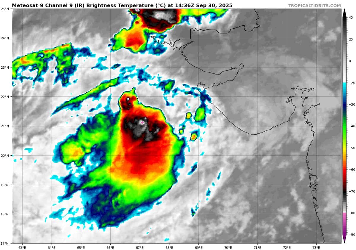
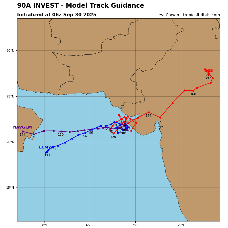
>>> There’s an area of disturbed weather being referred to as Invest 90A, which is located approximately 199 NM south-southeast of Karachi
Animated enhanced infrared (eir) satellite imagery depicts an exposed low level circulation center (llcc) with persistent convection displaced to the west of the llcc.
Environmental analysis reveals a marginal environment for development with low to moderate vertical wind shear (vws) of 15-20 knots, good poleward upper-level outflow, and warm sea surface temperatures (sst) of 28-29 c.
However, the system is overland and weak due to frictional effects.
Deterministic and ensemble models are in good agreement with ECMWF being the sole outlier, portraying 90A to maintain its position over land as it tracks northwest toward Karachi, Pakistan over the next 24-48 hours.
Maximum sustained surface winds are estimated at 23 to 28 knots.
The potential for the development of a significant tropical cyclone within the next 24 hours remains low.
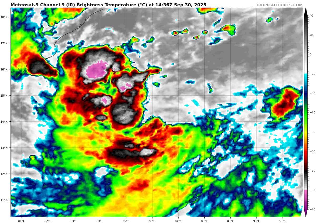
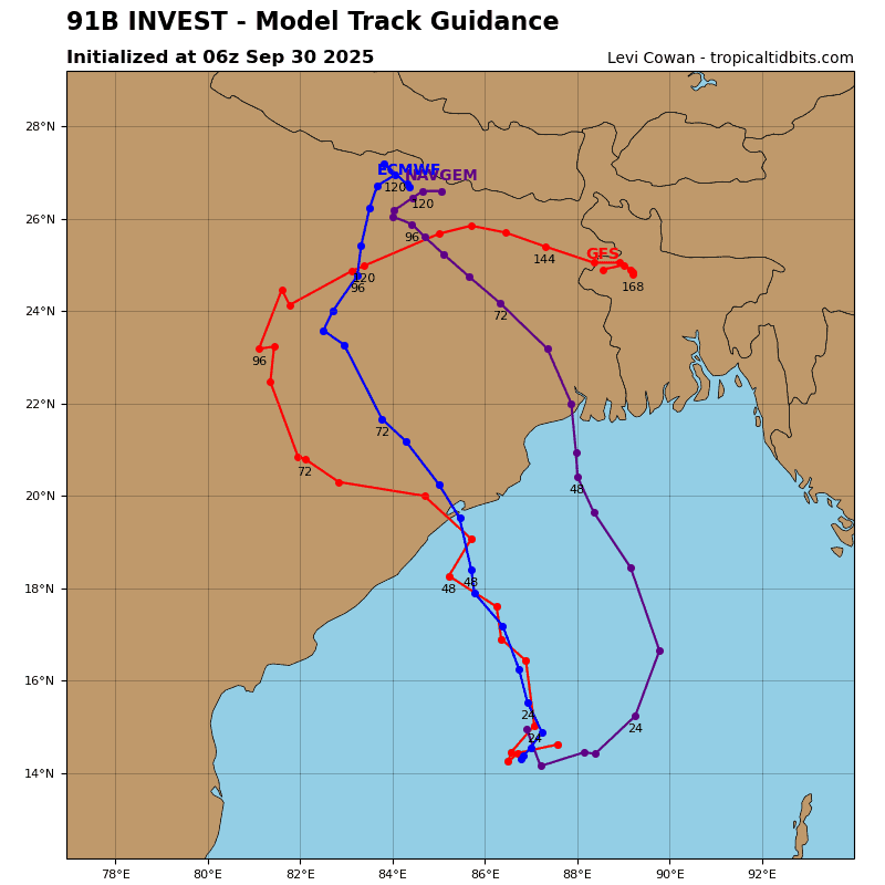
>>> There’s an area of disturbed weather being referred to as Invest 91B, which is located approximately 265 NM southeast of Visakhapatnam
Animated multi-spectral satellite imagery (msi) depicts flaring convection with an elongated low-level circulation. The msi also reveals broad convective banding within the western periphery of the system with strong easterlies aloft. A 090930z ascat pass shows strong winds (20-25 knots) to the west of the broad convection center.
Analysis reveals favorable conditions with good equatorward outflow, low (10-15 knot) vertical wind shear, and warm sea surface temperatures (28-29 c).
Global models indicate steady development with a north-northwestward track over the next 24-48 hours. GFS is the most aggressive with development while ECMWF shows the system struggling to consolidate.
Maximum sustained surface winds are estimated at 25 to 30 knots.
The potential for the development of a significant tropical cyclone within the next 24 hours is upgraded to high.