Western Pacific, Indian Ocean, and adjacent Seas:
Western Pacific

")

By PDC’s Senior Weather
Specialist Glenn James

The Pacific Disaster Center’s (PDC Global) Wednesday, September 23, 2025, Tropical Cyclone Activity Report…for the Pacific Ocean, the Indian Ocean, and adjacent Seas
Current Tropical Cyclones:
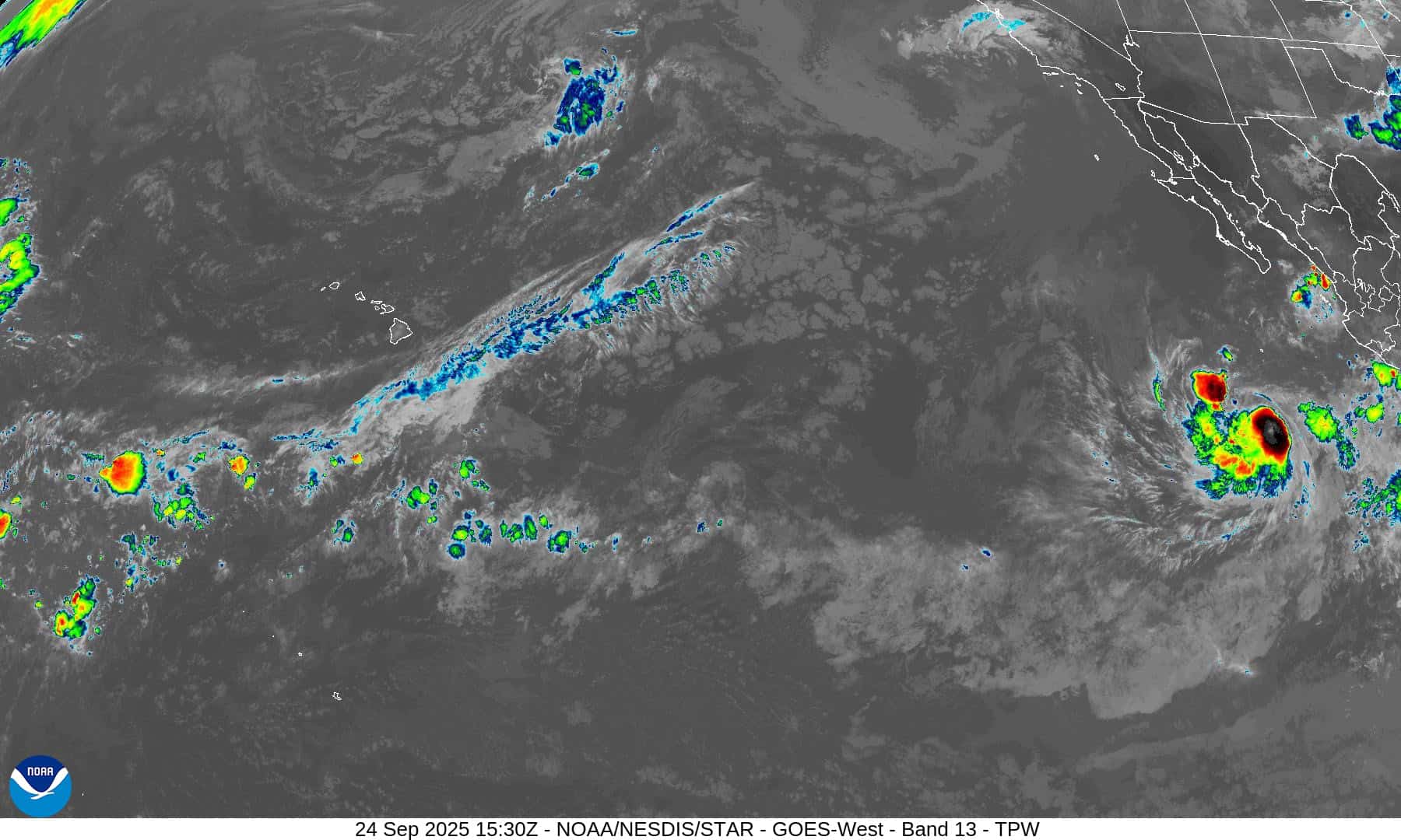
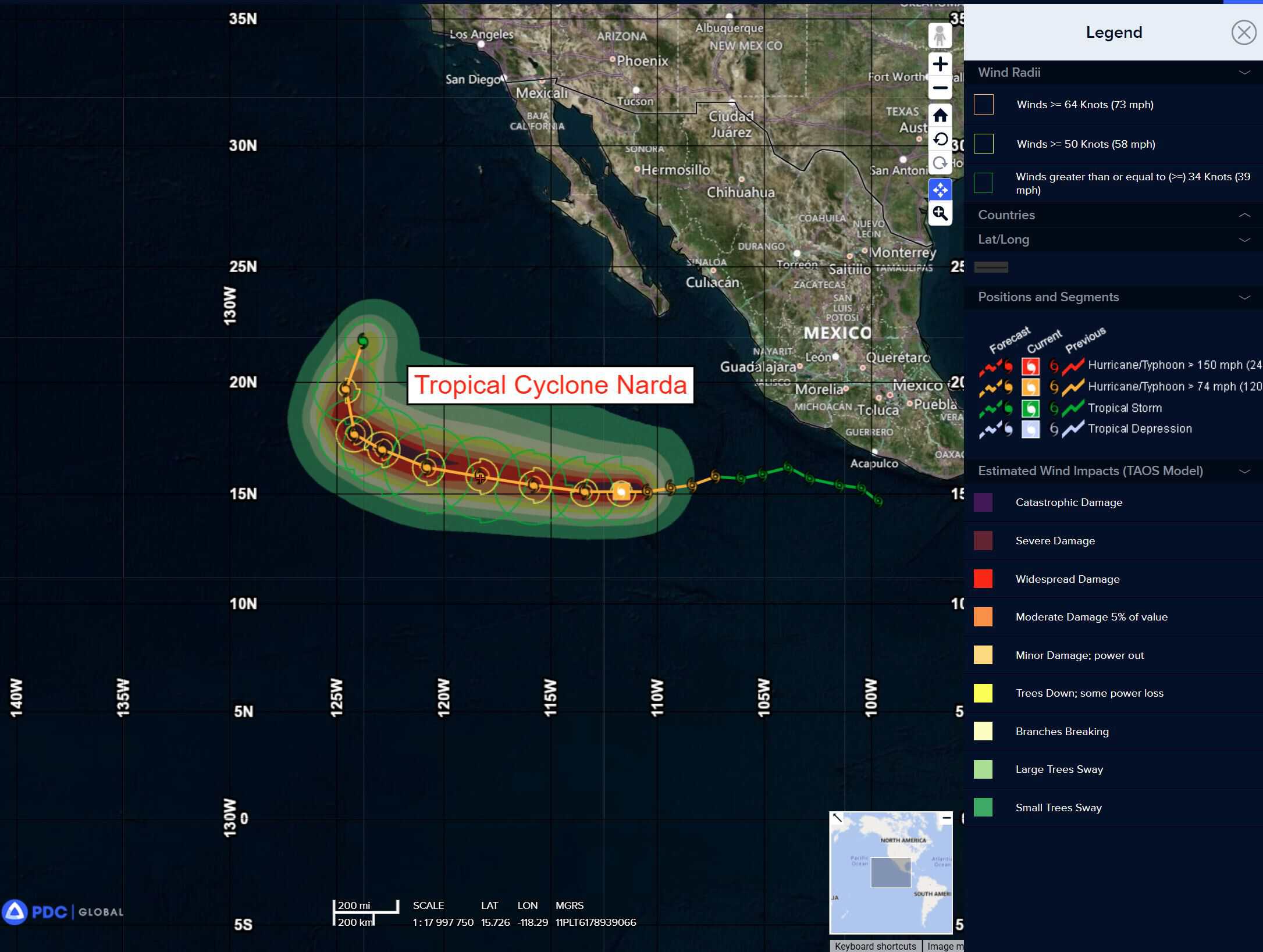
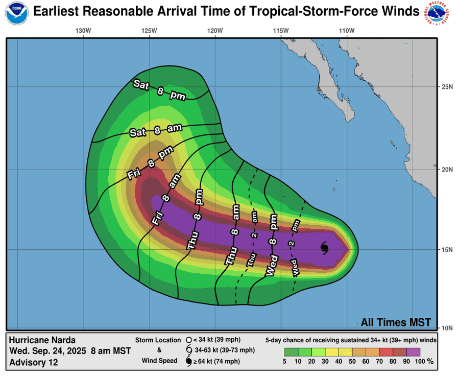
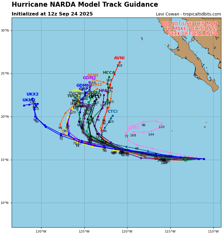
Tropical Cyclone 14E (Narda) is located approximately 550 NM south-southwest of the southern tip of Baja CA
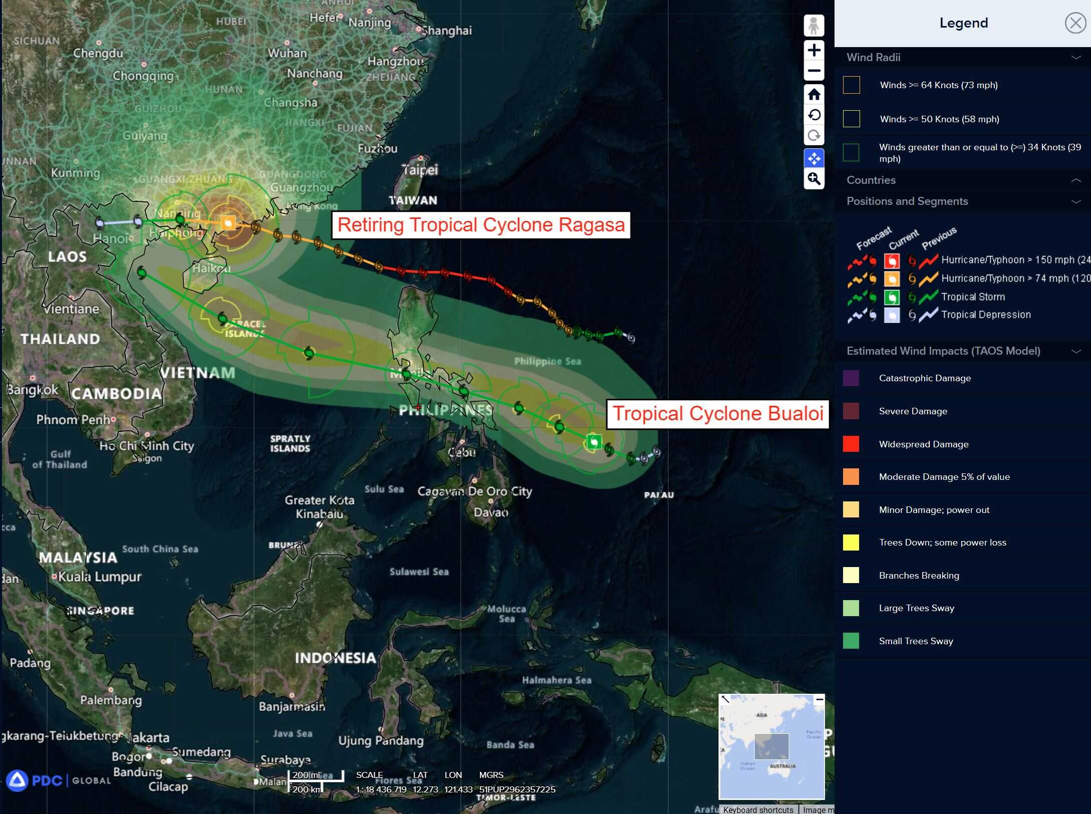
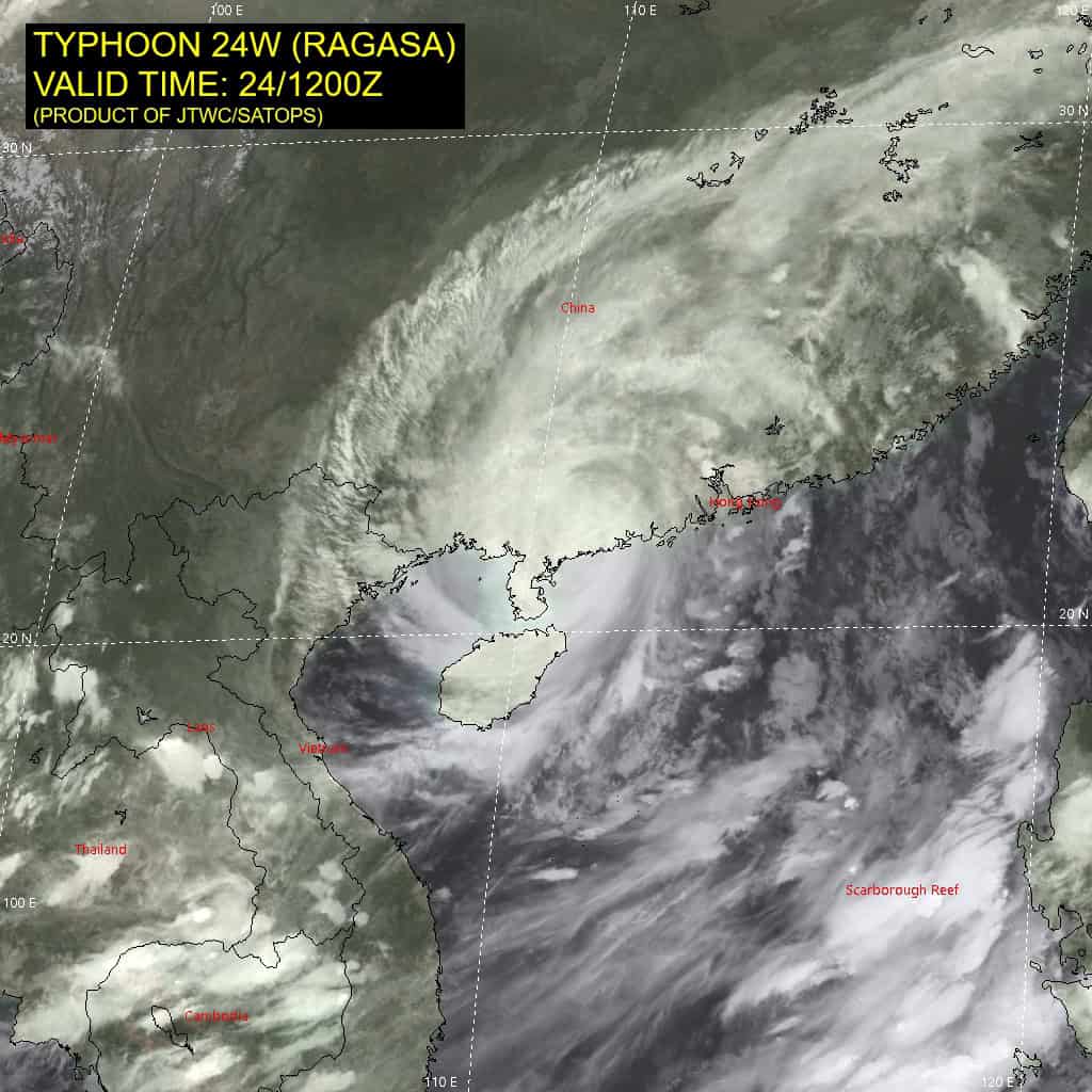
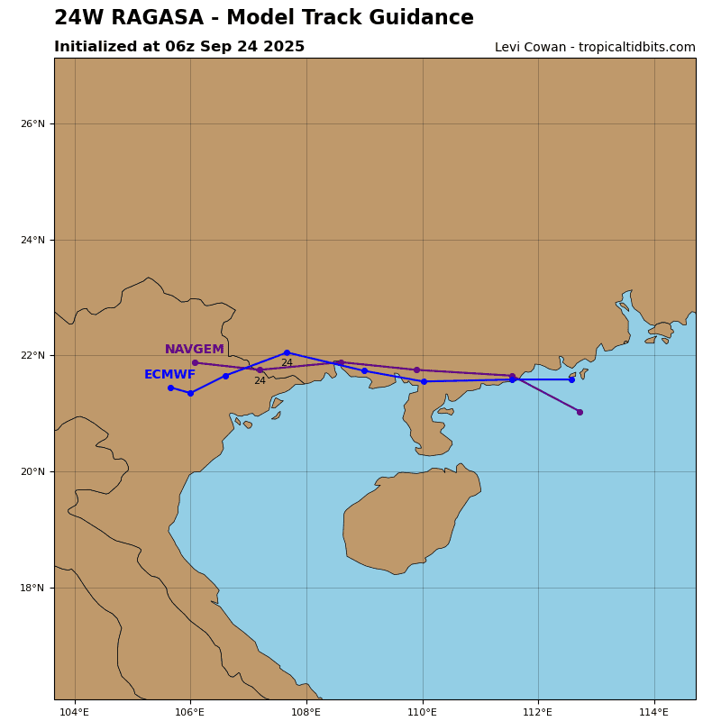
Tropical Cyclone 24W (Ragasa) is located approximately 175 NM west of Hong Kong – Final Warning
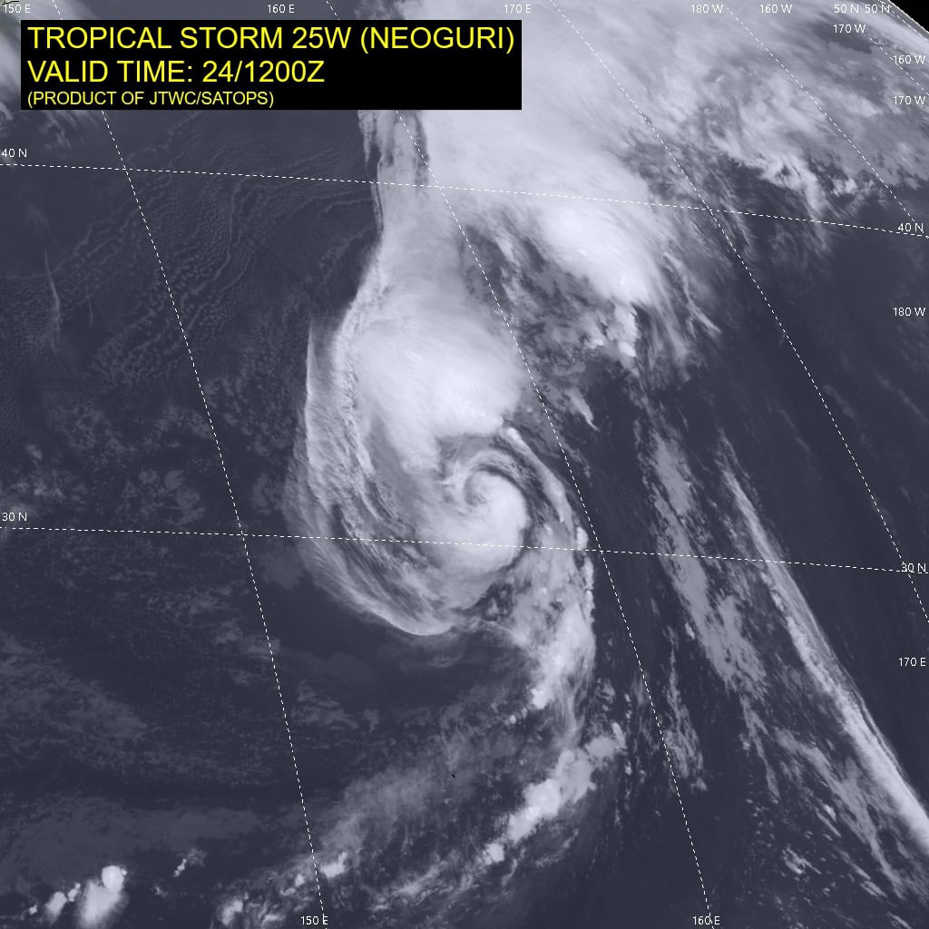
Tropical Cyclone 25W (Neoguri) is located approximately 446 NM north-northeast of Minami Tori Shima
Tropical Cyclone 26W (Bualoi) is located approximately 638 NM east-southeast of Manila, Philippines
Northeast Pacific Ocean:
Tropical Cyclone Narda
NARDA HOLDING STEADY FOR NOW
According to the NHC advisory number 12
Narda is moving toward the west near 13 mph (20 km/h), and this general motion is expected to continue during the next couple of days. Maximum sustained winds remain near 105 mph (165 km/h) with higher gusts. Some slight weakening is expected through tonight, followed by some restrengthening Thursday night and Friday. Hurricane-force winds extend outward up to 25 miles (35 km) from the center and tropical-storm-force winds extend outward up to 115 miles (185 km). The estimated minimum central pressure is 972 mb (28.71 inches).
HAZARDS AFFECTING LAND
Surf: Swells generated by Narda are affecting portions of the coast of southwestern and west-central Mexico, and are expected to spread to portions of Baja California Sur late this week through the weekend. These swells are likely to cause life-threatening surf and rip current conditions.
Western Pacific, Indian Ocean, and adjacent Seas:
Western Pacific
Tropical Cyclone 24W (Ragasa) – Final Warning
According to the JTWC warning number 25…sustained winds are 80 knots with gusts to near 100 knots.
Animated enhanced infrared (eir) as well as radar imagery indicate the system has made landfall near Yangjiang, China and is tracking westward. Frictional effects of land interaction result in significant and rapid deterioration of the vortex.
As typhoon 24W is steered westward under the influence from a subtropical ridge (str) to the northeast, it is forecast to continue weakening, while full dissipation is expected by 36 hours.
Within the next 12 hours the system will pass near the waters of South China Sea, just west of the Leizhou Peninsula, however majority of available guidance indicates track just north of open water.
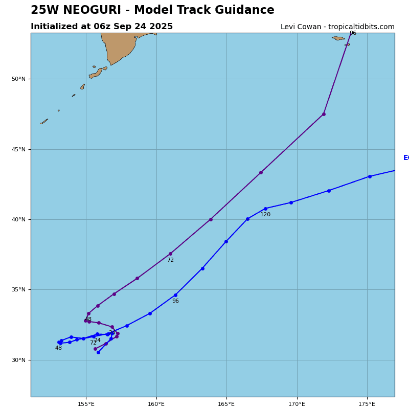
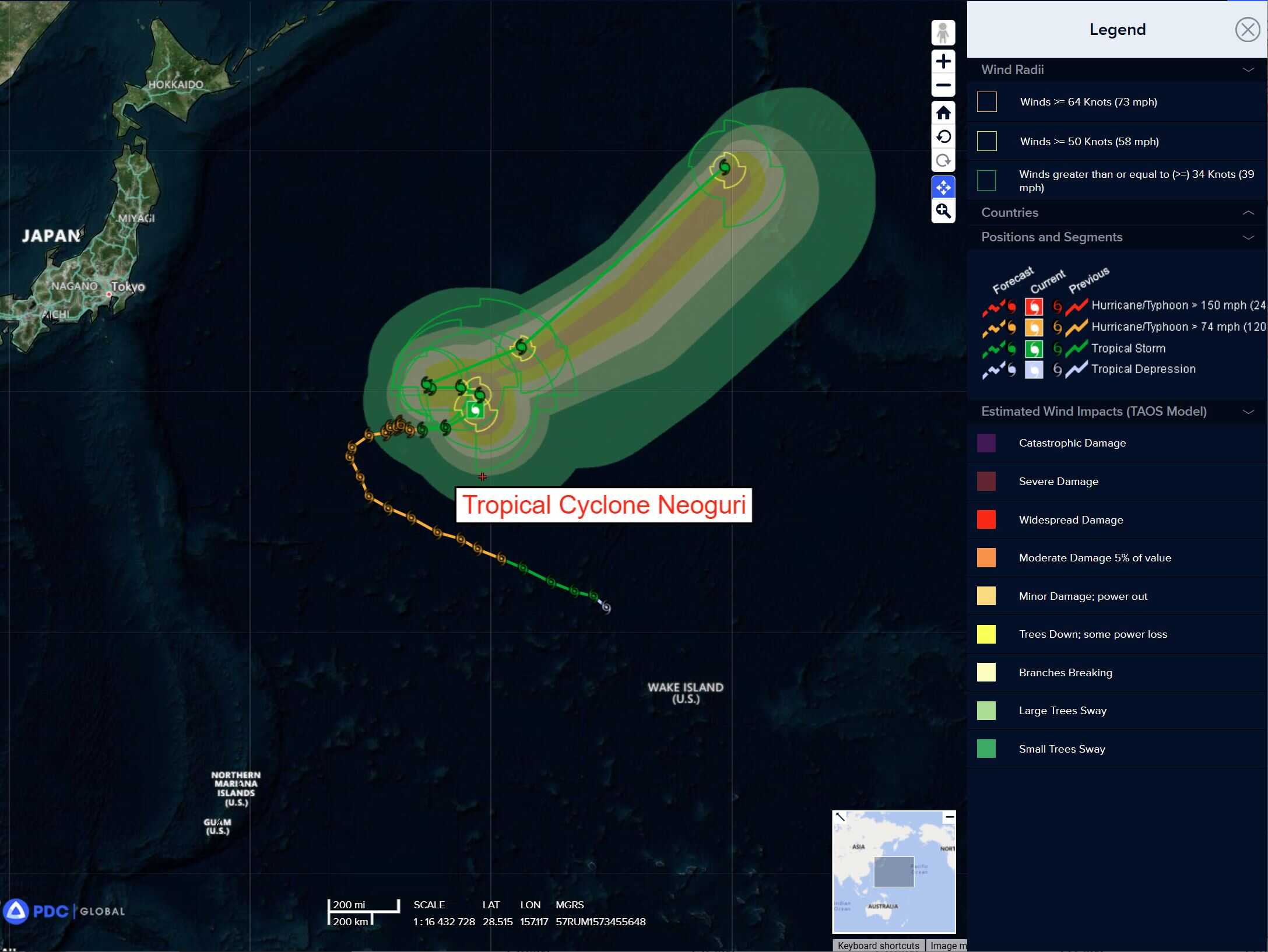
Tropical Cyclone 25W (Neoguri)
According to the JTWC warning number 25…sustained winds are 60 knots with gusts to near 75 knots.
Animated enhanced infrared (eir) satellite imagery depicts an elongated convective field with deep convection rebuilding over the circulation center of tropical storm 25W. The upper-level
trough to the northwest continues to enhance outflow strongly, but also causes strong southwesterly 20-25 knot vertical wind shear.
Tropical storm 25W will gradually curve to a northwestward track over the next 24 hours as the subtropical ridge to the west is eroded by a deep-layer trough. The competing steering environment will remain despite the slight weakening of the ridge, and the system will sharply track westward through 36 hours.
After a quasi-stationary period, a sharp turn to the northwest will occur after 48 hours as the deep layer jet enhances the track speed along the northern periphery of the subtropical ridge to the east. Due to the complexity of the steering environment, it is possible that erratic jagged or looping track motion may occur and is not captured within the warning graphic.
TS 25W will slowly weaken over the next 36 hours as vertical wind shear decreases slightly as the upper-level trough currently positioned north of the system moves eastward. At the same time, the system will recurve over a cool wake from previous upwelling, removing the heat source.
The aforementioned upstream trough will reintroduce high vertical wind shear at 72 hours that will continue through the end of the forecast period. Baroclinic forcing as the system begins extratropical transition at 72 hours will slightly increase the intensity, leading TS 25W to be a 60 knot extratropical cyclone by the end of the forecast period.
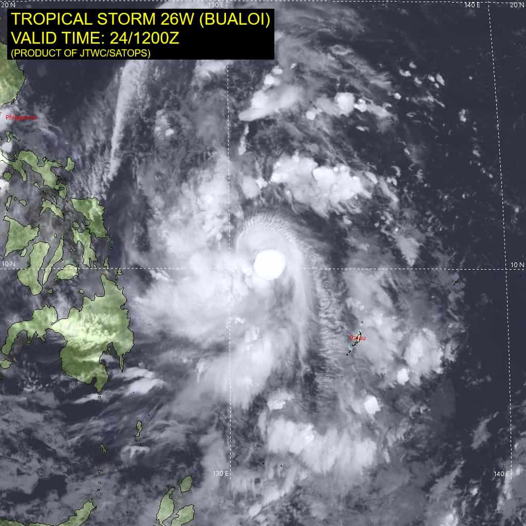
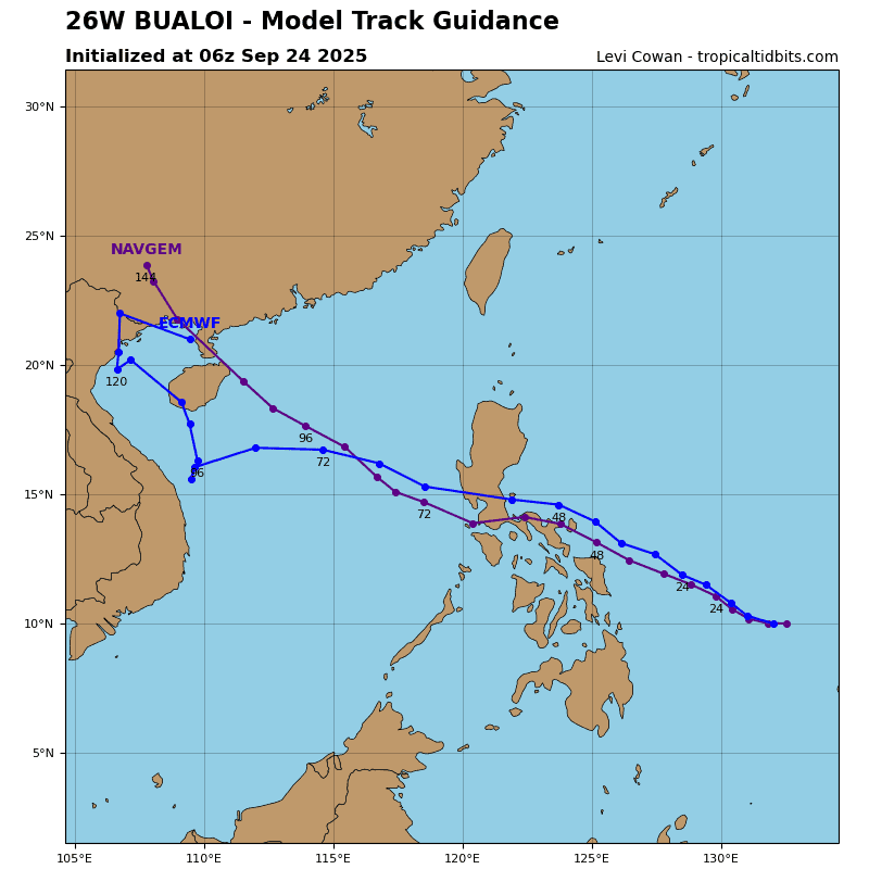
Tropical Cyclone 26W (Bualoi)
According to the JTWC warning number 5…sustained winds are 50 knots with gusts to near 65 knots.
Animated enhanced infrared (eir) satellite imagery depicts tropical storm 26w (bualoi) continuing to intensify as it transits
west-northwestward. Persistent central convection has reached peak cloud tops temperature of -89 c and developed irregular, pulsating cirrus canopy.
Environmental analysis indicates favorable development conditions, characterized by warm (29-30 c) sea surface temperatures (sst), strong poleward and equatorward outflow channels, and low to moderate (15-20 knot) vertical wind shear (vws).
TS 26W is expected to track generally northwestward through the current forecast period, under the influence of a str to the north. Long-term model guidance still suggests landfall over northern Vietnam around or shortly after 120 hours. However, numerical model track guidance now begins to diverge from the consensus as early as 48 hours, leading to uncertainty in
the track over the South China Sea, as well as the timing of the land interaction.
In terms of intensity, TS 26W is forecast to continue intensifying over the next 12 hours. Subsequently, a beneficial upper-level low is expected to retrograde westward, and at a faster rate than previously observed on the model fields. This will lead to a significant reduction of the poleward outflow channel. Simultaneously, a building upper-level ridge to the north will result in increased vertical wind shear on TS 26W, with impacts as early as 12 hours.
Around 36 hours, frictional effects from land passage, will further contribute to a brief weakening trend. After re-emerging over the South China Sea west of the Philippines, TS Bualoi is expected to resume intensification due to improved environmental conditions, particularly decreasing vws and warm ssts. The system is expected to reach peak intensity of 60-65 knots around 96 hours.