Western Pacific, Indian Ocean, and adjacent Seas:
Western Pacific

")

By PDC’s Senior Weather
Specialist Glenn James

The Pacific Disaster Center’s (PDC Global) Thursday, September 25, 2025, Tropical Cyclone Activity Report…for the Pacific Ocean, the Indian Ocean, and adjacent Seas
Current Tropical Cyclones:
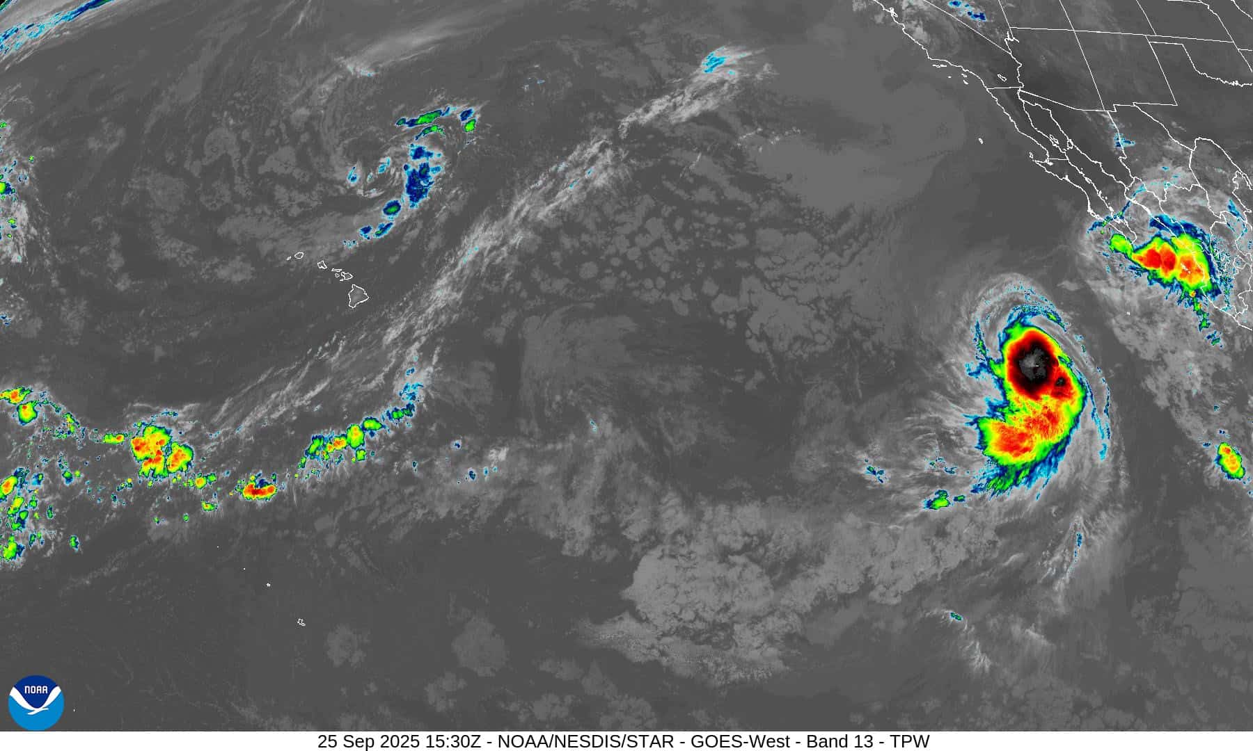
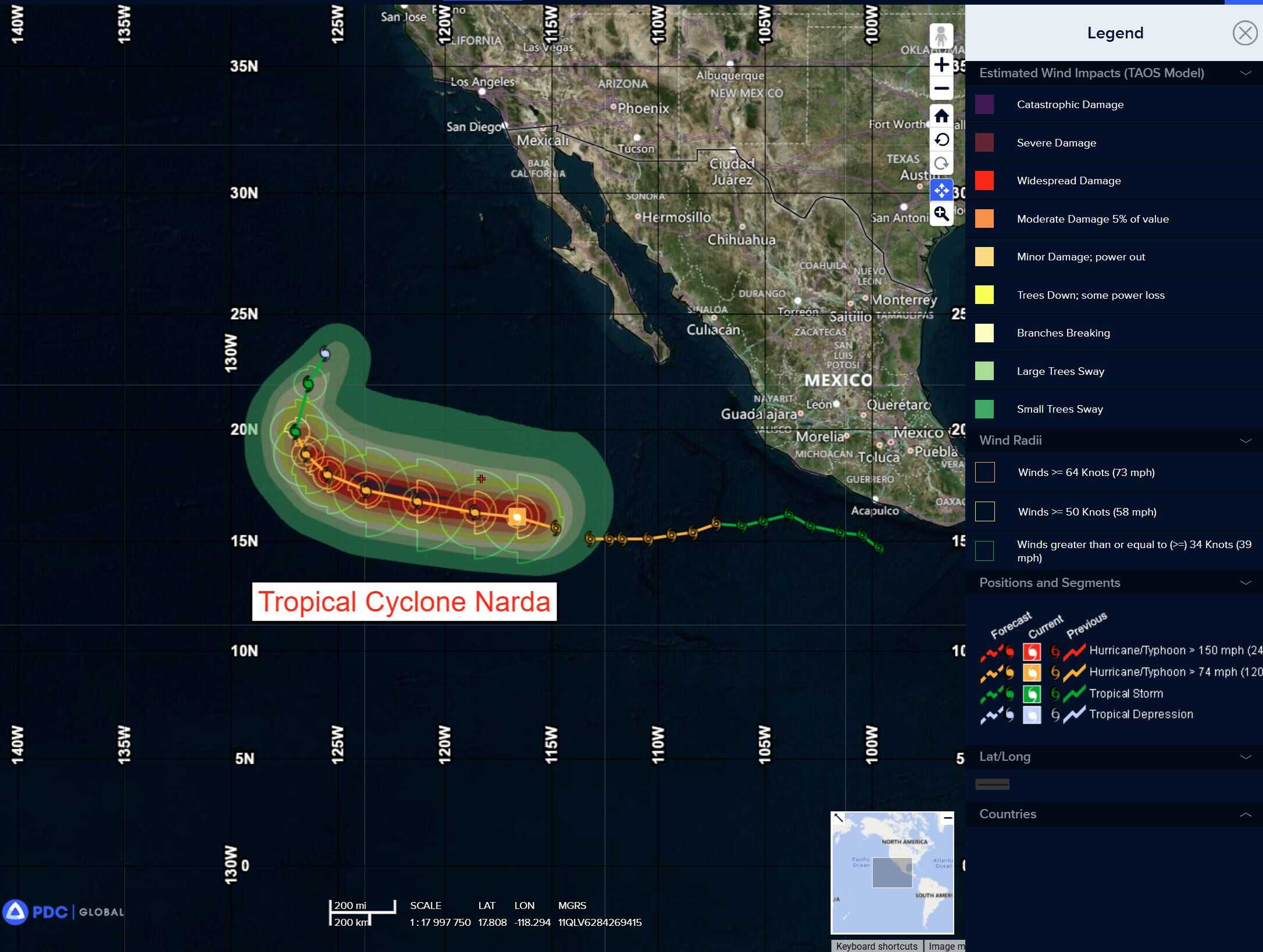
Tropical Cyclone 14E (Narda) is located approximately 640 NM southwest of the southern tip of Baja CA
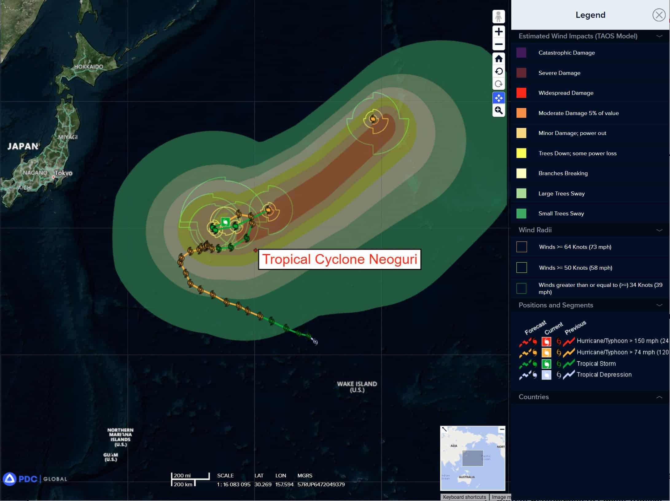
Tropical Cyclone 25W (Neoguri) is located approximately 776 NM east of Yokosuka, Japan
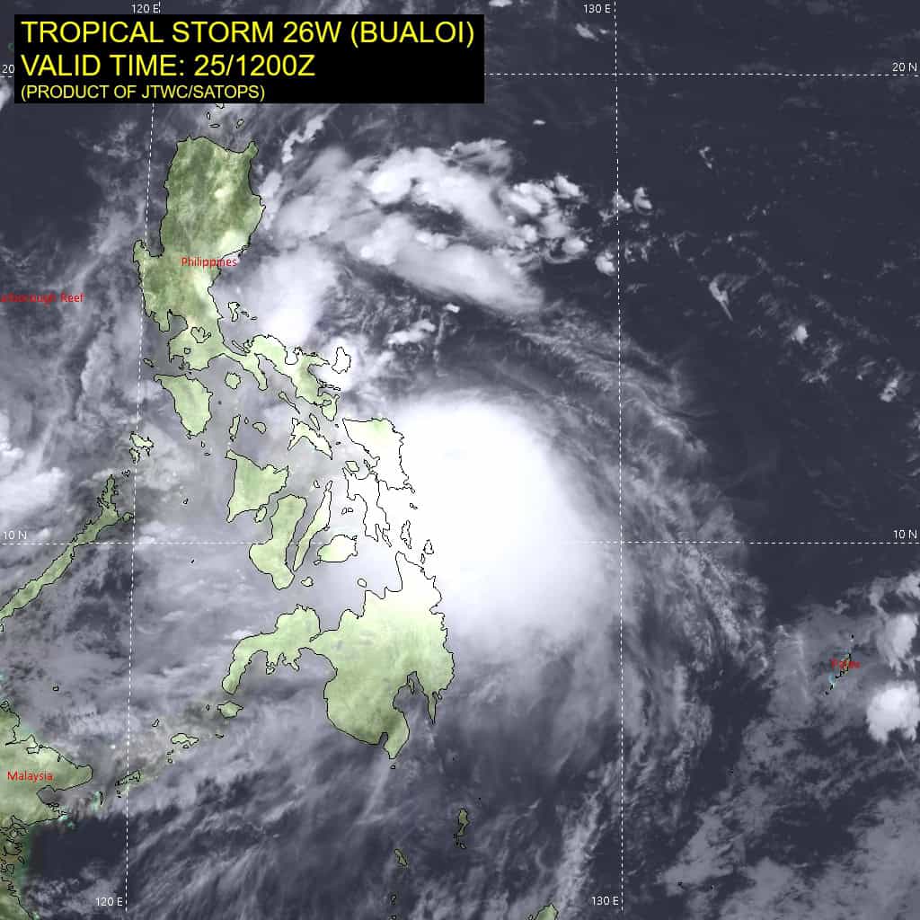
Tropical Cyclone 26W (Bualoi) is located approximately 373 NM east-southeast of Manila, Philippines
Northeast Pacific Ocean:
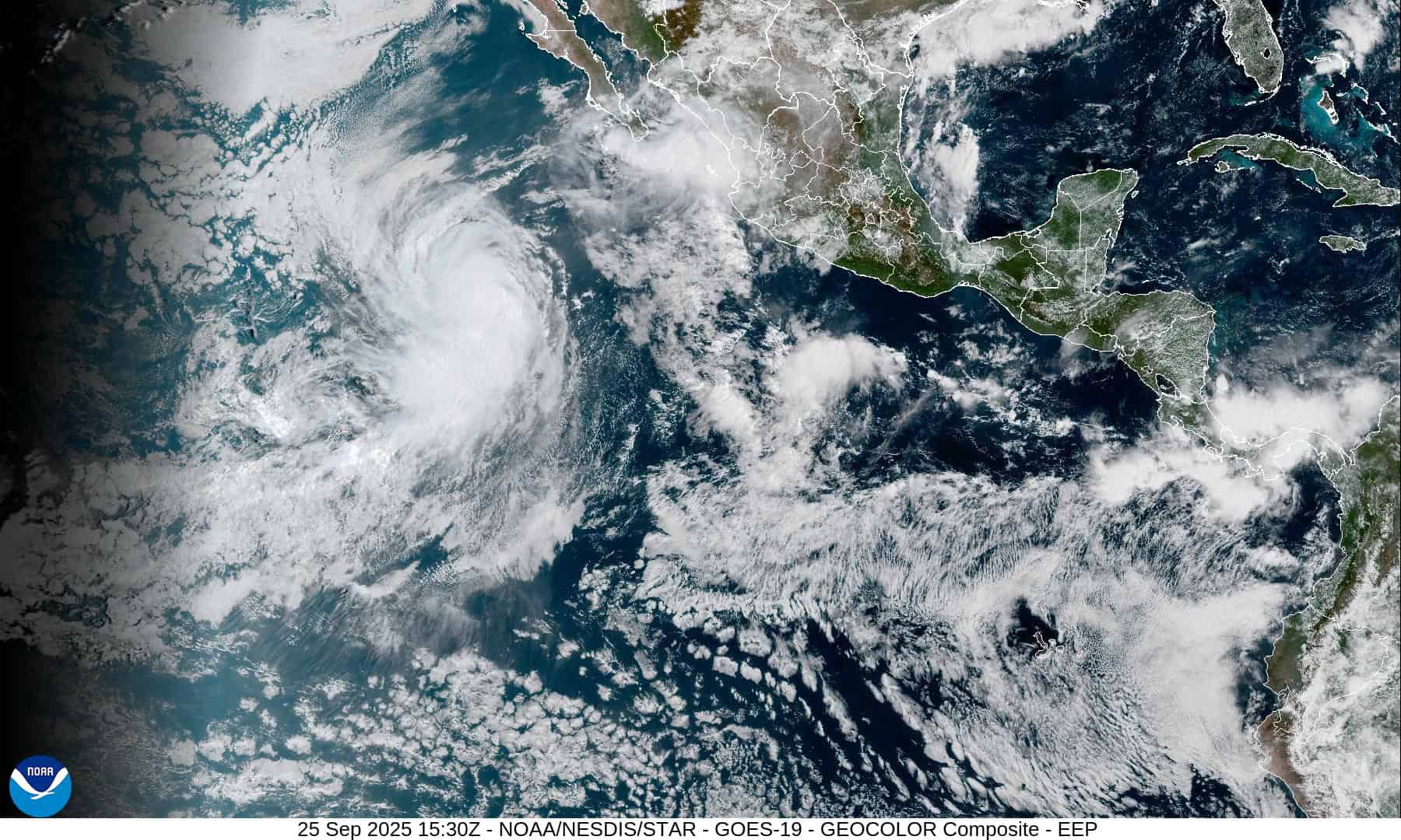
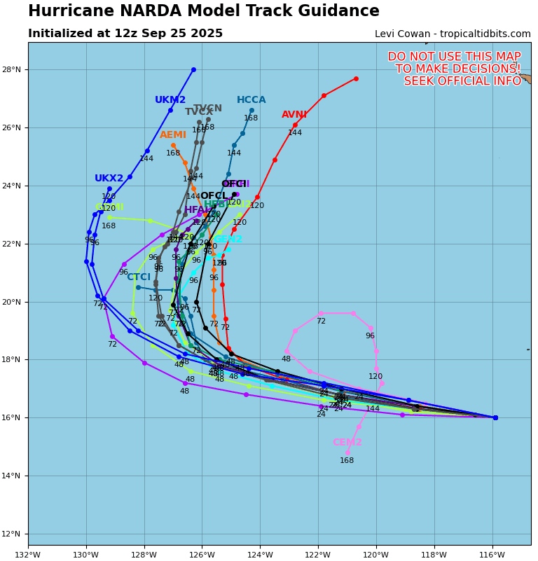
Tropical Cyclone Narda
NARDA COULD RESTRENGTHEN TO A CATEGORY 2 HURRICANE SOON
According to the NHC advisory number 16
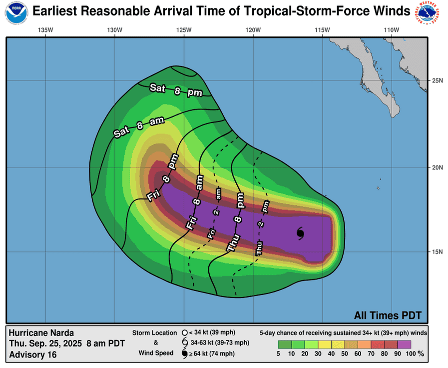
Narda is moving toward the west-northwest near 15 mph (24 km/h), and this general motion is expected to continue for the next couple of days. A northwestward motion is forecast to commence over the weekend, followed by a turn toward the north-northeast early next week. Maximum sustained winds are near 90 mph (150 km/h) with higher gusts. Some restrengthening is forecast and Narda could once again become a category 2 hurricane by Friday. Hurricane-force winds extend outward up to 45 miles (75 km) from the center and tropical-storm-force winds extend outward up to 150 miles (240 km). The estimated minimum central pressure is 980 mb (28.94 inches).
HAZARDS AFFECTING LAND
Surf: Swells generated by Narda are affecting portions of the coast of southwestern and west-central Mexico, and are expected to spread to portions of Baja California Sur beginning later today, then reach southern California over the weekend. These swells are likely to cause life-threatening surf and rip current conditions.
Central Pacific Ocean: There are no Tropical Cyclones
Tropical cyclone formation is not expected during the next 7 days.
Western Pacific, Indian Ocean, and adjacent Seas:
Western Pacific
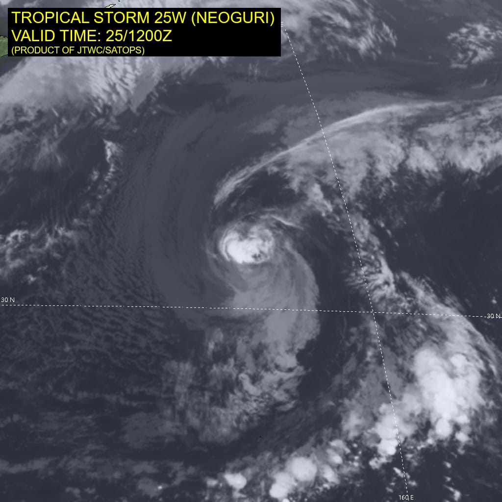
Tropical Cyclone 25W (Neoguri)
According to the JTWC warning number 29…sustained winds are 60 knots with gusts to near 75 knots.
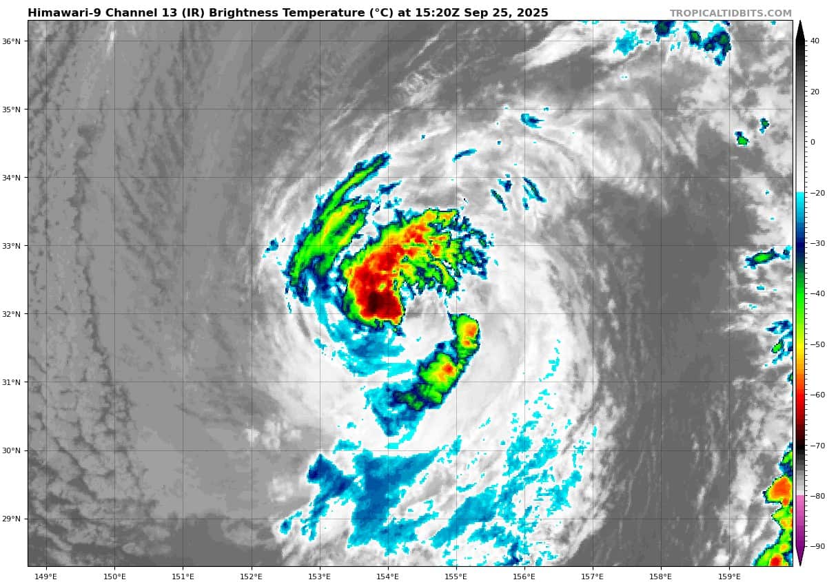
Animated multi-spectral satellite imagery (msi) depicts a partially exposed low level circulation center (llcc) with low-level clouds tightly wrapping into the llcc and associated persistent convection confined to the northwestern quadrant.
The overall appearance of the storm has degraded over the past 6 hours, likely due to upwelling effects and significant dry air entrainment.
Environmental analysis indicates the environment is marginally favorable, characterized by low (10-15 knot) vertical wind shear, warm (28-29 c) sea surface temperatures, and strong poleward outflow, offset by the upwelling and dry air.
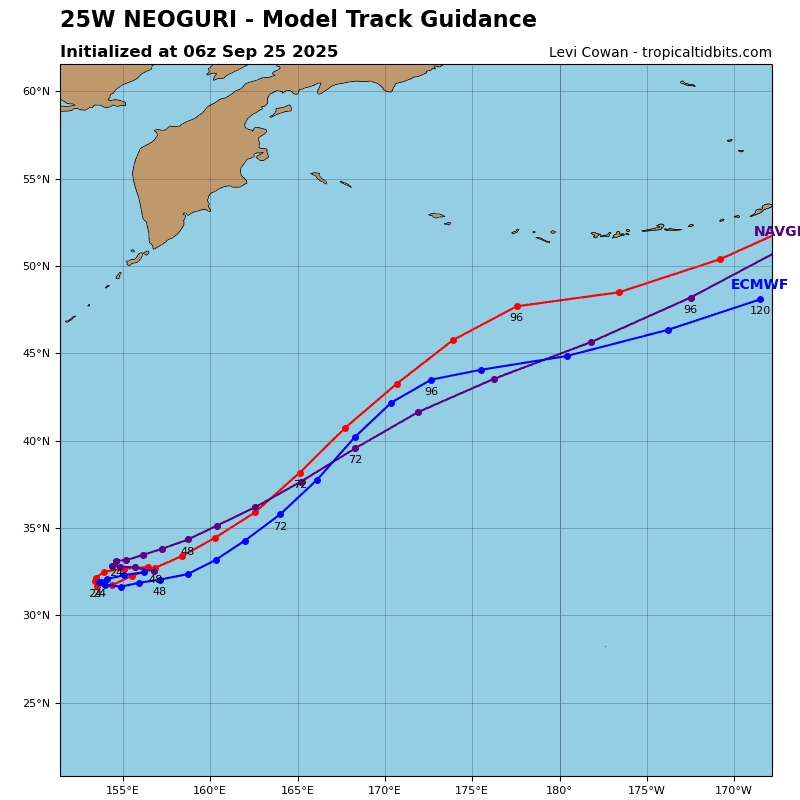
Tropical storm 25W is forecast to continue tracking southwestward through 24 hours, then becoming quasi-stationary from 24 to 36 hours. While the storm is quasi-stationary, erratic motion not reflected in the forecast may
occur.
After 36 hours, 25W is expected to loop back to the northeast and continue a northeastward track motion until it becomes fully
extratropical near 72 hours. Beginning around 48 hours, 25W will significantly accelerate as it enters under the influence of the
upper-level jet and will begin extratropical transition (ett) at that
time.
Regarding intensity, 25W is forecast to slightly weaken between 12-24 hours to 55 knots. Intensity is forecast to increase to 60-70 knots as 25W moves northeastward during ett and poleward outflow becomes more robust in response to interaction with the jet stream.
Tropical Cyclone 26W (Bualoi)
According to the JTWC warning number 9…sustained winds are 55 knots with gusts to near 70 knots.
Animated enhanced infrared (eir) satellite imagery depicts tropical storm 26W (Bualoi) with an expansive central dense overcast obscuring the low-level circulation center (llcc) and cloud tops measuring -90 c in multiple areas of the overshooting tops. A 251044z gmi 89 ghz microwave image revealed the low-level clouds tightly wrapping into the northern portion of the circulation and a vigorous burst of deep convection just to the south of the assessed center.
Environmental analysis continues to indicate that 26W is in a marginally favorable environment characterized by moderate outflow aloft, moderate to high (20-25 knot) east-northeasterly vertical wind shear, and warm (29-30 c) sea surface temperatures.
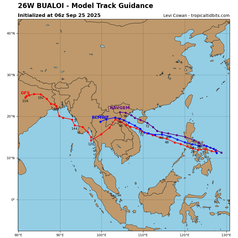
26W is forecast to track west-northwestward, along the southern periphery of the large subtropical ridge to the north through 48 hours. An initial landfall along northeastern Samar is expected within the next 6 hours. After 48 hours, 26W is forecast to turn slightly more northwestward as it tracks along the
southwestern extent of the ridge. A second landfall is currently
forecast to occur just after 72 hours, north of Vinh.
Regarding intensity, 26W is forecast to slightly weaken through 12 hours due to the easterly vertical wind shear and topographic interaction with the Visayas Islands. The relatively low elevation and continued supply of warm sea water will allow 26W to stay around 50 knots as it traverses through the islands.
After emerging within the South China Sea, the environment will improve with lower vertical wind shear, causing 26W to intensify as it approaches the Gulf of Tonkin. The environment within the Gulf of Tonkin is expected to be highly favorable, particularly in regard to the very warm sea surface temperatures. As a result, the system is expected to peak near 72 hours, southwest of Hainan Island.