The Pacific Disaster Center’s (PDC Global) Friday, September 12, 2025, Tropical Cyclone Activity Report…for the Pacific Ocean, the Indian Ocean, and adjacent Seas
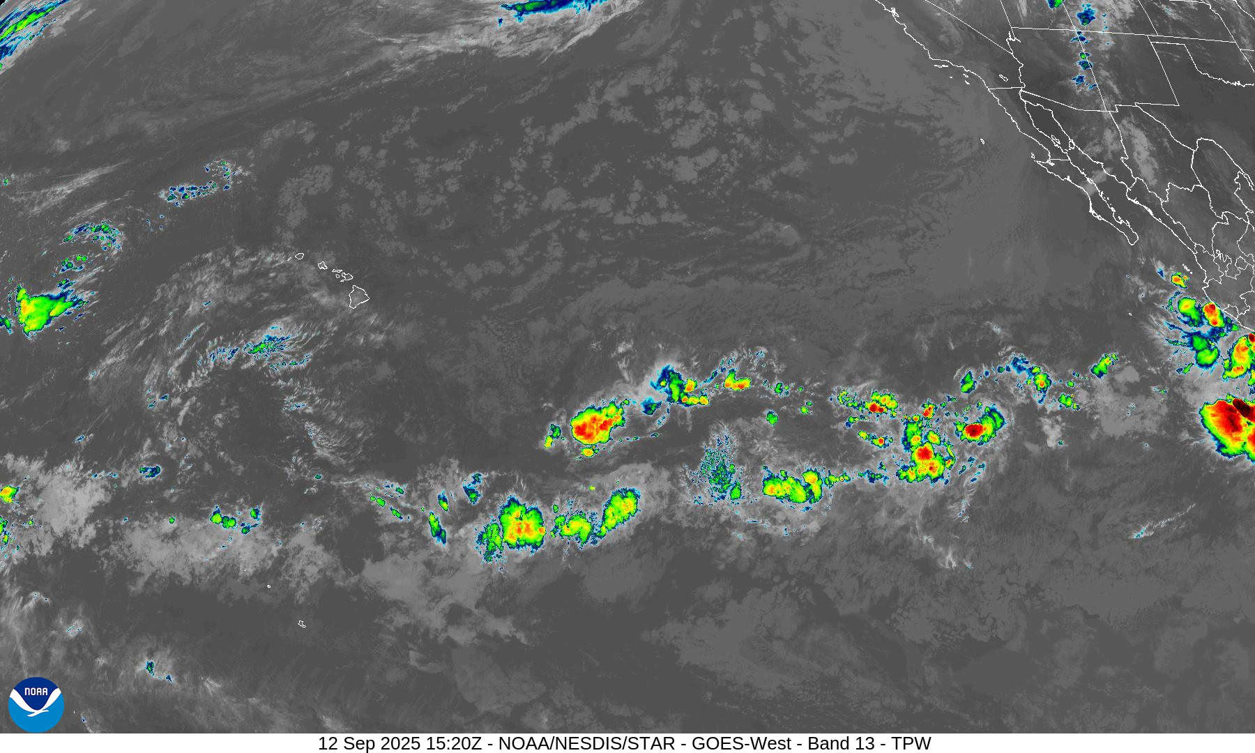
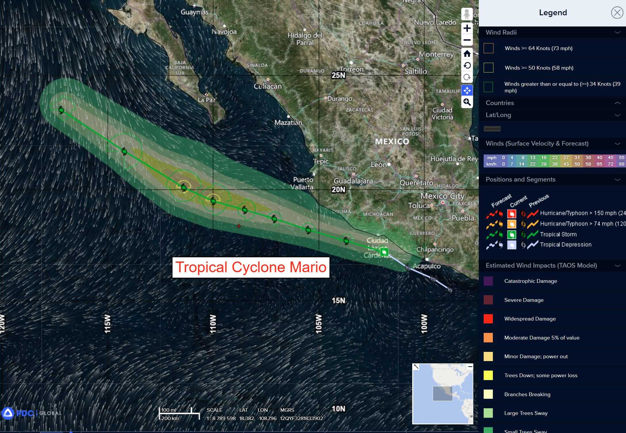
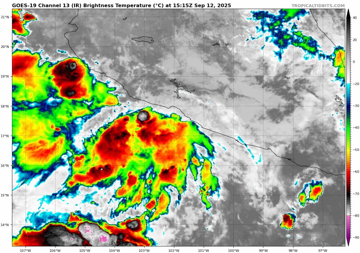
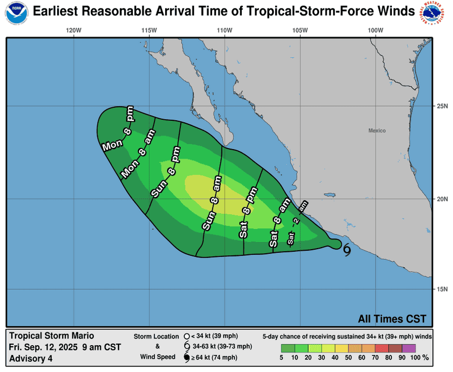
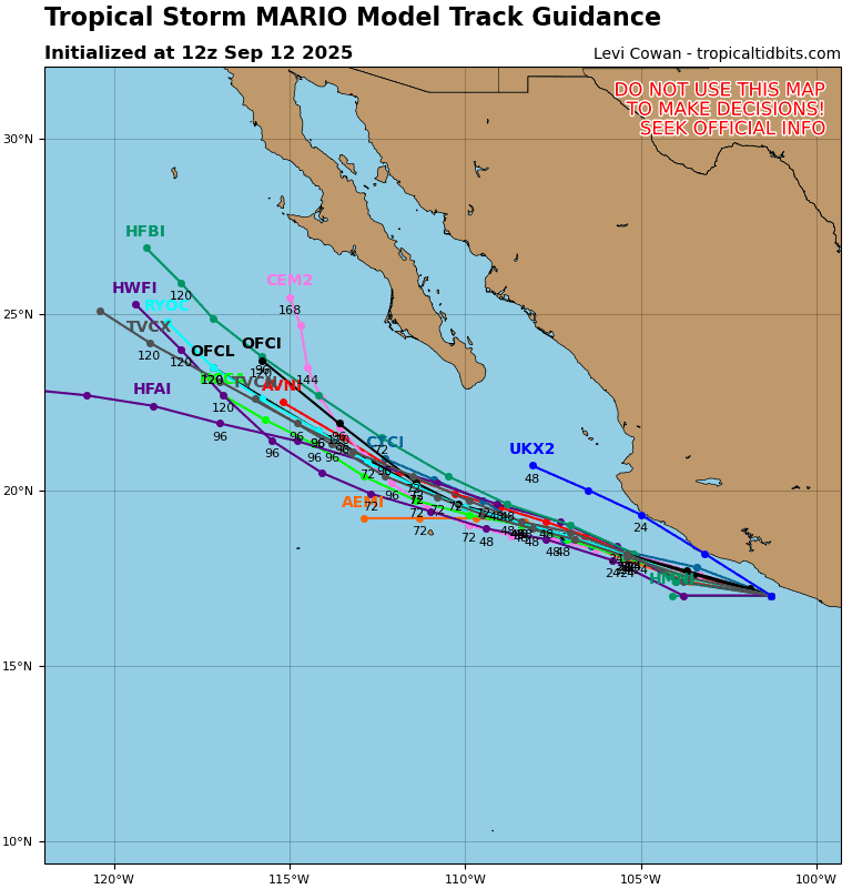
Tropical Cyclone 13E (Mario) is located about 80 miles southwest of Manzanillo, Mexico – Last Advisory
Northeast Pacific Ocean:
Tropical Cyclone 13E (Mario) – Last Advisory
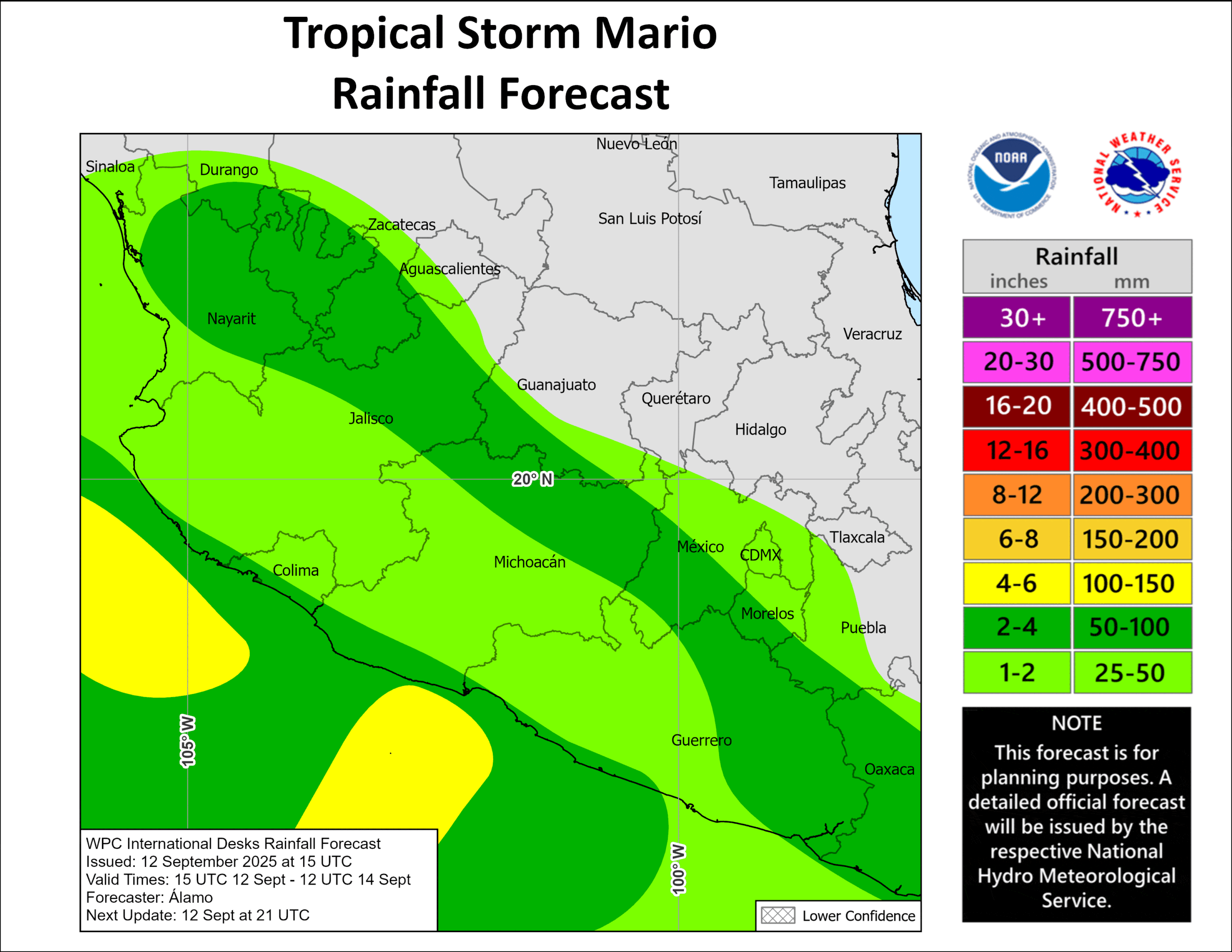
MARIO IS NO LONGER A TROPICAL CYCLONE
According to the NHC advisory number 7
The remnants are moving toward the west-northwest near 14 mph (22 km/h), and this general motion is expected to continue overnight. Maximum sustained winds are near 30 mph (45 km/h) with higher gusts. The estimated minimum central pressure is 1009 mb (29.80 inches).
HAZARDS AFFECTING LAND
RAINFALL: The remnants of Mario will lead to additional rainfall of 1 to 3 inches for Jalisco, with storm total amounts up to 6 inches locally through this morning. This brings a risk of flash flooding, especially in areas of higher terrain.
Central East Pacific:
>>> An area of low pressure could develop well offshore of the coast of
southern or southwestern Mexico early next week. Environmental
conditions are expected to be conducive for gradual development
thereafter, as the low tracks westward to west-northwestward around
10 to 15 mph.
*Formation chance through 48 hours…low…near 0 percent
*Formation chance through 7 days…low…20 percent
Central Pacific Ocean: There are no Tropical Cyclones
South and southeast of the Hawaiian Islands:
>>> An area of low pressure well southeast of the Hawaiian Islands is
producing a large area of disorganized showers and thunderstorms.
Environmental conditions appear conducive for some gradual
development of this system as it moves westward or
west-northwestward at around 10 mph.
*Formation chance through 48 hours…low…near 0 percent
*Formation chance through 7 days…low…20 percent
Western Pacific, Indian Ocean, and adjacent Seas: There are no Tropical Cyclones
Western Pacific
>>> There’s an area of disturbed weather being referred to as Invest 98W, which is located approximately 128 NM east-southeast of Legazpi
Animated multi-spectral satellite imagery (msi) depicts flaring convection to the northwest with a weakly defined low level circulation center (llcc). A 130029z ascat image shows 15-20 knot winds wrapping from the northern periphery with weaker winds to the south.
Environmental analysis for the area indicates marginally favorable conditions for development with low vertical wind shear (10-15 kts) and warm sea surface temperatures (30 c), offset by interaction with the Philippines and weak equatorward outflow aloft.
Global deterministic models are in agreement that 98W will move westward over the Philippines with little development. As for ensembles, ECENS is more aggressive in the short term than GEFS.
Maximum sustained surface winds are estimated at 13 to 88 knots.
The potential for the development of a significant tropical cyclone within the next 24 hours is low.
South Indian Ocean
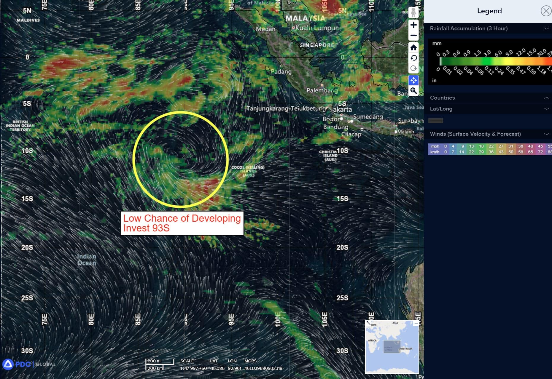
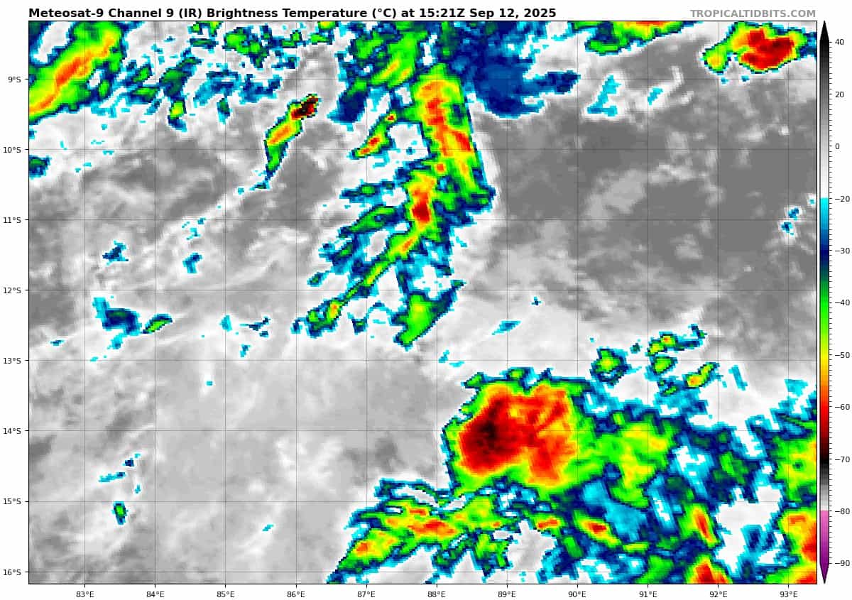
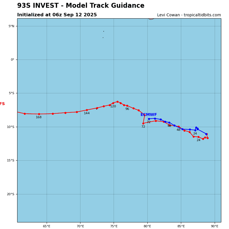
>>> There’s an area of disturbed weather being referred to as Invest 93S, which is located approximately 338 NM west-northwest of Cocos Islands
Animated multi-spectral satellite imagery (msi) does not depict a definable low level circulation center (llcc) for invest 93s, only a very broad and ill-defined rotation with convection being sheared to the southern periphery. A 112122z ssmis 91ghz microwave image depicted an ill-defined and elongated rotation displaced to the northeast of a patch of disorganized convection.
Environmental analysis reveals marginal to favorable environment for development with low to moderate vertical wind shear (20-25 knots), strong upper level equatorward outflow and
warm (27-28 c) sea surface temperature.
Deterministic models have rapidly backed off on development over the last couple runs, with no models showing significant development within the next 24 hours. However, ensemble models are continuing to depict a modest amount of development during the same time window. Both global and ensemble guidance agree on a west-southwestward track over the next 24-36 hours.
Maximum sustained surface winds are estimated at 22 to 28 knots.
The potential for the development of a significant tropical cyclone within the next 24 hours is downgraded to low.

")