IONA BECOMES THE FIRST NAMED STORM OF THE SEASON IN THE CENTRAL PACIFIC
According to the NHC advisory number 4

")
By PDC’s Senior Weather
Specialist Glenn James

The Pacific Disaster Center’s (PDC Global) Sunday, July 27, 2025, Tropical Cyclone Activity Report…for the Pacific Ocean, the Indian Ocean, and adjacent Seas
Current Tropical Cyclones:
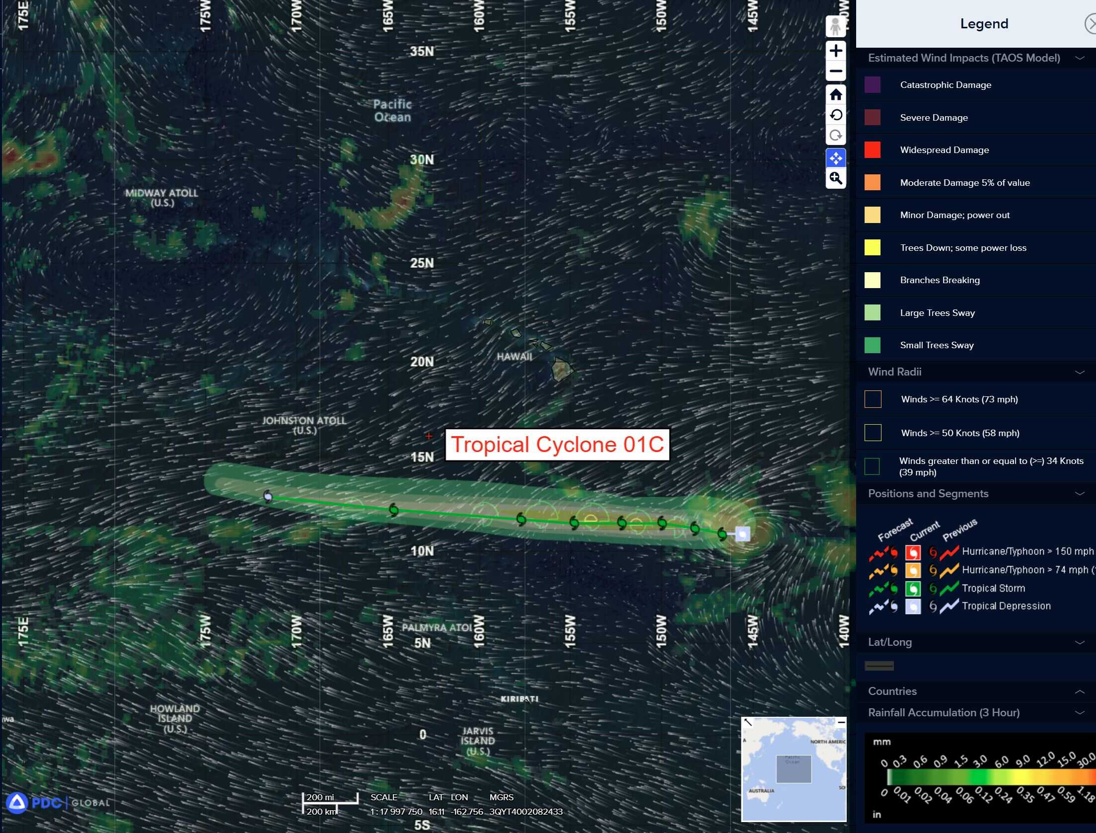
Tropical Cyclone 01C (Iona)…is located about 960 miles southeast of Honolulu, Hawaii
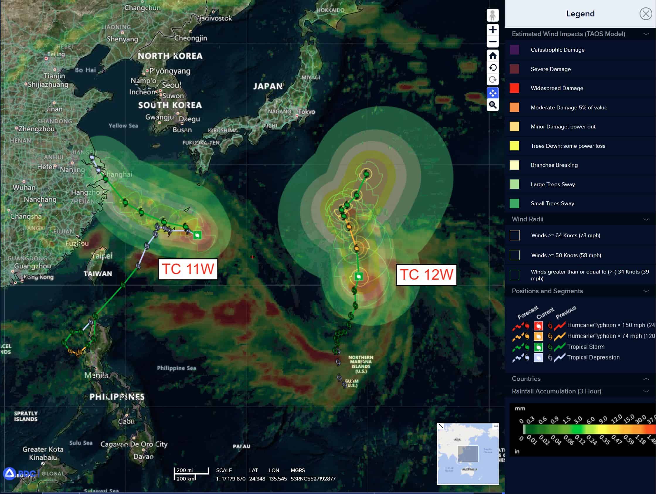
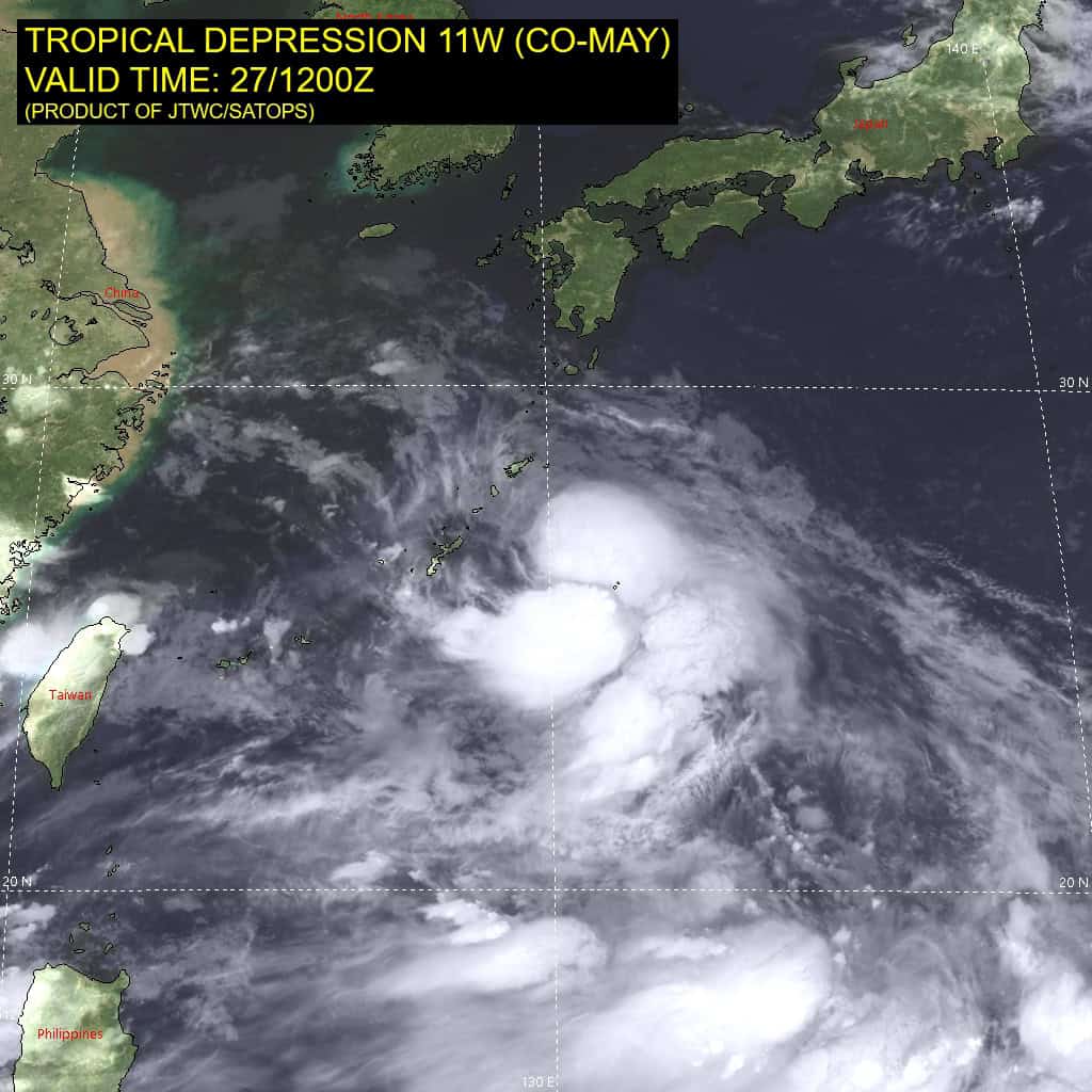
Tropical Cyclone 11W (Co-may)…is located 13 NM south-southeast of Kadena AB
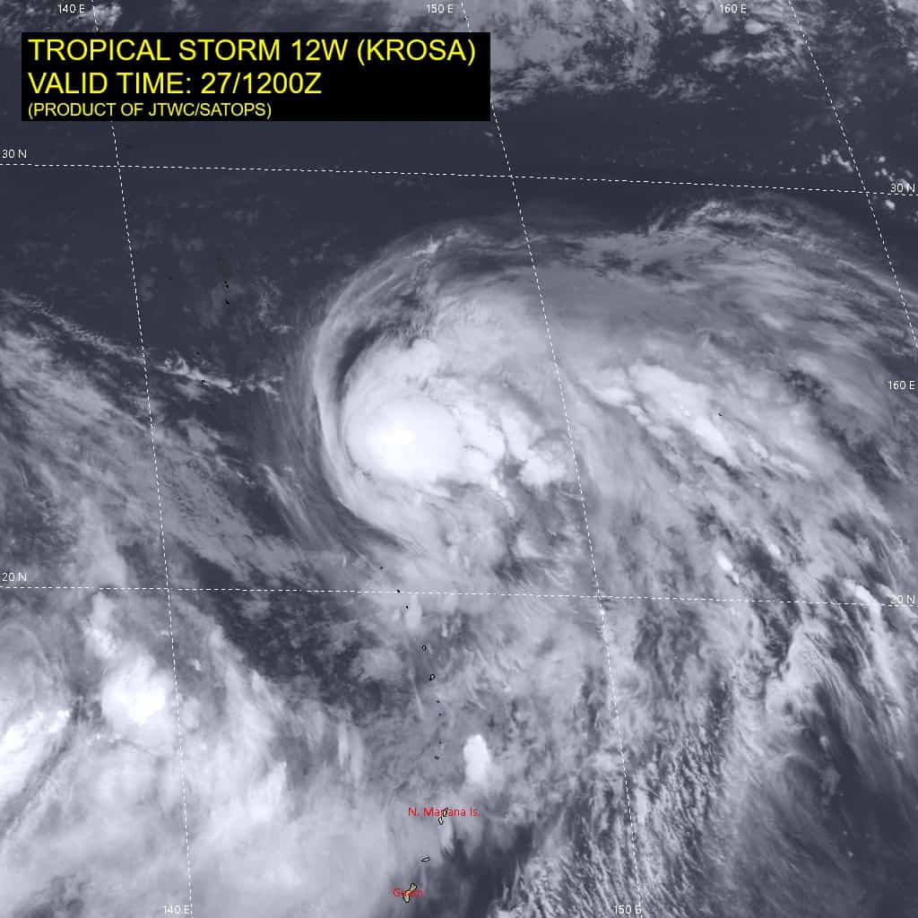
Tropical Cyclone 12W (Krosa)…is located 637 NM south-southeast of Yokosuka, Japan
Northeast Pacific Ocean: There are no Tropical Cyclones
Western East Pacific:
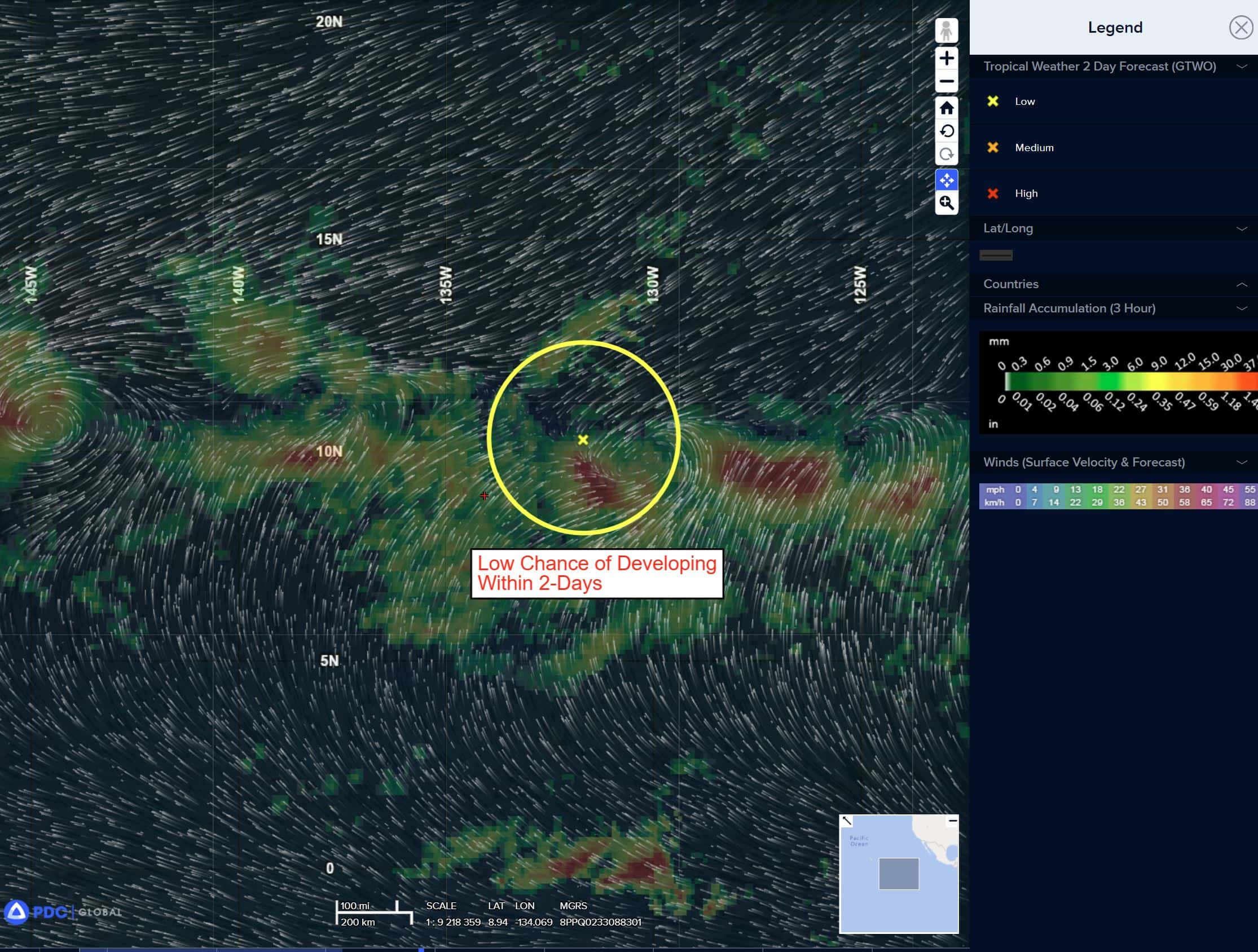
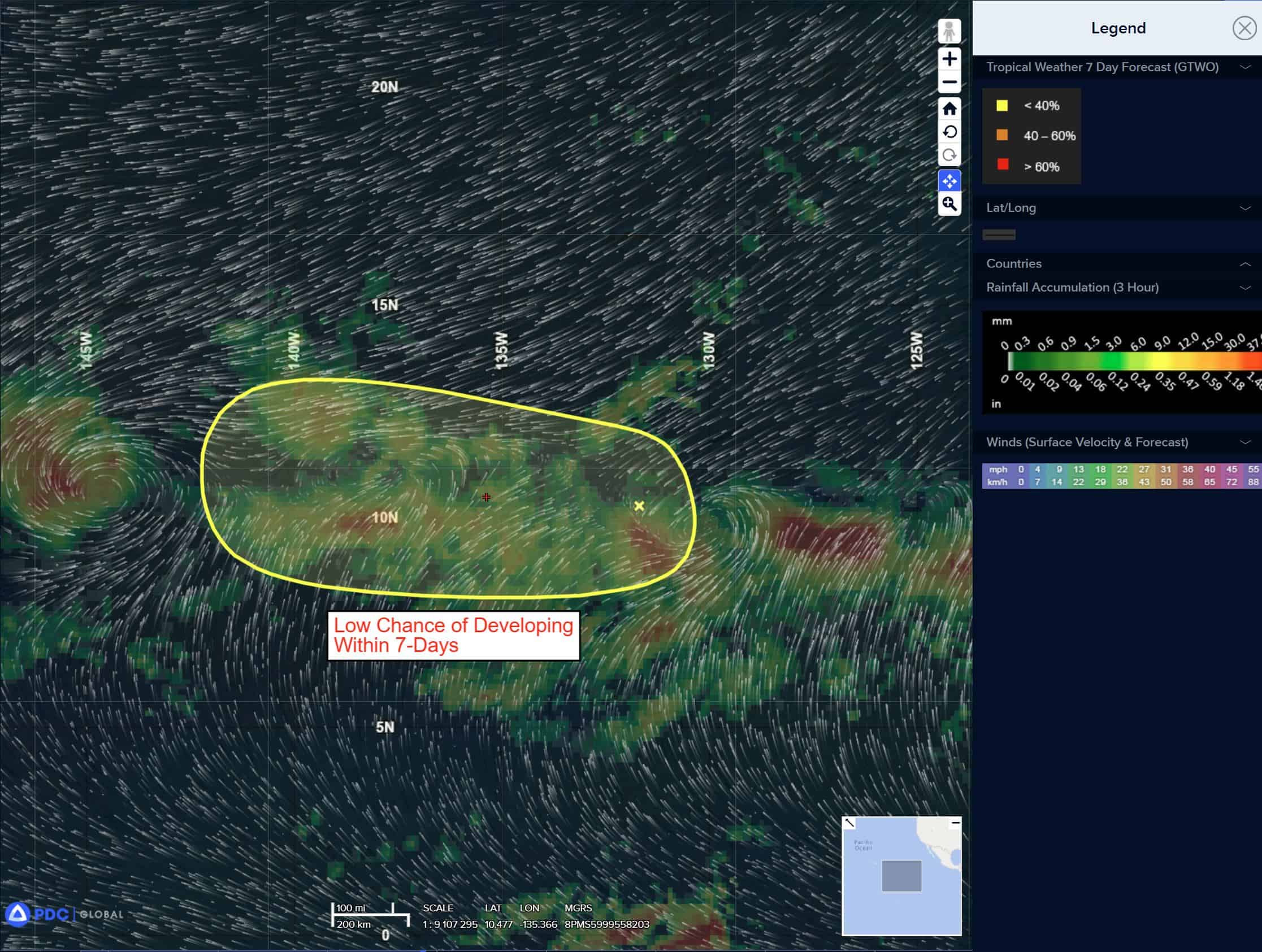
>>> An area of low pressure well east-southeast of the Hawaiian Islands is producing disorganized showers and thunderstorms. Gradual development of this system is possible and a tropical depression could form during the next couple of days as it moves generally westward around 10 mph.
* Formation chance through 48 hours…medium…40 percent
* Formation chance through 7 days…medium…40 percent
South of Southwestern Mexico:
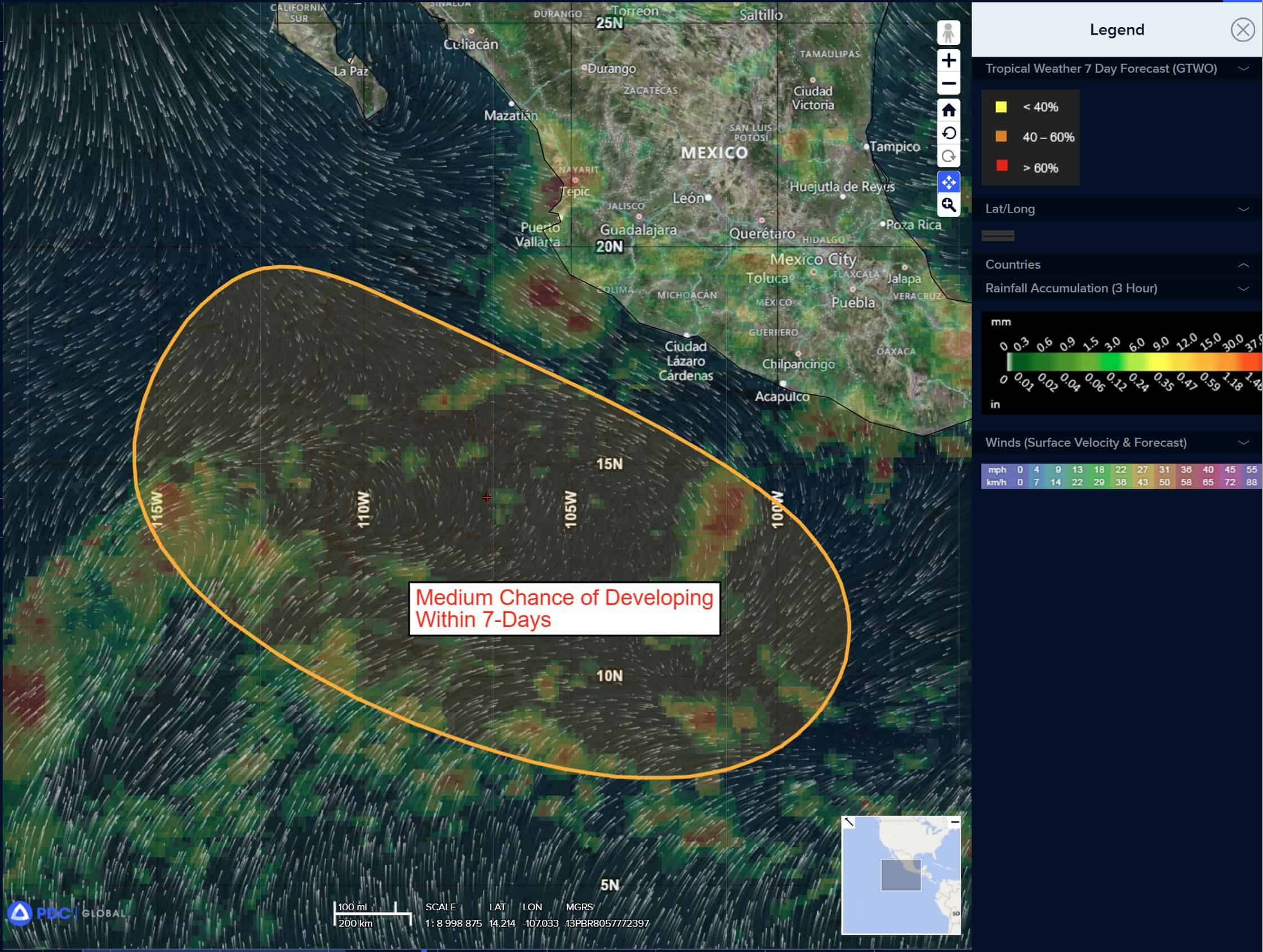
>>> A disturbance located several hundred miles south-southwest of the Gulf of Tehuantepec is producing a large area of disorganized showers and thunderstorms. During the next day or two, an area of low pressure is forecast to form from this area of disturbed weather, well off the coast of southwestern Mexico. Thereafter, environmental conditions appear conducive for gradual development of this system, and a tropical depression is likely to form late this week as it moves west-northwestward or northwestward at 10 to 15 mph.
* Formation chance through 48 hours…low…20 percent
* Formation chance through 7 days…high…70 percent
Central Pacific Ocean:
Tropical Cyclone 01C (Iona)
IONA BECOMES THE FIRST NAMED STORM OF THE SEASON IN THE CENTRAL PACIFIC
According to the NHC advisory number 4
Iona is moving toward the west near 10 mph (17 km/h). This motion is expected to continue for the next few days, with Iona remaining well to the south of the Hawaiian Islands. Maximum sustained winds are near 40 mph (65 km/h) with higher gusts. Steady strengthening is forecast during the next couple of days. Tropical-storm-force winds extend outward up to 35 miles (55 km) from the center.
Western East Pacific:
>>> A low pressure area has formed well east-southeast of the Hawaiian Islands. While the associated thunderstorm activity is currently disorganized, gradual development of this system is possible during the next couple of days while it moves generally westward around 10 mph.
* Formation chance through 48 hours…medium…40 percent
* Formation chance through 7 days…medium…40 percent
Western Pacific, Indian Ocean, and adjacent Seas:
Western Pacific
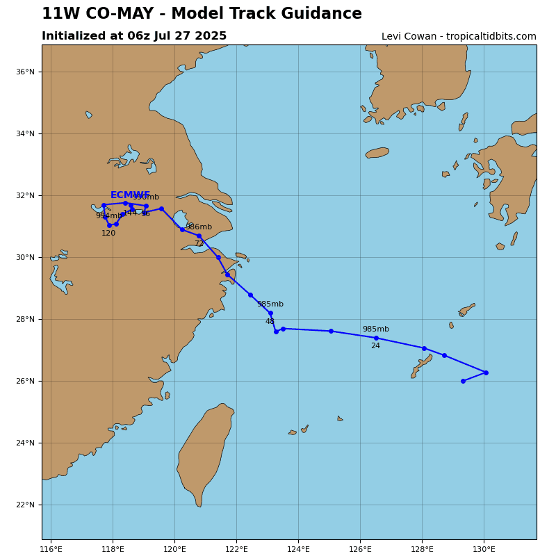
Tropical Cyclone 11W (Co-may)
According to the JTWC warning number 21 sustained winds are 35 knots with gusts to near 45 knots
Animated enhanced infrared (eir) satellite imagery depicts persistent deep convection building over a disorganized low-level circulation center (llcc). Water vapor imagery reveals equatorward outflow and dry air approaching from the north. an upper-level cyclone to the northwest applies pressure on the northwestern quadrant of the system, slightly shearing the deep convection to the east.
TS 11W will remain in a competing and confused steering environment between two ridges to the north and south for the next 12 hours. The track will remain weak and irregular before the ridge to the south weakens at 24 hours, allowing the system to assume a west-northwestward track. However, small deviations in the track movement may not be captured within the warning graphic. If the ridge extends farther south, TS 11W may track closer to Okinawa or south of the island. The system will continue to round the southwestern quadrant of the subtropical ridge curving to the northwest. Landfall will occur immediately following 72 hours, leading to dissipation by 120 hours.
Rapid intensification is possible during the next 24 hours as the upper-level cyclone to the northwest fills. The upper-level environment will become highly favorable with dual-channel outflow. The vertical wind shear will remain favorable and sea surface temperatures will continue to be warm through 48 hours. After 48 hours, vertical wind shear will increase unfavorably to 15-20 knots, and initiate a weakening phase. The system will weaken gradually prior to landfall before 72 hours. After 72 hours, topographic interaction will weaken the system to dissipation by 120 hours.
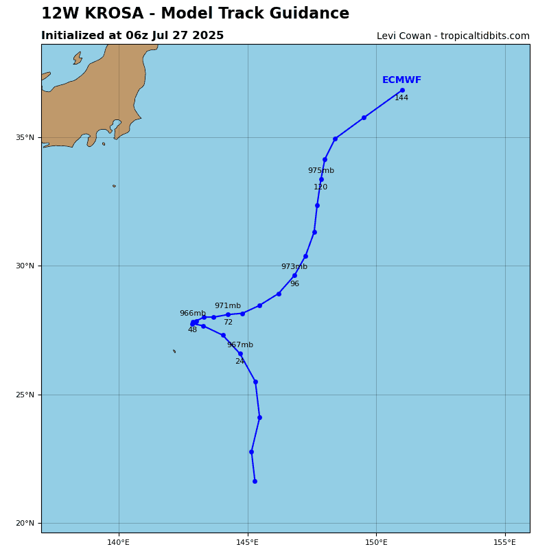
Tropical Cyclone 12W (Krosa)
According to the JTWC warning number 18 sustained winds are 80 knots with gusts to near 100 knots
Animated multi-spectral satellite imagery (msi) depicts building centralized deep convection over the low-level circulation center (llcc). Dry air and high vertical wind shear associated with a trough to the west imposing on the structure of tropical storm 11W. The difference between the two systems also indicates a vertical tilt with height given that the microwave eye in the upper level is positioned east of the llcc.
TS 12W will continue tracking northward on the near equatorial ridge to the east through 48 hours. The steering environment will become weak and competing between the near equatorial ridge and a subtropical ridge centered over japan. The near equatorial ridge will reorient on a southwest-northeast ridge after 72 hours, allowing the system to drive northwestward for the remainder of the forecast period.
The system will continue to combat highly unfavorable vertical wind shear with expansive dual-channel outflow for the next 24 hours. After 36 hours, vertical wind shear will increase unfavorably and entrain dry air into the core of the system. The quasi-stationary motion will drain the ocean heat content as well, but after 72 hours the system will move into warmer favorable waters and re-intensify to 80 knots by the end of the forecast.