Western Pacific, Indian Ocean, and adjacent Seas:
Western Pacific
Tropical Cyclone 22W (Tapah)

")
By PDC’s Senior Weather
Specialist Glenn James

The Pacific Disaster Center’s (PDC Global) Sunday, September 7, 2025, Tropical Cyclone Activity Report…for the Pacific Ocean, the Indian Ocean, and adjacent Seas
Current Tropical Cyclones:
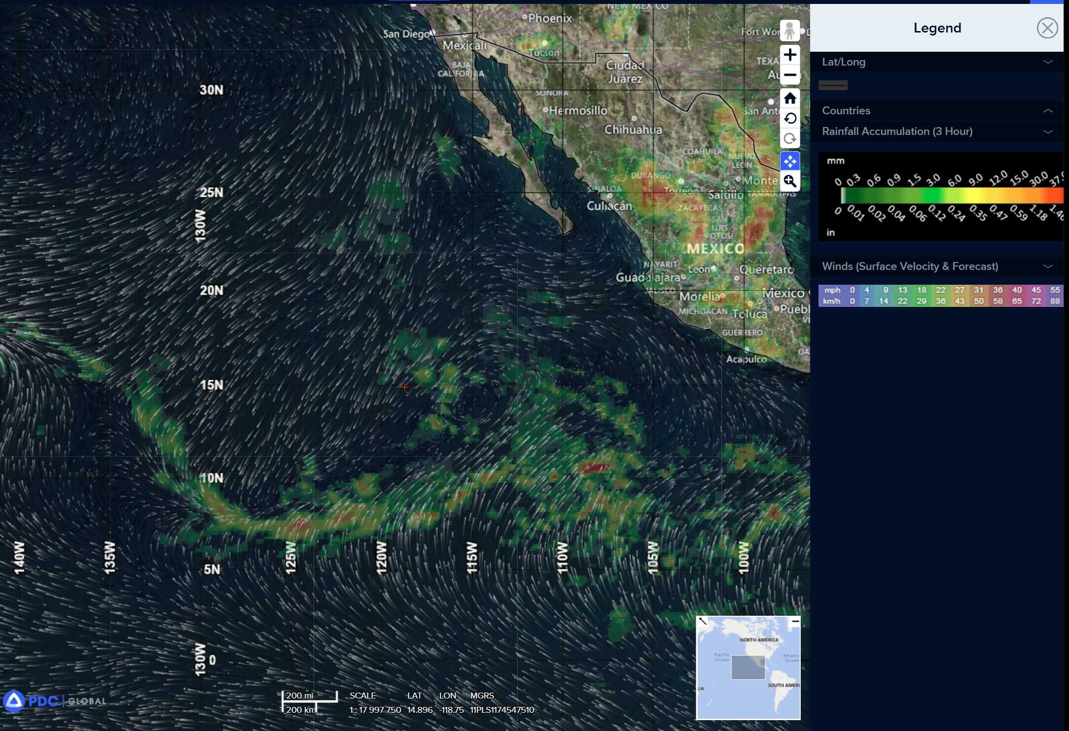
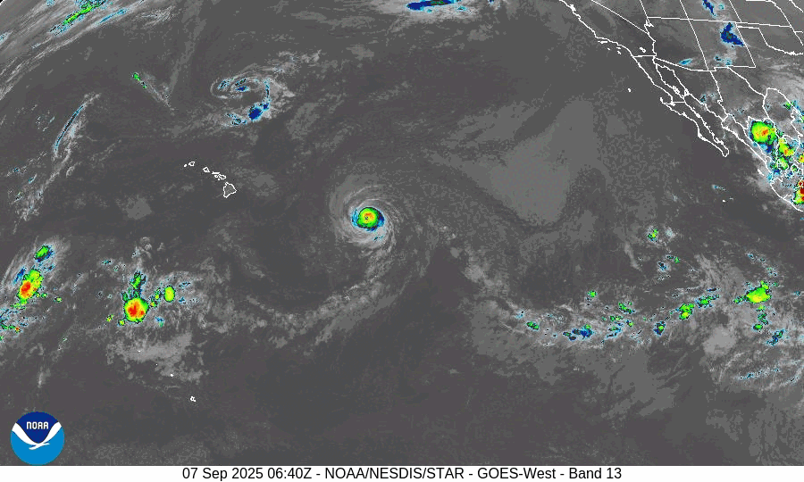
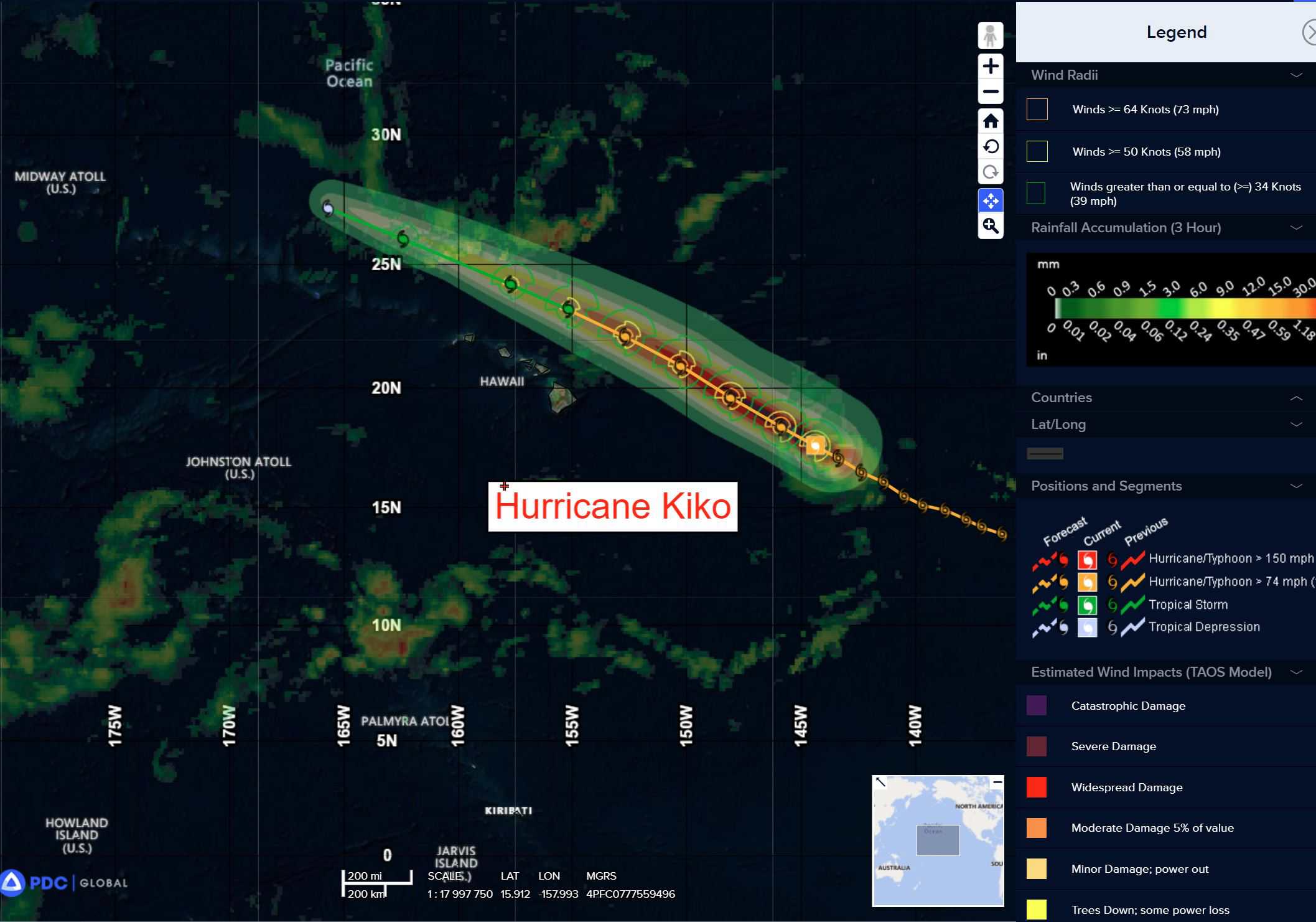
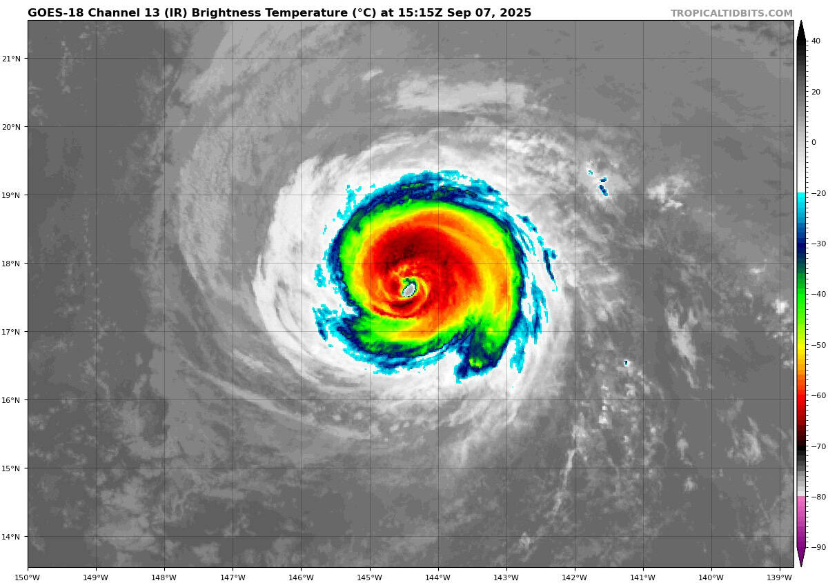
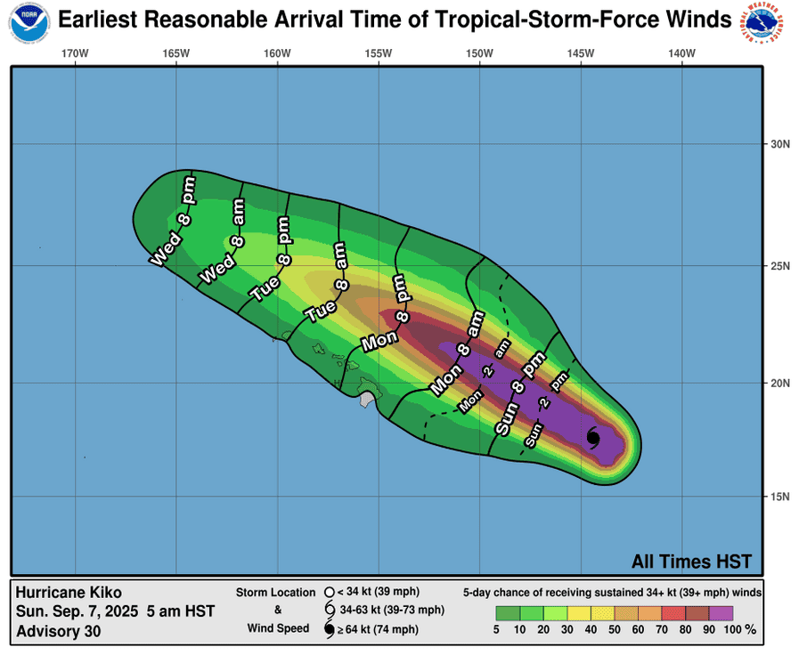
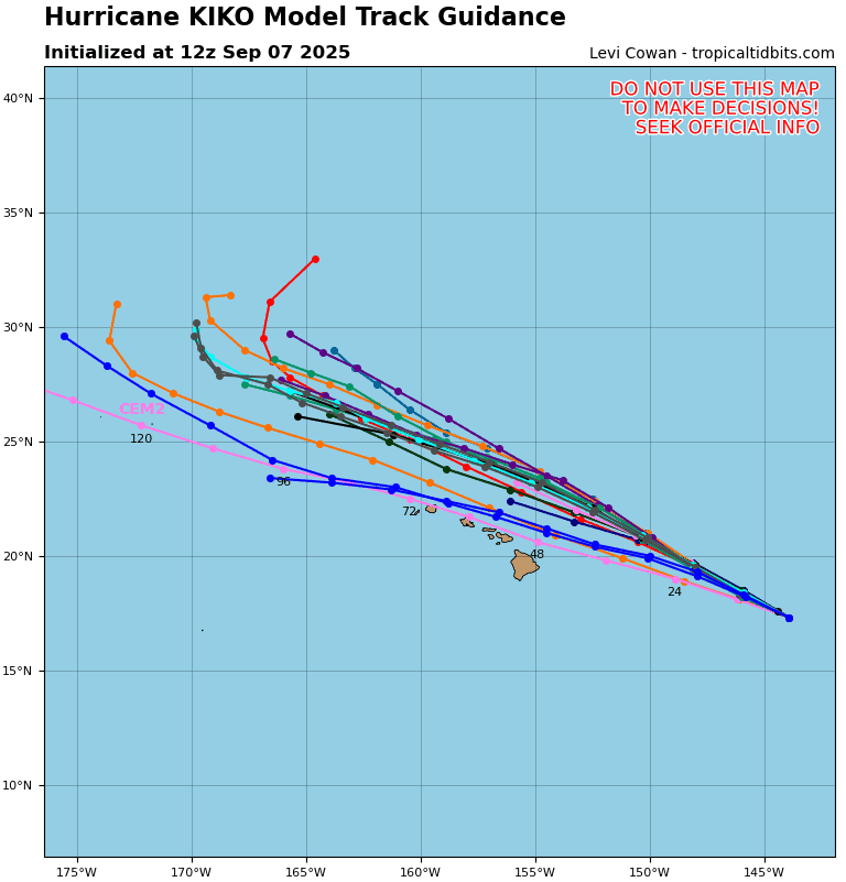
Tropical Cyclone 11E (Kiko) is located about 600 miles east of Hilo, Hawaii
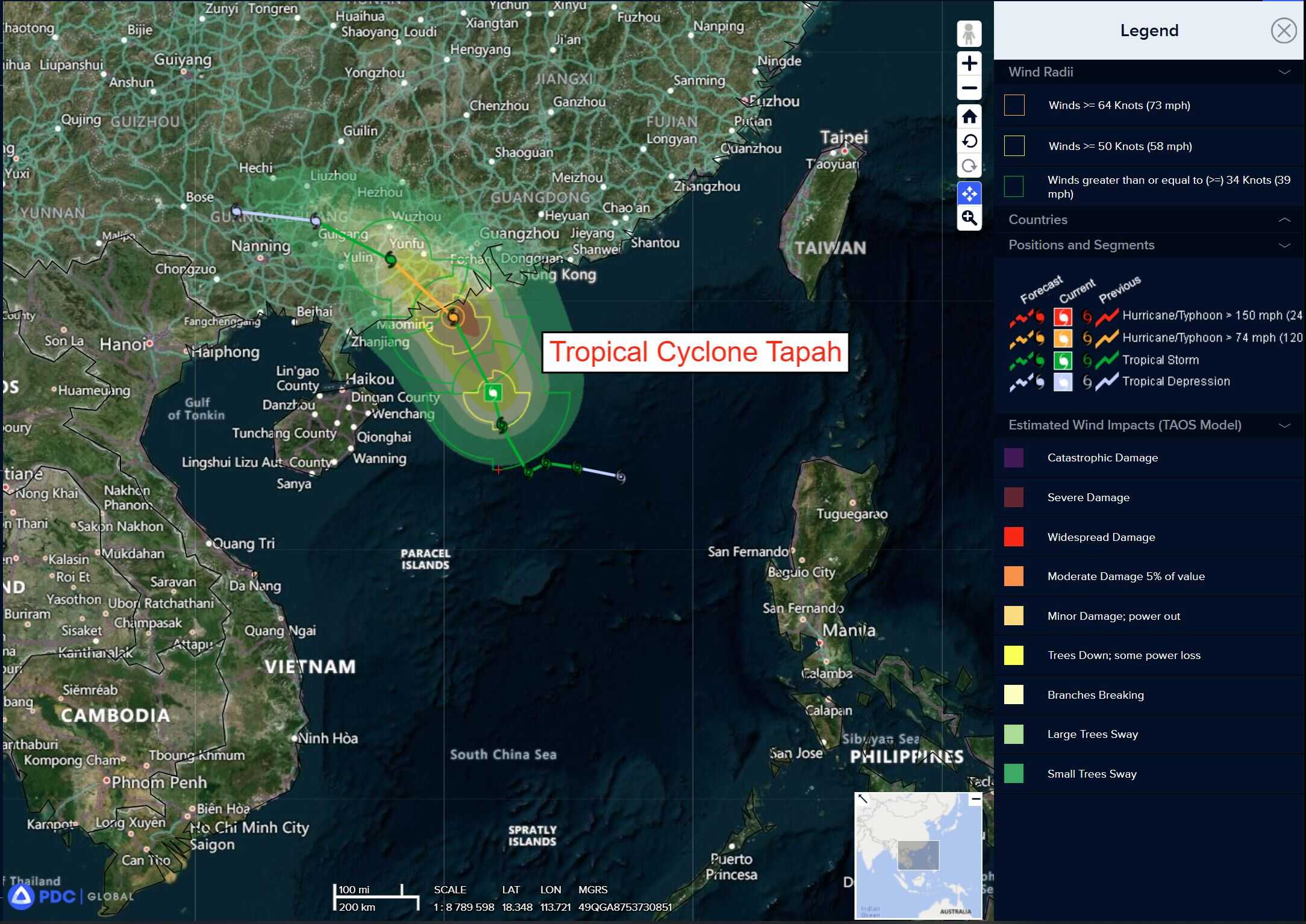
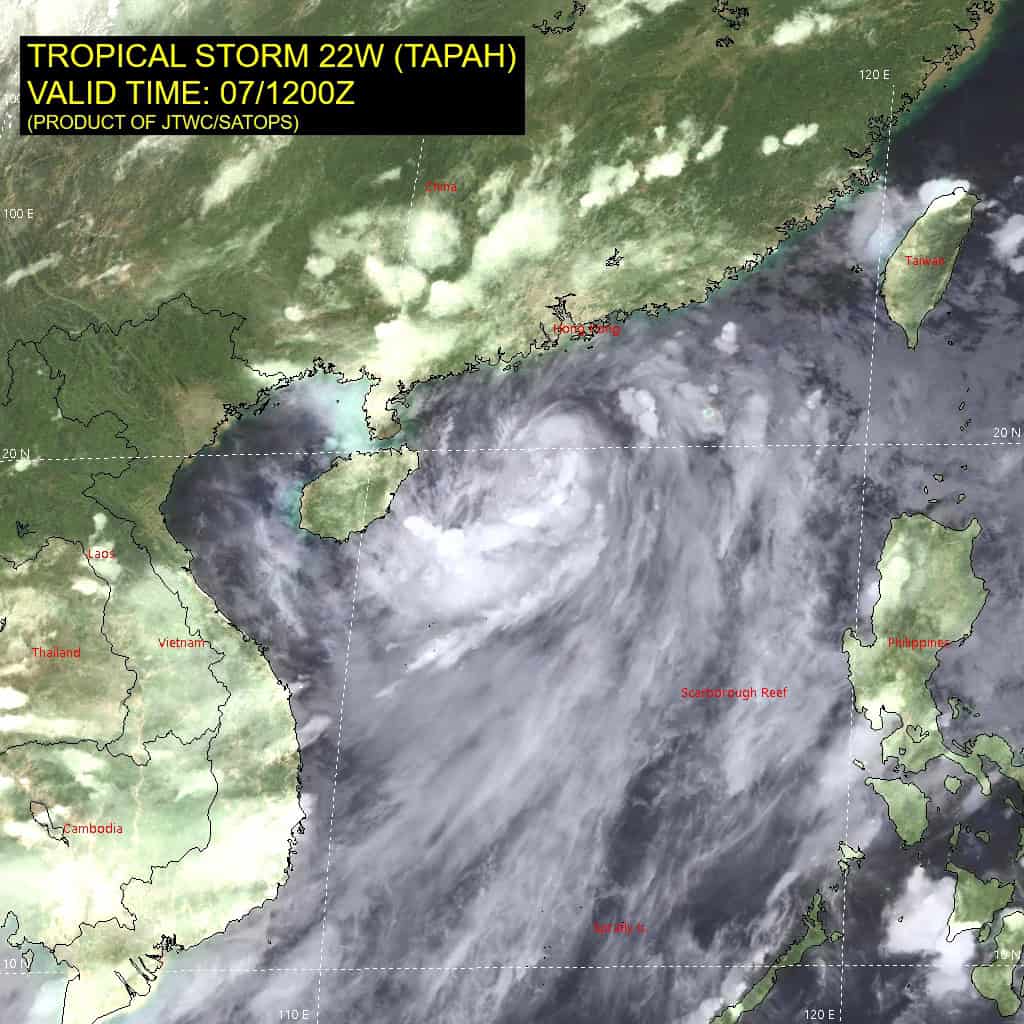
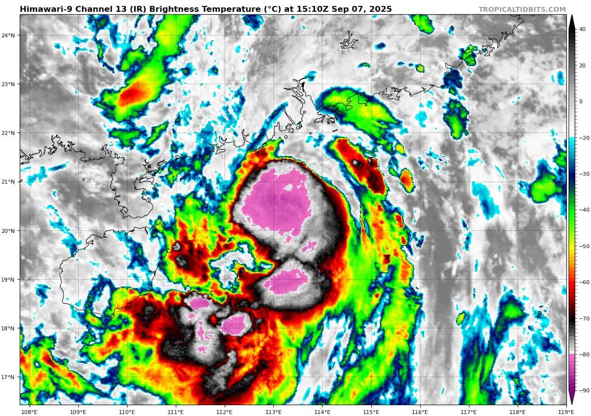
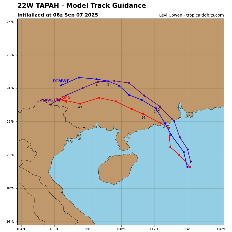
Tropical Cyclone 22W (Tapah) is located about 106 miles south-southwest of Hong Kong
Northeast Pacific Ocean: There are no Tropical Cyclones
Tropical cyclone formation is not expected during the next 7-days.
Central Pacific Ocean:
Tropical Cyclone 11E (Kiko)
AIR FORCE RESERVE HURRICANE HUNTERS FIND THAT KIKO CONTINUES TO WEAKEN…EXPECTED TO PASS NORTH OF THE HAWAIIAN ISLANDS ON TUESDAY AND WEDNESDAY
According to the NHC advisory number 31
Kiko is moving toward the west-northwest near 13 mph (20 km/h), and this general motion with a slight increase in forward speed is expected through Wednesday. On the forecast track, the center of Kiko is expected to pass north of the Hawaiian Islands on Tuesday and Wednesday. Reports from an Air Force Reserve Hurricane Hunter aircraft indicate that maximum sustained winds have decreased to near 110 mph (175 km/h) with higher gusts. Additional weakening is forecast during the next few days, and Kiko is expected to become a tropical storm by late Monday or Monday night. Hurricane-force winds extend outward up to 30 miles (45 km) from the center and tropical-storm-force winds extend outward up to 80 miles (130 km).
HAZARDS AFFECTING LAND
SURF: Swells generated by Kiko are expected to begin reaching the Big Island and Maui today. These swells will gradually build and are forecast to peak along east-facing exposures of the Hawaiian Islands late Monday through midweek, potentially producing life-threatening surf and rip currents.
Western Pacific, Indian Ocean, and adjacent Seas:
Western Pacific
Tropical Cyclone 22W (Tapah)
Animated enhanced infrared (eir) satellite imagery depicts a consolidating low-level circulation (llc), with deep convection building over the center. Animated radar imagery reveals a partial eyewall over the eastern quadrant, with a possible developing eye. The initial position is placed with high confidence based on the eir and radar imagery.
Based on the steady consolidation, cimss objective intensity estimates have increased and now range from 42-49 knots. The initial intensity of 50 knots is assessed with medium confidence, hedged slightly above the agency dvorak estimates based on the improving core structure.
Environmental conditions have steadily improved over the past 12 hours, with persistent strong equatorward outflow, expanding northward outflow, low vertical wind shear and warm sst values.
Tropical storm 22W is forecast to continue to steadily moisten and will consolidate quickly over the next 12 hours as it approaches the southern coast of China. A peak intensity of 65-70 knots will occur around 12 hours just prior to landfall. After 12 hours, the system will gradually turn west-northwestward to westward as it steers under the building str to the north. Dissipation is expected by 48 hours.
South Indian Ocean:
There’s an area of disturbed weather being referred to as Invest 92S, which is located approximately 254 NM east of Diego Garcia
Enhanced infrared satellite imagery (eir) depicts a disorganized area of convection with little to no banding evident. 850mb vorticity analysis indicates the invest is embedded within the near equatorial trof. A 071605z ascat-c image shows 10-15 knot winds wrapping around the broad circulation, with 20-30 knot winds to the southern periphery of invest 92S.
Environmental analysis reveals moderately favorable conditions for development with moderate vertical wind shear (15-20 knots), moderate diffluent outflow (primarily westward) aloft, and warm (27-28c) sea surface temperatures.
Global models show minor development with a west-southwestward track over the next 48 hours, passing close to the southeast of Diego Garcia.
Maximum sustained surface winds are estimated at 23 to 28 knots.
The potential for the development of a significant tropical cyclone within the next 24 hours is low.