
Western Pacific, Indian Ocean, and adjacent Seas: There are no Tropical Cyclones
")
Tropical Cyclone 11E (Kiko) / Invest 92S – Pacific
Monday, September 8, 2025
Current Snapshot
For all the latest updates visit: DisasterAWARE
kiko
e
1200×1200
goes18_ir_11E_202509081515_lat20.0-lon-148.2
081443_earliest_reasonable_toa_34
11E_tracks_latest
wpac
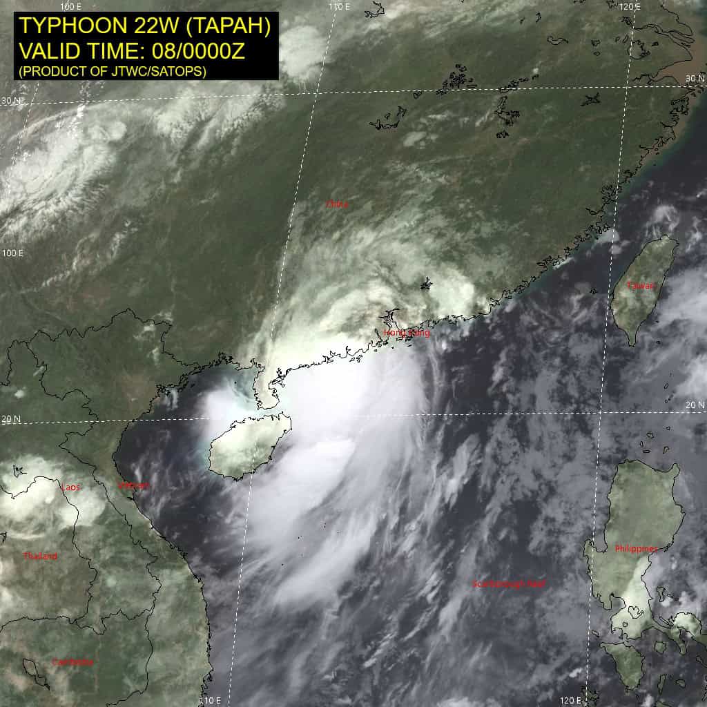
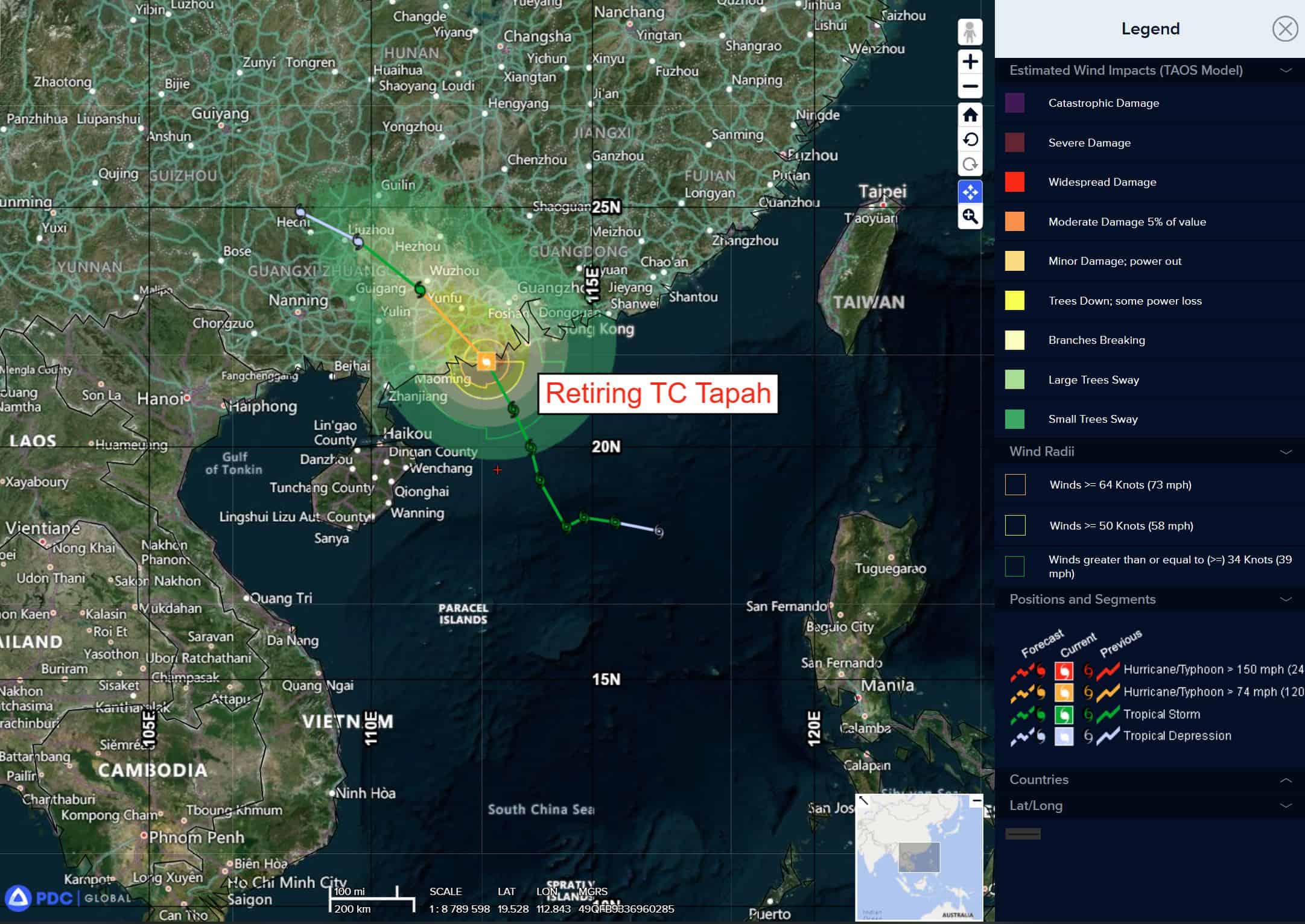
22W_080000sair
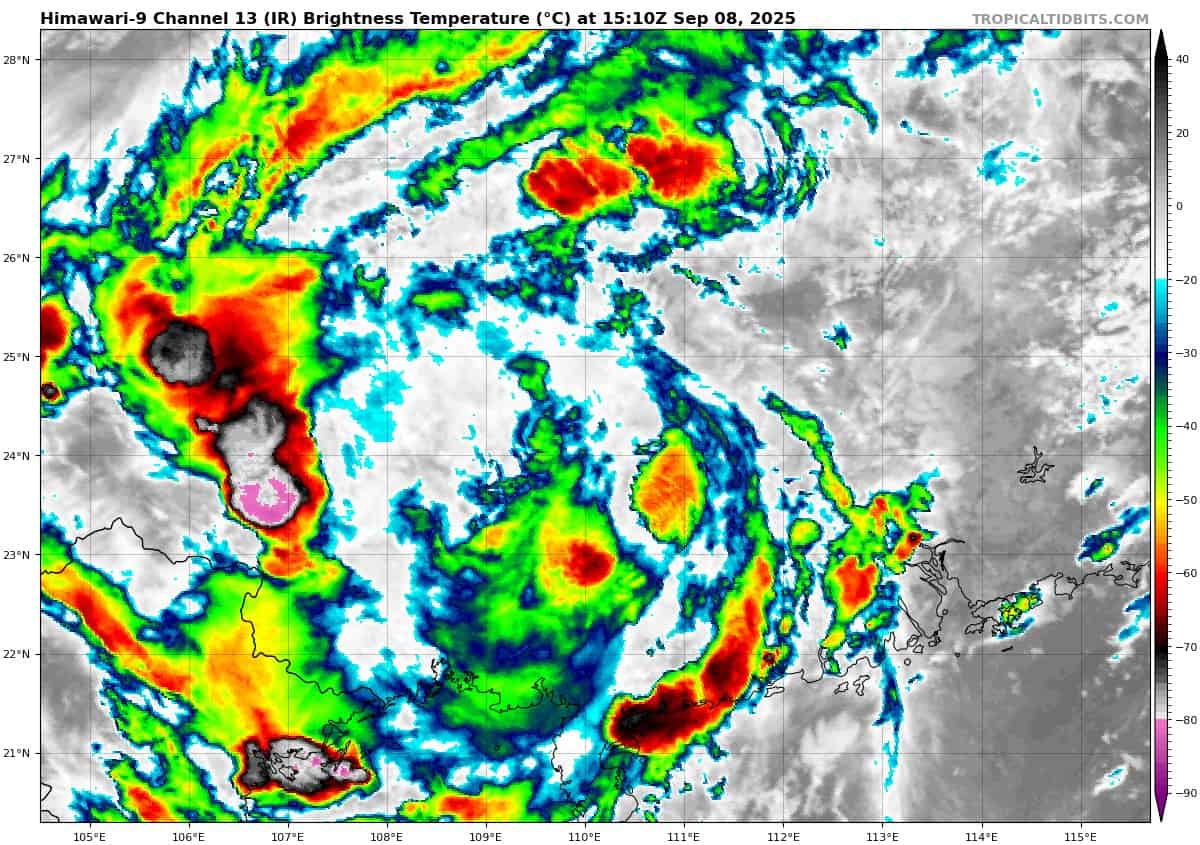
himawari9_ir_22W_202509081510_lat23.8-lon110.6
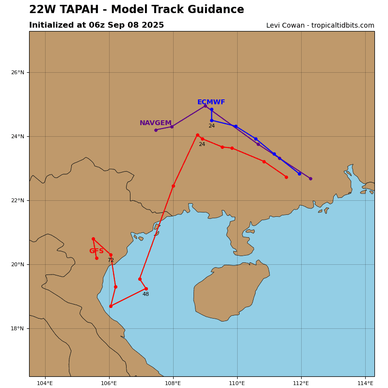
22W_tracks_latest
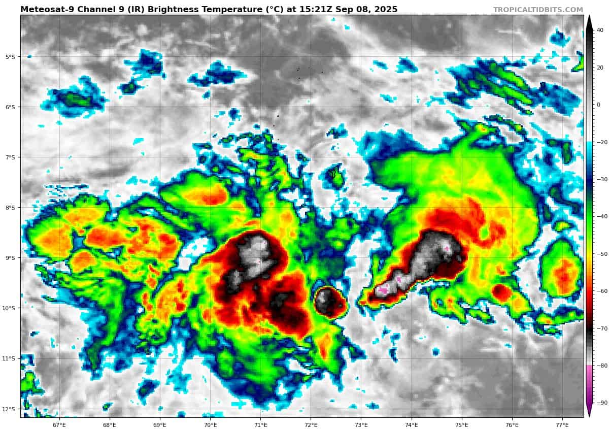
meteosat9_ir_92S_202509081521_lat-8.1-lon72.5
92S_tracks_latest
By PDC’s Senior Weather
Specialist Glenn James

The Pacific Disaster Center’s (PDC Global) Monday, September 8, 2025, Tropical Cyclone Activity Report…for the Pacific Ocean, the Indian Ocean, and adjacent Seas
Current Tropical Cyclones:
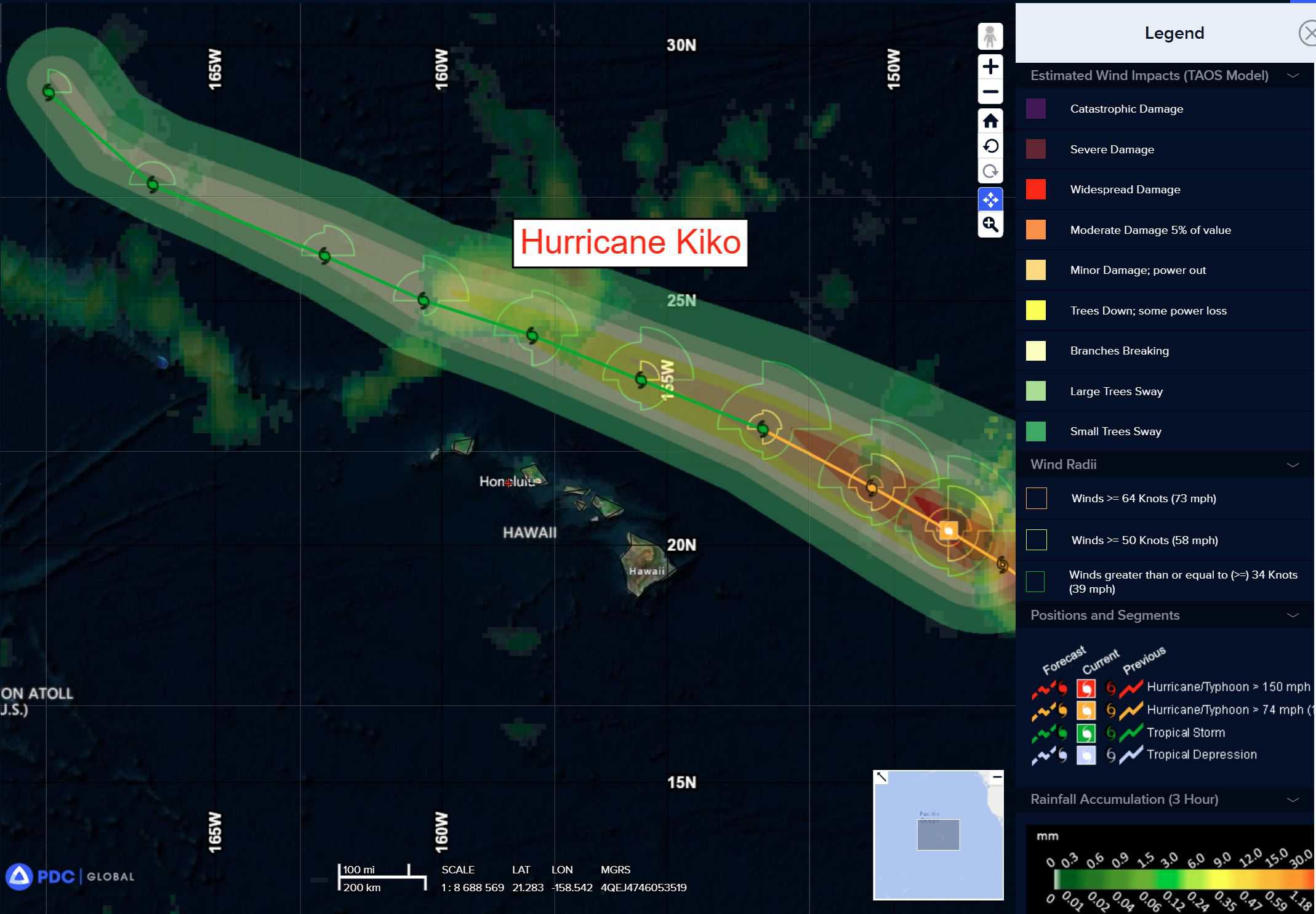
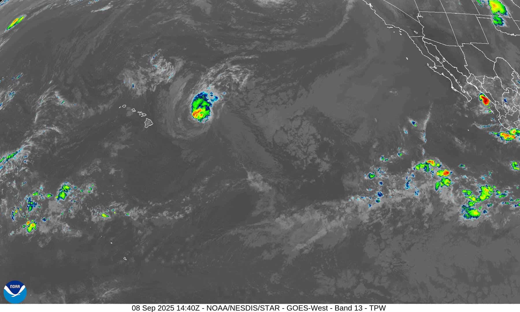
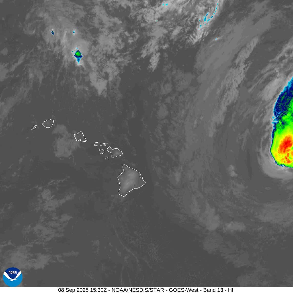
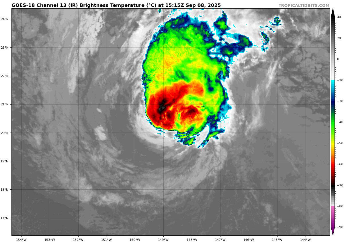
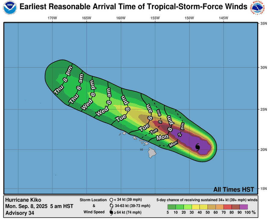
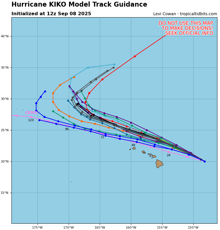
Tropical Cyclone 11E (Kiko) is located about 350 miles east-northeast of Hilo, Hawaii
Northeast Pacific Ocean: There are no Tropical Cyclones
Tropical cyclone formation is not expected during the next 7-days.
Central Pacific Ocean:
Tropical Cyclone 11E (Kiko)
KIKO STEADILY WEAKENS BUT REMAINS A CATEGORY 1 HURRICANE…FORECAST TO PASS NORTH OF THE HAWAIIAN ISLANDS TUESDAY AND WEDNESDAY
According to the NHC advisory number 36
Kiko is moving toward the northwest near 14 mph (22 km/h) and this motion is expected to continue for the next few days. On the forecast track, Kiko is expected to pass north of the main Hawaiian Islands on Tuesday and Wednesday. Maximum sustained winds are near 75 mph (120 km/h) with higher gusts. Weakening is forecast during the next few days, and Kiko is expected to become a tropical storm late tonight. Hurricane-force winds extend outward up to 45 miles (75 km) from the center and tropical-storm-force winds extend outward up to 125 miles (205 km).
HAZARDS AFFECTING LAND
SURF: Swells generated by Kiko are expected to gradually build and are forecast to peak along east-facing exposures of the Hawaiian Islands later today through midweek, potentially producing life-threatening surf and rip currents.
South Indian Ocean:
>>> There’s an area of disturbed weather being referred to as Invest 92S, which is located approximately 123 NM southwest of Diego Garcia
Animated enhanced infrared satellite imagery depicts deep convection building over the center with curved deep convective banding. A 081725z ascat image shows 25-30 knot winds wrapping around a consolidating circulation.
Environmental analysis for the area indicates moderate favorable conditions for development with high vertical wind shear (25-30 kts), offset by warm sea surface temperatures (28-29 c) and moderate poleward outflow aloft.
Global deterministic models are all in good agreement that 92S will continue to intensify over the next 48 hours on a westward track. Global ensemble models are in agreement as well that 92S will intensify over the next 48 hours with ECENS showing higher intensity support.
Maximum sustained surface winds are estimated at 23 to 28 knots.
The potential for the development of a significant tropical cyclone within the next 24 hours is upgraded to high.