Western Pacific, Indian Ocean, and adjacent Seas:
Western Pacific
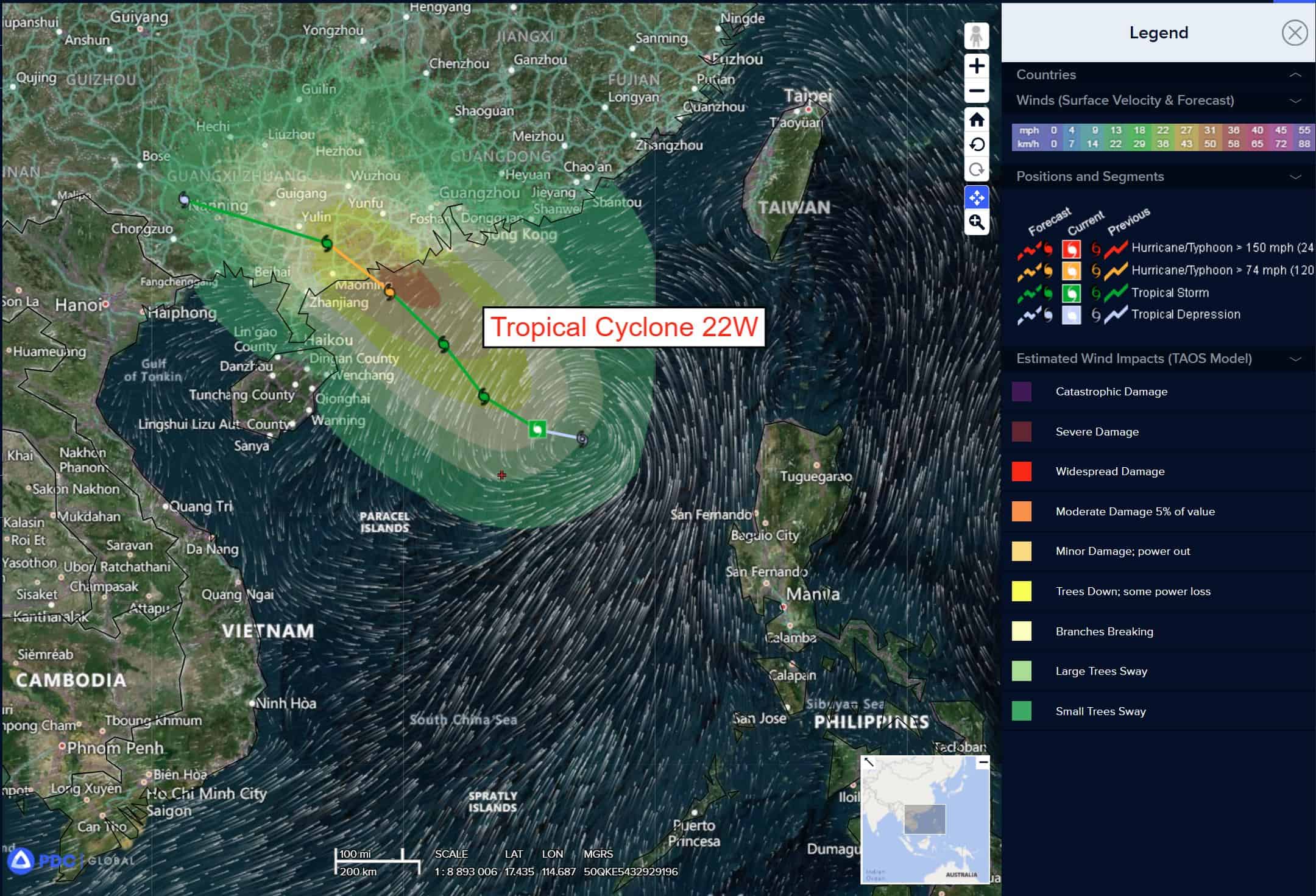
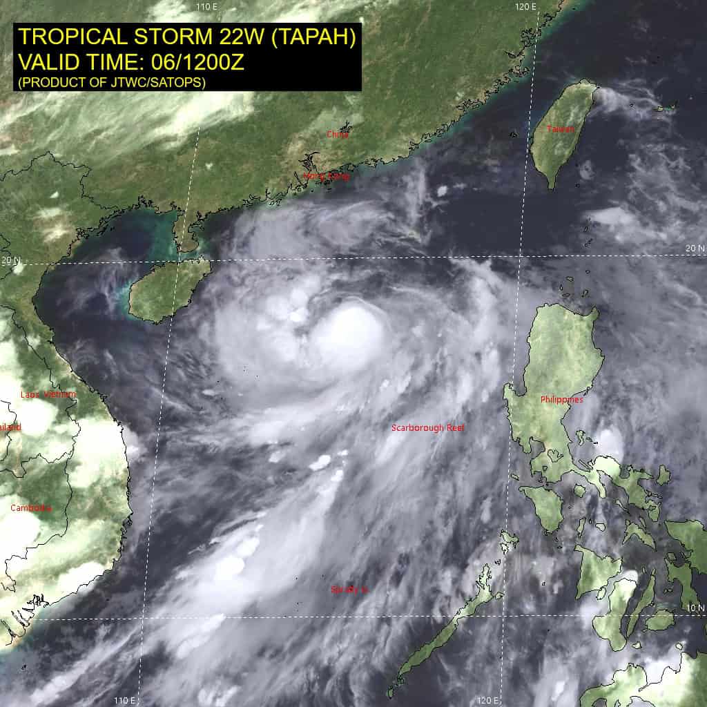
Tropical Cyclone 22W (Tapah)

")
By PDC’s Senior Weather
Specialist Glenn James

The Pacific Disaster Center’s (PDC Global) Saturday, September 6, 2025, Tropical Cyclone Activity Report…for the Pacific Ocean, the Indian Ocean, and adjacent Seas
Current Tropical Cyclones:
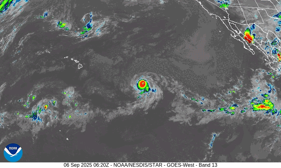
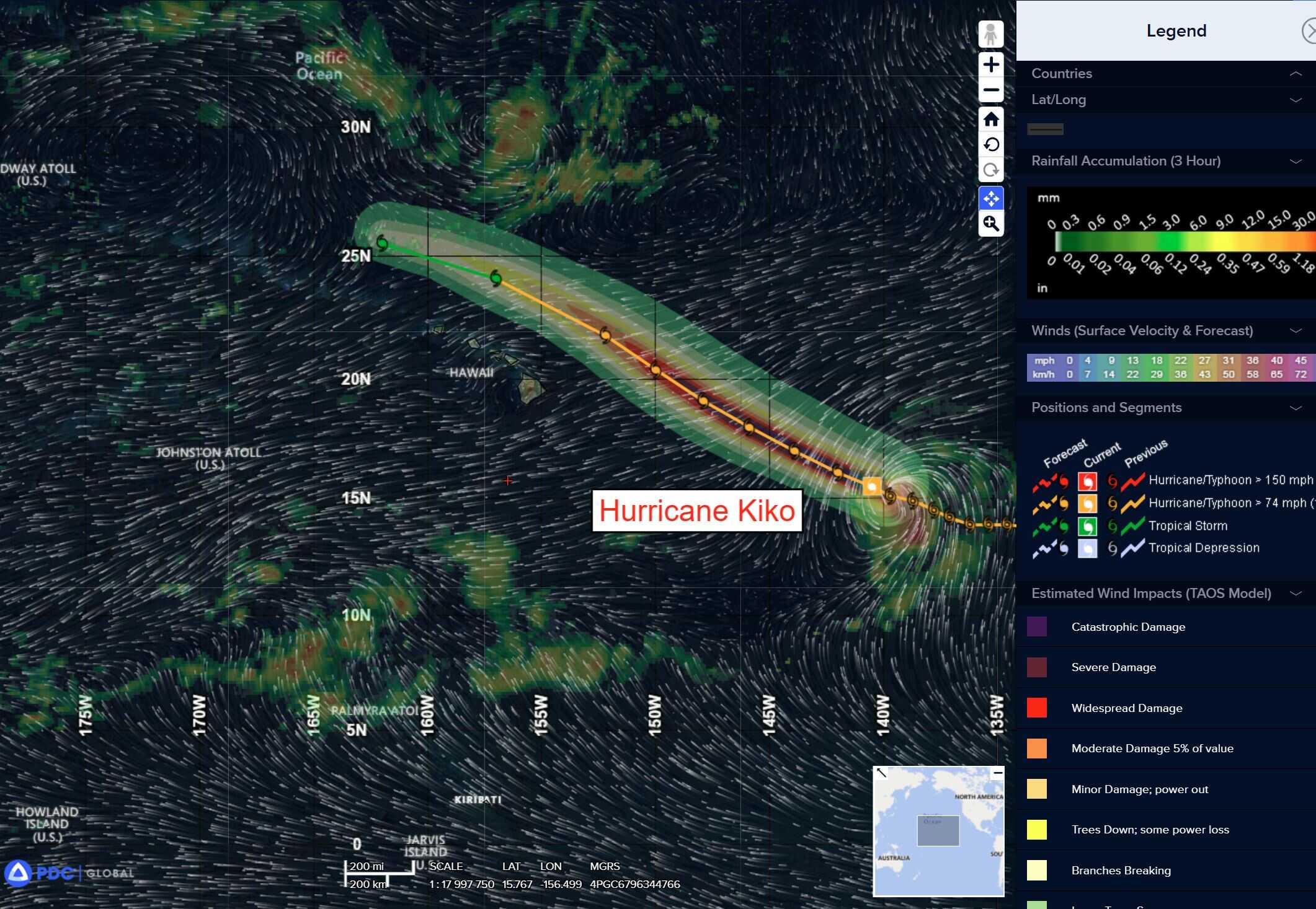
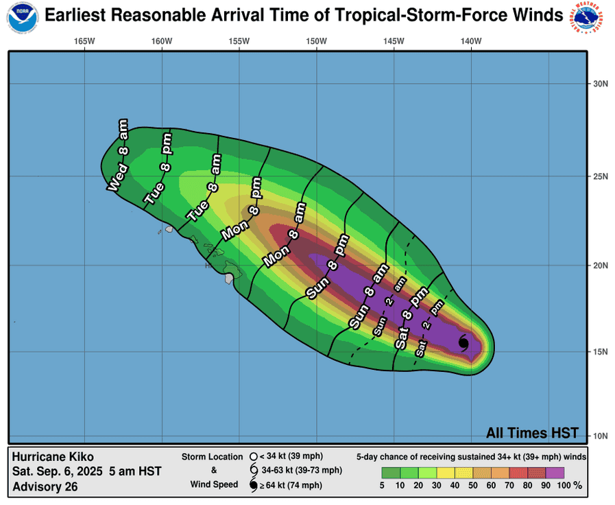
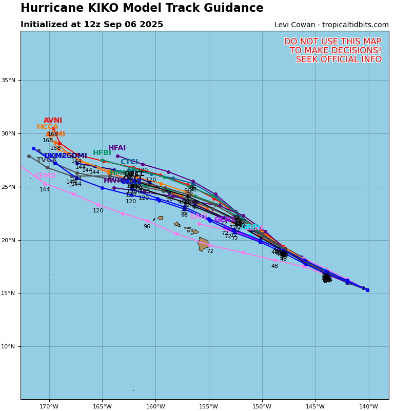
Tropical Cyclone 11E (Kiko) is located about 860 miles east-southeast of Hilo, Hawaii
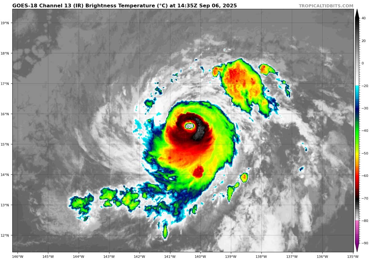
Tropical Cyclone 22W (Tapah) is located about 240 miles south of Hong Kong
Northeast Pacific Ocean:
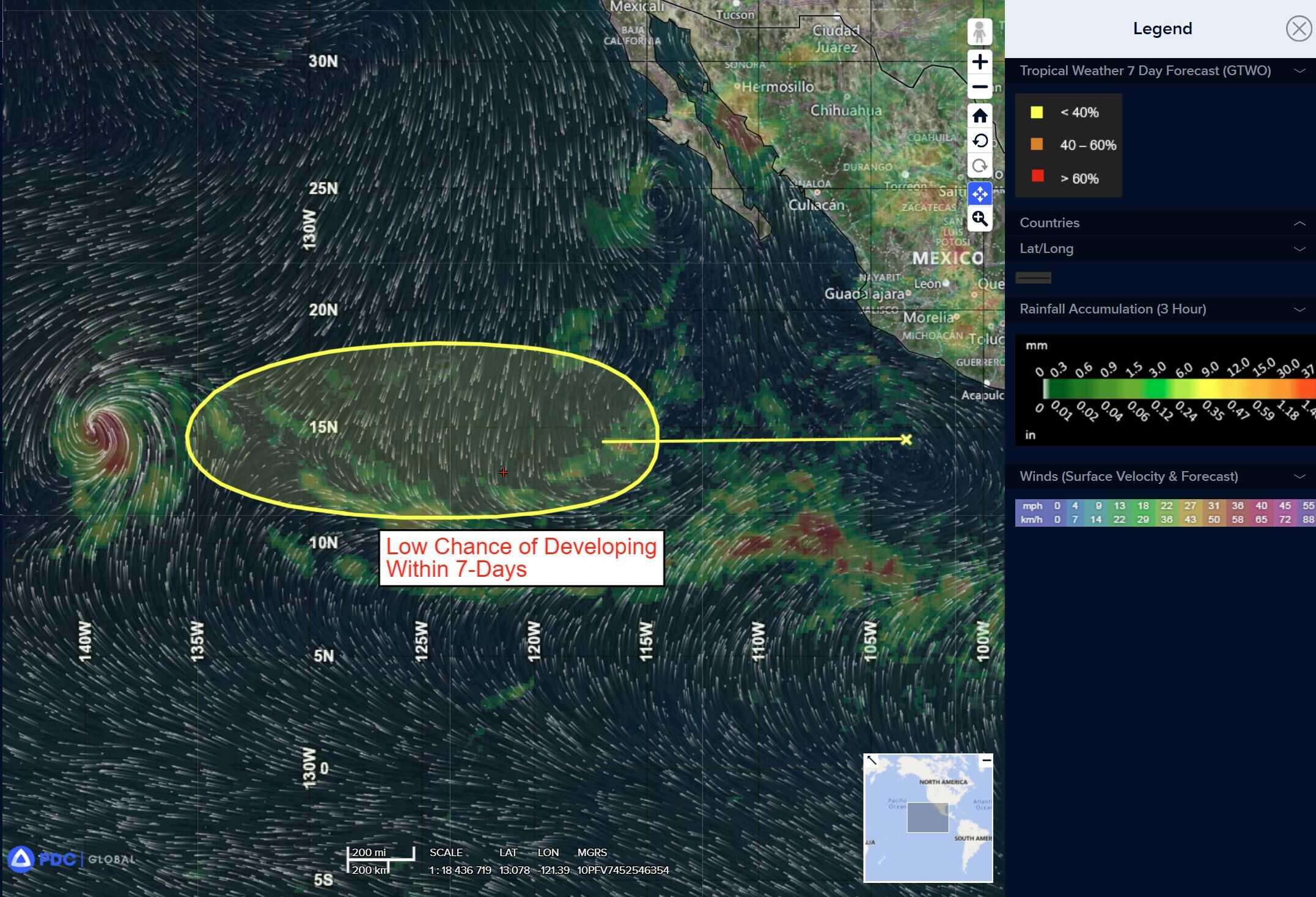
Central East Pacific:
>>> A tropical wave located a few hundred miles southwest of the southwestern coast of Mexico is producing a few showers and thunderstorms.
Development, if any, of this system should be slow to occur while it moves generally westward at around 10 to 15 mph over the open waters of the eastern Pacific.
* Formation chance through 48 hours…low…near 0 percent
* Formation chance through 7 days…low…10 percent
Central Pacific Ocean:
Tropical Cyclone 11E (Kiko)
KIKO RE-STRENGTHENS TO A CATEGORY 4 AS IT MOVES WEST-NORTHWESTWARD IN THE CENTRAL PACIFIC
According to the NHC advisory number 28
Kiko is moving toward the west-northwest near 12 mph (19 km/h) and this general motion is expected to continue for the next few days. Maximum sustained winds are near 140 mph (220 km/h) with higher gusts. Kiko is a category 4 hurricane on the Saffir-Simpson Hurricane Wind Scale. Only minor fluctuations in strength are anticipated tonight, with gradual weakening expected to begin by Sunday. Hurricane-force winds extend outward up to 25 miles (35 km) from the center and tropical-storm-force winds extend outward up to 70 miles (110 km).
HAZARDS AFFECTING LAND
SURF: Swells generated by Hurricane Kiko are expected to reach the Big Island and Maui by Sunday. These swells will gradually build and are forecast to peak along east-facing exposures of the Hawaiian Islands late Monday through midweek, potentially producing life-threatening surf and rip currents.
Western Pacific, Indian Ocean, and adjacent Seas:
Western Pacific
Tropical Cyclone 22W (Tapah)
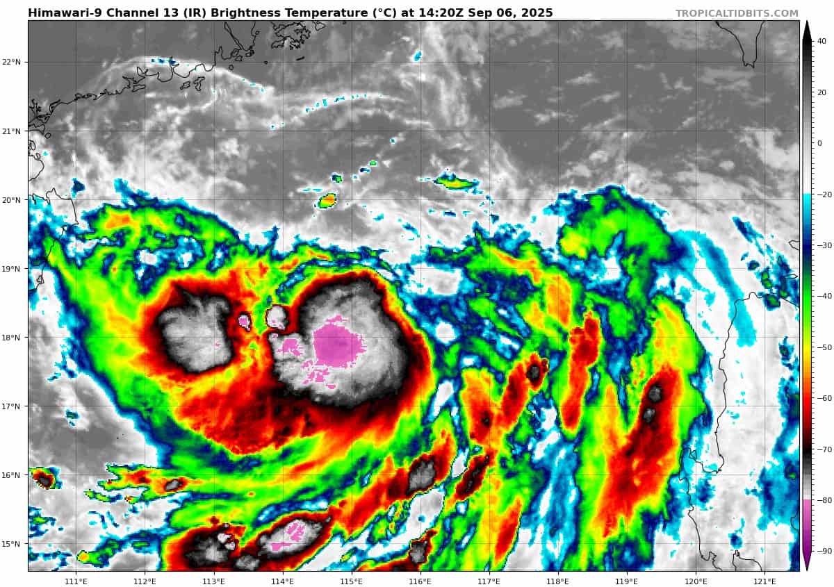
As indicated in animated water vapor imagery, equatorward outflow remains robust. Additionally, the northeasterly pressure is abating, with poleward outflow expanding gradually northward. Consequently, animated enhanced infrared satellite imagery shows deep convection building and sustaining over the low-level circulation (llc), with a more symmetric core of central convection. The initial position is placed with medium confidence, showing a defined center with 30-35 knot winds. The center is located northeast of intense convective bursts, with cloud top temperatures as cold as -88c.
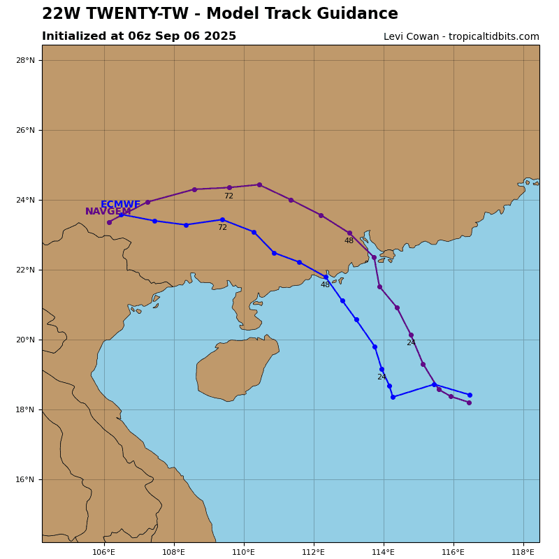
Upper-level conditions are forecast to gradually improve within the next 12 hours, with improving poleward outflow into a break in the upper-level ridge to the north. This will allow the system to become vertically aligned and commence a short period of near rapid intensification (ri) from 35 to 65 knots by 36 hours.
During this period, tropical storm 22W will track northwestward making landfall over the southern coast of China near 39 hours. Ater 39 hours, TS 22W will rapidly weaken inland while turning west-northwestward to westward as the high re-builds to the north. Dissipation is expected by 72 hours.