The Pacific Disaster Center’s (PDC Global) Tuesday, September 9, 2025, Tropical Cyclone Activity Report…for the Pacific Ocean, the Indian Ocean, and adjacent Seas
Current Tropical Cyclones:
The Pacific Disaster Center’s (PDC Global) Tuesday, September 9, 2025, Tropical Cyclone Activity Report…for the Pacific Ocean, the Indian Ocean, and adjacent Seas
Current Tropical Cyclones:
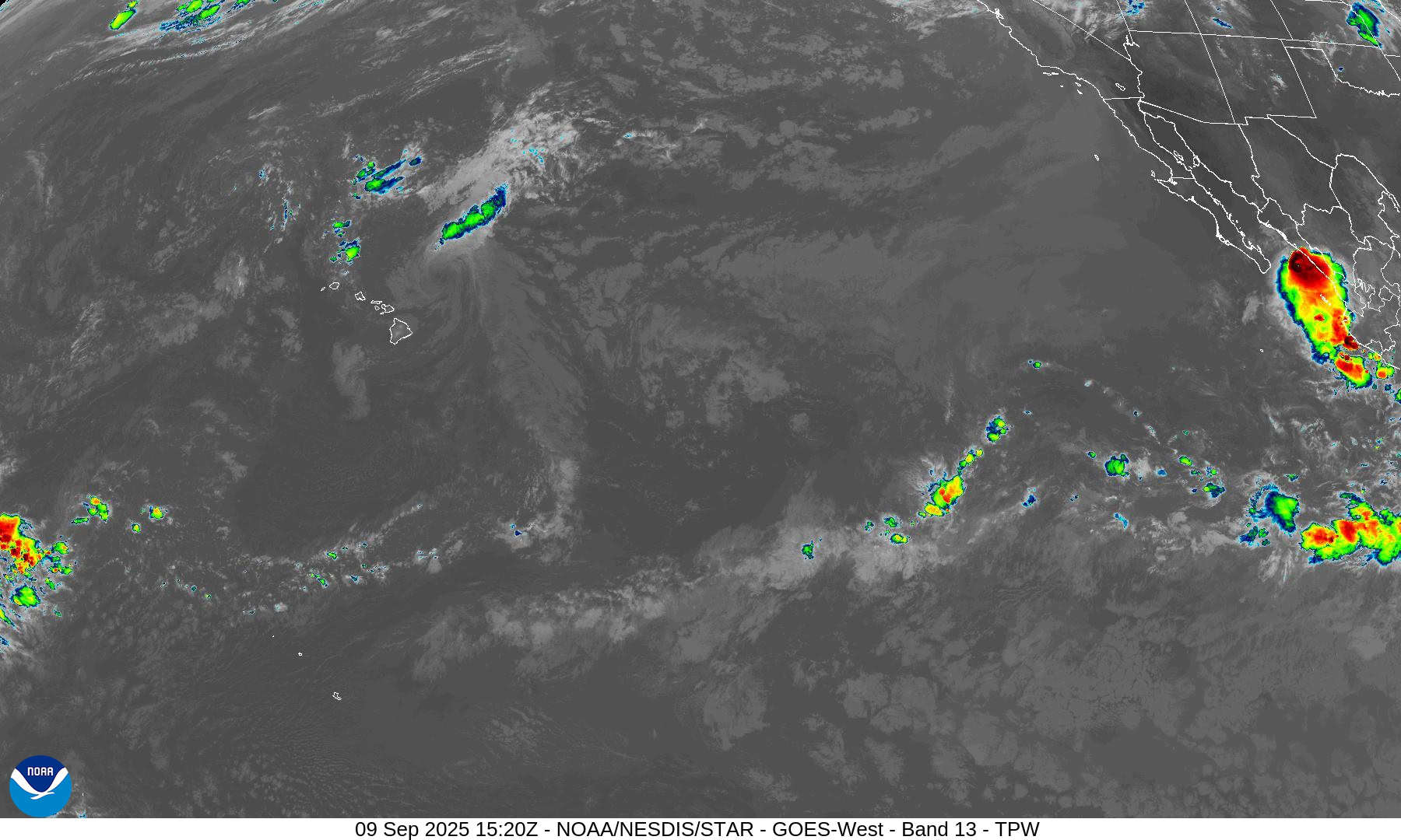
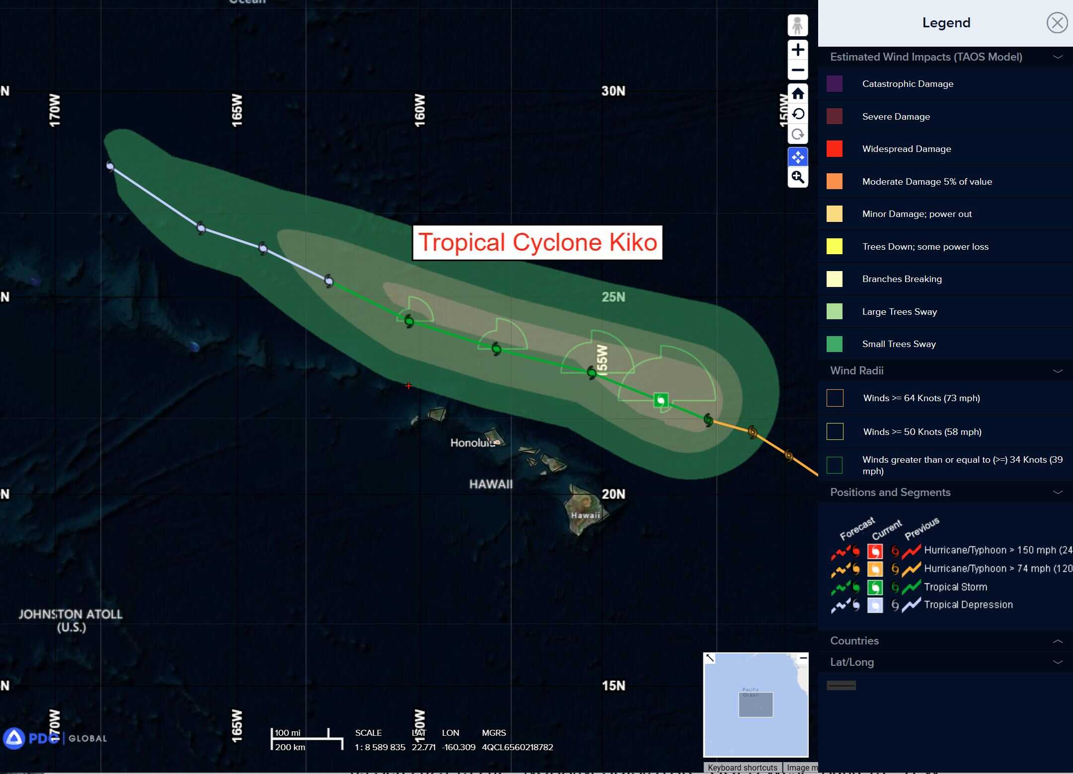
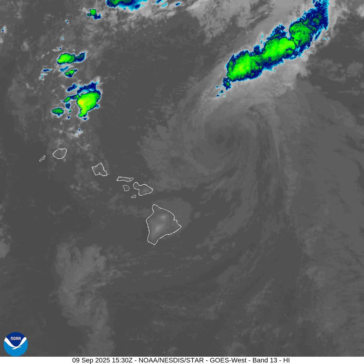
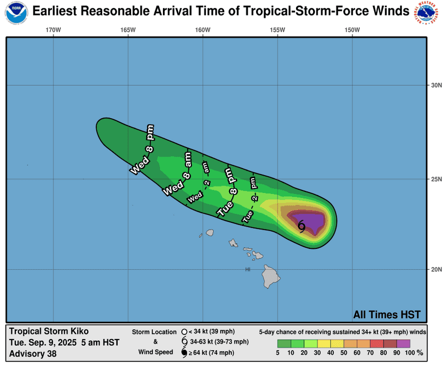
Tropical Cyclone 11E (Kiko) is located about 150 miles northeast of Honolulu, Hawaii
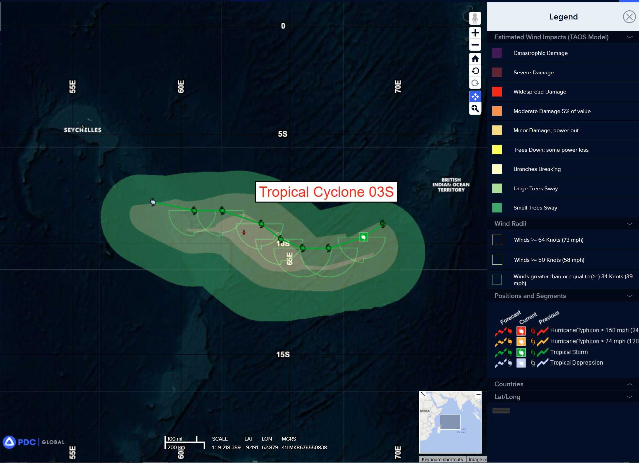
Tropical Cyclone 03S is located approximately 368 NM west-southwest of Diego Garcia
Northeast Pacific Ocean: There are no Tropical Cyclones
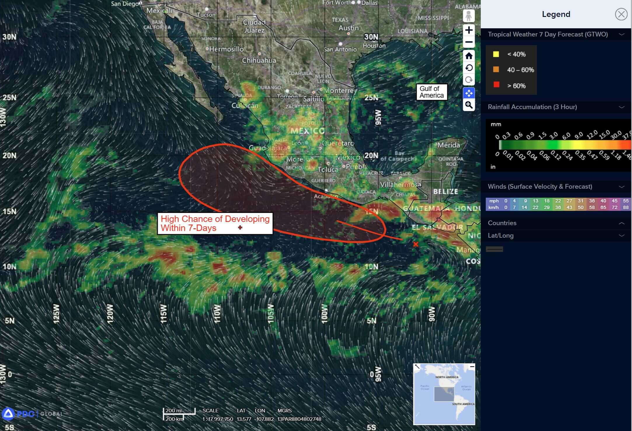
>>> South of Southern and Southwestern Mexico:
Invest 95E
A tropical wave located a few hundred miles south of the Gulf of Tehuantepec is producing a large area of disorganized showers and thunderstorms.
Environmental conditions are favorable for development of this system, and a tropical depression is likely to form by late this week as it moves west-northwestward, roughly parallel to but offshore of the Mexican coast.
* Formation chance through 48 hours…medium…40 percent
* Formation chance through 7 days…high…80 percent
Central Pacific Ocean:
Tropical Cyclone 11E (Kiko)
KIKO IS PRODUCING LIFE-THREATENING RIP CURRENTS AND HIGH SURF ACROSS PORTIONS OF HAWAIIAN ISLANDS
According to the NHC advisory number 40
Kiko is moving toward the west-northwest near 14 mph (22 km/h) and this motion is expected to continue for the next few days, while passing north of the main Hawaiian Islands.
Maximum sustained winds have decreased to near 40 mph (65 km/h) with higher gusts. Additional weakening is expected, and the system may become post-tropical in a couple days.
Tropical-storm-force winds extend outward up to 90 miles (150 km) from the center. The estimated minimum central pressure is 1008 mb (29.77 inches).
HAZARDS AFFECTING LAND
SURF: Swells generated by Kiko are building from east to west across the exposed Hawaiian waters and are forecast to peak today through Wednesday, potentially producing life-threatening surf and rip currents.
Western Pacific, Indian Ocean, and adjacent Seas:
South Indian Ocean
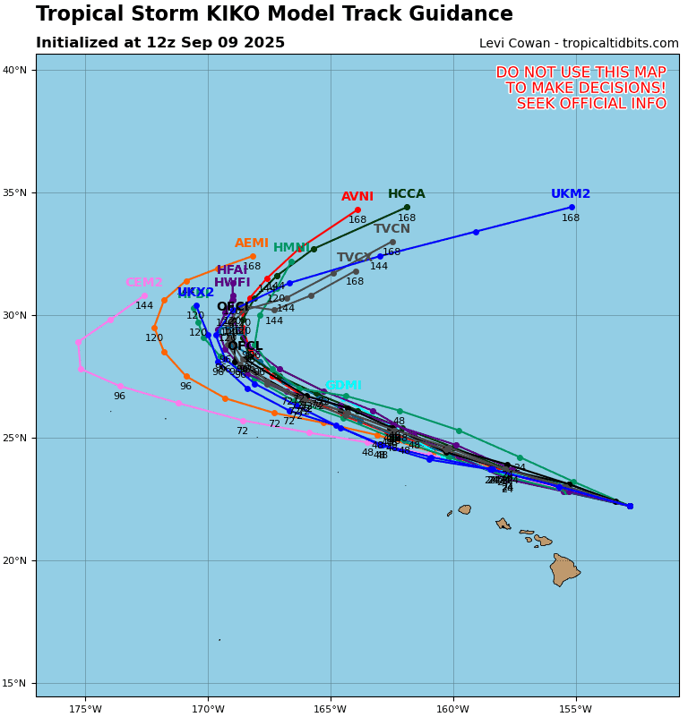
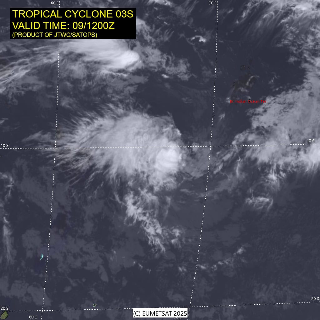
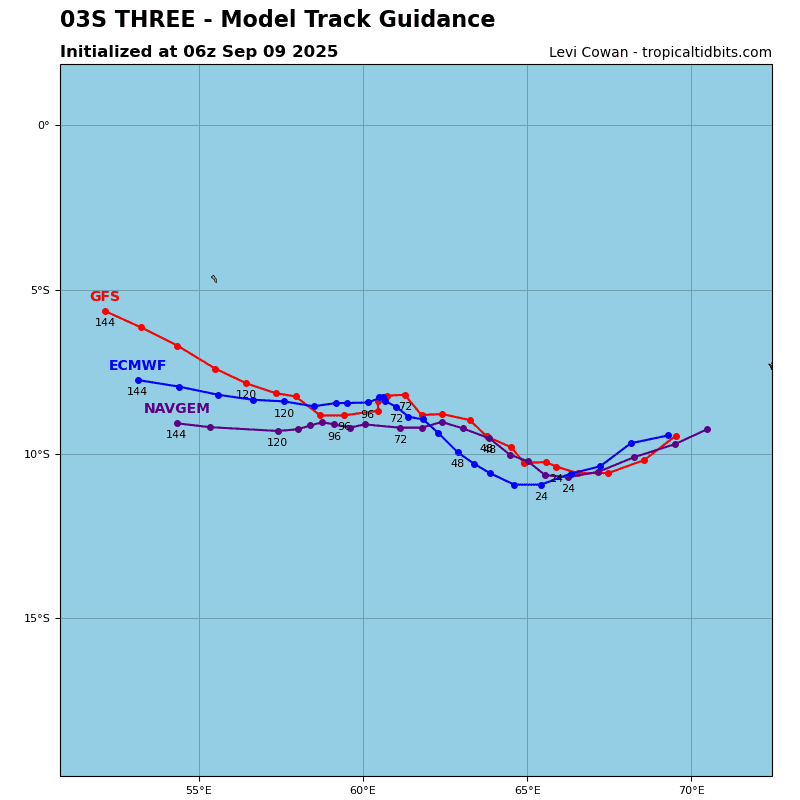
Tropical Cyclone 03S
According to the JTWC warning number 3, sustained winds are 35 knots with gusts to near 45 knots
Animated multi-spectral satellite imagery (msi) depicts tropical cyclone 03S with an elongated, partially exposed low-level circulation center (llcc) and deep convection sheared off to the west. The wind field remains highly asymmetric with the strongest winds confined to the southern semicircle.
Environmental analysis indicates that 03S is in a marginally favorable environment characterized by strong westward outflow, moderate (15-20 knots) easterly vertical wind shear, dry air entrainment from the north, and warm (27-28 c) sea surface temperatures.
03S is forecast to track west-southwestward, along the northwestern periphery of the subtropical ridge to the south through 24 hours. Near 24 hours, an incoming upper-level trough will momentarily break down the ridge, causing the steering pattern to reorient.
A second subtropical ridge is expected to build in east of Madagascar around 36 hours and extend out toward the system. 03S will then track northwestward, along the northeastern periphery of the building ridge through 72 hours. The trajectory will then become generally westward throughout the remainder of the forecast period.
Regarding intensity, 03S is forecast to nearly maintain an intensity of 35 knots through 96 hours. The intensity will be hindered by persistent easterly shear and asymmetrical wind field. The strongest winds will remain within the southern semi-circle throughout the forecast. A slight bump to 40 knots is forecast to occur at 36 hours as the vortex moistens and becomes more vertically aligned.
After the system crosses the 60E longitude, sea surface temperatures are expected to drop to 25-26 c and dry air entrainment will increase. These two factors, along with increasing easterly shear, will cause 03S to dissipate near 120 hours.
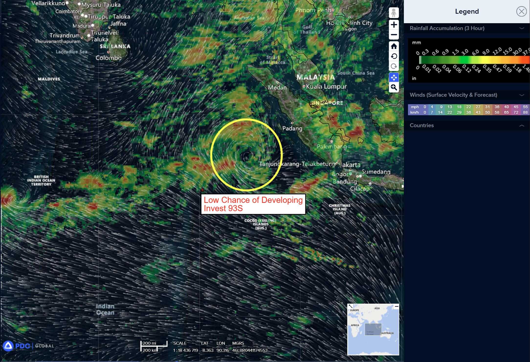
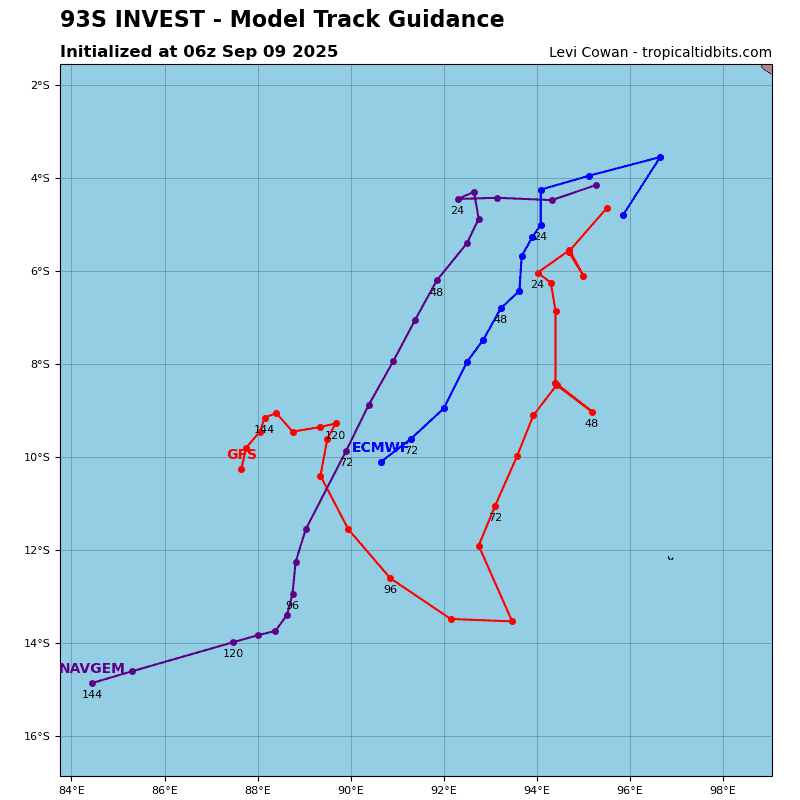
>>> There’s an area of disturbed weather being referred to as Invest 93S, which is located approximately 435 NM north-northwest of the Cocos Islands
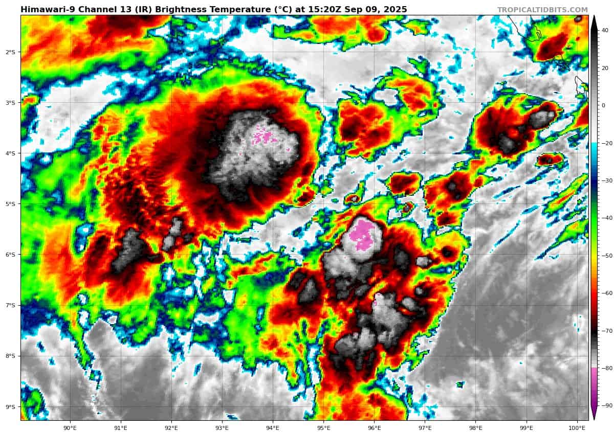
Animated enhanced infrared satellite imagery (eir) depicts cycling convection from the north east within the weakly defined low level
circulation center (llcc). a partial 091435z ascat image shows 20-25 knot winds wrapping from the northwest.
Environmental analysis for the area indicates marginal conditions for development with moderate vertical wind shear (20-25 knots), offset by warm sea surface temperatures (28-29 c) and moderate poleward outflow aloft.
Global deterministic models are in good agreement with 93S continuing to track south with slight intensification more on GFS over the next 48 hours. While global ensembles are in agreement as well that 93S will continue to track south, with ECMWF showing support for a higher intensity over the next 48 hours
Maximum sustained surface winds are estimated at 18 to 23 knots.
The potential for the development of a significant tropical cyclone within the next 24 hours is low.
Arabian Sea
>>> There’s an area of disturbed weather being referred to as Invest 97A, which is located approximately 50 NM north-northwest of Karachi
Animated enhanced infrared satellite imagery (eir) depicts a consolidating low level circulation center (llcc) with formative banding and persistent deep convection.
97A has now emerged over water.
Environmental analysis indicates favorable conditions for development with low vertical wind shear (10-15 knots), warm sea surf temperatures (27-28 c), and moderate equatorward outflow aloft.
Global deterministic models are in good agreement that 97A will continue on a westward track with ECMWF being the most aggressive in regard to intensity over the next 24 hours. Global ensemble models are also in agreement that 97A will continue to track westward.
Maximum sustained surface winds are estimated at 23 to 28 knots.
The potential for the development of a significant tropical cyclone within the next 24 hours is low.

")