Western Pacific, Indian Ocean, and adjacent Seas:
Tropical Cyclone 21W (Peipah) – Final Warning

")

By PDC’s Senior Weather
Specialist Glenn James

The Pacific Disaster Center’s (PDC Global) Friday, September 5, 2025, Tropical Cyclone Activity Report…for the Pacific Ocean, the Indian Ocean, and adjacent Seas
Current Tropical Cyclones:
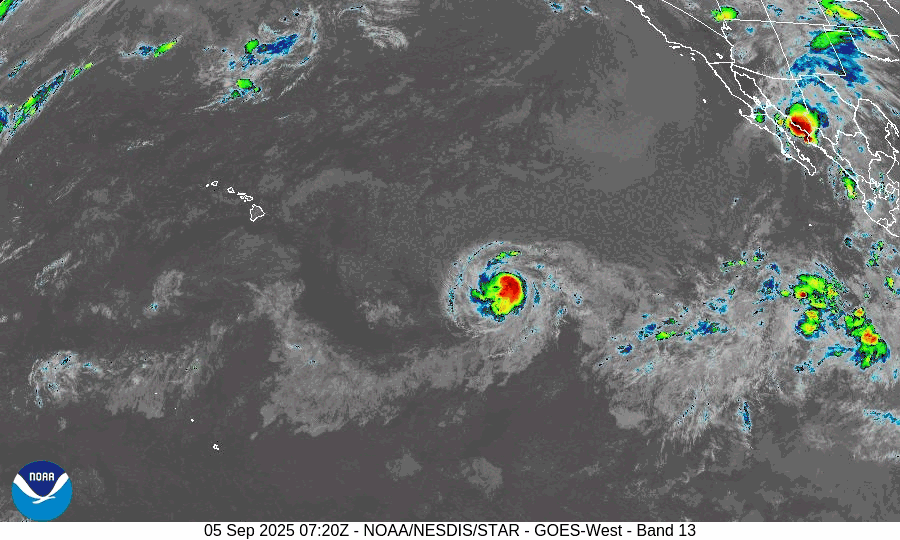
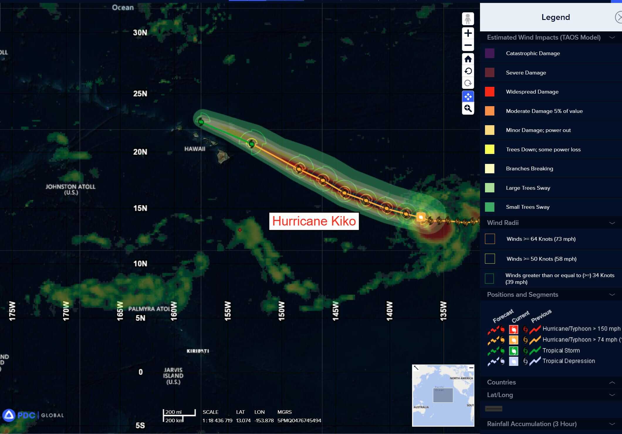
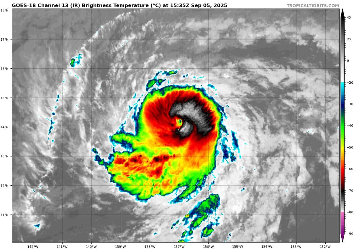
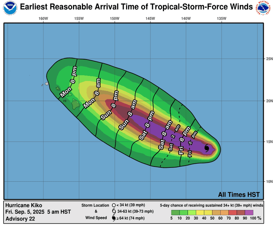
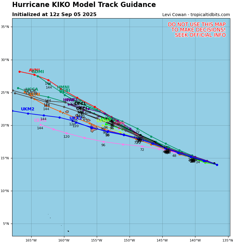
Tropical Cyclone 11E (Kiko) is located about 1130 miles east-southeast of Hilo, Hawaii
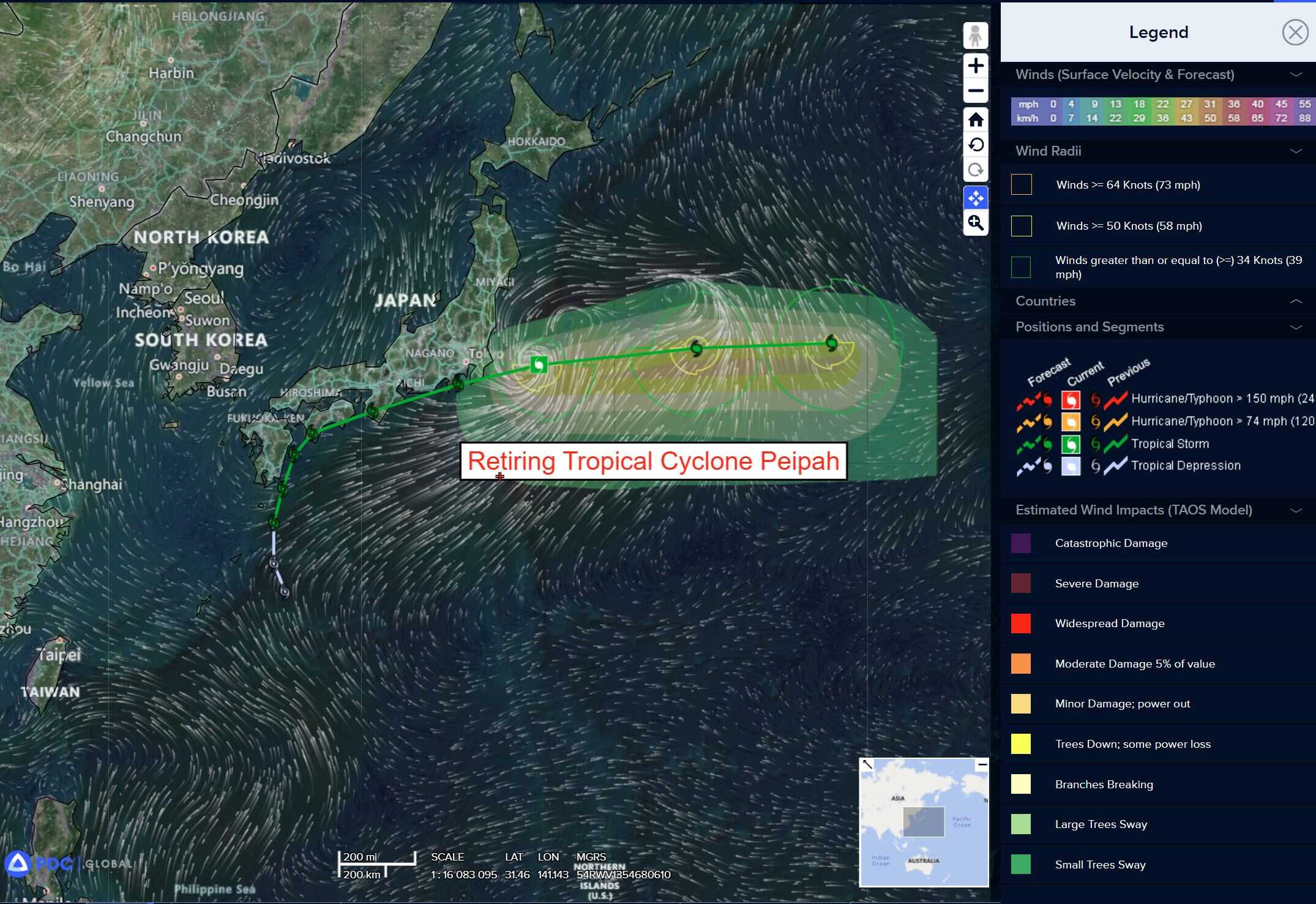
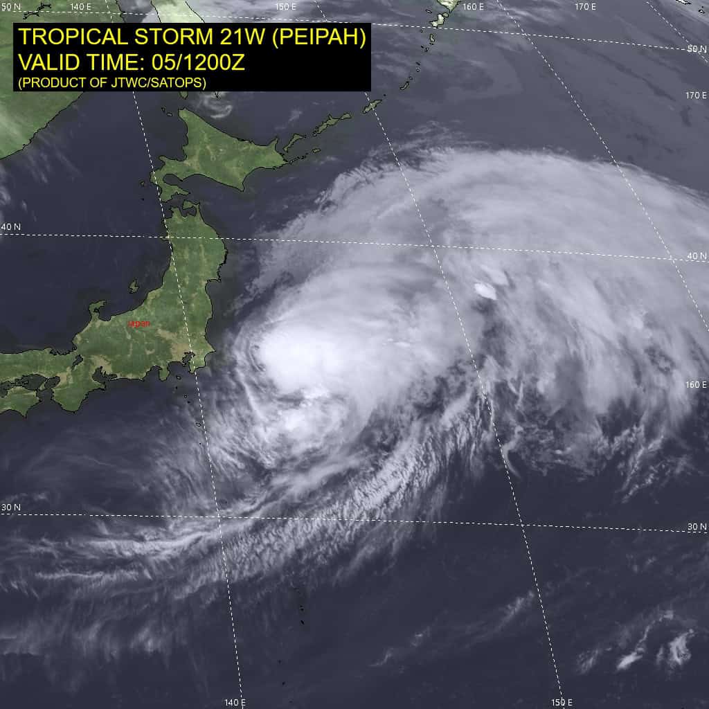
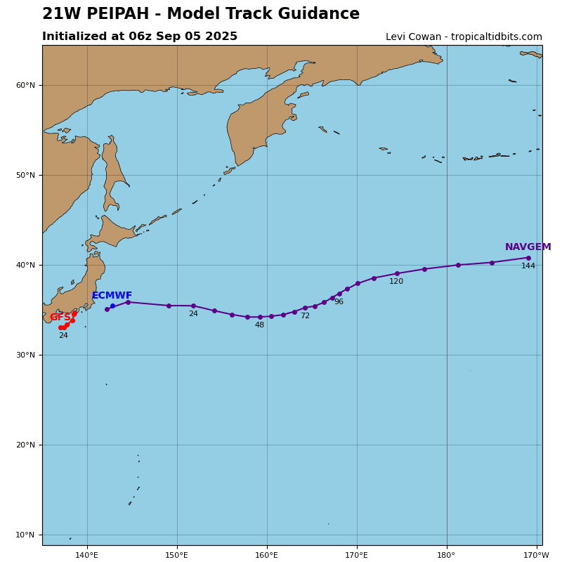
Tropical Cyclone 21W (Peipah) is located about 157 miles east of Yokosuka, Japan – Final Warning
Northeast Pacific Ocean:
Tropical Cyclone 11E (Kiko)
KIKO STRENGTHENS AS A CATEGORY FOUR HURRICANE AS IT APPROACHES THE CENTRAL PACIFIC BASIN
According to the NHC advisory number 24
Kiko is moving toward the west-northwest near 12 mph (19 km/h) and this motion is expected to continue over the next few days. Maximum sustained winds are near 140 mph (220 km/h) with higher gusts. Kiko is a category 4 hurricane on the Saffir-Simpson Hurricane Wind Scale. Additional strengthening is possible overnight and into Saturday before gradual weakening begins by Sunday. Hurricane-force winds extend outward up to 25 miles (35 km) from the center and tropical-storm-force winds extend outward up to 80 miles (130 km).
HAZARDS AFFECTING LAND
SURF: Swells generated by Hurricane Kiko are expected to begin reaching the Big Island and Maui by Sunday. These swells will gradually build and are forecast to peak along east facing exposures of the Hawaiian Islands late Monday through midweek, potentially producing life-threatening surf and rip currents.
Central East Pacific:
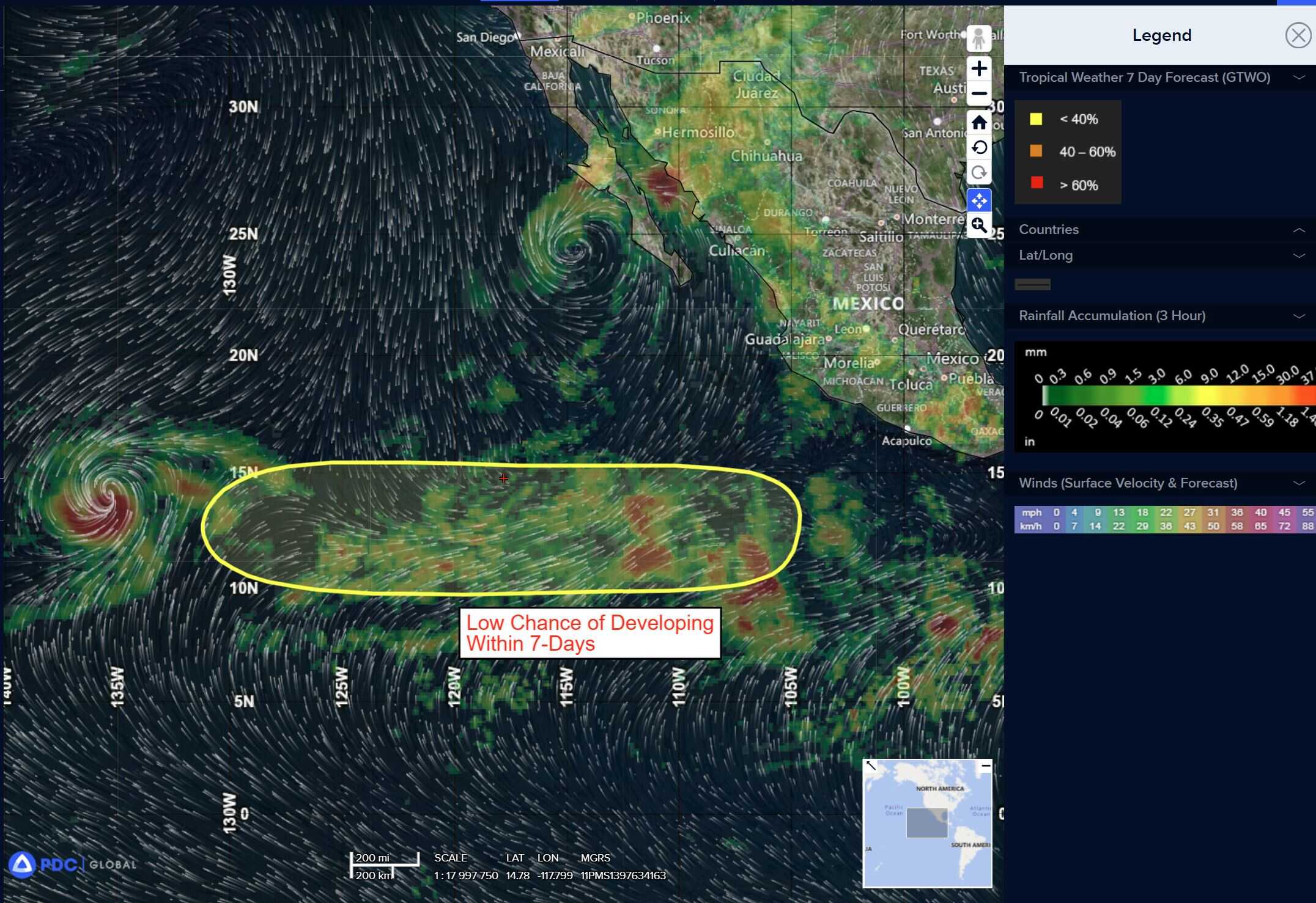
>>> An area of low pressure could develop in the central portion of the eastern Pacific well to the south of the Baja California Peninsula during the early portion of next week.
Some slow development of this system is possible thereafter as it moves generally westward over the open waters of the East Pacific.
* Formation chance through 48 hours…low…near 0 percent
* Formation chance through 7 days…low…20 percent
Central Pacific Ocean: There are no active tropical cyclones
The National Hurricane Center is issuing advisories on Hurricane Kiko, located in the East Pacific basin well east-southeast of the Hawaiian Islands. Kiko is expected to cross into the central Pacific basin by tonight.
The National Hurricane Center has issued the final advisory on Post-Tropical Cyclone Lorena, located just off the west coast of Baja California Sur.
Tropical cyclone formation is not expected during the next 7 days.
Western Pacific, Indian Ocean, and adjacent Seas:
Tropical Cyclone 21W (Peipah) – Final Warning
21W is currently transitioning into a storm-force extratropical cyclone with a developing frontal feature extending southward from the system. A major shortwave trough is currently directly to the north of the system, imparting increased vertical wind shear and thermal advection.
A 051155z metop-c ascat image revealed a highly elongated circulation with a swath of 45 knots confined to the southern periphery. 21W is forecast to track generally eastward over the next 24 hours with extratropical transition expected to complete within the next 12 hours.
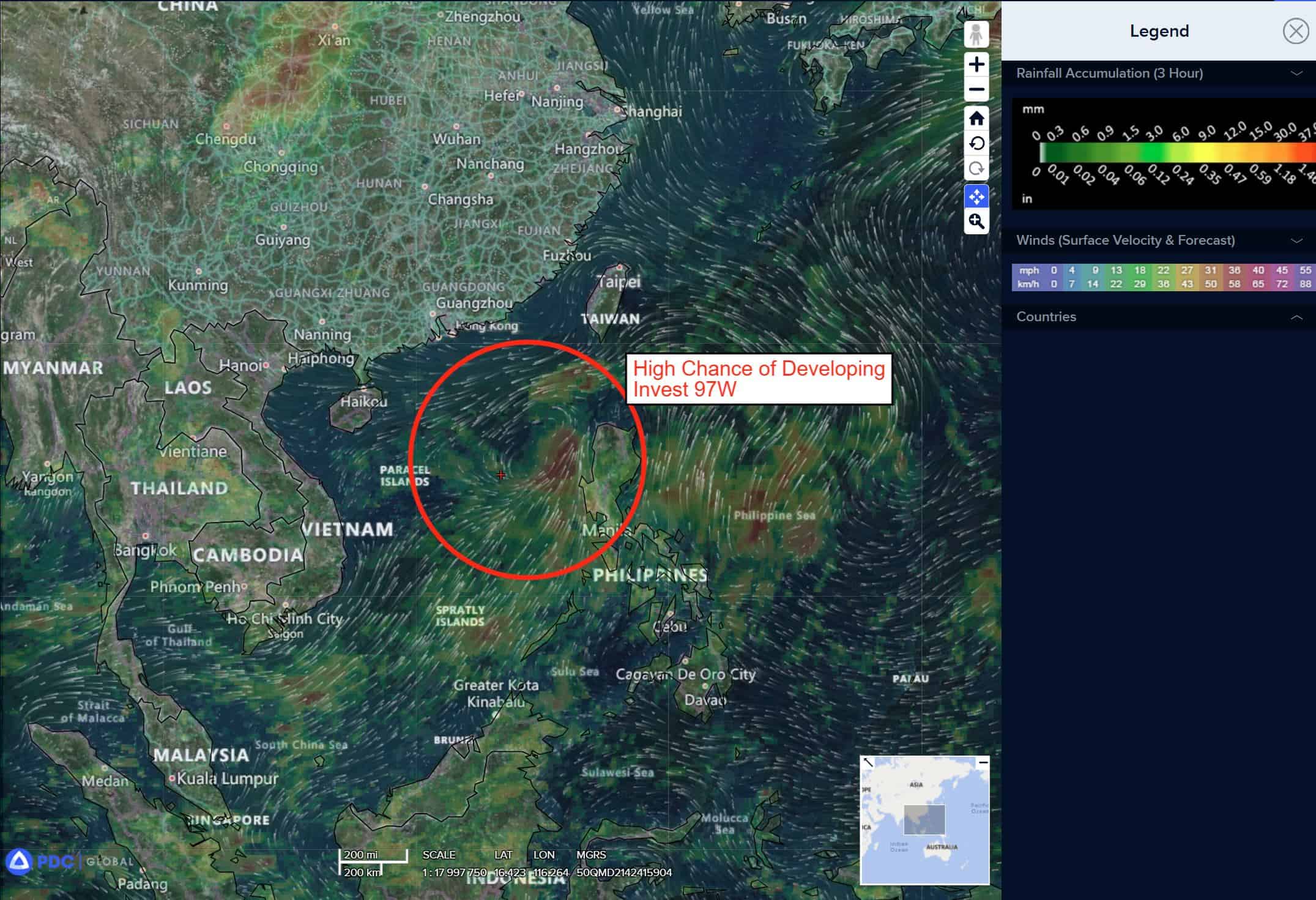
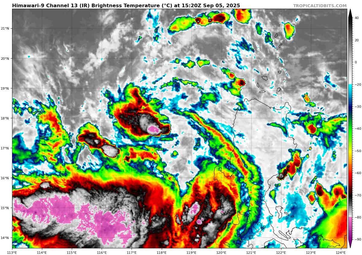
>>> There’s an area of disturbed weather being referred to as Invest 97W, which is located approximately 381 NM southeast of Hong Kong
Animated enhanced infrared imagery (eir) depicts a consolidating circulation with a band of flaring convection just south of the center assisting the system with a line of convergence deepening the convection. A 051241z metop-b ascat image reveals 15-20 knot winds from the northeast and the southwest beginning to wrap closer to the circulation center.
Environmental analysis for the area indicates a favorable environment for development with low (10-15 knots) vertical wind shear, warm (30 c) sea surface temperatures, and moderate equatorward outflow aloft.
Ensembles are in good agreement that 97W will track northwestward towards mainland China with continued consolidation over the next 24 hours.
Maximum sustained surface winds are estimated at 15 to 20 knots.
The potential for the development of a significant tropical cyclone within the next 24 hours is upgraded to high.