Western Pacific, Indian Ocean, and adjacent Seas:
Western Pacific

")

By PDC’s Senior Weather
Specialist Glenn James

The Pacific Disaster Center’s (PDC Global) Sunday, August 31, 2025, Tropical Cyclone Activity Report…for the Pacific Ocean, the Indian Ocean, and adjacent Seas
Current Tropical Cyclones:
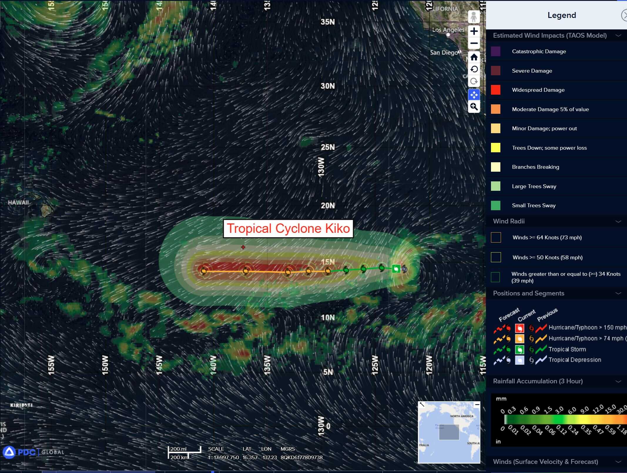
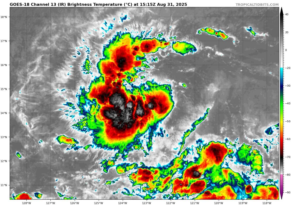
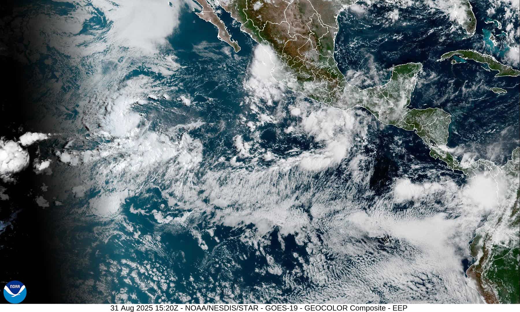
Tropical Cyclone 11E (Kiko) is located approximately 1120 miles west-southwest of the southern tip of Baja California
Northeast Pacific Ocean:
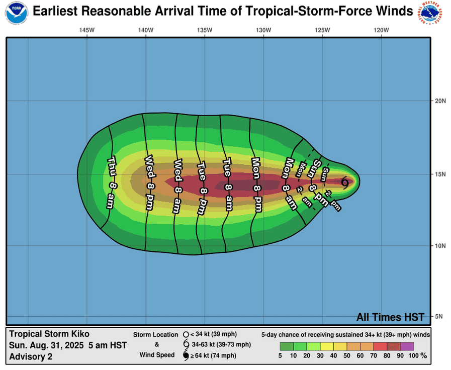
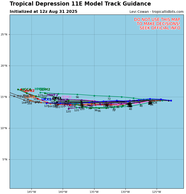
Tropical Cyclone 11E (Kiko)
According to the NHC advisory number 4
KIKO EXPECTED TO STEADILY STRENGTHEN DURING THE NEXT FEW DAYS
Kiko is moving toward the west near 9 mph (15 km/h), and this general motion is expected during the next few days. Maximum sustained winds have increased to near 45 mph (75 km/h) with higher gusts. Steady strengthening is expected, and Kiko is forecast to become a hurricane in a day or two. Tropical-storm-force winds extend outward up to 45 miles (75 km) from the center.
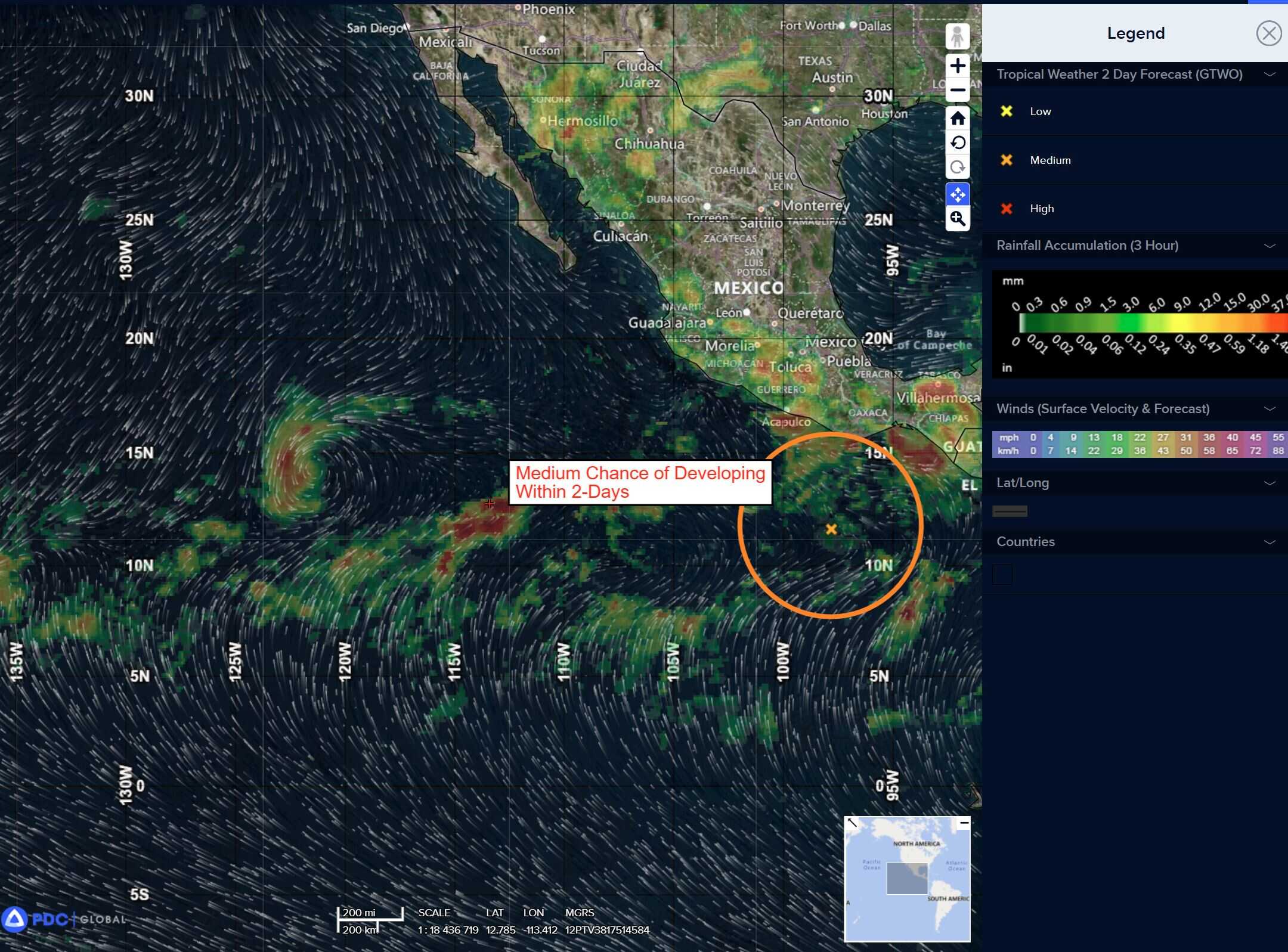
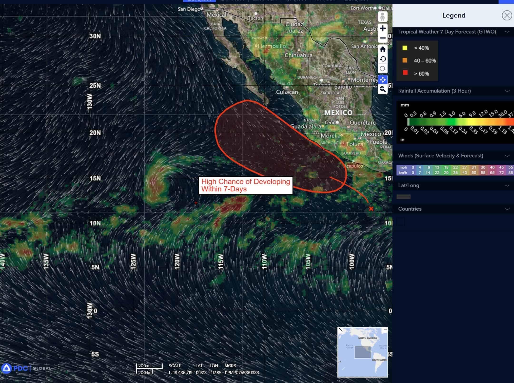
South of Southern Mexico:
>>> A tropical wave is producing a large area of disorganized showers and thunderstorms off the coast of southern Mexico. An area of low pressure is expected to form from this system within the next day or two, and it will likely become a tropical depression around the middle of the week. This system is expected to move west-northwestward to northwestward at 10 to 15 mph off the coast of southern and southwestern Mexico during the next few days. Interests in the Baja California peninsula should monitor the progress of this disturbance.
* Formation chance through 48 hours…medium…50 percent
* Formation chance through 7 days…high…80 percent
Central Pacific Ocean: There are no active tropical cyclones
Western Pacific, Indian Ocean, and adjacent Seas:
Western Pacific