The Pacific Disaster Center’s (PDC Global) Wednesday, August 27, 2025, Tropical Cyclone Activity Report…for the Pacific Ocean, the Indian Ocean, and adjacent Seas
Current Tropical Cyclones:
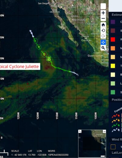
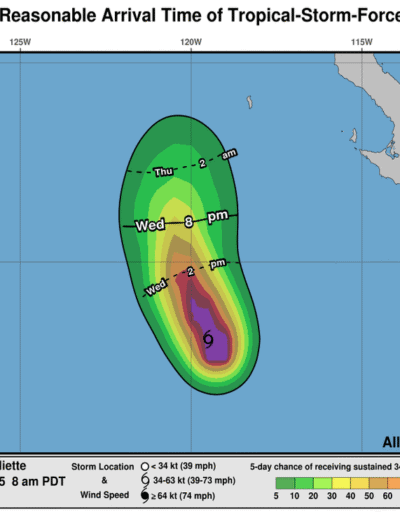
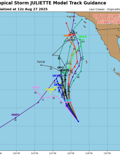
Tropical Cyclone 10E (Juliette) is located about 690 miles west-northwest of the southern tip of Baja California
Northeast Pacific Ocean:
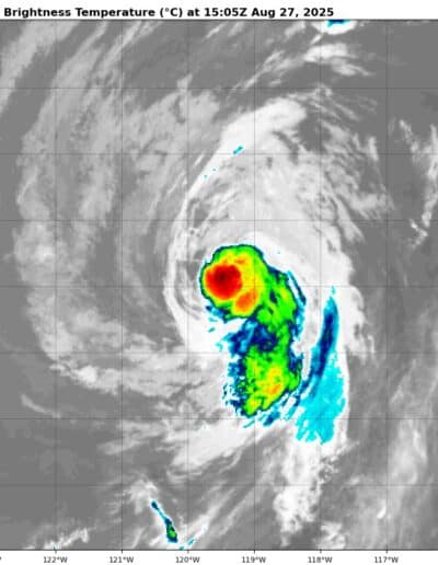
Tropical Cyclone 10E (Juliette)
JULIETTE GRADUALLY WEAKENING OVER COOLER WATERS
According to the NHC advisory number 14
Juliette is moving toward the north-northwest near 9 mph (15 km/h). A turn to the north and a reduction in forward speed is expected over next 24 hours. Maximum sustained winds are near 45 mph (75 km/h) with higher gusts. Weakening is forecast, and Juliette is expected to degenerate into a remnant low late Thursday. Tropical-storm-force winds extend outward up to 45 miles (75 km) from the center.
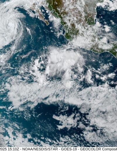
Well Southwest of the Baja California Peninsula:
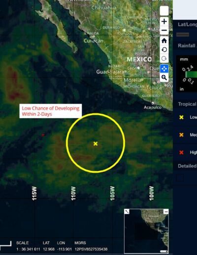
>>> A tropical wave located several hundred miles southwest of the coast of southwestern Mexico continues to produce a large area of disorganized showers and thunderstorms. Environmental conditions appear favorable for gradual development of this system during the next few days, and a tropical depression is likely to form over the weekend while the system moves westward to west-northwestward at around 15 mph across the central to western part of the eastern Pacific basin.
* Formation chance through 48 hours…low…30 percent
* Formation chance through 7 days…high…70 percent
South of Southern Mexico:
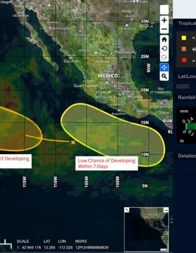
>>> Another area of low pressure could form this weekend offshore of the coast of southern Mexico. Environmental conditions appear conducive for some gradual development of this system during the early and middle portions of next week while it moves generally west-northwestward at 10 to 15 mph.
* Formation chance through 48 hours…low…near 0 percent
* Formation chance through 7 days…low…30 percent
Central Pacific Ocean: There are no active tropical cyclones
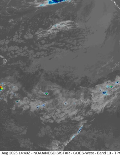
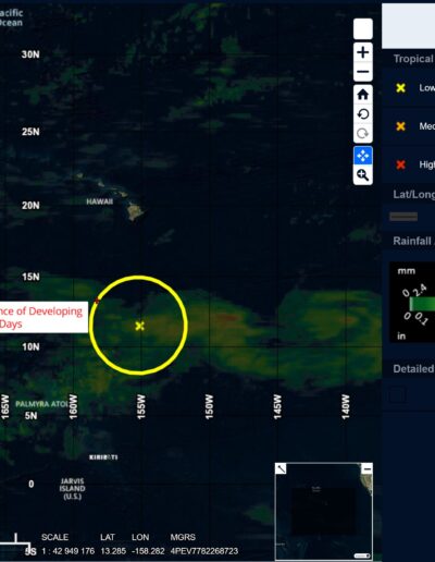
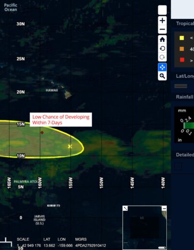
Well South of the Hawaiian Islands:
>>> A trough of low pressure located several hundred miles south of the Hawaiian Islands continues to produce disorganized showers and thunderstorms. Environmental conditions are only marginally conducive for some slow development of this system over the next few days while it moves westward at around 15 mph across the central Pacific basin. By Saturday, conditions are expected to become unfavorable for further development.
* Formation chance through 48 hours…low…10 percent
* Formation chance through 7 days…low…10 percent
Western Pacific, Indian Ocean, and adjacent Seas:
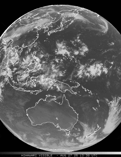
>>> There’s an area of disturbed weather being referred to as Invest 93, which is located approximately 284 NM west of Manila, Philippines.
The system is currently classified as a monsoon depression, generally characterized as a large cyclonic circulation, greater than 600 NM diameter, with extensive gale-force winds over the southeastern periphery and a weak core of light winds.
Multi-spectral satellite imagery (msi) depicts convective banding with a broad but rapidly consolidating low level circulation center (llcc). The imagery also highlights upper-level convection on the southern side of the
circulation.
Environment analysis reveals favorable conditions with low vertical wind shear, good equatorward outflow aloft, and warm (28-29 c) sea surface temperatures.
Global models are showing significant development with a northwestward track over the next 24 hours.
Maximum sustained surface winds are estimated at 23 to 28 knots.
The potential for the development of a significant tropical cyclone within the next 24 hours is upgraded to high.
