
")
Current Snapshot
For all the latest updates visit: DisasterAWARE
epac
1800x1080e
09w
09W_220600sair
10w
10W_221200sair

10W_tracks_latest
98w
himawari9_ir_98W_202507221520_lat11.1-lon149.0
By PDC’s Senior Weather
Specialist Glenn James

The Pacific Disaster Center’s (PDC Global) Tuesday, July 22, 2025, Tropical Cyclone Activity Report…for the Pacific Ocean, the Indian Ocean, and adjacent Seas
Current Tropical Cyclones:
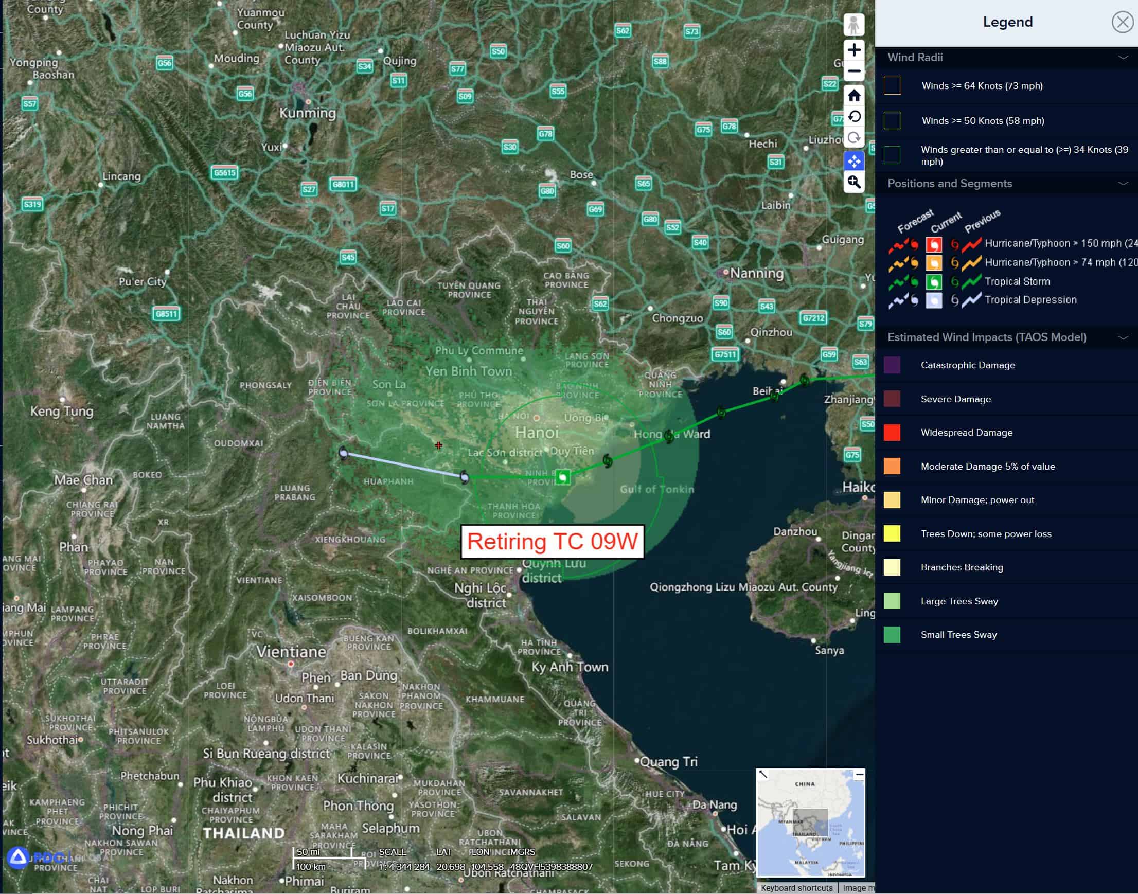
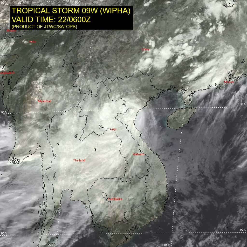
Tropical Cyclone 09W (Wipha)…is located 45 NM south-southeast of Hanoi, Vietnam – Final Warning
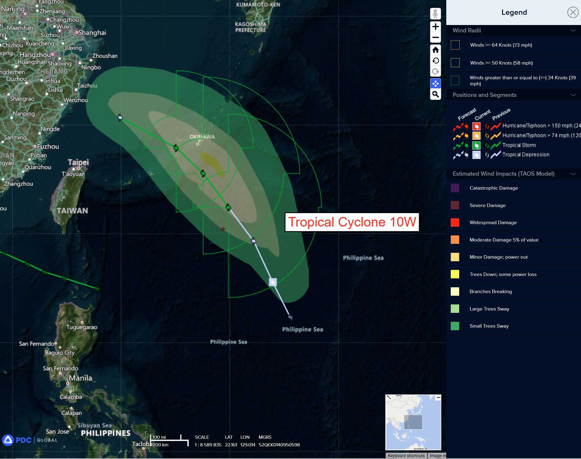
Tropical Cyclone 10W (Francisco)…is located 361 NM south-southeast of Kadena AB, Okinawa
Tropical Cyclone 11W…is located 254 NM north of Manila, Philippines
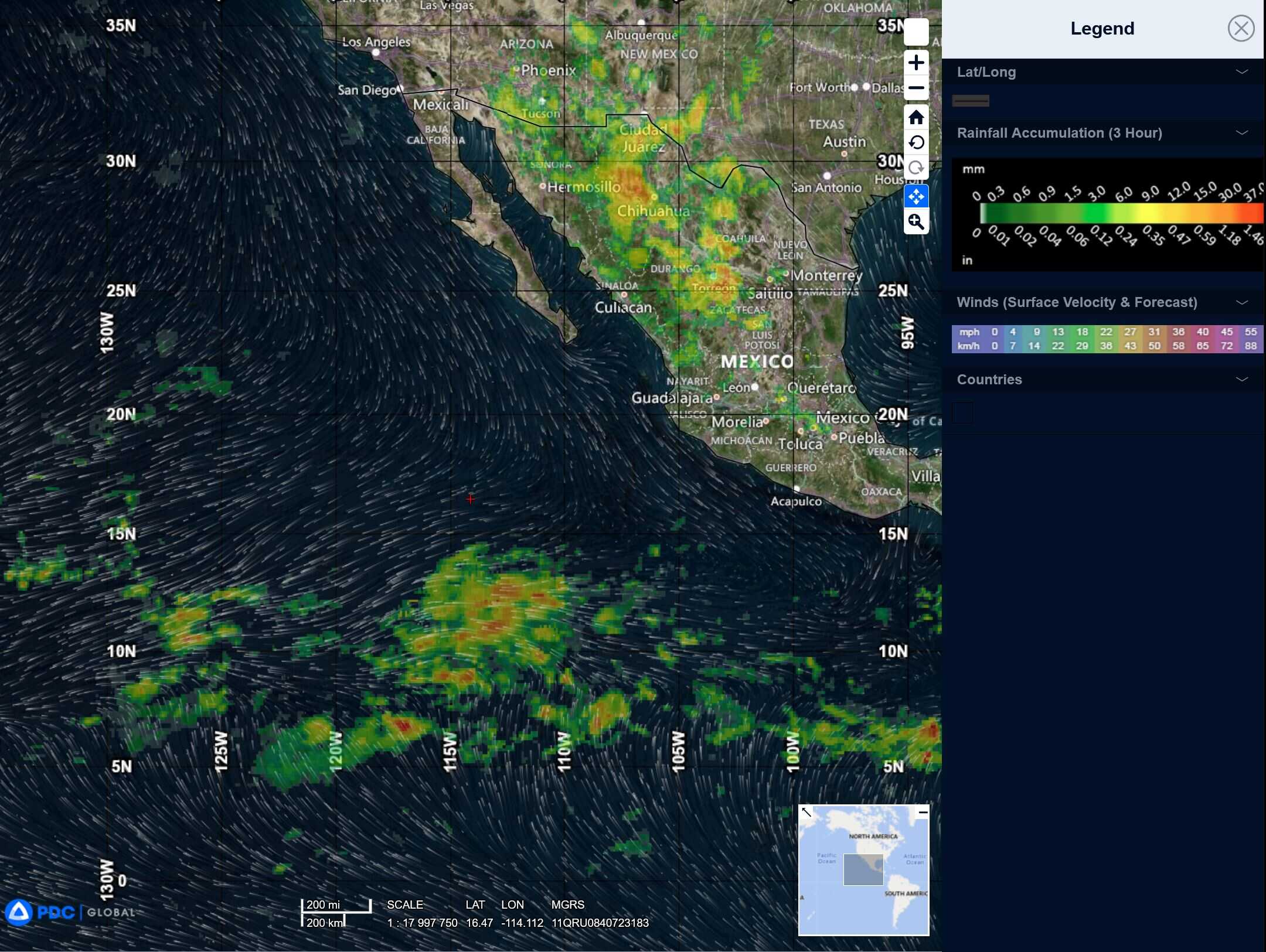
Northeast Pacific Ocean: There are no Tropical Cyclones
Tropical cyclone formation is not expected during the next 7-days.
Central Pacific Ocean: There are no Tropical Cyclones
Tropical cyclone formation is not expected during the next 7-days.
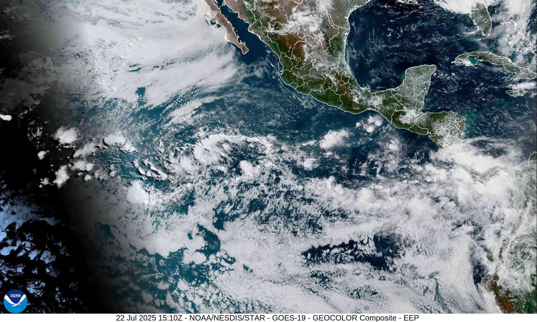
Western Pacific, Indian Ocean, and adjacent Seas:
Western Pacific
Tropical Cyclone 09W (Wipha) – Final Warning
According to the JTWC warning number 16 sustained winds are 35 knots with gusts to near 45 knots
Animated multi-spectral imagery reveals the exposed low-level circulation center (llcc)as the system has continued to decapitate over the last six hours. The initial position in the Red River delta region is made with high confidence due to the exposed nature of the circulation.
The system will continue to dissipate over land during the next 24 hours while driven westward on the southern periphery of the subtropical ridge to the north.
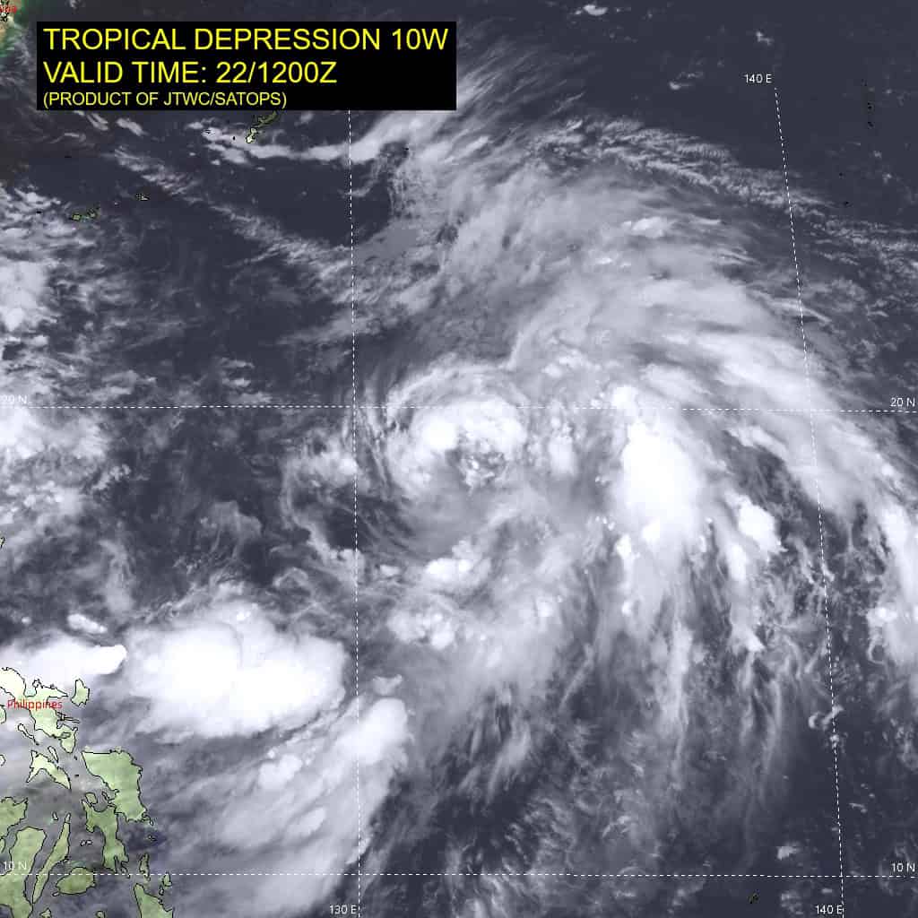
Tropical Cyclone 10W (Francisco)
According to the JTWC warning number 4 sustained winds are 30 knots with gusts to near 40 knots
Animated enhanced infrared (eir) satellite imagery depicts tropical depression 10W slowly consolidating as deep convective bands wrap inward from the southwest and southeast. An upper-level trough to the northwest both applies pressure to the northwest quadrant and poleward upper level diffluence.
The poleward outflow is complemented by equatorward diffluence, allowing for favorable dual-channel outflow. The initial position is placed with high confidence based on the aforementioned animated msi, and a metop-b ascat image which partially reveals the low-level circulation center bounded by 25 knot winds to the east.
A deep-layer ridge to the east will steer TD 10W north-northwestward along the northern edge of the monsoonal flow for the next 36 hours. Between 36-48 hours, the primary steering mechanism will transfer to the subtropical ridge centered over Japan, curving northwestward. Between 48-72 hours, an approaching upper-level trough will cause TD 10W to become shallow and the wind field will become broad. The monsoonal flow will close off, developing into a monsoon depression over the East China Sea, and ultimately causing TD 10W to weaken and dissipate into the larger monsoonal flow.
The system will intensify during the first 36 hours of the forecast while in a favorable environment of upper-level divergence, low vertical wind shear, and warm sea surface temperatures. Dry air will entrain into the circulation after 36 hours and an approaching upper-level trough will introduce unfavorably high vertical wind shear, initiating a weakening period. The system will dissipate into the strong monsoonal flow, ending the forecast at 30 knots.
Tropical Cyclone 11W
According to the JTWC warning number 1 sustained winds are 30 knots with gusts to near 40 knots
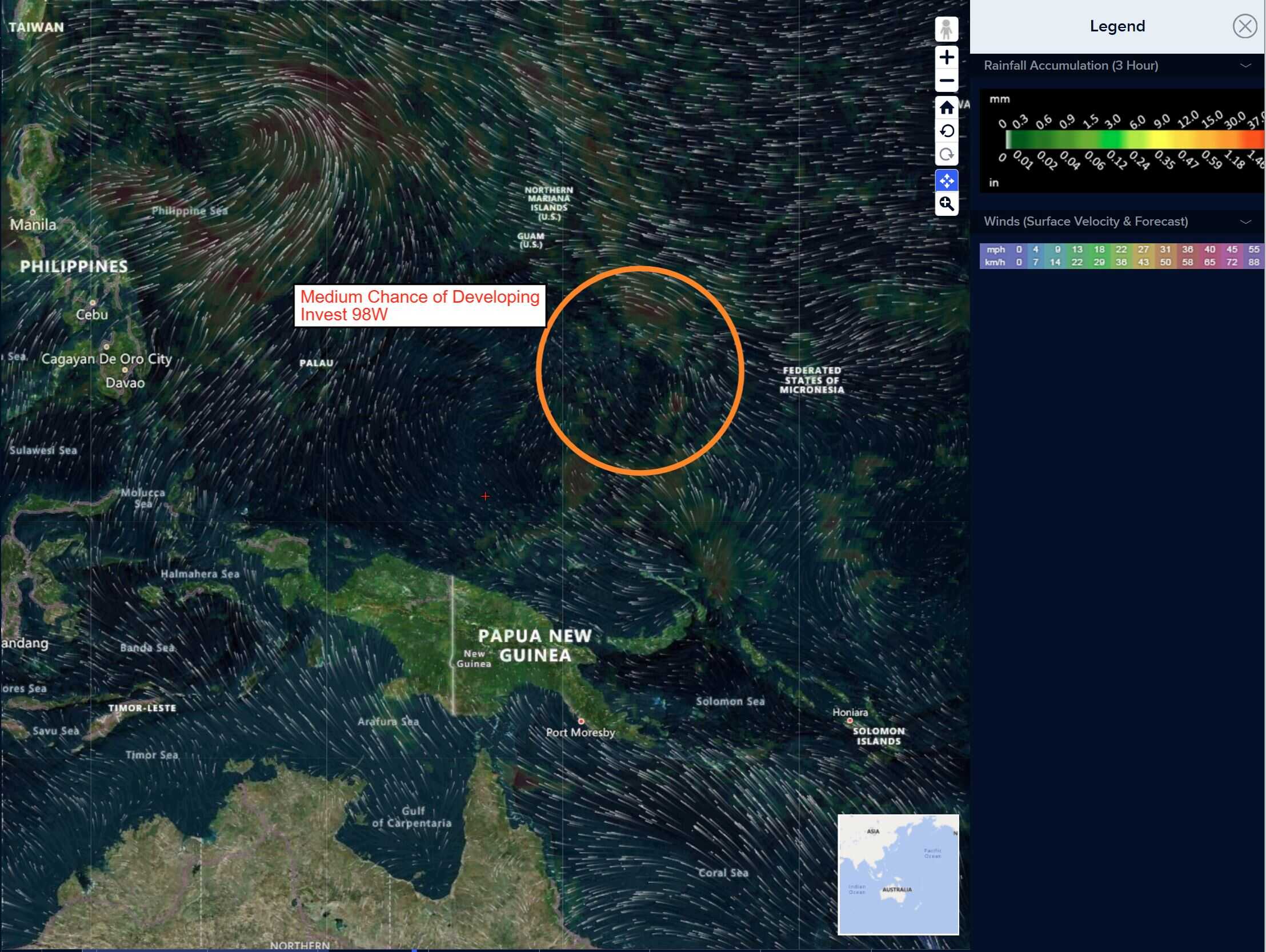
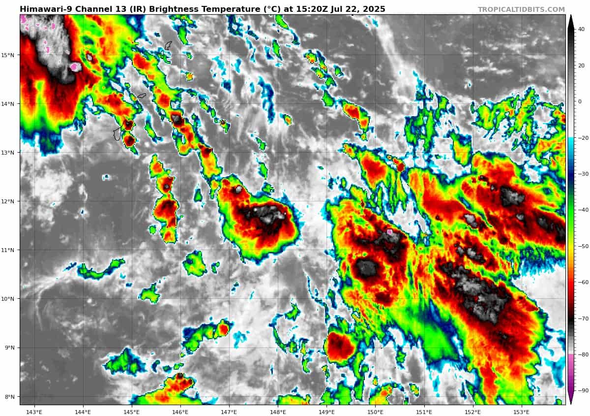
>>> There’s an area of disturbed weather being referred to as Invest 98W, which is located approximately 248 NM east-southeast of Guam
Animated multi-spectral satellite (msi) imagery depicts a broad low level circulation center (llcc) with flaring convection, and low level convergence from the southern quadrant wrapping around the llcc near Guam.
Environmental analysis reveals favorable conditions for development with moderate vws (vertical wind shear), warm sst (sea surface temperatures) and good equatorward outflow aloft.
Global models agree on steady development and a northwestern track steering towards Japan within a 24-36 hour period.
Maximum sustained surface winds are estimated at 18 to 23 knots.
The potential for the development of a significant tropical cyclone within the next 24 hours remains medium.