
")
Current Snapshot
For all the latest updates visit: DisasterAWARE
epac
7

1800×1080
wipha
09W_211200sair
wpac
himawari9_ir_97W_202507211520_lat16.0-lon134.0
97W_tracks_latest
himawari9_ir_98W_202507211520_lat7.9-lon152.8

98W_tracks_latest
By PDC’s Senior Weather
Specialist Glenn James

The Pacific Disaster Center’s (PDC Global) Monday, July 21, 2025, Tropical Cyclone Activity Report…for the Pacific Ocean, the Indian Ocean, and adjacent Seas
Current Tropical Cyclones:
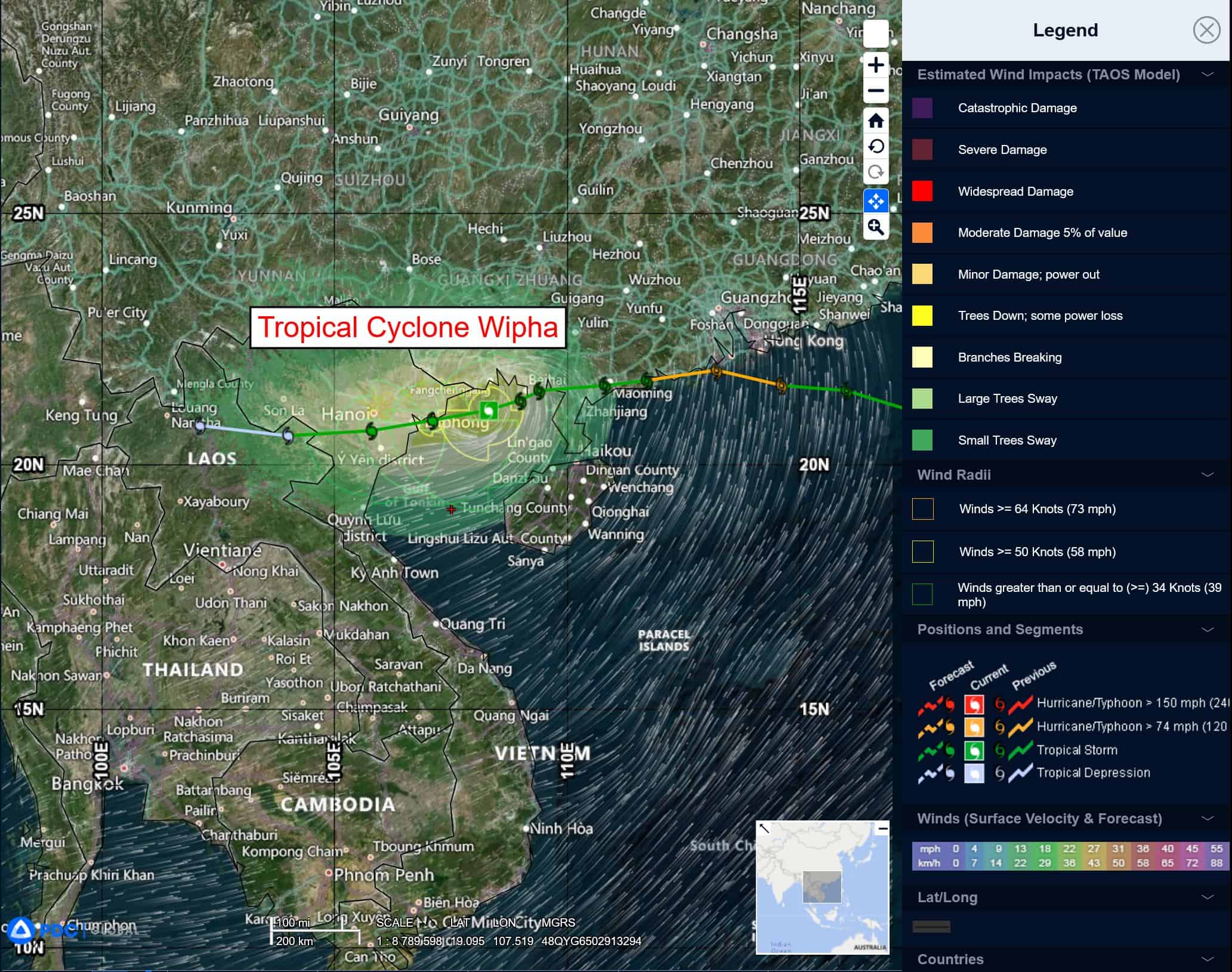
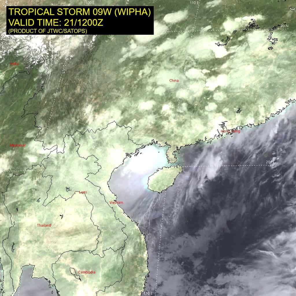
Tropical Cyclone 09W (Wipha)…is located 59 NM east-southeast of Hanoi, Vietnam
Northeast Pacific Ocean: There are no Tropical Cyclones
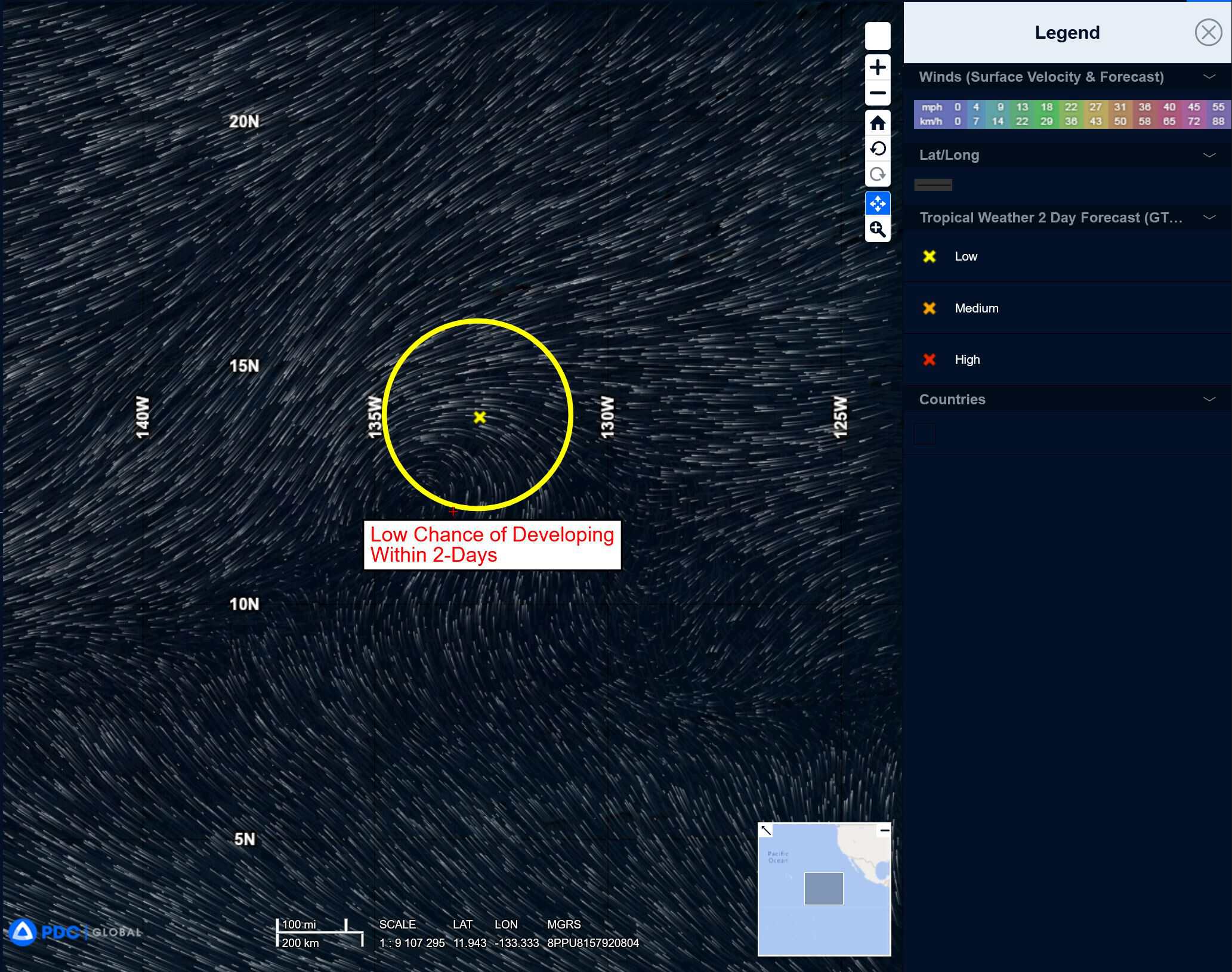
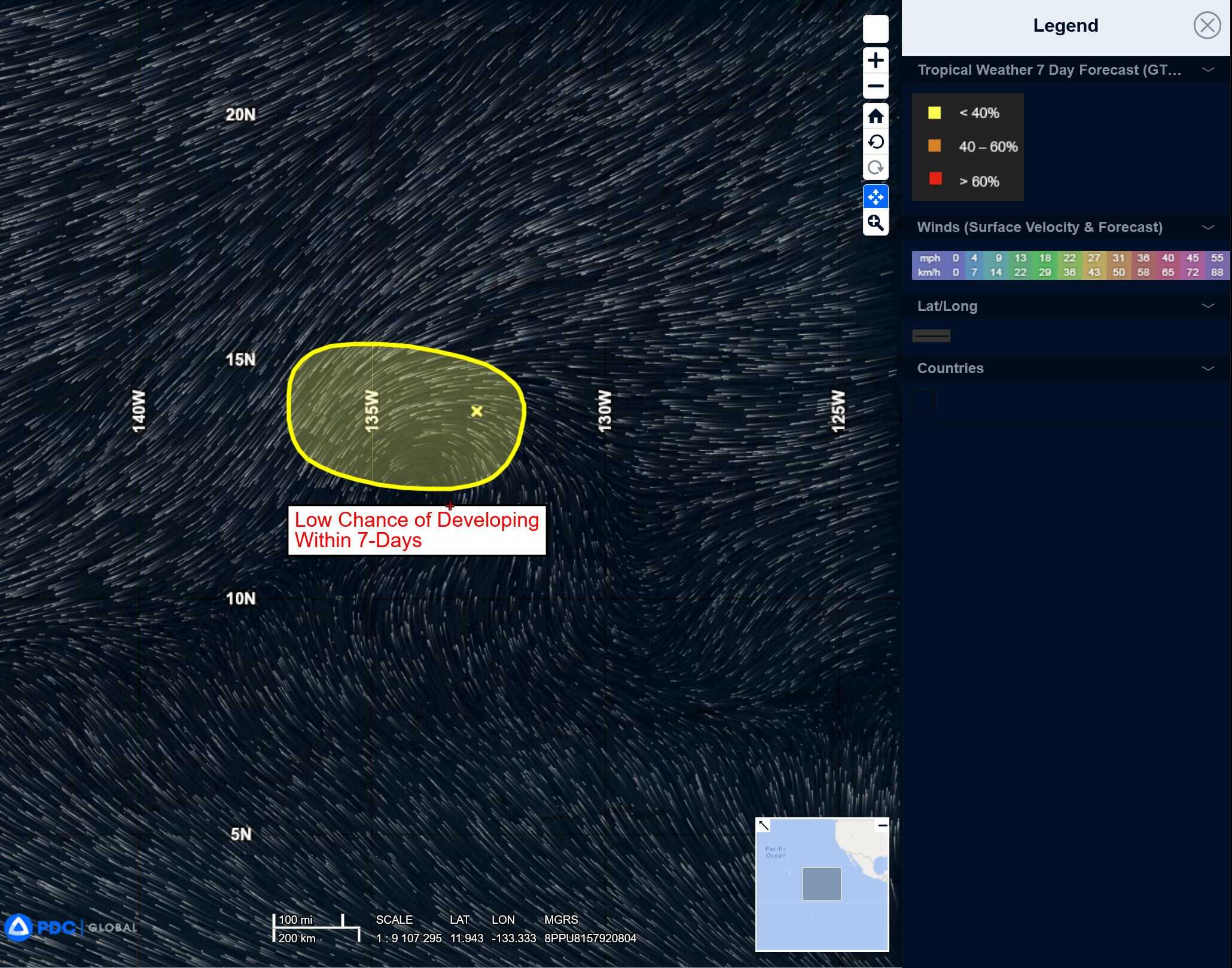
Well west-southwest of the Baja California Peninsula:
>>> A trough of low pressure located well west-southwest of the Baja California peninsula is producing limited shower activity.
The system is moving westward into an unfavorable environment, and development is no longer expected.
* Formation chance through 48 hours…low…near 0 percent
* Formation chance through 7 days…low…near 0 percent
Central Pacific Ocean: There are no Tropical Cyclones
Tropical cyclone formation is not expected during the next 7-days.
Western Pacific, Indian Ocean, and adjacent Seas:
Western Pacific
Tropical Cyclone 09W (Wipha)
According to the JTWC warning number 15 sustained winds are 45 knots with gusts to near 55 knots
Animated enhanced infrared (eir) satellite imagery reveals a large, slightly asymmetrical central dense overcast (cdo) feature associated with tropical storm 09W (Wipha), with cold cloud tops. The initial position is determined with medium confidence based on radar imagery, as well as extrapolation from a 211047z f16 ssmis microwave suite.
Environmental analysis depict a marginally conducive setup for further development, characterized by very warm sea surface temperatures (sst), moderate equatorward upper-level outflow, abundant moisture in the atmospheric column, offset by high northeasterly vertical wind shear (vws) currently analyzed at 25-30 knots.
TS 09W is forecast to continue tracking west-southwestward, steered by a weak subtropical ridge (str) positioned to the northeast. As the system remains over very warm
ssts of the Gulf of Tonkin, slight intensification is possible with peak sustained winds reaching 55 knots within the next 6-12 hours, before terrain interaction starts affecting the wind field and ultimately structure of the vortex.
Additionally, the ongoing impact of high vws will impose a limit on potential strengthening. Landfall is forecast to occur soon after 12 hours, resulting in a steady degradation of the low-level circulation over land, due to the interaction with the complex terrain of northern Vietnam and increasingly hostile shear. Complete dissipation is anticipated by or before 48 hours.
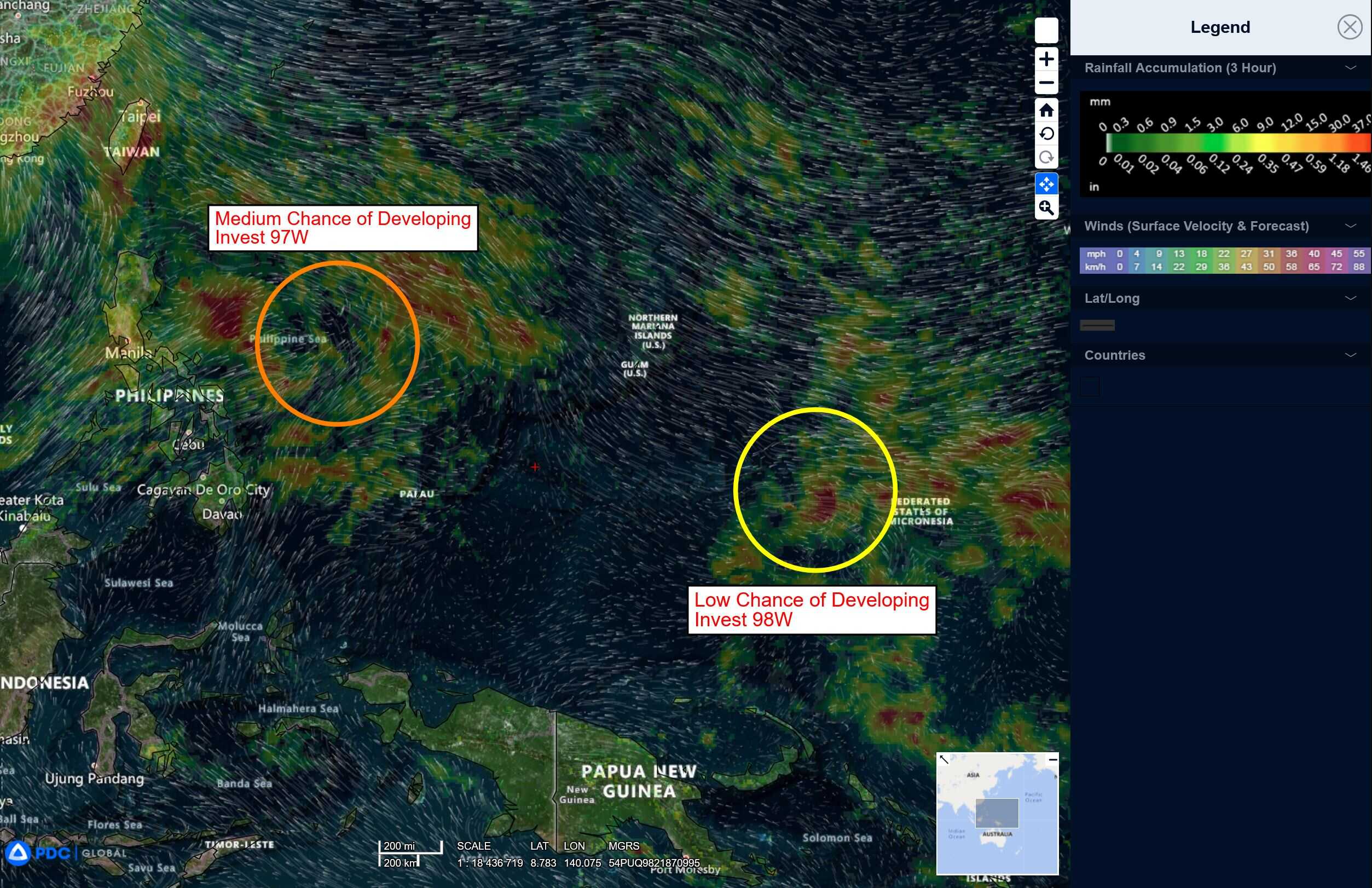
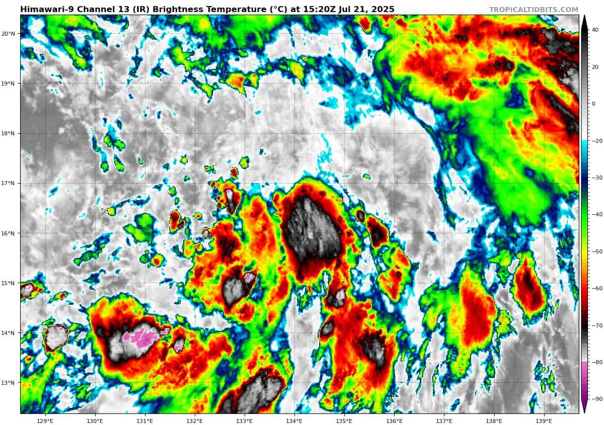
>>> There’s an area of disturbed weather being referred to as Invest 97W, which is located approximately 650 NM south-southwest of Kadena AB, Okinawa.
Animated multi-spectral satellite imagery depicts a rapidly consolidating low-level circulation (llc), with formative banding and low-level cloud lines wrapping into the center. An ascat-c bullseye image reveals a broad circulation, with patchy 20-25 knot winds over the eastern quadrant and 5-10 knot winds over the western semicircle. A microwave image depicts fragmented deep convective banding around the northern periphery, with improved shallow banding wrapping into a broad center.
Environmental analysis reveals a marginally favorable environment with low to moderate (15-20 knots) vertical
wind shear offset by dual channel outflow. SST values are favorable. Invest 97W has formed along the eastern periphery of an area of broad monsoonal flow, and is expected to track poleward along the eastern periphery of this complex system over the next 24 to 36 hours.
After this period, the system may dissipate and merge with a developing monsoon depression south of Okinawa. This monsoon depression is forecast to produce an extensive swath of gale-force winds along the eastern and northern peripheries.
Maximum sustained surface winds are estimated at 15 to 20 knots.
The potential for the development of a significant tropical cyclone within the next 24 hours is upgraded to high.
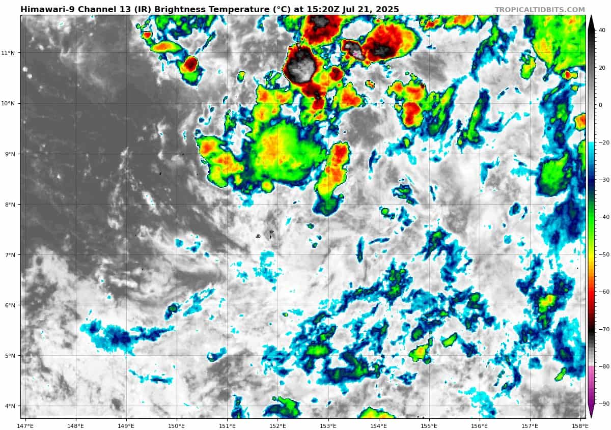
>>> There’s a second area of disturbed weather being referred to as Invest 98W, which is located approximately 408 NM north-northwest of Guam
Multi-spectral satellite imagery (msi) depicts a poorly organized low level circulation center (llcc) with cycling of deep convection south-southeast. An ascat pass with its strongest winds (20-25 knots) isolated to the northwest.
Environmental analysis for the area indicates favorable conditions with low vertical wind shear (10-15 knots) accompanied by warm sea surface temperatures and moderate equatorward outflow aloft.
Global deterministic are in fair agreement that the area of convection 98W will continue north as it gradually intensifies over the next 48 hours. Ensemble guidance agrees on a northward track with gefs being more aggressive on development than ecens.
Maximum sustained surface winds are estimated at 13 to 18 knots.
The potential for the development of a significant tropical cyclone within the next 24 hours is low.