
")
Current Snapshot
For all the latest updates visit: DisasterAWARE

1800×1080
09s
09S_201200sair
himawari9_ir_09S_202512201430_lat-12.3-lon105.3
09S_tracks_latest
By PDC’s Senior Weather
Specialist Glenn James

The Pacific Disaster Center’s (PDC Global) Saturday, December 20, 2025, Tropical Cyclone Activity Report…for the Pacific Ocean, the Indian Ocean, and adjacent Seas
Current Tropical Cyclones:
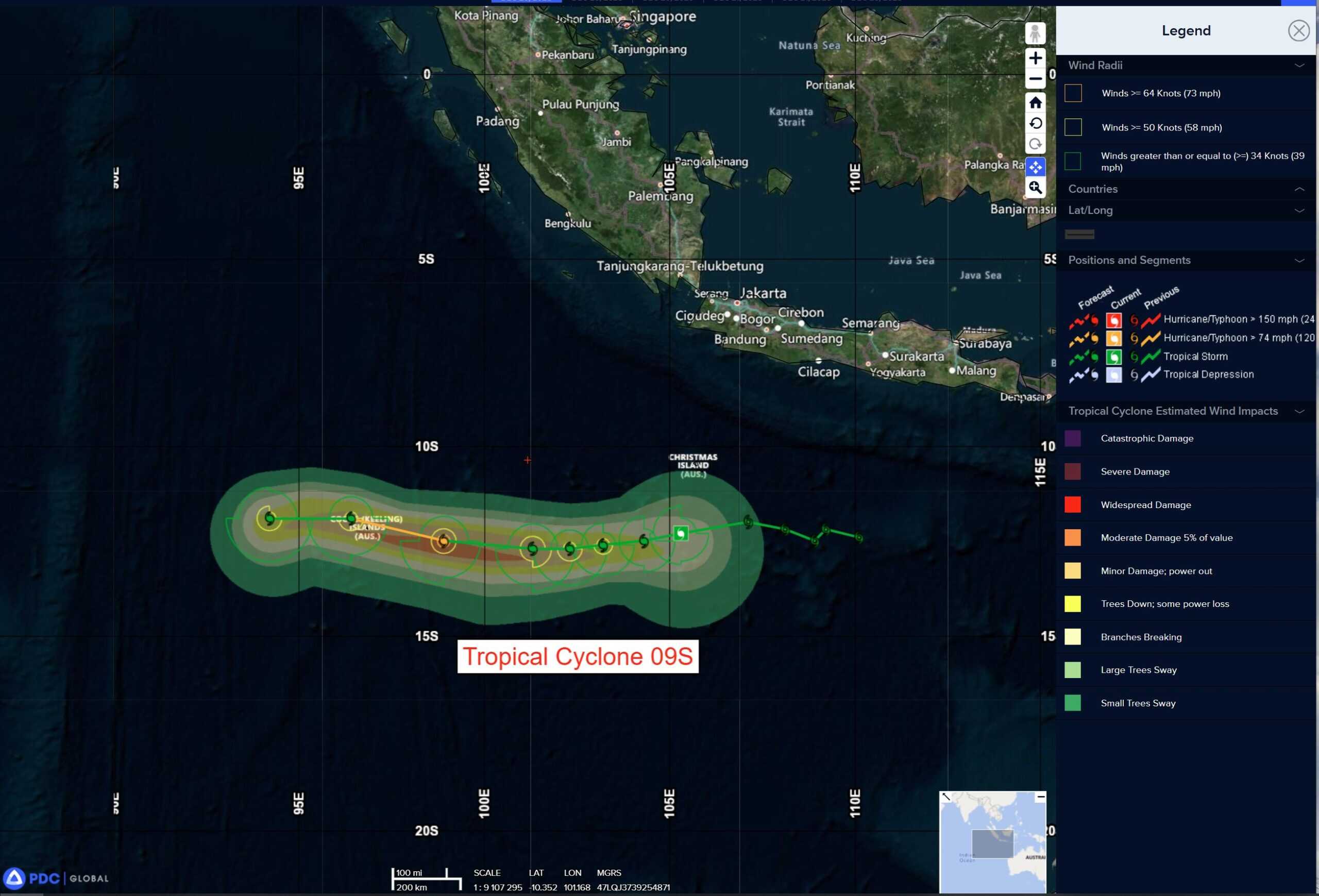
Tropical Cyclone 09S is located approximately 493 NM east of Cocos Islands
Northeast Pacific Ocean: There are no Tropical Cyclones
The last regularly scheduled Tropical Cyclone Activity Report of the 2025 eastern North Pacific Hurricane Season has been issued. Routine issuance of this section of the PDC product will resume on May 15, 2026. During the off-season, Special Tropical Weather Outlooks will be issued as conditions warrant by the NHC.
Central Pacific Ocean: There are no Tropical Cyclones
The 2025 central North Pacific hurricane season has ended. As such, the final routine Tropical Cyclone Activity Report for the 2025 season has been issued. Routine issuance of this section of the PDC product will resume on June 1, 2026. During the off-season, Special Tropical Weather Outlooks will be issued as conditions warrant by the CPHC.
Western Pacific, Indian Ocean, and adjacent Seas:
South Indian Ocean
Tropical Cyclone 09S
According to the JTWC warning number 7, sustained winds are 40 knots with 50 knot gusts
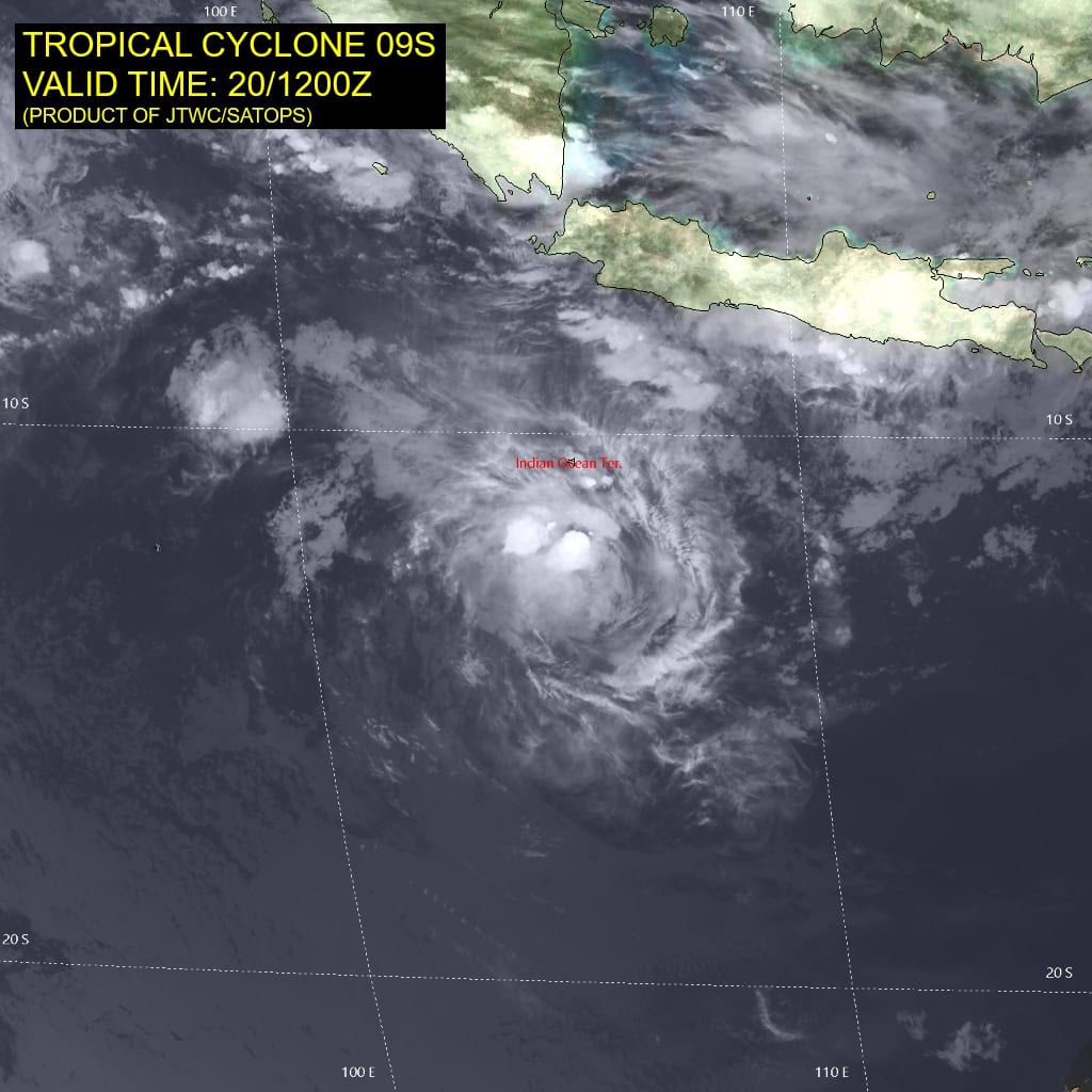
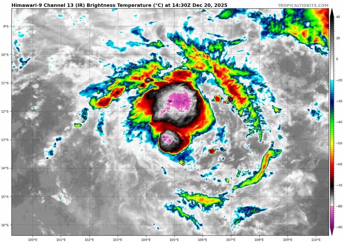
Animated multi-spectral satellite imagery (msi) depicts low level cloud lines wrapping into a developing low level circulation center, obscured by a cdo with overshooting cloud tops reaching temperatures as low as 82 degrees celsius. A 192251z wsf-m image reveals the compact nature of the central convective mass, indicating very strong scattering due to ice, representative of strong updrafts in the developing vortex.
Overall environmental conditions are generally favorable, however, weak outflow is the primary limiting factor.
Tropical cyclone 09S is forecast to slowly develop as outflow remains sub-optimal until around 72 hours, at which time a peak intensity of 65 knots is forecast. However, the small size may allow for a more aggressive trend.
Beyond 72 hours the window for intensification quickly closes as dry air moves in after that time leading to a weakening trend through the
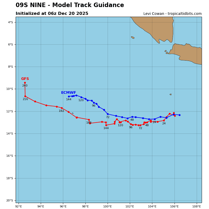
remainder of the forecast. TC 09S is expected to track generally westward along the steering ridge (str), with a weak trough passing to the south having little impact. in the extended range, the str will build, leading to an equatorward deflection.