
")
Current Snapshot
For all the latest updates visit: DisasterAWARE
1800x1080ec
grant
09S_291200sair
meteosat9_ir_09S_202512291451_lat-13.7-lon80.5
09S_tracks_latest
hay
10S_291200sair
himawari9_ir_10S_202512291430_lat-15.7-lon120.0
10S_tracks_latest
99p
goes18_ir_99P_202512291445_lat-13.8-lon-168.1
99P_tracks_latest
By PDC’s Senior Weather
Specialist Glenn James

The Pacific Disaster Center’s (PDC Global) Monday, December 29, 2025, Tropical Cyclone Activity Report…for the Pacific Ocean, the Indian Ocean, and adjacent Seas
Current Tropical Cyclones:
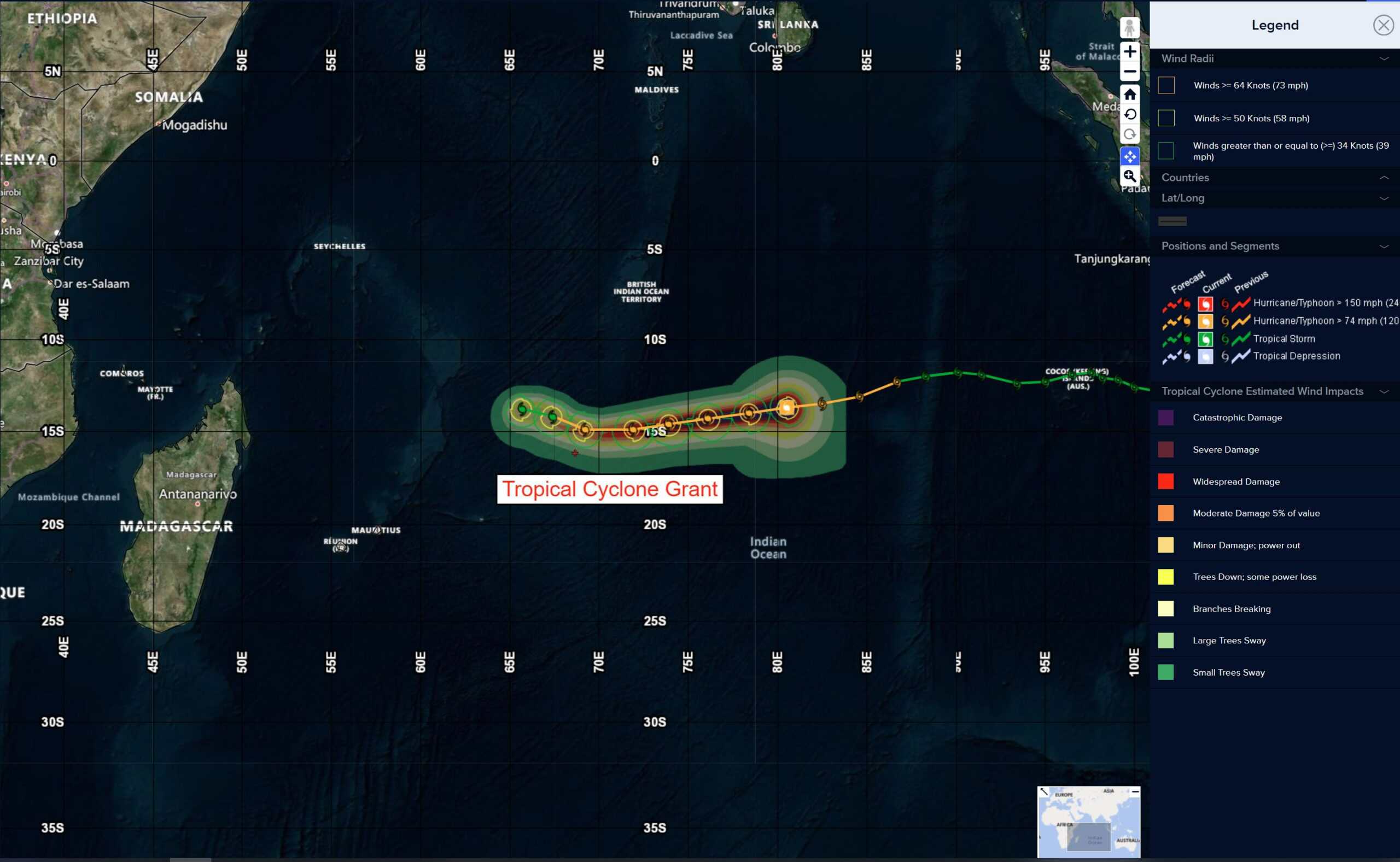
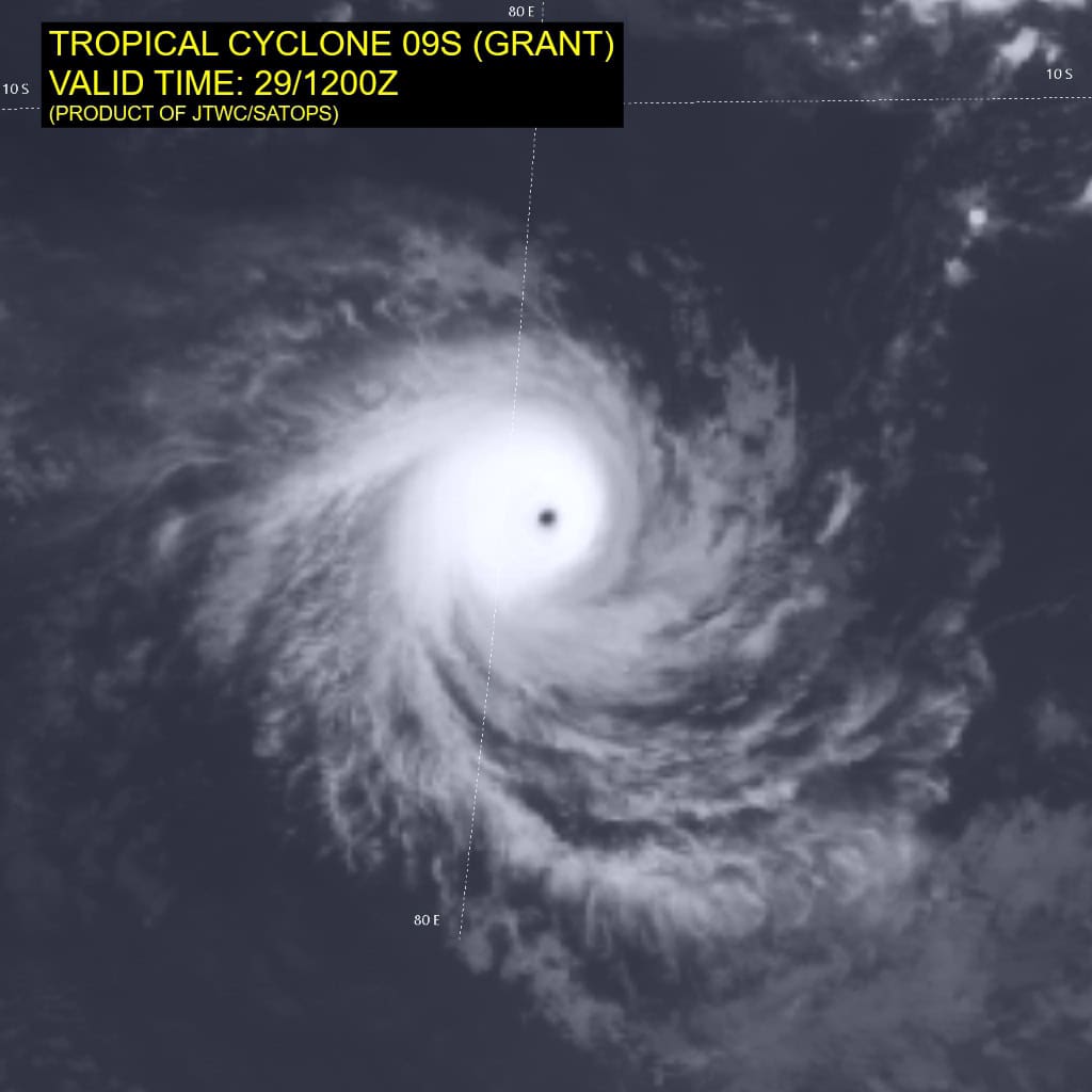
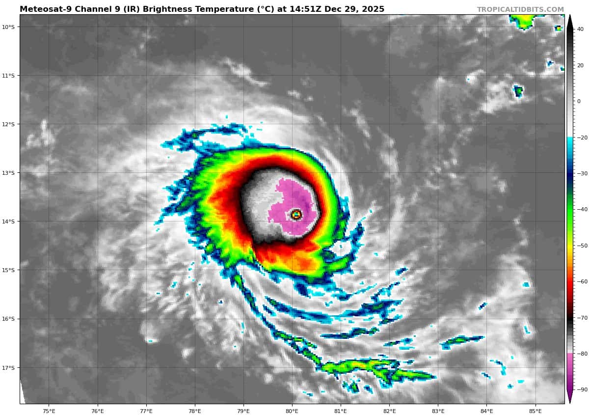
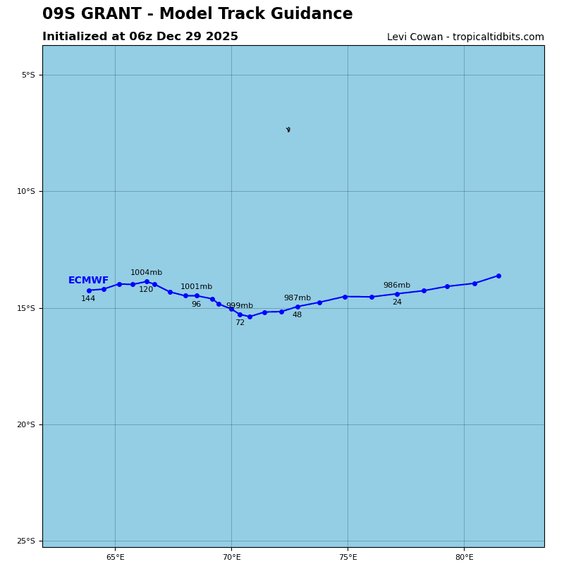
Tropical Cyclone 09S (Grant) is located approximately 616 NM southeast of Diego Garcia
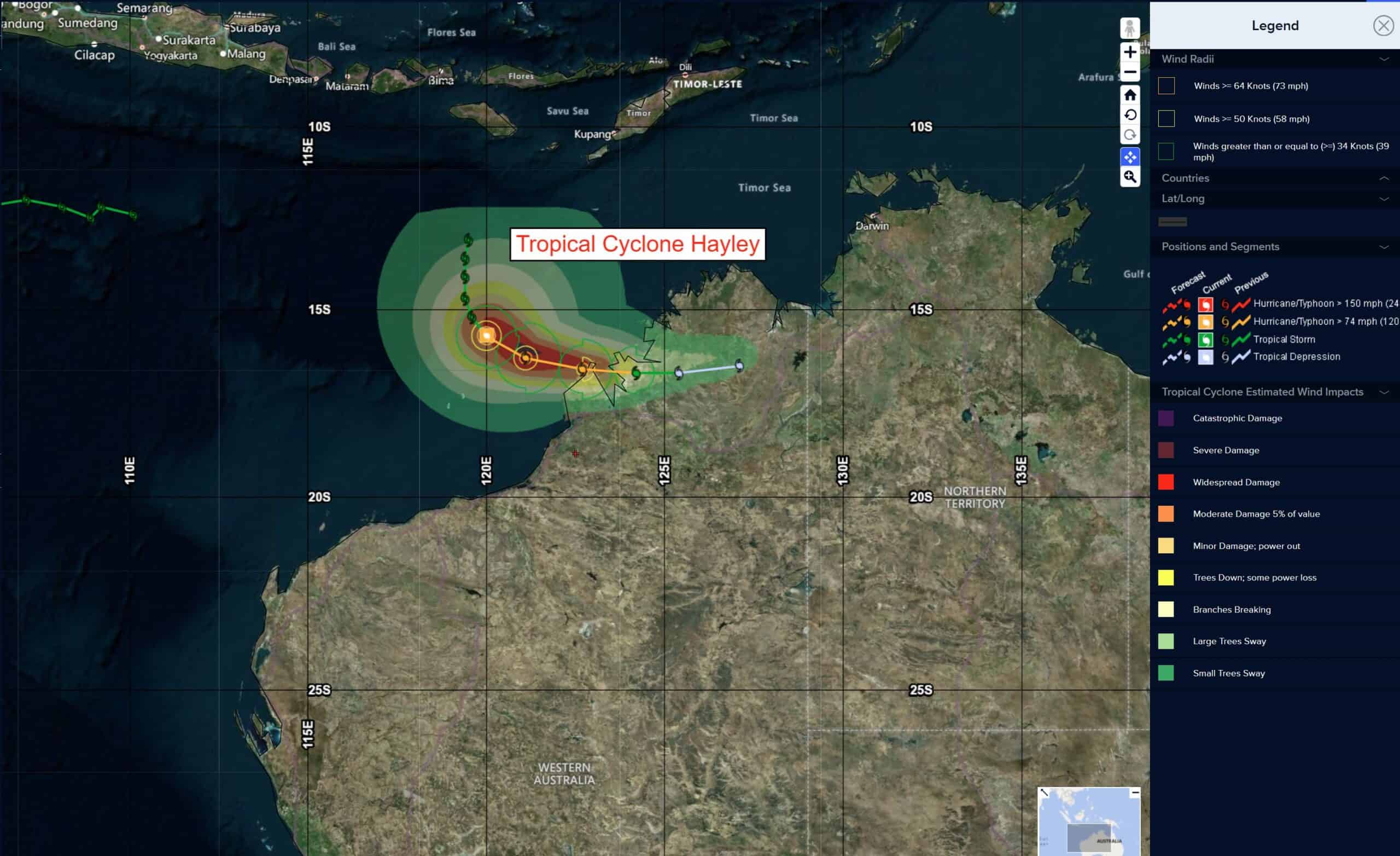
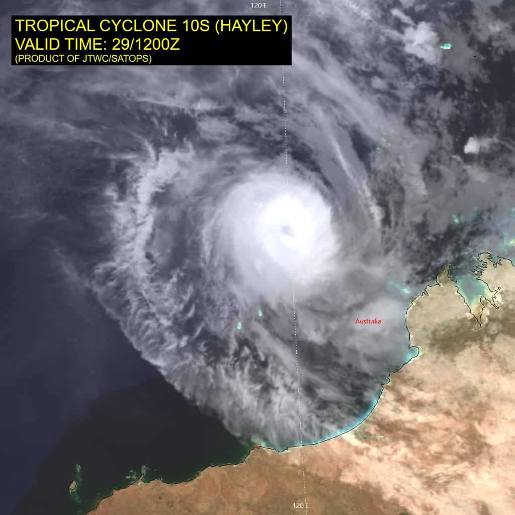
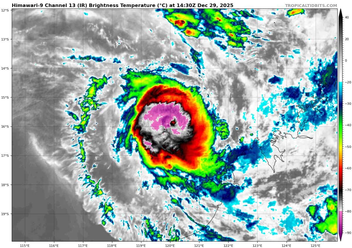
Tropical Cyclone 10S (Hayley) is located approximately 183 NM northwest of Broome, Australia
Northeast Pacific Ocean: There are no Tropical Cyclones
The last regularly scheduled Tropical Cyclone Activity Report of the 2025 eastern North Pacific Hurricane Season has been issued. Routine issuance of this section of the PDC product will resume on May 15, 2026. During the off-season, Special Tropical Weather Outlooks will be issued as conditions warrant by the NHC.
Central Pacific Ocean: There are no Tropical Cyclones
The 2025 central North Pacific hurricane season has ended. As such, the final routine Tropical Cyclone Activity Report for the 2025 season has been issued. Routine issuance of this section of the PDC product will resume on June 1, 2026. During the off-season, Special Tropical Weather Outlooks will be issued as conditions warrant by the CPHC.
Western Pacific, Indian Ocean, and adjacent Seas:
South Indian Ocean
Tropical Cyclone 09S (Grant)
According to the JTWC warning number 25, sustained winds are 120 knots with 145 knot gusts
Animated enhanced infrared (eir) satellite imagery depicts tropical cyclone 09S (Grant) with an 8 NM pinhole eye and very cold (-75 c) cloud tops entirely encircling the eye.
09S is analyzed to have rapidly intensified from 75 kts 24 hours ago to 105 kts now. However, the structure has started to slightly degrade from 0000z to 0200z. The intensity of 09s is likely to fluctuate as the small size of the system makes it more susceptible to the environment.
Environmental analysis indicates that 09S is in a highly favorable environment
characterized by strong poleward outflow, low (5-10 kts) vertical wind shear, and warm (27-28 c) sea surface temperatures.
09S is forecast to track west-southwestward, along the northern periphery of the str to the south, through 72 hours. Near 72 hours, a second str is expected to build to the southwest of the system, causing 09S to take a brief west-northwestward turn.
Regarding intensity, 09S is forecast to peak near 12 hours, though recent imagery suggests the peak may have already occurred. Nonetheless, the environment will remain favorable through 24 hours with strong poleward outflow and low vertical wind shear. After 24 hours, northeasterly shear is expected to increase, causing 09S to begin weakening. Around 72 hours, dry air is also expected to begin entraining into the vortex from the north, further weakening the system.
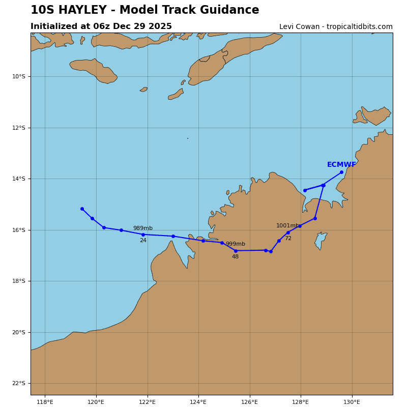
Tropical Cyclone 10S (Hayley)
According to the JTWC warning number 6, sustained winds are 75 knots with 90 knot gusts
TC 10S has intensified significantly over the past six hours. animated enhanced infrared (eir) satellite imagery depicts development of an 8 NMN eye surrounded by cooling deep convective banding.
TC 10Swill continue to turn eastward over the next 12 to 24 hours as it follows the peripheral flow associated with the near-equatorial steering ridge centered to the northeast.
The system is expected to undergo additional intensification over the next 12 hours under the supportive influences of low vertical wind shear, very warm sea surface temperatures, and moderate poleward outflow. Mid-level vertical wind shear will increase after 12 hours, resulting in intrusion of dry air into the system and marginal weakening before the system makes landfall over the Dampier Peninsula around 24 hours. Following landfall, persistent shear and land interaction will lead to steady dissipation by 48 hours.
Southwest Pacific Ocean
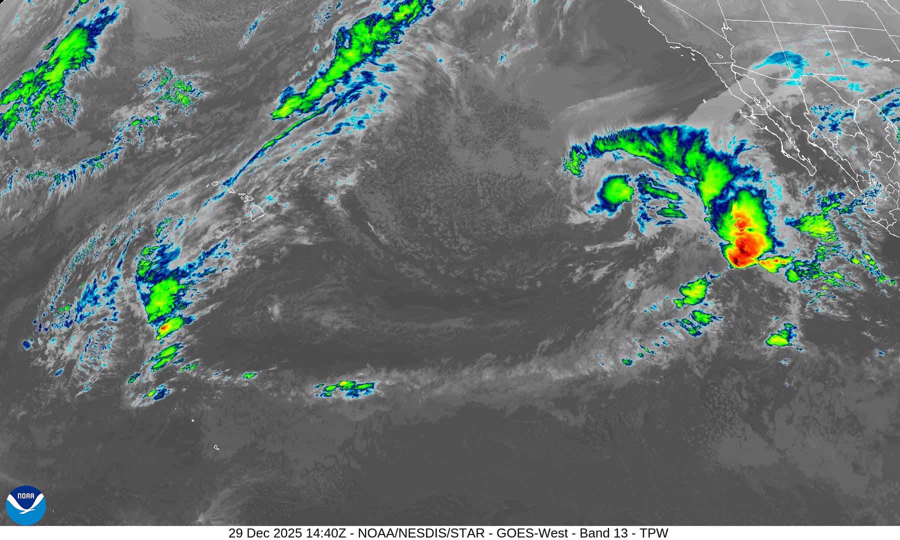
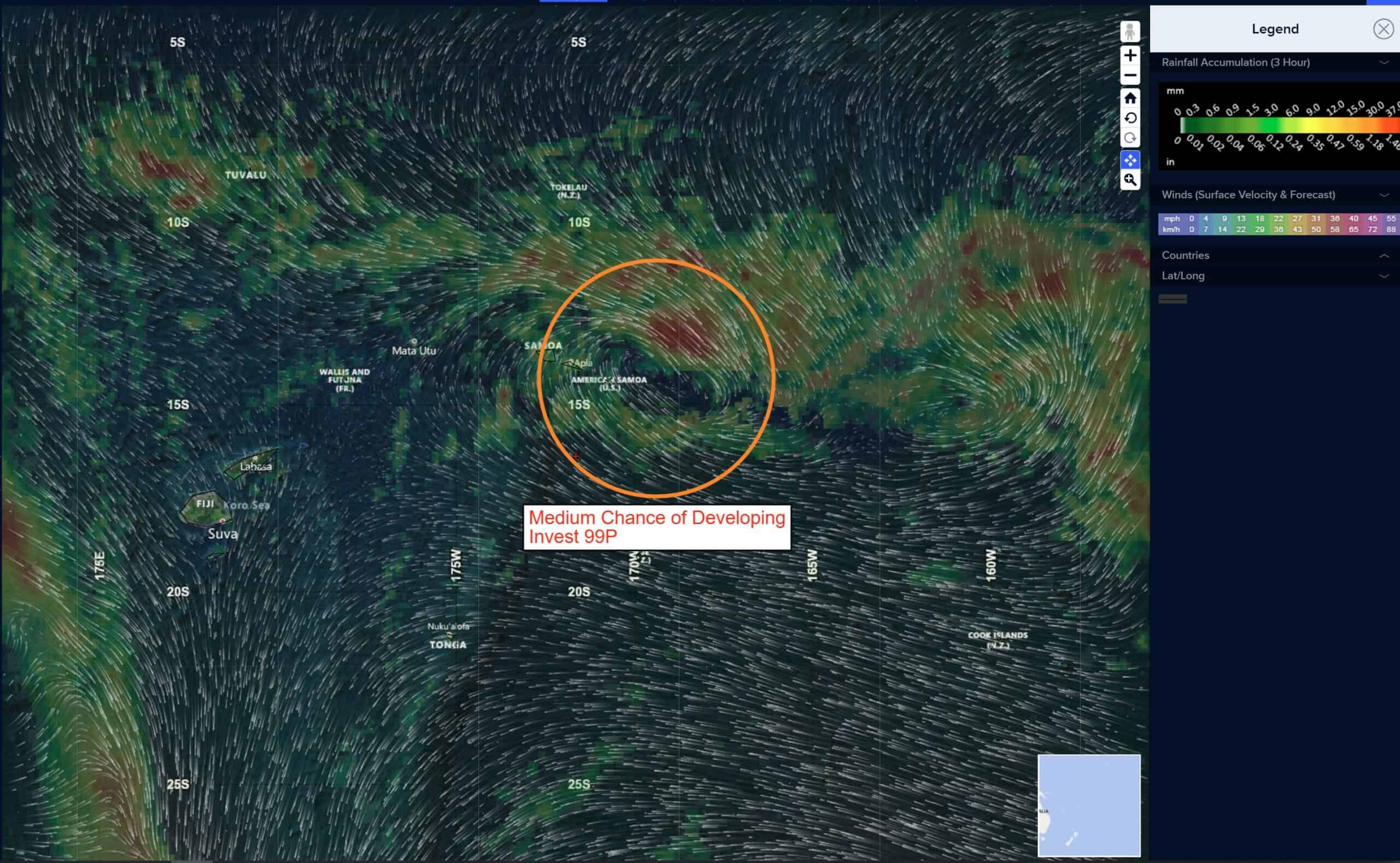
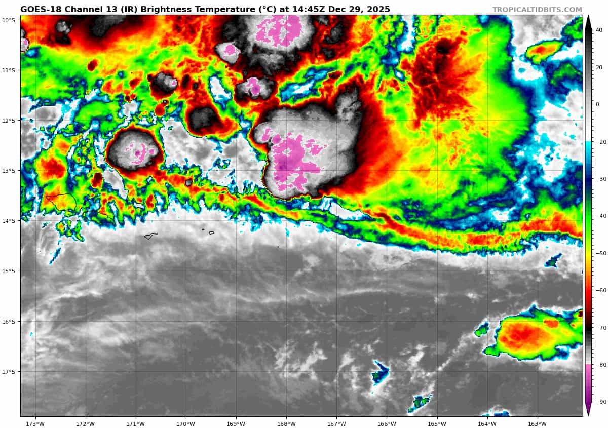
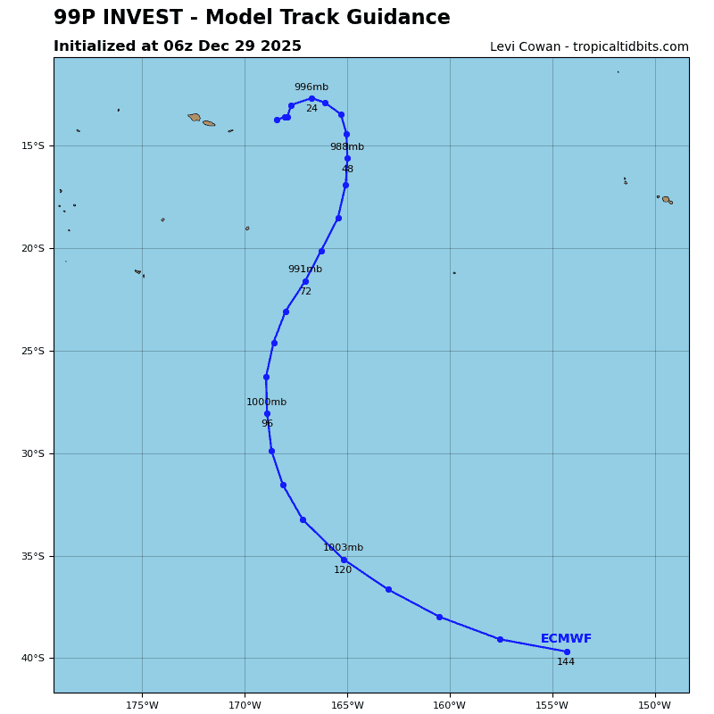
>>> There’s an area of disturbed weather being referred to as Invest 99P, which is located approximately 77 NM northeast of Pago Pago, American Samoa
multispectral satellite imagery depicts broad cyclonic turning with associated fragmented banding and deep convection, especially over the northeastern portion of the developing circulation.
Environmental analysis reveals a favorable environment for development with low vertical wind shear (10 to 15 knots), warm sea surface temperatures (29 to 30 c), and moderate poleward outflow.
Global deterministic and ensemble models depict increasing consolidation over
the next 24 to 48 hours as invest 99p moves eastward.
Maximum sustained surface winds are estimated at 23 to 28 knots.
The potential for the development of a significant tropical cyclone within the next 24 hours remains medium.