
")
Current Snapshot
For all the latest updates visit: DisasterAWARE
1800×1080
grant

09S_241200sair
himawari9_ir_09S_202512241430_lat-11.8-lon97.6
09S_tracks_latest
By PDC’s Senior Weather
Specialist Glenn James

The Pacific Disaster Center’s (PDC Global) Wednesday, December 24, 2025, Tropical Cyclone Activity Report…for the Pacific Ocean, the Indian Ocean, and adjacent Seas
Current Tropical Cyclones:
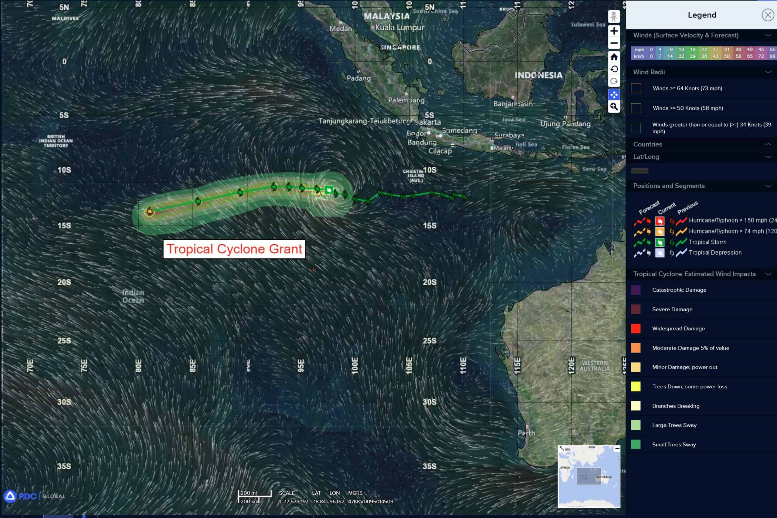
Tropical Cyclone 09S (Grant) is located approximately 30 NM northwest of the Cocos Islands
Northeast Pacific Ocean: There are no Tropical Cyclones
The last regularly scheduled Tropical Cyclone Activity Report of the 2025 eastern North Pacific Hurricane Season has been issued. Routine issuance of this section of the PDC product will resume on May 15, 2026. During the off-season, Special Tropical Weather Outlooks will be issued as conditions warrant by the NHC.
Central Pacific Ocean: There are no Tropical Cyclones
The 2025 central North Pacific hurricane season has ended. As such, the final routine Tropical Cyclone Activity Report for the 2025 season has been issued. Routine issuance of this section of the PDC product will resume on June 1, 2026. During the off-season, Special Tropical Weather Outlooks will be issued as conditions warrant by the CPHC.
Western Pacific, Indian Ocean, and adjacent Seas:
South Indian Ocean
Tropical Cyclone 09S (Grant)
According to the JTWC warning number 16, sustained winds are 45 knots with 55 knot gusts
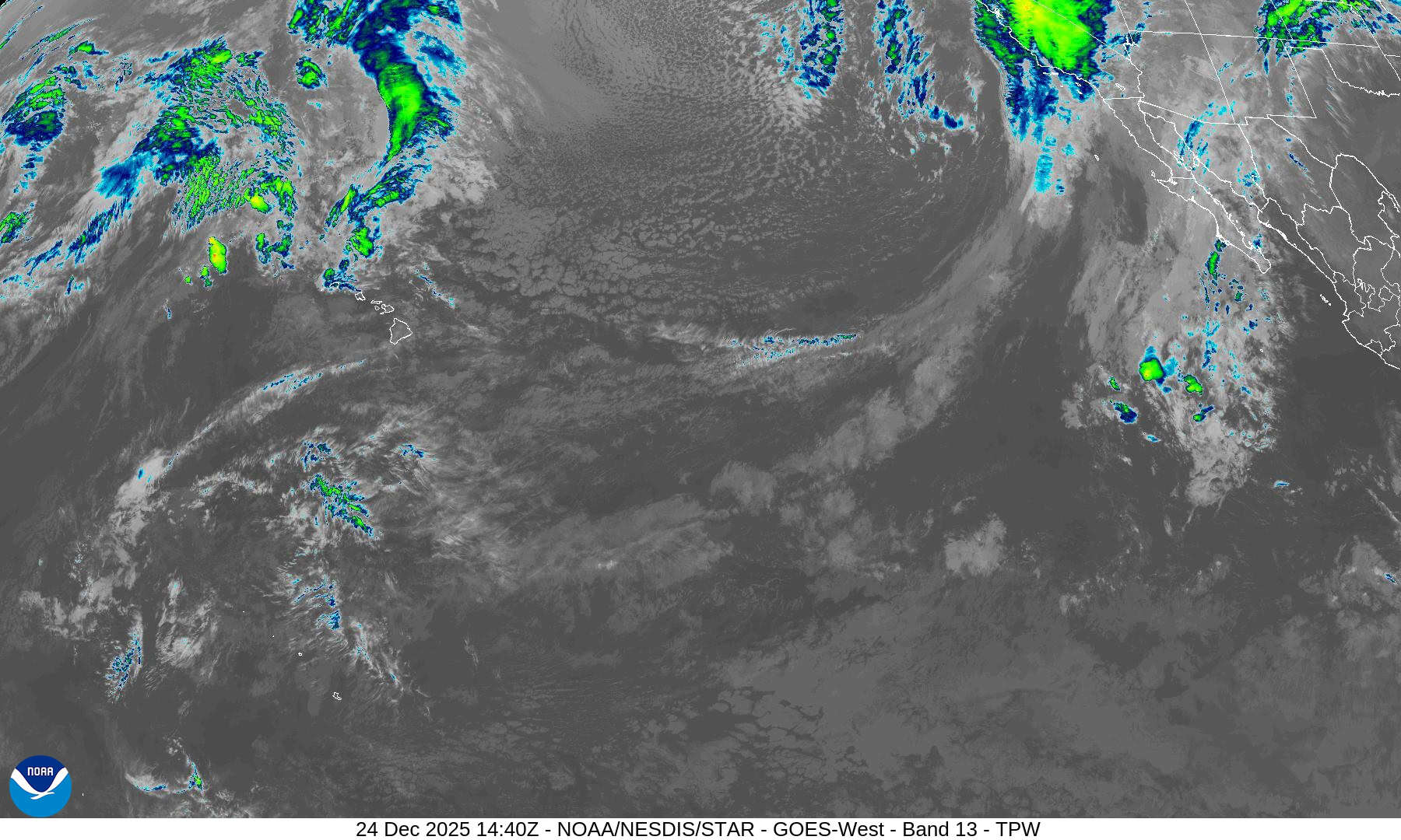
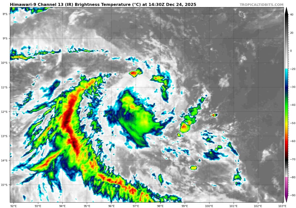
Tropical cyclone 09S (Grant) has displayed a highly cyclical nature over the past couple of days, with episodic bursts of convection followed by convective dissipation and enhanced northeasterly shear. The satellite loop over the past six hours indicates we are in the midst of another dissipation cycle at the current moment. And very similar to 24 hour ago, the low-level circulation center (llcc) has become challenging to locate as the convection moves away to the south and leaves behind strong mid-level rotation, which obscures the llcc.
Two recent microwave passes (a 121157z ssmis and a 121146z wsf-m) were fairly dissimilar in depicting the structure of TC 09S, and did not provide much clarity to the analysis. The ssmis 91ghz image lined up closest with what was seen in the eir loop, and the initial position was placed with low confidence on the northern edge of the deep convection which at that time was just started to push off to the
south.
The environment is marginally favorable, with low (10-15 knots) northeasterly vws, weak poleward and westward outflow and warm ssts. Dry air remains a concern, with the tpw loop showing a wedge of dry mid-level air pushing up from the south along the western flank of the system.
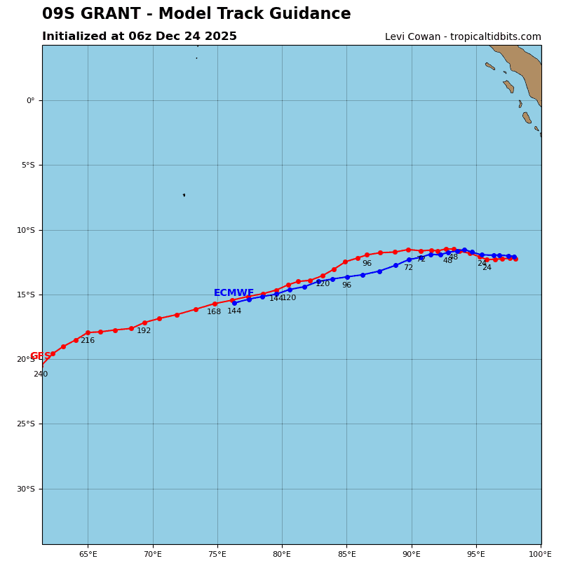
TC 09S has been moving northwestward at a slow pace over the past 12 hours, and this motion is expected to continue for the next 12 to 24 hours, as the steering pattern remains relatively weak, with competing influences from multiple ridges and a col region to the south. The track will flatten out by 36 hours and then quickly shift to a southwestward trajectory as the ridge to the southeast begins to build and strengthens the steering gradient.
TC 09S will begin to accelerate after 48 hours, while continuing on a southwestward track through the remainder of the forecast period as the str continues to build and moves southwest along with TC 09S.
Intensity presents a bit trickier of a proposition, especially with the compact nature of the system and the highly cyclical nature of the convection seen over the past couple of days. In the near term, available model guidance indicates a slight improvement in the environment is expected, with decreasing shear and increased moisture. This will allow TC 09S to intensify over the next 24 to 36 hours, though the expected peak intensity continues to decrease, now expected to be 60 knots.
After 36 hours, northeasterly shear will increase, while dry air will move in from the north as well, initiating a weakening phase, which is expected to continue through 72 hours. After 72 hours, conditions look
to improve once again, and TC 09S will re-intensify through the remainder of the forecast period.