
")
Current Snapshot
For all the latest updates visit: DisasterAWARE
1800×1080
atlantic
goes19_ir_08L_202510011605_lat36.5-lon-64.0
011453_earliest_reasonable_toa_34hum

08L_tracks_latest
goes19_ir_09L_202510011607_lat30.7-lon-71.3
011454_earliest_reasonable_toa_34im
09L_tracks_latest
By PDC’s Senior Weather
Specialist Glenn James

The Pacific Disaster Center’s (PDC Global) Wednesday, October 1, 2025, Tropical Cyclone Activity Report…for the Atlantic Ocean, the Caribbean Sea, and the Gulf of America
Current Tropical Cyclones:
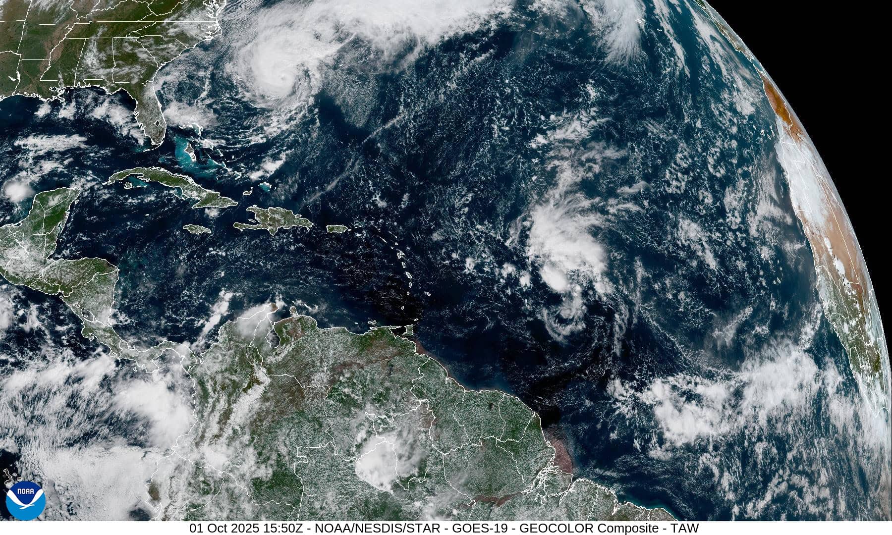
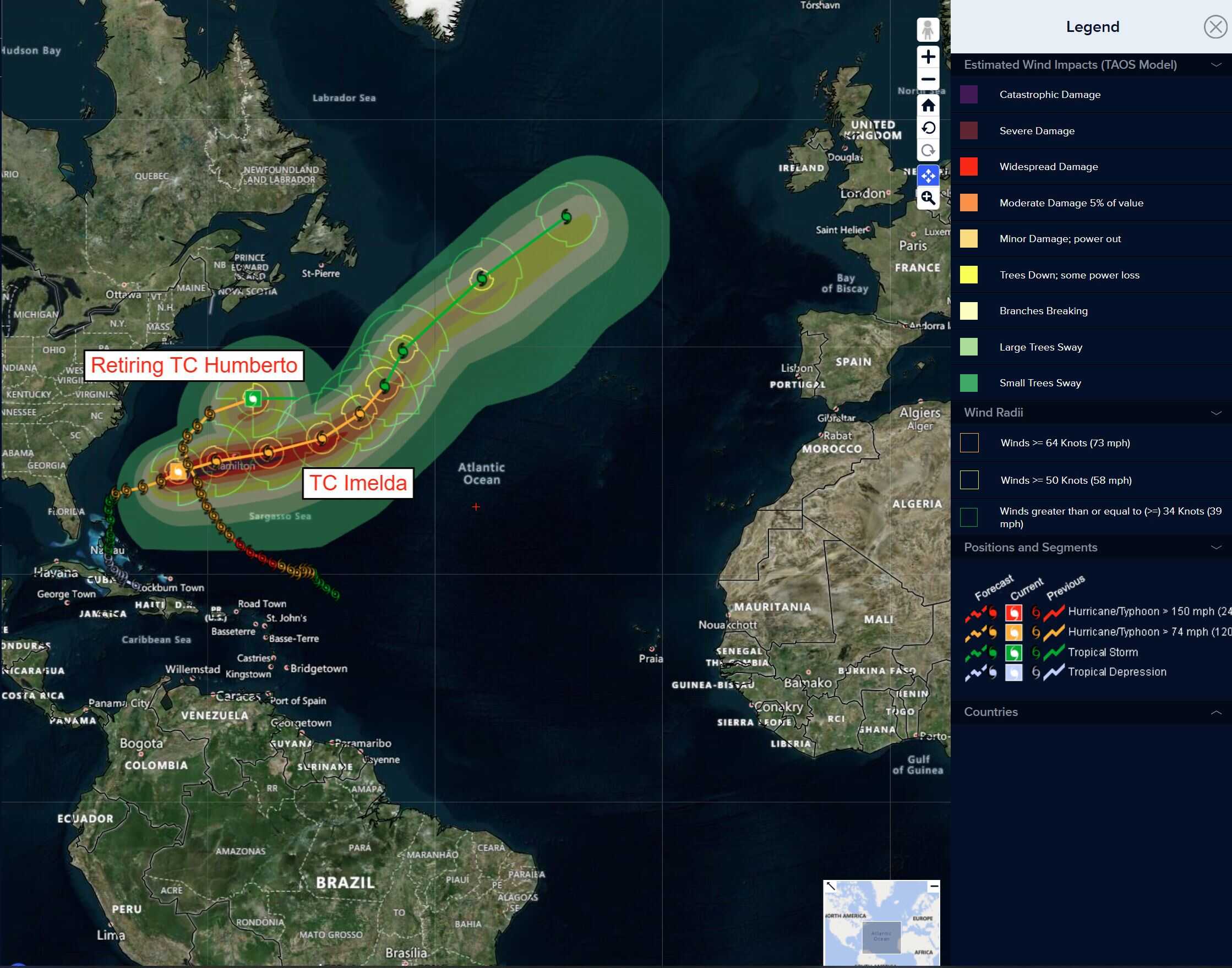
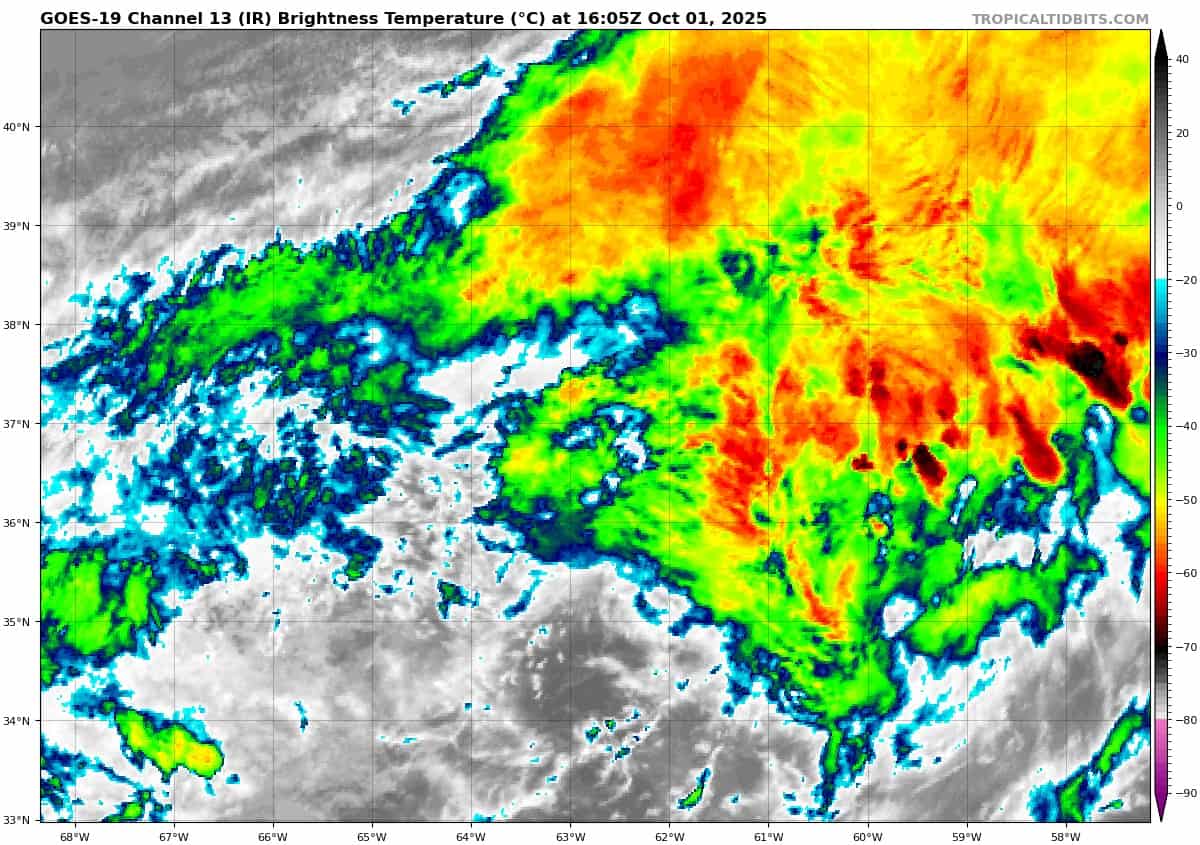
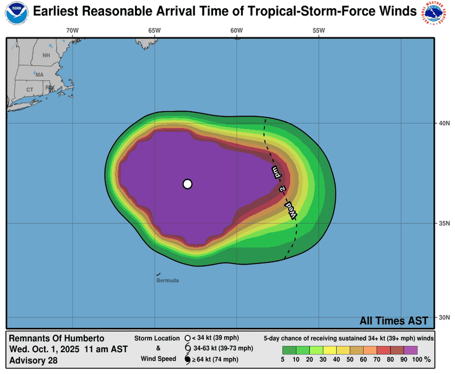
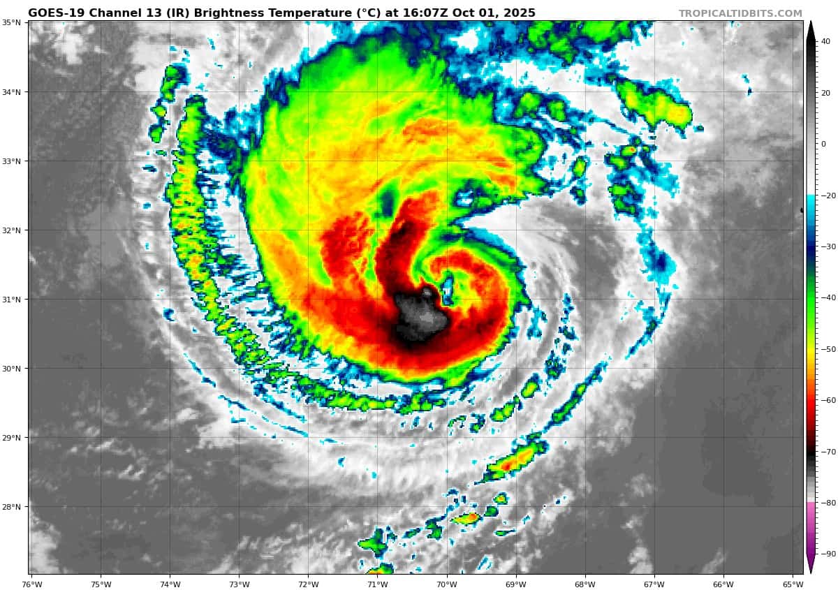
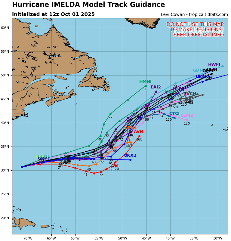
Tropical Cyclone 09L (Imelda)…is located about 80 miles east-northeast of Bermuda
Atlantic Ocean:
Tropical Cyclone 09L (Imelda)
IMELDA’S CORE NOW EAST-NORTHEAST OF BERMUDA WITH CONDITIONS ON THE ISLAND EXPECTED TO IMPROVE DURING THE NEXT SEVERAL HOURS
According to the NHC advisory number 22A
Imelda is moving toward the east-northeast near 30 mph (48 km/h) and this general motion is expected to continue through tonight. A northeastward motion is then forecast on Friday and Saturday. On the forecast track, the core of Imelda will move away from Bermuda during the next several hours.
Maximum sustained winds are near 90 mph (150 km/h) with higher gusts. Imelda is expected to become an extratropical low later today, with gradual weakening forecast thereafter.
Hurricane-force winds extend outward up to 45 miles (75 km) from the center and tropical-storm-force winds extend outward up to 255 miles (405 km). During the past few hours, an elevated observing site at the National Museum of Bermuda reported sustained winds of 78 mph (125 km/h) and a wind gust of 99 mph (159 km/h).
The estimated minimum central pressure is 973 mb (28.74 inches). Several stations on Bermuda reported minimum pressures of 975-977 mb (28.79-28.85 inches) as the center of Imelda passed just south of the island.
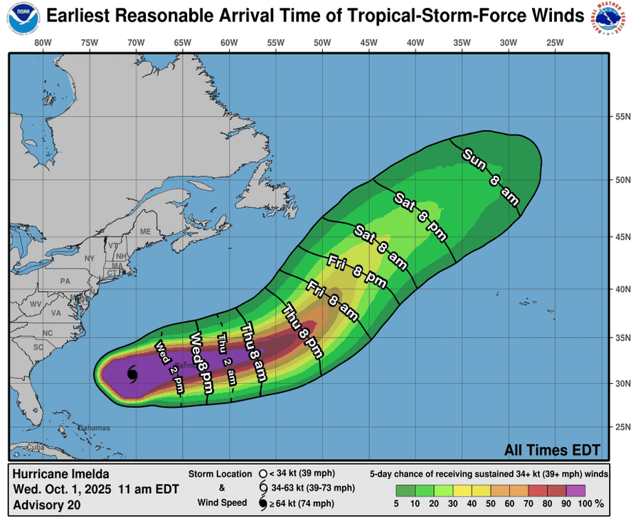
HAZARDS AFFECTING LAND
WIND: Hurricane conditions are expected over Bermuda tonight, with tropical storm conditions likely by this afternoon.
RAINFALL: Across Bermuda, 2 to 4 inches (50 to 100 mm) of rainfall is expected from later today into Thursday, which could lead to flash flooding.
STORM SURGE: In Bermuda, a dangerous storm surge is expected to produce coastal flooding in areas of onshore winds. The surge will be accompanied by large and damaging waves.
SURF: Swells generated by Imelda are affecting the Bahamas, Bermuda, and much of the U.S. East Coast. These swells are likely to cause life-threatening surf and rip current conditions.
Central Tropical Atlantic:
>>> A tropical wave is expected to move off the coast of Africa over the next day or two. Thereafter, this wave is forecast to interact with another disturbance in the eastern tropical Atlantic, and some slow development of the combined feature is possible as the system moves westward to west-northwestward at 15 to 20 mph.
* Formation chance through 48 hours…low…near 0 percent.
* Formation chance through 7 days…low…20 percent
Southwestern Atlantic:
>>> An area of low pressure may form near the northwestern Bahamas and southern Florida by Saturday. Any additional development is expected to be slow to occur as the system moves northwestward across the Florida Peninsula into the Gulf of America.
* Formation chance through 48 hours…low…10 percent
* Formation chance through 7 days…low…10 percent
Caribbean Sea: There are no active tropical cyclones
Tropical cyclone formation is not expected during the next 7-days.
Gulf of America: There are no active tropical cyclones
Tropical cyclone formation is not expected during the next 7-days.