Western Pacific, Indian Ocean, and adjacent Seas:

")
By PDC’s Senior Weather
Specialist Glenn James

The Pacific Disaster Center’s (PDC Global) Friday, August 8, 2025, Tropical Cyclone Activity Report…for the Pacific Ocean, the Indian Ocean, and adjacent Seas
Current Tropical Cyclones:
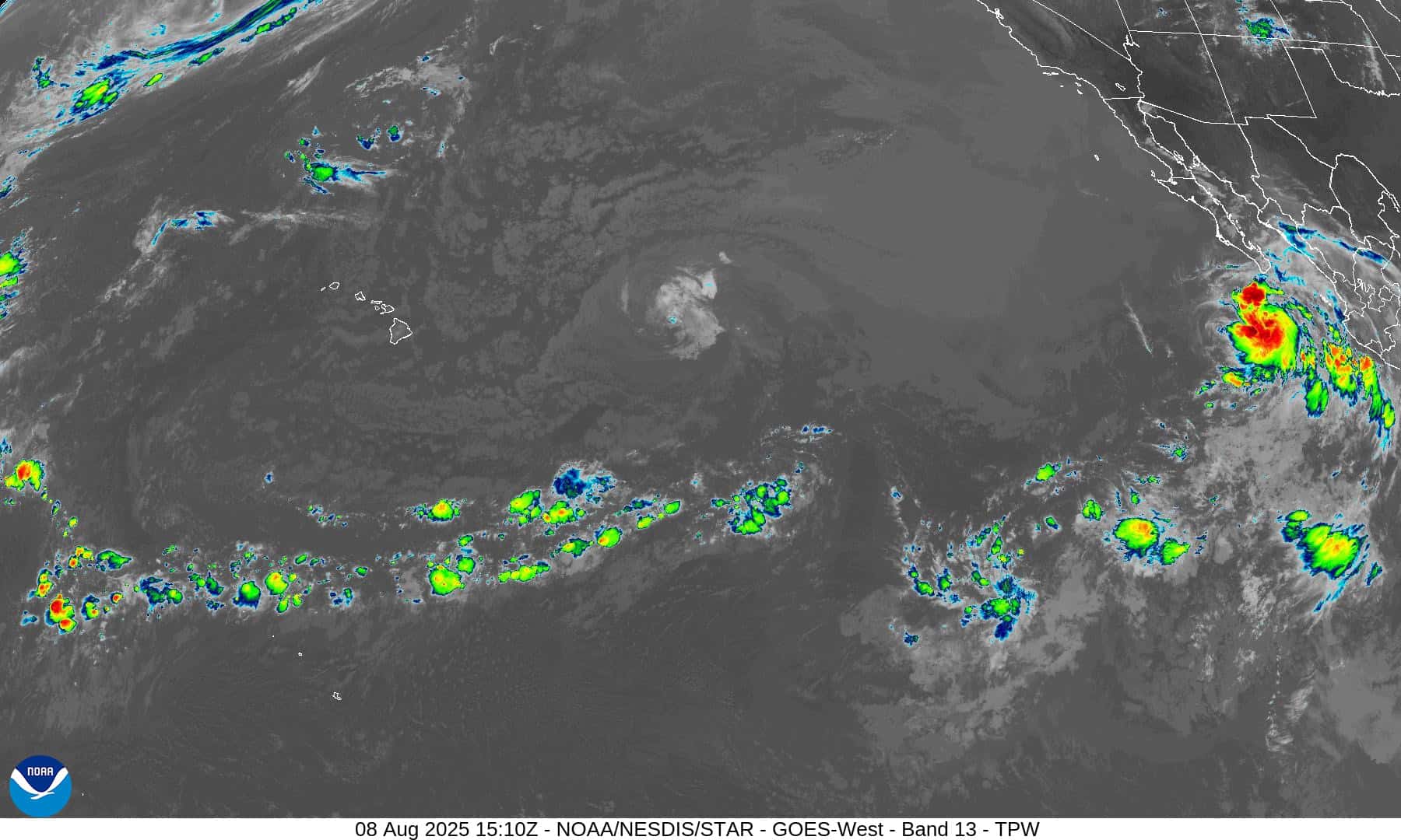
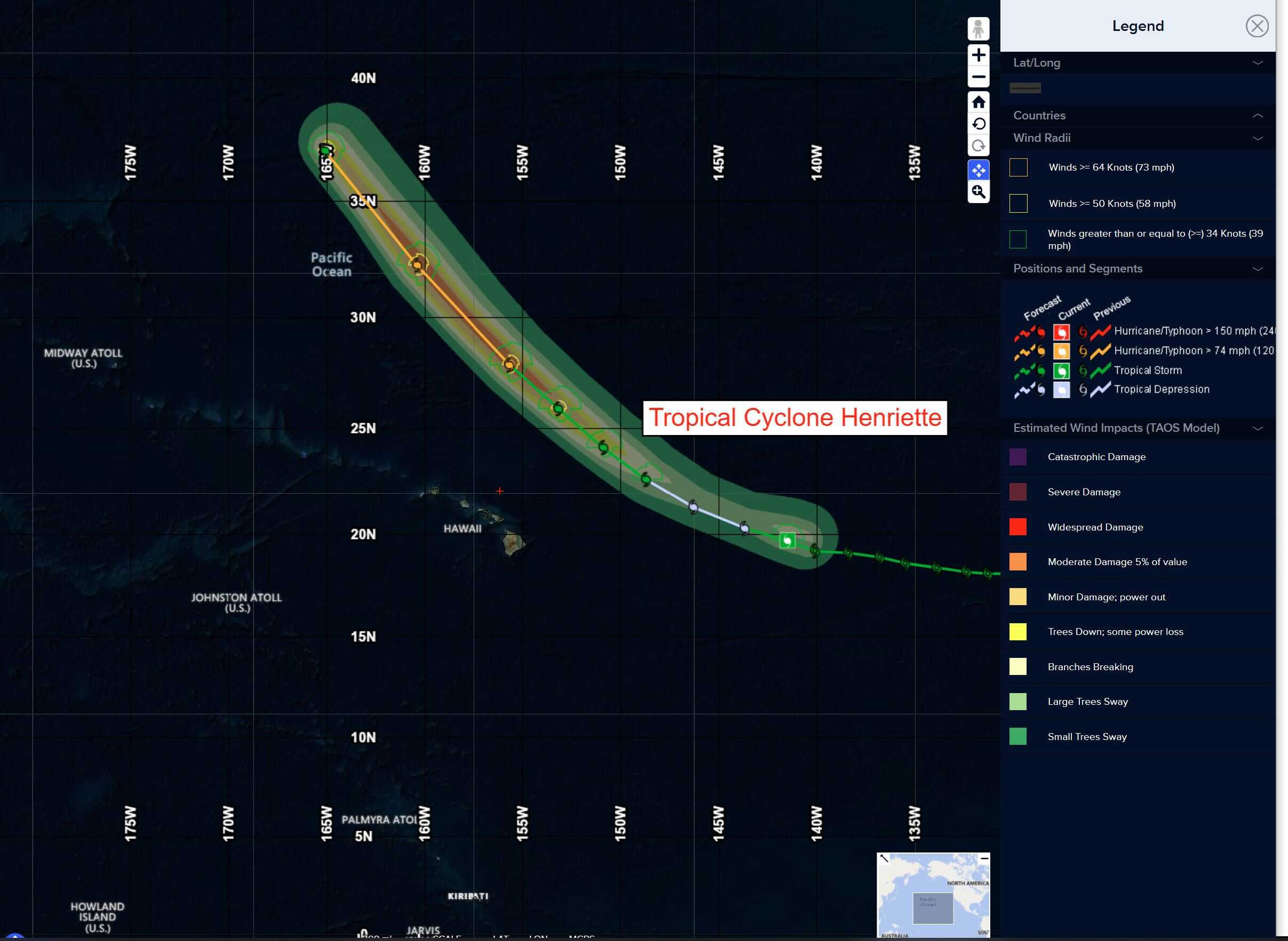
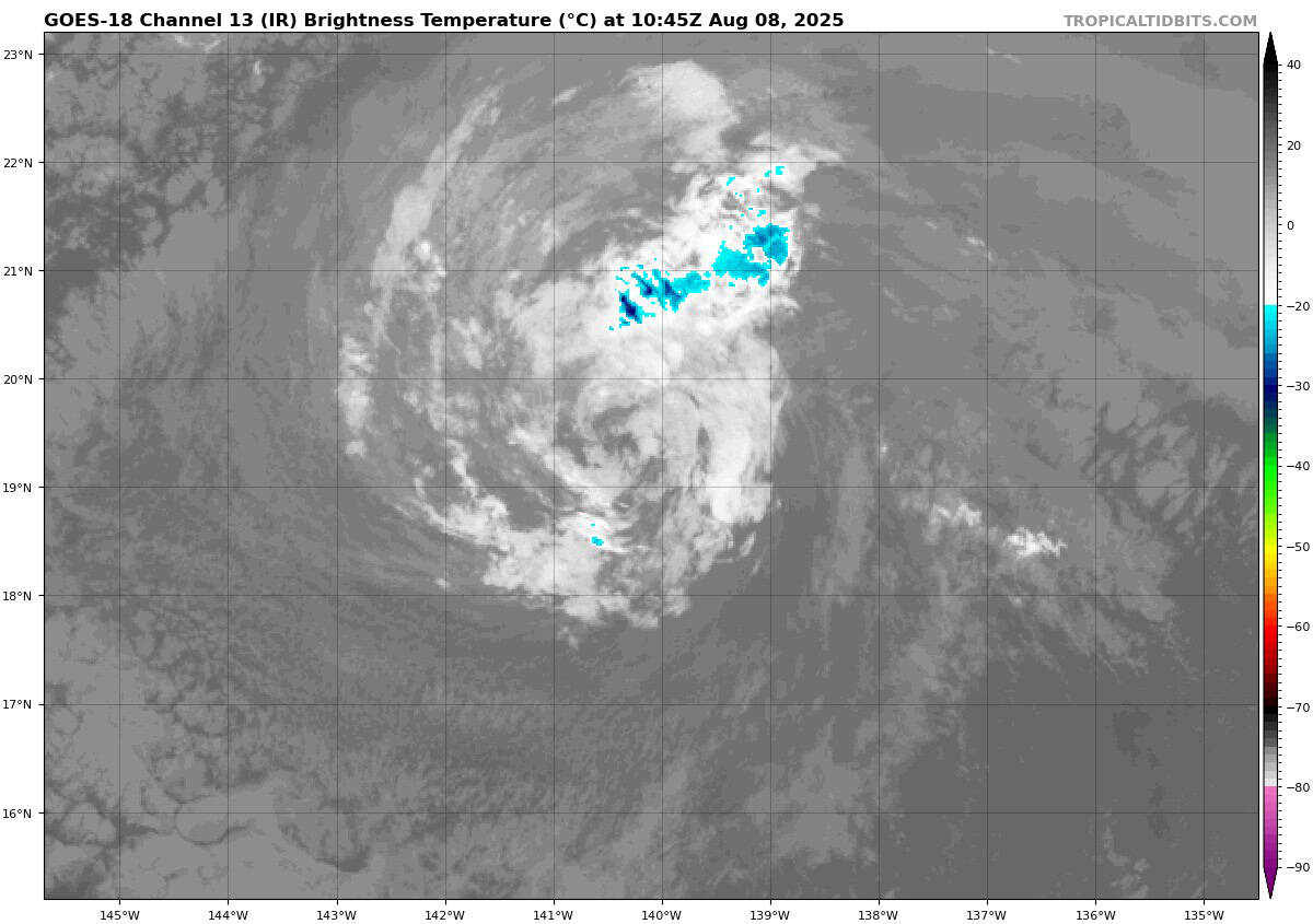
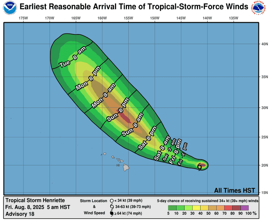
Post-Tropical Cyclone 08E (Henriette)…is located approximately 680 NM east of Hilo, Hawaii
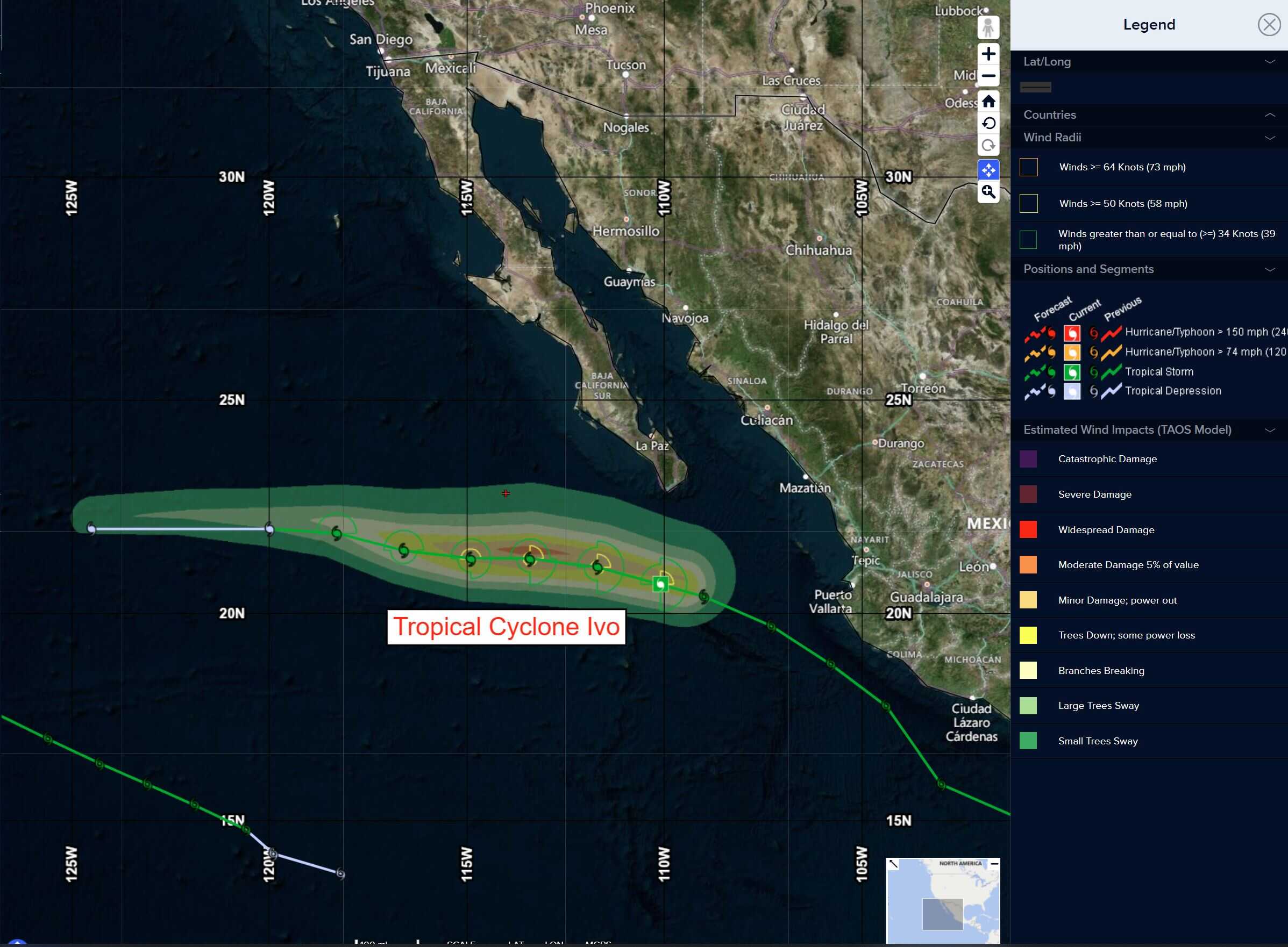
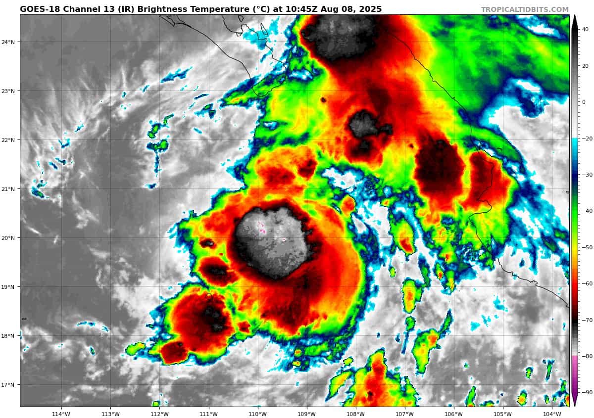
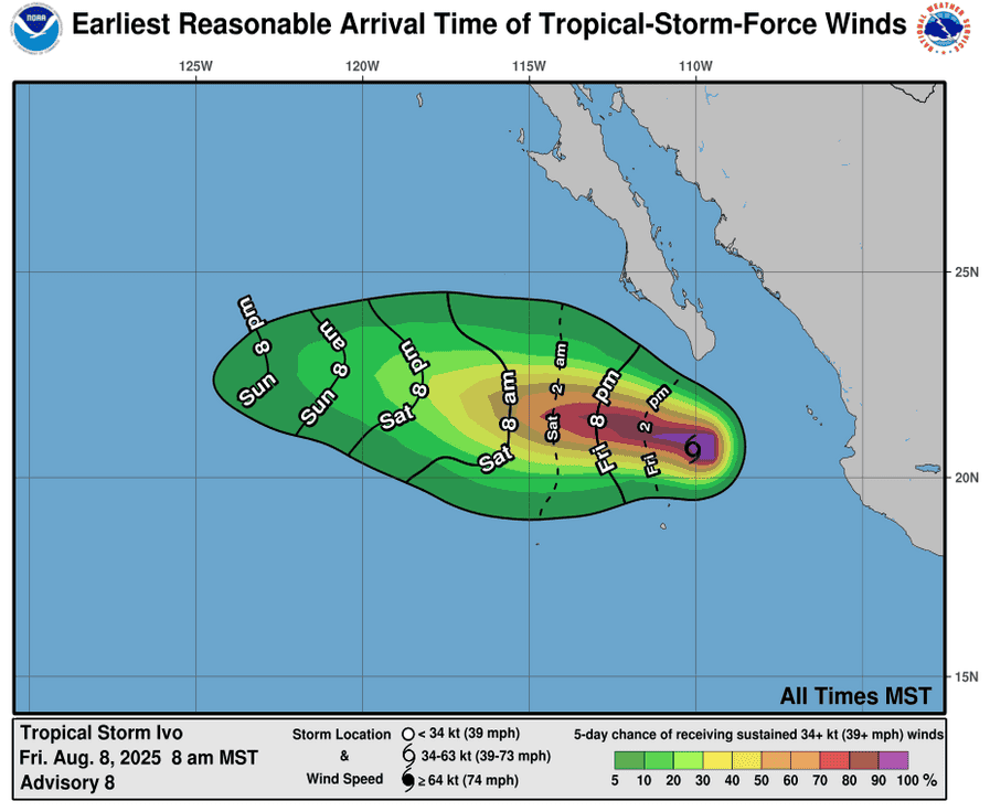
Tropical Cyclone 09E (Ivo)…is located approximately 220 NM southwest of the southern tip of Baja CA
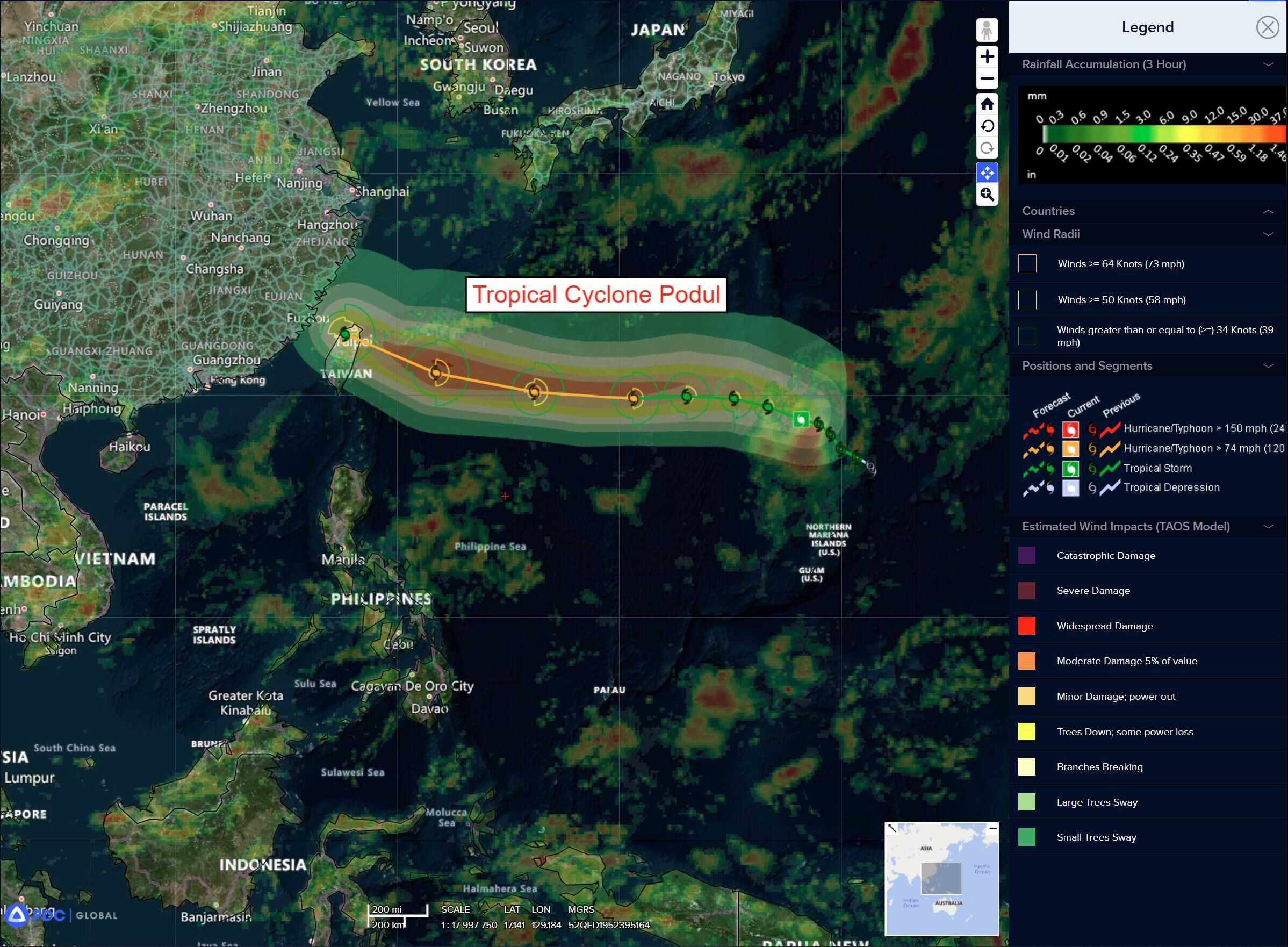
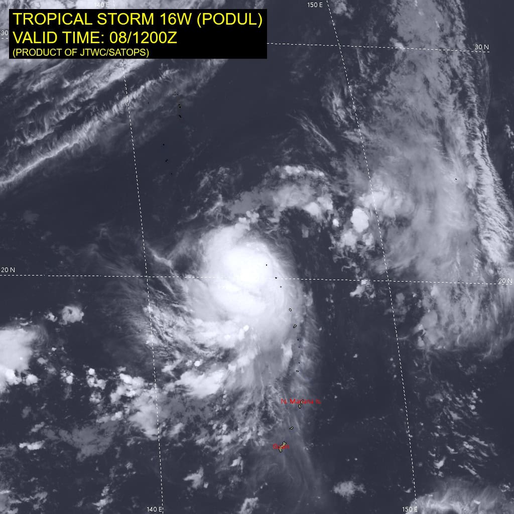
Tropical Cyclone 16W (Podul)…is located approximately 880 NM east-southeast of Kadena AB
Northeast Pacific Ocean:
Tropical Cyclone 09E (Ivo)
IVO MOVING WESTWARD WELL OFFSHORE OF BAJA CALIFORNIA
According to the NHC advisory number 10
Ivo is moving toward the west near 12 mph (19 km/h). A westward to west-northwestward motion is expected during the next few days. Maximum sustained winds remain near 65 mph (100 km/h) with higher gusts. Little change in strength is expected through early Saturday, followed by a gradual weakening trend. Ivo is forecast to become post-tropical by Sunday night. Tropical-storm-force winds extend outward up to 35 miles (55 km) from the center.
HAZARDS AFFECTING LAND
SURF: Swells generated by Ivo will continue to affect the southern portion of the Baja California peninsula during the next day or so. These swells are likely to cause life-threatening surf and rip current conditions.
Central Pacific Ocean:
Post-Tropical Cyclone 08E (Henriette)
HENRIETTE FORECAST TO REGAIN TROPICAL STORM STRENGTH THIS WEEKEND
According to the NHC advisory number 20
HENRIETTE DEGENERATES TO A REMNANT LOW…EXPECTED TO RESTRENGTHEN TO A TROPICAL STORM OVER THE WEEKEND
The post-tropical cyclone is moving toward the west-northwest near 16 mph (26 km/h). This motion is expected to continue through tonight, followed by a gradual turn toward the northwest over the weekend, keeping the center of Henriette well north of the Hawaiian Islands. Maximum sustained winds are near 35 mph (55 km/h) with higher gusts. Little change in strength is expected tonight, with strengthening forecast to begin over the weekend. Henriette is expected to regain tropical storm status by Sunday.
Western Pacific, Indian Ocean, and adjacent Seas:
Western Pacific
Tropical Cyclone 16W (Podul)
According to the JTWC warning number 9 sustained winds are 50 knots with gusts to near 65 knots
Tropical storm 16W appears to be undergoing another attempt at vortex consolidation and alignment, very similar to the attempt made 24 hours ago. Time will tell if this time it will actually succeed. Over the past six hours or so, animated enhanced infrared (eir) satellite imagery showed deep convection forming in the southeastern quadrant and then wrapping upshear where it eventually enveloped the low level circulation center (llcc).
Subsequent imagery shows powerful bursts of deep convective activity, with overshooting top temperatures very cold and impressive amounts of lightning activity, continuing to flare up in the vicinity of the assessed llcc. A 081037z ascat-b pass revealed the llcc tucked up under the northern edge of the convective mass in the eir. A 080832z rcm-3 sar pass showed a compact wind field, with the highest winds located along the eastern flank of the circulation, though there appears to be some ice contamination in the sar imagery and thus the windspeed measurements are too high.
Environmental conditions remain favorable, with low northeasterly deep-layer shear, warm ssts and good equatorward outflow. Cira derived motion vector (dmv) winds indicate increasing westward outflow and split flow upstream (northeast) of the llcc.
TS 16W made a fairly sharp westward turn over the past six hours, now heading west-northwest, along the southwestern side of the deep str. Over the next 24 to 36 hours, TS 16W will gradually come to a westward heading as the ridge builds westward to the north. TS 16W will come to an inflection point in the forecast after 48 hours, with significant uncertainty in the track trajectory after this point continuing to manifest itself in the model data, fully dependent upon the strength of the system at that time.
If the system actually succeeds in its current attempt at vortex alignment and symmetrization, it will obtain a higher intensity prior to the inflection point and travel on a flatter trajectory towards the west roughly between 20n-22n. On the other hand, if TS 16W fails in this second attempt to symmetrize, then it will remain significantly weaker through up to 48 hours, and travel on a more northwestward track generally towards the Ryukyu Chain.
The current forecast remains consistent with the previous one and assumes the system is ultimately successful in intensifying to typhoon strength by 48 hours, however this will likely occur in fits and starts, hence the slow pace of intensification. At 48 hours the system moves under a strong band of northeasterly flow, near jet strength in some models. A stronger system, or one positioned a bit further south, will be able to fend off the enhanced shear associated with these higher northeasterly winds, while a weaker storm will not.
The JTWC forecast calls for a steady intensity through 72 hours, though the system may very well weaken during this period. After 72 hours, the shear begins to decrease along the flatter track of the JTWC forecast, allowing for re-intensification. On this path, the actual peak intensity will
likely occur prior to landfall in Taiwan and is not directly captured in the forecast.
After landfall, the system rapidly weakens due to interactions with the rugged terrain. For a weaker system on a more northwestward path, the increased shear and dry air will result in a faster pace of weakening through the forecast period.