Western Pacific, Indian Ocean, and adjacent Seas:

")


By PDC’s Senior Weather
Specialist Glenn James

The Pacific Disaster Center’s (PDC Global) Sunday, August 10, 2025, Tropical Cyclone Activity Report…for the Pacific Ocean, the Indian Ocean, and adjacent Seas
Current Tropical Cyclones:
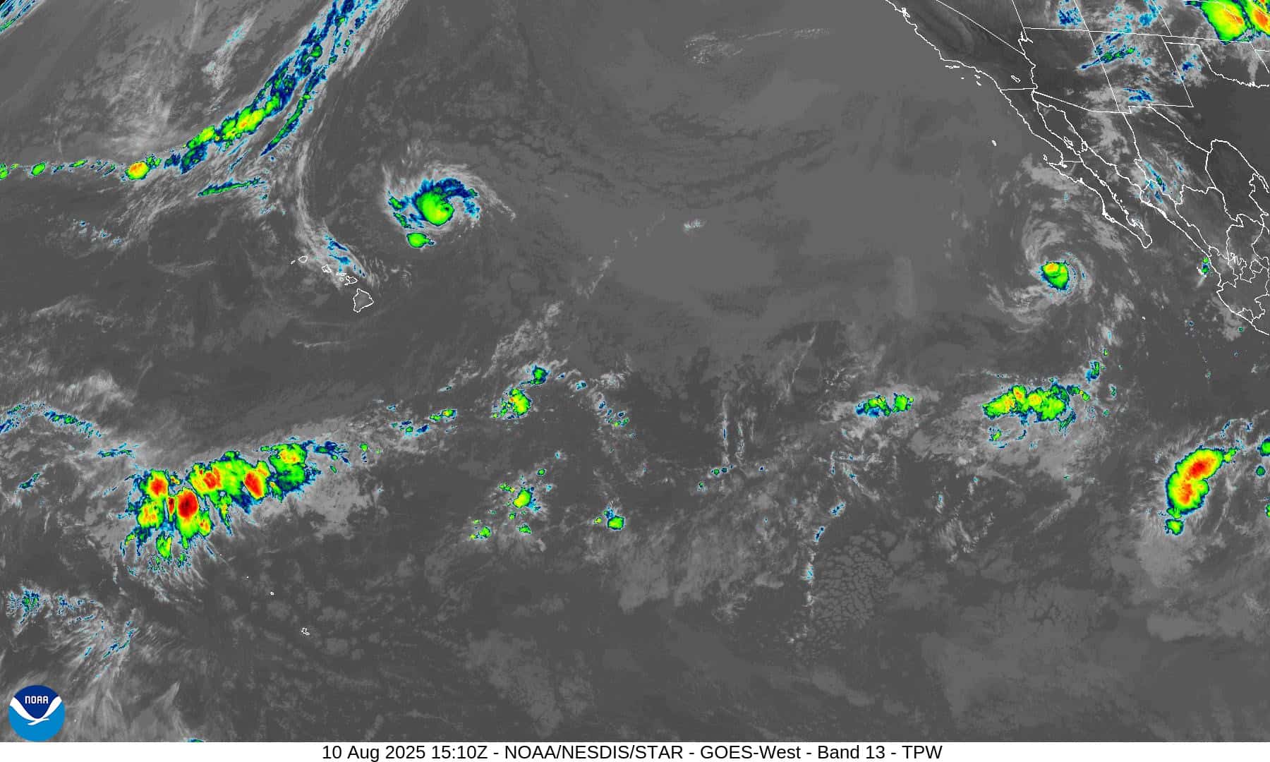
Tropical Cyclone 08E (Henriette)…is located approximately 495 NM north of Hilo, Hawaii
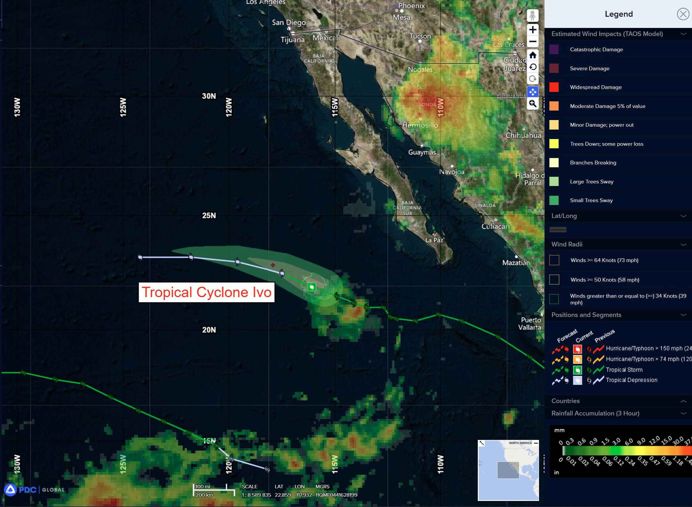
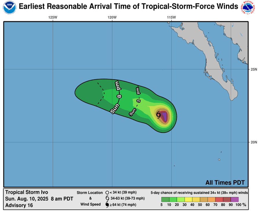
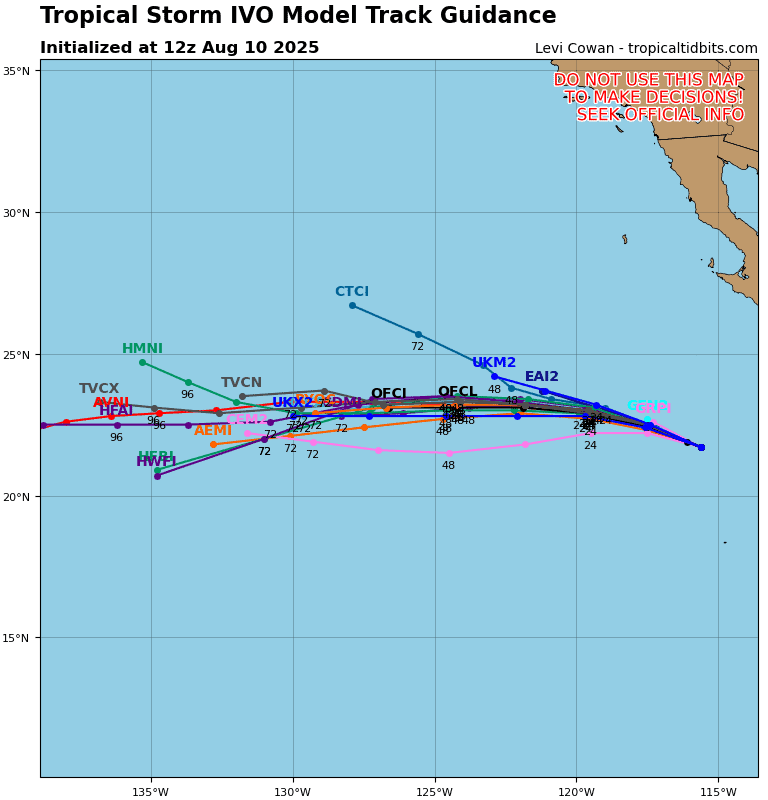
Tropical Cyclone 09E (Ivo)…is located approximately 510 NM west of the southern tip of Baja CA
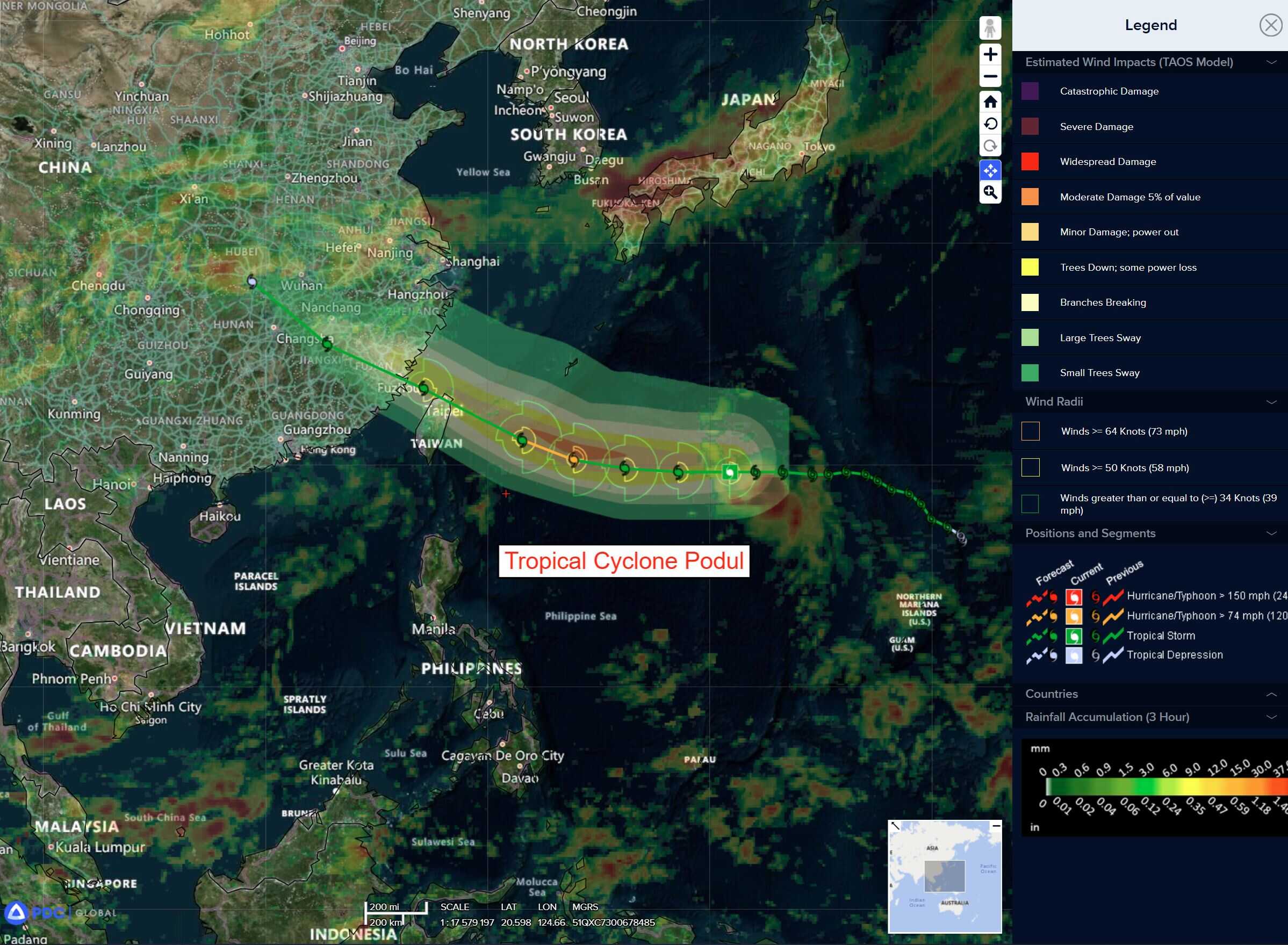
Tropical Cyclone 16W (Podul)…is located approximately 442 NM southeast of Kadena AB
Northeast Pacific Ocean:
Tropical Cyclone 09E (Ivo)
IVO WEAKENS TO A TROPICAL DEPRESSION…FORECAST TO BECOME A REMNANT LOW ON MONDAY
According to the NHC advisory number 18
The depression is moving toward the west-northwest near 10 mph (17 km/h). A west-northwestward and then westward motion at a similar forward speed is expected during the next day or two. Maximum sustained winds have decreased to near 35 mph (55 km/h) with higher gusts. Continued weakening is forecast, and Ivo is expected to become a remnant low early Monday. The remnant low is forecast to dissipate on Tuesday.
Central Pacific Ocean:
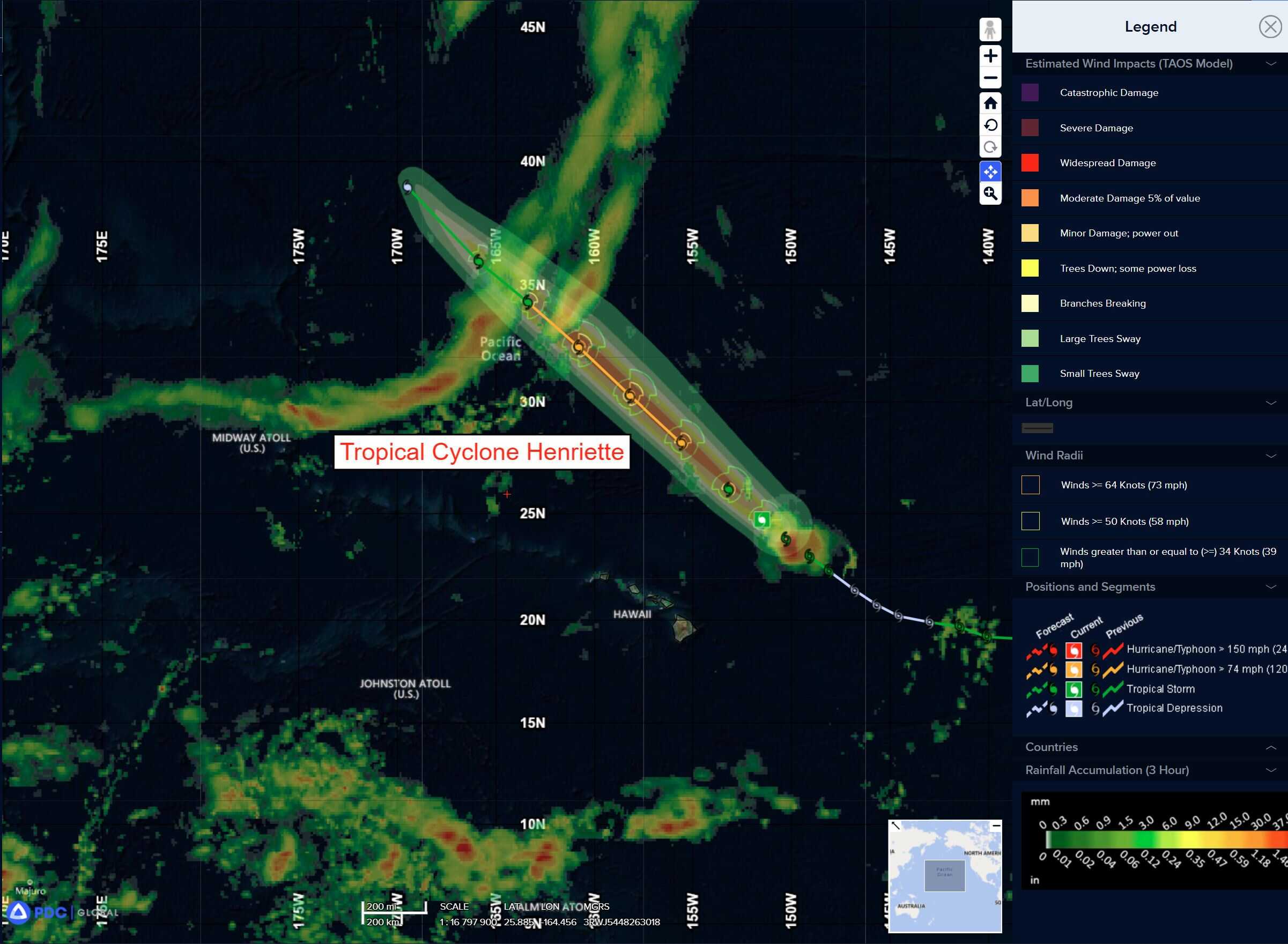
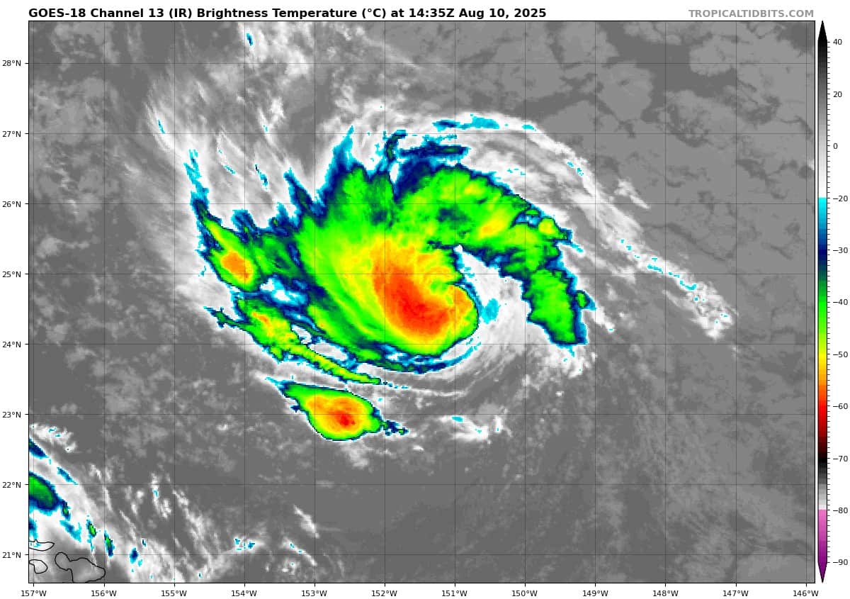
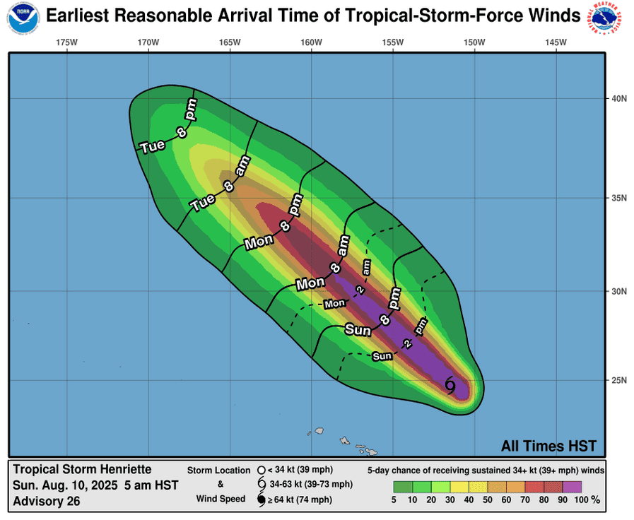
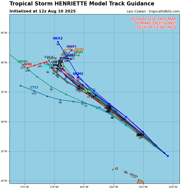
Tropical Cyclone 08E (Henriette)
HENRIETTE HOLDING STEADY AS IT MOVES NORTHWESTWARD
According to the NHC advisory number 28
Henriette is moving toward the northwest near 16 mph (26 km/h) and this motion is expected to continue during the next few days, taking Henriette far north of the Hawaiian Islands. Maximum sustained winds are near 80 mph (130 km/h) with higher gusts. Strengthening is possible over the next day or so, followed by weakening by Tuesday. Hurricane-force winds extend outward up to 15 miles (30 km) from the center and tropical-storm-force winds extend outward up to 70 miles (110 km).
Western Pacific, Indian Ocean, and adjacent Seas:
Western Pacific
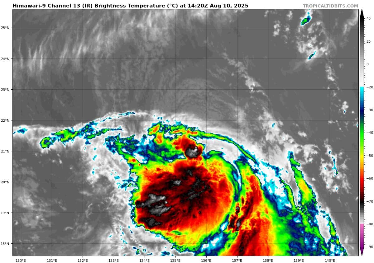
Tropical Cyclone 16W (Podul)
According to the JTWC warning number 17 sustained winds are 55 knots with gusts to near 70 knots
Animated multi-spectral satellite imagery (msi) depicts exposed low-level cloud bands along the northern periphery of tropical storm 16W. animated enhanced infrared imagery (eir) reveals warming cloud tops and collapsing deep convection indicating a weakening period. There is a distinct vertical tilt southwestward with height due to strong northeasterly vertical wind shear and associated dry air. outflow on water vapor imagery is moderate and equatorward while deep convection clearly flares upstream against
the northeasterly upper-level flow.
The initial position is placed with high confidence based on a 100604z dmsp f-18 ssmis microwave image highlighting the shallow banding along the northern periphery. The 91ghz image from the same satellite pass accentuates the southward vertical tilt and shallow structure.
TS 16W will track westward over the next 48 hours under the steering influence of an extension of a subtropical ridge to the north. After 72 hours, the elongated ridge will center and build over the East China Sea. During this time, the system will assume a northwesterly track while rounding the southwestern quadrant of the ridge.
High vertical wind shear will persist throughout the forecast period resulting in a gradual rate of intensification in the early-term intensity forecast. The high shear will be countered by favorable upper-level diffluence and warm sea surface temperatures, contributing to a peak of 65 knots at 48 hours when upper-level diffluence becomes slightly more favorable.
As the system curves northwestward between 48-72 hours, TS 16W will be inundated by enhanced upper-level northeasterly flow injecting dry air into the core of the circulation and eroding the vertical structure with high vertical wind shear. Weakening will continue as the system passes into shallower and cooler water just prior to landfall between 72-96 hours. Topographic interaction on mainland of China will dissipate the system fully by the end of the forecast period.