Western Pacific, Indian Ocean, and adjacent Seas:

")


By PDC’s Senior Weather
Specialist Glenn James

The Pacific Disaster Center’s (PDC Global) Sunday, August 10, 2025, Tropical Cyclone Activity Report…for the Pacific Ocean, the Indian Ocean, and adjacent Seas
Current Tropical Cyclones:
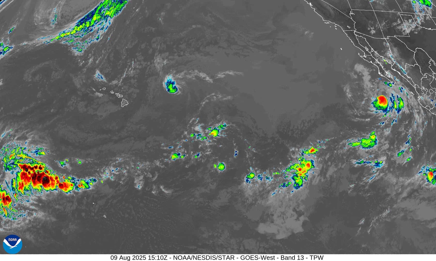
Tropical Cyclone 08E (Henriette)…is located approximately 445 NM north-northeast of Hilo, Hawaii
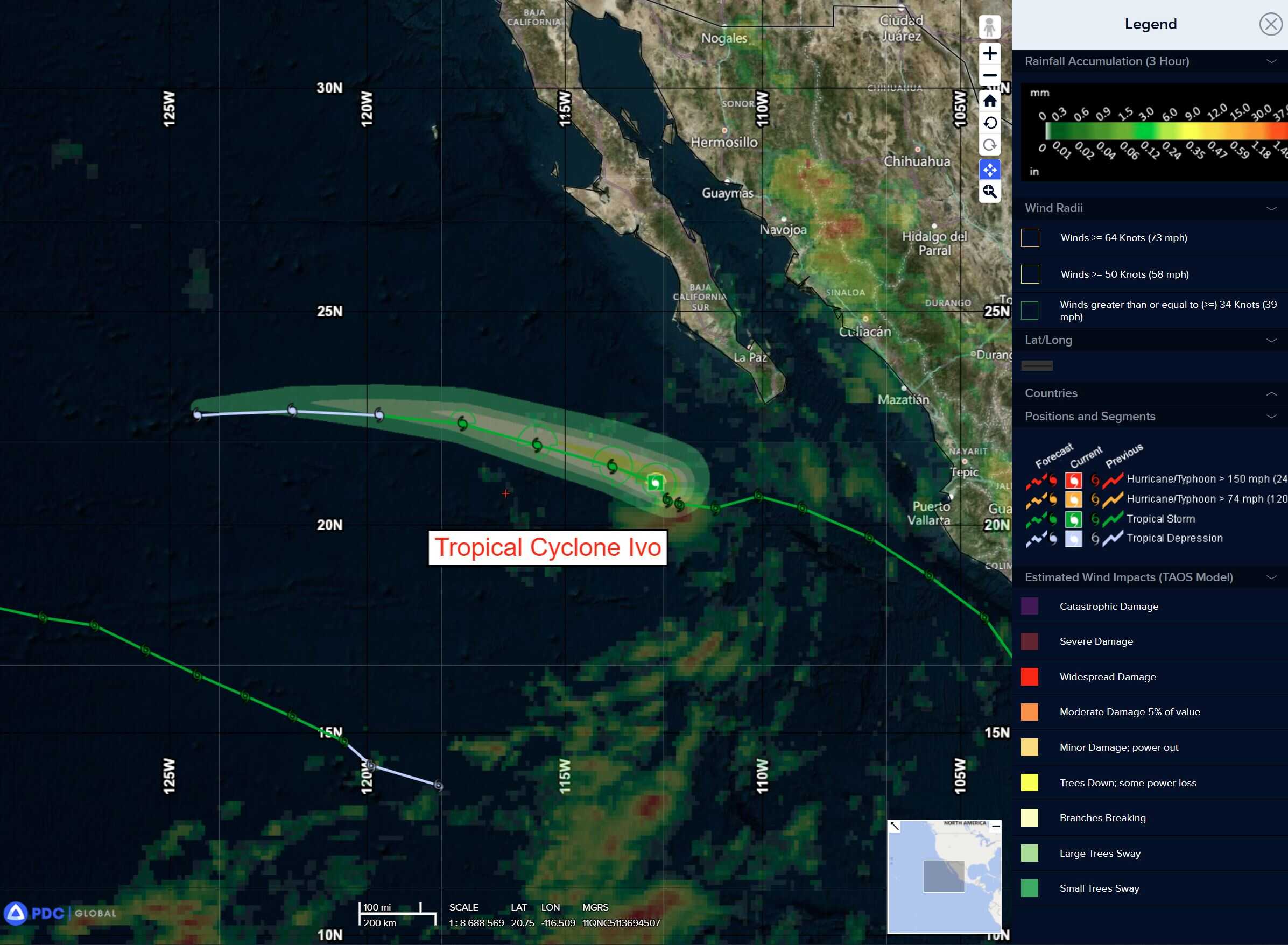
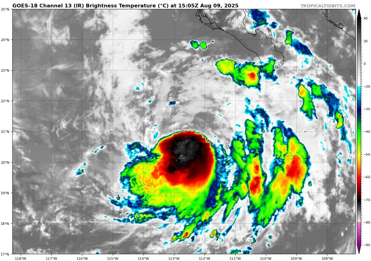
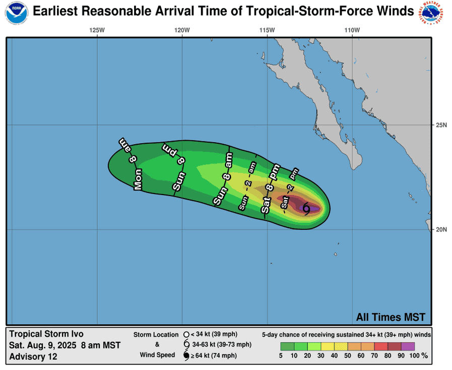
Tropical Cyclone 09E (Ivo)…is located approximately 470 NM west of the southern tip of Baja CA
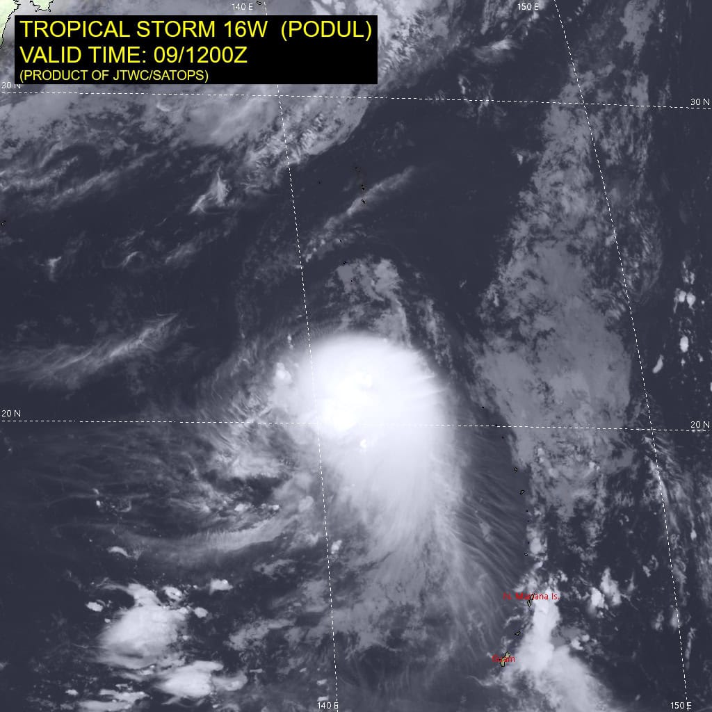
Tropical Cyclone 16W (Podul)…is located approximately 442 NM southeast of Kadena AB
Northeast Pacific Ocean:
Tropical Cyclone 09E (Ivo)
IVO RESILIENTLY MAINTAINING SHOWERS AND THUNDERSTORMS OVER COOL WATER…STILL EXPECTED TO BECOME A REMNANT LOW ON MONDAY
According to the NHC advisory number 17
Ivo is moving toward the west-northwest near 12 mph (19 km/h). A west-northwestward and then westward motion at a similar forward speed is expected during the next couple of days. Maximum sustained winds are near 40 mph (65 km/h) with higher gusts. Weakening is forecast, and Ivo is expected to become a remnant low on Monday. The remnant low is forecast to dissipate on Tuesday. Tropical-storm-force winds extend outward up to 35 miles (55 km) from the center.
Central Pacific Ocean:
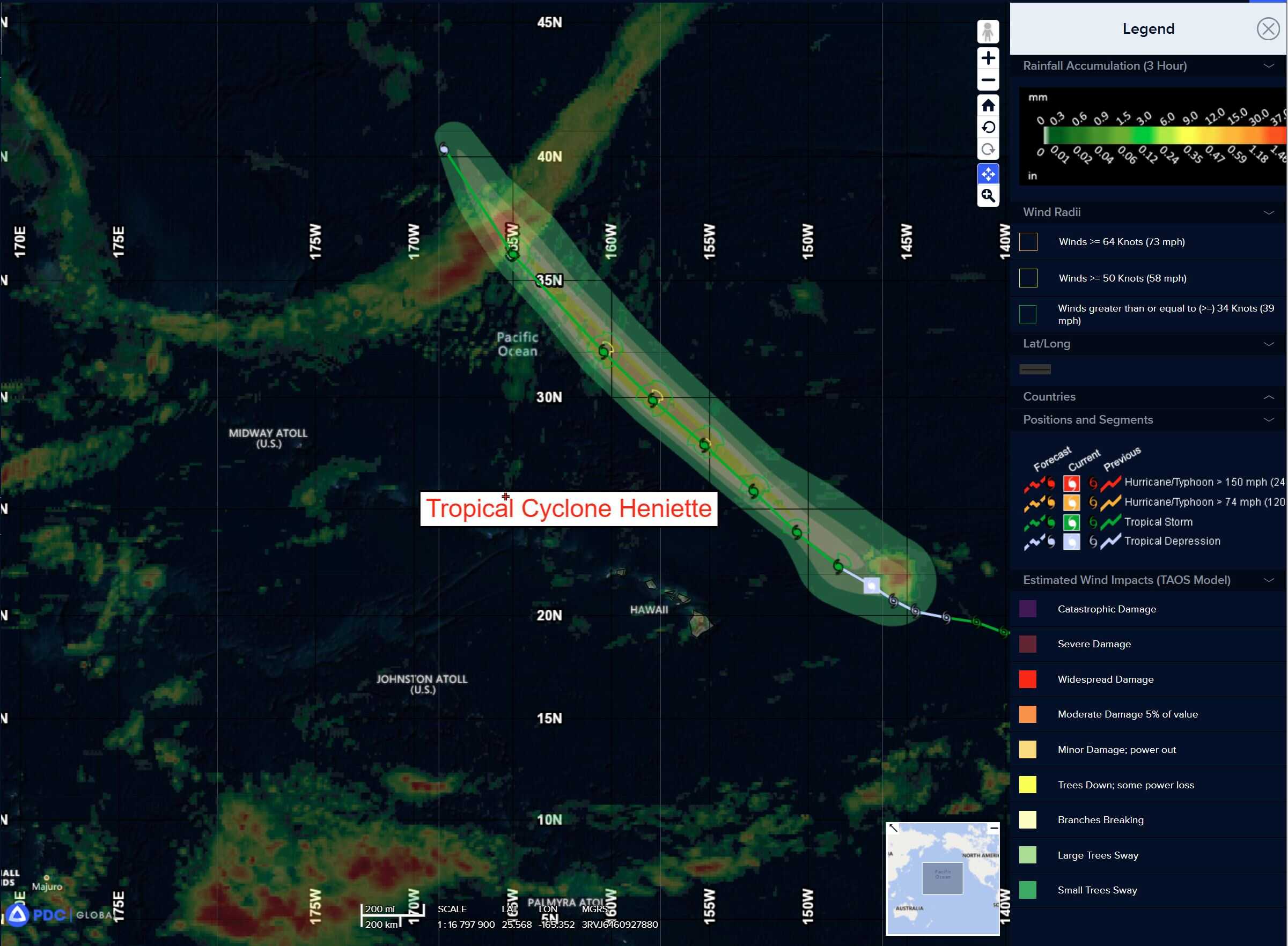
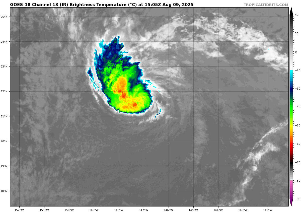
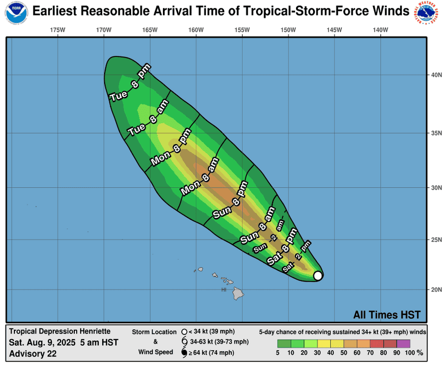
Tropical Cyclone 08E (Henriette)
HENRIETTE HOLDING STEADY AS A TROPICAL STORM
According to the NHC advisory number 23
Henriette is moving toward the northwest near 14 mph (22 km/h). This northwestward motion will continue into early next week, with Henriette passing well northeast of the Hawaiian Islands. Maximum sustained winds are near 40 mph (65 km/h) with higher gusts. Some strengthening is forecast during the next couple of days. Tropical-storm-force winds extend outward up to 70 miles (110 km) from the center.
Western Pacific, Indian Ocean, and adjacent Seas:
Western Pacific
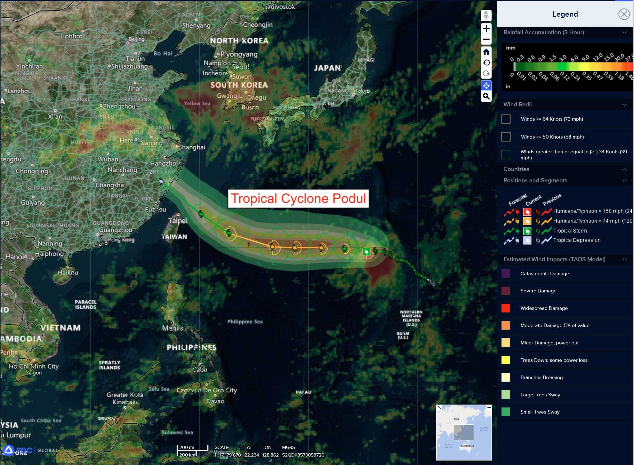
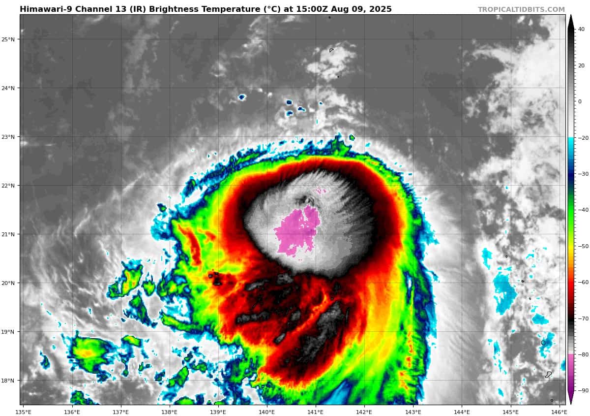
Tropical Cyclone 16W (Podul)
According to the JTWC warning number 17 sustained winds are 55 knots with gusts to near 70 knots
Animated enhanced infrared (eir) satellite imagery depicts deep convection obscuring the low-level circulation center (llcc) of tropical storm 16W. Water vapor imagery reveals dry air to the north and west of the deep convection. The initial intensity of 50 knots is assessed with medium confidence based on the partial scatterometry and an earlier 090841z rcm-3 synthetic aperture radar (sar) image revealing the strongest winds in the eastern periphery of the llcc. There is slight uncertainty in the peak intensities of the sar image, with some potentially extraneously high intensities due to ice contamination.
Tropical storm 16W will initially move westward for 48 hours, steered by a ridge to the north, before curving northwestward after 72 hours. The storm is forecast to intensify to a peak of 70 knots after 36 hours, benefiting from favorable conditions like warm sea surface temperatures and moderate easterly upper-level divergence.
However, the strength of 16W will be challenged by two key factors. Initially, marginal vertical wind shear (20-25 knots) will limit the rate of
development. Then, after 36 hours, vertical wind shear will become highly unfavorable (30-35 knots) as the system encounters enhanced
easterly flow of a building upper-level ridge. This increased shear, along with mid-level dry air, will cause the storm to gradually weaken to 30 knots by the end of the forecast, just after making landfall in mainland China.