Tropical cyclone formation is not expected during the next 7 days.
Western Pacific, Indian Ocean, and adjacent Seas:

")

By PDC’s Senior Weather
Specialist Glenn James

The Pacific Disaster Center’s (PDC Global) Thursday, August 7, 2025, Tropical Cyclone Activity Report…for the Pacific Ocean, the Indian Ocean, and adjacent Seas
Current Tropical Cyclones:
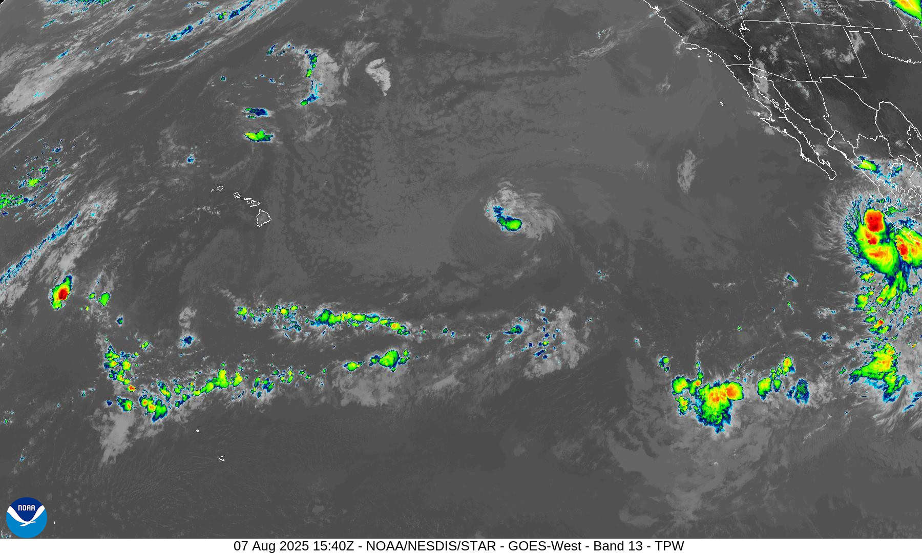
Tropical Cyclone 08E (Henriette)…is located approximately 1090 NM east of Hilo, Hawaii
Tropical Cyclone 09E (Ivo)…is located approximately 275 NM southeast of the southern tip of Baja CA
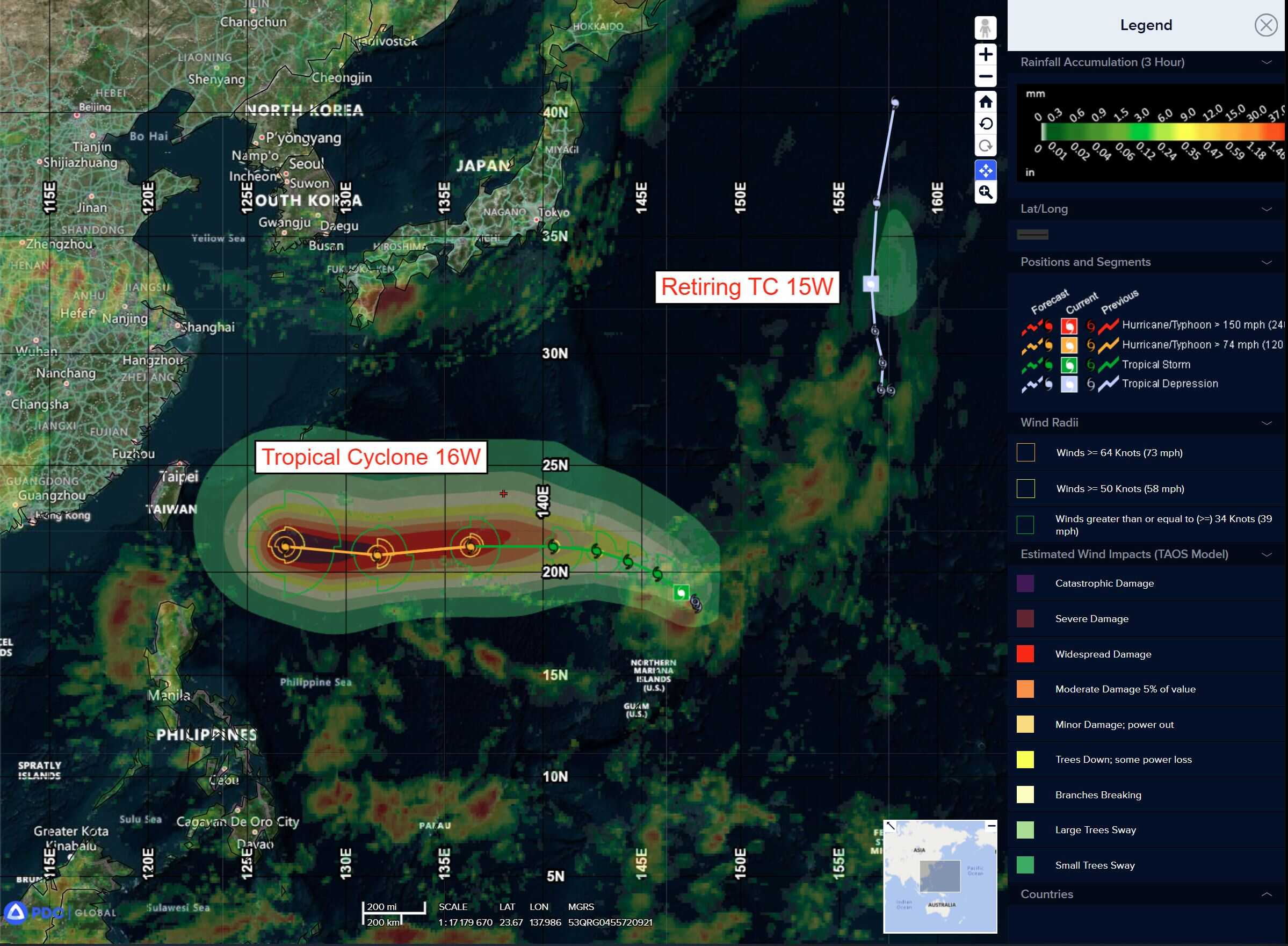
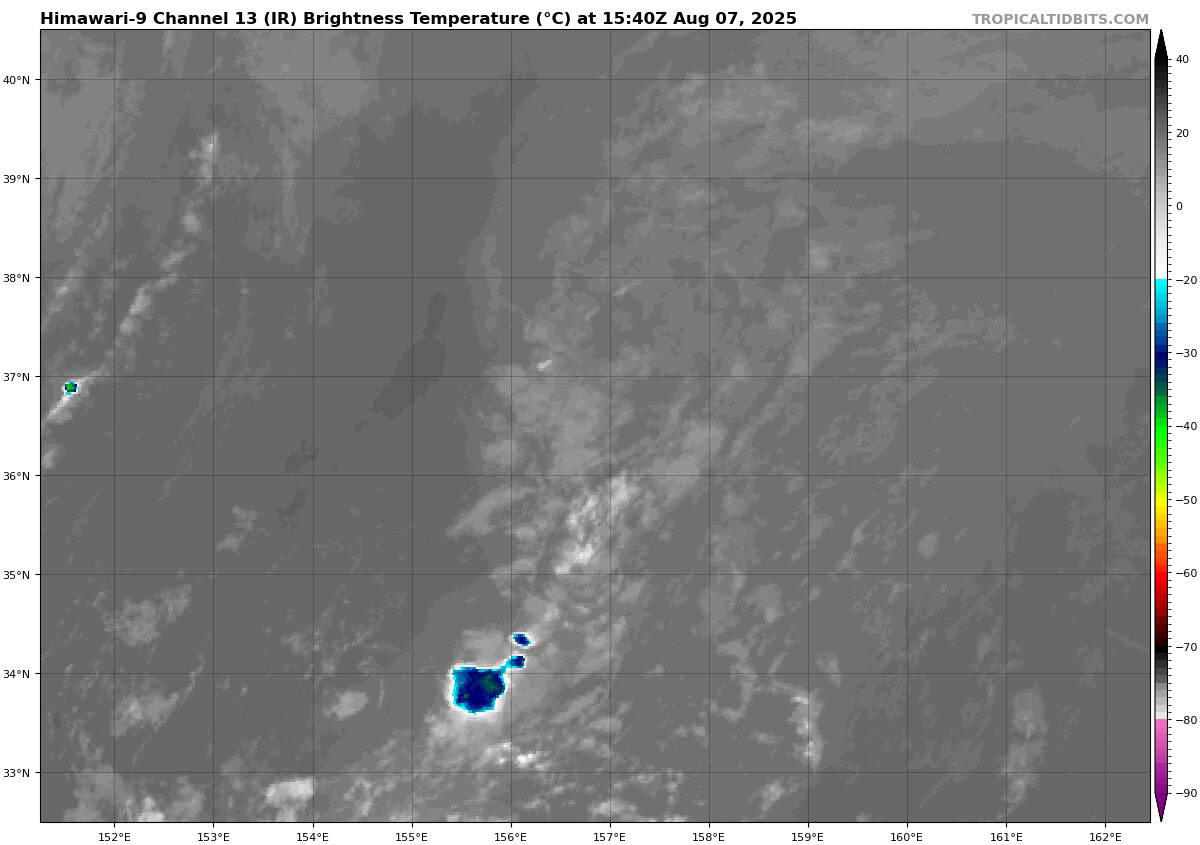
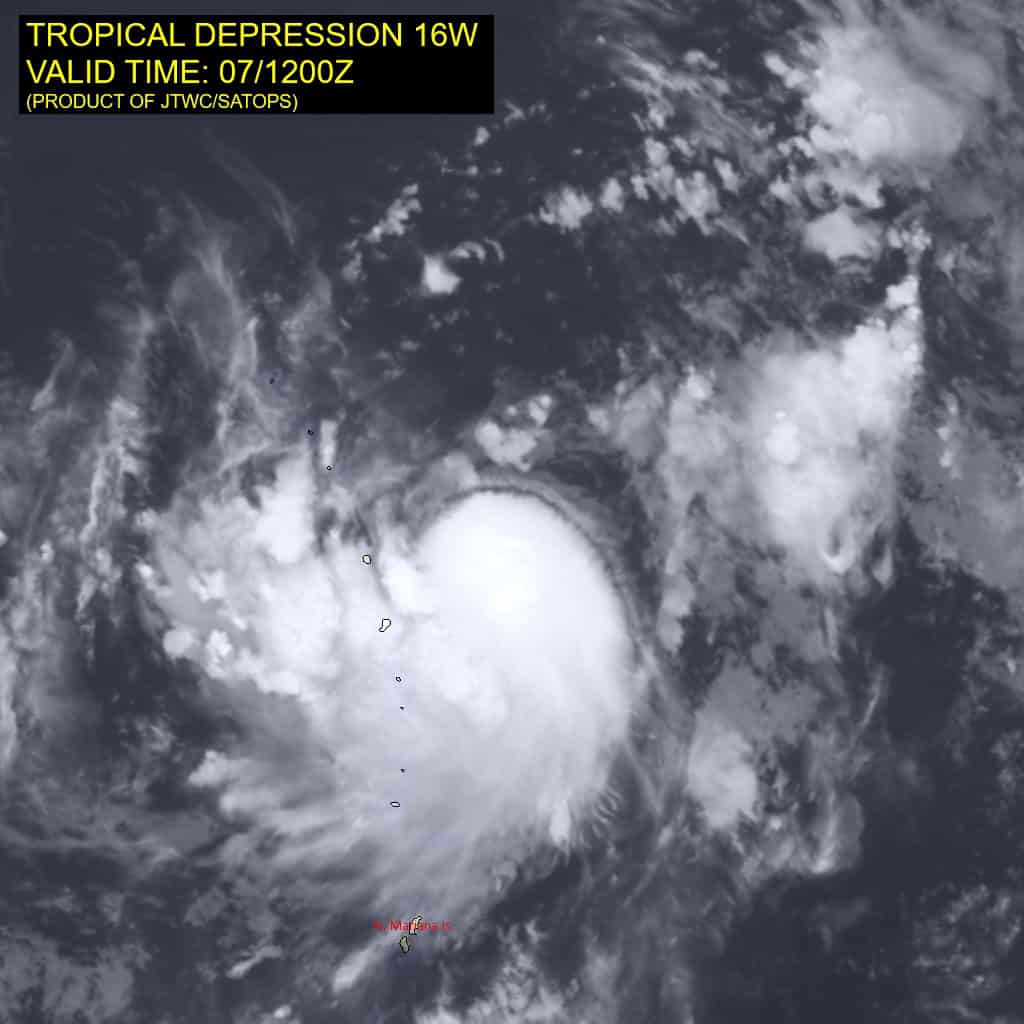
Tropical Cyclone 16W (Podul)…is located approximately 294 NM north of Saipan
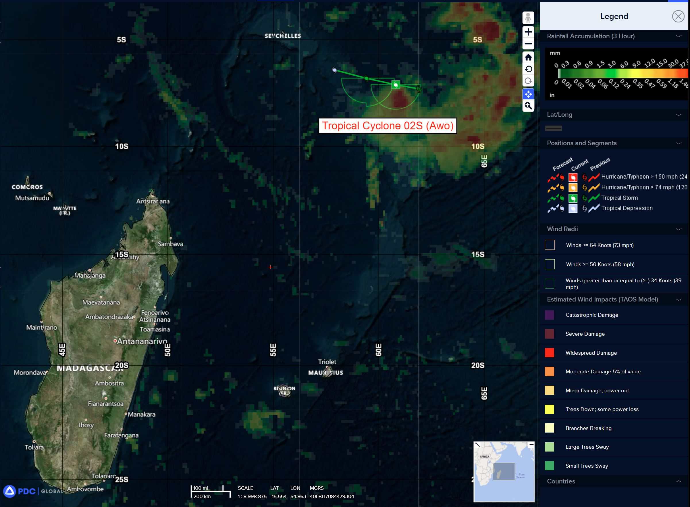
Tropical Cyclone 02S (Awo)…is located approximately 770 NM west of Diego Garcia
Northeast Pacific Ocean:
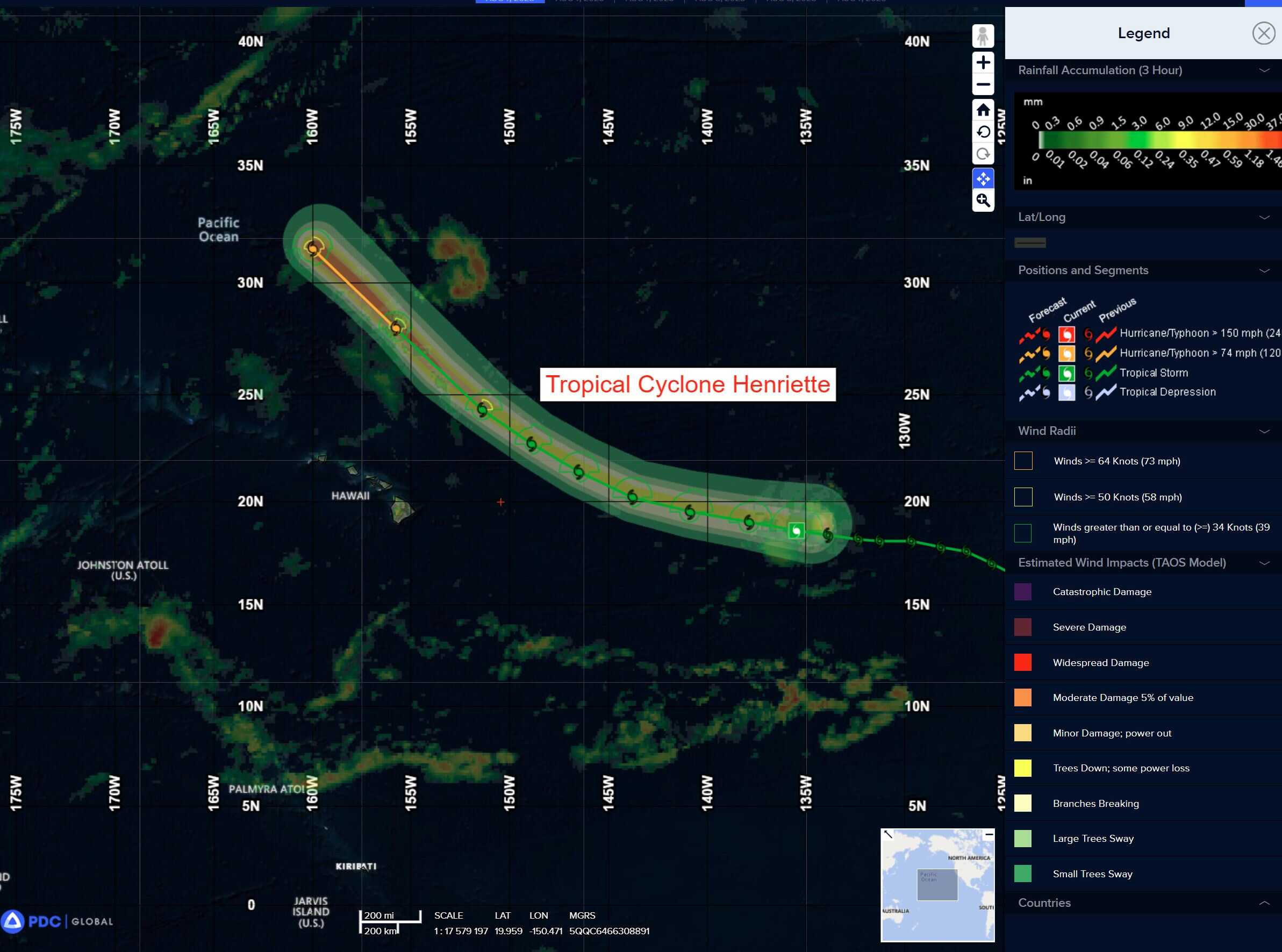
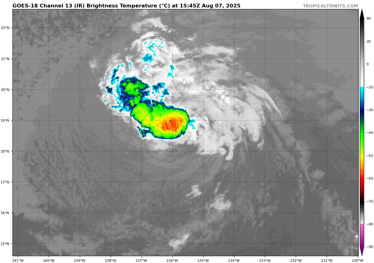
Tropical Cyclone 08E (Henriette)
HENRIETTE WEAKENS SLIGHTLY FAR TO THE EAST OF HAWAII
According to the NHC advisory number 16
Henriette is moving toward the west near 16 mph (26 km/h). A gradual turn toward the west-northwest is expected tonight and Friday, followed by a turn toward the northwest over the weekend, keeping the center of Henriette well to the north of the Hawaiian Islands. Maximum sustained winds are near 40 mph (65 km/h) with higher gusts. Little change in strength is forecast during the next 48 hours. Tropical-storm-force winds extend outward up to 60 miles (95 km) from the center.
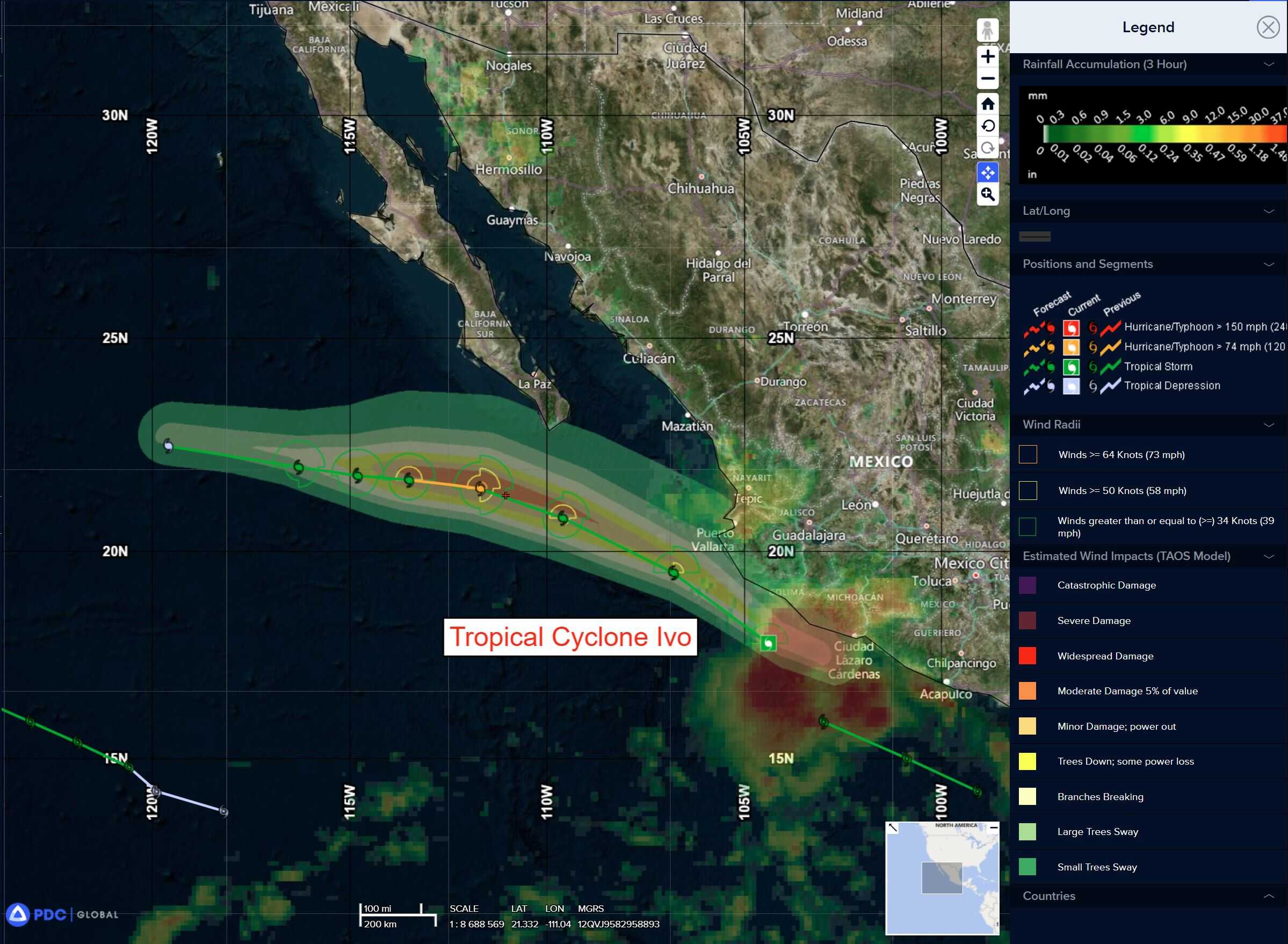
Tropical Cyclone 09E (Ivo)
IVO FORECAST TO STRENGTHEN AS IT PULLS AWAY FROM MEXICO
According to the NHC advisory number 6
Ivo is moving toward the northwest near 22 mph (35 km/h). A decrease in forward speed and a turn to the west-northwest are expected during the next few days. On the forecast track, Ivo is expected to pull away from mainland Mexico and pass well south of the Baja California peninsula. Maximum sustained winds remain near 60 mph (95 km/h) with higher gusts. Strengthening is forecast for the next day or so, and Ivo could become a hurricane on Friday. Weakening should begin over the weekend. Tropical-storm-force winds extend outward up to 45 miles (75 km) from the center.
HAZARDS AFFECTING LAND
RAINFALL: Tropical Storm Ivo is expected to produce storm total rainfall of 2 to 4 inches, with isolated maximum totals of 6 inches, across portions of the Mexican states of Guerrero, Michoacan de Ocampo and Colima through Friday. This would result in an elevated risk for flash flooding.
SURF: Swells generated by Ivo will be affecting the southwestern coast of Mexico during the next couple of days. These swells are likely to cause life-threatening surf and rip current conditions.
Central Pacific Ocean: There are no Tropical Cyclones
Tropical cyclone formation is not expected during the next 7 days.
Western Pacific, Indian Ocean, and adjacent Seas:
Western Pacific
Tropical Cyclone 16W (Podul)
According to the JTWC warning number 5 sustained winds are 45 knots with gusts to near 55 knots
Tropical storm 16W has rapidly consolidated and qualitatively improved in overall structural appearance over the past six hours. Animated enhanced infrared (eir) satellite imagery depicts an irregular central dense overcast (cdo) feature, with upper-level cirrus forming transverse bands along the eastern side of the cdo, indicative of strong upper-level outflow in these regions. Animated water vapor imagery and cira derived motion vector (dmv) products continue to indicate a weak tutt-cell positioned approximately 450 NM northwest of TS 16W and a second tutt-cell positioned approximately 950 NM to the east.
Upper-level winds are northeasterly across the region surrounding TS 16W, but the flow splits near the system, with a portion heading poleward into the east side of the tutt-cell, and the other portion heading equatorward. Additionally. a fortuitous 071150z ascat-c bullseye revealed the low level circulation center (llcc) has moved further under the cdo than originally thought and provided high confidence to the initial position. The same ascat pass revealed 35 knot winds in the southeastern quadrant of the rotation, confirming the pgtw t2.5 intensity estimate as well as the bulk of the objective intensity estimates.
Environmental conditions remain favorable, with low northeasterly vws, very warm ssts and moderate equatorward and poleward outflow.
TS 16W is forecast to continue tracking northwestward along the southwestern flank of the strong str over the next 24 hours. The system will gradually turn onto a westward track between 36 and 48 hours as the ridge builds westward and ultimately merges with a small str centered near Okinawa, creating a massive, deep, southwest-northeast oriented str that extends from coastal China to the dateline.
TS 16W will travel westward along the southern flank of this ridge through 72 hours, before dipping slightly southwestward around 96 hours as the ridge moves to a position southeast of Honshu. After 96 hours, TS 16W will begin tracking more west-northwestward due to slight changes in the orientation of the ridge as it continues to move towards the west.
TS 16w has already intensified more than originally expected by this time in the forecast. Unfortunately, the lack of recent microwave imagery precludes a concrete analysis of the low-level structure, which is obscured under the cdo. The ascat pass would suggest the low-level vortex has become better aligned. However, assuming this is true, the system should be able to steadily intensify over the next 24-48 hours. A faster rate of intensification is forecast after 48 hours as the system moves over a pool of relatively high ohc waters.
While deep-layer shear is expected to increase slightly beginning as early as 48 hours, the system at that point should be strong enough to resist, at least for about 24 hours. Beginning around 72 hours, shear is expected to increase sharply (up to about 25-30 knots), and be accompanied by dry air intrusion. The combination of factors will put a lid on intensification for about 24 hours, and may induce some weakening. After 96 hours, the system once again moves into
a lower shear environment and will resume its intensification trend through the end of the forecast period.
South Indian Ocean
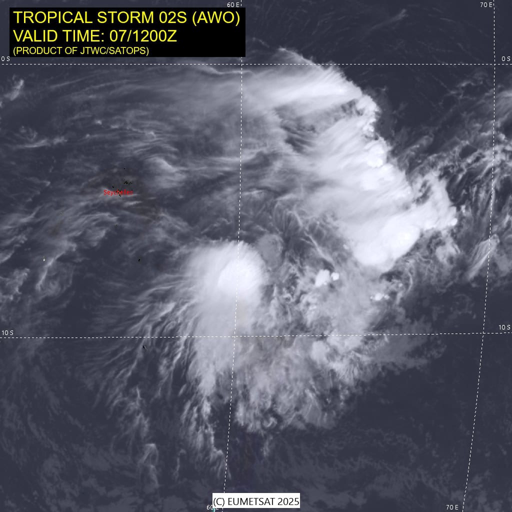
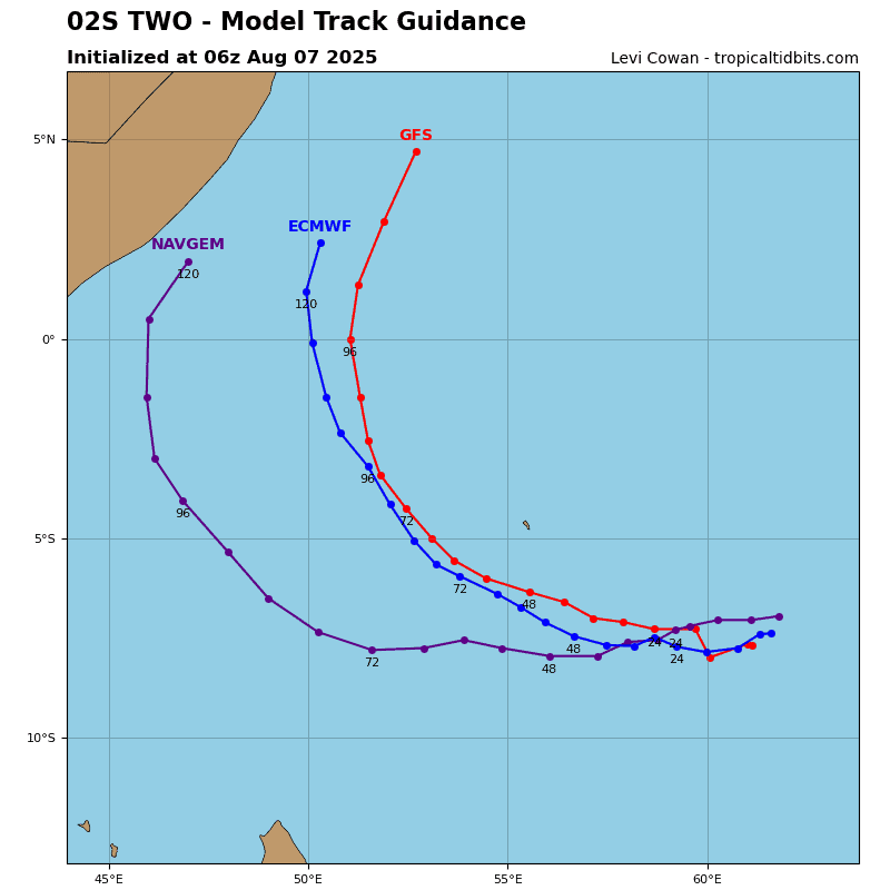
Tropical Cyclone 02S (Awo)
According to the JTWC warning number 3 sustained winds are 35 knots with gusts to near 45 knots
Animated enhanced infrared (eir) satellite imagery depicts a ragged and ill-defined circulation, with weak convection displaced to the southwest of a partially exposed low level circulation center (llcc). A 071143z ssmis 91ghz microwave image revealed shallow banding features laid out across the northern hemisphere of the rotation, with a small but well-defined llcc on the northeastern tip of a band of north-south oriented deep convection.
Environmental conditions are highly unfavorable, with moderate to high easterly shear, relatively cool ssts and a massive region of very dry air lurking just west of the llcc, which is already starting to wrap into the system from the northwest.
During the very short duration of the forecast, TS Awo is forecast to track west-northwestward along the northern side of the str situated far to the south. The system had a very short window of opportunity to develop, which is now rapidly closing. Shear is already estimated by cimss to be running in from the east at 25 knots. This is born out by the cimss amv data showing strong easterly flow extending far upstream of the system itself.
As mentioned above, a very large mass of very dry air lurks to the west and is already starting to infiltrate into the system, especially across the northern half of the rotation. The situation will deteriorate further over the next 12 hours, with the dry air expected to completely engulf and smother the inner core of TS Awo, marking its demise.
The system will rapidly weaken under this dry air and increasing shear, ultimately dissipating within the next 24 hours. The remnant circulation is likely to continue tracking towards the northwest and may track close to the Seychelles within the next 48 hours, but wind speeds will be minimal by that time.