
")
Current Snapshot
For all the latest updates visit: DisasterAWARE
1800x1080e
07s
07S_120600sair
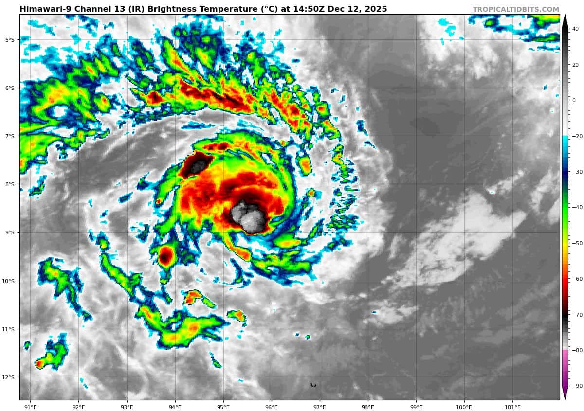
himawari9_ir_07S_202512121450_lat-8.4-lon96.7
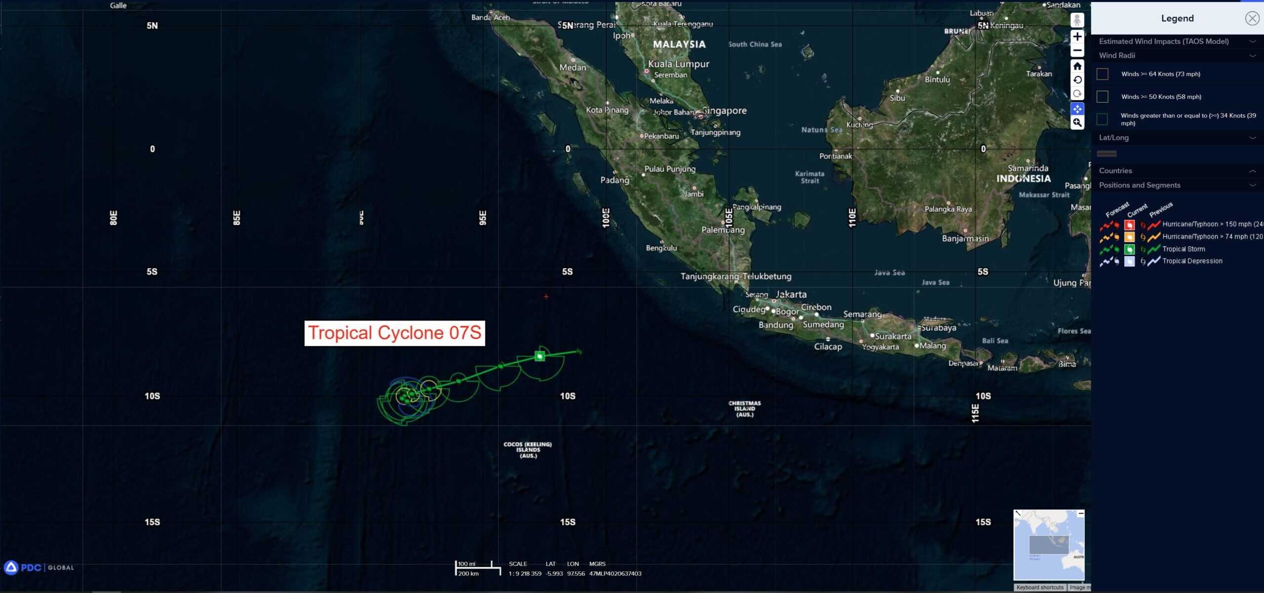
07S_tracks_latest
94p
himawari9_ir_94P_202512121450_lat-9.5-lon164.0
94P_tracks_latest
By PDC’s Senior Weather
Specialist Glenn James

The Pacific Disaster Center’s (PDC Global) Friday, December 12, 2025, Tropical Cyclone Activity Report…for the Pacific Ocean, the Indian Ocean, and adjacent Seas
Current Tropical Cyclones:
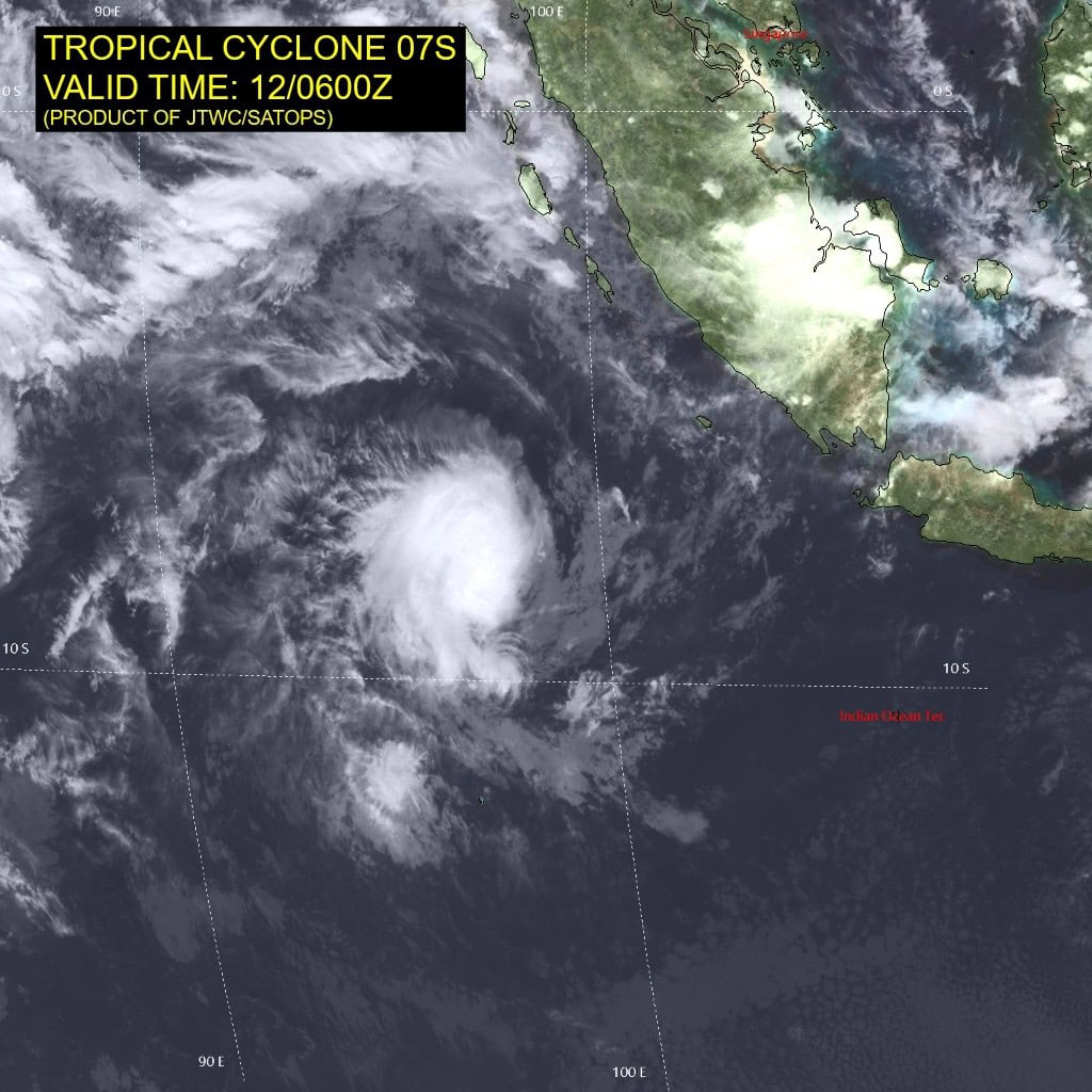
Tropical Cyclone 07S (Bakung) is located approximately 236 NM north-northwest of the Cocos Islands
Northeast Pacific Ocean: There are no Tropical Cyclones
The last regularly scheduled Tropical Cyclone Activity Report of the 2025 eastern North Pacific Hurricane Season has been issued. Routine issuance of this section of the PDC product will resume on May 15, 2026. During the off-season, Special Tropical Weather Outlooks will be issued as conditions warrant by the NHC.
Central Pacific Ocean: There are no Tropical Cyclones
The 2025 central North Pacific hurricane season has ended. As such, the final routine Tropical Cyclone Activity Report for the 2025 season has been issued. Routine issuance of this section of the PDC product will resume on June 1, 2026. During the off-season, Special Tropical Weather Outlooks will be issued as conditions warrant by the CPHC.
Western Pacific, Indian Ocean, and adjacent Seas:
South Indian Ocean
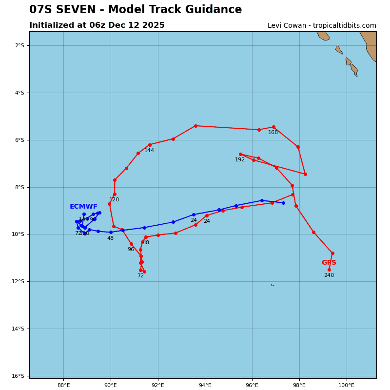
Tropical Cyclone 07S (Bakung)
According to the JTWC warning number 3, sustained winds are 45 knots with 55 knot gusts
Tropical cyclone 07S has improved significantly over the past 12 hours, with overall better organization, improved deep convective banding, and enhanced near-radial upper-level outflow.
The environment remains favorable for development, characterized by warm (28-29 c) sea surface temperatures, very low (0-5 kts) vertical wind shear (vws), and high moisture content.
TC 07S is expected to track west-southwestward through 36 hours. Beginning around 36 hours, a major shortwave trough will begin to weaken the steering ridge to the south of the system, leading to a weak and competing steering environment. As a result, 07S will drift slowly west-southwestward and stall between 48-96 hours, until the near equatorial ridge (ner) becomes the dominant steering influence. Near the end of the forecast period, the ner will cause 07S to drift eastward through 120 hours.
Regarding intensity, 07S will steadily intensify while within the favorable environment, and is expected to peak at 55 kts around 48 hours. Beginning around 48-60 hours, the vws will increase significantly, contributing to the weakening trend through the end of the forecast period.
The quasi-stationary period between 48-96 hours could lead to cool water upwelling, which would also weaken the system. The weakening trend will contribute to the ner taking over as the primary steering influence, as the shallower vortex will be more susceptible to lower-level flow.
Southwest Pacific Ocean
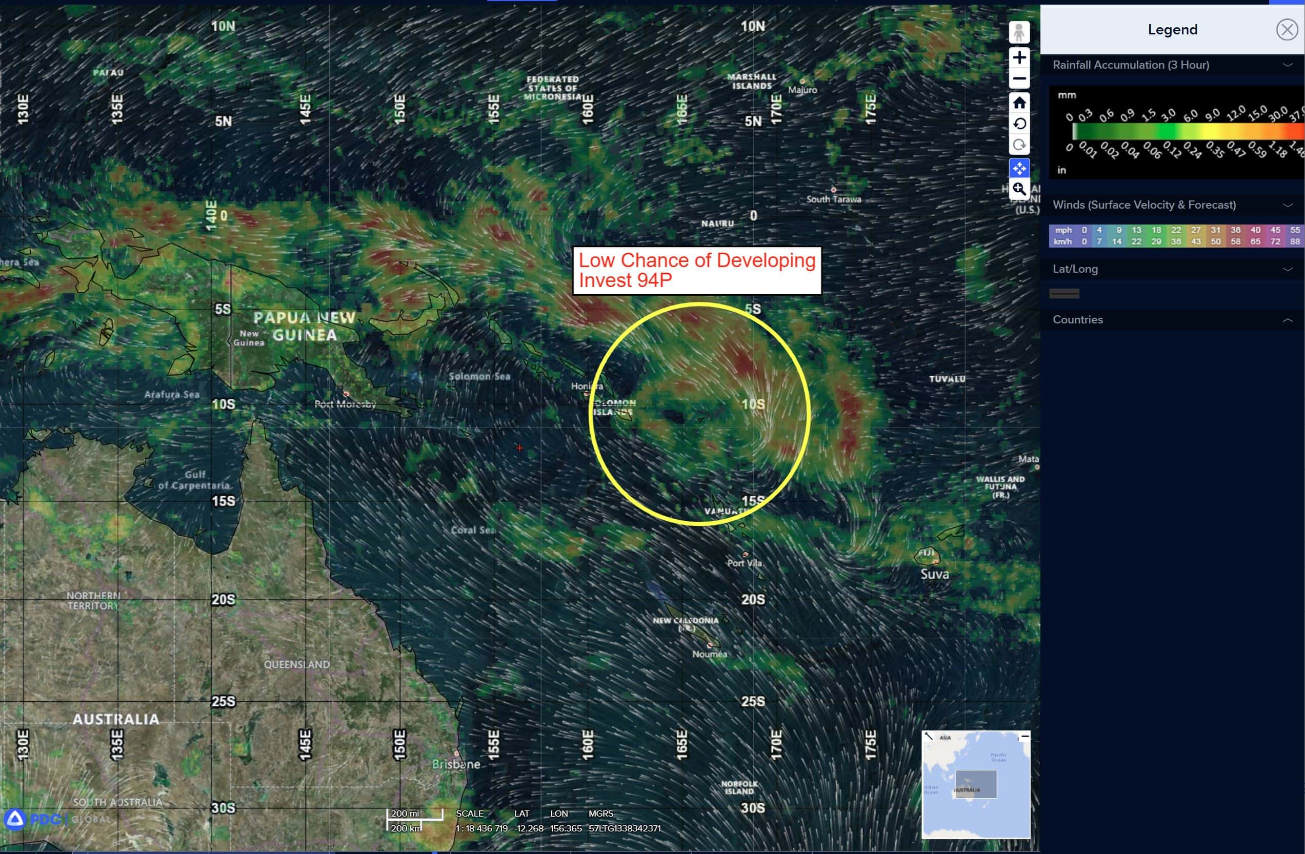
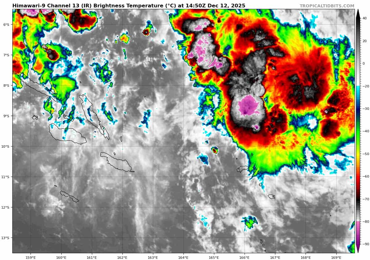
>>> There’s an area of disturbed weather being referred to as Invest 94P, which is located approximately 523 NM east-southeast of Christmas Island
Animated multispectral satellite imagery and a 121808z amsr2 89 ghz microwave image depict a consolidating partially exposed low-level circulation center with flaring convection along the southwestern
periphery.
Environmental analysis shows a marginally favorable environment with strong poleward outflow aloft, low to moderate vertical wind shear (15 to 20 kts), and warm sea surface temperatures (28 to 29 c).
Global models agree on 93s staying quasi-stationary as the system slowly starts to develop and condense over the next few days.
Maximum sustained surface winds are estimated at 13 to 18 knots.
The potential for the development of a significant tropical cyclone within the next 24 hours is low.