
")
Current Snapshot
For all the latest updates visit: DisasterAWARE
1800x1080e
bakung
07S_160600sair
himawari9_ir_07S_202512161420_lat-12.1-lon93.0
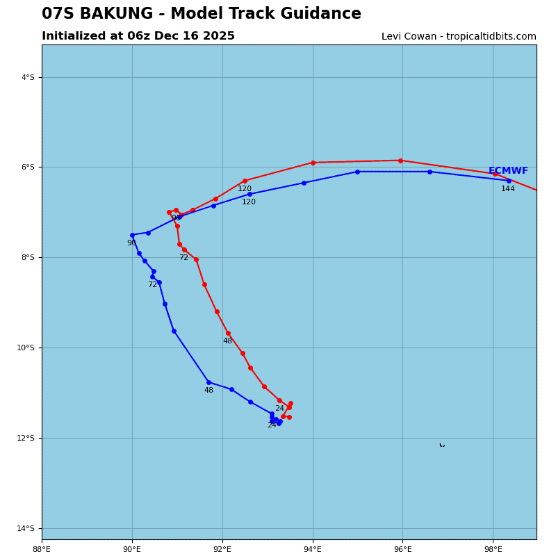
07S_tracks_latest
08p
08P_160600sair
08P_tracks_latest
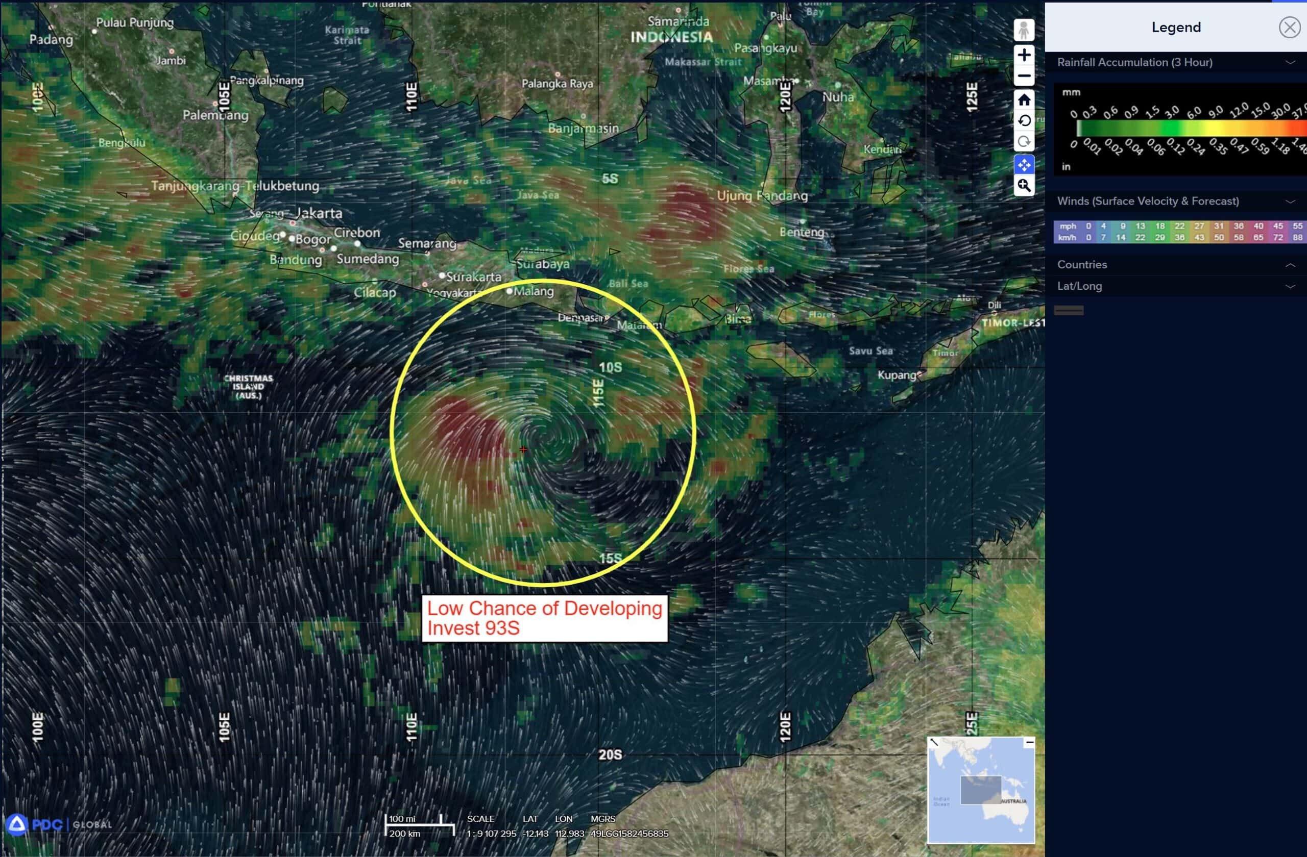
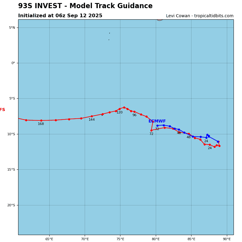
93S
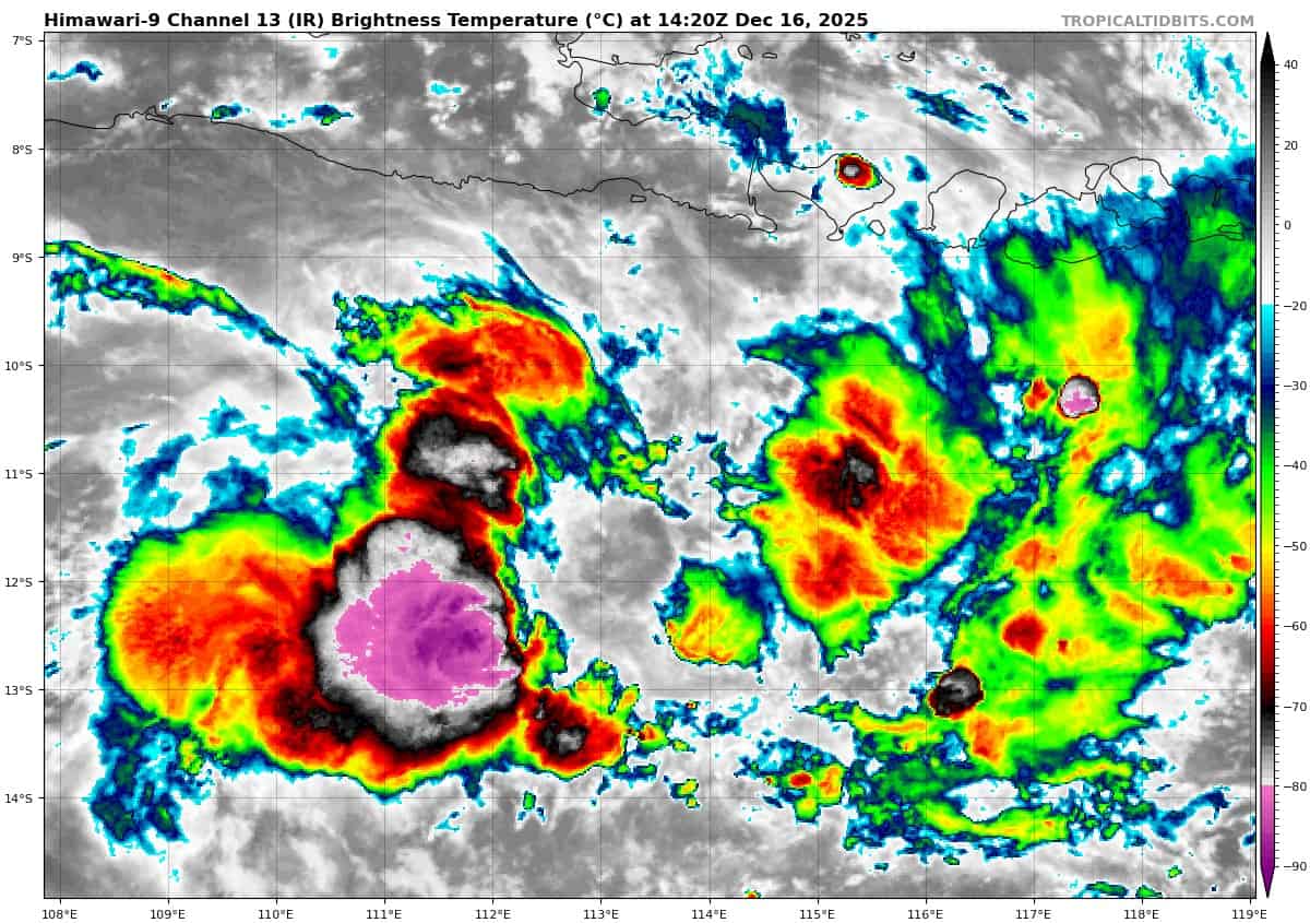
himawari9_ir_93S_202512161420_lat-11.2-lon113.4
93S_tracks_latest
By PDC’s Senior Weather
Specialist Glenn James

The Pacific Disaster Center’s (PDC Global) Tuesday, December 16, 2025, Tropical Cyclone Activity Report…for the Pacific Ocean, the Indian Ocean, and adjacent Seas
Current Tropical Cyclones:
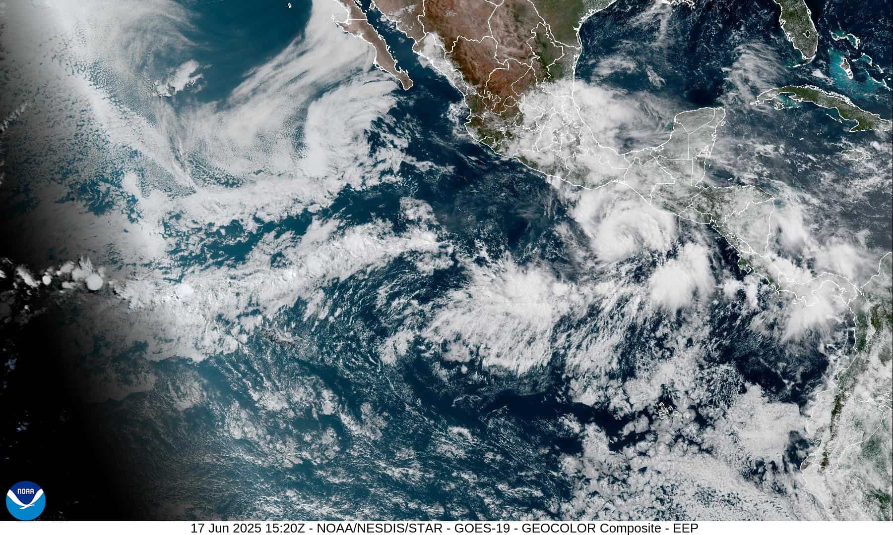
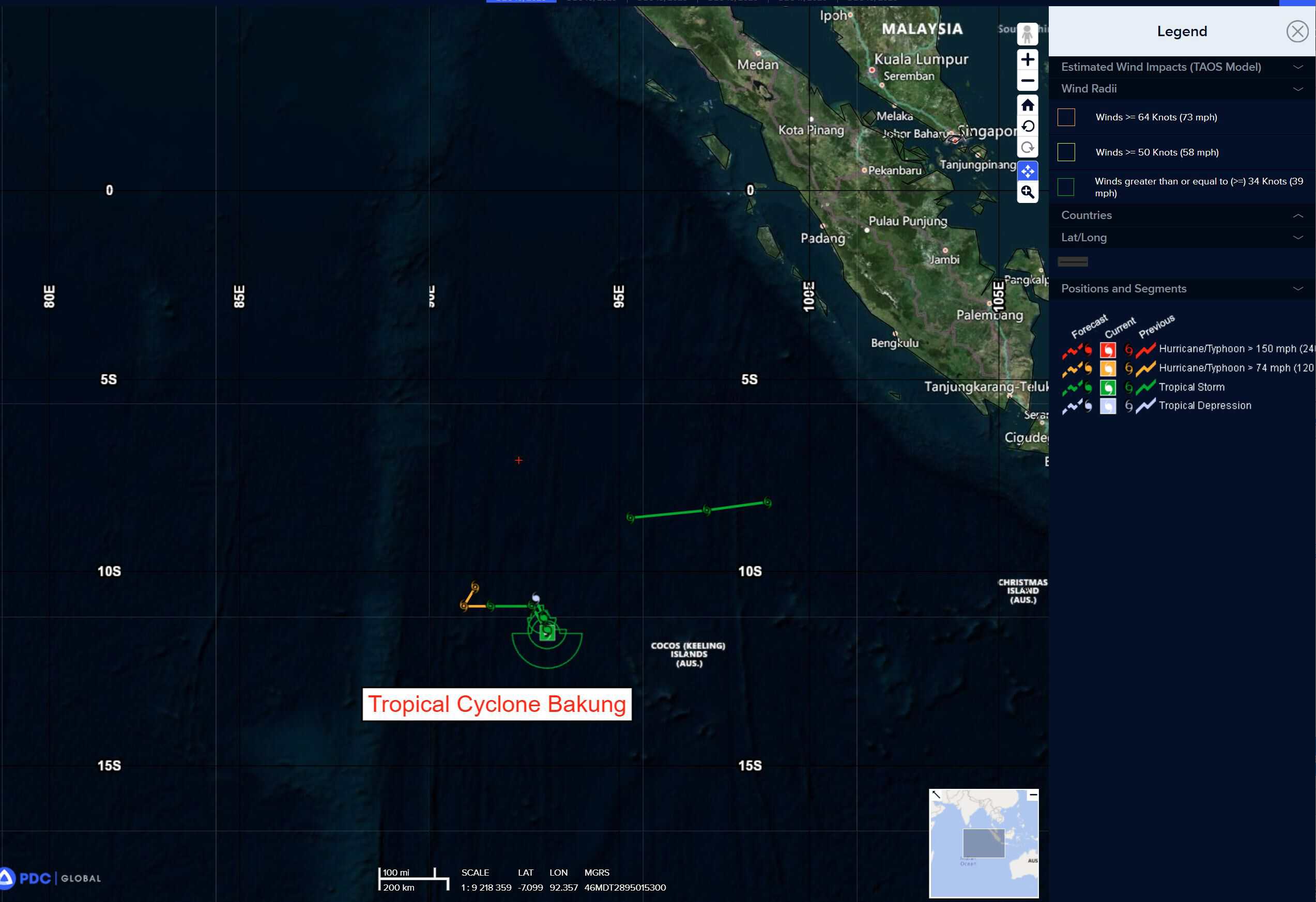
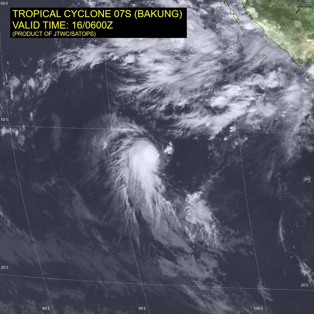
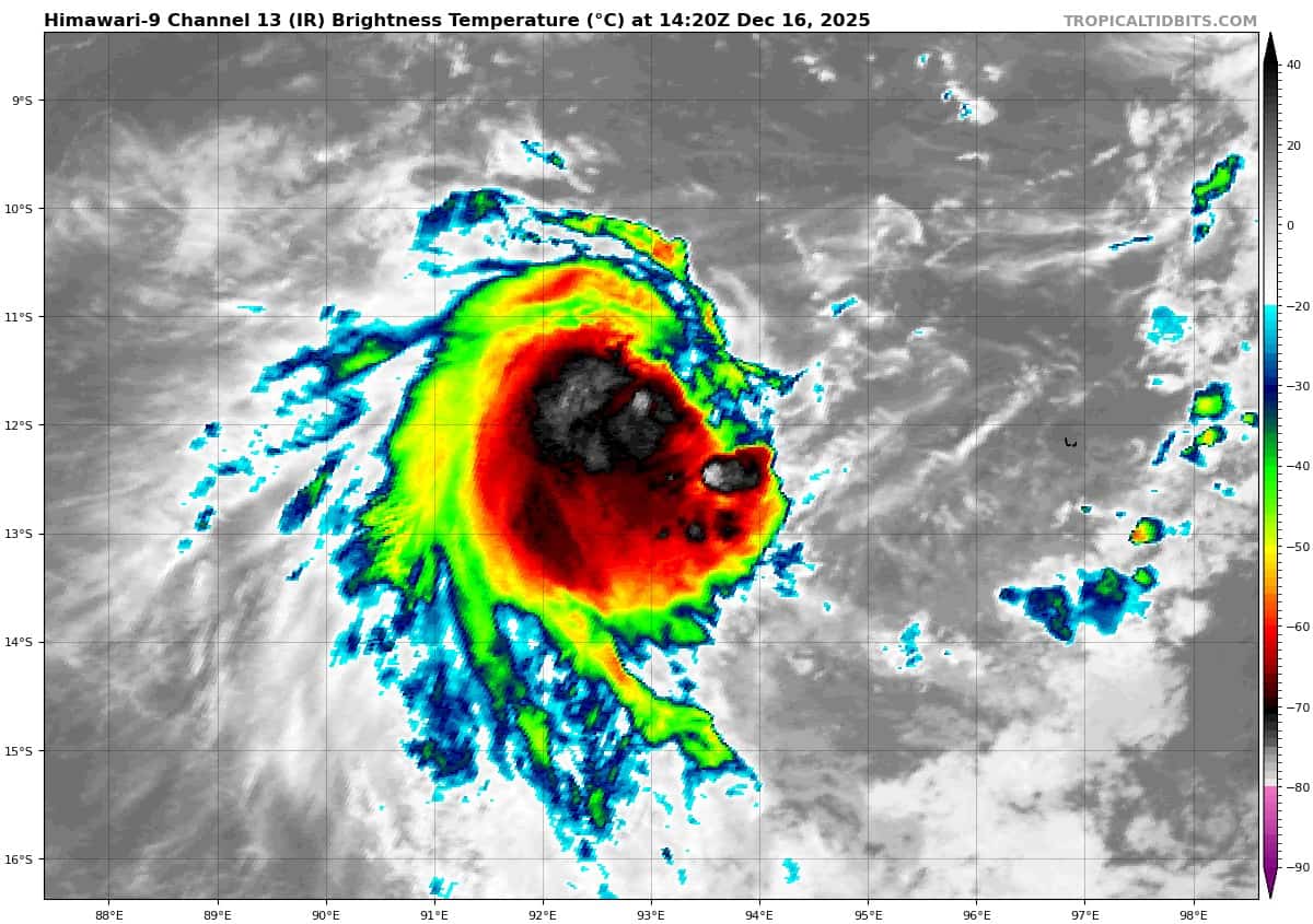
Tropical Cyclone 07S (Bakung) is located approximately 226 NM west of the Cocos Islands
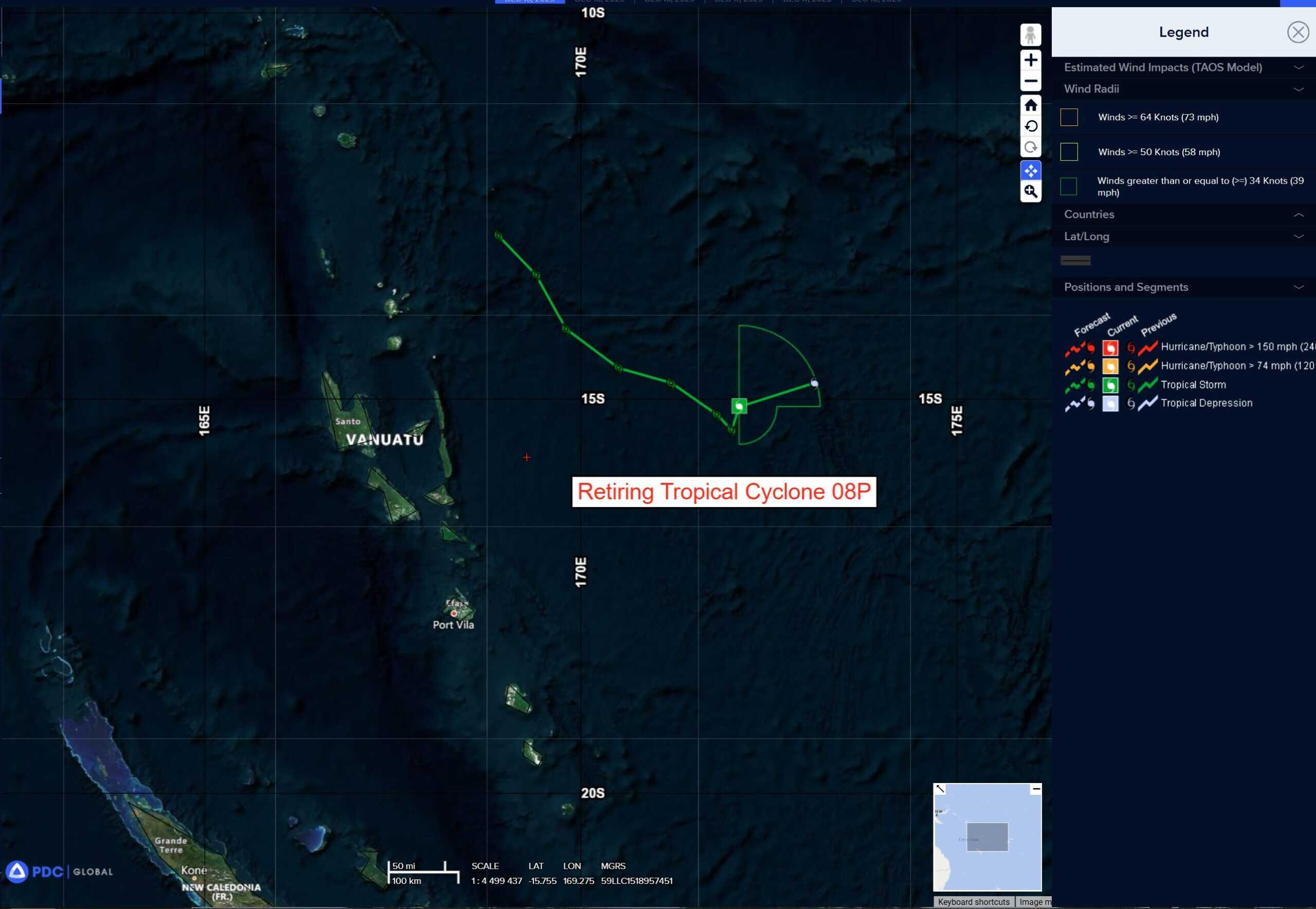
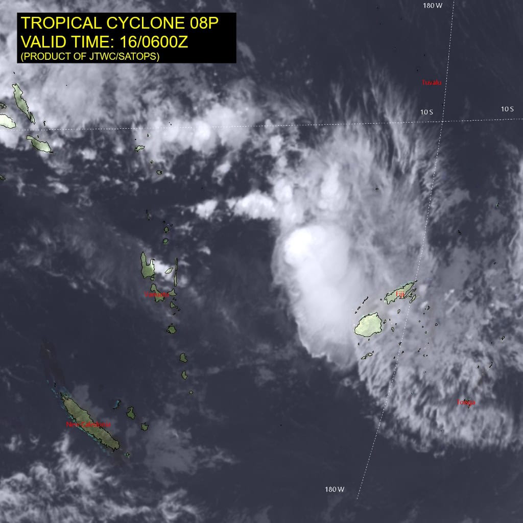
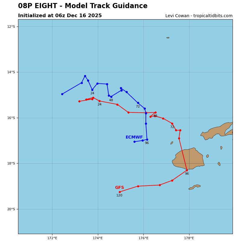
Tropical Cyclone 08P is located approximately 269 NM northeast of Port Vila, Vanuatu – Final Warning
Northeast Pacific Ocean: There are no Tropical Cyclones
The last regularly scheduled Tropical Cyclone Activity Report of the 2025 eastern North Pacific Hurricane Season has been issued. Routine issuance of this section of the PDC product will resume on May 15, 2026. During the off-season, Special Tropical Weather Outlooks will be issued as conditions warrant by the NHC.
Central Pacific Ocean: There are no Tropical Cyclones
The 2025 central North Pacific hurricane season has ended. As such, the final routine Tropical Cyclone Activity Report for the 2025 season has been issued. Routine issuance of this section of the PDC product will resume on June 1, 2026. During the off-season, Special Tropical Weather Outlooks will be issued as conditions warrant by the CPHC.
Western Pacific, Indian Ocean, and adjacent Seas:
South Indian Ocean
Tropical Cyclone 07S (Bakung)
According to the JTWC warning number 10, sustained winds are 45 knots with 55 knot gusts
Tropical cyclone 07S (Bakung) has shifted south-southwestward with a partially exposed low level circulation center as depicted via animated multispectral satellite imagery (msi). Some deep convection persists especially on the western side of the circulation. The system exhibits moderate poleward outflow.
Tropical cyclone 07S will remain in weak steering environment. As a result of a previous binary interaction with another surface-level vorticity maximum, it will now track generally northward oscillating slightly towards the east and west.
The system has slowed significantly but will begin to gain speed again under the influence of subtropical ridging centered to the southwest.
Continued entrainment of the dry air combined with moderate vertical wind shear will cause steady weakening of the system as it progresses further north. TC 07S is forecast to dissipate over water by 36 hours.
Southwest Pacific Ocean
Tropical Cyclone 08P – Final Warning
According to the JTWC warning number 6, sustained winds are 35 knots with 45 knot gusts
Convection has become completely displaced from the llcc with accelerated decoupling caused by high (30+ kts) wind shear. The system moved erratically over the past twelve hours tracking east, northwest, and finally north-northeastward. Due to the shallow nature of the system the circulation will continue to follow the near surface steering flow and weaken below 35 kts by 12 hours.
South Indian Ocean
>>> There’s an area of disturbed weather being referred to as Invest 93S, which is located approximately 474 NM northwest of Rowley Shoals, Australia
Animated enhanced infrared (ir) imagery depicts a partially exposed broad low-level circulation center (llcc) with flaring convection. a 151332 metop-c ascat image reveals 15-20 knot winds on the northern periphery of the convection.
Environmental analysis depicts a moderately favorable environment with moderate
vertical wind shear (15 to 20 kts), warm sea surface temperatures (28-29 c), and moderate westward outflow.
Deterministic global models are in good agreement on 93S gradually developing over the next 24-36 hours, with gfs having faster consolidation than ecmwf. Deterministic and ensemble models are in good agreement on a quasi-stationary, meandering motion over the next 24-36 hours.
Maximum sustained surface winds are estimated at 15 to 20 knots.
The potential for the development of a significant tropical cyclone within the next 24 hours is low.