
")
Current Snapshot
For all the latest updates visit: DisasterAWARE
1800x1080a
a2
goes19_ir_07L_202509251445_lat36.4-lon-36.7
251435_earliest_reasonable_toa_34
07L_tracks_latest
goes19_ir_08L_202509251445_lat21.3-lon-56.7
251437_earliest_reasonable_toa_34
08L_tracks_latest
2a
7a
goes19_ir_94L_202509251452_lat20.0-lon-70.7

94L_tracks_latest
By PDC’s Senior Weather
Specialist Glenn James

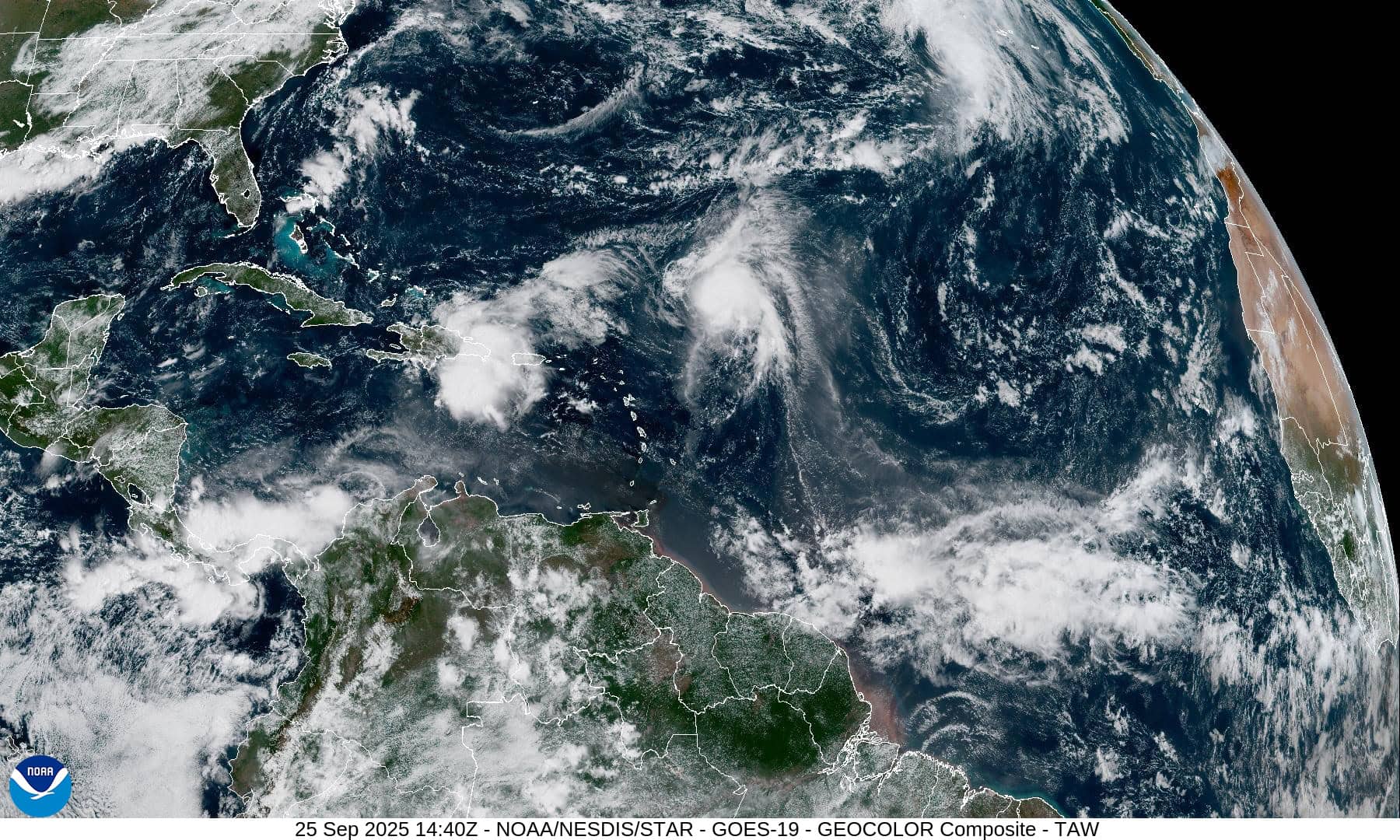
The Pacific Disaster Center’s (PDC Global) Thursday, September 25, 2025, Tropical Cyclone Activity Report…for the Atlantic Ocean, the Caribbean Sea, and the Gulf of America
Current Tropical Cyclones:
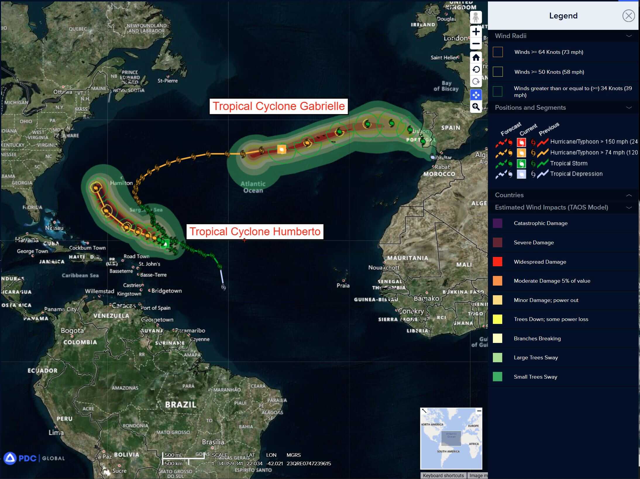
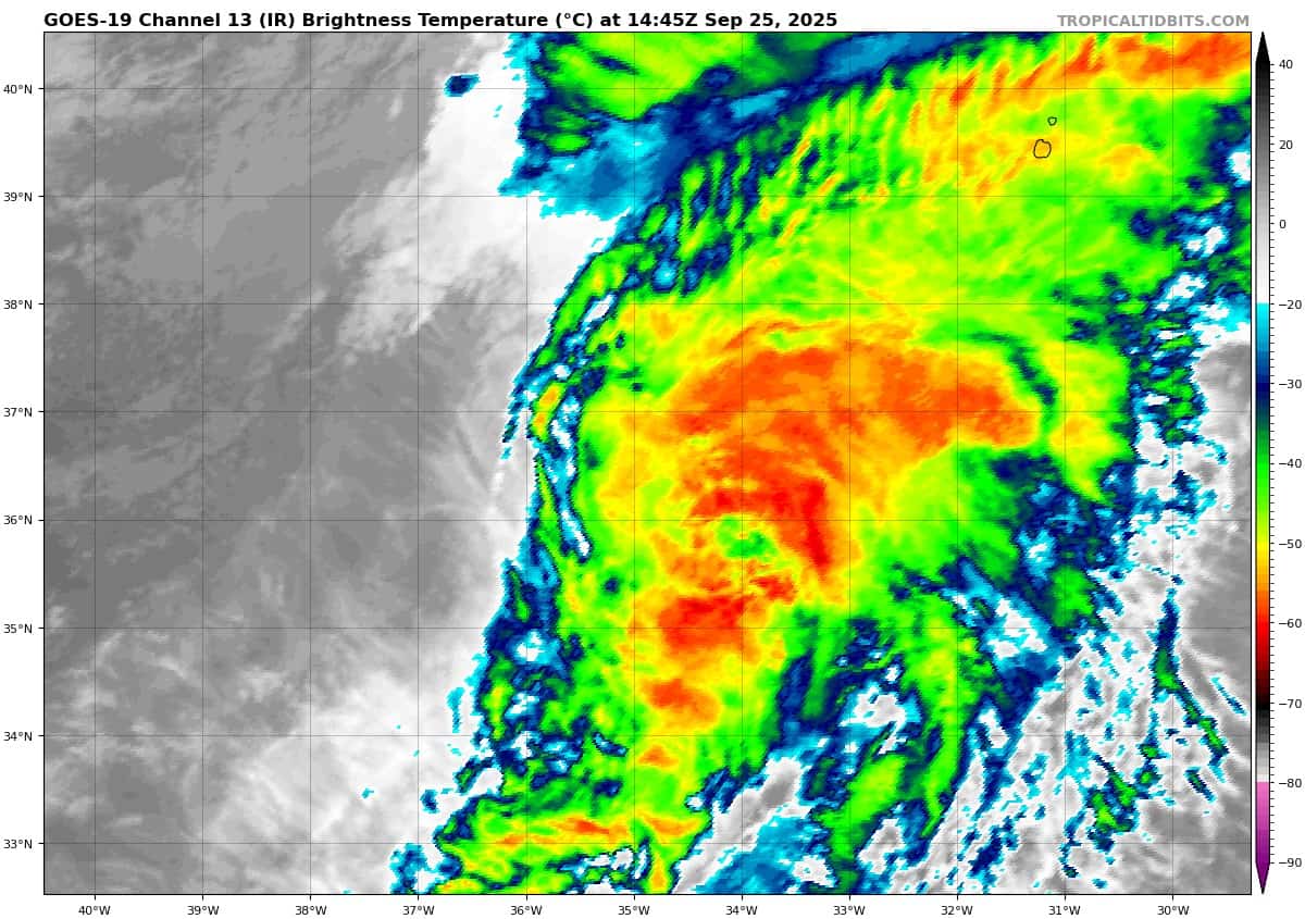
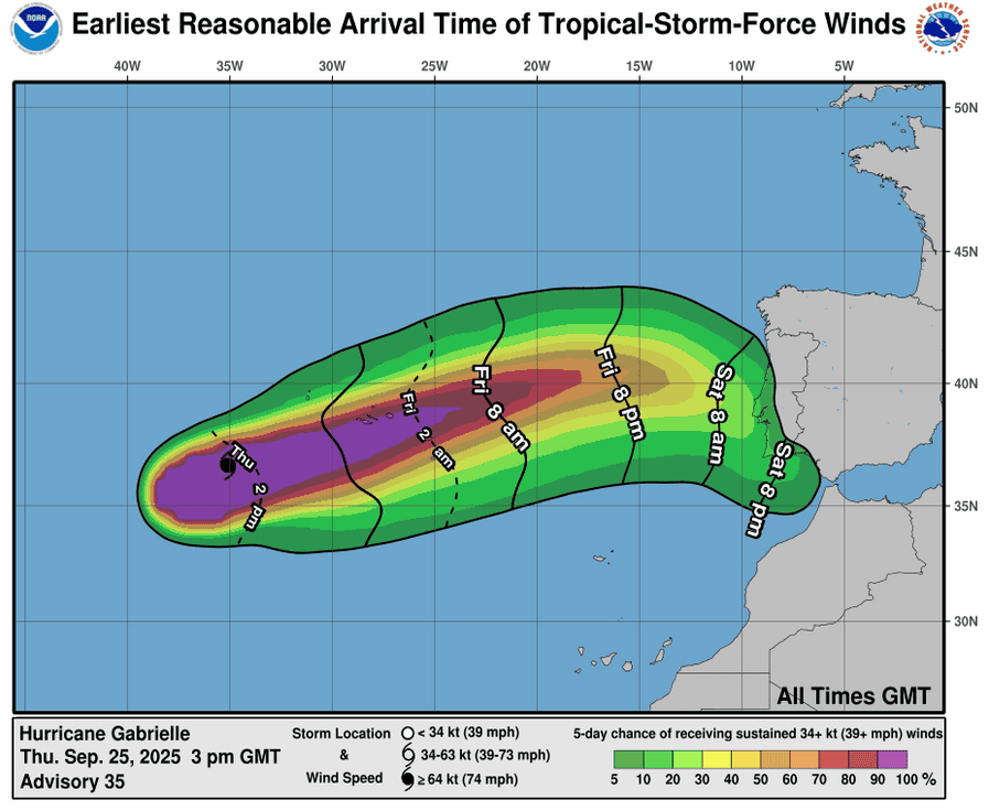
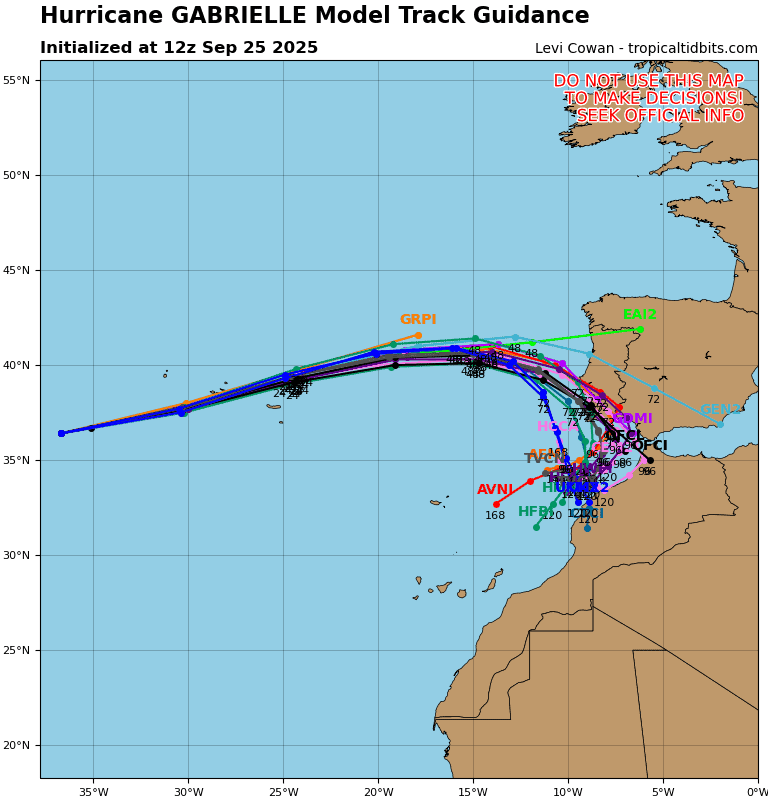
Post-Tropical Cyclone 07L (Gabrielle)…is located about 120 miles southwest of Faial Island in the central Azores
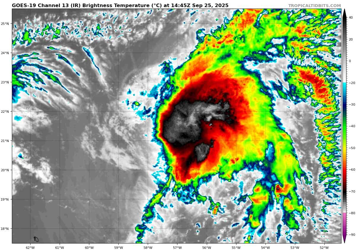
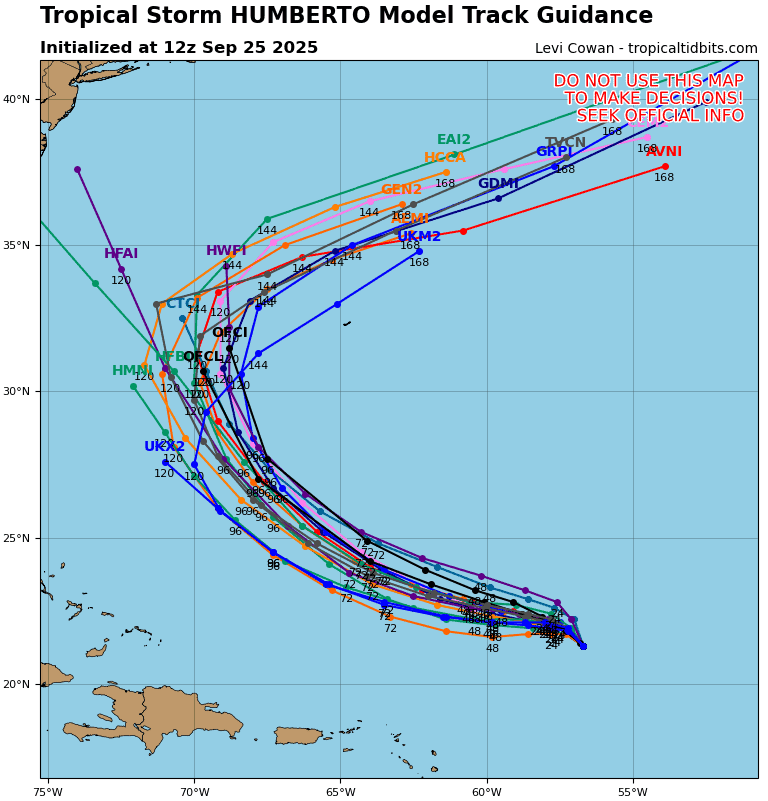
Tropical Cyclone 08L (Humberto)…is located about 475 northeast of the northern Leeward Islands
Atlantic Ocean:
Port-Tropical Cyclone 07L (Gabrielle)
STRONG WINDS EXPECTED TO BEGIN IN THE AZORES WITHIN THE NEXT HOUR OR TWO
According to the NHC advisory number 36A
The post-tropical cyclone is moving toward the east-northeast near 30 mph (48 km/h). An eastward to east-northeastward motion with a gradual decrease in forward speed is expected through Saturday, followed by a turn toward the southeast through early next week. On the forecast track, the center of post-tropical Gabrielle will move across the Azores this morning, then approach the coast of Portugal by early Sunday. Maximum sustained winds are near 70 mph (110 km/h) with higher gusts. Gabrielle is forecast to be at or near hurricane strength when it passes through the Azores. Then, weakening is expected over the weekend and into early next week. Gale-force winds extend outward up to 185 miles (295 km) from the center. Horta on Faial Island in the central Azores recently reported a wind gust to 43 mph (69 km/h). The estimated minimum central pressure is 983 mb (29.03 inches).
HAZARDS AFFECTING LAND SURF:
WIND: Hurricane conditions, especially in gusts, are expected in the Azores tonight into early Friday, with tropical storm conditions likely by this evening. Significant hurricane-force wind gusts are likely across portions of the Azores even after the center passes.
STORM SURGE: A dangerous storm surge is expected to produce significant coastal flooding in areas of onshore winds in the Azores. The surge will be accompanied by large and destructive waves.
RAINFALL: Through Friday morning, Gabrielle could produce up to 3 to 5 inches, 75 to 125 mm, of storm total rainfall across the central Azores. This rainfall could produce flash flooding within the mountains. Elsewhere, Gabrielle is expected to yield 1 to 3 inches, or 25 to 75 mm, of rain across the western and eastern Azores.
SURF: Swells generated by Gabrielle will continue to affect Bermuda, the northeastern coast of the U.S., and Atlantic Canada today. Swells from Gabrielle will spread across the Azores today and tonight. These swells are expected to produce life-threatening surf and rip current conditions.
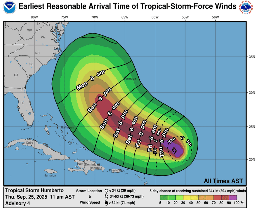
Tropical Cyclone 08L (Humberto)
HUMBERTO CONTINUES TO STRENGTHEN OVER THE CENTRAL ATLANTIC…EXPECTED TO BECOME A HURRICANE TOMORROW
According to the NHC advisory number 6
Humberto is moving toward the northwest near 3 mph (6 km/h). A slow west-northwest to northwest motion is expected during the next couple of days. Maximum sustained winds have increased to near 65 mph (100 km/h) with higher gusts. Significant strengthening is forecast, and Humberto is expected to become a hurricane on Friday, and a major hurricane this weekend. Tropical-storm-force winds extend outward up to 90 miles (150 km) from the center. The estimated minimum central pressure is 998 mb (29.47 inches).
Caribbean Sea: There are no active tropical cyclones
Central Caribbean Sea and Southwestern Atlantic:
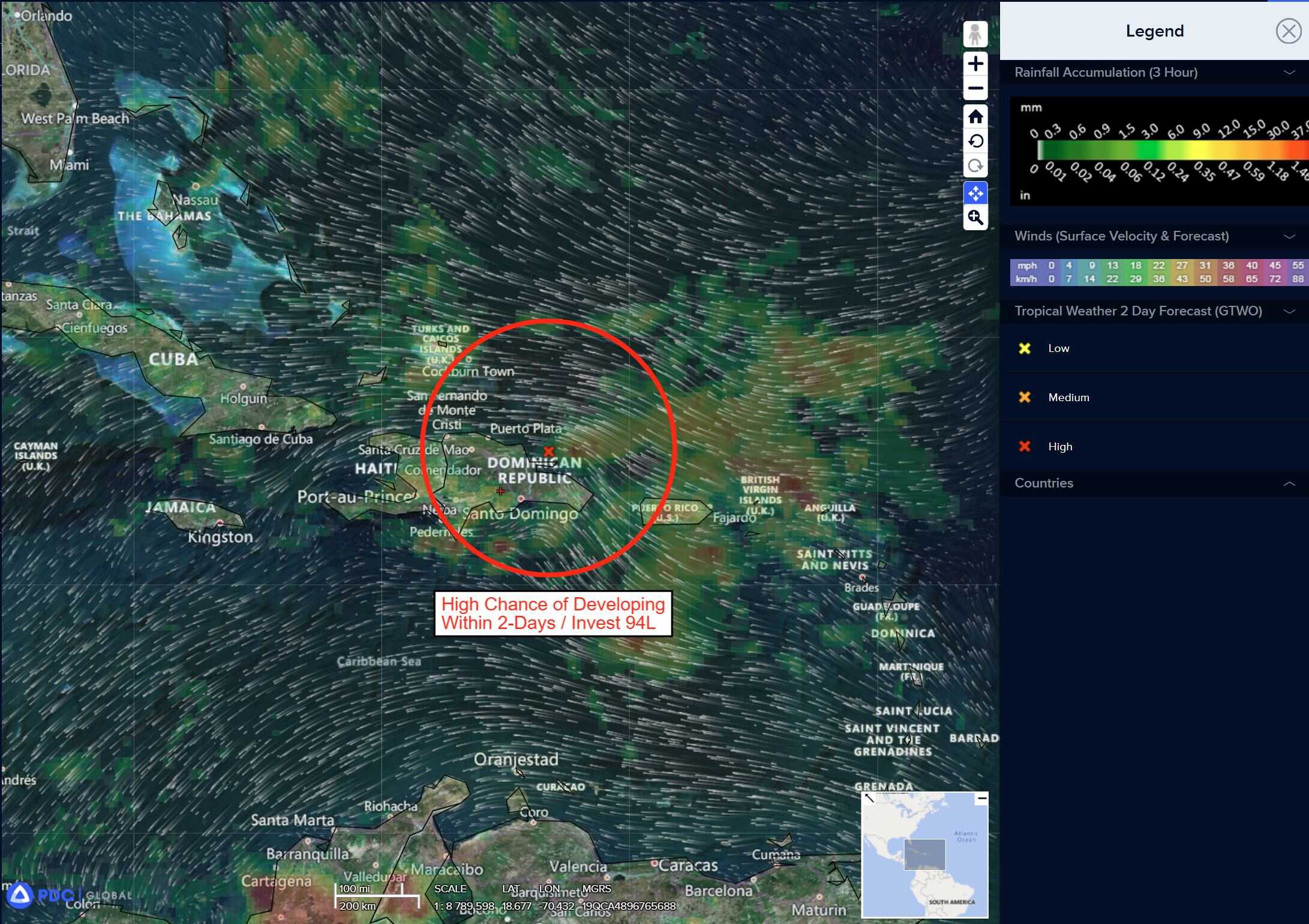
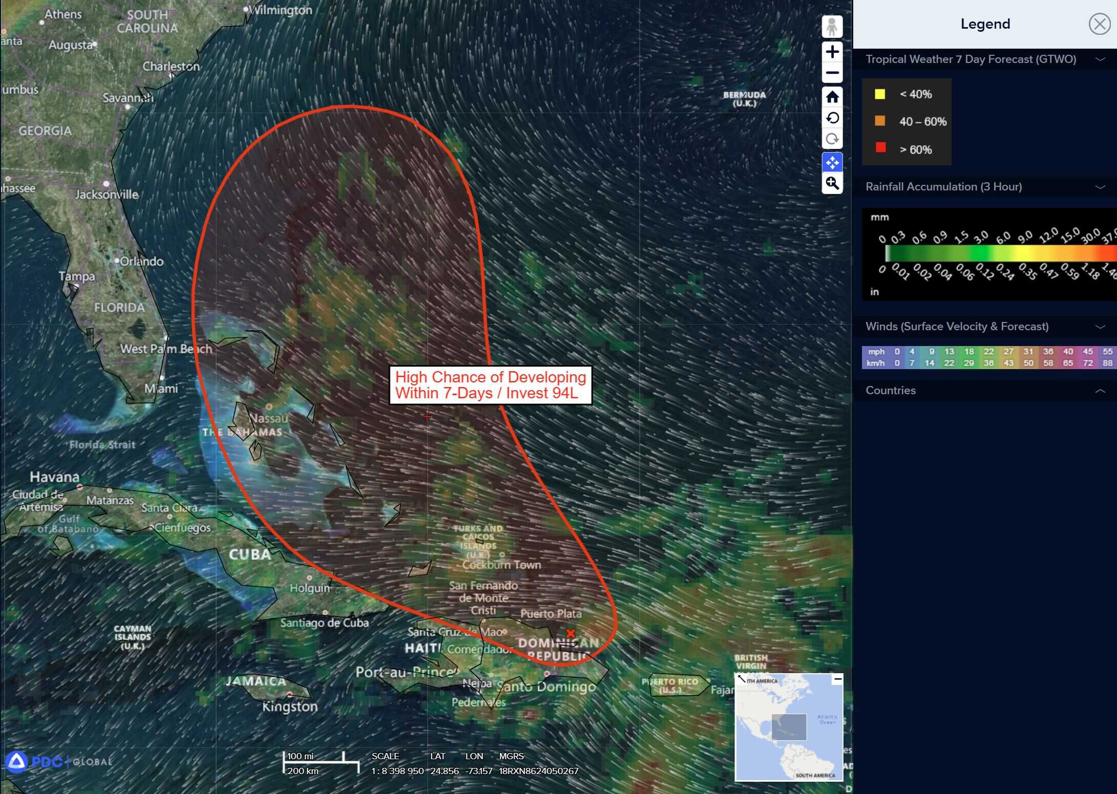
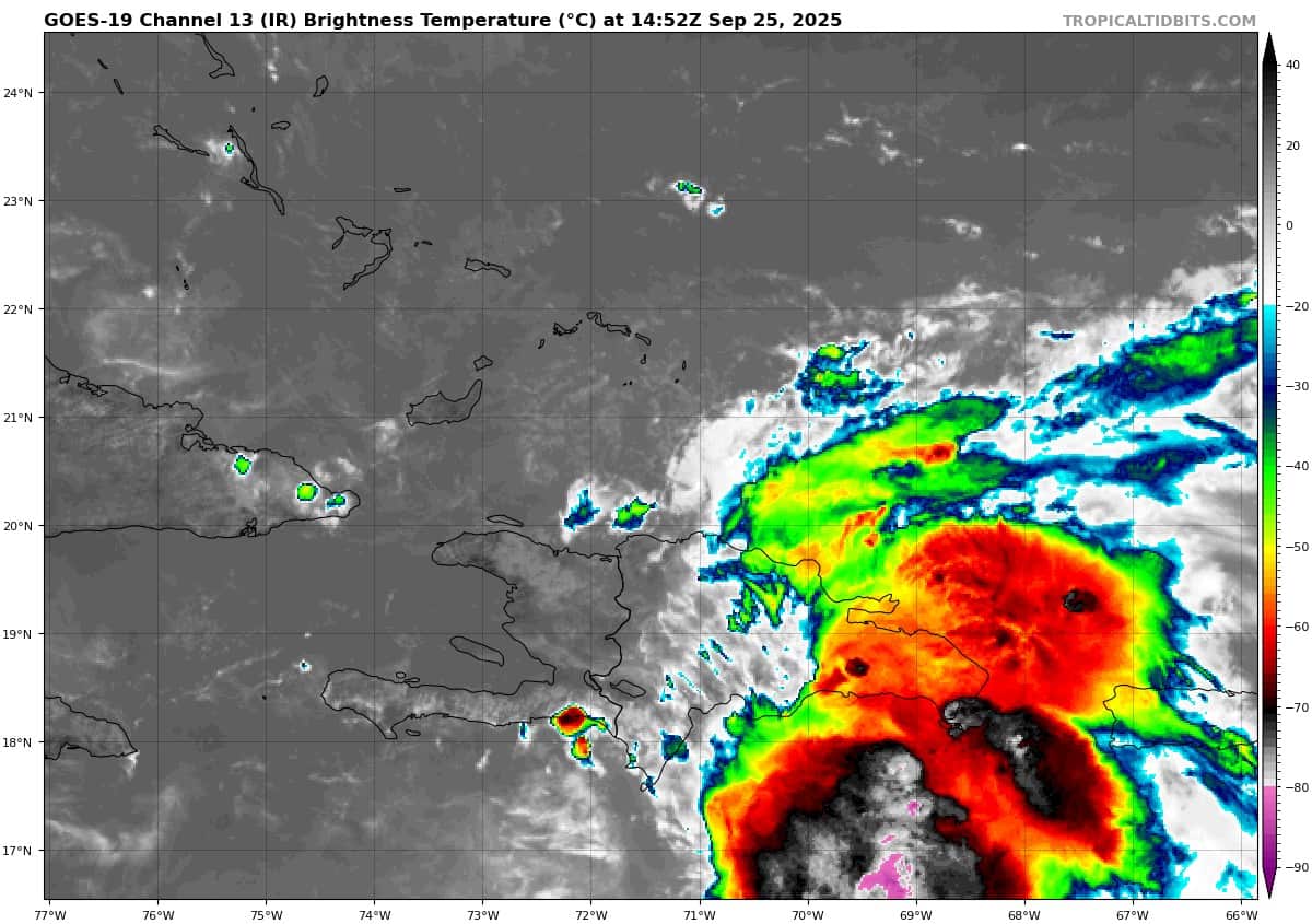
Invest 94L
>>> Showers and thunderstorms are showing signs of organization in association with a a tropical wave located near Hispaniola and the Turks and Caicos Islands. An area of low pressure is expected to form along the wave tonight or early Friday when it moves near the southeast Bahamas. This low is expected to become a tropical depression when it is in the vicinity of the central and northwest Bahamas late Friday or over the weekend, and then track northwestward or northward over the southwestern Atlantic.
Interests in the Dominican Republic, Haiti, the Turks and Caicos Islands, and the Bahamas should monitor the progress of this system. Regardless of development, heavy rains and gusty winds are likely across that region during the next couple of days. While there is significant uncertainty in the long-range track and intensity of the system, the chances of wind, rainfall, and storm surge impacts for a portion of the southeast U.S. coast are increasing. Interests in that area should monitor the progress of the system.
* Formation chance through 48 hours…high…80 percent Formation chance through 7 days…high…90 percent
Gulf of America: There are no active tropical cyclones
Tropical cyclone formation is not expected during the next 7-days.